BOU AVENUE
Kessler Peak And Teutonia
Peak
On 24 November 2018, I arrived early at Providence
Mountains State Recreation Area (SRA) located within California's Mojave
National Preserve (NP). Providence Mountains SRA re-opened in 2017
after being closed for a number of years, and I was eager to climb a
couple of peaks within the SRA that had been on my radar for quite some
time. Unfortunately, I found out shortly after entering the SRA
that the backcountry was off-limits on this day due to safety concerns.
This caught me by surprise, and I had to scramble, so to speak, to find a
Plan B. Having already squandered half the morning waiting to get
into the SRA (they are only open from 8AM to 5PM, Friday thru Sunday), I
opted to drive north and tackle Kessler Peak just off Cima Road in the
northern half of Mojave NP. If I had time, I would also include
nearby Teutonia Peak.
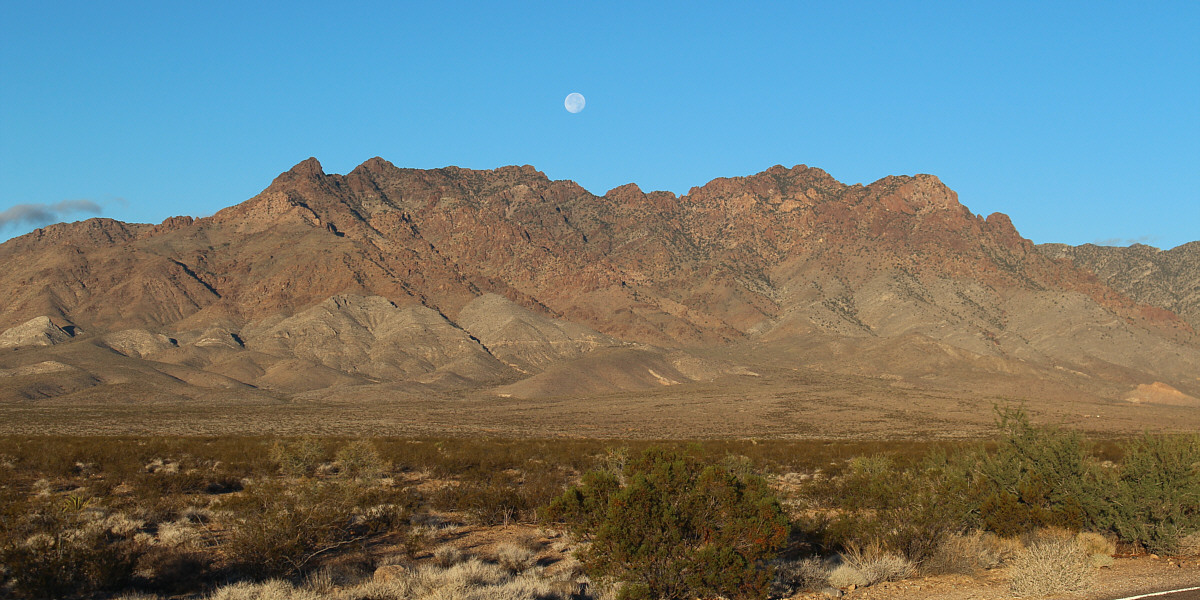
The moon sets over the Providence Mountains.
Unfortunately, the peaks are not accessible on this day due to a
backcountry closure.
I had a vague recollection of Bob Spirko's trip
reports for
Kessler Peak and
Teutonia Peak, but without any Internet available, I had no way to
access any route details or to even know where to start.
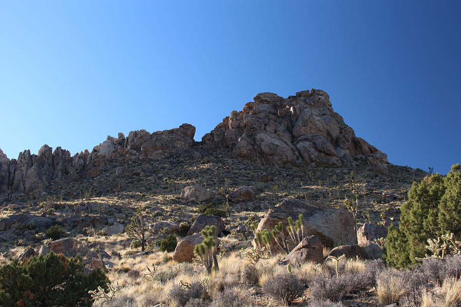
Fortunately, Kessler Peak is not a difficult mountain to climb, and I
basically parked my car on the side of the highway and made a beeline for
the base of the west slopes. The worst part of the whole ascent was
the tedious approach which quickly turned into a game of finding the path
of least resistance through annoying low bushes while avoiding nastier
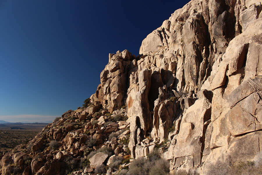
plants like cacti or chollas. There are a few significant cliff
bands on the west slopes of Kessler Peak, but with a bit of careful
route-finding, I was able to avoid any difficult climbing. After
gaining a rather rugged false summit, I continued up more easy slopes
over a second false summit before finally topping out on the true summit
which has a survey marker and register.
 |
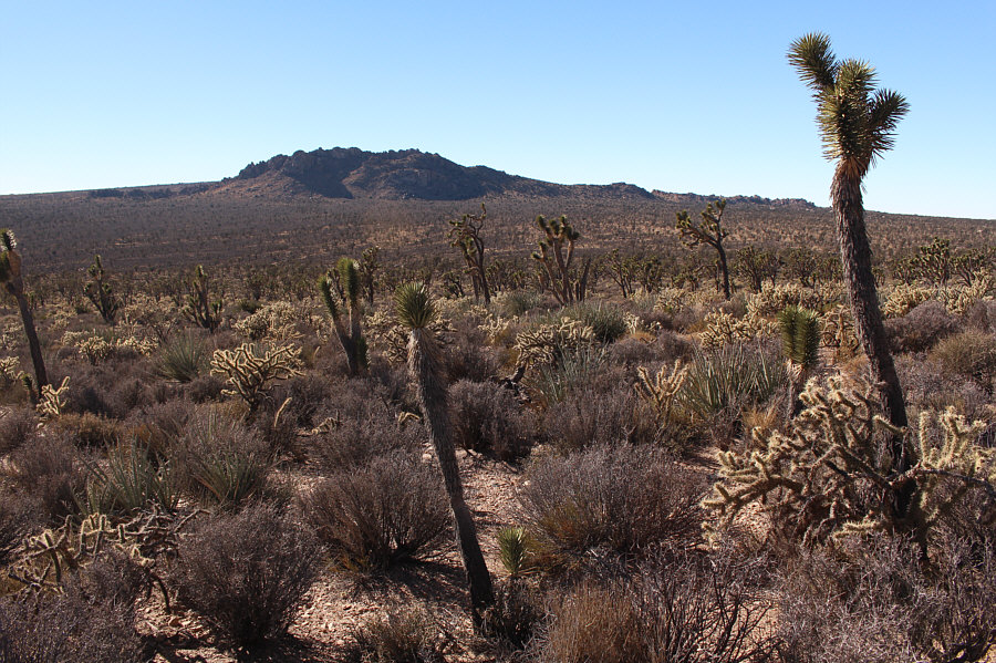
Joshua trees dot the landscape on the
western approach to Kessler Peak. |
 |
Here is a view to the west of Teutonia
Peak from the lower slopes of Kessler Peak. |
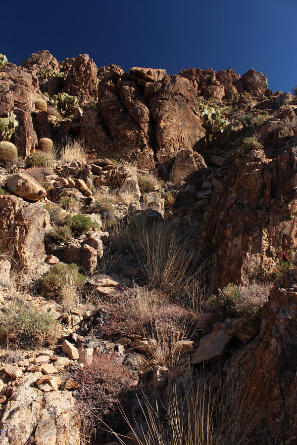 |
This is typical of the terrain on the
west slopes of Kessler Peak. |
 |
Sonny looks up after reaching the
first of two false summits. |
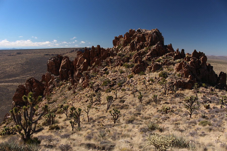 |
The first false summit is quite
rugged. |

Sonny stands on the summit of Kessler Peak (1876
metres).
 |
To the west, Teutonia Peak is merely a
pimple on the broad volcanic remnant known as Cima Dome. |
 |
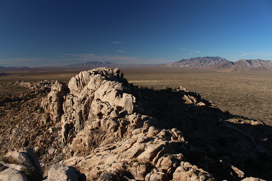
Kingston Peak (distant left) and Clark
Mountain (right) stand out to the northwest. |
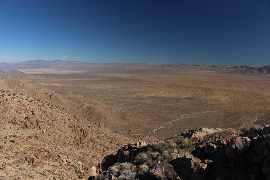 |
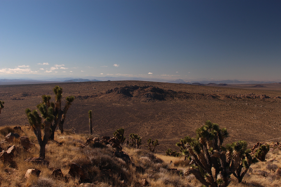
Northeast of Kessler Peak is the vast
expanse of Ivanpah Valley. |
 |
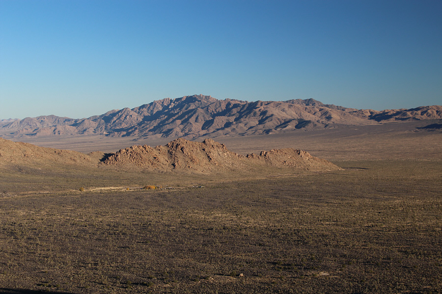
The Providence Mountains are shrouded
in clouds to the south. The light patch at centre are the
Kelso Dunes. |
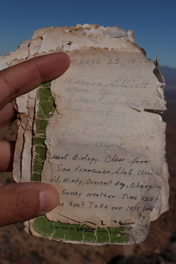 |
Some of the entries in Kessler Peak's
summit register date back to 1975. |
On descent, I retraced my steps to the first false summit and then took a
slightly different route down the west slopes. Rocks here are
exasperatingly loose which made the descent feel like a big long stumble. At one point, I inadvertently bumped into a prickly pear cactus, and
I spent a substantial amount of time afterwards picking spines out of
my butt cheeks! I was in a bit of a foul mood when I resumed hiking, and
there were more than a few curses uttered as I thrashed my way across the
desert flats back to Cima Road.
 |
This is looking back at the west
slopes of Kessler Peak from the bushy desert floor. |
When I reached Cima Road, I simply crossed it and continued
winding through the desert flats toward Teutonia Peak. Had I
recalled Spirko's trip report more vividly, I would have known that there
is actually a trail which approaches the north end of Teutonia Peak and
which originates from a trailhead only a short distance north of where I
parked my car. Alas, I had to find my own way through more tedious
bushy terrain although the occasional short-lived clearing granted some
temporary relief from the suffering. As I got closer to Teutonia
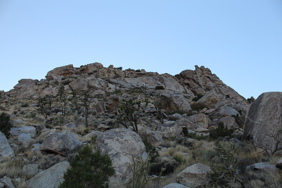
Peak, I headed for an obvious notch near its south end. From the
notch, I turned north and easily scrambled up what Spirko refers to as
South Peak. Just north of South Peak is Centre Peak which is the
true summit, but getting there entails a drop into a gap
followed by a scramble up an exposed rock face and crack. Although
the route looked daunting at first, it turned out to be fairly
straightforward as I was able to find good holds where I needed them.
A summit register can be found tucked in a small cairn on top of Centre
Peak.
 |
Traversing across the desert to the
base of Teutonia Peak can be quite tedious. |
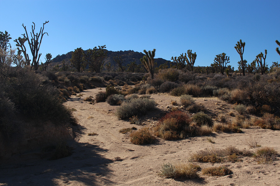 |
A few small washes like this one
provide some relief from the prickly desert bushes. |
 |
The notch at centre near the south end
of Teutonia Peak provides easy access to the upper mountain. |
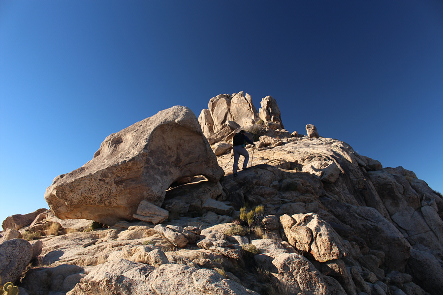 |
Sonny hikes past a large boulder on the south ridge of Teutonia Peak. |
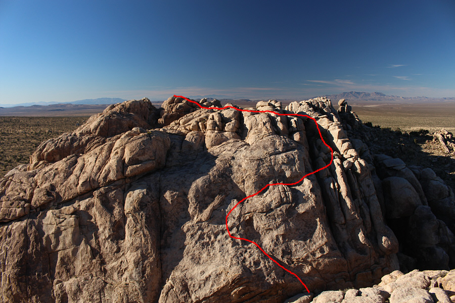 |
This is the view of Teutonia Peak's Centre Peak from the South Peak
(1741 metres). Sonny's approximate ascent route is shown. |
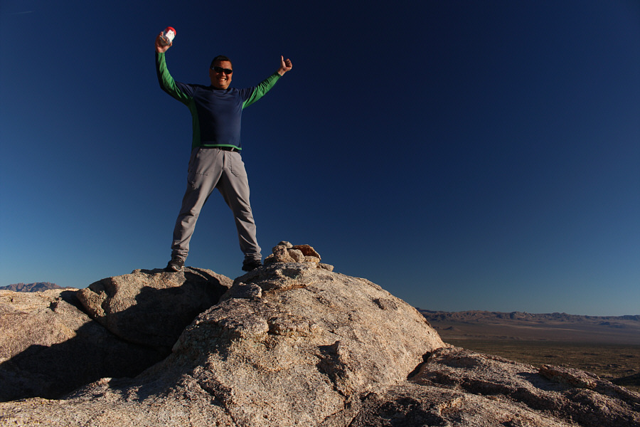 |
Sonny raises his arms in triumph as he holds up the register on top of
Centre Peak (1744 metres) which is also the true summit of Teutonia Peak. |
 |
The connecting ridge to North Peak is more complex than
it looks. |
 |
In contrast, Kessler Peak looks rather
uncomplicated to the east. |
After signing the summit register on top of Centre Peak, I turned my
attention to another high point further north which Spirko refers to as North Peak. Unfortunately,
pinnacles along the summit ridge prevent an easy traverse from peak to
peak. Probably the best way to traverse the summit ridge is along the
base of the cliffs on the east side just as Spirko's party had done (in
reverse), but too lazy to backtrack, I ended up slithering down a
difficult crack on the north side of Centre Peak and eventually ended up
on the west side of the summit ridge. The terrain here is rugged and
difficult, but with a bit of luck and route-finding, I managed to get
around to the north end of the summit ridge. I was surprised to see a few
hikers here and only realized later that they must have come up the
aforementioned trail which ends at this spot. Reaching the top of North Peak requires
climbing up a low Class 5 chimney followed by a short but exposed walk up
a knife-edged boulder. I was a bit apprehensive at first about
tackling this route solo, but once I got my hands on the rock, it turned
out to be a lot of fun.
 |
The crack on the left provides a
difficult but feasible route to descend the north side of Centre
Peak. |
 |
Negotiating the terrain below the
cliffs on the west side of Teutonia Peak is far from trivial. |
 |
Sonny stands on top of North Peak (1741 metres). |
 |
This is a looking southeast from North
Peak along the connecting ridge to Centre Peak. |
 |
Northwest of Teutonia Peak is another vast
drainage known as Kingston Wash. Kingston Peak stands out on
the right horizon. |
 |
The New York Mountains dominate the southeast
horizon. Barely visible at centre in front of the low ridge is
Kessler Ranch. |
After tagging the top of North Peak, I descended the same way,
and although down-climbing the chimney was challenging, it was much easier
than the crack on the north side of Centre Peak. By the time I got
down to easier ground, the hikers at the north end had disappeared, but unsure of which way they went, I simply descended the
east side of Teutonia Peak. This was not as straightforward as I
was hoping, but with some more careful route-finding, I managed to work
my way safely back down to the desert flats. The rest of the hike
back to my parked car was again tedious but uneventful.Despite the
disappointment of having to forego my original objectives in Providence
Mountains SRA, I was happy to still salvage the day with my ascents of
Kessler Peak and Teutonia Peak. Furthermore, Teutonia Peak's
challenging summit ridge proved to be surprisingly fun. This
wrapped up my relatively quick but very enjoyable solo road trip (I drove
to northern Utah that night and made it back to Calgary the following
evening) which saw me tag 10 summits, sleep in the back of my Honda CR-V
for 5 out of 9 nights, and drive over 5256 kilometres.
 |
This is the crux for gaining
access to the top of North Peak. |
 |
This is looking back up the section
along the east side of Teutonia Peak that Sonny descended. |
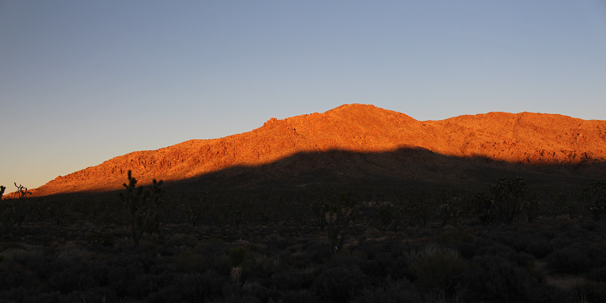
The top of Kessler Peak glows late in the day.
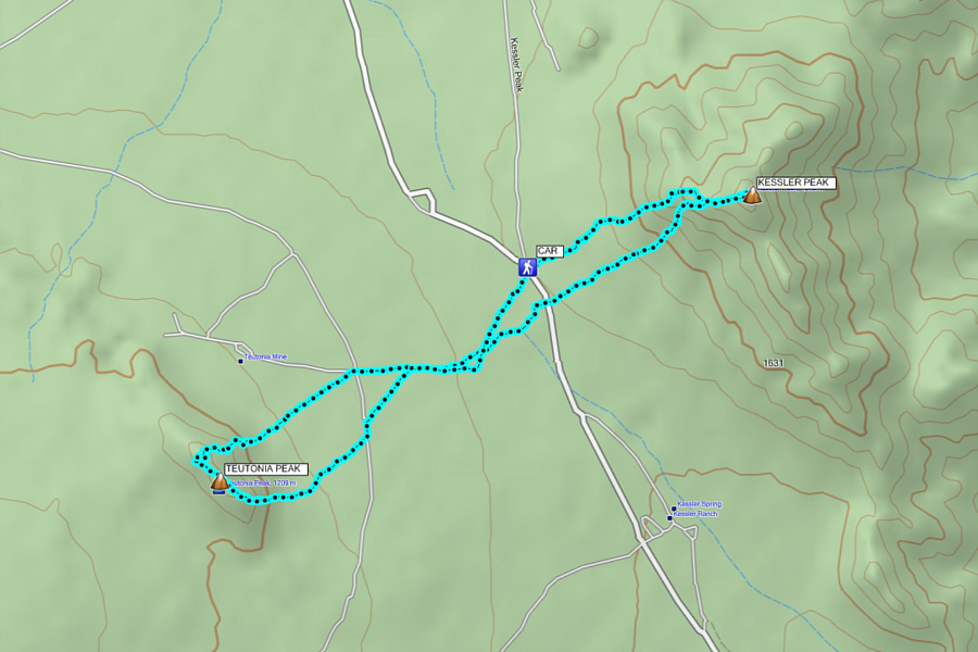 |
Total Distance:
9.8 kilometres
Round-Trip Time: 6 hours 56 minutes
Net Elevation Gain to Kessler Peak: 353 metres
Net Elevation Gain to Teutonia (Centre) Peak:
221 metres
Cumulative Elevation Gain: 687 metres
GPX Data |
