BOU AVENUE
Lightning Peak
On our way to southern Alberta for the long weekend, Marta Wojnarowska, Zosia Zgolak and I climbed Lightning Peak in the Livingstone Range on 19 May 2018.  The route was pioneered by Bob Spirko, and a recently reported successful ascent prompted us to give the peak a try.  We began our hike from the Forestry Trunk Road (SR 940) about 2.8 kilometres south of the junction with Maycroft Road (Highway 517).  Due to space limitations in my car, we chose not to bring bicycles for the long approach, but given how muddy Daisy Creek Road was due to recent rains and snowmelt, biking would have been highly unpleasant anyway.  After crossing Pocket Creek, we actually missed the side road which heads eastward toward the peak, but rather than backtrack to the junction, we simply made a beeline through the forest until we intersected the side road.

The turnoff from the side road is at an obvious dry creek bed marked with flagging.  We hiked up the creek bed for a short distance before leaving it to climb up a forested ridge on a fairly good beaten path.  As we climbed higher, we encountered more and more snow, some of it probably freshly fallen.  Visibility was limited as we cleared tree line and gained the crest of the Livingstone Range.  We increasingly relied on a pre-marked route (presumably Spirko's) in my cel phone to keep us pointed in the right direction.  At one point, we actually descended the wrong side of a false summit and wasted some time trying to get back on track.  When we eventually reached the summit of Lightning Peak, views were disappointingly nonexistent, and we simply tagged the cairn and took a quick photo before returning the way we came.  Aside from a little wallowing in deep snow and a few minor spills by me, our descent was mostly uneventful.
Not the best road conditions for driving! 
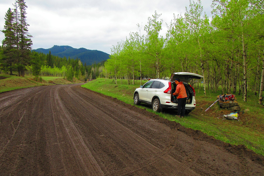
Sonny gears up beside the muddy Forestry Trunk Road.  Daisy Creek Road branches off here just out of view to the left.

Photo courtesy of Zosia Zgolak

Not the best road conditions for biking! 
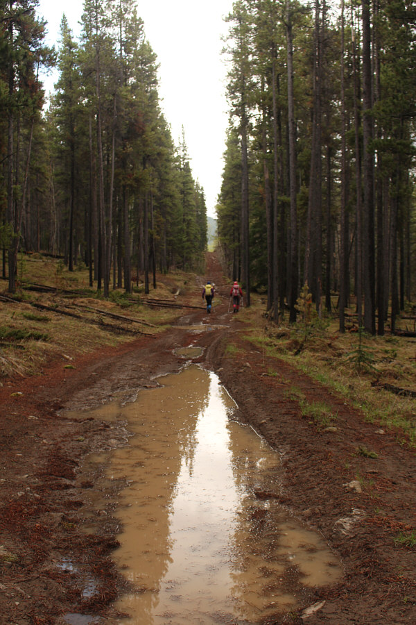
Marta and Zosia hike along Daisy Creek Road which is very muddy on this day.
It's a tricky ford!

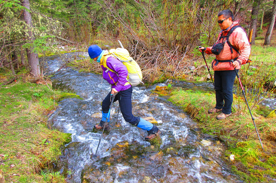
Sonny watches as Marta steps across Pocket Creek.

Photo courtesy of Zosia Zgolak

We would soon leave the creek bed and climb up the right bank. 
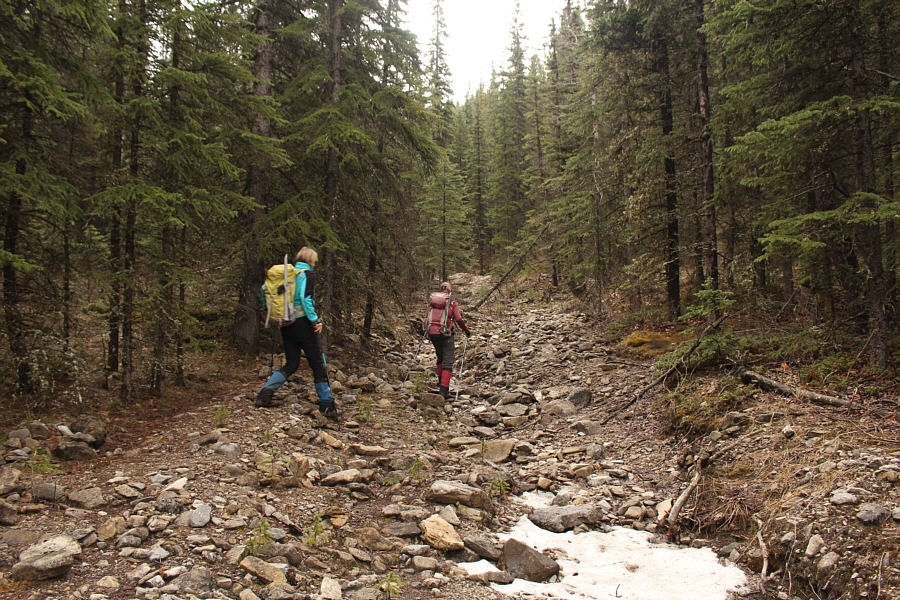
Marta and Zosia leave the side road along Pocket Creek to head up a dry creek bed.
Hmmm...that looks like a lot of snow still up there... 
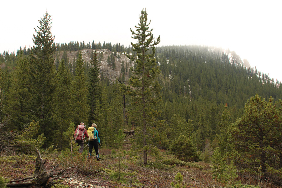
Zosia and Marta hike up a forested ridge which leads to Lightning Peak.
I wish I could move that fast up the slope! 
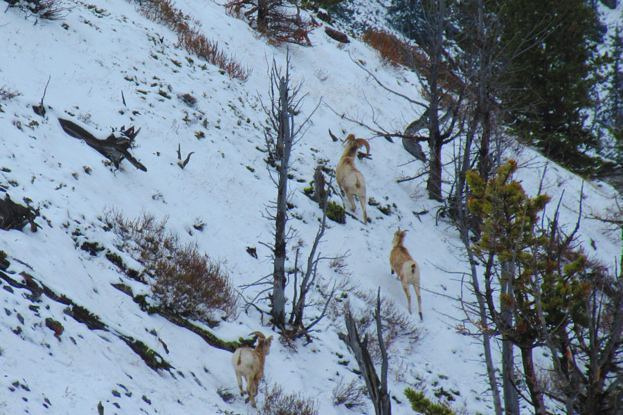
Some startled sheep dash off along the snowy slope.

Photo courtesy of Zosia Zgolak

So much for keeping my feet dry! 
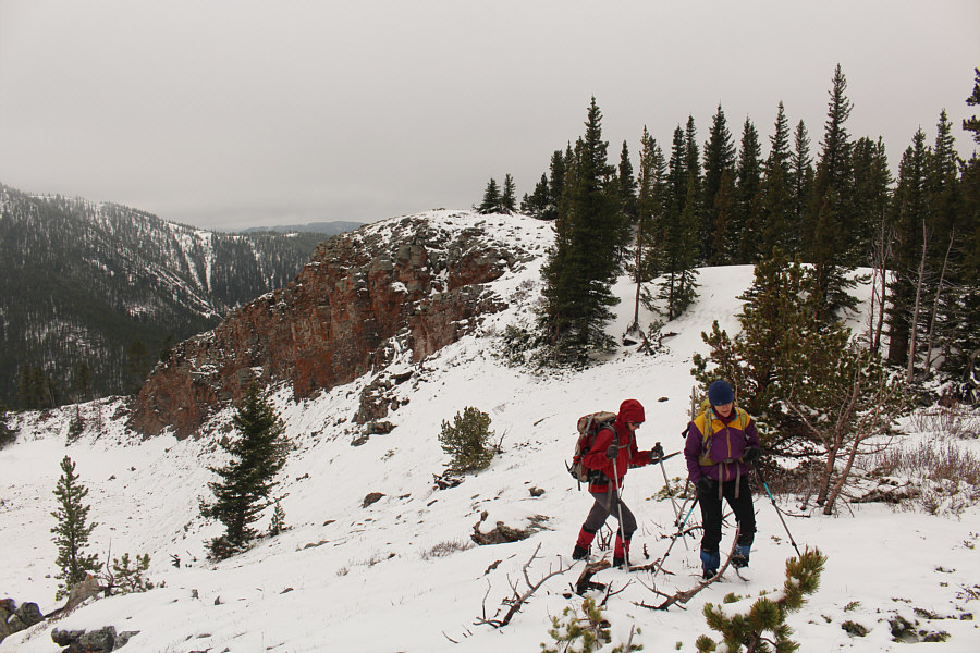
Zosia and Marta trudge through more snow higher up the ridge.
Hey, I got some new "likes" on Facebook! 
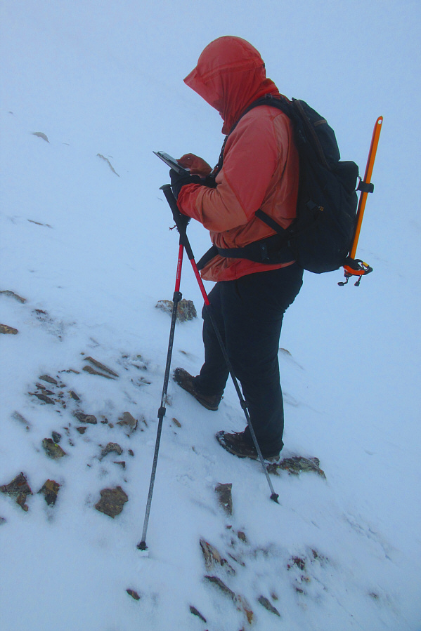
Sonny checks his phone to make sure he is still on the right track.

Photo courtesy of Zosia Zgolak

So much for views on this day! 
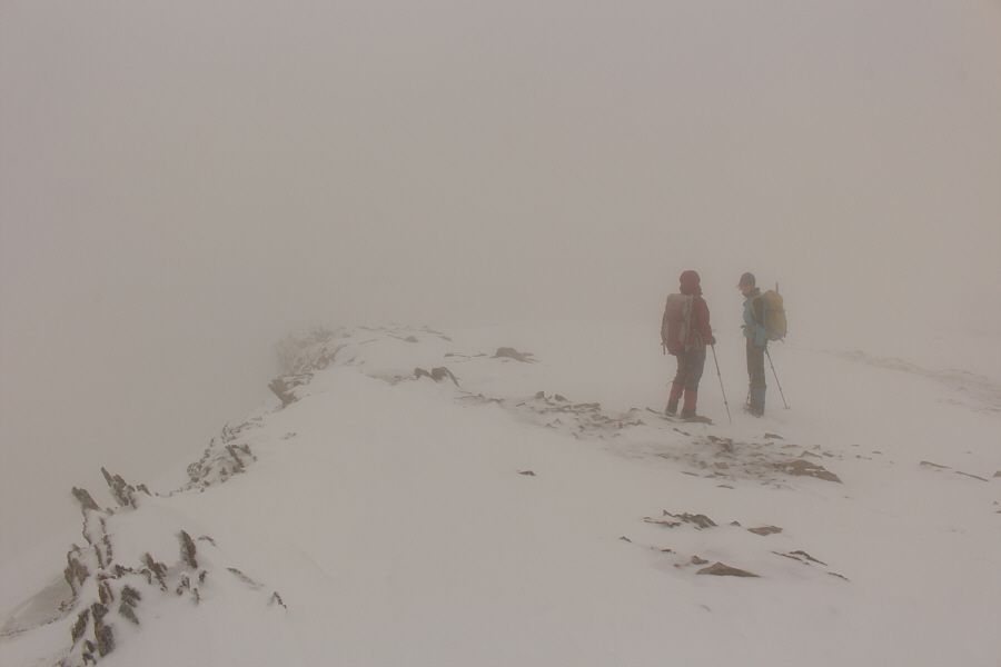
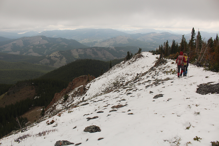
Visibility is very limited as Zosia and Marta reach the crest of the Livingstone Range.
Looks like we're climbing up Everest! 
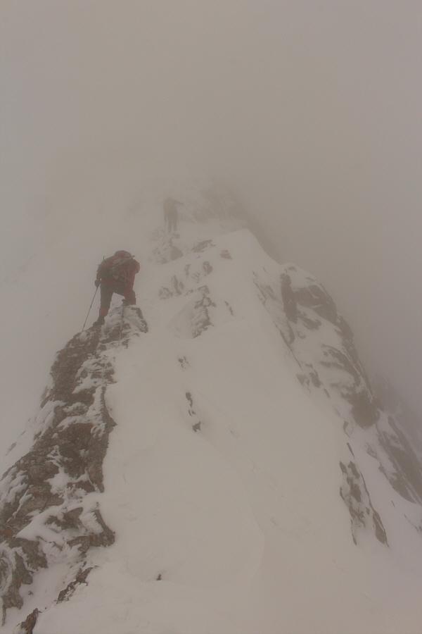
Zosia and Marta climb up a narrow section of the ridge crest.
This is the correct route off the false summit. Dropping off the top of a false summit, Zosia follows Marta's footprints down a steep bench along the ridge.
Could be anywhere along the whole Livingstone Range! 
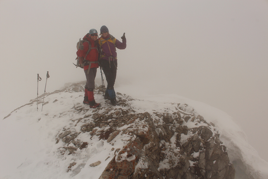
Zosia and Marta reach the summit of Lightning Peak (2475 metres).
Was the summiit worth the effort today? Hmmm... 
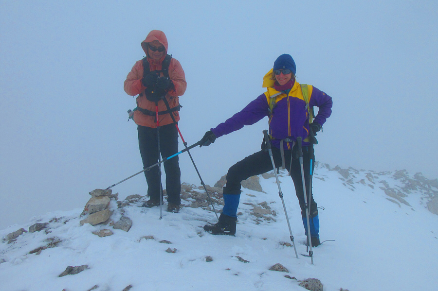
While Marta is satisfied with the cairn, Sonny consults his phone to make sure that this truly is the summit.

Photo courtesy of Zosia Zgolak

At least we weren't distracted by amazing views while descending here! Marta and Zosia carefully retrace their steps down the ridge crest.
The snow actually got deeper lower down! Sonny and Marta plunge-step down a steep snowy slope.

Photo courtesy of Zosia Zgolak

Oh well, it's better than nothing, I guess! Zosia and Marta are finally rewarded with some views as they descend the forested ridge.
Zosia makes it look easy! 
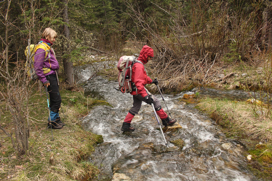
Marta watches as Zosia steps across Pocket Creek.
Of all the numerous parties that recently climbed this peak, ours was the only one that had zero views from the top. Doh! 
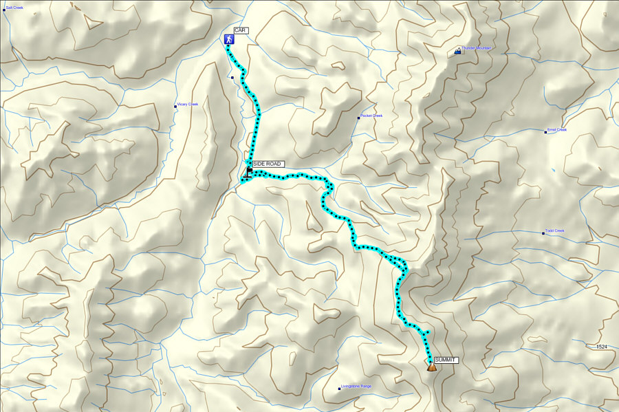
Total Distance: 21.9 kilometres
Round-Trip Time: 11 hours 2 minutes
Net Elevation Gain: 1026 metres

GPX Data