BOU AVENUE
Northgate Peaks
On my way to Las Vegas, Nevada for a week-long solo vacation, I took a detour to visit Kolob Terrace in Utah's Zion National Park.  In particular, I had ambitious plans to climb a couple of peaks there--North Guardian Angel and South Guardian Angel.  Both are challenging ascents, and South Guardian Angel also entails a complicated approach which requires descending into and climbing out of a deep canyon.  Naturally, South Guardian Angel was my primary objective when I arrived at the Wildcat Canyon trailhead on the morning of 18 November 2018 after camping the previous night at a nearby Bureau of Land Management (BLM) campsite.

From Highway 9 near the east end of Virgin, Utah, turn onto Kolob Terrace Road and drive north for 25 kilometres to the signed turnoff for the trailhead.  Turn right and drive another 100 metres to a large parking area with a vault toilet nearby.

In my haste to leave home, I had neglected to upload GPS tracks or bring printouts of the route descriptions for both peaks.  Nevertheless, I had previously studied the routes at length and felt confident enough in my route-finding ability to just "wing it".  I would soon learn the folly of my ways.

When I arrived at the trailhead, I met a woman from Oregon named Serai Furlong who was planning to do a one-way solo canyoneering trip through the Subway, a very popular canyon in the vicinity.  In fact, this is the very same canyon crossed by the approach route for South Guardian Angel.  Since both our routes shared the same trail for the first couple of kilometres, we agreed to hike together at the start just for some company.  I learned that Serai was in the midst of a two-month long road trip all over the southwestern United States and that she had taken climbing lessons and bought all the requisite gear specifically for the trip through the Subway.  Since she would end up at a lower trailhead far from her car, I offered to give Serai a lift if she could not find one at the end of her trip.  At this point, I was planning to spend another day in the area anyway (possibly to climb North Guardian Angel), and it would not have been a great inconvenience for me to wait for her.  We eventually parted ways as she began her descent into the canyon via Russell Gulch while I continued along the trail to Northgate Peaks.
Good location but no toilet. 
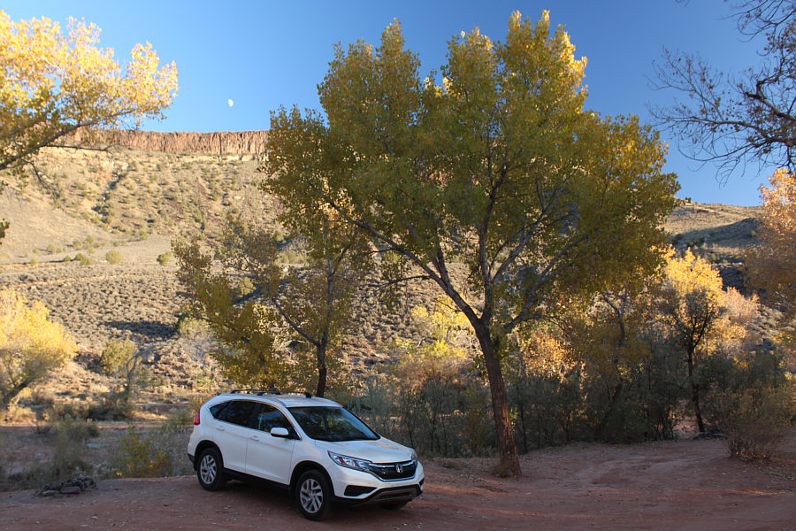
On the previous day, the moon rises above a ridge near a free BLM campsite just outside the town of Virgin, Utah.
Lotsa interesting things up the valley! 
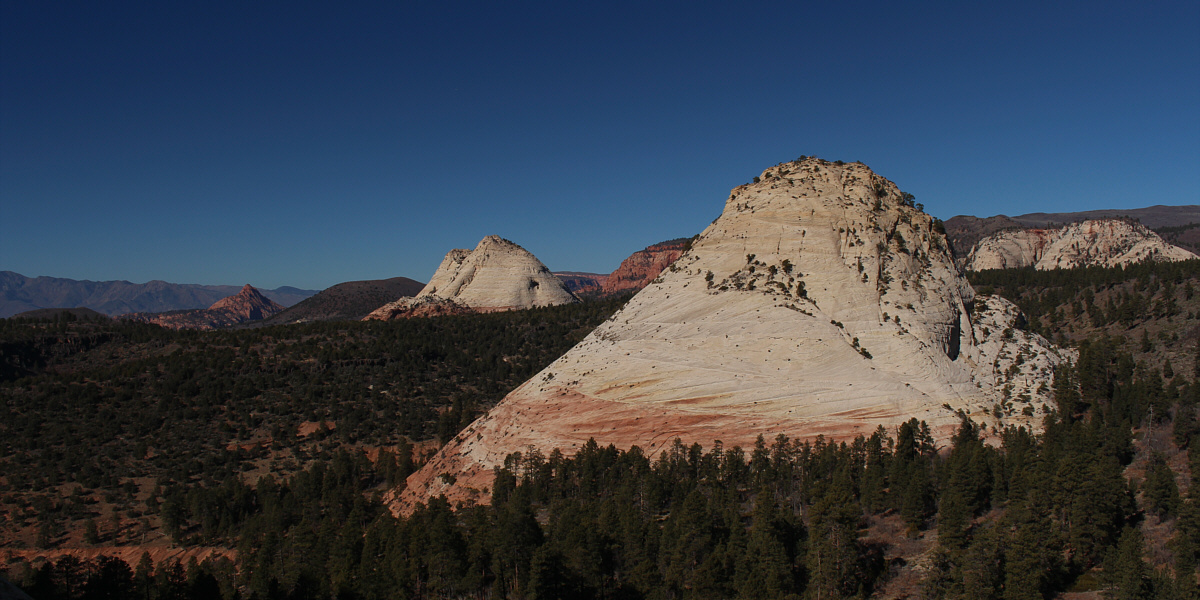
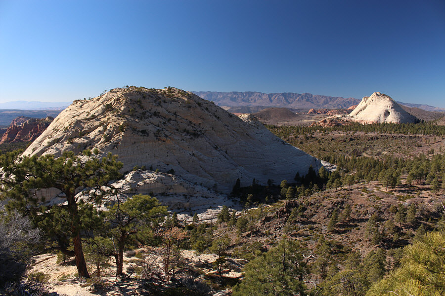
Late in the afternoon on the previous day, a low ridge near the BLM campsite offers this glimpse of some peaks to the northeast including Pine Valley Peak (far left), Tabernacle Dome (left), Northgate Peaks West (centre) and North Guardian Angel (right).
She's one tough lady! 
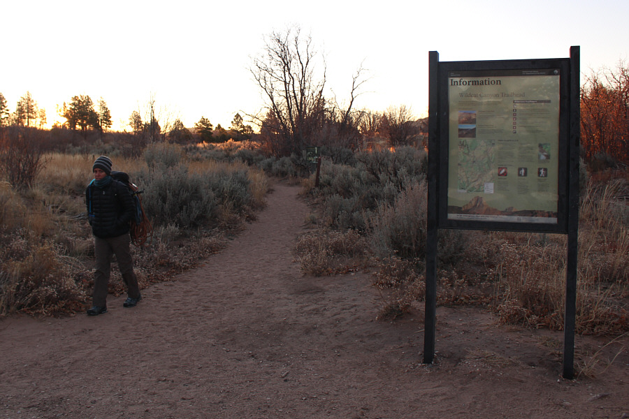
In the morning at Wildcat Canyon trailhead, Serai Furlong is ready to embark on her solo canyoneering trip through the Subway.
Unfortunately, it's not a scramble! 
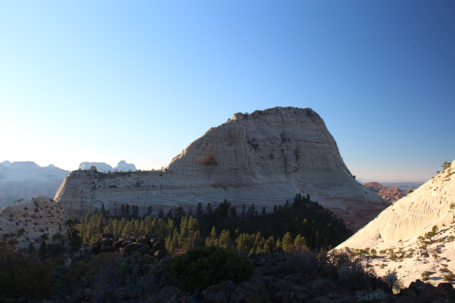
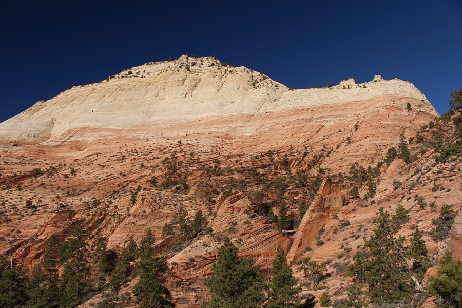
The early morning sun illuminates Pine Valley Peak near the trailhead.
The official trail ends at a rocky viewpoint situated between the two Northgate Peaks (East and West).  I dropped down some beaten paths below the viewpoint and worked my way southward passing the east side of North Guardian Angel.  This is where the route-finding became challenging.  I was expecting to find some cairns but saw very little evidence of human passage.  Already worried about being off-route, I descended an obvious ridge which ultimately led to a maze-like zone of rock ribs and thick bushes.  Without GPS tracks or a detailed route description, I floundered for quite awhile here trying to guess where to go next.  I thrashed through a fair bit of nasty vegetation and also got cliffed out a couple of times.  Having already squandered a great deal of time, I decided to pull the plug on my attempt of South Guardian Angel and began climbing back up the ridge I had descended.
Looks like a big shark fin! 
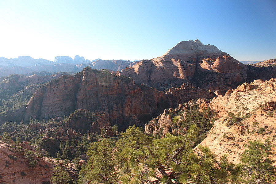
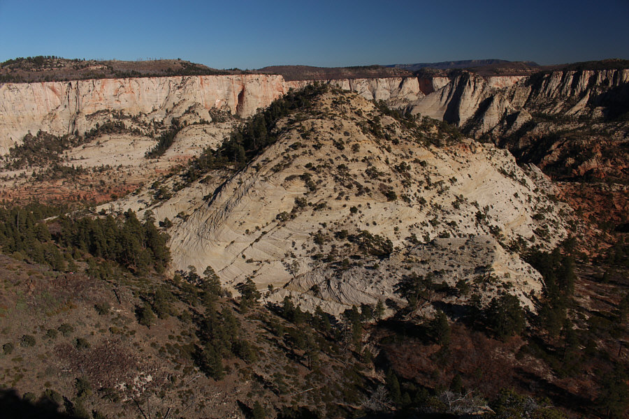
North Guardian Angel dominates the view to the south from the viewpoint at the end of Northgate Peaks trail.
Easiest peak to bag in the area. The sun peeks over Northgate Peaks East.
A route-finder's nightmare for sure! South Guardian Angel sits across a seemingly impenetrable canyon.
Might be easier to the right... This is looking back up at a difficult crack that Sonny descended while attempting to reach the bottom of the canyon.
Giving up on South Guardian Angel, my focus was now on North Guardian Angel. Here is the southeast face of North Guardian Angel.
Out of curiosity, I wandered into the canyon next to North Guardian Angel and worked my way upwards from there.  I actually got more than I bargained for when I encountered a chockstone in the canyon that proved to be very difficult to climb over.  It took me a few tries, but by employing some stemming, I managed to get over the chockstone--just barely.  I felt a measure of relief when I finally escaped the canyon and started working my way around to the northeast side of North Guardian Angel which was now my "Plan B" for the day.

The slope on the northeast side of North Guardian Angel is much steeper than I was expecting, and a few slings left on some trees attest to the difficulty of the terrain here.  With a bit of careful route-finding, I was able to climb onto the east shoulder of the peak, and soon I was at the base of the upper east ridge.  Unfortunately, the ridge proved to be a bit too technical for my liking.  I was confident that I could have climbed up, but without a rope, I would not have been able to descend safely.  Prudently, I decided to back off, and I was now eyeing the Northgate Peaks as my "Plan C".
I could climb this, but I would not be able to get down safely without a rope. Sonny would abandon his attempt to climb North Guardian Angel at this technical section along the east ridge.

I guess we're switching to Plan C now!

The east shoulder of North Guardian Angel grants this view to the north of (L to R) Red Butte, Pine Valley Peak, and Northgate Peaks West.


Dropping down the northeast side of North Guardian Angel, I worked my way back to the beaten paths I had used to descend from the viewpoint at the end of Northgate Peaks trail.  Instead of climbing back up to the viewpoint, I circled around to the north side of Northgate Peaks East and found a good trail leading all the way to the summit without any complications.  After coming up empty with my first two objectives of the day, I felt some joy in finally reaching the top of something.

Already turning my attention to Northgate Peaks West, I kept my summit stay short and promptly descended the same trail I had come up.
It might be possible to scramble up here, but there is an easier route to the summit... Here is the southwest face of Northgate Peaks East.
Keep an eye out for a cairn and a trail. Contouring along the edge of the forest leads to easier terrain on the north side of Northgate Peaks East.
Finally, success! Sonny stands on the summit of Northgate Peaks East (2174 metres).
Okay, let's go do the West Peak! From the summit of Northgate Peaks East, the view to the northwest includes Northgate Peaks West and Pine Valley Peak.
From the bottom of the trail, I hiked back to the viewpoint at the end of Northgate Peaks trail before scrambling down the other side into a shallow valley below the east face of Northgate Peaks West.  Just as I had done on Northgate Peaks East, I circled around to the north end and started to climb up easy terrain there.  Some steeper sections higher up near a false summit felt a bit airy, but generally, the north slope of Northgate Peaks West is just a Class 2 hike.  I had no problems climbing over the false summit and subsequently reaching the true summit.

I took a slightly longer break on this summit before retracing my steps back down the north slope.  Instead of returning to the viewpoint, I continued hiking northward and then turned east through open forest to eventually intersect Northgate Peaks trail.  The rest of my hike back to the trailhead was uneventful.
Groovy! 
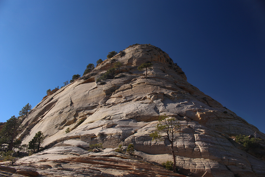
The grooved terrain on the north side of Northgate Peaks West makes for generally easy scrambling although it gets steeper near the false summit ahead.
No problemo! From the false summit, the remainder of the route to the top of Northgate Peaks West is straightforward.
Still got my second summit of the day! Sonny smiles upon reaching the summit of Northgate Peaks West (2190 metres).
Unfortunately, both are NOT scrambles! To the north, Red Butte and Pine Valley Peak are worth another look.
If only all the peaks around here were as easy to climb as this one... 
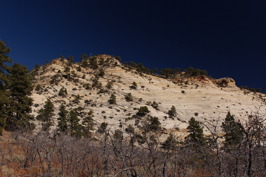
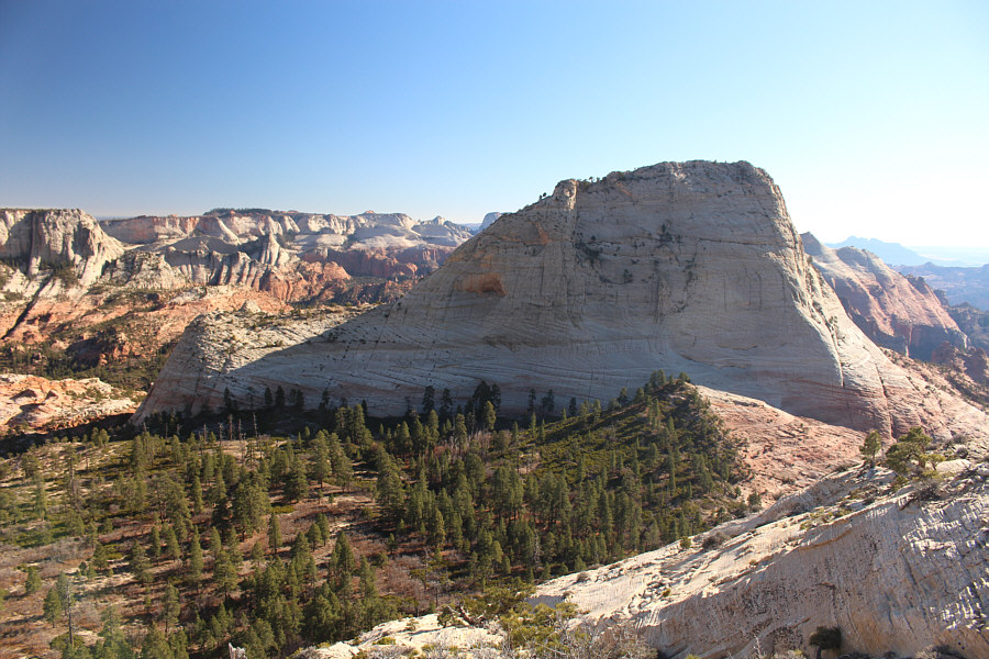
Here is a comprehensive view of Northgate Peaks East.
Doesn't look so hard from this angle... Immediately south of Northgate Peaks West is North Guardian Angel.
Better than loose scree! This is a close-up of some of the grooves on the north slope of Northgate Peaks West.
End of a bittersweet day... 
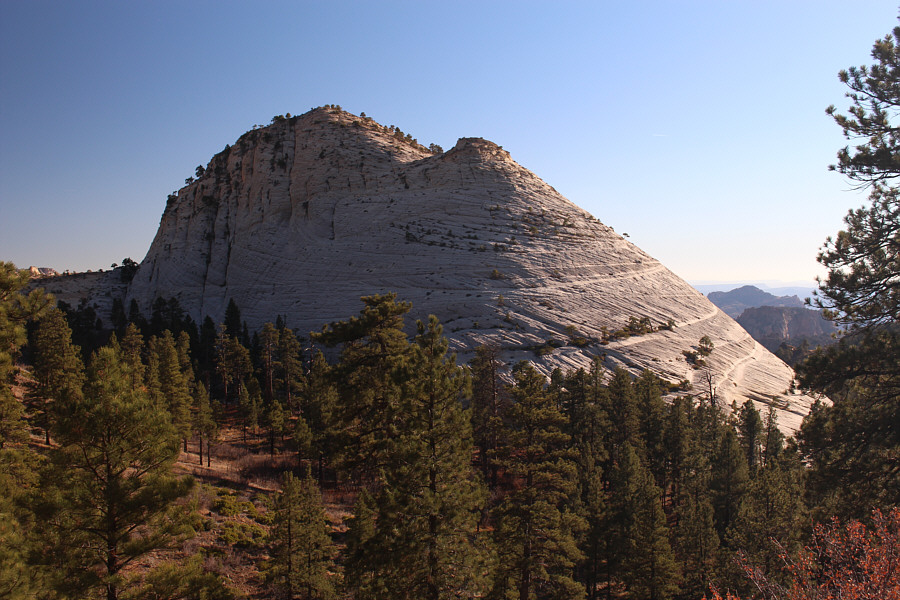
Here is a last look at the northern aspect of Northgate Peaks West.
Upon returning to the trailhead, I noticed that Serai's car was still there.  Just in case we missed each other in transit, I left her a note before driving to the lower trailhead to wait for her.  As it turned out, I had just missed her by a few minutes, and she had managed to get a ride back to her car with the help of some hikers she met in the Subway.  Fortunately, she found my note and quickly drove back to the lower trailhead to let me know that my services were no longer required.  Feeling really hungry, she invited me to join her for dinner somewhere, and we eventually settled on a restaurant in the nearby town of La Verkin.  Over dinner, she regaled me with tales of her adventures so far on her road trip including that day's eventful journey through the Subway.  Even though Serai did not require me to drive her back to her car, she thanked me anyway by picking up the tab for dinner.

Parting ways with Serai after dinner, I hit the highway and ultimately drove into Nevada to camp for the night.
Awesome meatloaf here! 
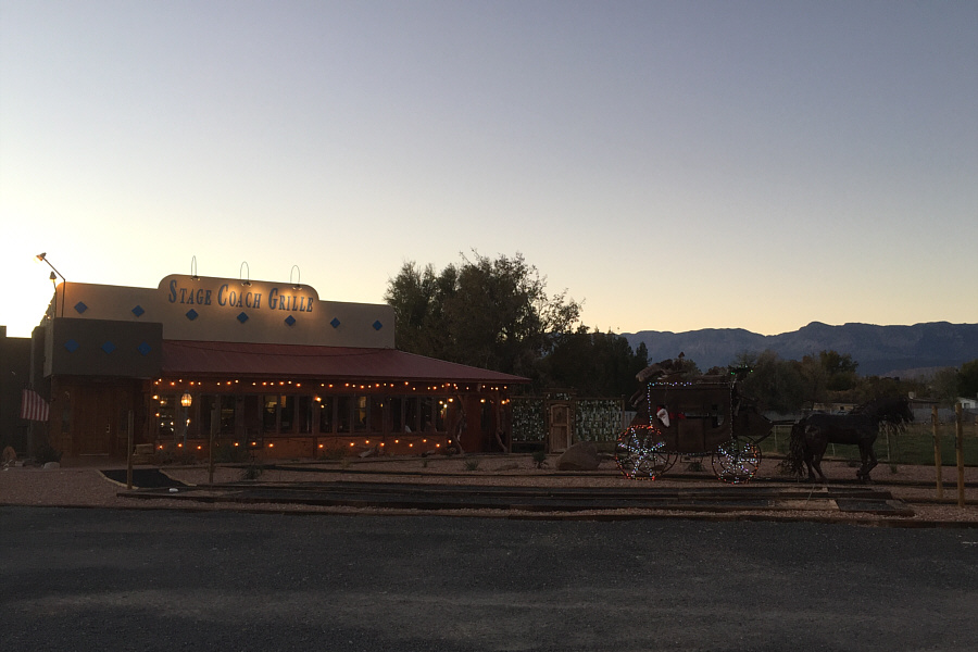
At the end of the day, Serai would treat Sonny to dinner at this restaurant in the town of La Verkin, Utah.
I'll be back...maybe... Total Distance:  16.0 kilometres
Round-Trip Time:  8 hours 33 minutes
Net Elevation Gain to East Peak: 137 metres
Net Elevation Gain to West Peak: 153 metres

GPX Data