BOU AVENUE
Survey Peak

Survey Peak near Saskatchewan Crossing in Alberta's Banff National Park has long been on my to-do list ever since I noticed a mention of it in Mike Potter's guidebook, Backcountry Banff.  On a backpack trip to Glacier Lake years ago, I made a half-hearted attempt to find a route of some sort starting from the backcountry campsite, but the thick bush promptly cut short that endeavour.  In the intervening years, several of my contemporaries have published trip reports for Survey Peak, but all have reported experiencing long and arduous bushwhacking both in winter and summer conditions.  As such, I put Survey Peak on the back burner to save it for a day when I felt especially masochistic.

Then just earlier this year, Rafal (Raff) Kazmierczak reported on social media that he and Joanna Ford had discovered a flagged route up Survey Peak with minimal bushwhacking.  Not surprisingly, this was followed by a significant increase in the number of peak-baggers paying a visit, and several new trip reports surfaced online shortly after including this one!

After contacting Raff to obtain his GPS track, I invited Asieh Ghodratabadi, Bob Parr, Ali Shariat, and Marta Wojnarowska to join me for an ascent of Survey Peak on 14 July 2018.  Starting from the Glacier Lake trailhead, we followed the well-maintained trail across the bridge over North Saskatchewan River and continued past a scenic viewpoint with another of Parks Canada's now ubiquitous dual red Adirondack chairs.  A short while later, we passed an obvious trail branching to the right.  Without a GPS track, we might have been tempted to follow this spur trail, but instead, we stuck to the main trail until we found flagging only a short distance further.  Ironically, there was less evidence of a trail here, but we faithfully followed the GPS track and plunged into the forest.  The route is quite ambiguous for the first few metres in the forest, and we ended up bushwhacking for a short while until we finally stumbled onto a distinct trail climbing steadily uphill.

As promised, this trail provides a somewhat boring but relatively painless way to ascend the forested east ridge of Survey Peak.  We had to do some route-finding in a few spots where the trail was a bit vague and also when we left the trail altogether at a flagged spot just short of tree line.  Clearing the last of the trees, we stopped for a short break at a flattening of the ridge before continuing up the remaining three hundred metres or so of mostly tedious rubble.  It is worth noting that the mosquitoes were very bad on this day, and we were continually harassed almost all the way to the summit.  Amazingly, the summit was largely bug-free even without much of a breeze, and we enjoyed a lengthy stay up there for about 1.5 hours.

For our descent, we simply retraced our steps back down the mountain.  The mosquitoes resumed their relentless harassment when we reached tree line, and the hike down through the trees was just as monotonous the second time around.  Nevertheless, we had no serious issues descending to Glacier Lake trail, and the only annoying part of the return was having to go uphill again near the very end.

On the way home, we stopped at the A&W in Canmore to have a quick dinner and take advantage of Free Root Beer Day.  It was a great way to cap off another enjoyable day in the mountains with good friends.
Like a bridge over troubled waters... Asieh and Ali cross a bridge over North Saskatchewan River.  Survey Peak is visible above the trees at left.
This mountain is beckoning to me... Puffy clouds drift in front of Mount Murchison in this view from the bridge over North Saskatchewan River.
Its mother was nearby too!

A young grouse remains quiet and still not far off the trail.

With a good trail, this peak is only going to become more and more popular in the future! Here is a more complete view of Survey Peak and its broad east ridge from a scenic viewpoint along the trail to Glacier Lake.
Start keeping your eyes open here for flagging! The group follows the trail alongside Howse River.  At left is Mount Sarbach.
We missed the path on the way in and ended up bushwhacking more than we should have! The group leaves the trail and plunges into the forest at this flagging tape.  A beaten path of sorts can be found a little to climber's left of here.
Beats having to bushwhack! Most of the route goes through viewless forest just like this.
No trail or flagging here; just keep going uphill!

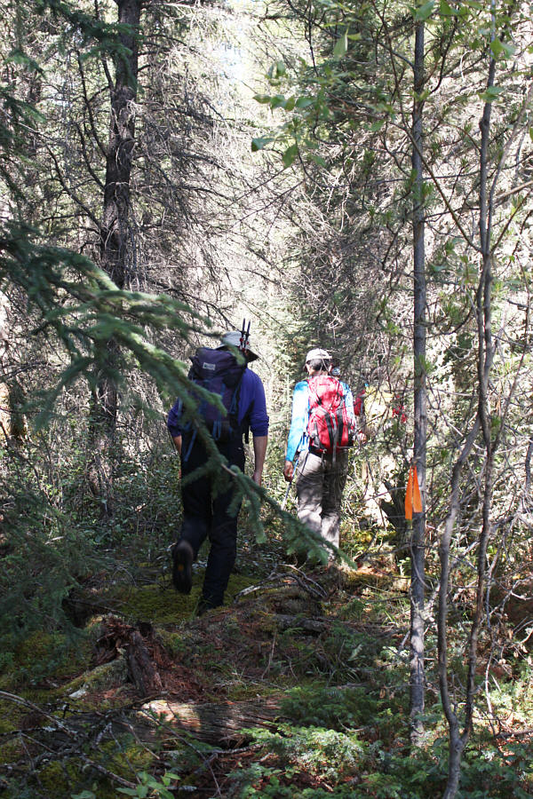
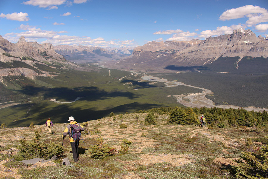
The group hikes off-trail not far below tree line.

I'm still itchy as I write this!

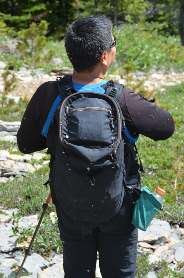
Sonny is being eaten alive by mosquitoes.

Photo courtesy of Ali Shariat

We've paid our dues; now it's time to reap the rewards!

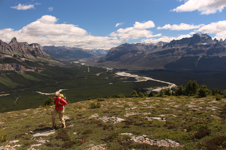
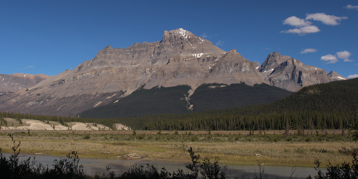
Views of Saskatchewan Crossing open up as Marta clears the last trees.

You could kill them all with one swat...but more would follow!

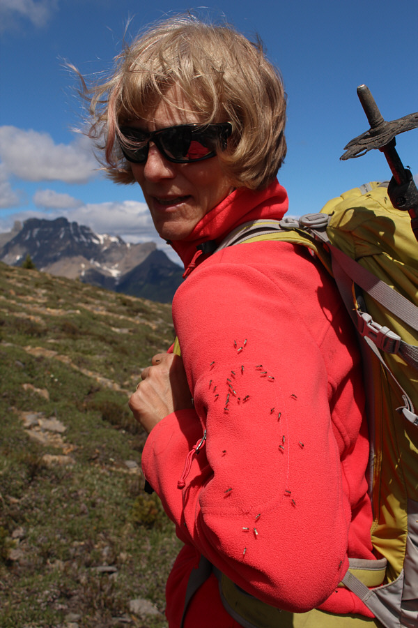
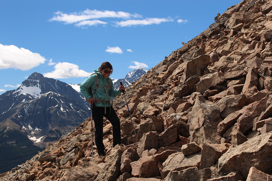
The mosquitoes are still relentless above tree line.

The mosquitoes were still annoying us here!

Marta approaches the summit block of Survey Peak.


Still another 300 metres of elevation gain left! The group follows the connecting ridge to the summit block.
She's a trooper! Despite having to ascend tedious rubble, Asieh still manages to crack a smile.
Just put your head down and keep grinding uphill! The climb up the rubble is longer than it looks because of foreshortening.
Mount Amery is just hidden behind the ridge on the left. In this view to the northwest, Cirrus Mountain and Mount Coleman can be spotted on the distant right horizon.

I would like to climb and ski this one someday...

Mount Wilson dominates the view to the northeast.


Supposedly one of the new 11,000ers!

To the east is the massive hulk of Mount Murchison.


That was a great scramble so many years ago!

Mount Sarbach sits across Howse River to the southeast.


I will be dreaming about Mount Forbes for awhile still! Mount Outram and Mount Forbes round out the views to the southwest.
That's a big-ass cairn for such an infrequently (at least up until this year) visited peak. Ali, Asieh, Sonny, Marta and Bob sit beside the cairn on the summit of Survey Peak (2681 metres).
I think they want to scramble some more! Marta and Bob visit a striking outlier on the west side of the summit.
Erasmus looks like a daunting mountain to climb...

Bob and Marta reach the top of the outlier.  The snow-capped peak to the west is Mount Erasmus.

Dropping straight down to the lake is doable but not recommended! The east end of Glacier Lake is visible as the group makes its way down the rubble slope.
And getting harassed again by mosquitoes! The group gets one last good view of Saskatchewan Crossing before plunging back into forest.

Looks like this will be next on my to-do list in this area...

Here is a last look at Mount Murchison from Glacier Lake trail.


Much better than that O'Doul's swill that Bob Parr drinks after every scramble! Bob, Marta, Asieh and Ali enjoy dinner at the A&W in Canmore on Free Root Beer Day.
Save this one for later in the summer or fall; the mosquitoes are horrible! Total Distance:  17.9 kilometres
Round-Trip Time:  10 hours 28 minutes
Net Elevation Gain:  1235 metres

GPX Data