Photo courtesy of Zosia Zgolak
|
|
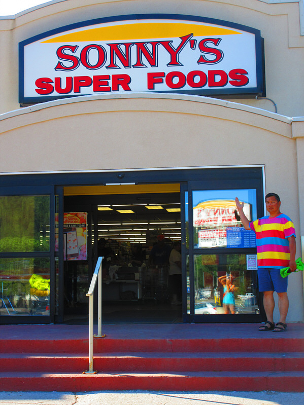
Sonny feels compelled to buy some "super foods" at this grocery store in
the town of Hot Springs, South Dakota. Photo courtesy of Zosia Zgolak |
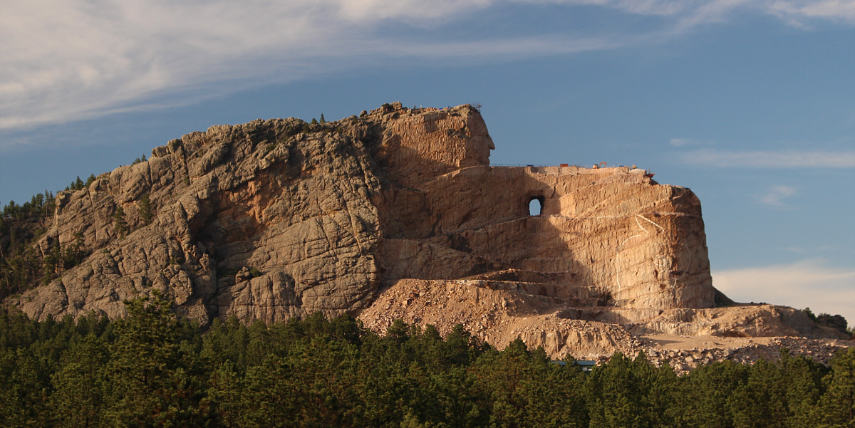
Crazy Horse Memorial is being carved right out of Thunderhead Mountain.
 |
Zosia stands beside a scaled version of what Crazy Horse Memorial will look like if it is ever finished. |
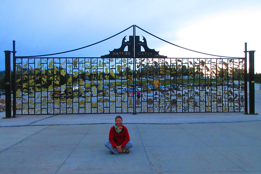 |
Zosia sits in front of an ornamental gate near the visitor centre. Photo courtesy of Zosia Zgolak |
 |
During the summer, a laser light show is superimposed on Crazy Horse
Memorial every evening after dark. Photo courtesy of Zosia Zgolak |
Zosia and I got up early the next morning (14 July 2019), and relieved that the forest around us had not burned down, we prepared for our hike up Black Elk Peak. While the northern approach usually starts from a signed trailhead beside the horse camp, we actually started hiking from a pullout on the south side of Highway 244 (5.6 kilometres east of the junction with US Highway 16/385 or 11 kilometres west of the junction with US Highway 16A). While researching the route, I had spotted this short cut trail on my phone's mapping application, and it also appears on the USGS topo map. For some strange reason, the short cut is not mentioned in summitpost.org and does not appear in the area's trail map published by the USDA. Regardless, the short cut does shave off at least a kilometre from the approach.
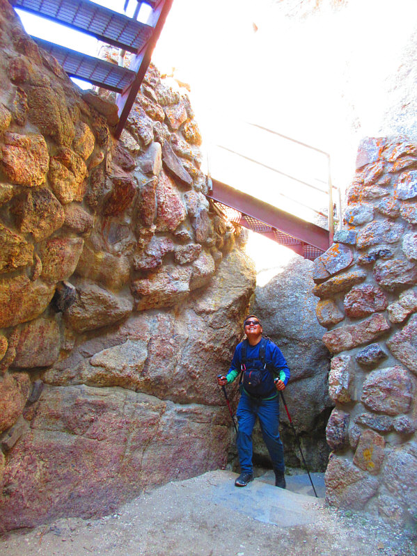
From the gate at the pullout, Zosia and I followed an overgrown track for about 300 metres before connecting with Trail #8 coming from the horse camp trailhead. Turning left, we hiked southward along Trail #8 for about 300 metres to reach a signed junction with Trail #9N. Taking Trail #9N, we climbed up to a pass just northwest of Elkhorn Mountain before dropping slightly to a creek crossing which is probably the only reliable source of water along the route. From the creek, we resumed climbing and eventually gained the crest of the connecting ridge between Elkhorn Mountain and Black Elk Peak. This is essentially the northeast ridge of Black Elk Peak, and we had no difficulties continuing to follow Trail #9N which heads more directly from here towards the summit. We eventually reached a 3-way junction with the trail coming from Sylvan Lake (Trail #9S) and a spur trail leading to the summit. Taking the spur trail, we climbed up to the base of some rocks guarding the summit block, and after passing through a hole in the rocks, we finished the ascent by climbing an iron staircase leading to a stone fire lookout tower. According to Wikipedia, the Civilian Conservation Corps completed construction of the fire lookout tower atop Black Elk Peak in 1938, and it was manned until 1967. We explored the desolate interior of the tower briefly before making our way outside and scrambling for a short distance to reach a subsidiary peak to the west.
After taking a lunch break on the subsidiary peak, Zosia and I returned to the tower and then retraced our steps all the way back to the pullout on Highway 244. The return trip was uneventful but felt long because of the rising heat of the day. By the time we returned to my car, the temperature was soaring, and we took some time to re-hydrate before hitting the road.
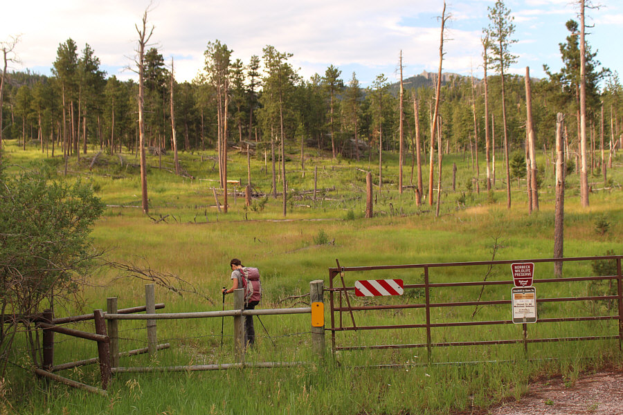 |
Zosia starts hiking from a gate on the side of Highway 244. Black Elk Peak can be seen in the distance at right. |
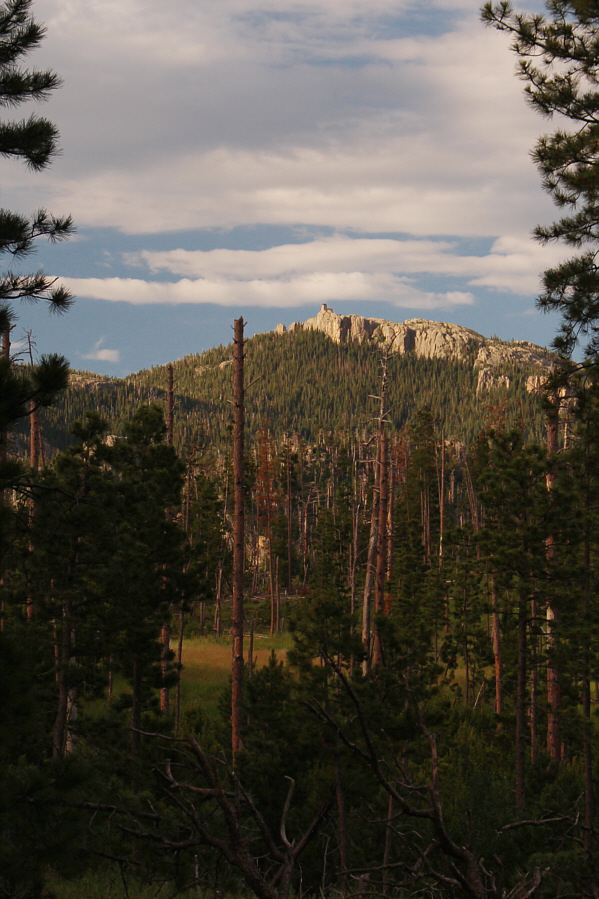 |
Black Elk Peak is once again visible through a clearing in the forest. |
 |
Zosia enters Black Elk Wilderness. The northwest aspect of Elkhorn Mountain is visible behind the trees. |
 |
Here is a clearer look at Elkhorn Mountain from the south. |
 |
Tick season is still in full swing at Black Elk Wilderness. |
 |
Western wood lilies are blooming on this day beside the trail. |
 |
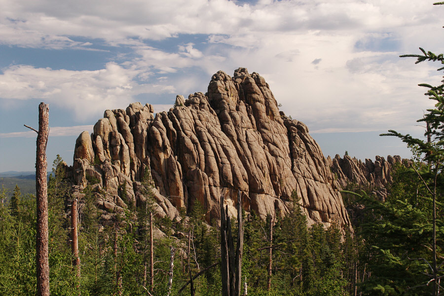
Zosia approaches Black Elk Peak along its northeast ridge. |

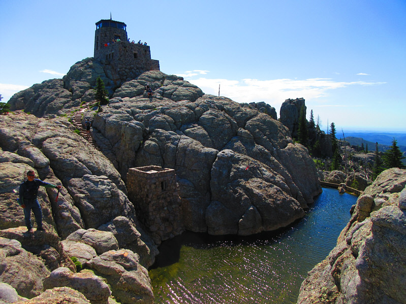
Here is a closer look at the fire lookout tower which sits atop Black Elk Peak.
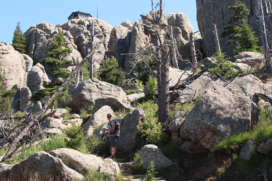 |
The fire lookout tower is tantalizingly close as Zosia climbs the final section of trail before the top. |
 |
Man-made stairs simplify the last few metres of climbing. Photo courtesy of Zosia Zgolak |
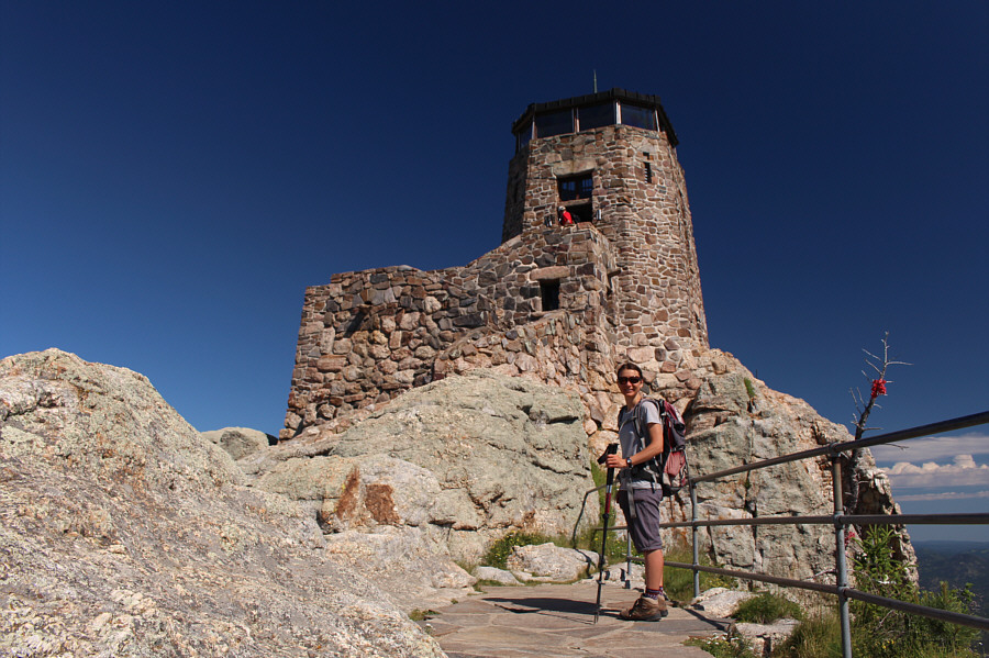 |
Zosia arrives at the base of the fire lookout tower on top of Black Elk Peak. |
 |
A plaque beside the tower entrance still bears the old official name of the peak. Interestingly, the year of completion on the plaque is slightly different than what is reported in online literature. Furthermore, Sonny's GPS recorded an elevation of 2208 metres for Black Elk Peak. |
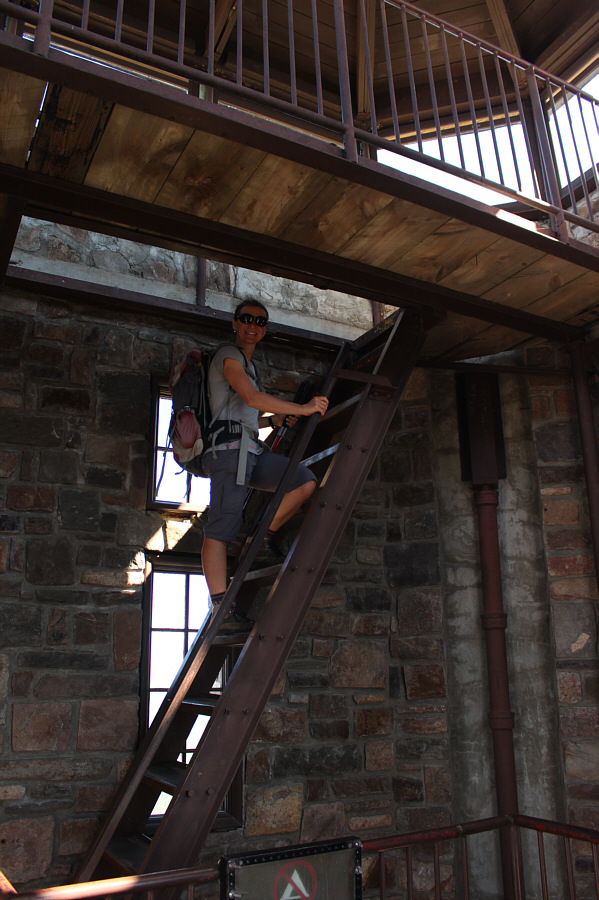 |
Inside the fire lookout tower, Zosia climbs up to the observation deck on stairs that are more like ladders on a ship. |
 |
In this view to the southwest, the prominent rock outcrop at far left is known as Little Devils Tower. Unfortunately, Crazy Horse Memorial is hidden from view behind forested Sylvan Peak at distant right. |
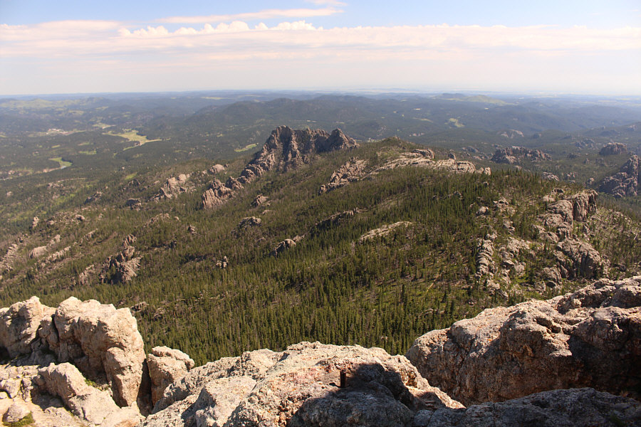 |
This is looking northeast toward Elkhorn Mountain. The approach trail can also be seen. |
 |
This man-made reservoir used to supply water for the living quarters
below the tower. Apparently, the living quarters had flush toilets
as well as electricity and central heating. Photo courtesy of Zosia Zgolak |
 |
Zosia stands on a subsidiary peak just to the west of the fire lookout tower. |
 |
Total
Distance: 16.2 kilometres Round-Trip Time: 7 hours 7 minutes Cumulative Elevation Gain: 812 metres |
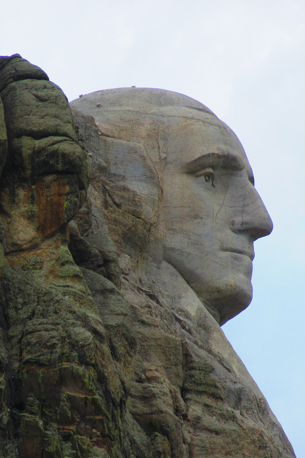 |
A pullout along Highway 244 just west of Mount Rushmore National Monument
grants this view of George Washington's profile. Photo courtesy of Zosia Zgolak |
 |
Sonny and Zosia take a selfie in front of Mount Rushmore. Most visiting tourists are probably unaware that there is a man-made chamber tucked in a canyon behind the faces that is meant to provide an explanation of the carvings for future civilizations. Unfortunately, this "Hall of Records" is presently off-limits to the public. |

Here is a closer look at the faces of George Washington, Thomas Jefferson, Theodore Roosevelt and Abraham Lincoln.
Photo courtesy of Zosia Zgolak
Leaving South Dakota, Zosia and I entered northeastern Wyoming and ended our long day with a visit to Devils Tower National Monument. We arrived in the early evening, and while the weather was still very warm, we felt refreshed enough after the long drive to hike the two-kilometre long Tower Trail which circumnavigates Devils Tower. The mountain is most famously associated with Steven Spielberg's 1977 movie, Close Encounters of the Third Kind, but unfortunately, we did not see any aliens or spaceships there on this day.
 |
The west face of Devils Tower looks brilliant in the late day sunshine. |
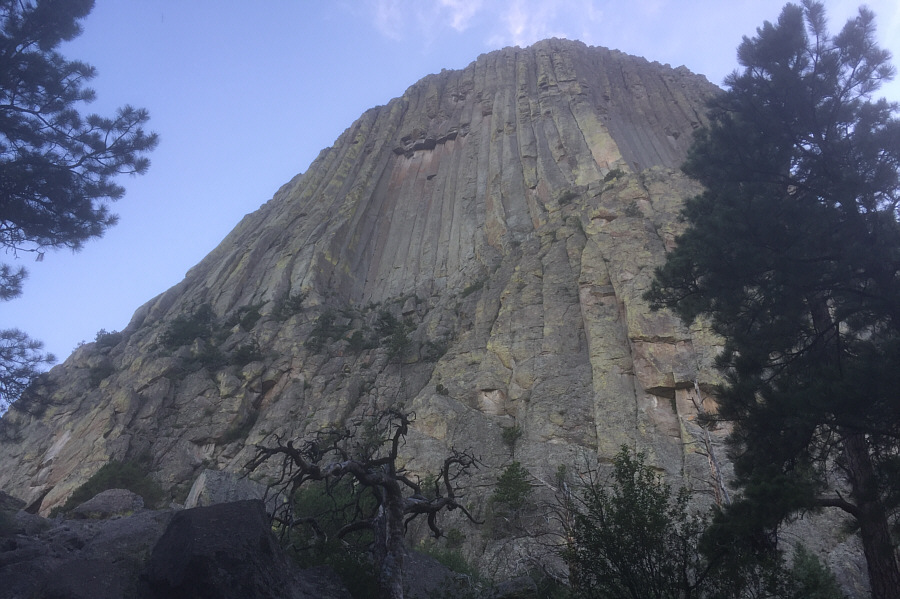 |
This is looking up the shady northeast face of Devils Tower. |
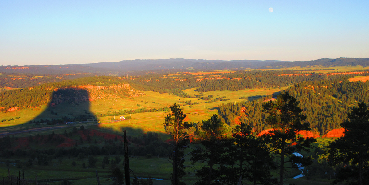
Devils Tower casts a distinct shadow to the east late in the day.
Photo courtesy of Zosia Zgolak
 |
Zosia takes a closer look at the southeast face through fixed binoculars. |
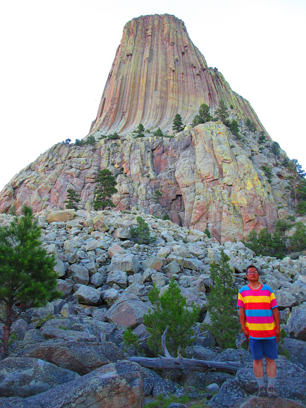 |
The horizontal stripes on Sonny's shirt stand in stark contrast to the
vertical columns of Devils Tower. Photo courtesy of Zosia Zgolak |
 |
Here is a last look at the west face of Devils Tower after sunset. |