 |
Sonny grabs a free wilderness permit at the trailhead. Photo courtesy of Zosia Zgolak |
 |
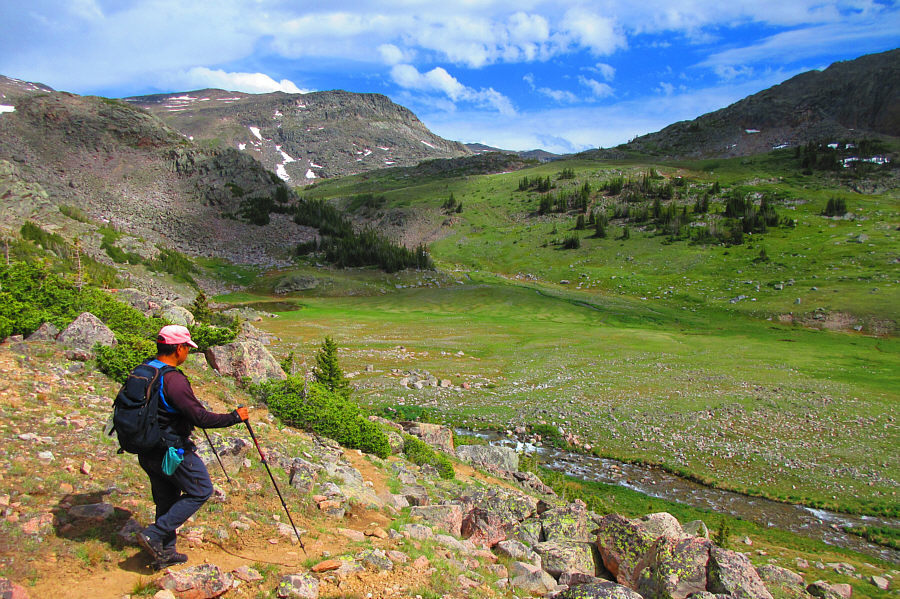
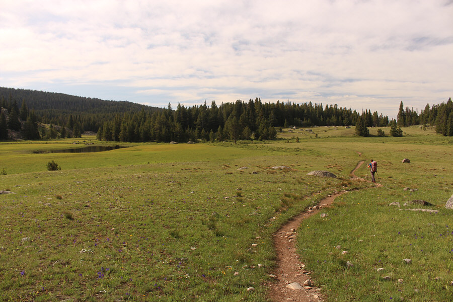
Sonny enjoys pleasant hiking near West
Tensleep Lake near the start of the trip. Photo courtesy of Zosia Zgolak |
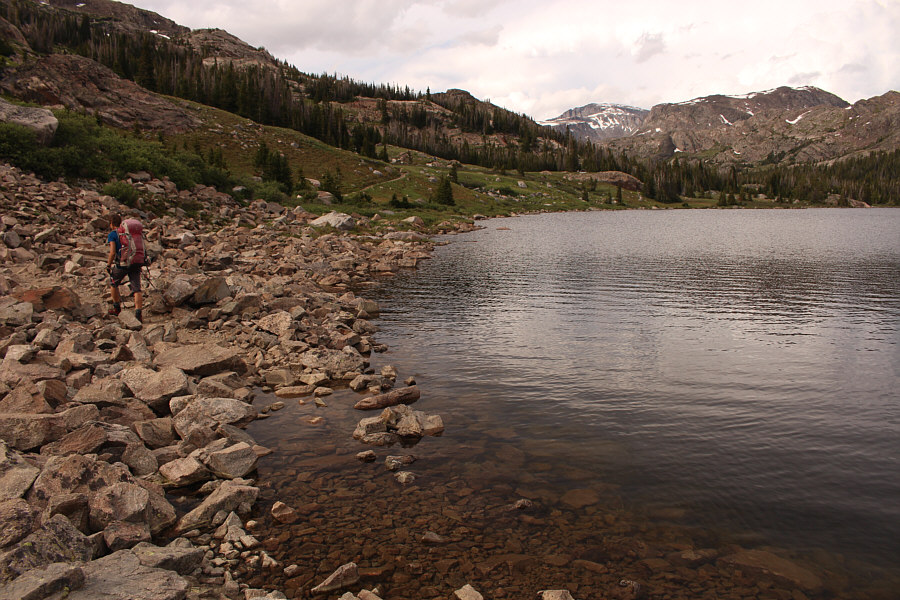 |
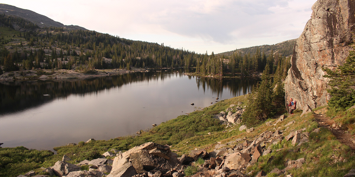
The trail disappears briefly among the rocks near Lake Helen. Cloud Peak is already visible in the distance at right. |
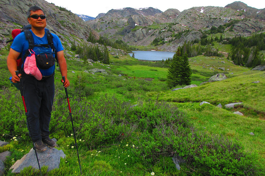 |
Lake Marion is tucked into a narrower part of the valley, and as a
result, it is seldom seen from afar. Photo courtesy of Zosia Zgolak |
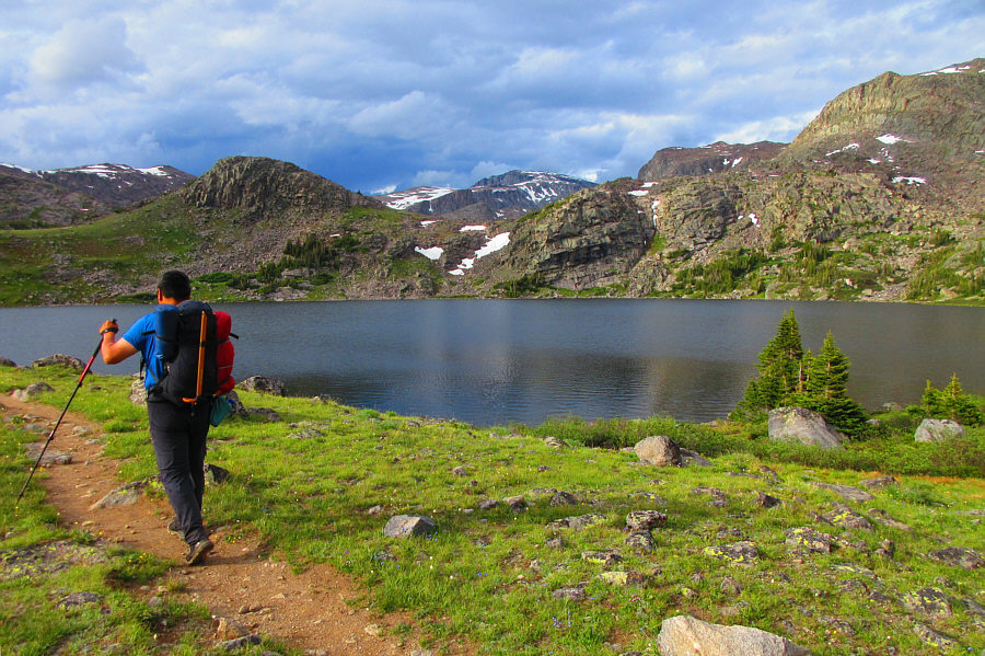 |
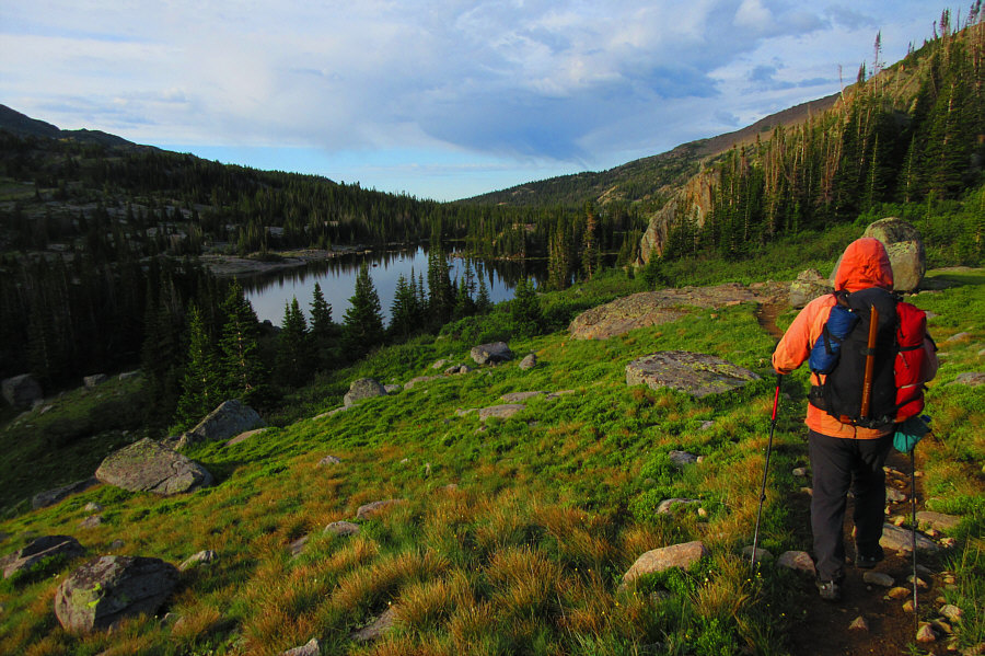
Sonny finally arrives at Misty Moon Lake with Cloud Peak visible at
centre. Photo courtesy of Zosia Zgolak |
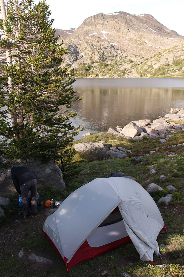 |
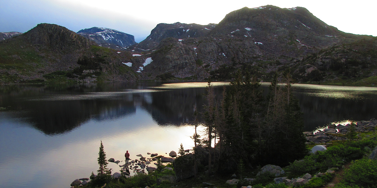
Zosia sorts out her gear after setting up the tent beside Misty Moon Lake. |
 |
Zosia tries to enjoy her dinner on the south shore of Misty Moon Lake,
but mosquitoes are rampant here. Photo courtesy of Zosia Zgolak |
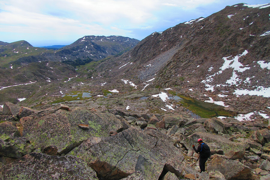
In the upper valley, Zosia and I followed the trail up a series of benches that eventually merge into the southwest ridge of Cloud Peak. We encountered a few challenges along the way including tip-toeing through a marshy section and climbing up a steep patch of snow with water flowing underneath. As we climbed higher, the trail became less defined, and we began relying more on cairns to find the most efficient route through increasingly rocky terrain. Cloud Peak's southwest ridge is not technically difficult (mostly Class 2), but the route is still long and tedious with foreshortened views and endless rubble. It seemed to take an eternity to climb up the last hundred metres or so, but we eventually staggered up to the summit cairn which sits atop a large boulder near the east end of the broad summit plateau. The views from the top did not disappoint, and we took a suitably long break there for snacks and photography.
 |
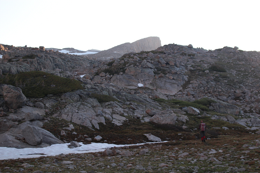
This is a view of the entrance to the upper Paint Rock Creek valley from a pass north of Misty Moon Lake. A good trail climbs further left of the waterfall and proceeds up the valley to the right. |
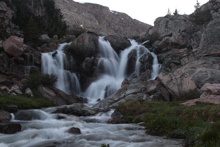 |
Here is the waterfall at the entrance to the upper Paint Rock Creek valley. |
 |
After scrambling above the waterfall on the wrong side of Paint Rock Creek, Zosia makes a tricky crossing to get to the correct side. |
 |
In the upper valley, Zosia starts to gain the southwest ridge of Cloud Peak. |
 |
Further up the ridge, the trail becomes less distinct, but cairns help with route-finding. |
 |
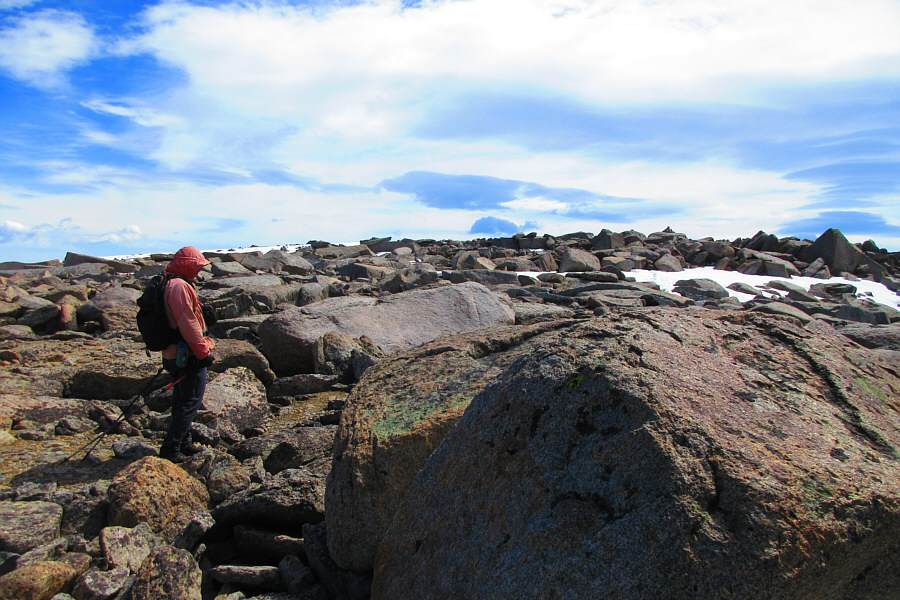
While climbing up Cloud Peak's southwest ridge, Sonny passes one of the
unnamed lakes in the upper Paint Rock Creek valley. Photo courtesy of Zosia Zgolak |
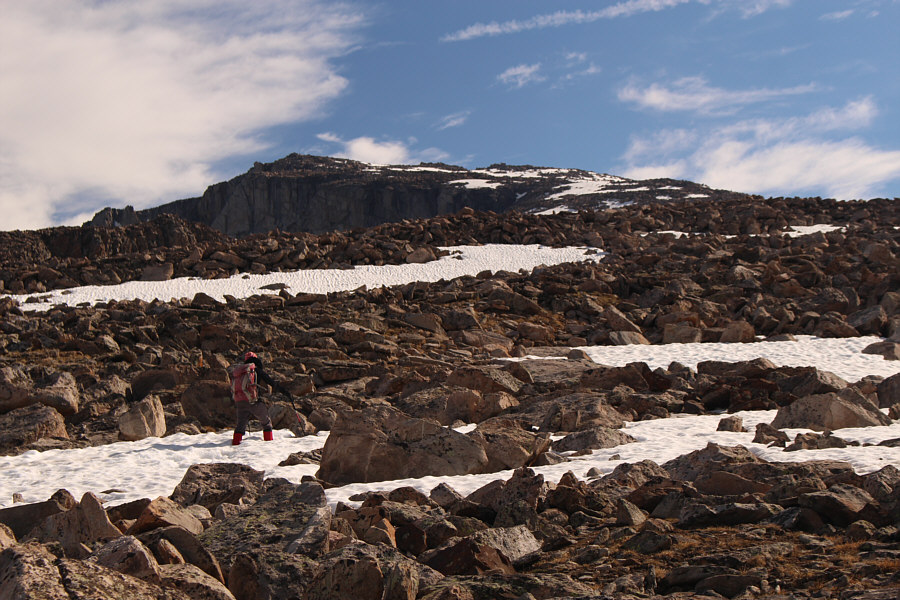 |
Zosia climbs up increasingly bigger rocks on the upper mountain. |
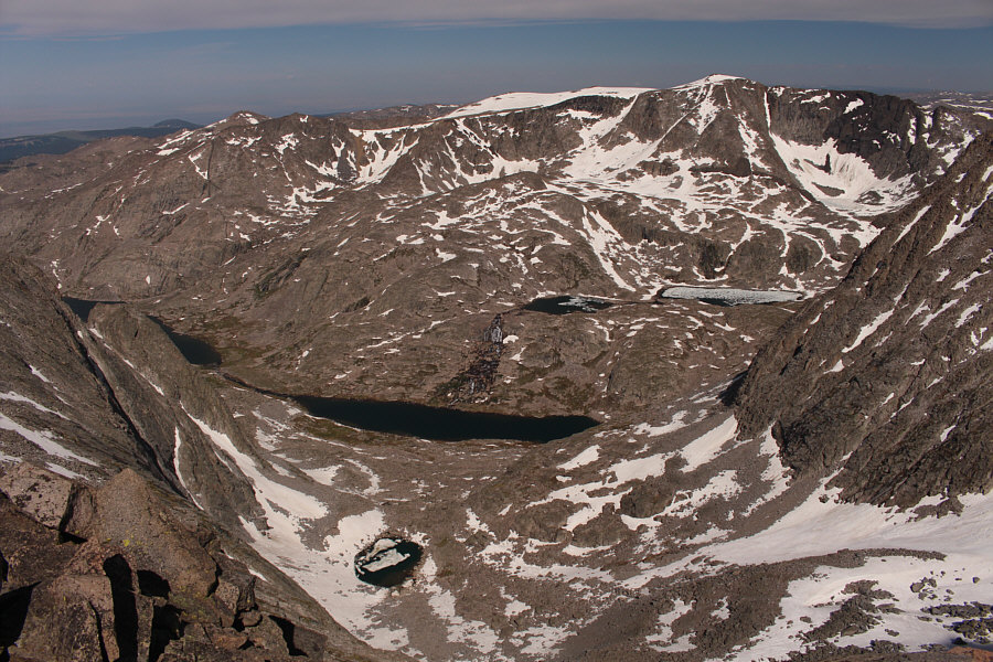 |
Numerous unnamed lakes crowd the basin to the west of Cloud Peak. |
 |
Sonny follows some old tracks in the snow not far below the top of Cloud
Peak. Photo courtesy of Zosia Zgolak |
 |
Sonny hikes across the broad summit plateau. The summit cairn can
be seen on the right horizon. Photo courtesy of Zosia Zgolak |
 |
Sonny and Zosia reach the summit of Cloud Peak (4015 metres). |
 |
In this view to the northeast, Penrose Peak is the mountain that is partly hidden behind the unnamed snowy peak at centre. At bottom is Cloud Peak Glacier, the only active glacier remaining in the Bighorn Mountains. |
 |
Glacier Lake is still essentially frozen in the basin east of Cloud Peak. Further down the valley to the right is unfrozen Diamond Lake. A bit of Cloud Peak Reservoir is also visible beyond the ridge at left. |
 |
Zosia stands above the precipitous east face of Cloud Peak. |
 |
Here is another view of Glacier Lake plus the steep north-facing cliffs along Cloud Peak's east ridge. |
Right after crossing the creek, Zosia and I initially considered lounging there for awhile to dry our feet and possibly take a quick nap in the warm sun, but the sudden appearance of annoying mosquitoes, which had largely been absent for most of the day, prompted us to quickly move on. Retracing our steps from the morning, we hopped back over the same tributary before climbing up the spur trail to regain trail #038 and subsequently the pass overlooking the basin. With fatigue setting in and relentless mosquitoes pestering us, this last climb of the day felt especially wearisome for me (Zosia, on the other hand, is seemingly always indefatigable). Nevertheless, we eventually made it over the hump and then easily cruised back to our camp at Misty Moon Lake.
Our round-trip time from camp was an astonishingly long 12 hours. Although we conceivably had plenty of daylight left to strike camp and hike back to the trailhead, Zosia and I decided to relax and spend another night at Misty Moon Lake. Dinner that evening was another crowded affair between us and a bazillion mosquitoes, and once again, Zosia and I retired to the tent as soon as we were done eating and cleaning up.
 |
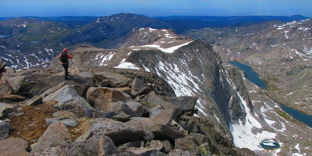
This sub-peak at the west end of the summit plateau appeared to be higher, but it is actually lower than the true summit by about 4 metres. |
 |
From the sub-peak is this view of the ascent route up the southwest ridge. Lake Helen and Misty Moon Lake are visible at distant left. |

Black Tooth Mountain (left) and Mount Woolsey (centre) are the only officially-named peaks in this view to the north.
Sonny begins the long and arduous descent of the southwest ridge.
Photo courtesy of Zosia Zgolak
 |
Sonny carefully picks his way through the ubiquitous big boulders along
the route. Photo courtesy of Zosia Zgolak |
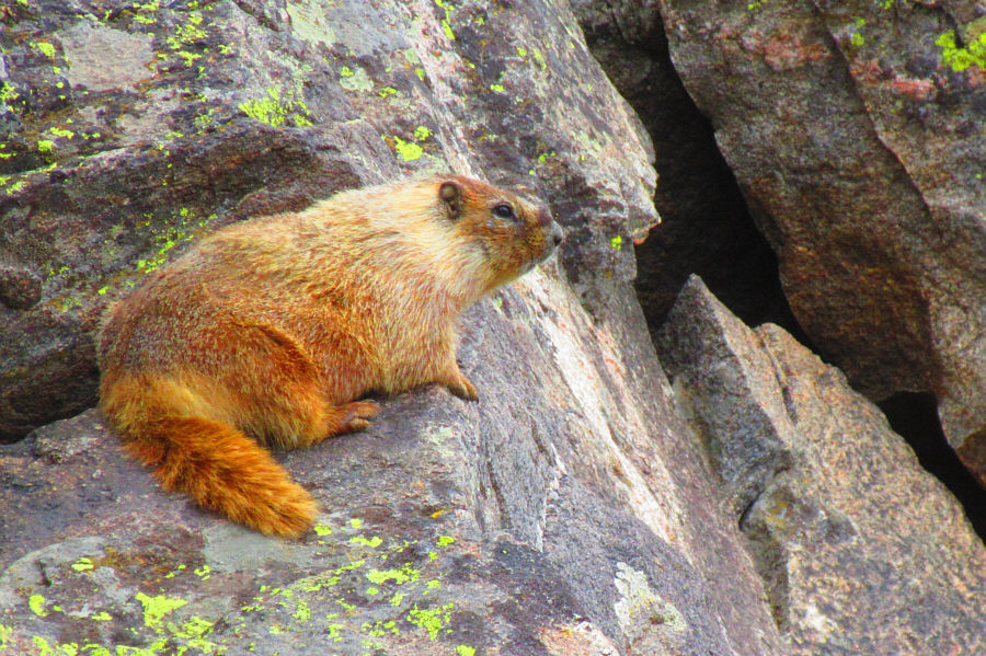 |
A yellow-bellied marmot shows little concern for a couple of tired hikers
passing through its home. Photo courtesy of Zosia Zgolak |
 |
Sonny descends to Paint Rock Creek below. Getting back to Misty
Moon Lake will require a ford of the creek followed by a soul-sucking
climb over the pass in the distance. Photo courtesy of Zosia Zgolak |
 |
Sonny carefully fords Paint Rock Creek. Photo courtesy of Zosia Zgolak |

Sonny looks rather exhausted after returning from Cloud Peak.
Photo courtesy of Zosia Zgolak
Some time during the night, Misty Moon Lake was hammered by a violent thunderstorm. Both Zosia and I were awakened by lightning, thunder, rain and hail. Strong winds also buffeted the tent, and as I had already stated, I was very thankful for the shelter provided by the trees and rocks surrounding our campsite. The storm eventually moved out of the area, and we enjoyed peace and quiet for the rest of the night.
On the morning of 17 July 2019, we got up at a reasonable time and had another quick breakfast by the lake before striking camp. The long hike back to West Tensleep trailhead was fairly straightforward, but mosquitoes hounded us the whole way. Upon returning to the trailhead, we changed into fresh clothes, enjoyed some refreshments, and packed up my car before driving to the town of Buffalo, Wyoming. In Buffalo, we enjoyed a free shower at an outdoor swimming pool, and after going to a nearby grocery store to pick up some fresh food, we returned to the pool and ate lunch at a nearby picnic shelter. Best of all, not a single mosquito bothered us during lunch!
Sonny eats breakfast at Misty Moon Lake in the morning.
Photo courtesy of Zosia Zgolak
 |
Sonny hikes back toward Lake Helen on the way out. Photo courtesy of Zosia Zgolak |
Here is a last look at Lake Helen.
 |
Zosia reaches extensive meadows in the lower valley. |
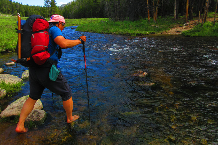 |
Sonny fords West Tensleep Creek for the second time in three days. Photo courtesy of Zosia Zgolak |
 |
West Tensleep Lake is a sight for sore eyes at the end of the long trip. |
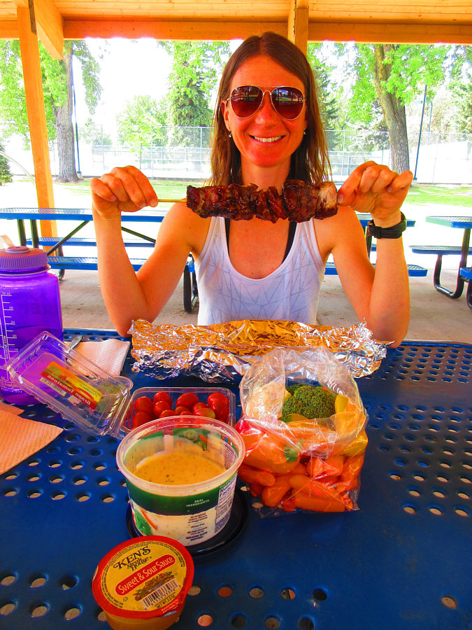 |
After enjoying a free shower at an outdoor pool in the town of
Buffalo, Zosia sits down to enjoy a fabulous lunch which includes "Hog on
a Log". Photo courtesy of Zosia Zgolak |
 |
Total
Distance: ~39.5 kilometres Round-Trip Time: 43 hours 34 minutes Net Elevation Gain: 1209 metres |