BOU AVENUE
Huron Peak
On 6 July 2019, Zosia Zgolak and I hiked up Huron Peak in the Collegiate Peaks Wilderness of central Colorado.  We used the standard route as described in Chris Meehan's guidebook, Climbing Colorado's Fourteeners.

From US Highway 24, turn west onto County Road 390 about 31 kilometres south of Leadville or 24 kilometres north of Buena Vista.  Drive the 2WD gravel road for about 19 kilometres to the ghost town of Winfield.  Turn left at the junction in Winfield and cross a bridge over Clear Creek.  There is a large campsite with an outhouse on the south side of the creek.  The condition of the road begins to deteriorate south of Winfield, but if the road is open, high clearance vehicles can probably continue for another 3.4 kilometres up the valley to the actual trailhead for Huron Peak.

Unfortunately, the road south of Winfield was blocked by avalanche debris on this day, and we had to walk the extra distance to the trailhead.  One section of the road was actually overrun by a fast-flowing creek, and I wondered if I could have even driven through with my Honda CR-V.  The walk up the valley was otherwise quite pleasant, and we reached the signed trailhead in less than an hour from my car.

From the trailhead, we began climbing up a seemingly endless series of switchbacks, and although the grade is never too steep, the monotony of the forest quickly became wearisome.  After hiking for about 1.5 hours above the trailhead, we finally broke out of the trees onto a plateau in a large cirque.  We muddled through a large snowfield here before climbing a headwall and gaining the long northern slopes of Huron Peak.  We encountered more snow patches while ascending these slopes, and inevitably, we were forced to climb up a few of them.  Fortunately, the last hundred metres or so before the top was snow-free, and that is a good thing since this section is, by far, the steepest part of the entire ascent.  The trail greatly simplifies the climb here, but the view is also severely foreshortened making the climb longer than it appears.

After taking a short break at the summit, Zosia and I promptly retraced our steps down the mountain.  Aside from the usual slipping, sliding, and post-holing through the snow patches, we encountered no serious difficulties on descent.  The switchbacks on the lower mountain were expectedly mind-numbing, but once we got back to the trailhead, the hike became pleasant again as we marched back to our starting point just south of Winfield.

Upon returning to my car, we stopped at the campsite to relax a bit and eat some food.  We then toured some of the historic buildings in Winfield before leaving the area for good.
I guess we're walking the rest of the way! The road to the trailhead for Huron Peak is blocked by avalanche debris on this day.
Maybe we should have brought a canoe? 
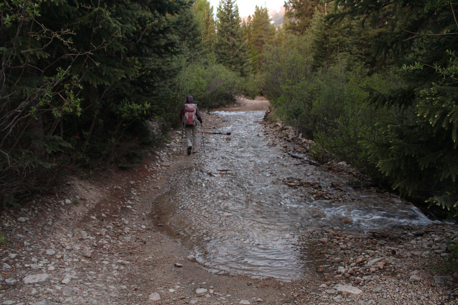
Part of the road to the trailhead has become a river.
The walk to the trailhead was nicer than expected. 
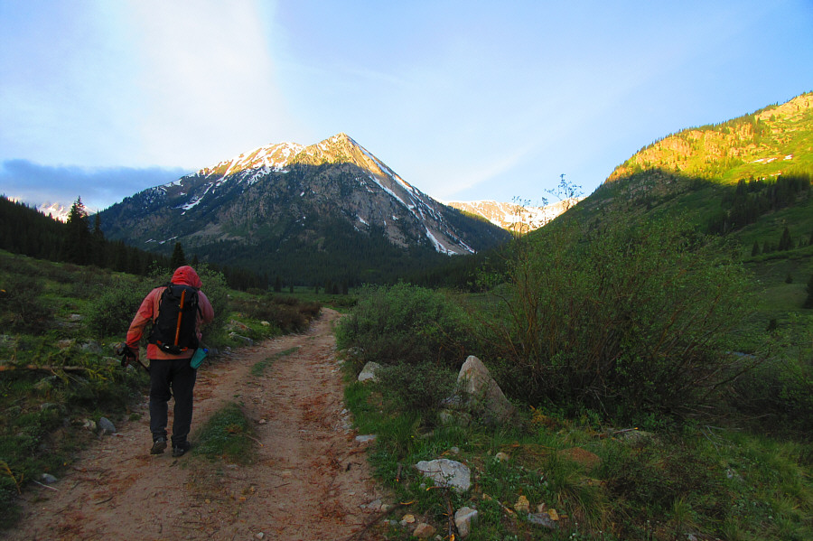
The valley opens up further along the road to the trailhead.  Granite Mountain dominates the head of the valley.

Photo courtesy of Zosia Zgolak

Time to start climbing! 
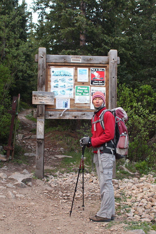
Zosia arrives at the official trailhead for Huron Peak.  The trail behind the sign is a continuation of the Continental Divide Trail.
The most interesting part of an otherwise boring hike up endless switchbacks! Zosia balances on a makeshift bridge while crossing this creek.
Still a lot of climbing left from this point! 
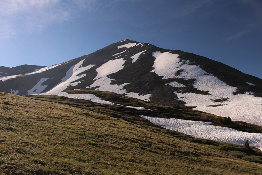
Huron Peak finally comes into view above tree line.
The snowfield is not as easy to cross as it looks! 
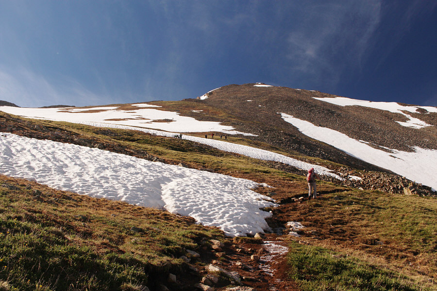
Zosia follows another group across a large snowfield.  The trail climbs the headwall and continues up the slope to the right.

Looks like I'm traveling on a glacier!

The sun-kissed snow makes for some rather tricky footing for Sonny even while he is following a beaten path.

Photo courtesy of Zosia Zgolak


Very foreshortened view here--the top is further away than it looks. Zosia tries to avoid the lingering snow patches as she climbs higher up the slope.
I feel like skiing again! 
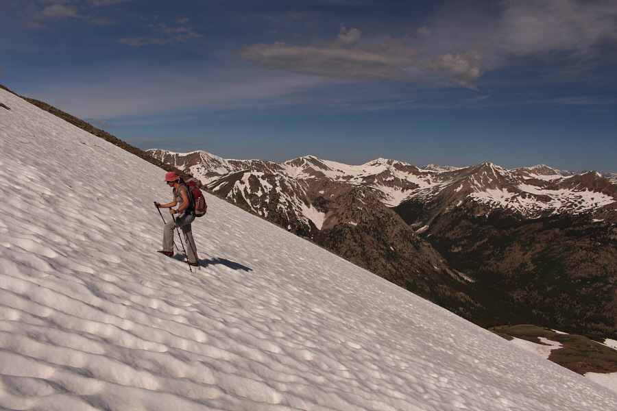
Some snow patches are unavoidable, but thankfully, the snow is generally supportive on this day.
The hardest thing about this slope is finding privacy if you need to pee! Zosia finds the trail again above the snow patches.
Those must be goat footprints at bottom left! 
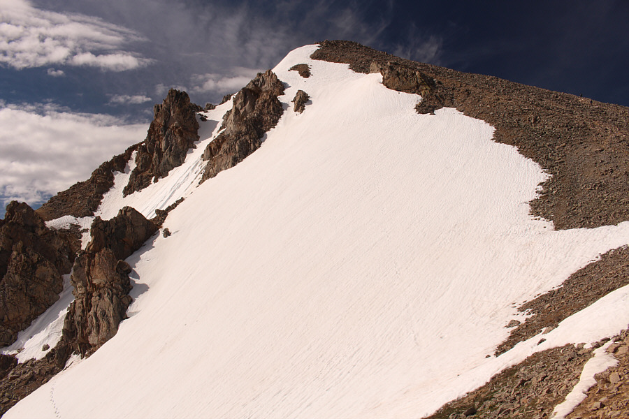
At far right, the final slope before the summit is steeper and longer than it appears.
Look, ma! No headaches! 
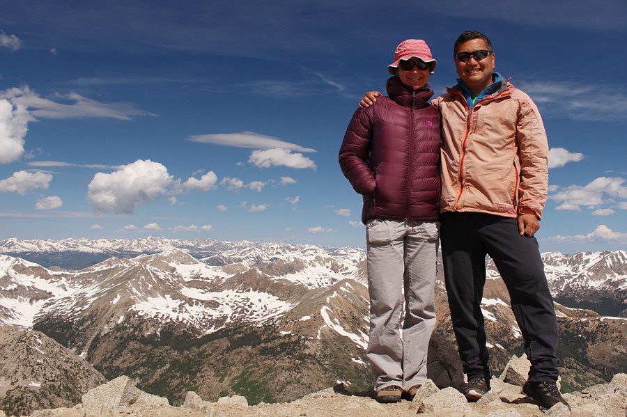
Zosia and Sonny stand on the summit of Huron Peak (4261 metres).
West Apostle is out of view to the right. North Apostle and Ice Mountain (two of The Three Apostles) sit close together at right in this view to the south.
You could spend a lifetime bagging all these peaks here! 
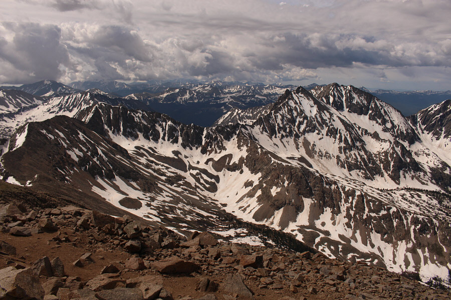
A sea of snowy peaks stretches as far as the eye can see to the northwest.
There is a trail somewhere here...I think... Sonny carefully descends the rocks below the summit.

Photo courtesy of Zosia Zgolak

Despite the usual warnings about starting early to avoid afternoon thunderstorms, we saw a lot of hikers starting out late throughout our trip in Colorado. As Zosia descends the trail, some other hikers still coming up can be spotted crossing the snowfield below.
Give me a good scree slope to surf! Re-crossing the makeshift bridge, Sonny is starting to grow weary of the numerous switchbacks to get down the mountain.

Photo courtesy of Zosia Zgolak

Go Raptors! After the hike, Sonny visits one of the historic buildings in the nearby ghost town of Winfield.

Photo courtesy of Zosia Zgolak
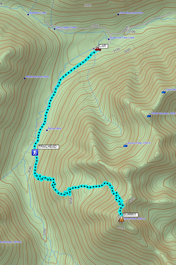
It's mostly a steep hike, but it does feel long especially with all the switchbacks above the valley. Total Distance:  16.6 kilometres
Round-Trip Time:  8 hours 17 minutes
Net Elevation Gain:  1119 metres

GPX Data