Crossing to the south side of the highway, Zosia and I made a beeline for the very obvious mountain in front of us and began walking across the desert flats. We soon came upon a wash that eased our approach and led us to the foot of the mountain. Although there are no technical difficulties with ascending Shadow Mountain, it pays to pick out an efficient route that minimizes unnecessary elevation gains and losses. Ultimately, we climbed out of the wash and worked our way up succeeding bumps along the north ridge until we reached the summit. Along the way, there are some cairns and even short stretches of trail that help alleviate some of the tedium of the climb, but from a route-finding perspective, it is difficult to get off track on this mountain. A very fierce wind greeted us at the top, but fortunately, a small wind break near the summit cairn provided enough shelter for us to have an extended break.
After spending about 50 minutes on the summit, Zosia and I retraced our steps back down the mountain. The only hiccup on our return was when we descended into a different wash at the foot of the mountain. It did not take much to correct our course, and upon regaining the wash we used for our approach, we had no further issues hiking back to our starting point.
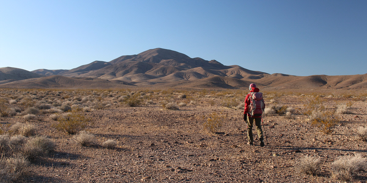
Zosia makes a beeline across the desert flats toward Shadow Mountain.
 |
Zosia enters a wash which leads to the base of the mountain. |
 |
Zosia begins to gain elevation quickly after climbing out of the wash. |
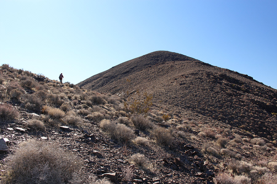 |
The ascent is mostly easy off-trail hiking up the north ridge. |
 |
Zosia climbs up one of the steeper slopes along the ridge. |
 |
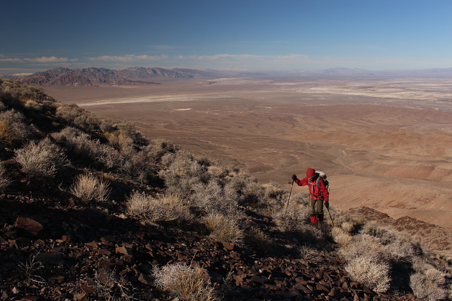
Zosia approaches the final slope before the summit. |
 |
The benchmark on the summit of Shadow Mountain curiously reads, "QUARTZ PK". |
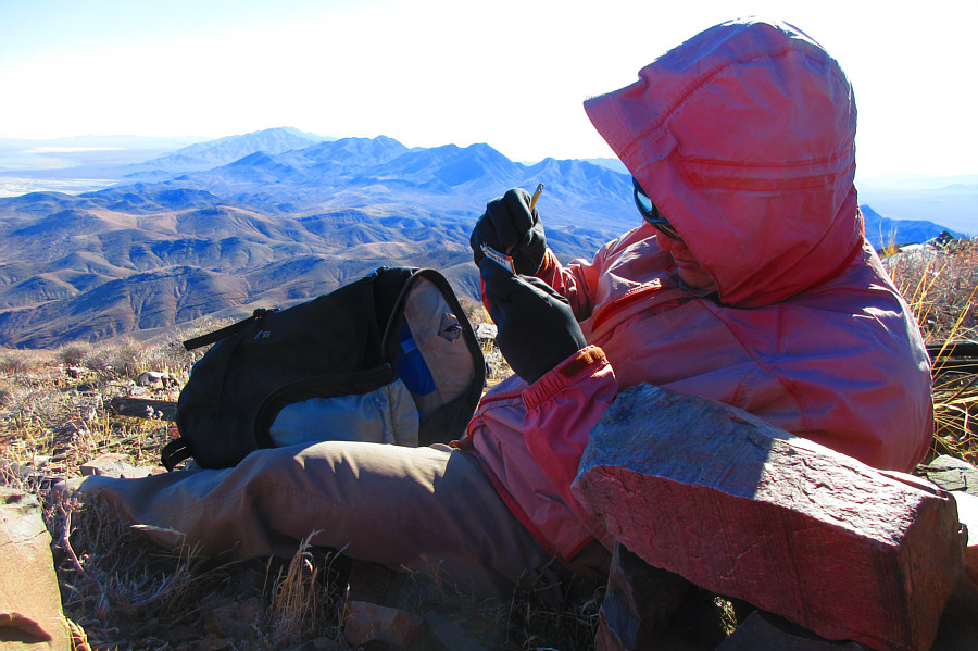 |
Sonny huddles beside a small wind
break to sign the summit register. Photo courtesy of Zosia Zgolak |
 |
Sonny and Zosia brace against a fearsome wind on the summit of Shadow Mountain (1559 metres). |
 |
The view to the south includes numerous unnamed peaks of the Resting Spring Range. The Nopah Range is also visible in the distance at left, and even further beyond on the left horizon is Clark Mountain. |
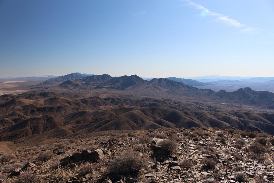
Eagle Mountain is the dark ridge to the southwest. The Panamint Range is also visible on the right horizon further west.
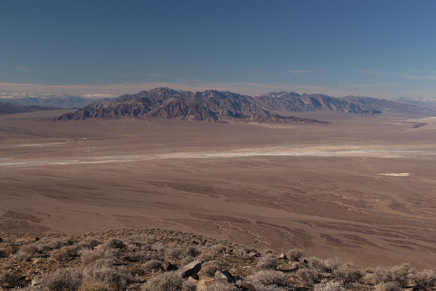 |
The Funeral Mountains stand out to the northwest. Also visible at far left on the desert floor is the tiny community of Death Valley Junction, California. |
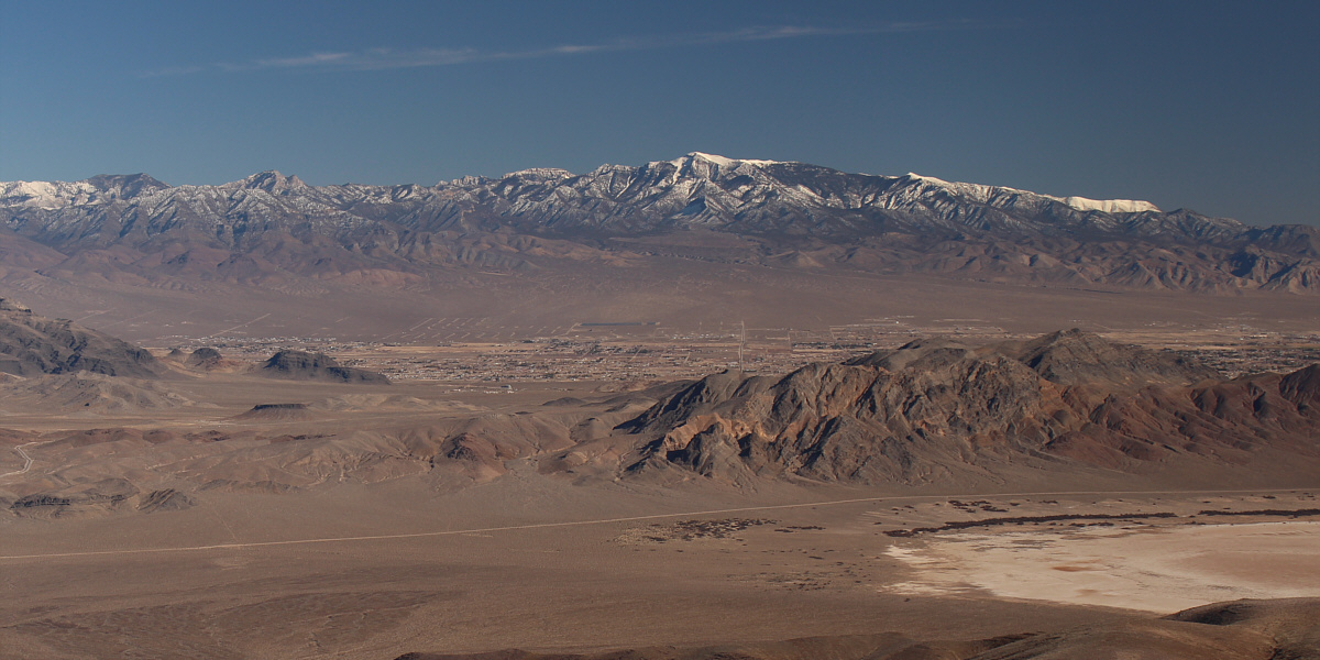
The town of Pahrump, Nevada and the Spring Mountains are the main attractions to the east.
 |
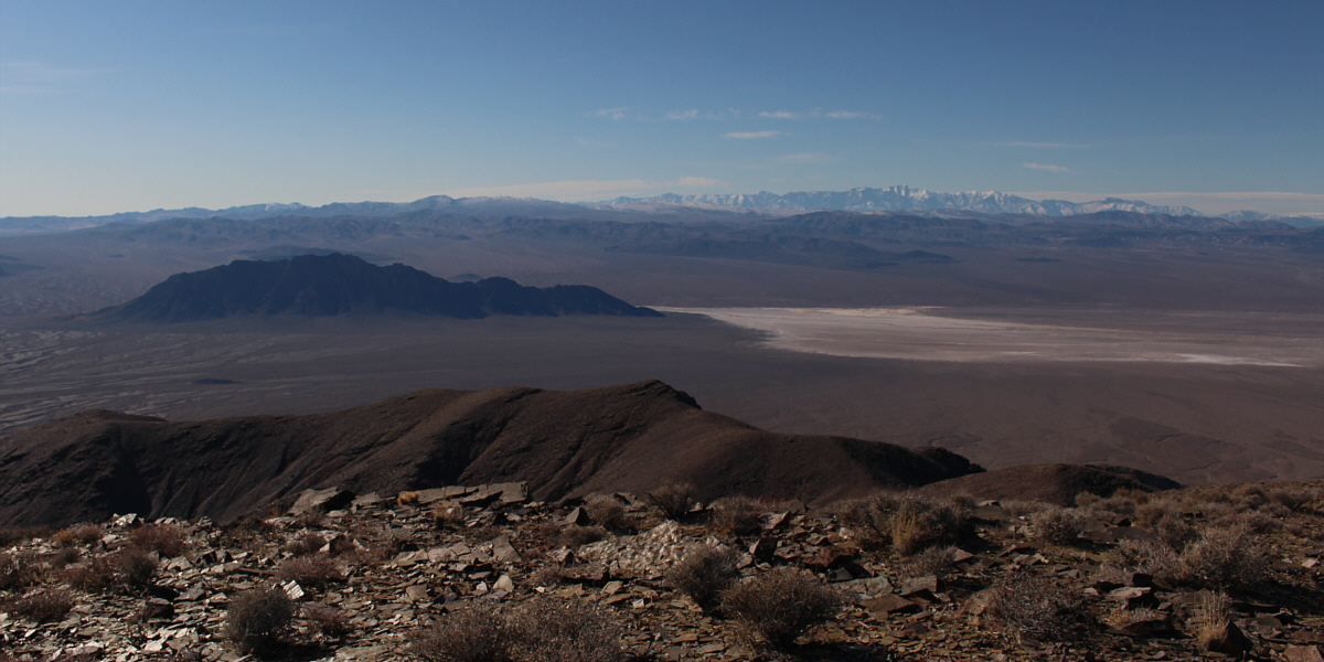
The unnamed playa (dry lake) to the southeast is in Stewart Valley. Most notable on the horizon are Charleston Peak (far left) and Potosi Mountain (centre). |
 |
Zosia descends to the original wash she used for the approach. |
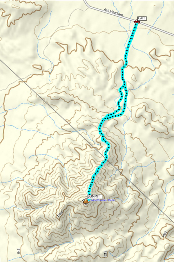 |
Total
Distance: 15.7 kilometres Round-Trip Time: 6 hours 54 minutes Net Elevation Gain: 801 metres |
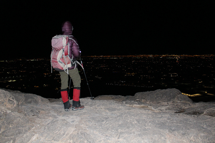
Unaware that there were no time restrictions, Zosia and I arrived at the trailhead (gravel pullout at the north end of Vegas Vista Trail which is accessed via West Alexander Road) in the early evening and geared up for the hike. Somewhat surprisingly, there was no one else around when we arrived, and it felt a little spooky to start hiking in the dark. Thankfully, we were able to find the main trail right away, and we quickly gained the crest of the north ridge without too much difficulty. From there, we turned right and followed the wide and seemingly braided trail up the ridge crest to the summit. At the top, we had a commanding view of Las Vegas, and the city lights did not disappoint. We even saw some premature fireworks go off. When we were ready to leave the summit, we simply retraced our steps down the same trail. During our descent, we started to see other people ascending, and I wondered if some of them were planning to party on top of Lone Mountain until after midnight.
After returning to the trailhead, Zosia and I drove north out of Las Vegas, and we eventually stopped for the night at Moapa Paiute Travel Plaza along I-15 at the junction with Valley of Fire Highway. Despite fireworks going off all night in a nearby field, we were so tired that we both fell asleep before the start of the New Year.
 |
Zosia gets a glimpse of the lights of North Las Vegas after gaining the ridge crest on Lone Mountain. |
 |
Sonny and Zosia give thumbs up on the summit of Lone Mountain (1016 metres). |

Here is a comprehensive view of Las Vegas at night from the summit of Lone Mountain.

Here is a closer look at the Las Vegas Strip hotels.
 |
Total
Distance: 2.0 kilometres Round-Trip Time: 1 hour 23 minutes Net Elevation Gain: 174 metres |