BOU AVENUE
Surveyor's Benchmark (Attempt)
On 17 February 2019, Zosia Zgolak and I organized a snowshoe trip for a number of our friends staying with us over the long weekend at Shunda Creek Hostel near Nordegg, Alberta.  We chose what we thought would be a technically easy objective with the promise of some views in Surveyor's Benchmark which is described in The David Thompson Highway Hiking Guide (2nd Edition) by Daniel Kyba and Jane Ross.  Joining Zosia and me were Asieh Ghodratabadi, Houmaro Kone, Jordan Kone, Kiara Kone, Ali Shariat and Dorota Sokolowska.

Parking at Nordegg Museum (big yellow building), we geared up in bitterly cold temperatures and started by walking south along Stuart Street for about 100 metres.  Just south of a side street on the left, we headed east into some trees and picked up an obvious trail which climbs around the north side of a cemetery (white picket fence) before turning south and going under an old railway trestle.  The area south of Nordegg is a confusing maze of roads, railways and cut-lines, and even with the route description by Kyba and Ross in hand, we had a lot of route-finding difficulties.  Some signage that we encountered seemed to only add to the confusion, and at one point, we abandoned the trail and simply made a beeline for where we thought we would find the main access road leading to Surveyor's Benchmark.  By luck, we stumbled onto the correct road, and noticing that some of it was plowed, I realized that we probably could have driven to that point from Nordegg and saved ourselves about two kilometres of walking each way.

In any case, we settled into a long plod up the gently graded road for the next 3.5 kilometres before reaching a major T-intersection.  By this point, we were admittedly wandering a bit blind since I had a difficult time reconciling the route description with any obvious landmarks along the road.  We turned right at the T-intersection, and seeing that we were close to some sort of high point on my GPS map, I directed everyone to head uphill where feasible.  Ultimately, we ended up at a telecommunications tower with zero views which, of course, was not our objective.  However, the tower is mentioned in the route description, and we now at least had a point of reference by which we could navigate.

We subsequently backtracked to the T-intersection and took the other fork, but once again, I had difficulty reconciling what was in the route description with what we were seeing along the road.  The snow cover on the ground certainly made identifying landmarks a bit more challenging, but I think the route description by Kyba and Ross leaves a lot to be desired as well.  Ironically, their descriptions of every little junction--there are a lot of them listed for this hike--is actually less helpful for navigation.  In retrospect, I think they put too much emphasis on where and which way to turn along the serpentine route and not enough on describing broader terrain features.

About a kilometre beyond the T-intersection, we made the decision to turn around since we were getting nowhere and it was starting to get late.  The walk back to Nordegg was long, and more than once, I pined for my light touring skis.  Fortunately, we all returned safely, and as far as I could tell, everyone was still in good spirits despite not being rewarded after all the effort and enduring such cold conditions.

It is worth noting that the route that is marked on the map in the guidebook is incorrect (where it marks Surveyor's Benchmark is actually the telecommunications tower).  A later analysis of our GPS track in Google Earth showed that we were actually very close to a clearing at the point where we turned around.  The clearing looks like the only one in the immediate vicinity with the potential for views, and it is possible that this is the actual location of Surveyor's Benchmark (see map at the bottom of this page).  If I ever return for another go at Surveyor's Benchmark however, I am bringing either skis or a mountain bike.
Brutally cold morning... 
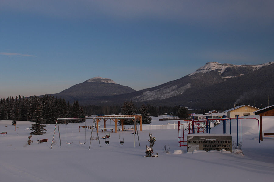
Shunda Mountain and Coliseum Mountain dominate the northwest skyline in this view from the town of Nordegg.
It's Mr. Sasquatch!

Asieh and Ali engage with one of the locals in front of the Nordegg Museum.

Boo! Zosia passes an old cemetery near the start.
The kid looks a bit cold... 
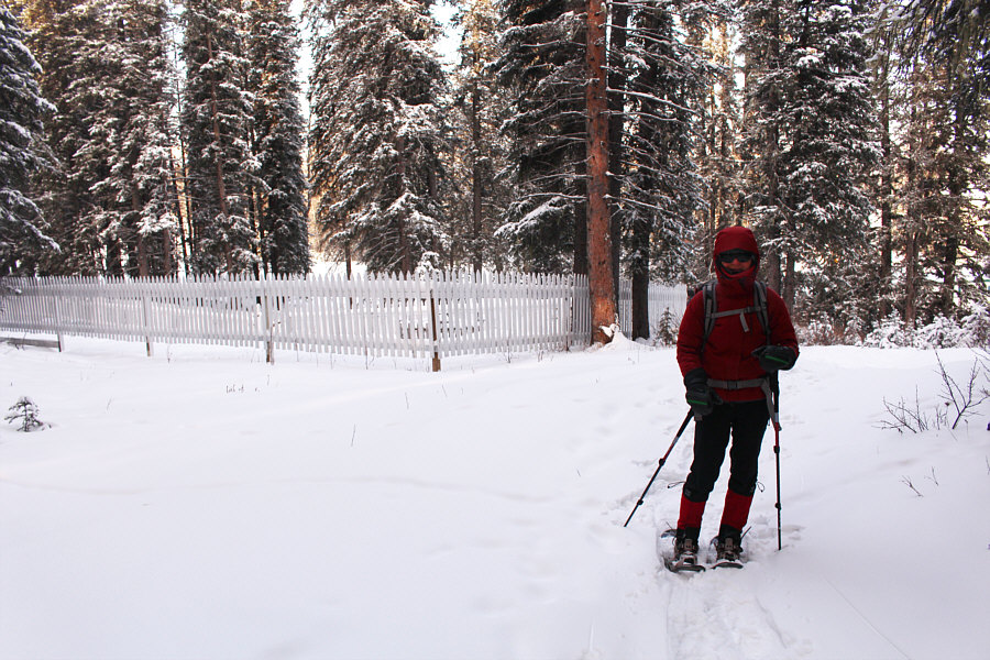
Dorota follows behind Jordan on his first ever snowshoe outing.

Photo courtesy of Zosia Zgolak

Kiara is pretty chill...quite literally! 
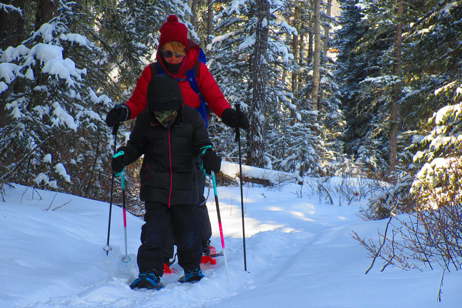
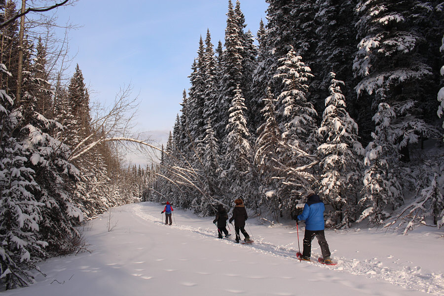
Kiara and her father, Houmaro, pass under a bent-over tree.
A very neat thing to see early in the trip.

The trail goes under an old railway trestle.

We should have just hung around here all day... 
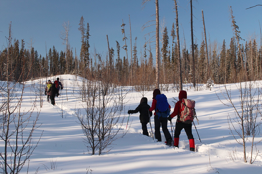
After losing the trail, the group makes their own route through open terrain.
Doh! This service road appears to be plowed and could potentially be an alternate starting point for the trip (and saving approximately 2 kilometres of walking each way).
Wish I had my skis though... 
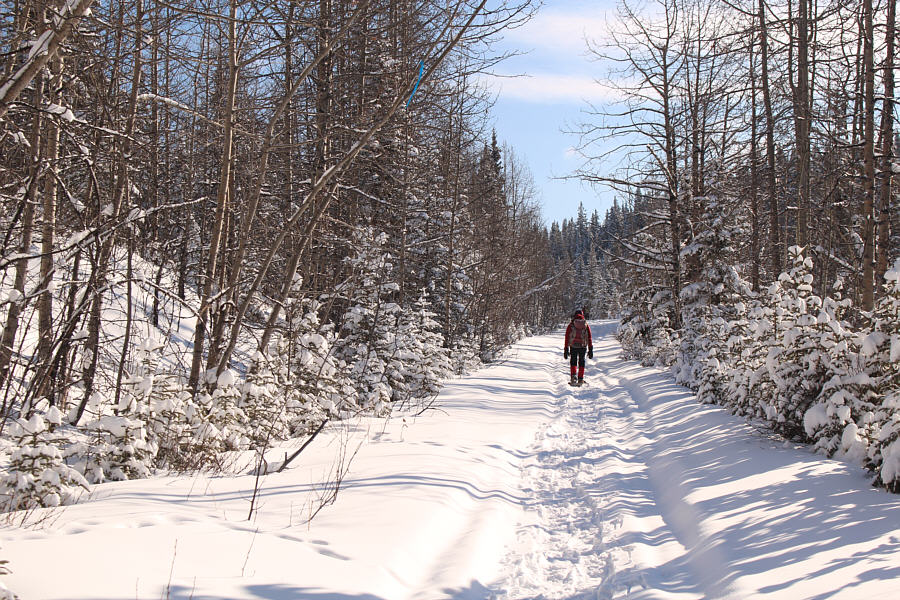
Despite being mostly in forest, the access road to Surveyor's Benchmark is not necessarily unappealing for snowshoeing.
We later saw what looked like steam emanating from behind one of the trees above the ditch (the tree that is plastered with extra snow). 
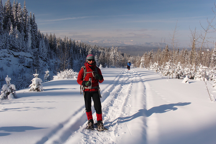
Zosia stops to drink some hot tea as views open up a bit along the access road.  The ditch at left is possibly one of the old mine sites in the area.
Unfortunately, we're going the wrong way here! Houmaro, Jordan and Dorota take a short cut to gain a higher road.
This was our high point of the day, but it's a scenic zero! Ali and Zosia arrive at the telecommunications tower (~1760 metres) described in the guidebook.

We should have been skiing...

Houmaro, Dorota, Jordan, Kiara, Asieh, Zosia and Ali are still in good spirits despite not finding Surveyor's Benchmark after a long and cold walk.


We should have just stopped on the open hillside here and called it a day! 
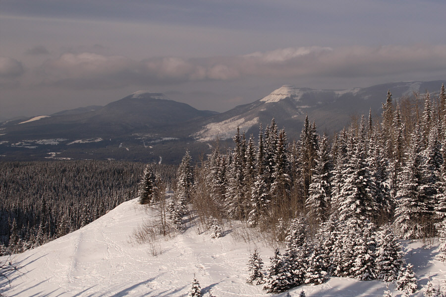
A break in the trees along the access road grants this view of Shunda Mountain and Coliseum Mountain.
I sound like a broken record, but we should have been skiing here... Dorota, Jordan, Kiara and Houmaro make the long trudge back to Nordegg.
This is how Asieh looks whenever she returns to Iran for a visit! Asieh is embracing the cold weather quite nicely.

Photo courtesy of Zosia Zgolak

The trestle is worth another look! Houmaro ducks under a fallen tree beside the railway trestle.
We survived the brutal cold for over 6 hours! 
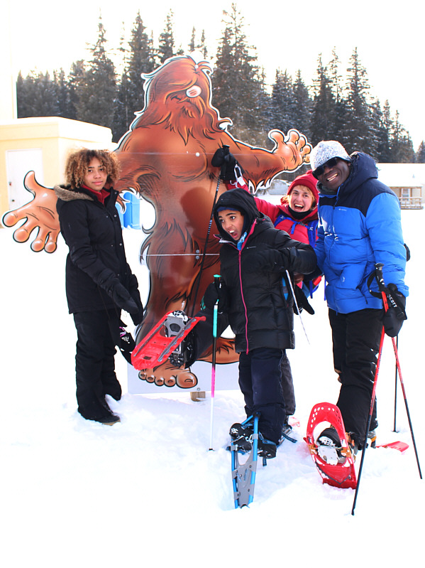
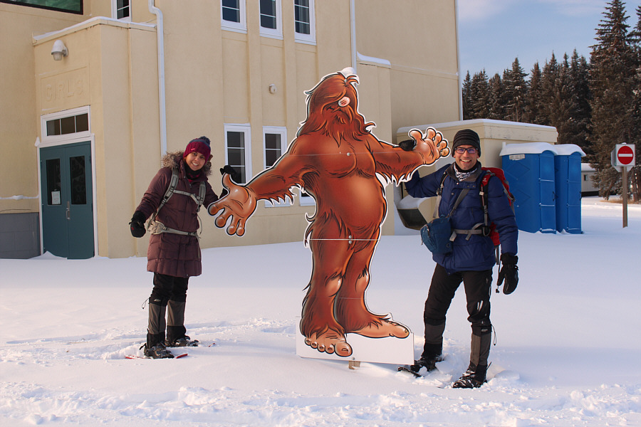
At the end of the trip, Kiara, Jordan, Dorota and Houmaro celebrate with Mr. Sasquatch.
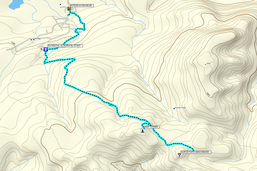
Not sure if this one is worth coming back for...maybe on skis... Total Distance:  15.2 kilometres
Round-Trip Time:  6 hours 39 minutes
Net Elevation Gain to AGT Tower:  464 metres

GPX Data