As Zosia and I reached the summit, the weather began changing for the worse, and the wind picked up substantially. We took shelter in the lee of the ridge just below the summit cairn, but fearing impending rain, we were on the move again after a short break. Leaving the summit, we continued to follow the ridge crest which turns eastward and drops down to a grassy saddle. We had some concerns about a stand of trees which seemingly blocked our route to the saddle, but fortunately, we found a nice, bush-free corridor through this obstacle. From the saddle, we descended an obvious gully pointed toward Barnes Lake, but at the bottom of this gully, we somehow missed the trail that McMurray and Nugara had taken to get to the lakeshore. As a result, we bushwhacked a bit and ended up in a scrubby drainage which was somewhat unpleasant to follow but ultimately led us down to the south end of the lake. We picked up a trail here which runs around the east side of the lake, and although it was easy enough to follow, the trail makes a few long-winded detours around deadfall resulting in some rather annoying undulations. Clearly, the trail had been re-routed to accommodate ATVs even though, according to McMurray, there are signs prohibiting the use of such beyond the junction at the exploration road. In any case, the trail straightens out in the meadows north of Barnes Lake and eventually becomes the side road that we passed earlier in the day. We kept heading northward at a confusing split in the side road near a shallow creek crossing, but once we reached the junction, the remainder of our hike out was trouble-free.
A big thank you goes out to Dave McMurray and Andrew Nugara for their legwork in finding such an amazing route. Relatively easy access, moderately-challenging route-finding, quiet solitude, and beautiful scenery all add up to make Barnes Peak a real gem of a hike.
 |
Zosia crosses a bridge over Michel Creek at the start of the trip. |
 |
Sonny rock-hops another creek along the exploration road. Photo courtesy of Zosia Zgolak |
 |
Zosia prepares to leave the road and plunge through the bush here to reach Limestone Ridge. |
 |
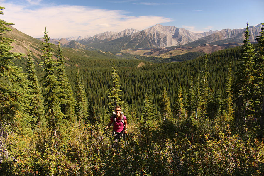
Zosia works her way toward the ridge in the background. |
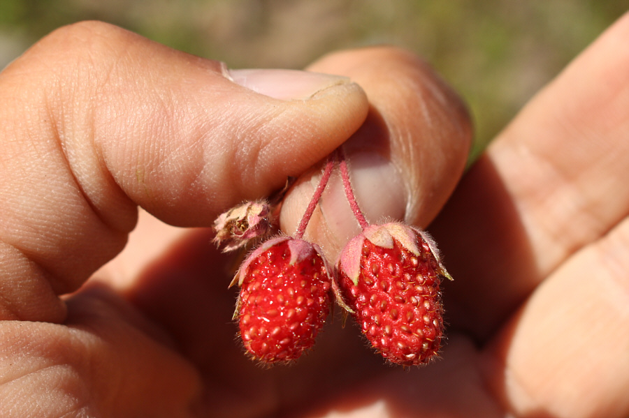 |
Wild strawberries are in abundance here on this day. |
 |
Views start to open up as Zosia climbs higher. Right of centre on the horizon is Mount Ptolemy. |
 |
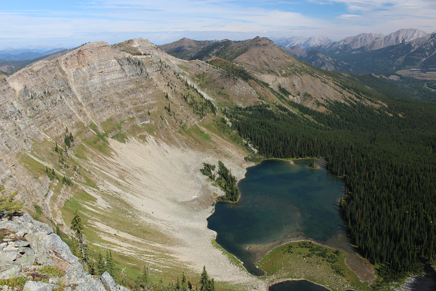
Here is the first glimpse of Barnes Lake from the ridge. |
 |
The remainder of the climb to Limestone Ridge is straightforward. |
 |
This body of water is officially unnamed, but according to Dave McMurray, a sign near the bridge over Michel Creek refers to it as Elliot Lake. |
 |
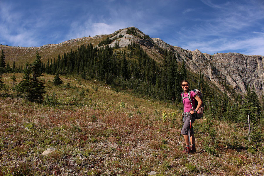
Zosia heads south along the crest of Limestone Ridge. |

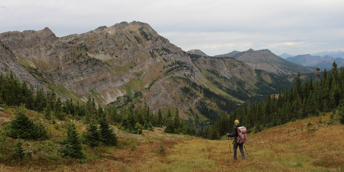
After climbing over a high point along Limestone Ridge, Zosia finally gets a clear view of Barnes Peak.
 |
Sonny pauses at a viewpoint overlooking Barnes Lake. Photo courtesy of Zosia Zgolak |
 |
Sonny continues hiking along the crest of
Limestone Ridge. Photo courtesy of Zosia Zgolak |
 |
Zosia climbs up the north side of Barnes Peak. |
 |
Zosia passes some impressive slabs en route to the top. |
 |
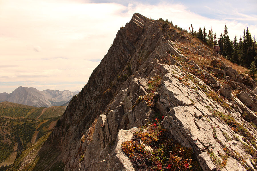
The summit of Barnes Peak is within sight. |
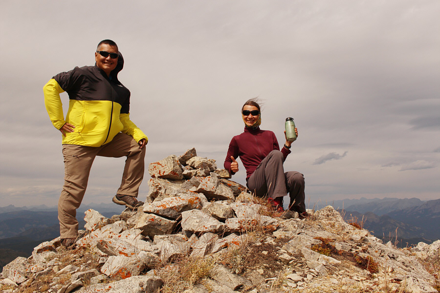 |
Sonny and Zosia reach the summit of Barnes Peak (2444 metres). |
 |
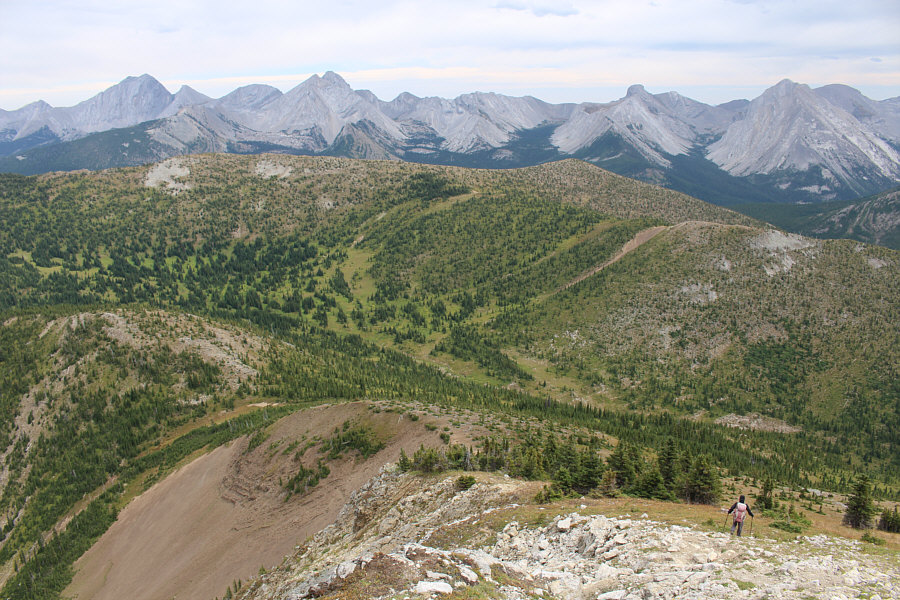
Here is another view of Barnes Lake from the summit. |
 |
Visible in the distance are Centre Mountain (far left), Mount Borsato (left of centre), and Mount Corrigan (lower of the two bumps to the right of Mount Borsato). |
 |
Zosia turns east and heads for the obvious saddle at lower left. At far left on the horizon is Mount Darrah. |
 |
A stand of trees seemingly blocks access to the saddle, but Zosia finds an easy corridor through this obstacle. |
Zosia descends an obvious gully aiming for Barnes Lake.
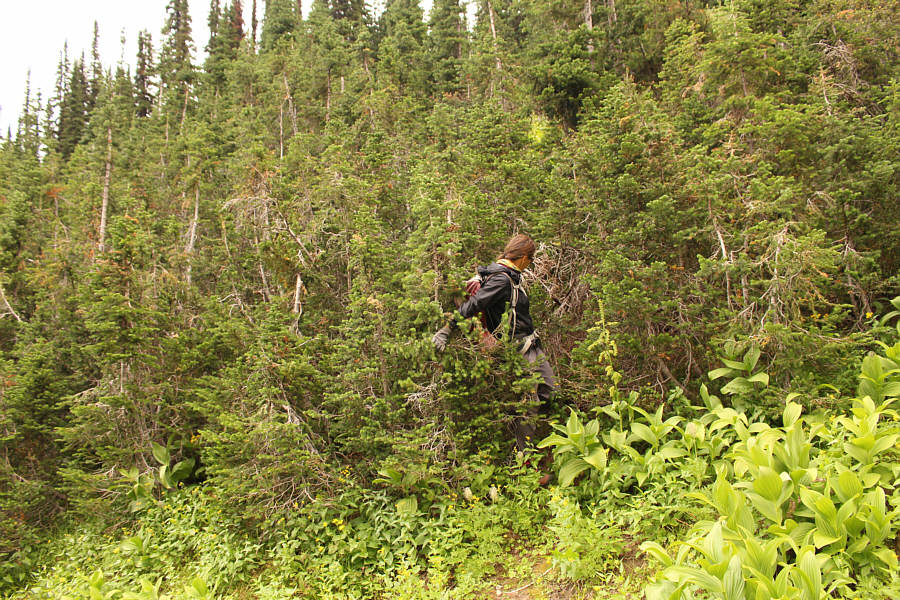 |
Zosia thrashes through a thicket of trees on her way down to the lake. |
 |
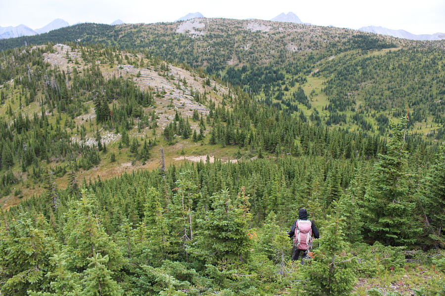
The remainder of the descent to the lake from here still requires some route-finding and mild bushwhacking. |
 |
A dead weasel lies on the trail near Barnes Lake. |
 |
Sonny finds a two-person kayak stashed near the north end of Barnes Lake. Photo courtesy of Zosia Zgolak |
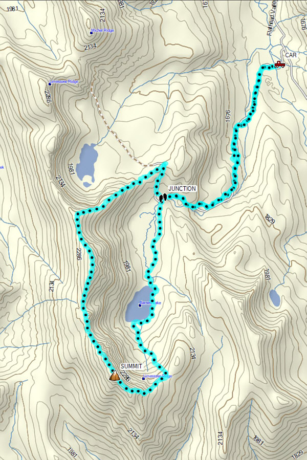 |
Total
Distance: 16.5 kilometres Round-Trip Time: 8 hours 48 minutes Cumulative Elevation Gain: 1210 metres |