BOU AVENUE
Mount Brennan

Located along the southern border of British Columbia's Goat Range Provincial Park, Mount Brennan attracts a lot of attention from peak-baggers due to its lofty elevation and relatively easy access.  A long but non-technical ascent route is described in Kathy & Craig Copeland's guidebook, Where Locals Hike in the West Kootenay.  With stellar weather in the forecast, Zosia Zgolak and I decided to give the route a try on 16 August 2020.

From Highway 31A, turn north onto Rossiter Creek Forest Service Road (should be okay for 2WD vehicles) 24 kilometres east of New Denver or 23 kilometres west of Kaslo.  Drive for 1.1 kilometres and keep left at a junction.  Drive for another 1.3 kilometres and keep left at a second junction.  Continue driving an additional 4.6 kilometres to the signed trailhead at a switchback just past a large parking area.

After spending a restless night at the trailhead (loud music was blaring from an all-nighter party on some nearby private property), Zosia and I groggily started up the steep trail behind the trailhead sign.  We soon intersected a road, quite possibly a continuation of the same one we drove in on.  Turning left, we descended the road to cross a bridge over Lyle Creek.  On the far side of the bridge is a wooden ladder leaning against a steep embankment.  We climbed up the ladder and followed a trail through the forest before emerging onto yet another road.  Turning right, we followed this reclaimed road into a huge basin highlighted by an obvious waterfall and also a couple of long steel cables--the remnants of an old aerial mining tramway.  The road ends at the old trailhead where a fallen sign lies next to a trail heading into the tall undergrowth.  This trail climbs up the headwall guarding the upper basin which contains a number of tarns unofficially known as Lyle Lakes.  The climb up the headwall is long, but the grade is quite reasonable.  However, it is sobering to realize that reaching Lyle Lakes is only the halfway point to the top of Mount Brennan in terms of both distance and elevation gain.  This is a big mountain!

Arriving at Lyle Lakes, Zosia and I climbed a little higher on the trail and took a short break before resuming our ascent.  The trail ascends a steep drainage and ultimately peters out near an old mine site.  From there, the remainder of the ascent is little more than a long slog up generally easy terrain.  We tried to avoid lingering snow patches initially, but later on, we took advantage of them to alleviate some of the drudgery of ascending rubble.  The numerous cairns here are largely superfluous as many route variations are possible.

The far-reaching views from the summit on this day were breathtaking.  Zosia and I lingered here for 1.5 hours before reluctantly beginning the long descent.  Without ice axes, we steered clear of steeper snow patches, but we boot-skied many of the shallower ones.  Leaving the snow to descend rubble and slabs felt a little tedious at times, but we nevertheless made our way down to the old mine site without any drama.  Regaining the trail there, we cruised back to the Lyle Lakes and subsequently down the headwall.  The worst thing about the headwall was having the hot afternoon sun beat down on us as we descended it.  We moved as quickly as we could through here in order to reach the shady side of the lower basin.  Once we were out of the sun, we enjoyed a more relaxing hike back to the trailhead.
Whoever designed the new trail here needs to have their head examined! 
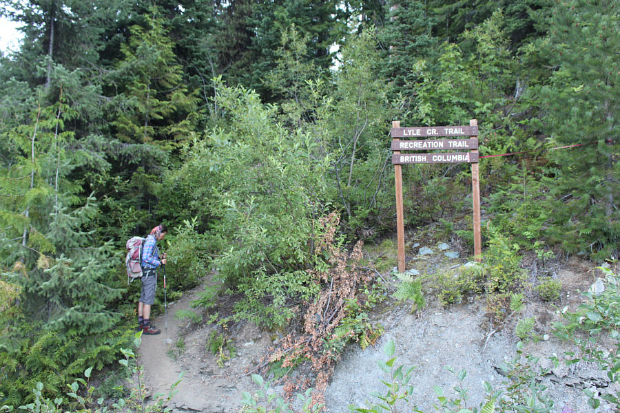
Zosia starts hiking from the new trailhead.
Yes, climb the ladder! The short but steep trail from the new trailhead leads to this road which descends to a bridge over Lyle Creek with a ladder on the far embankment.
Zipline for the descent? 
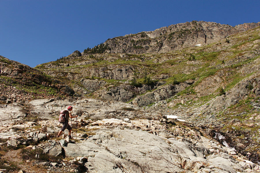
The route follows a reclaimed road into this basin with a waterfall streaming down a headwall.  The visible cable is the remnant of an old aerial mining tramway.
It's a long uphill grind... Zosia climbs up the headwall guarding the upper Lyle Creek basin.
It's a bit sobering to realize that you're only at the halfway point of the ascent here! 
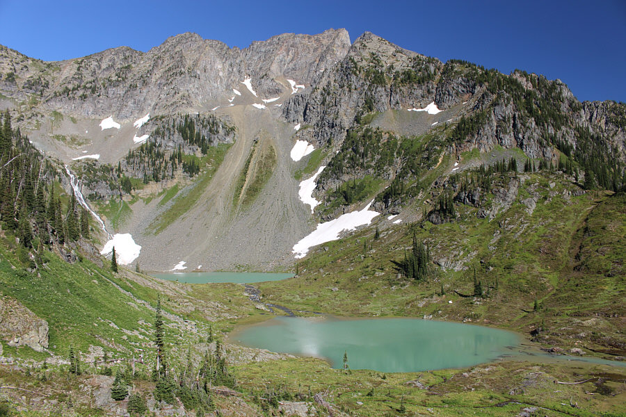
Zosia arrives at one of the tarns--unofficially known as Lyle Lakes--in the upper Lyle Creek basin.
Back to work! The trail climbs away from the Lyle Lakes up this drainage.
And the scrambling begins! The trail climbs out of view to the right here before petering out completely.
Are those bloody smears from previous glissaders? Beyond the end of the trail, there are many options for ascending the upper mountain.

Photo courtesy of Zosia Zgolak

Still a lot of climbing left! The ascent is fairly straightforward the rest of the way to the summit.
Keep grinding; you're almost there! 
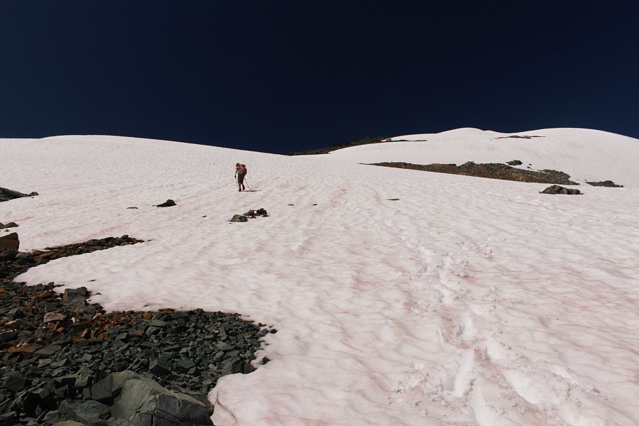
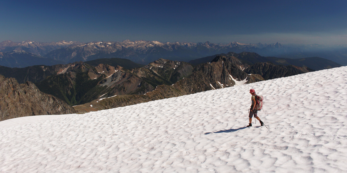
Zosia crosses easy-angled snow patches en route to the summit.
We couldn't have picked a better day to be up here! Zosia and Sonny take a well-deserved break on the summit of Mount Brennan (2894 metres).
There once was a man from Nantucket... Zosia reads the summit register.

More beautiful peaks that might be worth exploring in the future...

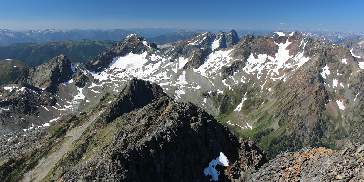
Whitewater Mountain (left) and Mount Dryden (right) sit to the west.  Inverness Mountain and Marten Mountain can be seen through the gap just right of centre.


Probably seldom climbed. Intrigued?

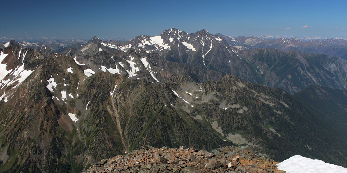
To the northwest, Mount Stubbs (left) and Mount Cooper (centre) are located in a remote part of Goat Range Provincial Park.


Mount Davis looks like an easy ridge walk. 
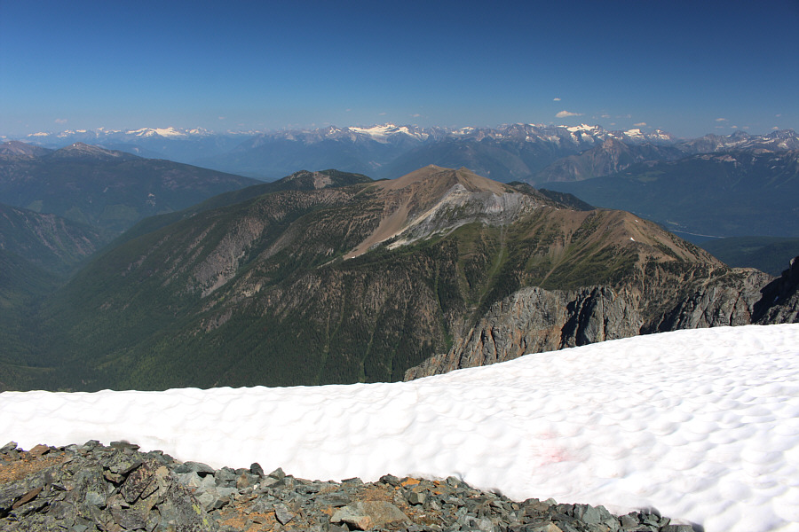
Mount Davis sits to the northeast.  At centre on the horizon is the Macbeth Icefield.
Someone left their barbeque on? 
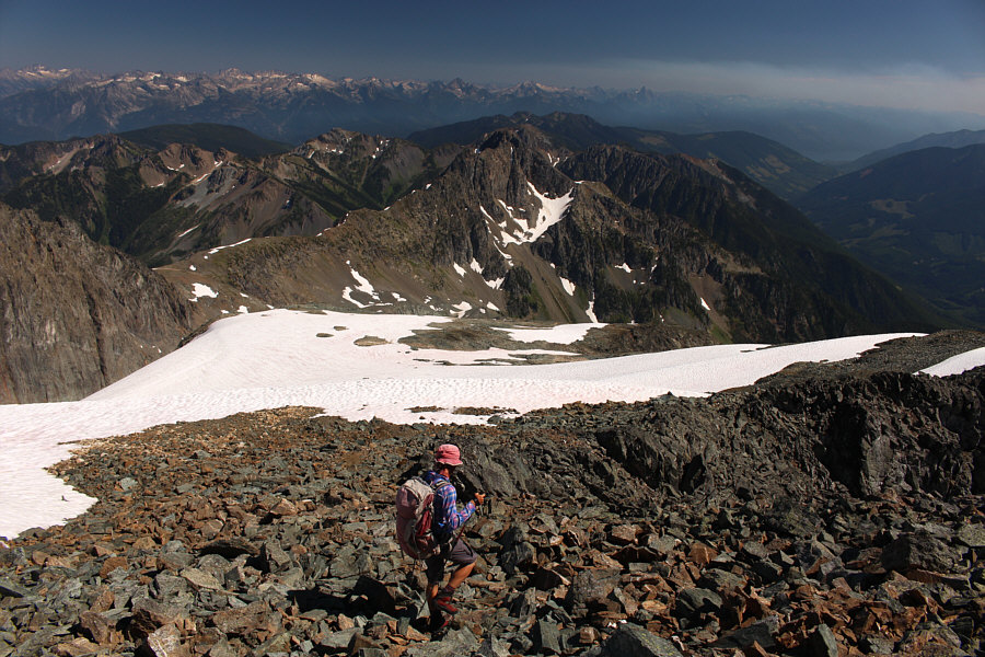
As Zosia leaves the summit, wildfire smoke can be seen in the distance at far right.

Lotsa impressive-looking mountains across the horizon!

Zosia descends a sun-kissed snow patch.


Wasn't steep enough--now my butts wet! Sonny tries glissading a snow patch.

Photo courtesy of Zosia Zgolak

Only halfway down...sigh. Here is a last look at the Lyle Lakes.
Should be on every peak-bagger's to-do list! Total Distance:  16.3 kilometres
Round-Trip Time:  11 hours 45 minutes
Net Elevation Gain:  1587 metres

GPX Data