


Photo courtesy of Zosia Zgolak

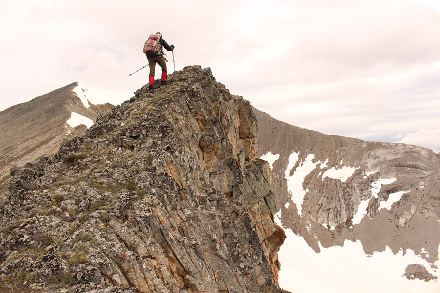
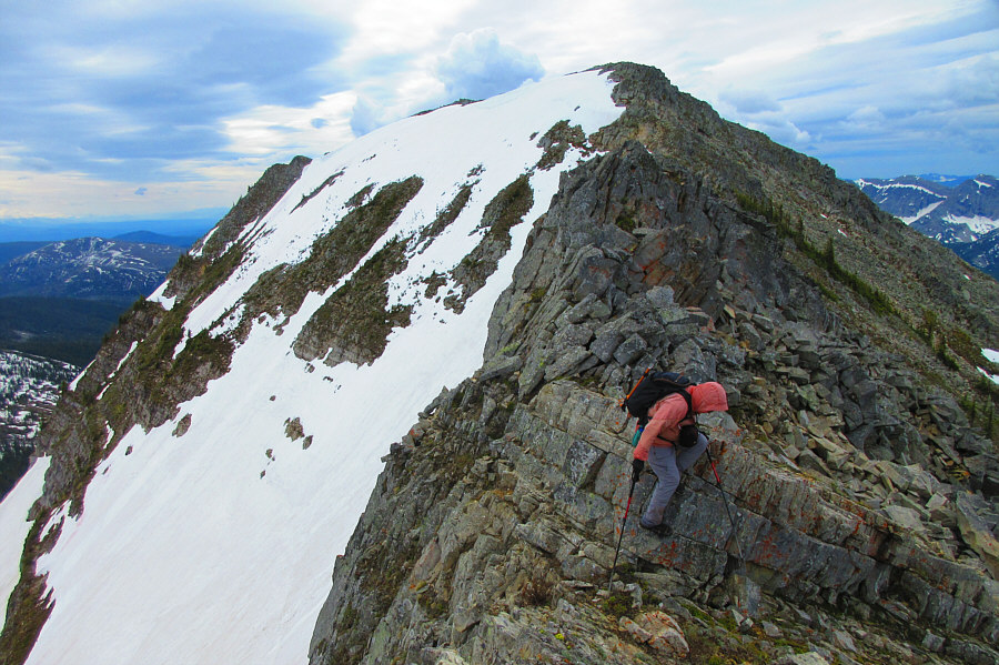
Photo courtesy of Zosia Zgolak
|
|
Zosia begins hiking up the skid road that leads up the valley towards Mount Doupe. |
|
|
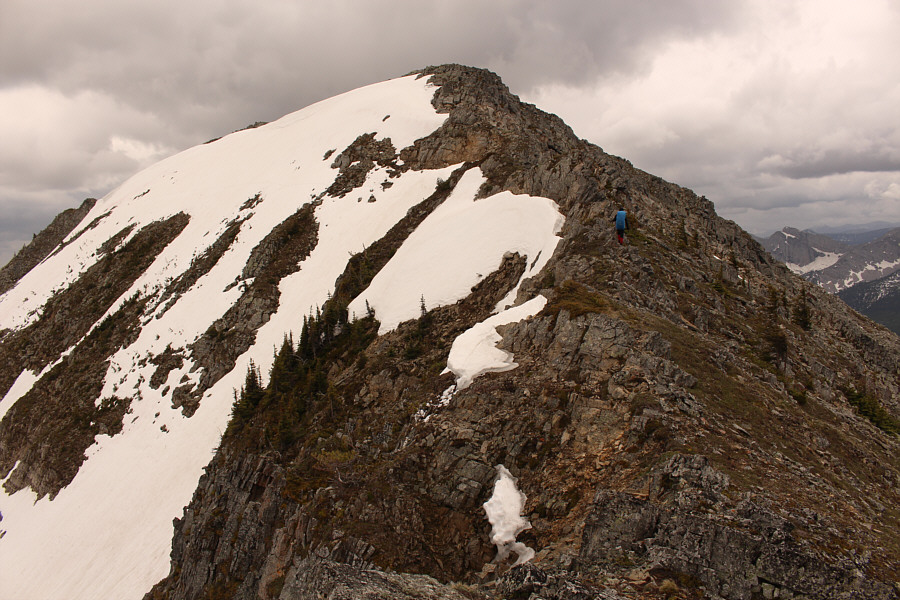
Access to the top of Mount Doupe is via the ridge on the right. |
|
|
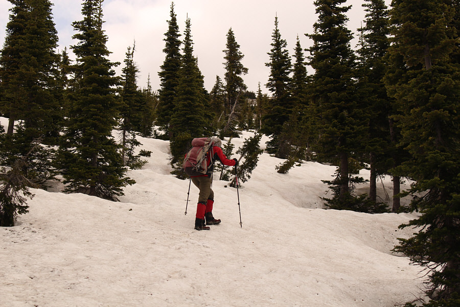
Zosia encounters a lot of lingering snow near tree line, but fortunately, the snow is very supportive on this day. |
|
|
Sonny makes good progress up the snow-covered slope. Stretched out
behind him to the south is Inverted Ridge. Photo courtesy of Zosia Zgolak |
|
|
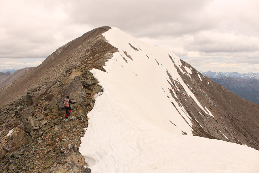
Zosia gets her first clear look at the top of Mount Doupe from the first of two false summits. |
|
|
Zosia traverses the connecting ridge leading to the second false summit. |
|
|
Sonny descends a short step along the connecting ridge. In the
background is the first false summit. Photo courtesy of Zosia Zgolak |
|
|
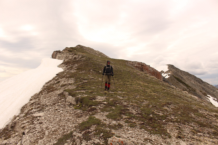
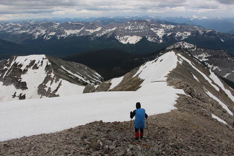
Zosia easily descends to the low point of the connecting ridge. |

Zosia approaches the second false summit with the true summit further to the right.
 |
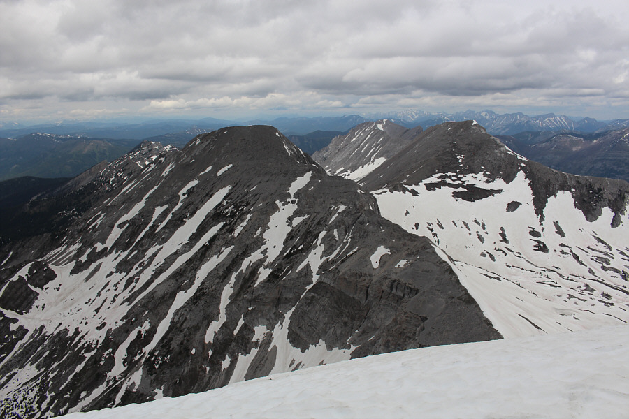
The top of the second false summit provides the most comprehensive view
of the bowl southeast of Mount Doupe. Photo courtesy of Zosia Zgolak |
 |
Zosia makes her way up the summit ridge. |
 |
Zosia and Sonny stand on the summit of Mount Doupe (2663 metres) and are supposedly the first visitors here since the summit register was placed on 27 August 2019. The register also acknowledges that Rick Collier and others ascended this mountain on 1 July 2009. |
 |
The view to the west includes Soowa Mountain (distant left behind the unnamed snowy ridge in the foreground), Mount Swope (right of centre), and Overfold Mountain (right with big snow patch). Mount Broadwood can also be seen on the right horizon between Mount Swope and Overfold Mountain. |
 |
To the north are some unnamed peaks that are nearly as high as Mount Doupe. |
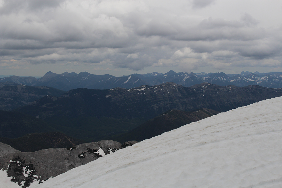 |
The most prominent peaks visible on the eastern horizon include Syncline Mountain (left), Mount Haig (right of centre), and Castle Peak (far right). In the middle foreground is Piaysoo Ridge. |
 |
Zosia leaves the summit to retrace her steps back over the two false summits. The snow-capped peak on the far right horizon is Mount Mahaney. |
 |
Zosia climbs back over the first false summit. |
 |
Zosia takes advantage of the firm snow to boot-ski down the slope. |
 |
After emerging from the forest and regaining the skid road not far from
this flagged tree, Sonny marks a waypoint in his GPS unit. This is
the recommended spot for leaving the road to climb up Mount Doupe. Photo courtesy of Zosia Zgolak |
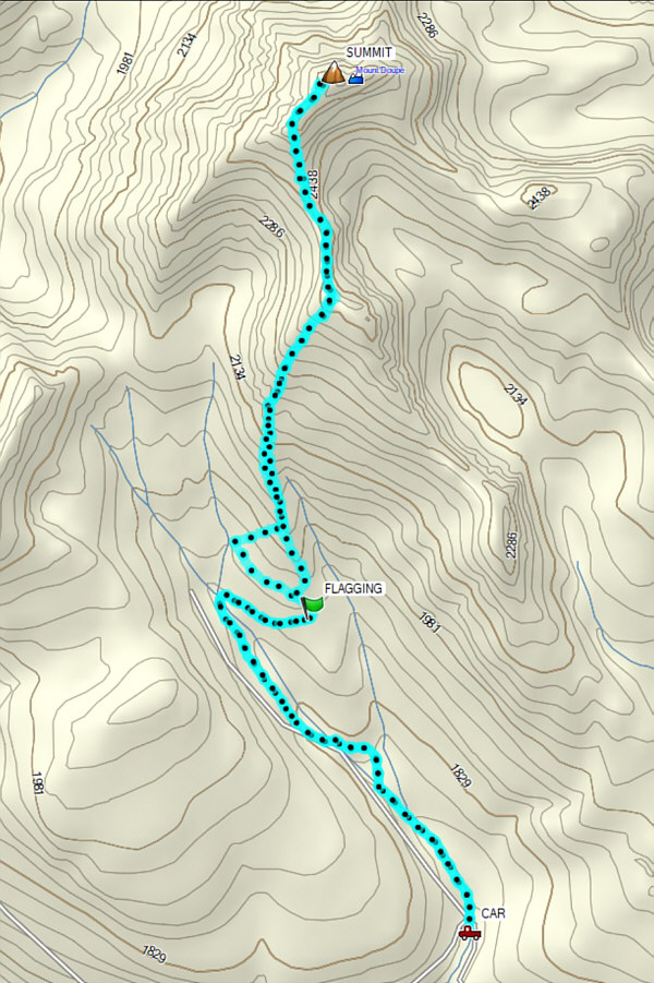 |
Total
Distance: 12.3 kilometres Round-Trip Time: 8 hours 16 minutes Net Elevation Gain: 954 metres |