BOU AVENUE
Grassy Mountain

In the midst of the Victoria Day long weekend, Shaun Luong, Marta Wojnarowska, Zosia Zgolak and I ascended Grassy Mountain near Coleman, Alberta on 17 May 2020.  Despite its close proximity to the town, this mountain probably does not see a lot of visits from hikers due to an ongoing mining proposal (currently undergoing an environmental assessment) for the area which severely restricts recreational access especially from the south.  However, the northern half of Grassy Mountain lies within the forest reserve, and there is even a convenient road which grants hikers a high starting point and relatively easy access to the summit ridge.  On paper at least, we were expecting Grassy Mountain to be nothing more than a short and pleasant hike, but as it turned out, the mountain would not be so easily won.

From the town of Coleman, turn north onto Highway 40 (Forestry Trunk Road) from Highway 3 (there is a Subway on the northwest corner of the intersection).  Drive for 9.5 kilometres (the pavement turns to gravel just outside of town) and turn right (east) onto Daisy Creek Trail.  Ignore all side roads and drive for about 2.9 kilometres before crossing a narrow bridge.  Drive an additional 3.5 kilometres to reach a turnoff to a locked gate on the south side of the road.  In dry conditions, Daisy Creek Trail should be suitable for 2WD vehicles at least as far as the locked gate, but the road does begin to deteriorate somewhat as it climbs beyond the narrow bridge (beware of occasional large rocks sitting in the middle of the road).

On this day, a large patch of snow prevented us from parking near the locked gate at the start, and although this only meant that we had to walk an extra seventy metres or so, we probably should have paid closer attention to the poor quality of the snow which would have ramifications for us soon after.  Beyond the locked gate, we followed the continuation of a wide gravel road which initially turns eastward going past a vast open plateau.  Where the road appears to turn back to the west, we left it to ascend a small clear cut and gain a rough exploration road higher up.  We followed this second road southward only briefly before leaving it to climb up a steep hillside leading to the north end of Grassy Mountain.  Somewhat unexpectedly, we now faced a blanket of deep and mostly unsupportive snow covering the ridge.  Stubbornly and perhaps foolishly, we forged ahead and post-holed up the ridge.  Although we would occasionally encounter sporadic islands of bare ground, we were mostly wallowing through hip-deep snow for the next two kilometres.  Not surprisingly, our progress slowed to a crawl, quite literally in a few places.  After over three hours of post-holing hell, we only made it as far as the north end of the summit ridge.

By now, we were all mentally frazzled, but just when we were almost ready to give up, the snow conditions miraculously improved.  For some reason, the snow pack on the summit ridge was much more supportive which allowed for easier travel.  More surprisingly, we encountered a series of rocky pinnacles here, and we were all delighted to scramble on top of these all the way to the summit.  There is some mild exposure on this rocky section of the ridge, but the scrambling is never more than moderately difficult.  The summit itself sits right on the edge of an immense open strip-mine site which is, at the same time, both devastating and sublime.

After a short break at the summit, we turned around and backed out the way we came.  A second round of scrambling on the pinnacles was followed by a lengthy egress more or less along our broken tracks in the snow.  Although our progress was generally quicker this time, we were still constantly stumbling and sinking in the snow right to the bitter end.  Once we cleared the last of the snow, we stopped for a quick break to wring out our wet socks before hiking the remainder of the route back to the locked gate without further issues.
This hurdle turned out to be a good warm-up for what was to come! 
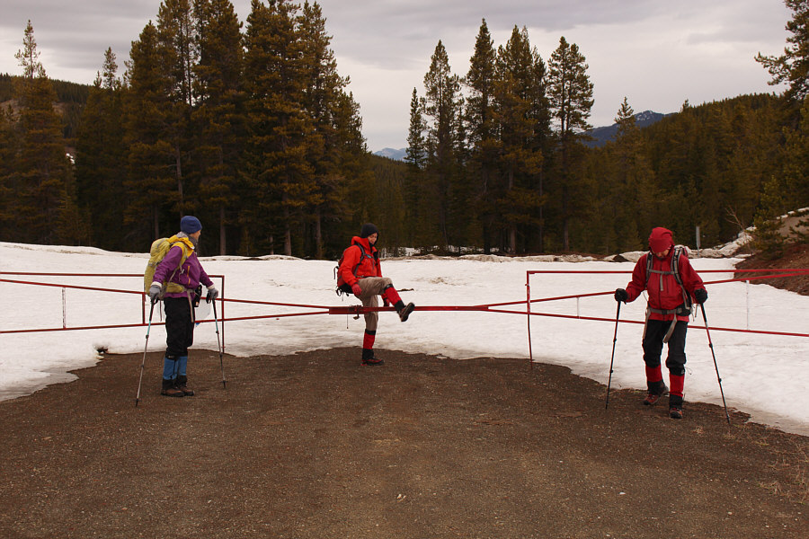
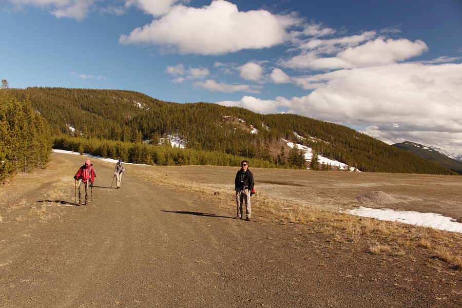
Marta, Shaun and Zosia pass a locked gate at the start of the trip.
We spotted lots of bear tracks along the access road. 
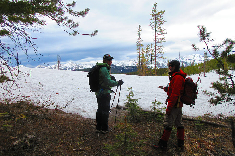
Beyond the locked gate is a vast plateau with far-reaching views to the south.  At far left is Grassy Mountain while Bluff Mountain and Greenhill Ridge (centre) can be seen further in the distance.  The main access road continues out of view to the left.
So far, so good... 
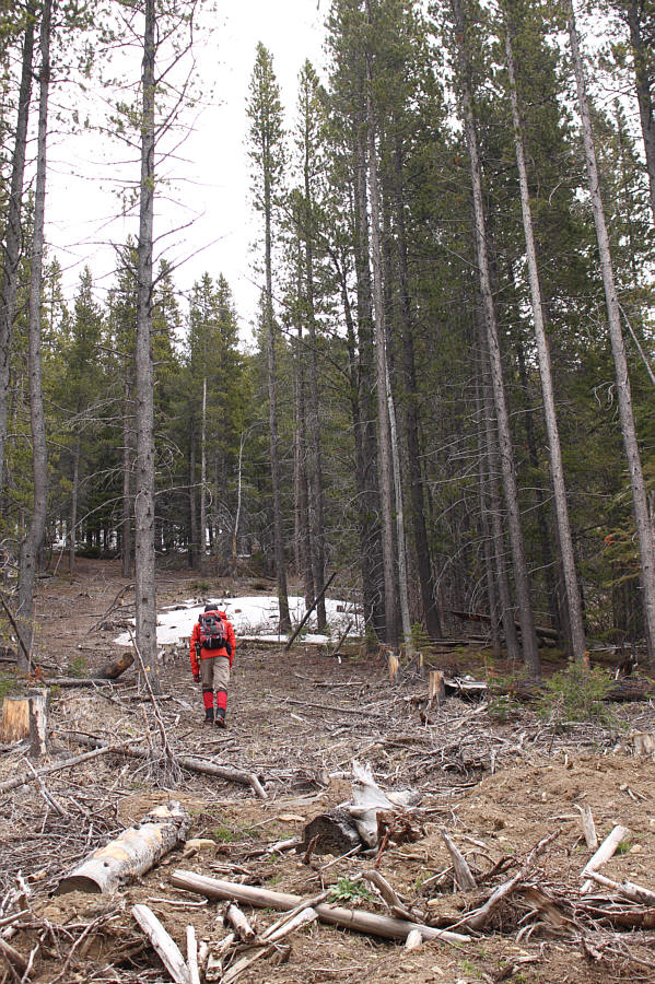
Shaun leaves the access road and ascends a small clear cut.
All that snow hidden in the trees did not bode well for us... 
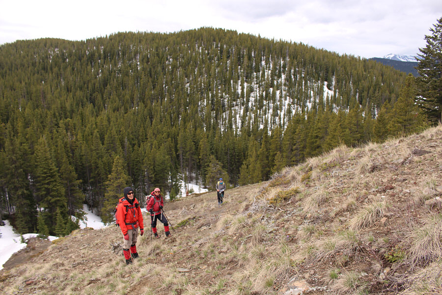
After briefly following an exploration road, Shaun, Zosia and Marta climb steeply up an open hillside.
Uh-oh... Sonny and Shaun encounter a lot of unavoidable snow near the north end of Grassy Mountain.

Photo courtesy of Zosia Zgolak

Oh how I miss my skis! Sonny quickly finds out that the snow here is not supportive at all.

Photo courtesy of Zosia Zgolak

Sigh... Progress through the deep unsupportive snow is naturally slow.
Just shoot me now... 
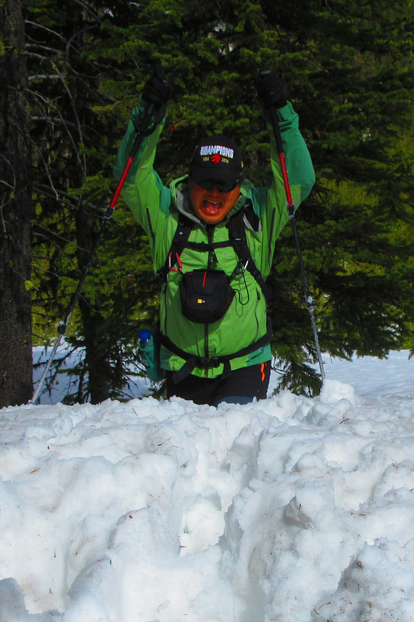
The deep snow begins to drive Sonny crazy.

Photo courtesy of Zosia Zgolak

Unfortunately, these supportive sections were more the exception than the rule! 
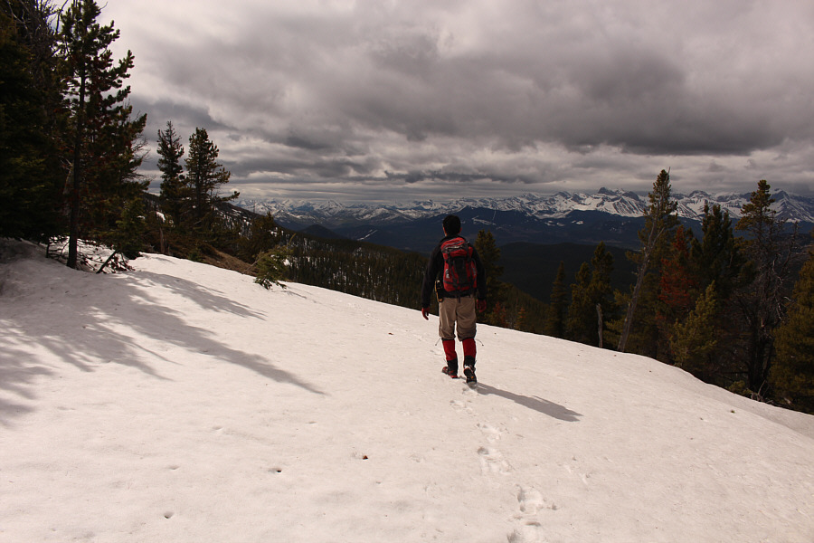
Shaun walks across a rare supportive section of snow.
And the snow here was also much more supportive too! Marta follows Sonny to the start of a much-welcomed rocky section of the summit ridge.

Photo courtesy of Zosia Zgolak

Feels...so...good!!! 
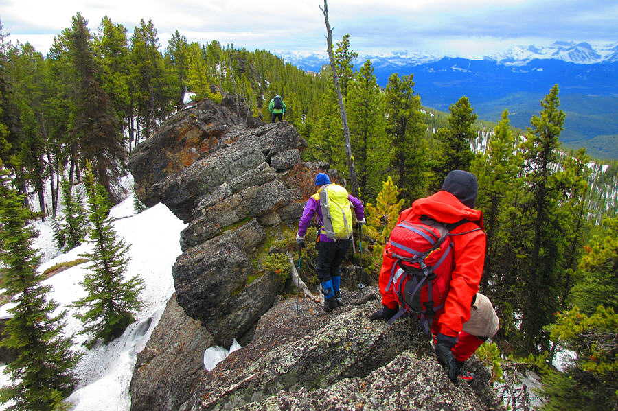
Sonny, Marta and Shaun scramble along the rocky section of the summit ridge.

Photo courtesy of Zosia Zgolak

Marta is in her element! Shaun and Zosia wait while Marta descends into a gap along the rocky ridge.
This was a bit out of Zosia's comfort zone, but she handled it like a real trooper! 
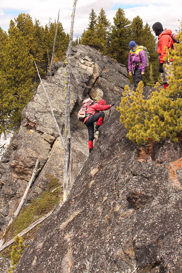
Marta and Shaun watch Zosia climb out of the same gap along the ridge.
Looks like I'm surrounded by a bunch of lepers! 
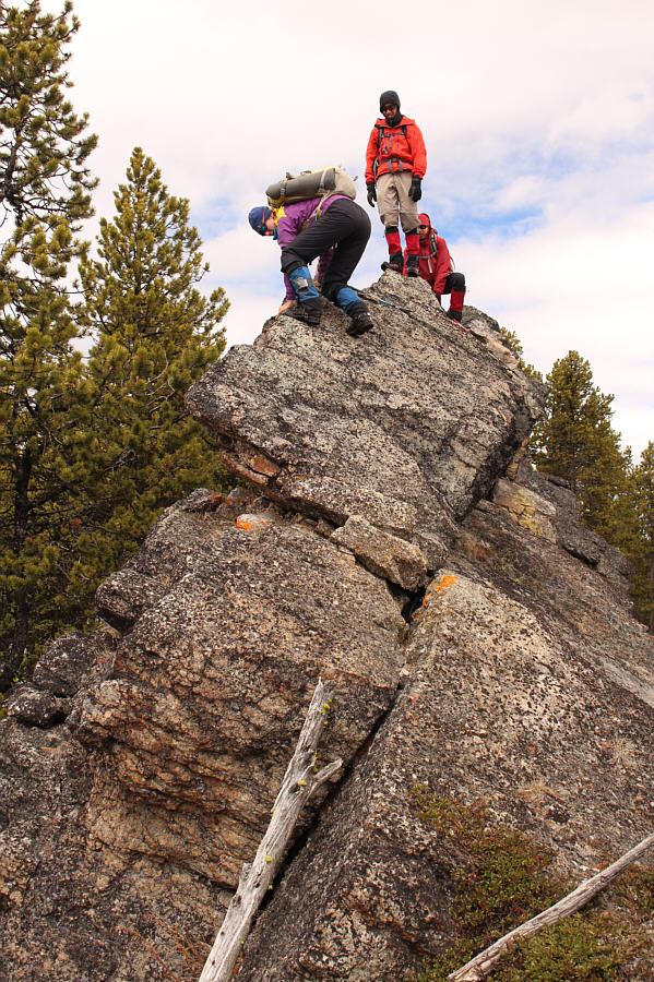
Shaun, Zosia, Sonny and Marta stand on a spacious ledge near the summit of Grassy Mountain (2087 metres).
Both are very high on my to-do list this summer! 
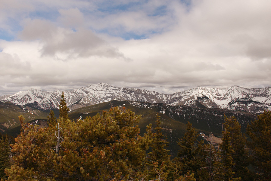
Visible to the east are Centre Peak (left of centre) and Caudron Peak (leftmost of two bumps at right).

Both ugly and beautiful at the same time!

The south end of Grassy Mountain is a big open pit coal mine.


Au cheval! 
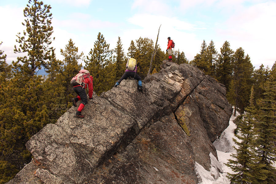
The group enjoys a second round of scrambling along the rocky ridge on the way back.
No worries...we still had a lot of post-holing ahead of us! The snow is surprisingly supportive along this covered road.
The post-holing hell is almost over! The group descends the last few hundred metres of snow-covered terrain near the north end of Grassy Mountain.  A short section of Daisy Creek Trail (road) is visible in the distance at centre.
Well, that was fun! None the worse for wear, Zosia, Marta and Shaun leave Grassy Mountain behind them as they return to the vast plateau near their starting point.
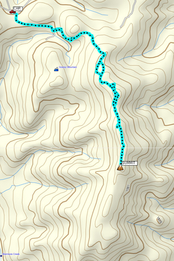
How to turn a half-day hike into an all-day epic... Total Distance:  9.5 kilometres
Round-Trip Time:  8 hours 37 minutes
Net Elevation Gain:  251 metres

GPX Data