BOU AVENUE
Lost Mountain
Slowly working our way back home near the tail end of our three-week road trip, Zosia Zgolak and I hiked up Lost Mountain just west of British Columbia's Kootenay Pass on 21 August 2020.  I discovered this hike on the West Kootenay Hiking website, and its main appeal is the fact that there is no need to drive up seemingly endless bumpy backroads just to get to the trailhead.

The Lost Mountain trailhead is located on the north side of Highway 3, 11 kilometres east of Lost Creek Rest Area or 10 kilometres west of Kootenay Pass.  Park on the south side of the highway in a large gravel pullout with an information kiosk (no toilets--use the ones at the rest area or Kootenay Pass).

The crux of this hike is crossing the busy highway safely; cars and trucks are usually burning through here in excess of 100 kilometres per hour.  On the north side of the highway, we picked up an obvious trail running diagonally up and to the left.  After an initial steep climb, the trail flattens out and makes a rather long-winded traverse parallel to the highway.  According to the West Kootenay Hiking website, the old trail was re-routed in 2017 to discourage hikers from parking at a chain-up area further up the highway.  About two kilometres from the trailhead, the trail finally begins to climb in earnest as it steadily rises more than 850 metres over the remaining four kilometres to the top.  Ripe huckleberries were bountiful throughout this hike which significantly slowed our upward progress.  The trees begin to thin out higher up the mountain, and although the trail also becomes less defined here, route-finding is still fairly easy with orange diamond markers helping to point the way.  Despite haze from wildfire smoke, we still enjoyed some far-reaching views from the summit although I would not rate them as mind-blowing.

On descent, we simply retraced our steps along the same trail, and other than a few stops to collect more huckleberries, our hike out was uneventful.
The true crux of this trip is crossing the highway!

After crossing the highway, Sonny starts up the trail to Lost Mountain.

Photo courtesy of Zosia Zgolak

After awhile, we could only eat so much! On this day, there is an abundance of huckleberries and blueberries throughout almost the entire length of the trail.
Yep, it's another grind! 
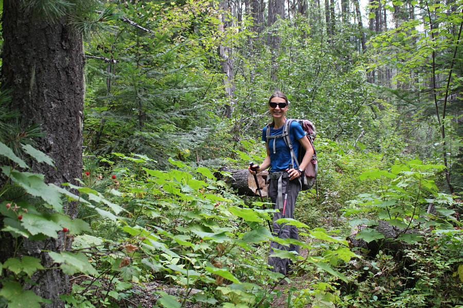
Most of the trail climbs through viewless forest.
Still far away! A partially open viewpoint along the trail grants a first glimpse of Lost Mountain's summit.
Still lots of low-lying blueberries here! The forest starts to open up a bit as Zosia climbs higher.
This is about as close to scrambling as you'll get on this mountain. The trail becomes less distinct higher up the mountain, but the route is well-marked and still easy to follow.
Easy street. The summit is within sight.  The route continues up the broad ridge at left.
Our shirt colours complement each other well! 
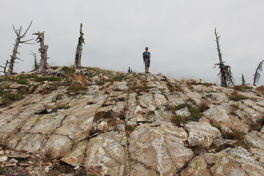
Sonny and Zosia stand on the summit of Lost Mountain (2151 metres).
It's strange that there are so many geographical names in the West Kootenays that reference American locations. 
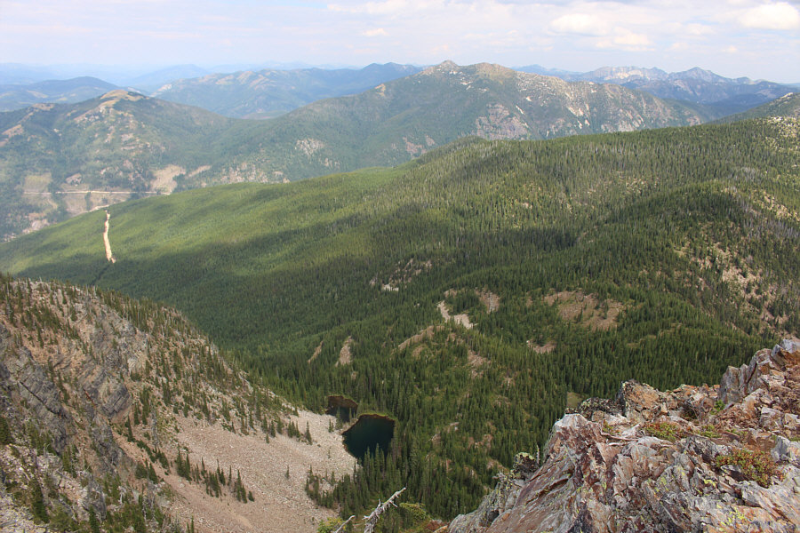
A couple of small tarns sit in a basin north of the summit.  Also visible are Nevada Mountain (far left) and Mount Waldie (right of centre).
These peaks and ridges all seem more interesting in winter... To the east are the numerous peaks and ridges in Stagleap Provincial Park.  Kootenay Pass is at centre while the prominent peak at far right is Ripple Mountain.
We could have collected so much more if we had more bags! 
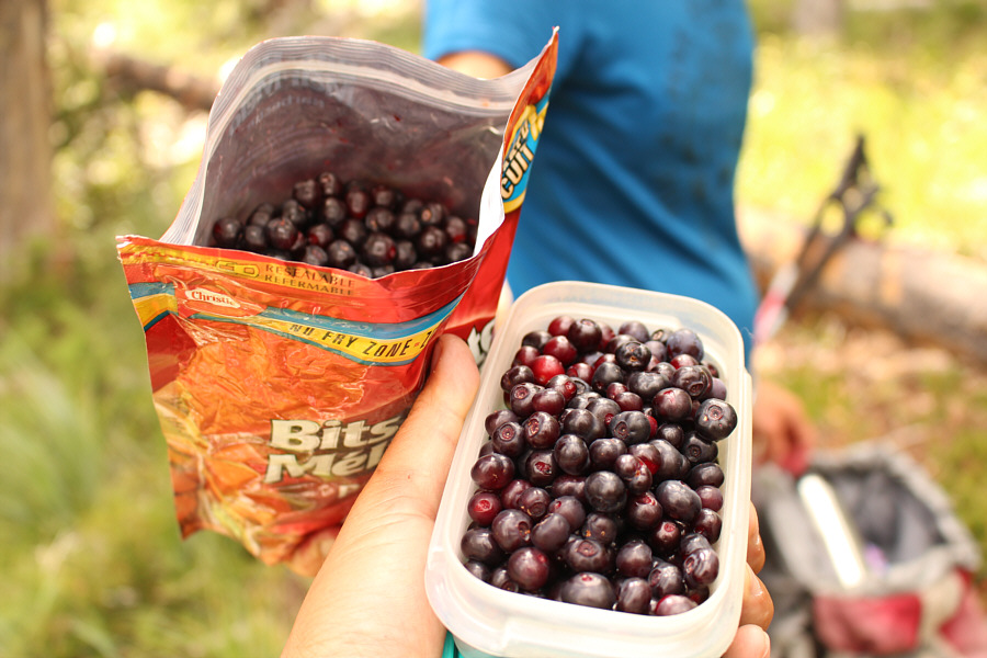
On descent, Zosia and Sonny collect more huckleberries.
It's nearly impossible to pick and store these. They must be eaten immediately! A thimbleberry is a nice change from all the huckleberries.
Only worthwhile during berry season! Total Distance:  11.7 kilometres
Round-Trip Time:  8 hours 12 minutes
Net Elevation Gain:  1092 metres

GPX Data