From Highway 93, turn east onto an unsigned gravel road (GoogleMaps labels this as "Connor Road") 33 kilometres south of the junction with Highway 3 (Elko) or 3.9 kilometres north of the Canada-USA border (Roosville). In 250 metres, stay on the main road as it bends left, and in another 260 metres, veer right onto Phillips Creek Forest Service Road (suitable for 2WD vehicles but high-clearance is recommended). Drive east for another 11.0 kilometres and look for a flagged trail on the north side of the road. Park in a small pullout on the south side of the road.
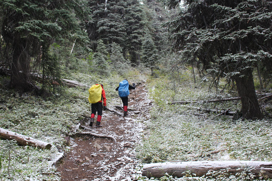
Snow was already falling as Shaun, Zosia and I began hiking up the well-maintained trail which gains about 270 metres of elevation over the first 1.5 kilometres. In fact, we were quite fortunate to have snow instead of rain which would have likely soaked us quickly to the point of serious discomfort. Furthermore, much of the approach trail is in forest which conveniently sheltered us from the wind which we could still hear roaring across the nearby ridges. After the steep initial climb, we passed through a v-shaped notch and abruptly dropped down about 80 metres on the other side. The trail levels out at the bottom of this steep drop and climbs more gradually with some undulations for another three kilometres to a lake known unofficially as Baldy Lake. By the time we arrived there, the snowfall had pretty much ended, and the clouds had lifted enough for us to see the top of Mount Mahaney just across the lake. Despite the wind still blowing hard, we felt confident that we could make it up to the summit, and we began circling around the northeast shore of the lake. On the north side of the lake, we hiked past a green throne toilet and ascended semi-open slopes aiming for the eastern shoulder of the mountain. Partway up, we stumbled onto an excellent trail and followed it all the way up to the shoulder where it seemingly peters out near a cairn. From there, we simply climbed up the grassy eastern slope of Mount Mahaney, but as we cleared the last of the trees, we could feel ourselves actually being pushed uphill by the fierce wind. At the top of the slope, we turned south and walked another hundred metres to reach the summit cairn adorned with a Canadian flag and some underwear flapping in the wind.
Although Shaun, Zosia and I were able to find some respite from the wind on the lee (west) side of the summit, we only stayed long enough to snap a few requisite photographs before returning the way we came. As we descended the eastern slope, we of course ran into the teeth of the same wind that had pushed us upward during our ascent. There were a few painful moments as we strived to shield our faces from the blistering force of the wind, but thankfully, it did not take us long to drop back down to the shelter of the trees on the eastern shoulder. Picking up the trail we came up, we easily followed it all the way down to Baldy Lake. The actual start of the trail near the lake was rather nebulous which was why we missed it in the first place. We built a few cairns here to make the turnoff more obvious before taking a 15-minute break for lunch. When we resumed hiking, it took us about 80 minutes to walk the remaining five kilometres back to the trailhead. The sun even came out a few times which brought a smile to our faces. On the drive out, we noticed that a tree had freshly fallen across the road at one of the junctions near the highway. Luckily, I was still able to drive around it, but we were perhaps also fortunate that the wind did not knock down more trees further up the road or even on top of my car!
|
|
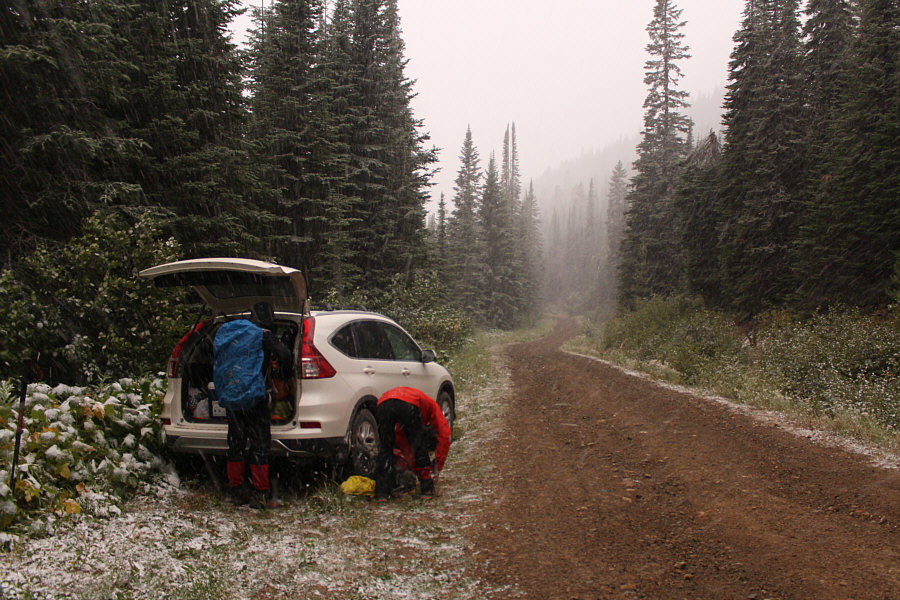
Zosia and Shaun gear up beside Sonny's parked car. The flagged trail starts on the opposite side of the road at far right. |
|
|
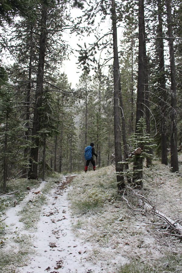
The trail is still easy to follow despite some fresh snowfall. |
|
|
Zosia and Shaun go through a notch in the ridge. |
|
|
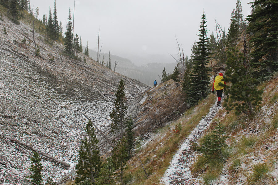
The trail drops steeply down the north side of the notch and follows the meadow visible at centre to another pass in the distance right of centre. |
|
|
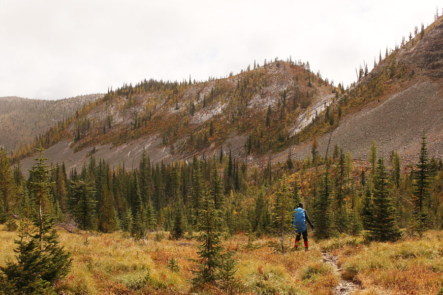
Shaun and Zosia climb up the final section of trail before unofficially-named Baldy Lake. |

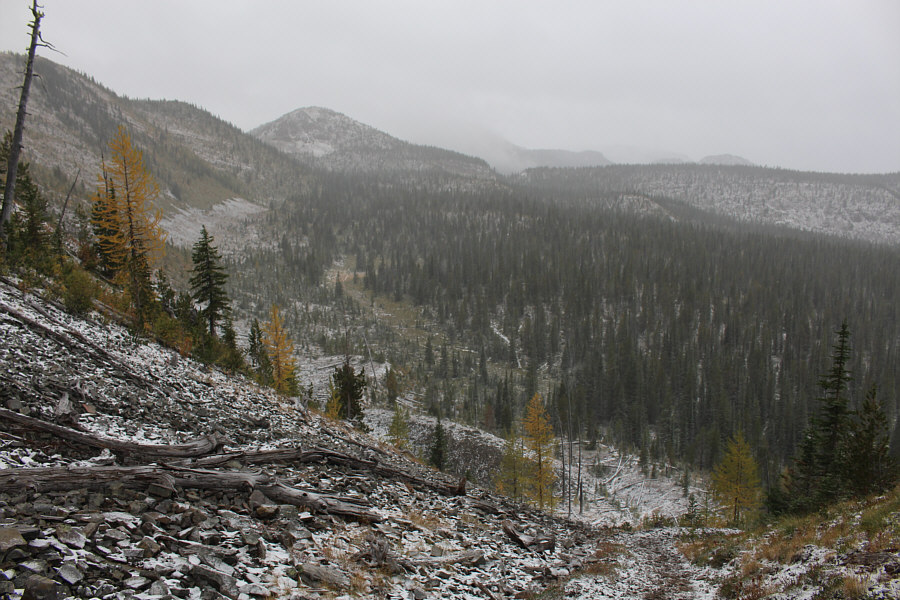
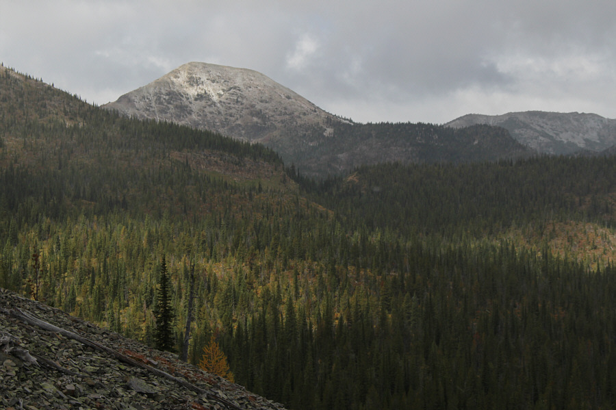
Mount Mahaney sits northwest of Baldy Lake.
 |
Shaun and Zosia stumble onto a trail which leads to the eastern shoulder of Mount Mahaney. |
 |
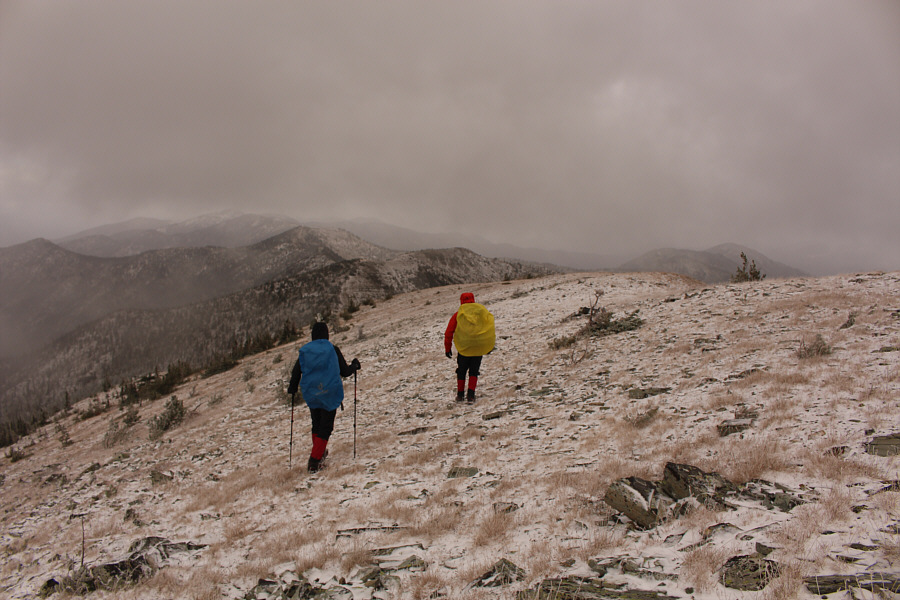
Shaun and Zosia grind their way up the eastern slope of Mount Mahaney. |
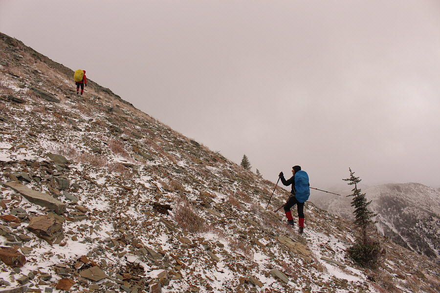 |
As Shaun and Zosia climb higher, they are buffeted by a very fierce wind. |
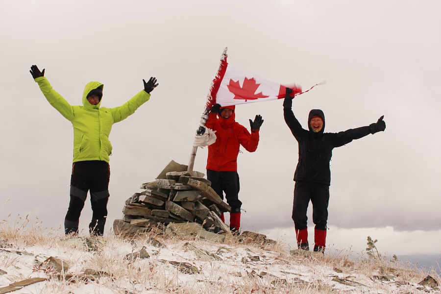 |
Sonny, Shaun and Zosia reach the summit of Mount Mahaney (2405 metres). |
 |
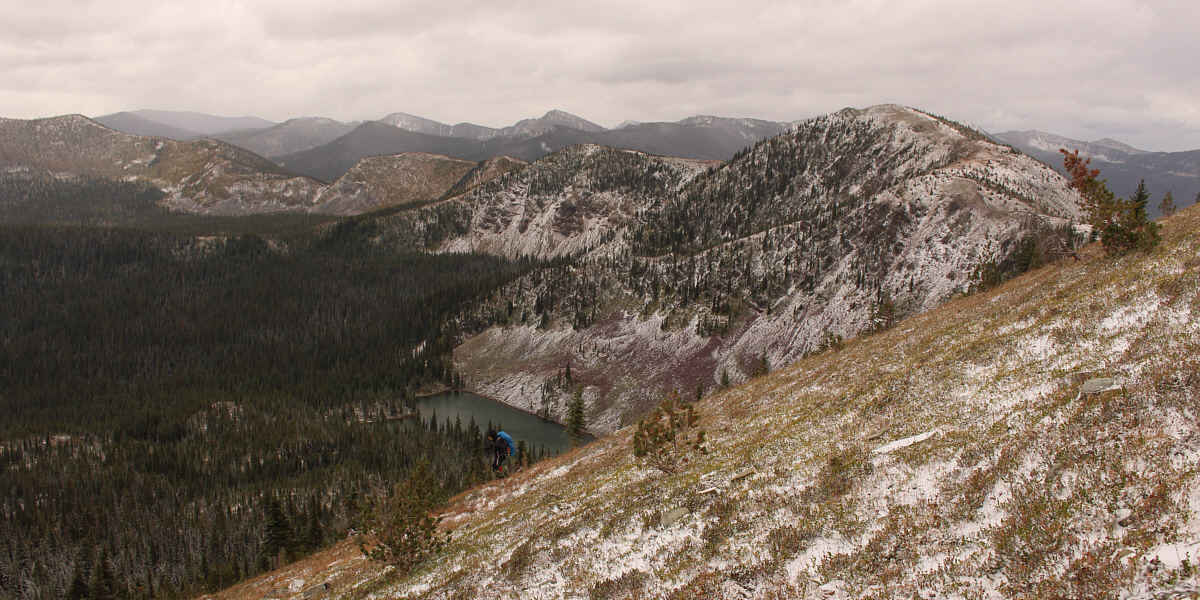
Here is the view of Baldy Lake from the summit. Visible on the far right horizon is Poorman Mountain which is located inside Montana. |
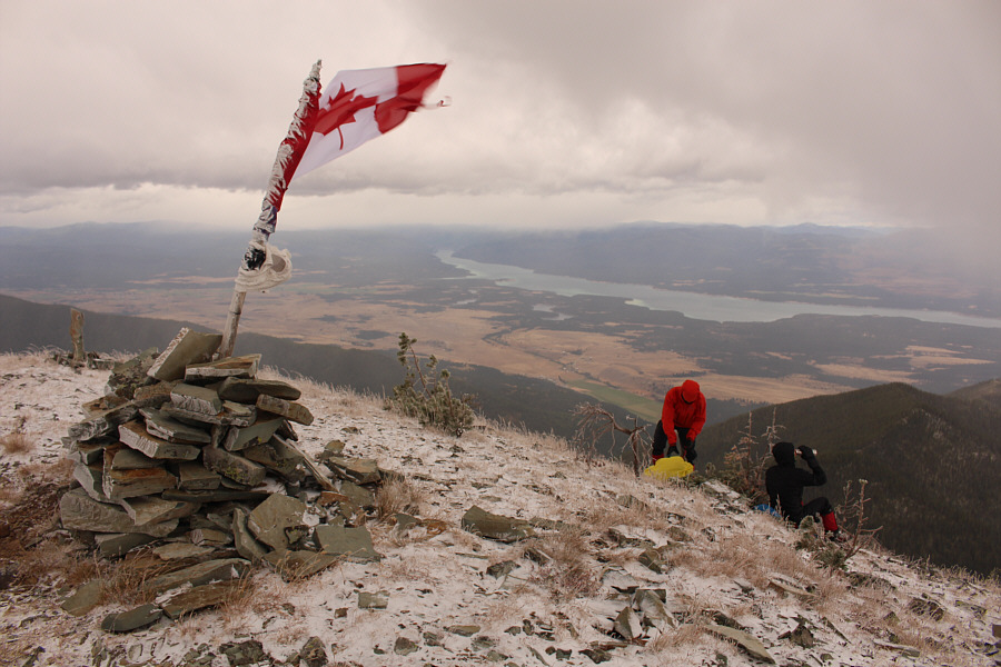 |
While the flapping flag attests to the ferocity of the wind, Shaun and Zosia find some respite on the lee of the summit. Lake Koocanusa is visible to the southwest. |
 |
Zosia and Shaun head back along the summit ridge. |
Zosia runs into the teeth of the fierce wind as she descends the eastern slope of Mount Mahaney.
 |
Back at Baldy Lake, Shaun and Sonny enjoy a pleasant lunch break without
getting pummeled by the wind. Photo courtesy of Zosia Zgolak |
 |
The sun starts to shine as Zosia heads back to the notch at right. |
 |
Shaun and Zosia climb the steep trail back up to the notch. |
 |
Here is a last look at Mount Mahaney from the notch. |
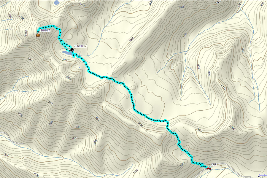 |
Total
Distance: 13.4 kilometres Round-Trip Time: 5 hours 14 minutes Net Elevation Gain: 634 metres |