BOU AVENUE
Okotoks Mountain

On 7 March 2020, Zosia Zgolak and I ascended Okotoks Mountain which is located within OH Ranch Heritage Rangeland about 14 kilometres southwest of Turner Valley, Alberta.  Little more than a scrubby ridge, Okotoks Mountain is nevertheless an officially-named summit, and as such, it holds some attraction for peak-baggers like myself.  Although OH Ranch Heritage Rangeland is technically public land, it is leased to agricultural stakeholders who may restrict access under certain circumstances.  Before our trip, I was able to secure permission to access the area by contacting the leaseholder as identified on the Alberta Environment and Parks Recreational Access Internet Mapping Tool.  I also studied the area on Google Earth to find an appropriate access point and to plan a tentative route that would hopefully entail minimal bushwhacking.  We still had a lot of uncertainty about the terrain we would encounter and the amount of snow in the area, and given a snowfall warning on the day of our trip, we decided to bring both light touring skis and snowshoes.

From the 4-way stop in Turner Valley (junction of Highways 22 and 546), go south on Main Street for 330 metres and turn left onto Decalta Drive.  Drive 1.6 kilometres--crossing a bridge over Sheep River--to a T-intersection with 16 Avenue.  Turn right and head west for 1.7 kilometres before veering left (south) onto 208 Street.  Drive another 1.8 kilometres and turn right onto 450 Avenue.  Ignoring all side roads, drive westward for 11.0 kilometres and look for a locked gate on the south side of the road.  There may be other access points for OH Ranch Heritage Rangeland along this road, but this gate is easy enough to climb over.

Despite some fresh snowfall, Zosia and I had no problems driving to my selected starting point along the access road which presumably gets plowed from time to time during the winter.  After a quick check of the snow on the ground, we opted to begin our approach on skis, but we strapped our snowshoes onto our packs just in case the upper parts of the mountain proved too difficult to ski.  From the gate, we started skiing along a road through light forest and soon passed a large open field on our right.  We continued southward and climbed up a corridor cutting through a separate stretch of forest.  Resembling a short ski run, this corridor is steep enough to warrant donning climbing skins, but we managed to get up by herringboning and zigzagging a bit in the forest beside it.  Emerging from the top of the corridor, we entered another large field and crossed to the southwest corner where we found the start of another longer corridor which undulates along the eastern flank of Okotoks Mountain.

Finally donning our skins here, Zosia and I proceeded only about 400 metres along this second corridor before abandoning it to ascend a lightly forested slope leading to the summit ridge.  Although we probably could have skinned all the way up, we soon realized that descending this same slope on our light touring gear might be a bit too ambitious for our skill level.  As a result, we ditched our skis partway up the slope and switched to snowshoes, and even then, I struggled a bit to climb the last 50 metres before the summit ridge.  This was the steepest part of the ascent for us, and the variable snow conditions here (fresh powder overlying a mix of icy crusts and unconsolidated sugar) made it challenging sometimes to gain purchase with our snowshoes.  Fortunately, this difficult section is short, and once we gained the crest of Okotoks Mountain's north ridge, we had little trouble traversing over the north and middle summits to reach the highest south summit.

While the open slopes beyond the south summit looked very tempting to descend, Zosia and I regrettably had to go back the way we came in order to retrieve our skis.  Again, we had no issues traversing the summit ridge, but the descent of the steep slope we had come up was not without a few anxious moments due to the aforementioned snow conditions.  When we got back to our skis, we picked them up and continued to descend the slope on our snowshoes until we returned to the second corridor.  We removed our skins here and strapped our snowshoes back onto our packs before commencing our ski out.  The ski descent proved to be the real highlight of the day for me as we glided almost effortlessly all the way back to the gate at our starting point.  If doing laps on light touring gear was a thing, the approach route for Okotoks Mountain would definitely be the place to do it!

With the necessity to obtain access permission, Okotoks Mountain is probably not destined to become a classic hiking or snowshoeing objective especially given the wealth of similar or even better options in nearby Kananaskis Country.  Still, the uncomplicated terrain and general solitude here may appeal to those looking for an easy day out away from the usual outdoor crowds.
Not posted, so you could probably still enter without the leaseholder's permission... Zosia climbs over a gate to enter OH Ranch Heritage Rangeland.
Who needs groomed trails anymore??  
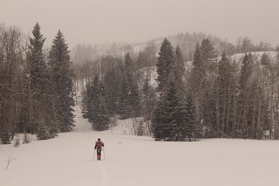
A light dusting of fresh snow makes for some great ski conditions on this day.
Some herringboning may be required here if not using skins. 
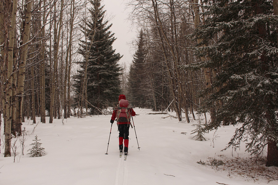
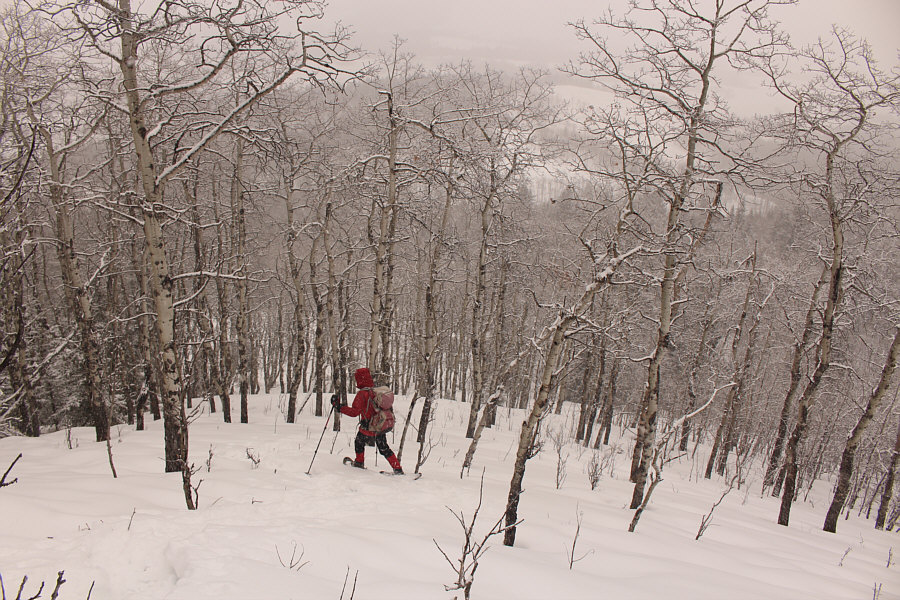
Zosia approaches the first corridor which climbs up to the right behind the trees.
Surprisingly sublime. 
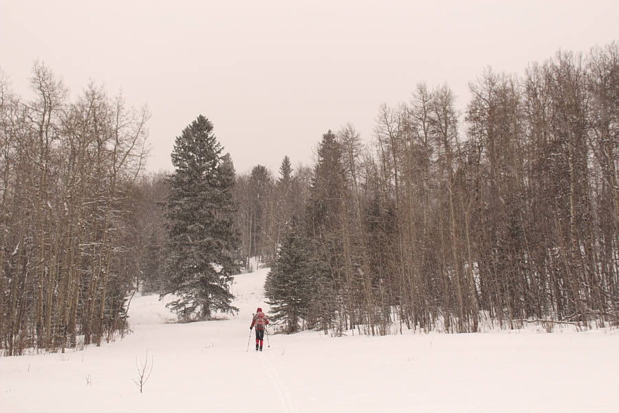
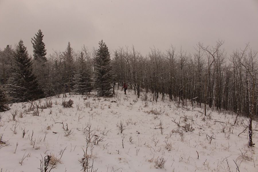
The north ridge of Okotoks Mountain is visible in the background as Zosia skis toward the start of another corridor which climbs through the trees to the left.
Hardest 50 metres I have ever climbed! 
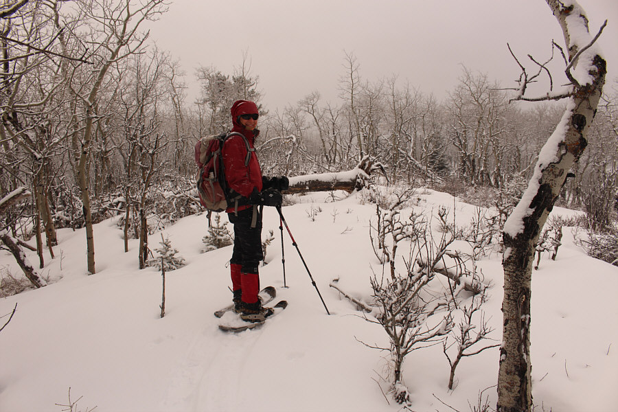
After ditching her skis and donning snowshoes, Zosia climbs up a steep forested slope.
Most of the hard work is done! Zosia gains the crest of Okotoks Mountain's summit ridge.
Yay. Zosia reaches the north summit (1582 metres) of Okotoks Mountain.
Snowshoes were the right call here on this day! 
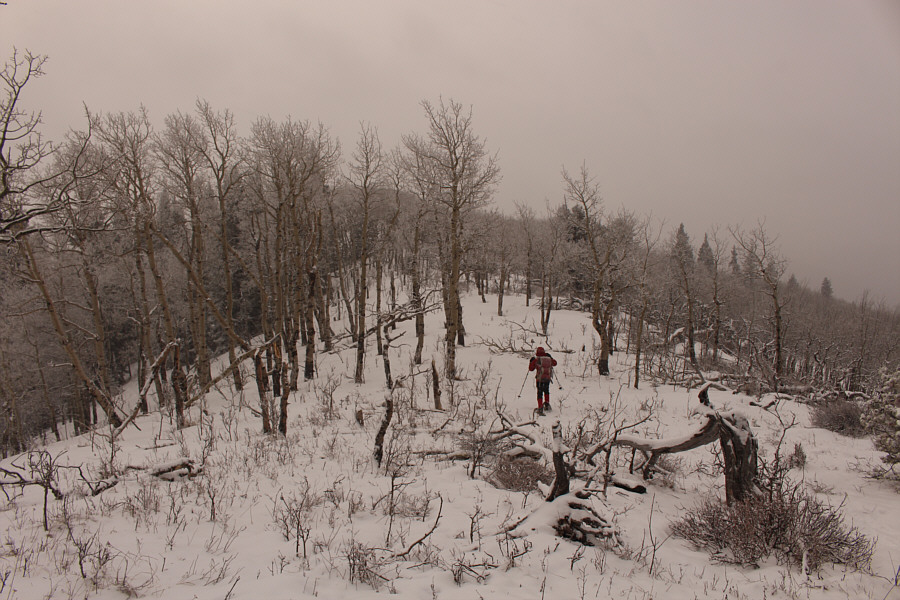
Although much of the summit ridge is forested, travel is still generally easy with very little bushwhacking.
This is the gazetted summit on the map in my GPS unit. 
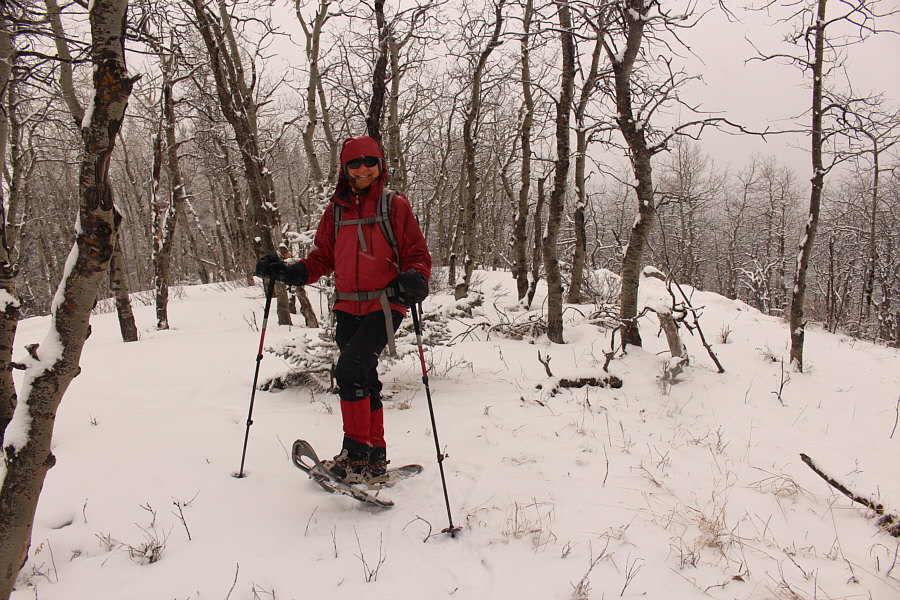
Zosia arrives at the middle summit (1582 metres) of Okotoks Mountain.
Yep, looks about the same as the north end! Zosia approaches the south end of the summit ridge.
We conquered the mighty Okotoks Mountain! Sonny and Zosia stand atop the south (highest) summit (1585 metres) of Okotoks Mountain.
Best view of the day... Whisky Ridge is barely visible to the south.
Even with snowshoes, this was a bit tricky to descend because of the underlying icy crust. After backtracking along the summit ridge, Zosia descends the steep forested slope to retrieve her skis.
We only descended about 100 metres from here, but this was the best ski descent for me this season! Back to skiing mode, Zosia prepares to glide down the rest of the mountain.
Better snow than at Nakiska, Mount Norquay or even Lake Louise! 
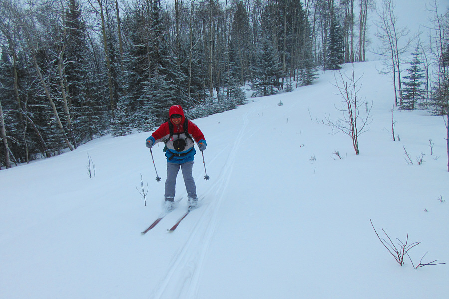
Sonny sails back down the first corridor as if he was at a ski resort.

Photo courtesy of Zosia Zgolak
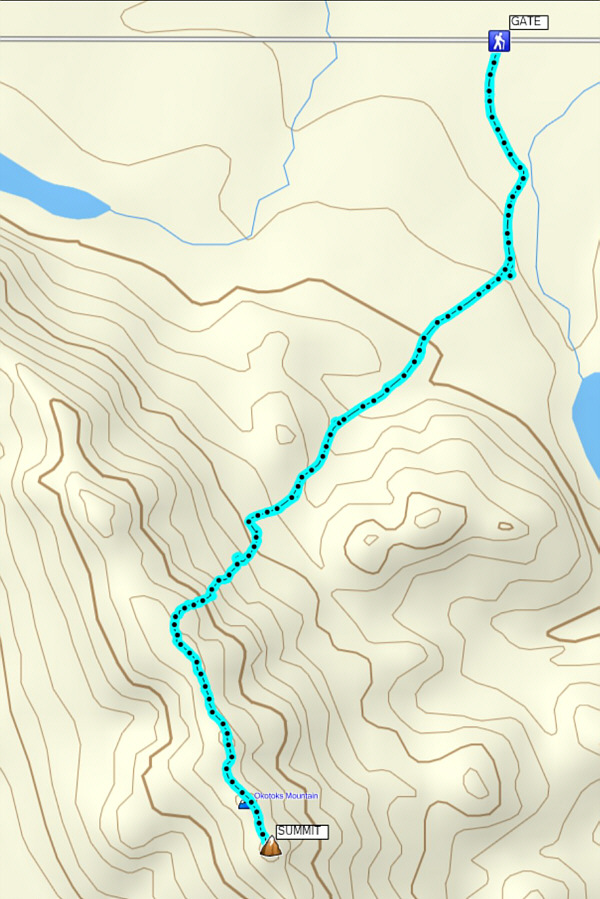
An excellent winter or shoulder season objective. Total Distance:  6.1 kilometres
Round-Trip Time:  3 hours 3 minutes
Net Elevation Gain:  237 metres

GPX Data