Having driven through St. George, Utah on
many occasions--usually en route to other destinations such as Zion
National Park or Las Vegas--I felt that it was time to stop and explore
some of the hiking opportunities in the area on 2 January 2020.
After spending the previous night at a truck stop in St. George, Zosia
Zgolak and I started the day with a hike to Snow Canyon Overlook.
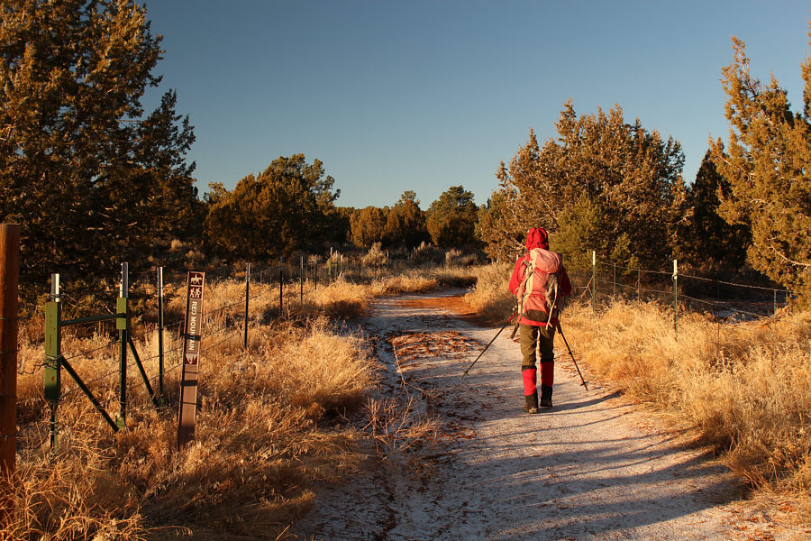
The overlook is accessed via Red Mountain Trail as described in 100
Hikes in Utah by Steve Mann & Rhett Olson, and the trailhead (vault
toilet and equestrian corrals) is on the west side of Highway 18 about 25
kilometres north of the junction with I-15. The trail climbs very
gradually along some sort of easement with fencing for the first 1.4
kilometres to a wilderness gate. Beyond the gate, the trail
continues in much the same manner for another 1.5 kilometres to a signed
junction. We turned left here and walked for another 750 metres to
reach the scenic overlook with its million-dollar view of Snow Canyon.
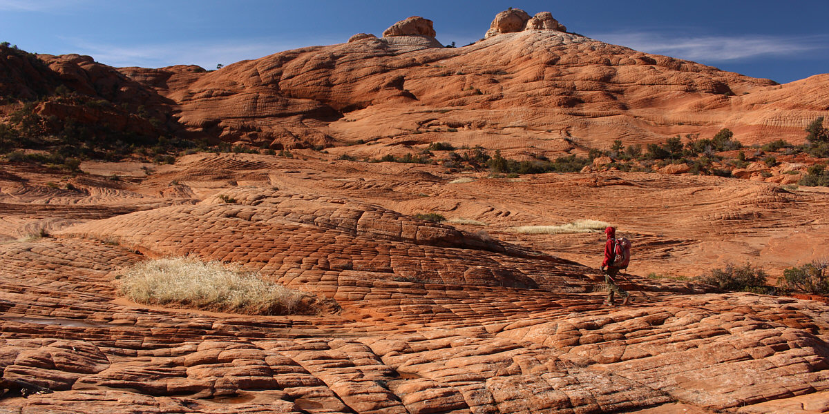
Not satisfied with reaching the overlook, we scrambled up a couple of
nearby high points just for fun before returning the way we came.
 |
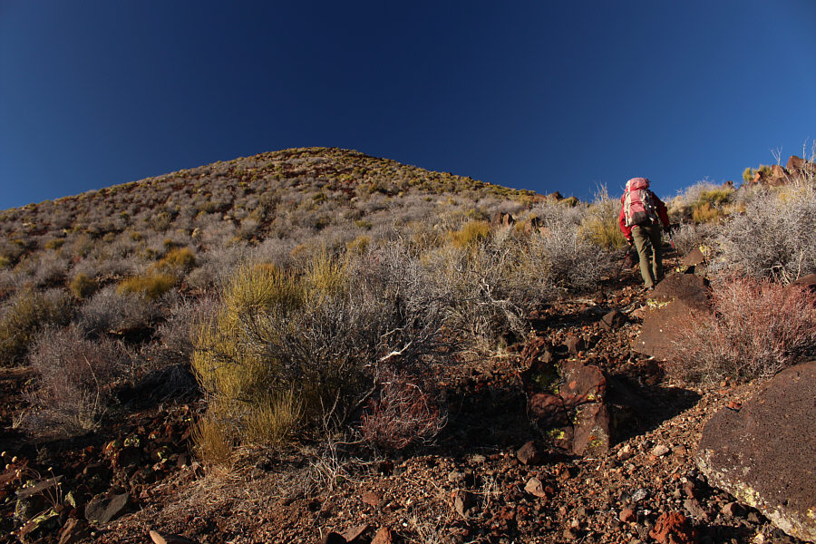
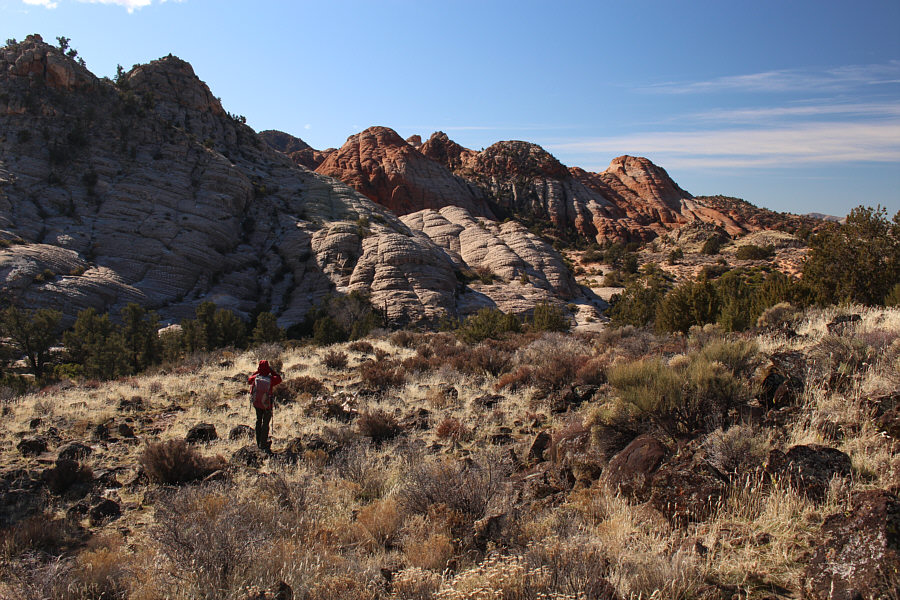
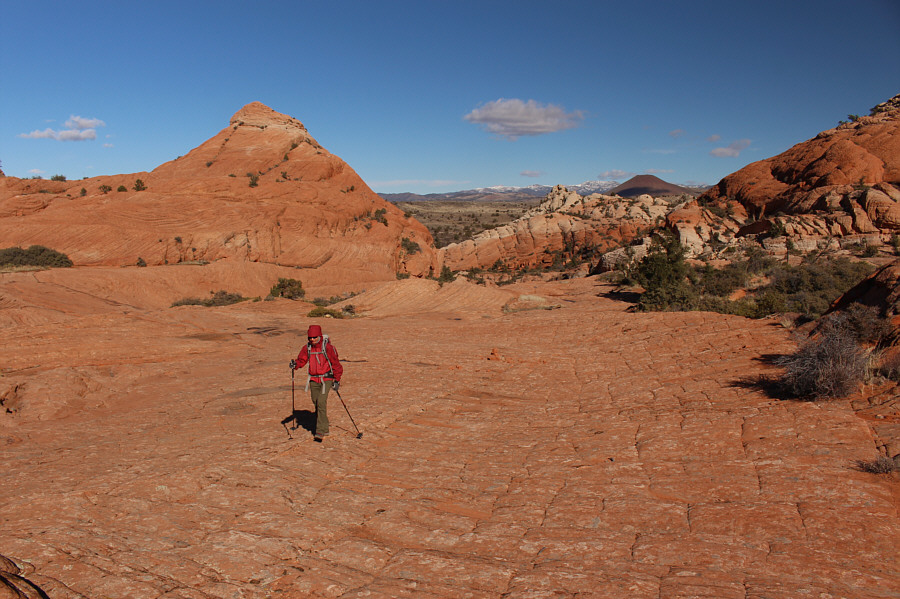
Zosia begins hiking along Red Mountain Trail. Although the general
area is collectively known as "Red Mountains", there is no actual peak
named "Red Mountain". |
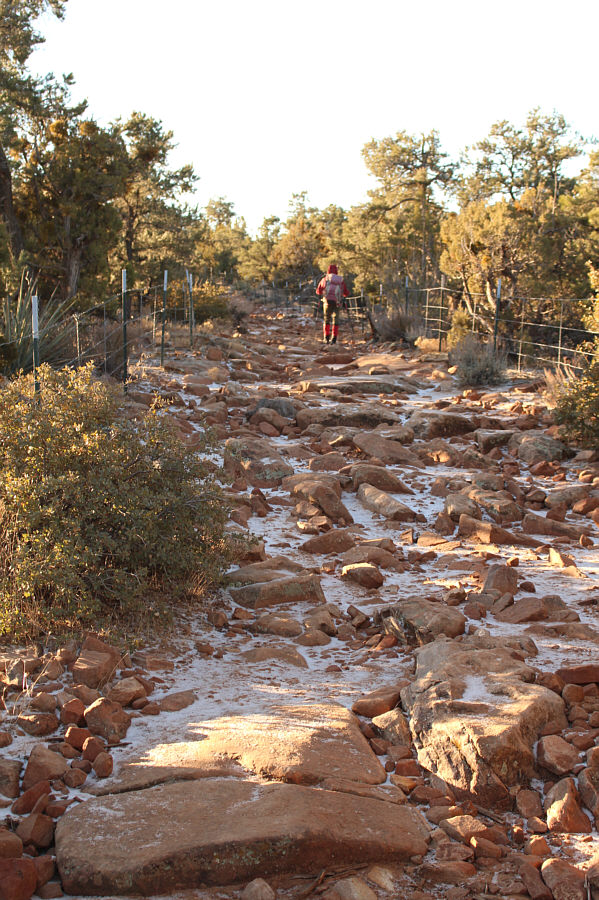 |
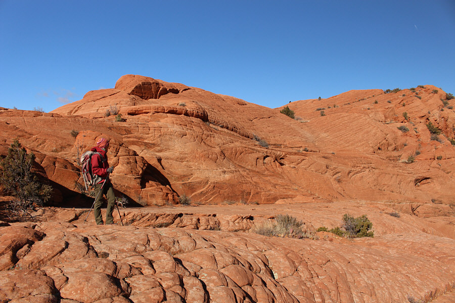
Much of the trail is wide and rocky like this. |
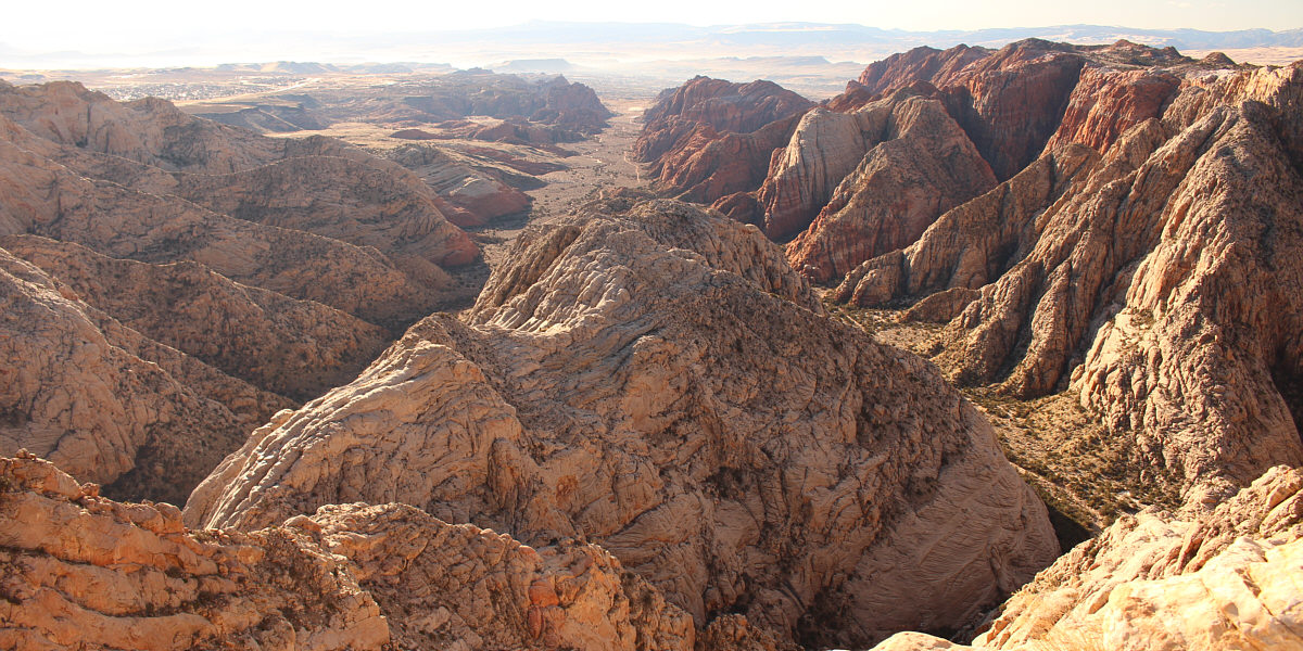
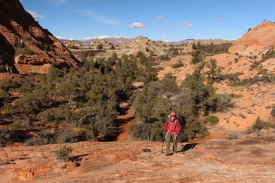
Here is the view of Snow Canyon from the overlook.
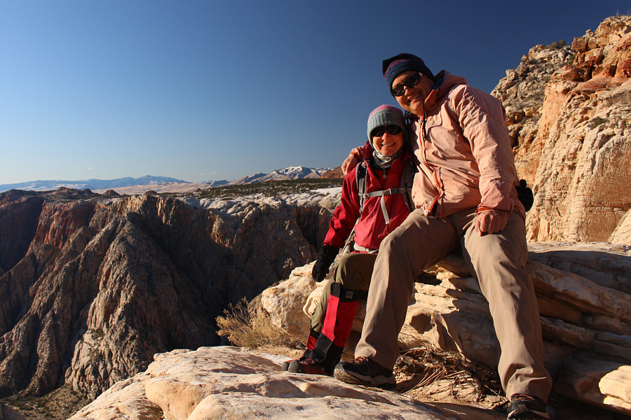 |
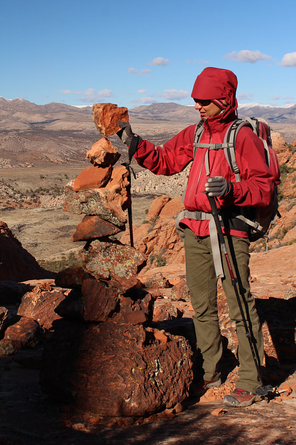
Zosia and Sonny enjoy the warm
sunshine at Snow Canyon Overlook (1519 metres). |
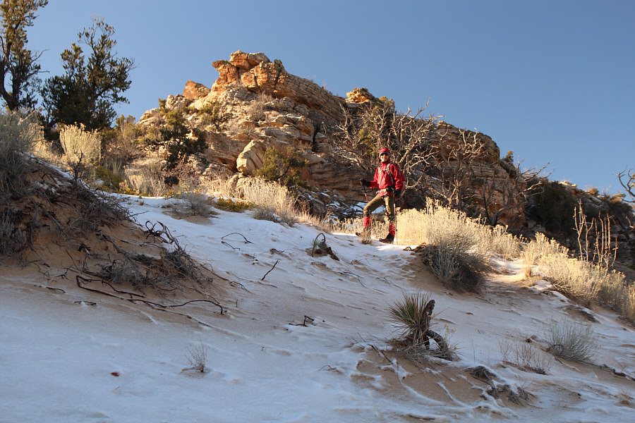 |
Heading for some nearby high points, Zosia hikes up a slope with a
strange mix of snow and sand. |
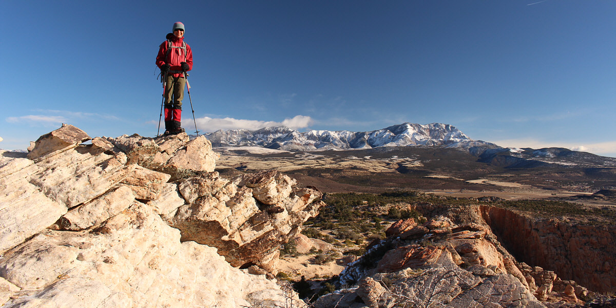
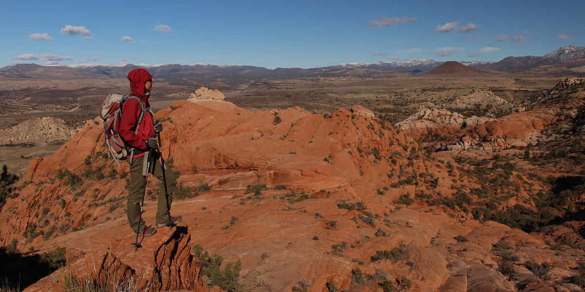
Zosia stands on an unnamed high point (1556 metres)
near the overlook. Behind her are the Pine Valley Mountains.
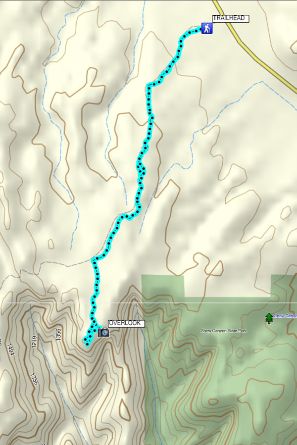 |
Total
Distance: 8.1 kilometres
Round-Trip Time: 2 hours 52 minutes
Total Elevation Gain: 222 metres
GPX Data |
Our next destination of the day was a big hole in the ground
known as The Vortex. This is apparently a popular hike in the
region, and there are some good route descriptions available online.
From the first trailhead, Zosia and I drove north along Highway 18 for
about 4.6 kilometres before turning left onto Lower Sand Cove Road.
Unless conditions are wet or muddy, this graded dirt road is suitable for
2WD vehicles. About 2 kilometres from the highway, we passed an
unsigned junction with a rougher road heading north toward a cinder cone
known as Veyo Volcano. Ignoring the cinder cone for the time being,
we kept driving for another 6.6 kilometres passing a reservoir and some
sort of maintenance building before reaching the turnoff for Lower Sand
Cove trailhead. The actual trailhead is about 120 metres further,
but because a big mud hole was blocking access, we elected to park right
at the turnoff. Two other cars were already parked here as well.
Zosia and I had a quick bite to eat in our car before starting our hike
past the mud hole. Numerous trails descending into Sand Cove Wash
caused us a lot of confusion, and we actually went the wrong way for a
bit before correcting our course. Even then, the route is not
well-marked, and all throughout the hike, we were often left to guess
where to go next. Mostly by following old footprints, we worked our
way across the wash and climbed up a valley of slickrock that had
interesting groove patterns and occasional small potholes filled with
water or ice. Farther up the valley, we ran into a family who had
started ahead of us, but they were still wandering about searching for
the whereabouts of The Vortex. By default, they were about to
explore a nearby sandstone ridge with some rock outcrops known
unofficially as the "Camelback", and although I was certain that The
Vortex was there, Zosia and I continued well past it to climb up another
ridge overlooking the whole basin. Backtracking to the Camelback,
we ran into the family again, and they confirmed that The Vortex was
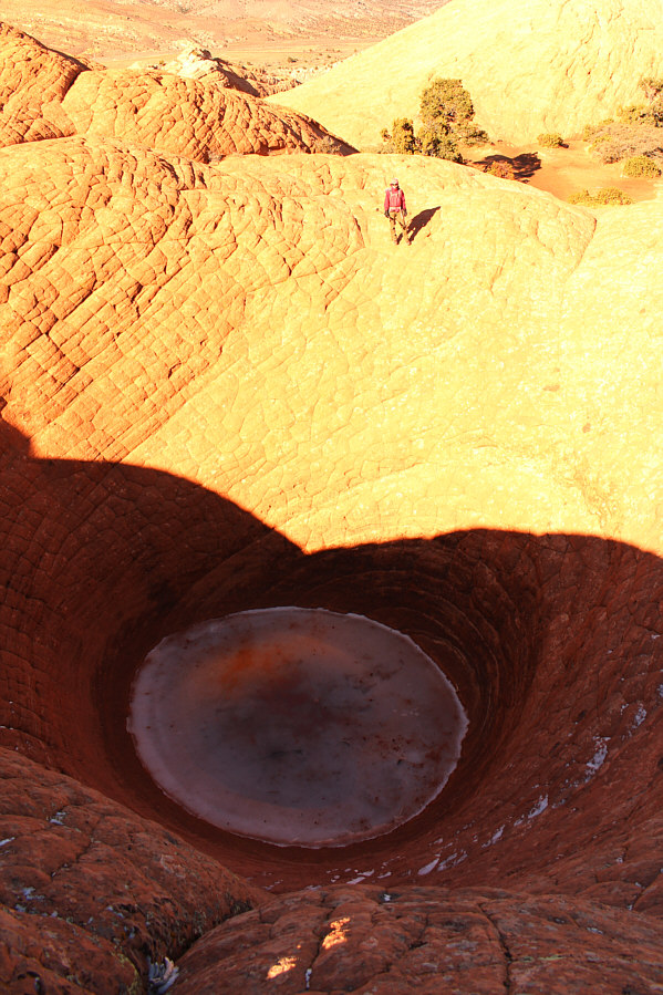
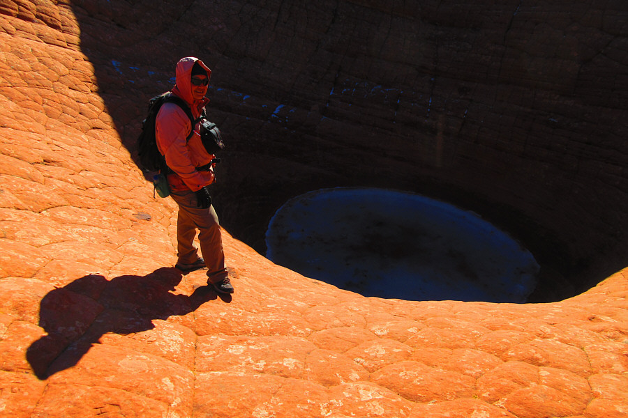
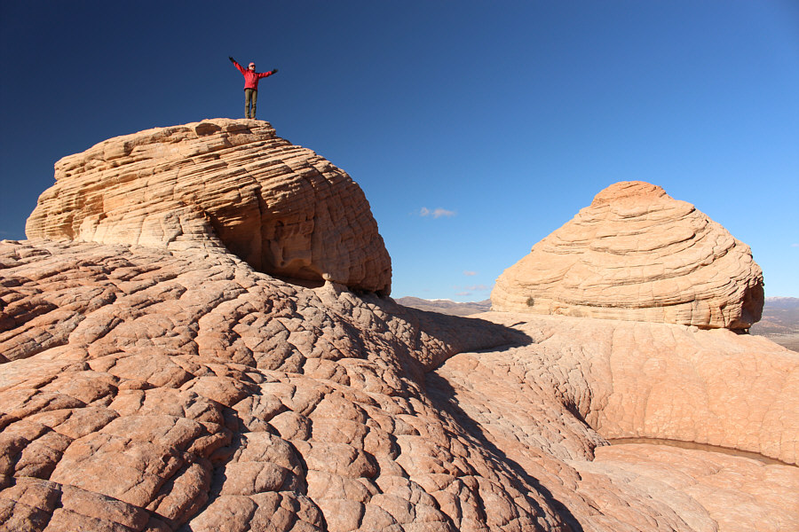
indeed there. There are actually four separate potholes of varying
sizes on the sandstone ridge with The Vortex being the deepest and most
dramatic-looking. Sadly, the walls of The Vortex are full of carved
graffiti left by previous inconsiderate hikers; it is a shame that an
ammo box with a register was never placed here. When we were done
circling The Vortex, we retreated to the slickrock valley and easily
hiked back to Lower Sand Cove trailhead.
 |
The route to The Vortex drops into Sand Cove Wash and eventually turns to
the left just beyond the grey rocks. |
 |
Zosia climbs out of Sand Cove Wash. |
Above Zosia is the sandstone ridge unofficially known
as the "Camelback". The Vortex is actually somewhere on the ridge
at upper left.
 |
Zosia passes a small cairn which means that she is still on the right
track. Visible in the distance at right is the dark form of Veyo
Volcano. |
 |
Still unsure about which way to go at this point,
Zosia looks up to where The Vortex is actually located. |
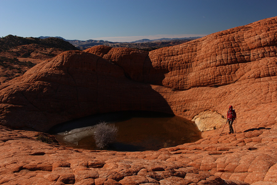
Zosia stands on a ridge overlooking the basin.
The Vortex is somewhere among the red rocks left of centre. Veyo
Volcano is visible at distant right.
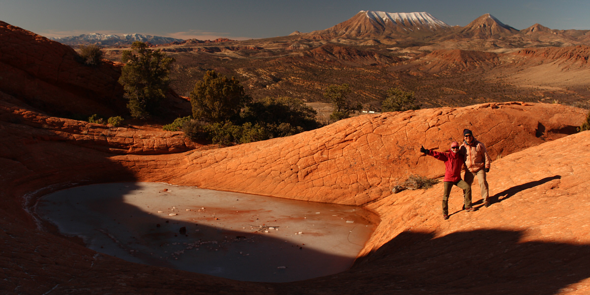
Just beyond The Vortex, this basin of water is almost
completely frozen. On the horizon at right are Square Top Mountain
and Jackson Peak.
 |
Zosia stands atop one of the "humps" on the Camelback. There is
another small basin of water at bottom right. |
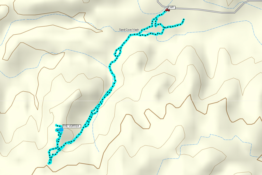 |
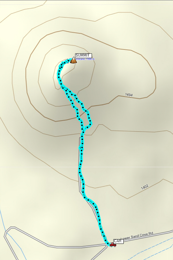
Total
Distance: 5.4 kilometres
Round-Trip Time: 2 hours 46 minutes
Net Elevation Gain: 85 metres
GPX Data |
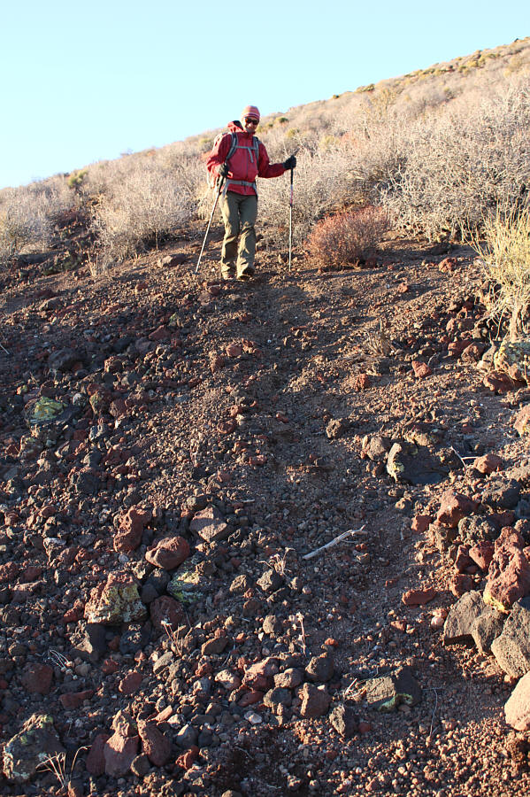
Upon returning to our car, Zosia and I drove back to the
aforementioned junction with the rough road leading to Veyo Volcano.
With about two hours of daylight left, we decided to try and squeeze in a
quick ascent of this small mountain with a cool-sounding name.
Although I probably could have driven right to the foot of the cinder
cone, we elected to park on the main road and just walk the approach on
the rough road. The ascent of the south slope was steep but
uncomplicated. From the top of the south slope, we hiked along the
broad and somewhat bushy summit ridge to a cairn at the northeast end.
After a very short break at the top, we essentially retraced our steps
along the summit ridge and down the south slope. The loose volcanic
soil worked well for a quick descent, and we were back at our car with
about half an hour of daylight to spare.
Overall, this was a great introduction to hiking opportunities near St.
George. The landscape here is as scenic as anything found in the
national parks, and yet, there are no crowds and very few restrictions.
Several mountains in the vicinity caught my attention, and I hope to
return in the future to climb a few of them.
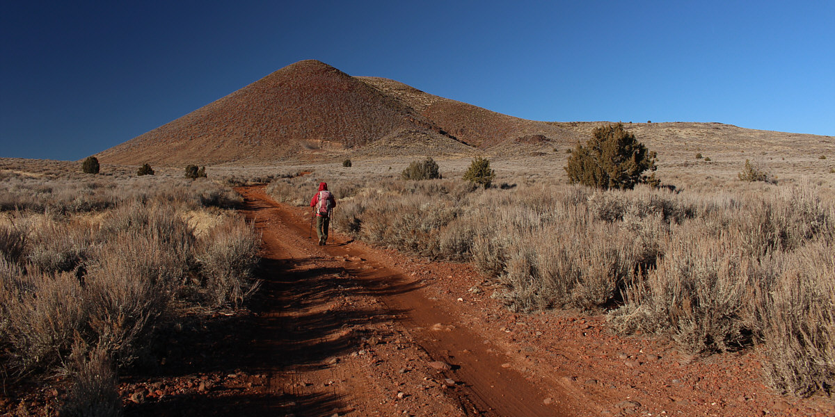
Zosia approaches Veyo Volcano from the south along a
rough dirt road.
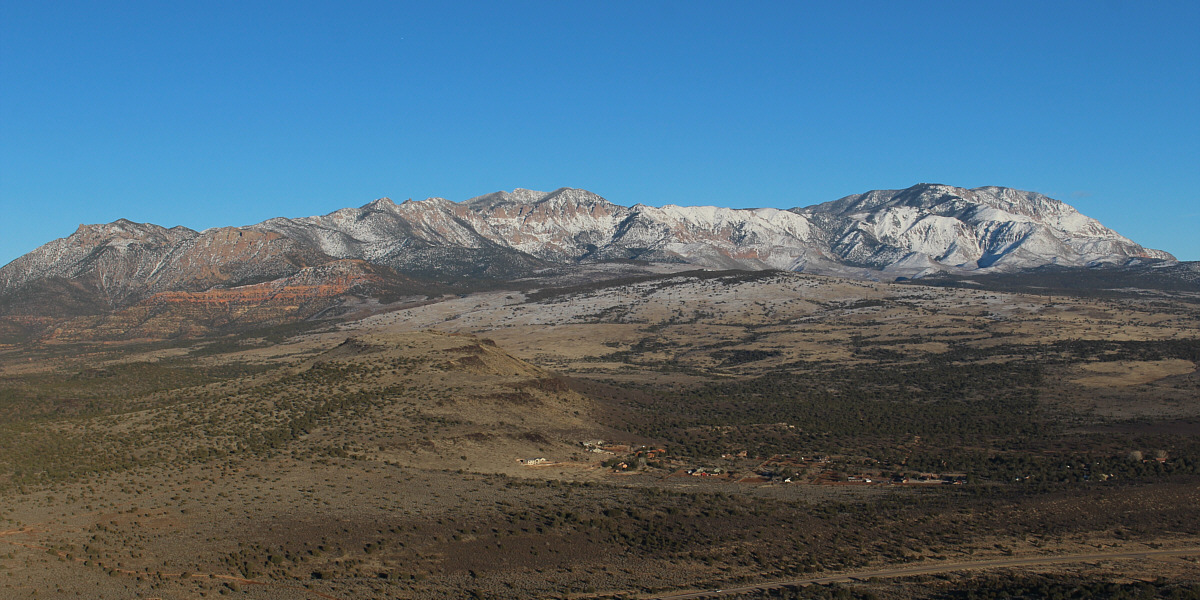
Signal Peak is the rightmost bump and is the highest in
the Pine Valley Mountains.
 |
Zosia takes advantage of the loose volcanic soil to surf down the south
slope. |
 |
Total
Distance: 2.9 kilometres
Round-Trip Time: 1 hour 33 minutes
Net Elevation Gain: 221 metres
GPX Data |