BOU AVENUE
Texas Peak And Reco Mountain

After spending a relaxing rest day in and around New Denver, British Columbia, Zosia Zgolak and I were back roaming the mountains to the east of the village on 18 August 2020.  Inspired by a trip report on the West Kootenay Hiking website and feeling energetic, we decided to tackle both Texas Peak and Reco Mountain in the vicinity of Retallack Lodge, a commercial cat skiing and mountain biking operation.  Because of the commercial operation, access to these two mountains is relatively easy, and the myriad of trails and roads here allows for some route variation as well.

From Highway 31A, turn south onto the road to Retallack Lodge 20 kilometres east of New Denver or 27 kilometres west of Kaslo.  Immediately cross a bridge and go left (right is the Retallack Old Growth Cedars trailhead).  About 200 metres past the bridge, fork right onto Stenson Creek Forest Service Road (left goes to the lodge).  Ignoring side roads, drive for 3.6 kilometres to a junction and go right.  Drive for another 1.6 kilometres and keep left on the main road.  Continue driving for 1.4 kilometres and cross a bridge over Stenson Creek.  Drive an additional 2.1 kilometres and park at a switchback along the road.  Total distance from the highway is about 9 kilometres.  A high-clearance vehicle is recommended.

From where we parked, Zosia and I walked up the continuation of the access road and almost immediately turned left onto another road which climbs steeply into the Stenson Creek basin.  About 700 metres up this road, we passed a junction with another exploration road coming in from the right but ignored it and kept going straight.  About 1.3 kilometres beyond this junction, we left the road and took a short cut trail which quickly gains the crest of the connecting ridge between Texas Peak and Reco Mountain.  Opting to tag Texas Peak first, we turned left (east) and followed a good trail along the ridge crest to where it peters out at the foot of a steep grassy slope below the first of two false summits.  The grind up this grassy slope is easy but long.  Surprisingly, we picked up another trail at the top of the first false summit, and we followed this down into a dip and partway up the second false summit.  This trail is likely utilized by mountain bikers, and we were a bit shocked by how steeply it rises--almost vertically--to the top of the second false summit.  Instead of following the trail, we stayed on the ridge crest and easily scrambled over the second false summit.  After dropping into another dip, we continued up the slightly more challenging west ridge of the true summit.  Fortunately, we had no serious problems and were soon standing beside the summit cairn of Texas Peak.
Too steep to drive unless you have a 4WD high-clearance vehicle. 
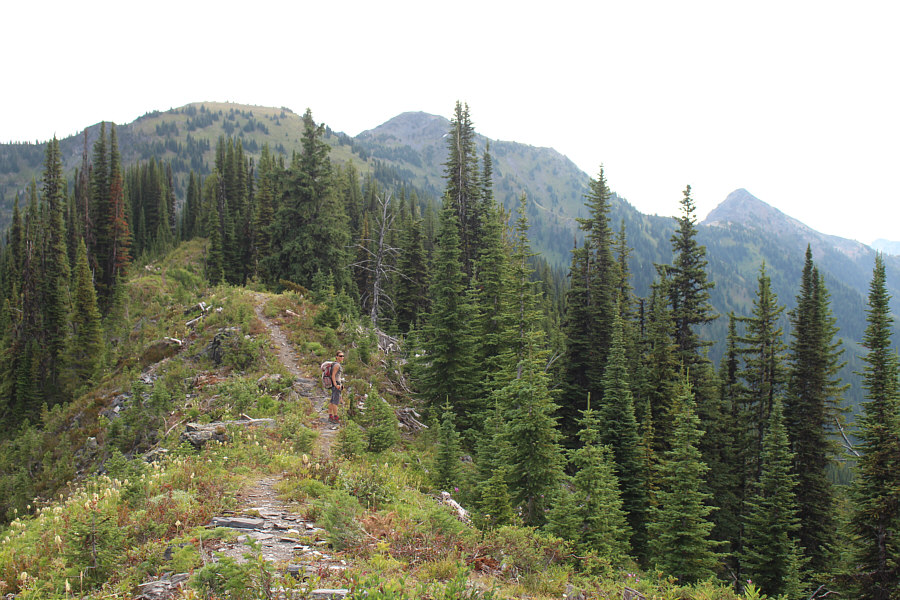
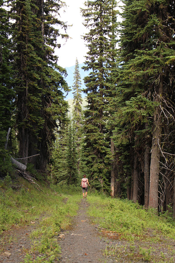
Zosia climbs up the steep road leading to the back of Stenson Creek basin.
Looks like we've already gained all the elevation for the day...NAWT!! 
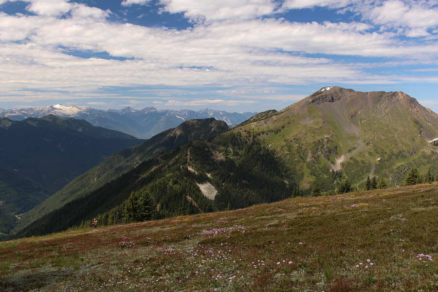
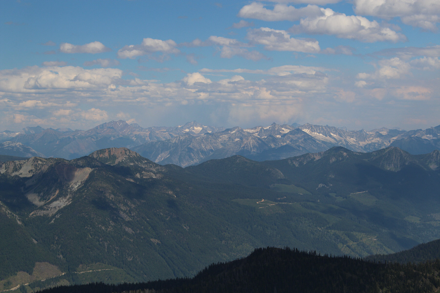
The connecting ridge between Texas Peak and Reco Mountain is visible in the distance.
Some serious ups and downs ahead... 
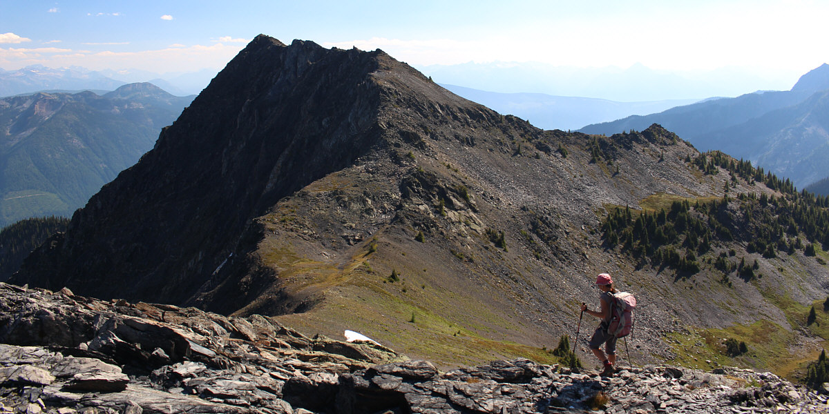
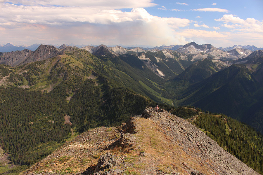
Zosia heads east along the connecting ridge and will eventually climb over the two bumps on the left.  The true summit of Texas Peak is not visible here.  The pointy peak at far right is Paddy Peak.
One of those put-your-head-down-and-just-keep-pumping-your-legs type slopes! 
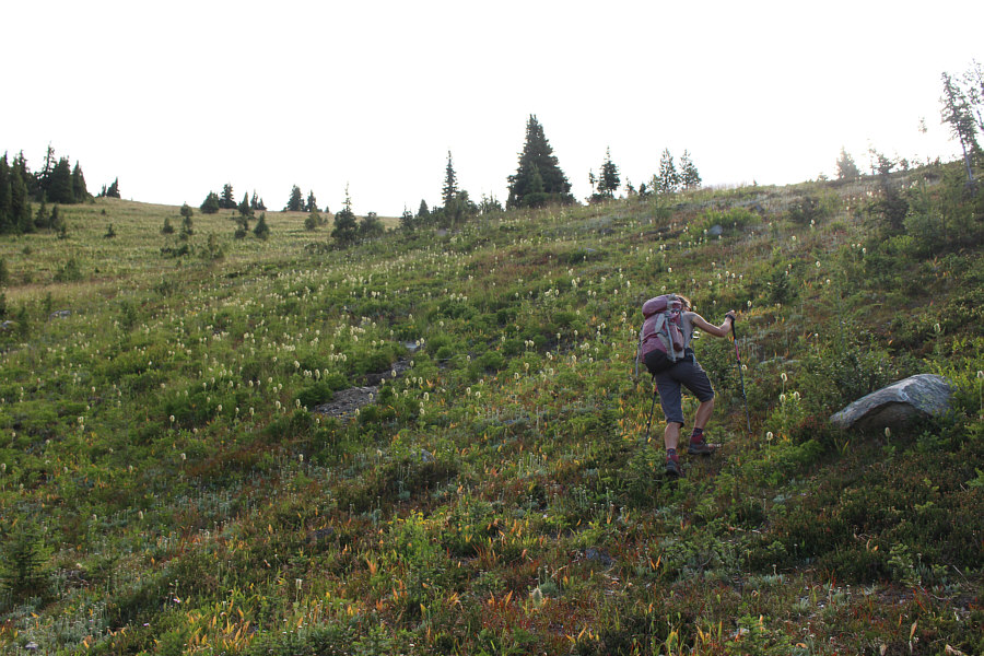
Zosia grinds her way up a steep grassy slope.
Why does the true summit always have to be the further peak?? 
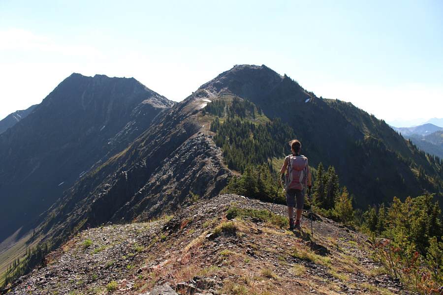
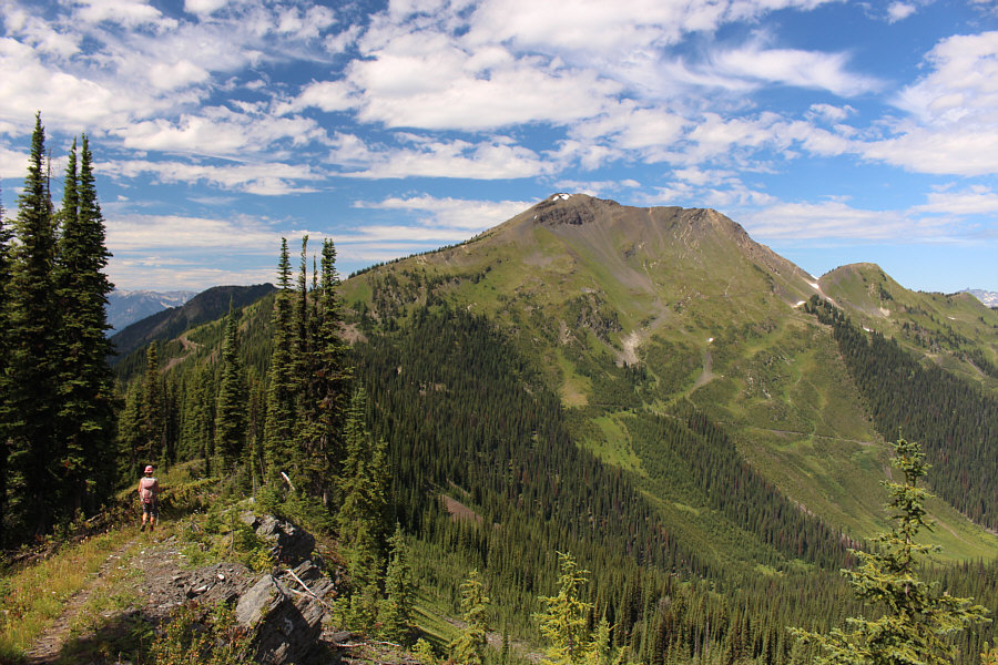
From the top of the first false summit, Zosia gets her first good look at the true summit of Texas Peak at far left.
Less problematic than trying to sidehill bash to save elevation gain. Zosia easily climbs up the second false summit.

Slowly but surely, we're getting there!

Zosia descends from the second false summit en route to the true summit of Texas Peak.


Not nearly as friendly as the goats in Valhalla! A couple of goats are startled by the presence of humans nearby and would quickly disappear.

Photo courtesy of Zosia Zgolak

Chasing after the goats! 
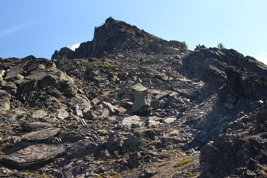
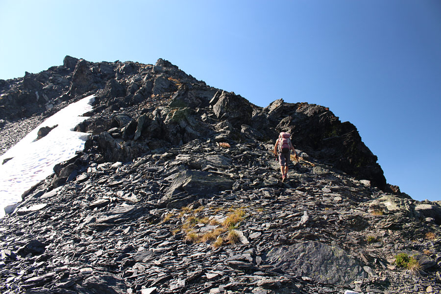
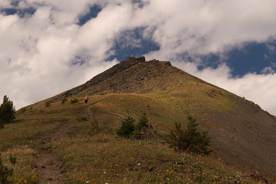
Zosia scrambles up easy rubble towards the summit ridge.
The goats have vanished into thin air! Zosia gains the summit ridge.
We forgot our cowboy hats! Zosia and Sonny reach the summit of Texas Peak (2484 metres).
So many intriguing peaks around here! The view to the south includes Paddy Peak (far left), Mount Carlyle (behind Paddy Peak), Kokanee Glacier (left horizon), and Long Mountain (pointy peak right of centre on horizon).
Can you figure out which one is Gimli Peak? Directly behind the second false summit (centre) is Selkirk Peak with Idaho Peak to the right.  The snowy peaks of Valhalla Provincial Park stretch across the entire western horizon.

If the road to Idaho Peak hadn't been closed, we might not have bothered to hike here.

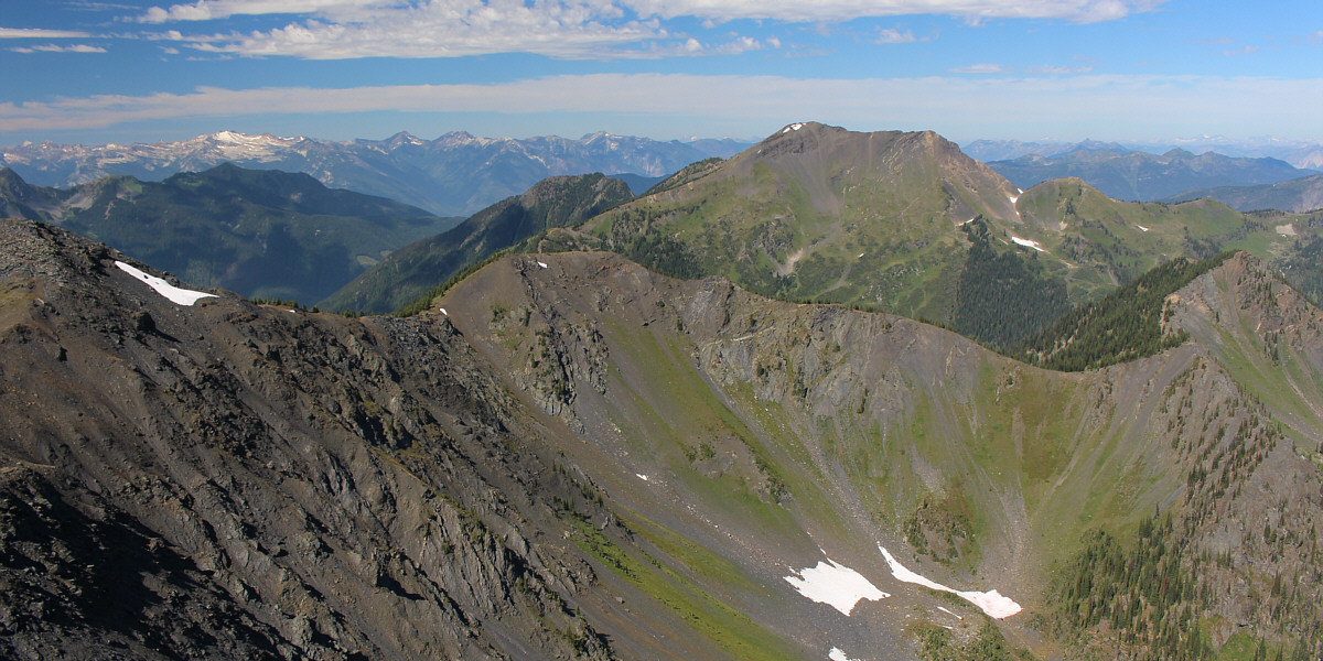
Left of centre is the first false summit with Reco Mountain to the right.


I think I can still hear that shitty music playing at that outdoor party below Mount Brennan! To the northwest are Mount Brennan (right) and many other rugged peaks of Goat Range Provincial Park.
Zosia and I took a 40-minute break on top of Texas Peak before retracing our steps back to the false summits.  While Zosia climbed over the top of the second false summit, I opted to save some elevation gain by side-hill bashing across the steep and loose north side.  Although doable, this short traverse was unpleasant enough for me to not recommend it.  Reuniting on the other side, we climbed over the first false summit and dropped down the steep grassy slope to regain the trail on the connecting ridge.  The long traverse to Reco Mountain is uncomplicated since the trail runs all the way to the summit, but the final steep pull up the south ridge was astonishingly strenuous for me and longer than I had expected.

Zosia and I took another extended break at the top of Reco Mountain before backtracking a short way down the south ridge.  Instead of returning via the connecting ridge, we took an obvious mountain biking trail which makes a descending traverse across the eastern slope of Reco Mountain.  The mountain biking trail ultimately connects to a road near tree line, and although we were not absolutely certain, we had a hunch that this was the same exploration road that we had passed near the start of the trip.  Sure enough, we followed the road down through the forest and popped out of the trees precisely at the expected junction.  Turning left, we easily hiked the remainder of the main road back to our car.  The subsequent long and bumpy drive back to the highway was uneventful.
Onward! Zosia descends from the first false summit en route to Reco Mountain.
That left-hand ridge is steeper than it looks! As Zosia approaches Reco Mountain, a number of roads can be seen crisscrossing its eastern slope.
People ride mountain bikes down this?? Zosia follows the trail up the steep south ridge of Reco Mountain.
And Zosia is doing it in her bare feet! Sonny and Zosia stand on the summit of Reco Mountain (2513 metres).
Guess which one is Mount Brennan. 
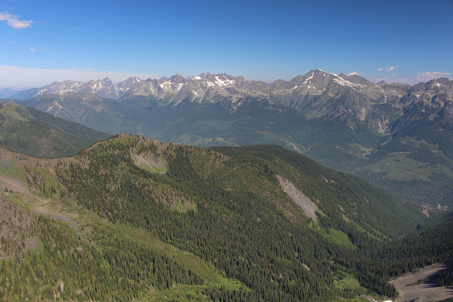
The peaks of Goat Range Provincial Park stretch across the northern horizon.

An amazing area in spite of the presence of OHVs.

Here is a comprehensive view of the connecting ridge to Texas Peak (left) to the east.  The pointy peak on the centre horizon is Mount Loki.


Smoke gets in your eyes...

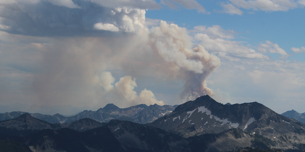
A wildfire breaks out somewhere behind Mount Carlyle to the southeast.  The peak further away to the left is Trafalgar Mountain.


Burn baby, burn! An even larger wildfire erupts to the east somewhere behind Mount Clutterbuck.
We were doing so well with wildfires this summer until today! Zosia hurries down the ridge in case another wildfire breaks out.
A bike, a bike, my kingdom for a bike! This mountain bike trail is an alternate route for descending Reco Mountain.  It leads to a road in the forest at bottom right.  In the distance at left is Mount Brennan.
Just a lot of steep downhill walking from here. Zosia enjoys an easy descent on an exploration road.
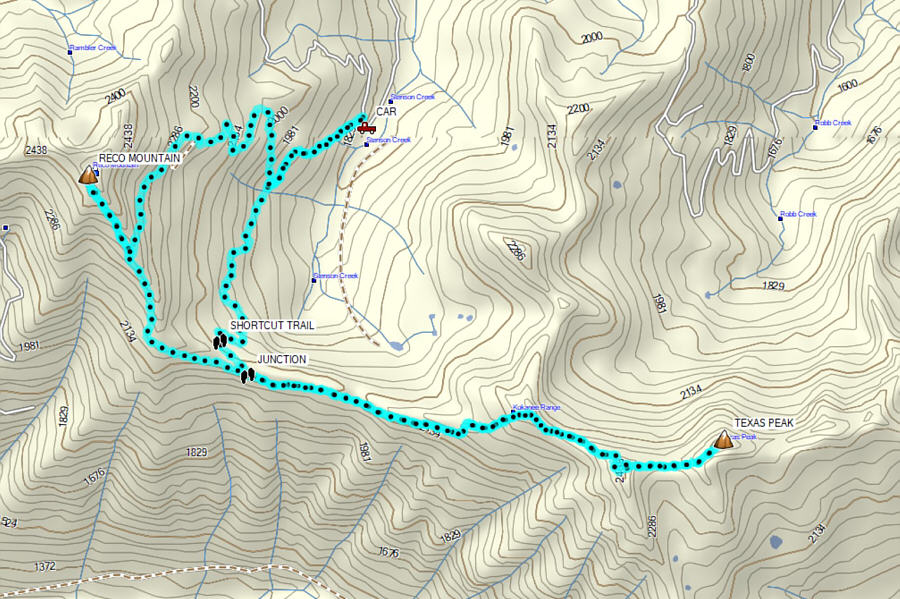
A strenuous but highly satisfying double-summit day! Total Distance:  14.0 kilometres
Round-Trip Time:  8 hours 42 minutes
Cumulative Elevation Gain:  1408 metres

GPX Data