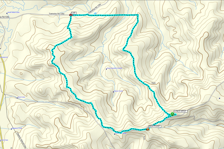
Heading south through the barbed wire gate, we crossed an open field and squeezed through another barbed wire fence before climbing up a forested slope (although we were totally inside public land for the entire trip, we would encounter numerous annoying barbed wire fences throughout the area). We soon reached the crest of a subsidiary ridge located between Highway 22 and Squaw Coulee, and we followed this ridge southward toward the west end of Trout Creek Ridge. Travel was generally easy, and after stumbling onto a 4x4 road, we were able to follow it for most of the length of the subsidiary ridge. At one point, we spotted some big bear tracks in a lingering snow patch, but we did not give them much further thought since they did not appear to be freshly made.
Upon gaining the west end of Trout Creek Ridge, we turned eastward onto another 4x4 road, but we began encountering more lingering snow patches. We tried to avoid the snow as much as possible, but some surprisingly deep post-holing was inevitable. We eventually stopped to have lunch on a partially-treed hump located about midway along the ridge. Our highest elevation reached was actually on a bump just before our lunch spot, but this bump is merely the shoulder of an even higher ridge branching off to the southeast. As such, the exact high point of Trout Creek Ridge is ill-defined.
 |
Zosia opens a gate to enter the forest reserve. |
 |
Zosia hops over a barbed wire fence within the forest reserve. |
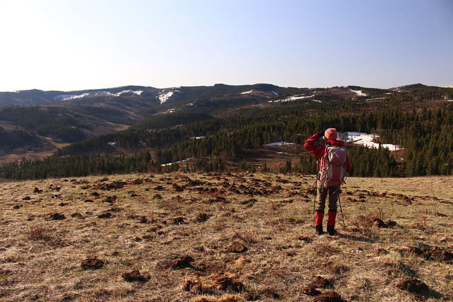 |
Stretched across the horizon is Trout Creek Ridge. |
 |
Aspen trees are abundant in this part of the forest reserve. |
 |
There are already far-reaching views from the crest of the approach ridge. |
 |
This is one of many pasque flowers blooming throughout the area. |
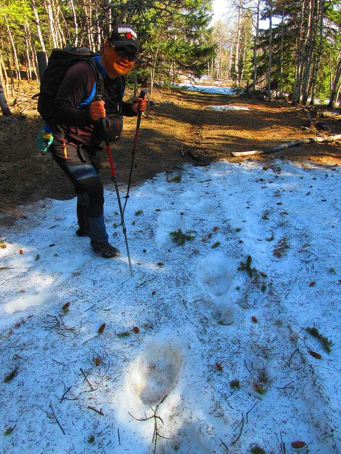 |
Sonny examines some very large bear tracks in the snow. Photo courtesy of Zosia Zgolak |
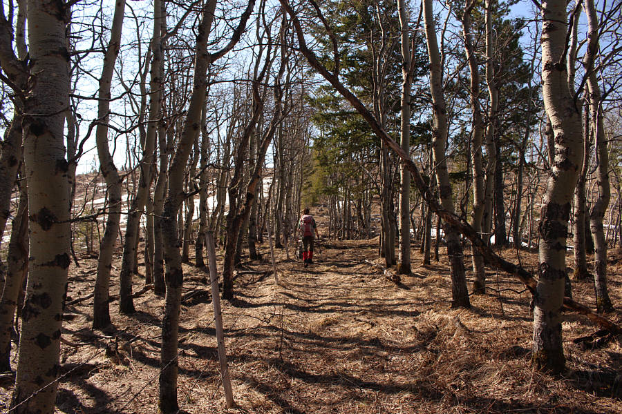 |
Zosia hikes through another stand of aspen trees not far from the crest of Trout Creek Ridge. |
 |
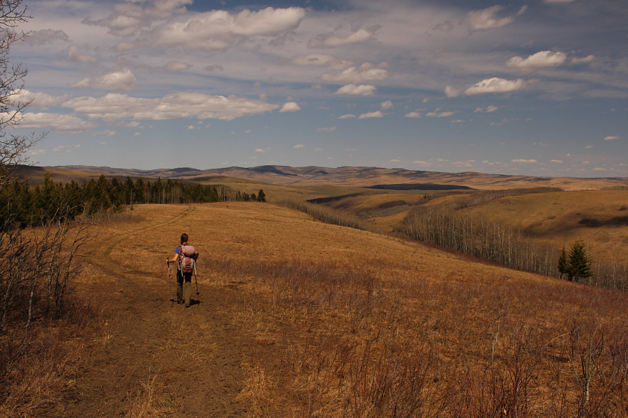
Zosia follows a road along the crest of Trout Creek Ridge. |
 |
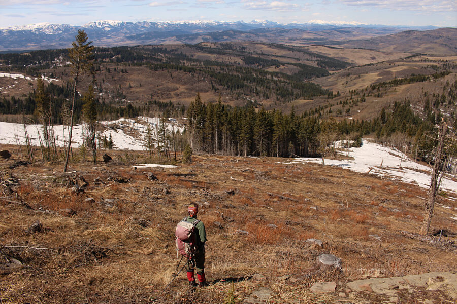
Zosia tries to figure out how to get around the deep snow after dropping down from the high point (1758 metres) of the day. |
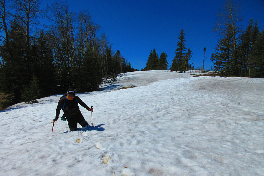 |
Sonny flounders in a deep patch of snow on the ridge crest. Photo courtesy of Zosia Zgolak |
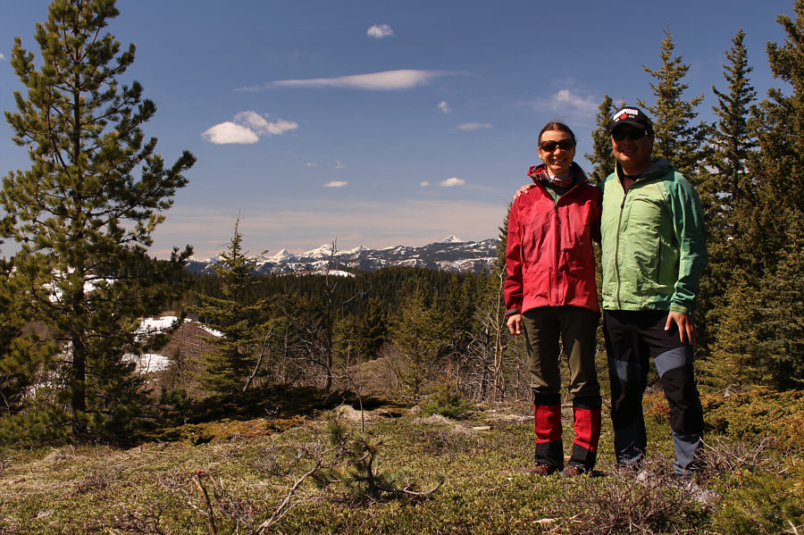 |
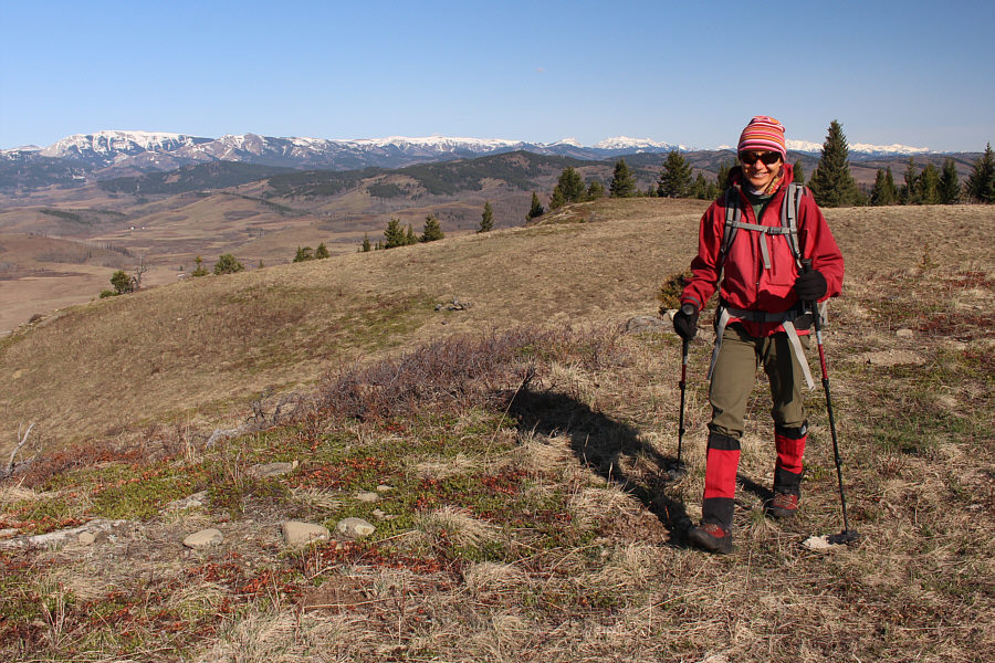
Zosia and Sonny pose for a photo near their lunch spot on the crest of Trout Creek Ridge. |
The very north end of the branching ridge is on agricultural public land, but because we did not secure access permission from the leaseholder beforehand, we felt it was prudent not to continue northward along the 4x4 road which presumably intersects Riley Road. Instead, we turned westward and followed the forest reserve boundary fence line which drops into Squaw Coulee and then climbs over the crest of the same ridge we started on at the beginning of the day. Despite the annoying extra elevation loss and gain, we were at least making a beeline for our starting point, and the only real difficulty was having to dodge a lot of cow dung and muddy sections along the way. We eventually merged onto Riley Road at the point where it borders the forest reserve boundary, and we easily walked the remaining few hundred metres back to my car to complete a most satisfying loop hike.
 |
After dropping off the crest of Trout Creek Ridge, Zosia contemplates her return route down the broad ridge at far right. |

Most of the return route is pleasant hiking along a 4x4 road.
 |
The return route is surprisingly scenic. |
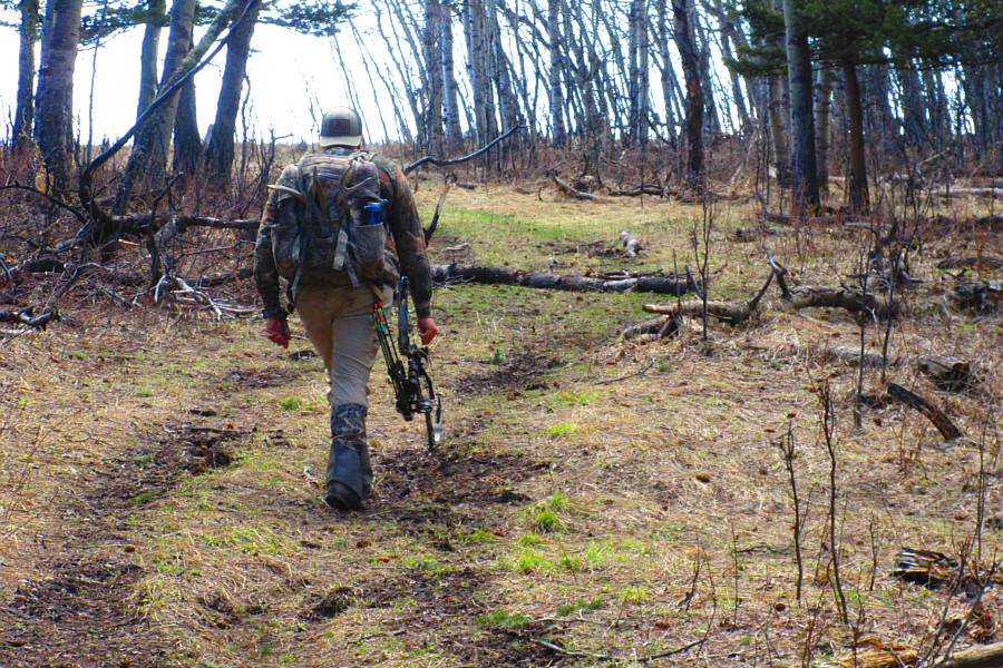 |
This wildlife biologist is hunting
black bear in the area with a bow. Photo courtesy of Zosia Zgolak |
 |
Sublime grasslands stretch far away to the east. |
 |
At the northern boundary of the forest reserve, Zosia turns west along the fence line and has to drop down into Squaw Coulee before climbing over the far ridge to get back to her starting point. |
 |
Total
Distance: 17.0 kilometres Round-Trip Time: 7 hours 23 minutes Total Elevation Gain: 744 metres |