BOU AVENUE
Beauvais Lake Hill
With a less-than-stellar weather forecast in the mountains, Zosia Zgolak and I opted for a short and relaxing hike in Alberta's Beauvais Lake Provincial Park on 4 April 2021.  Since we had already hiked up some high points in the southern half of the park, we decided to explore the unnamed hill northeast of Beauvais Lake.  Unable to find any other references, I have taken the liberty to call this "Beauvais Lake Hill".  Starting from a parking spot along the access road about 1.7 kilometres beyond the park entrance, we hiked north through a break in the trees and were soon climbing up open grassy slopes alongside a fence.  The actual high point of Beauvais Lake Hill is just a short distance east of the fence, and although we were uncertain if this was outside the park boundary, we did not see any "No Trespassing" signs and assumed it was okay to hop over.  When we reached the high point, we spotted another one a little further to the southeast that appeared just as high if not higher.  Naturally, we felt compelled to investigate.  This second high point has a survey marker and cairn, and although it appears on a lower contour in my GPS map, the elevation reading I got here was actually slightly higher than the first high point.  In any case, we snapped a requisite photo here before retreating back to the west side of the fence.  Since this hike was so short, we decided to extend it by descending the ridge to the northwest and following the park's northern boundary fence line.  Initially, this was easy to do, but further on, we ran into a boggy area and increasingly more deadfall.  At this point, we decided to leave the fence line and climb up a low rise where we stumbled onto the park's maintenance area.  After snooping around here a bit, we stopped for a snack break before venturing eastward along the open slopes north of Beauvais Lake.  We soon joined the established Aspen Trail and followed it down to the lakeshore.  From there, we easily walked back to our starting point to conclude a surprisingly enjoyable hike.
A good place as any to start hiking.

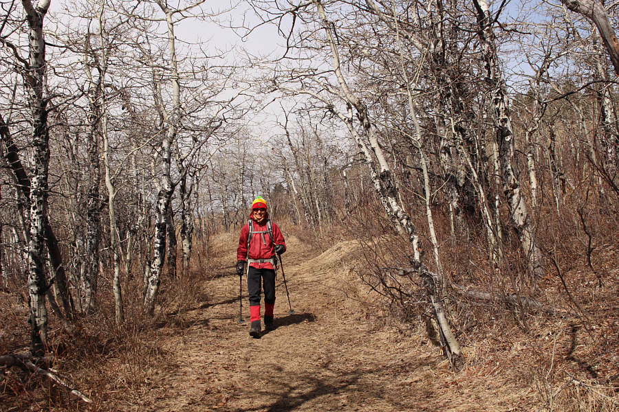
Zosia goes through a break in the trees to access Beauvais Lake Hill.

These flowers look like they're still waking up.

The appearance of pasque flowers is a sign that spring is here.

Great views already! There is a more comprehensive view of Beauvais Lake as Zosia climbs up the hill.
If there was more snow, this might be a good hill for a ski tour...or toboggan! 
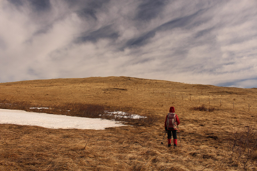
The grassy south side of Beauvais Lake Hill is easy to ascend.

Don't need to go far or climb high for great views!

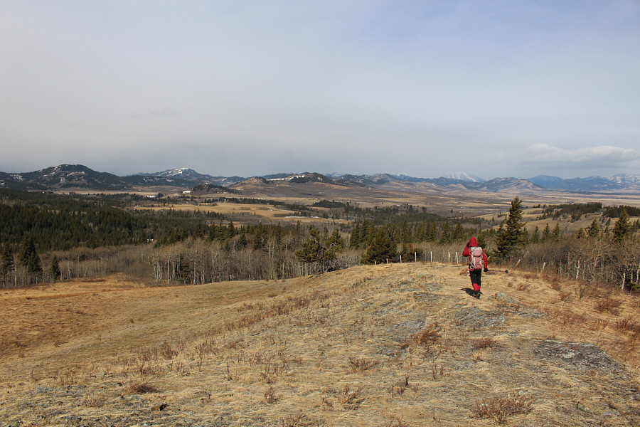
Well before the top, there are already expansive views to the west.


I guess it's okay to cross the fence? 
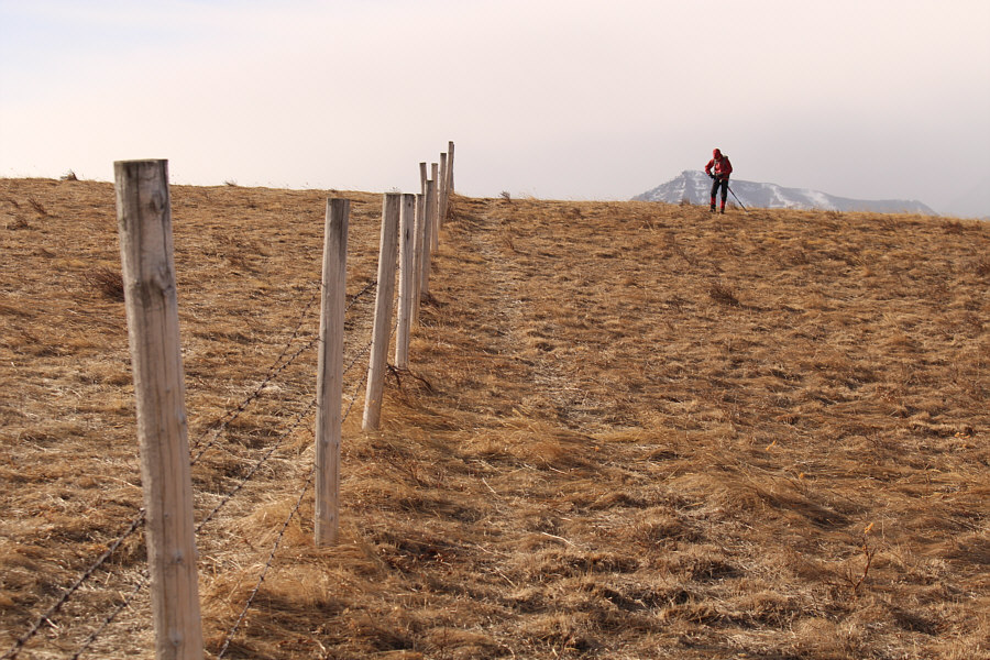
This fence appears to demarcate the eastern boundary of Beauvais Lake Provincial Park, and although the other (left) side of the fence is probably not public land, there are no "No Trespassing" signs here.
Still no "No Trespassing" signs! Zosia approaches the highest point along the fence line.
Still not sure if this was the highest point, but at least there was a survey marker here. 
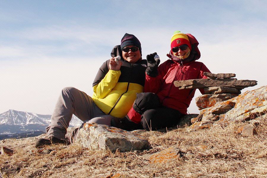
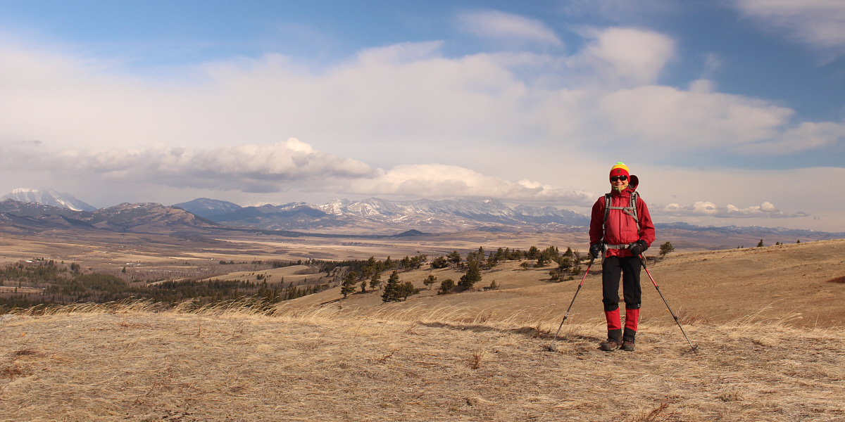
Sonny and Zosia celebrate Easter Sunday on the high point of Beauvais Lake Hill (1525 metres).
Heading into the unknown! Zosia heads west along the northern boundary of the park.
It gets boggy later too! 
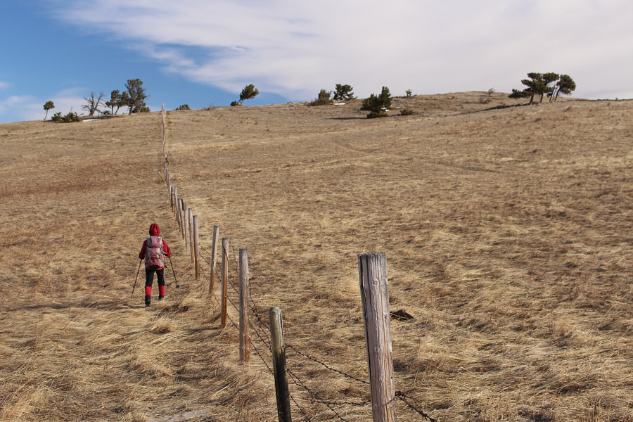
The northern fence line is easy enough to follow although views are somewhat limited.
Grrrrrrrrrrr!!!

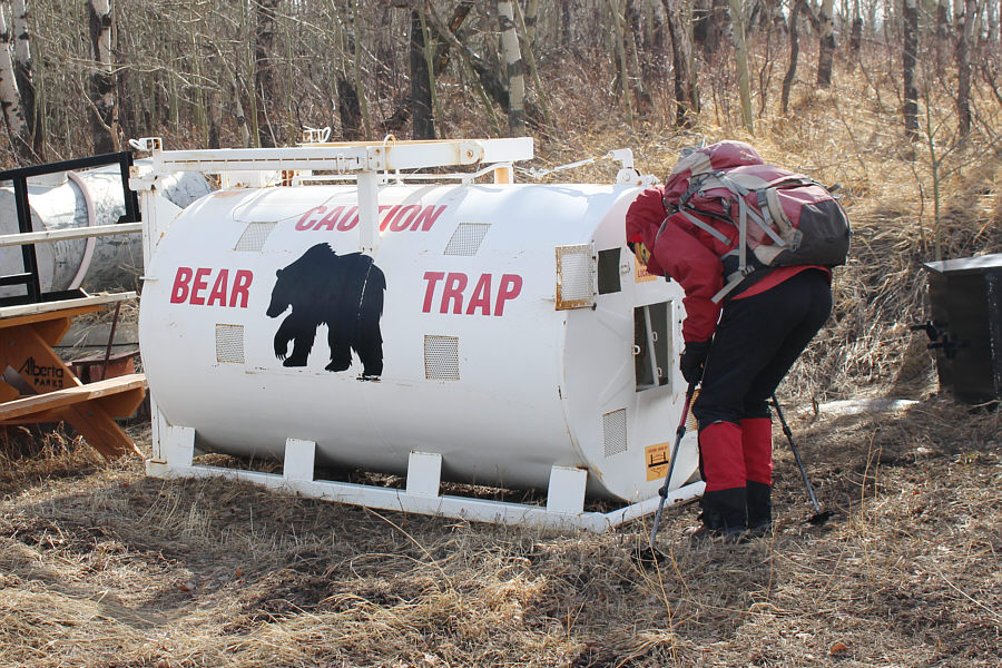
Zosia checks to see if there is a bear inside this trap at the park's maintenance area.

Birdie num num.

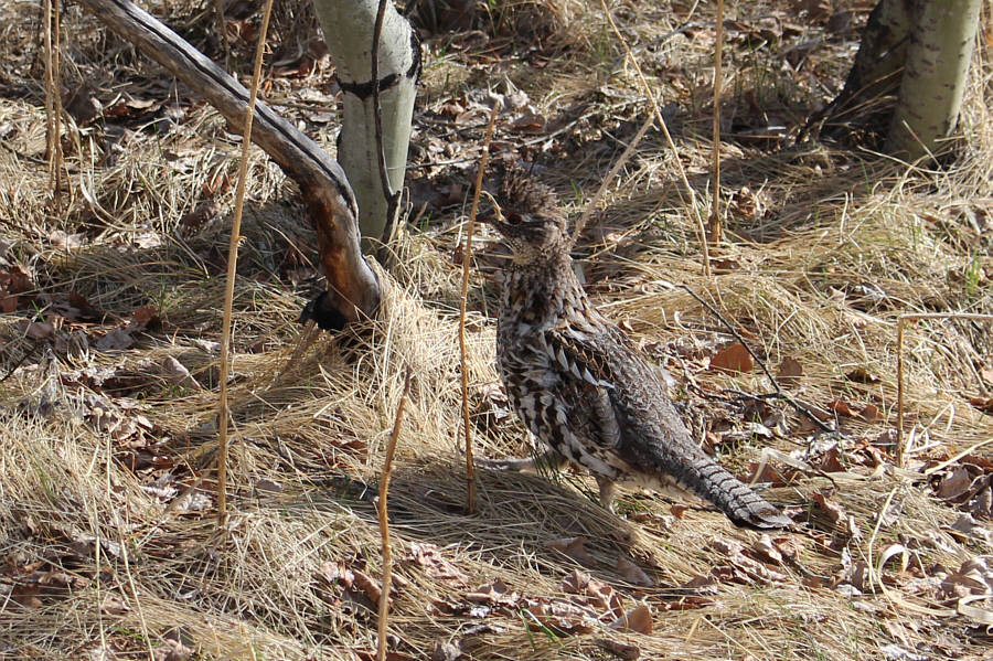
A ruffed grouse quickly walks away after almost being stepped on.

Easy and no bushwhacking! Zosia heads east on open slopes above Beauvais Lake.
Like going for a Sunday stroll!

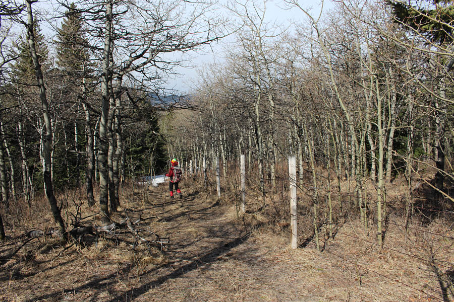
Zosia hikes the appropriately-named Aspen Trail.

Can't get anymore stress-free than this!

Zosia stops for a last look at Beauvais Lake.
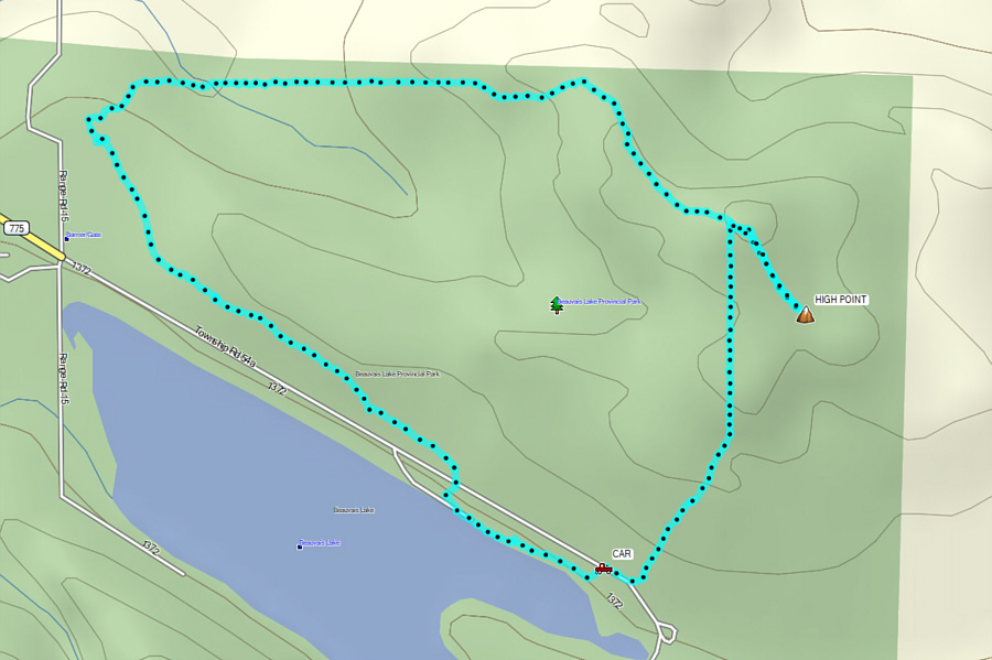
A thoroughly enjoyable walk through a neglected part of the park. Total Distance:  5.8 kilometres
Round-Trip Time:  3 hours 13 minutes
Net Elevation Gain:  146 metres

GPX Data