BOU AVENUE
China Nose Mountain
Zosia Zgolak and I hiked up peculiarly-named China Nose Mountain near Houston, British Columbia on 19 August 2021.  We noticed this striking escarpment from the Yellowhead Highway as we were driving out to the coast a couple of weeks earlier, and after doing a little research, we learned that there is an easy hiking route to the top as described on the Houston Hikers website.  As detailed in the British Columbia Geographical Names website, "Nose" is sometimes substituted with its homophone "Knows" in reference to a likely apocryphal story of Chinese railroad workers discovering gold on the mountain.  At the same time, a map linked to the Houston Hikers website shows that there is actually a rock feature on the mountain that resembles a nose although its association with China is perhaps a stereotypical one which could even be construed as being derogatory.  In any case, the curious name only added to the mountain's intrigue for us as we drove out to the trailhead that morning.

From Highway 16, turn south onto McKilligan Road (2WD gravel) 7.7 kilometres east of the Bulkley River bridge in the town of Houston or 21.0 kilometres west of the village of Topley.  Drive 1.0 kilometre and stay left on Aitken Road which becomes Heading Creek Forest Service Road (FSR) after passing the Knockholt Landfill 2.0 kilometres further.  Drive 12.0 kilometres past the landfill and turn left onto Heading East FSR (high-clearance recommended).  Drive 2.6 kilometres and turn left onto a road with a warning sign (something about the road being decommissioned).  Drive another 1.0 kilometre to reach a small parking area across from the signed trailhead.

From the trailhead, Zosia and I started by hiking through an open cut block at the south end of China Nose Mountain.  Right away, an abundance of ripe raspberries here slowed us down, and it took awhile before we finally got going again.  Soon after entering the remnants of a forest scorched by a 2014 wildfire, we had to scramble up a short but steep section of trail which was badly eroded.  Fortunately, there are fixed ropes here to aid with traction.  Beyond the ropes, we enjoyed a fairly pleasant hike along the broad and undulating south ridge of the mountain.  The trail peters out before the final rise to the summit at the north end, but the terrain here is open and still easy to hike.  Upon reaching the summit, we were treated to some jaw-dropping views of the mountain's precipitous north-facing cliffs--the highlight of the trip.  We also wandered to a couple of slightly lower points along the western cliff top, but some vigilance is required here as there are some alarmingly deep fissures cutting across the ground.  When we had our fill of ogling the spectacular cliffs, we returned to the summit for a nice lunch break.  At the time, we were unaware of the rock feature resembling a nose and did not go looking for it.

After lunch, Zosia and I hiked back the way we came with no issues other than stopping for a second round of gorging on raspberries near the trailhead.  In summary, perhaps it would be apt to borrow and rephrase one of William Shakespeare's most famous quotes:  What's in a name?  That which we call China Nose by any other name would still smell or taste as sweet!
Because China spies on everyone!

The signs at the trailhead adopt the homophone "Knows" in place of "Nose".

Vegetation is returning nicely seven years later. Most of the mountain was ravaged by a wildfire in 2014.
So many of them! Zosia stops to pick wild raspberries.
Not absolutely necessary but they're there if needed. 
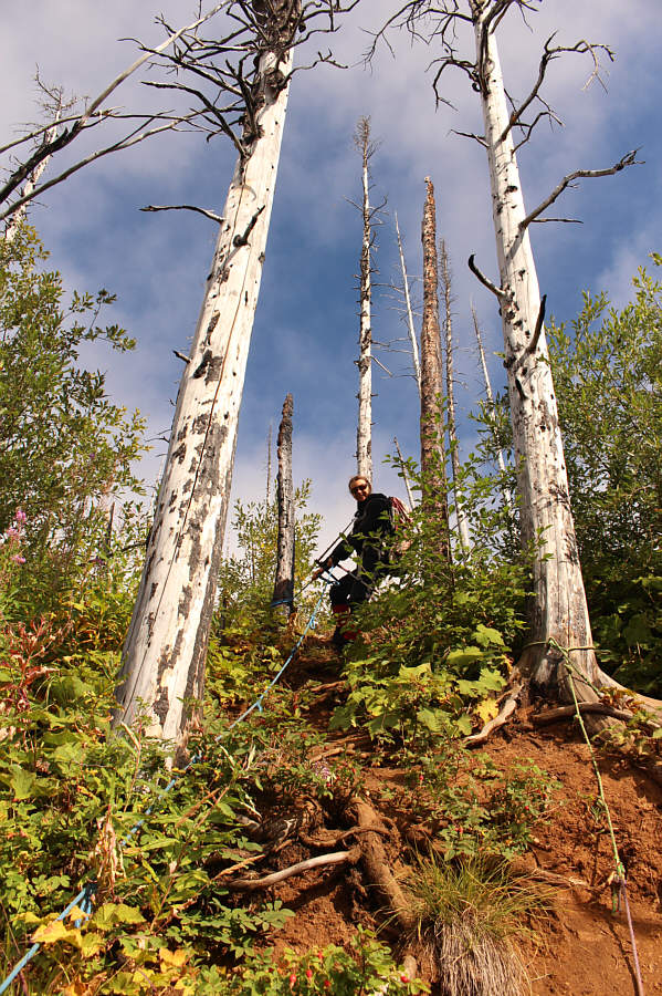
This steep and eroded section of trail has some fixed ropes to aid hikers.
Suitable for children and dogs...so far! 
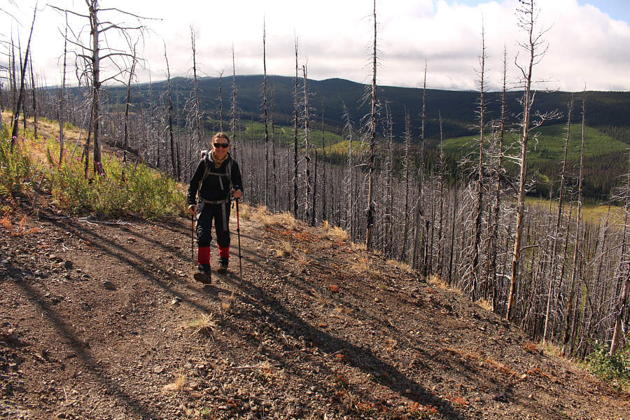
Zosia enjoys hiking the easy trail.
The dips are short but annoying! Zosia descends into one of several dips along the route.
Not a good place to play disc golf! 
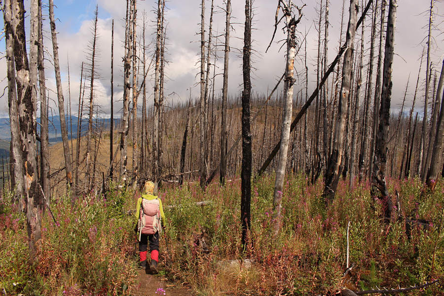
The underbrush seemingly swallows up Zosia in the midst of some burnt trees.
Pick your nose! Zosia approaches the top of China Nose Mountain which has three distinct "noses".
Wow, we weren't expecting the cliffs to be this impressive! 
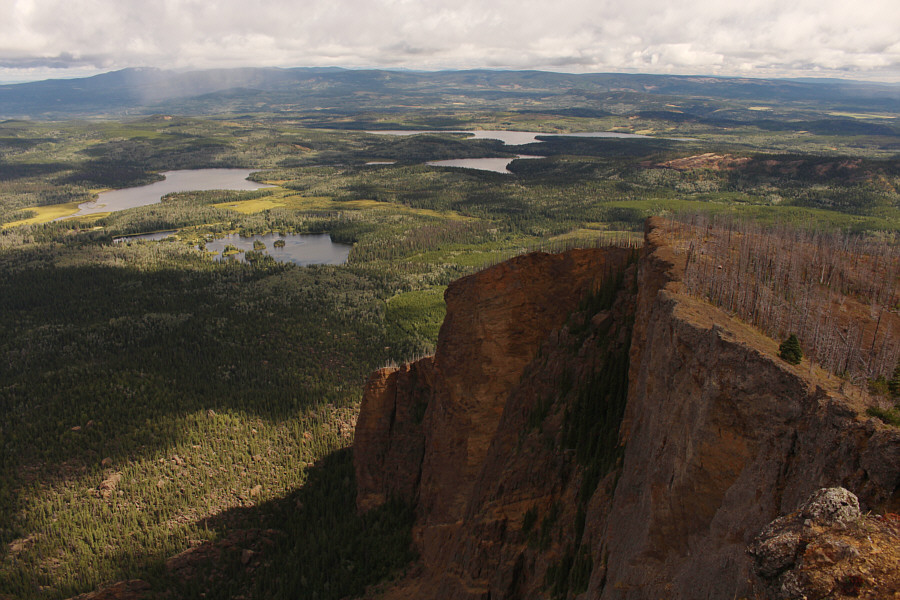
The north end of China Nose Mountain is guarded by impressive cliffs.  Swans Lake (left) and Elwin Lake (far centre) are visible to the northeast.
Don't look down! Zosia stands on the "highest nose" which also happens to be the summit.
Definitely the boring side of the mountain! 
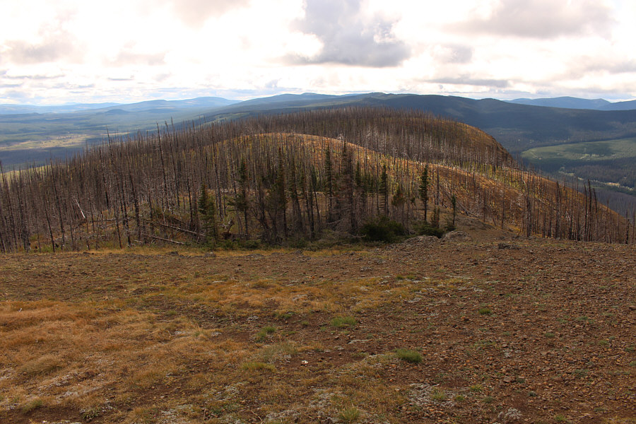
This is looking south from the summit at the approach route which climbs over several gentle rolls.
The top looks flat enough to be a "China Nose"! Here is another view of Zosia on the "highest nose".
Perhaps one day, the whole nose may collapse! Zosia stops short of going to the "lower nose" because of some intimidating fissures in the rock.
Looks like it's even overhanging! Zosia returns to stand atop the "middle nose".
Maybe high enough for base jumping? This is a more complete view of the cliffs below the "middle nose".
The "middle nose" is my favourite of the three! Here is one last look at Zosia on the "middle nose".
中国鼻子山 Zosia and Sonny return to the summit of China Nose Mountain (1442 metres).
Yum, yum! 
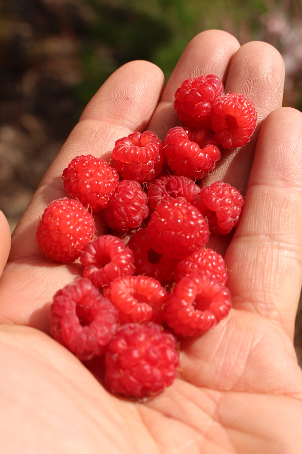
There are still lots of raspberries left on the slope above the trailhead.

Can you spot the three "noses"?

Here is a last look at China Nose Mountain from the access road.


A short and easy day with unexpected rewards. Total Distance:  6.8 kilometres
Round-Trip Time:  4 hours 21 minutes
Cumulative Elevation Gain:  474 metres

GPX Data