BOU AVENUE
Mount Clague
On 16 August 2021, Zosia Zgolak and I ascended Mount Clague located just west of Kitimat, British Columbia.  We got our inspiration for this trip from a cursory route description in the Northern BC edition of the Backroad Mapbooks, and with my phone's map application (maps.me), we were able to locate the trailhead.

From Kitimat, drive west along Haisla Boulevard and cross the bridge over Kitimat River.  About 350 metres past the bridge, veer right onto Station Street, and in another 200 metres, turn right onto Enterprise Avenue.  Drive past 8 Street (pavement ends) and continue on Enterprise Avenue as it curves left and becomes 9 Street.  About 280 metres past a railway crossing, turn right at a T-intersection with Saunders Haul Road.  Drive north for 1.2 kilometres and turn left onto a rough and narrow road (high-clearance recommended) which improves markedly after the first hundred metres or so.  Drive 1.9 kilometres and park next to a trail information kiosk at a 3-way junction (the road coming in from the right is an alternate but longer approach from Saunders Haul Road).

Going past the information kiosk, Zosia and I hiked the continuation of the road which rises steeply up a forested slope.  The initial part of the ascent follows an apparently popular snowmobile route, and as a result, the road is quite muddy and ugly in places.  A rerouted section of trail (follow signs) bypasses the churned-up road, but the trail itself is also quite muddy and wet in places.  Beyond a signed junction with a trail leading to a backcountry cabin, the trail to Mount Clague briefly rejoins the road before plunging into thick bush and going up a mucky drainage.  The trail is little more than a flagged route at this point, and I found climbing up the drainage to be generally unpleasant and annoyingly buggy.  Above the drainage, the route flattens out and crosses some boggy meadows before rising steeply again alongside a cascading creek.  For some reason, the flies and mosquitoes were especially bad here, and they continued to hound us for the remainder of the ascent.  Above the cascading creek, we crossed another short meadowy section before scrambling up a steep rubble slope to gain the broad southeast ridge of Mount Clague.  The remainder of the route to the summit is mostly easy off-trail hiking, but with no more flagging and virtually no cairns, a fair bit of route-finding is necessary to avoid unnecessary dips or steep technical terrain.  The entire area is dotted with charming little tarns, and camping here would be heavenly if not for the incessant bugs.  The summit of Mount Clague is quite broad and marked with a couple of cairns and a broken tripod.  Incidentally, there is another bump about 1.5 kilometres to the northwest which is part of the same massif and obviously higher, but all topographical maps identify the lower first bump with the cairns as the summit of Mount Clague.  Perhaps vanquished by a light breeze, the bugs that had been bothering us ever since the bushy drainage finally thinned out at the summit, and we were able to take an extended break there in relative peace.

For our descent, Zosia and I more or less retraced our steps down the mountain.  With the help of my GPS unit, we were able to find our way back to the steep rubble slope where we first gained the southeast ridge, and from there, we picked up the flagged route we had come up and pretty much followed it down to the rerouted trail and muddy road.  While I was bracing myself for a second round of swatting bugs, they were inexplicably not as prevalent this time, and consequently, our descent overall turned out to be much more pleasant.
Actually, she is always enthusiastic about hiking anywhere!

Sonny tightens up his pack at the trailhead in preparation for a long day of hiking.

Photo courtesy of Zosia Zgolak

Probably hasn't even been closed in years... This gate is supposed to keep motorized traffic out of the area during the summer months, but this is highly doubtful.
Don't worry...it gets worse! A convenient footbridge here allows hikers to bypass a torn up section of the road.
The trail is quite boggy and needs a lot of work. 
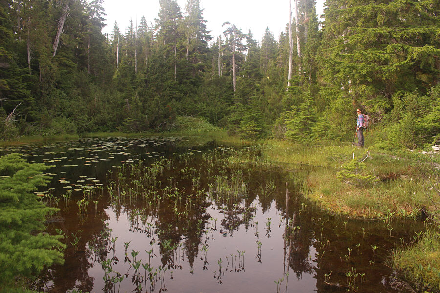
Zosia stops to admire a small lily pond along a section of trail rerouted for hikers.
In combination with pesky flies and mosquitoes, this was a most unpleasant section to ascend! 
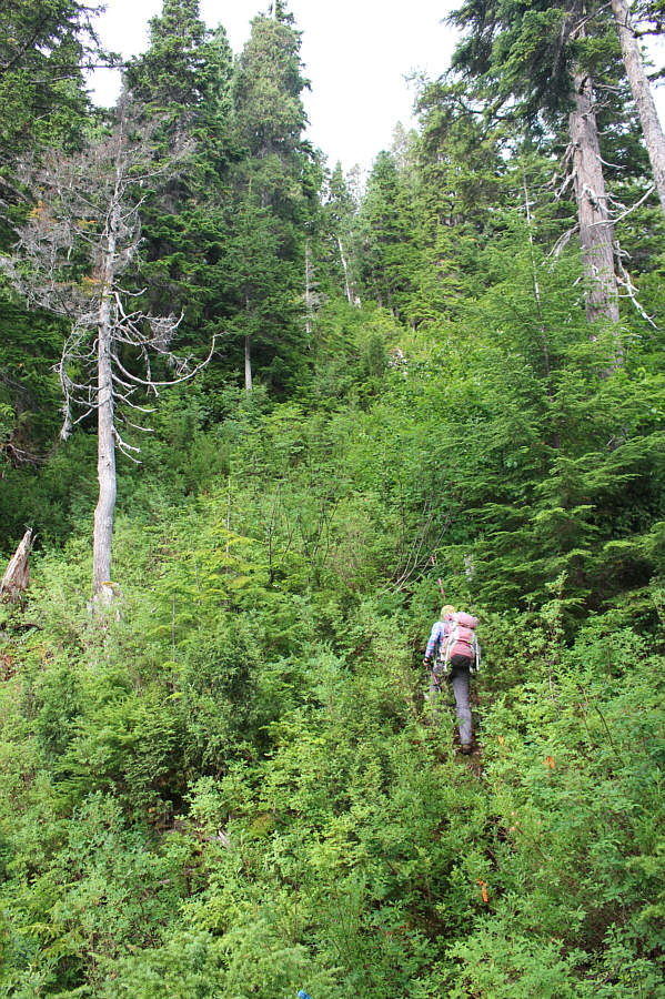
Zosia begins to climb steeply up a bushy drainage.
Bugs hounded us the whole way up the ridge! The terrain begins to open up but is more boggy than it appears.  Zosia would eventually head to far left to climb the ridge in the background.
Bugs were absolutely brutal here! 
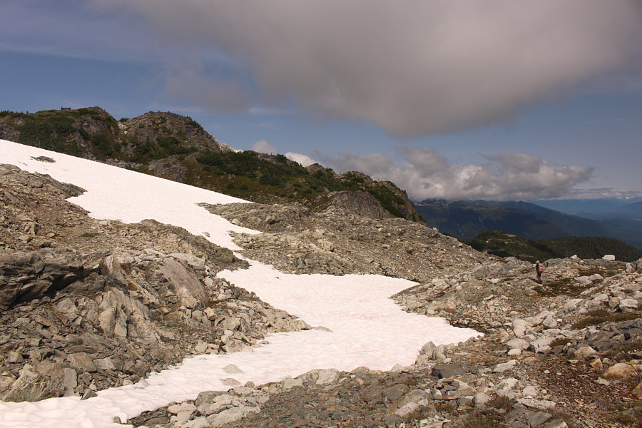
Zosia prepares to circumvent this lingering snow patch and ascend the drainage.
Frickin' bugs are still on us here! There is no more flagging beyond this area, but the route roughly goes up the rubble slope at centre.
Lotsa great spots for camping...if you're willing to drag a heavy backpack all the way up here! 
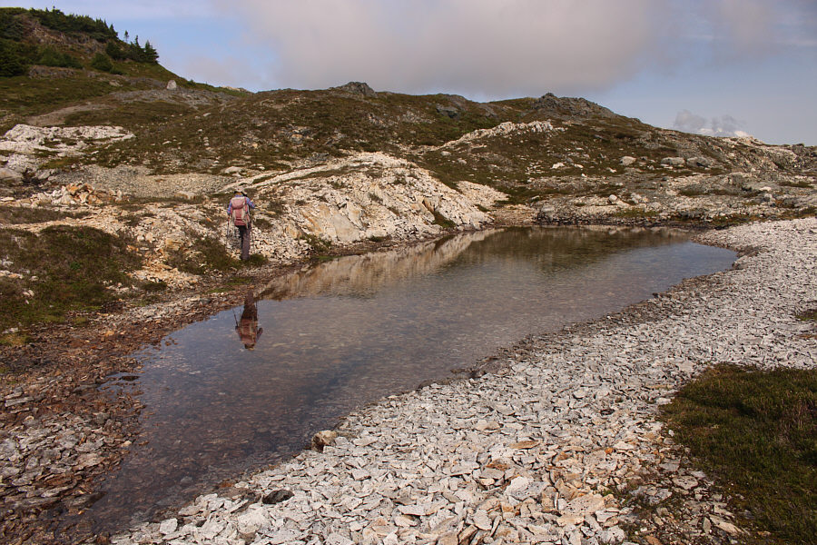
Zosia passes one of many shallow ponds in this area.
The lake is actually quite large, but we didn't have time or energy to check it out. 
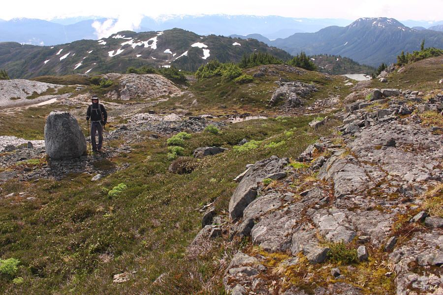
Zosia passes a rock which resembles a tombstone.  Note the lake at far right.
Nothing about this mountain comes easy it seems! The summit block is within sight, but some careful route-finding is still necessary to reach it.
No ice axe needed. 
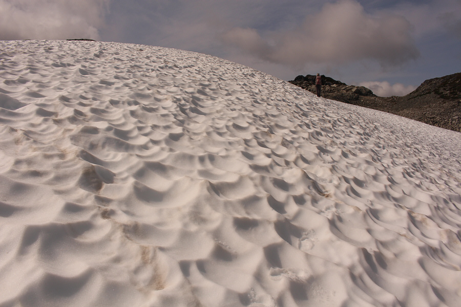
Zosia opts to ascend a sun-kissed snow slope.

Another example of a "summit" that is not the highest point of the mountain!

Sonny and Zosia stand on the gazetted summit of Mount Clague (1346 metres).  Note behind Sonny and Zosia a higher unnamed point which is part of the same massif as Mount Clague.


Not to be confused with the one in Waterton! In this view to the west, the only officially-named peak is Mount Carthew, the flat-topped peak to the left of the two pointy peaks.
Hiya, Chuck! The most prominent peak to the northwest is Mount Charlie (right).
Doesn't quite feel like the ocean... A small part of Kitimat Arm (ocean) can be seen to the south.
Lots of future exploration here...I hope! 
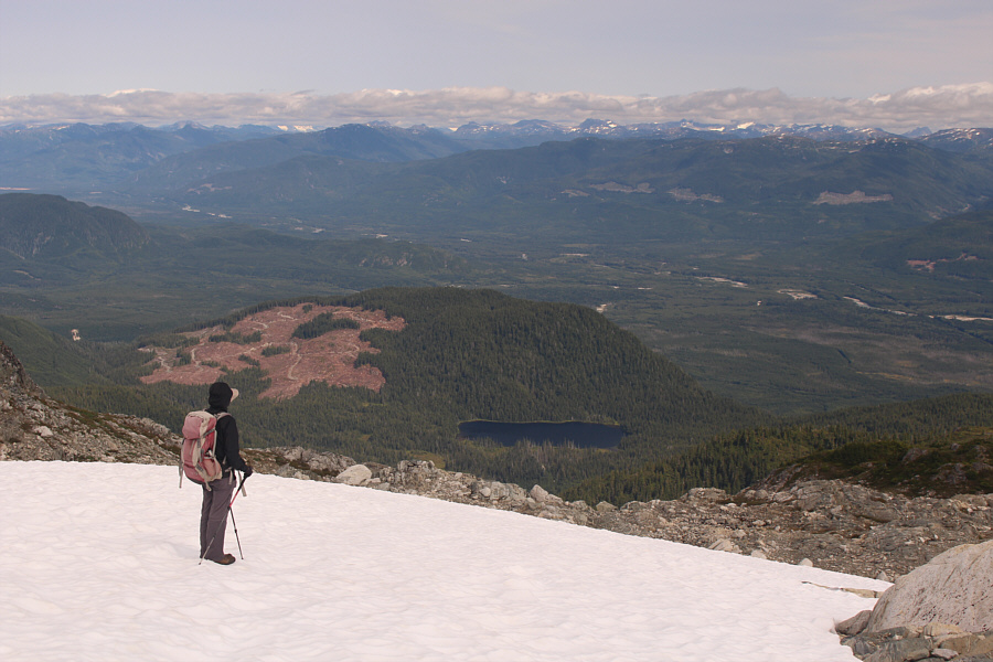
While descending a snow slope, Zosia pauses to check out the view of Bowbyes Lake and many intriguing mountains on the horizon.
I think the bugs have finally gone away! 
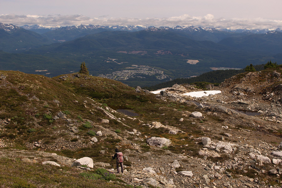
The town of Kitimat can be seen in the distance as Zosia descends Mount Clague.
They need to build a better access trail to the subalpine meadows for hikers! Total Distance:  16.5 kilometres
Round-Trip Time:  10 hours 3 minutes
Net Elevation Gain:  1240 metres

GPX Data