BOU AVENUE
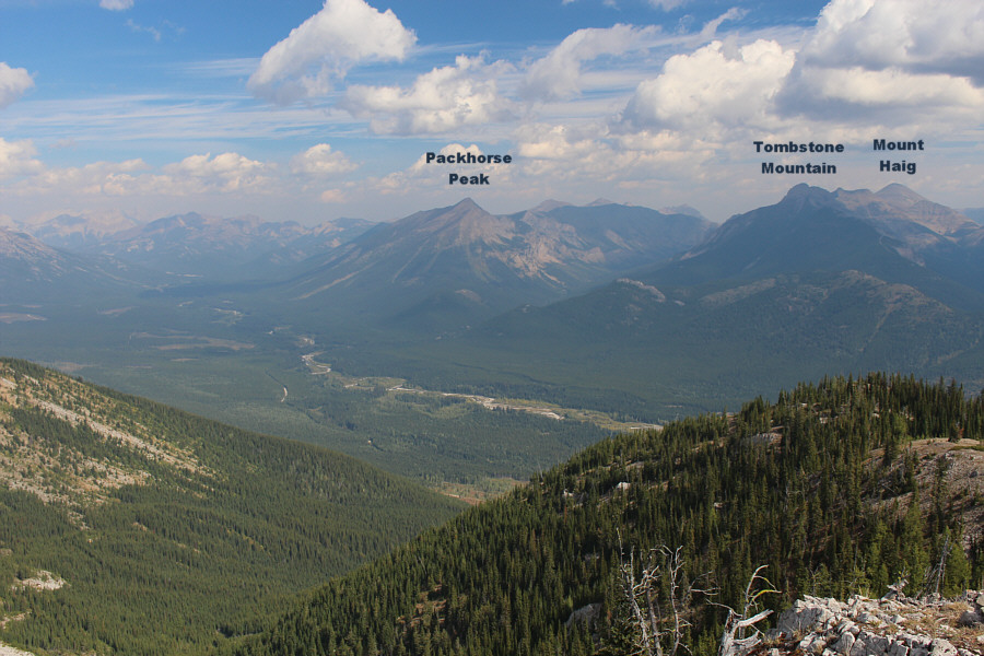
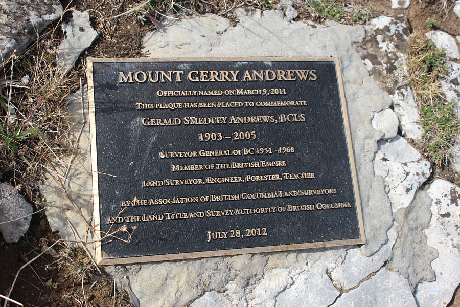
Mount Gerry Andrews (Trachyte
Ridge)
Wrapping up our Labour Day long weekend
camping trip, Andrea Battistel, Shaun Luong, Zosia Zgolak
and I climbed up Mount Gerry Andrews in the Flathead region of southeast
British Columbia (BC) on 6 September 2021. The mountain is actually
the high point of Trachyte Ridge and was named in honour of a former
surveyor general of BC. Route information for Mount Gerry Andrews
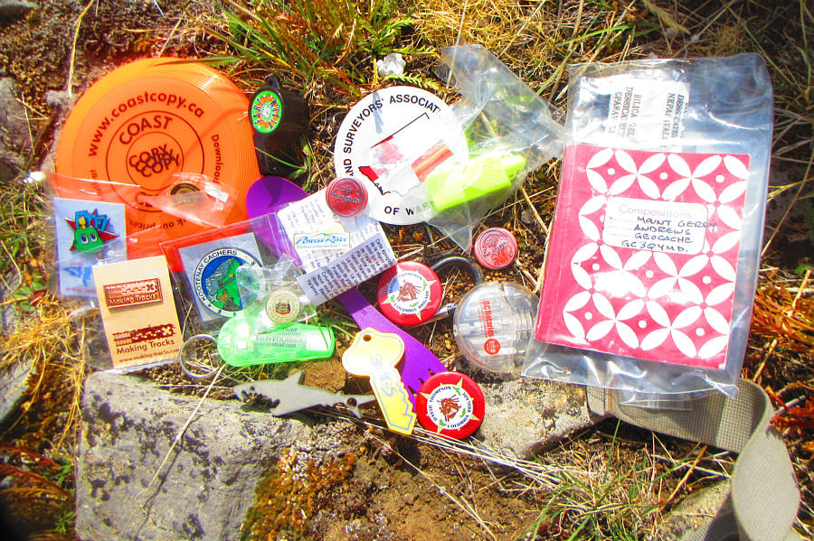
is scarce. I could only find a geocache
website which provides some hints through a few photographs but does
not provide any details about the route or even where to start. In
retrospect, I suspect that the geocachers ascended via the south ridge,
but relying on a partial route--the origin or which is unknown--in my
phone's map application, we would use a completely different approach via
the north ridge.
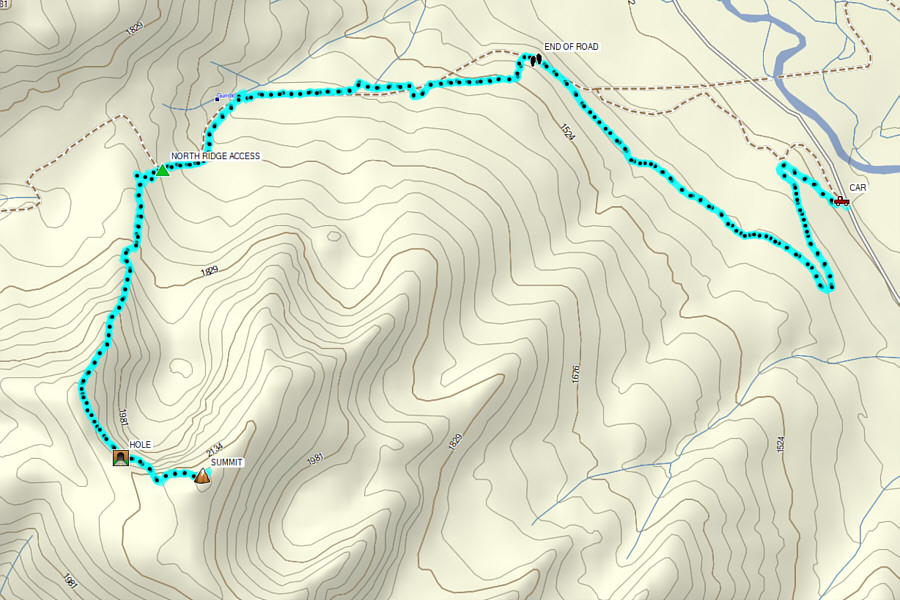
From Highway 3, turn east onto Morrissey Road about 8.8 kilometres
south of the turnoff to Fernie Ski Resort or 17 kilometres east and north
of the junction with Highway 93. Cross both the bridge over Elk
River and the train tracks before turning right at a T-intersection.
Stay on Morrissey Road and keep right at a split about 3 kilometres south
of the T-intersection (there is a cut-off road 560 metres further along
the left fork if you miss this split). From the split, drive 9.1
kilometres along Lodgepole Forest Service Road (FSR) to a junction with
Wigwam FSR. Stay left and drive 17 kilometres to a junction with
McLatchie FSR. Keep right and drive another 15 kilometres to a
junction with Flathead FSR (a big sign here reads "Sasquatch Junction").
Turn south (right) and drive 6.3 kilometres to the start of a deactivated
logging road. Park in a pullout just past the start of the logging
road. In dry conditions, this long drive is suitable for 2WD
vehicles.
Originally, I was hoping to be able to drive up the logging road and save
about 2.5 kilometres (one-way) of walking and 100 metres of elevation
gain. However, whoever deactivated the road did such a thorough job
that Andrea, Shaun, Zosia and I completely missed it on our original
drive-by. After a fruitless search for an obvious trailhead further
south along the FSR, we returned to where the start of the logging road
is marked in my phone's map application. Andrea offered to go for a
quick scouting trip, and she confirmed that the logging road did continue
beyond the deactivated section. We quickly geared up and started
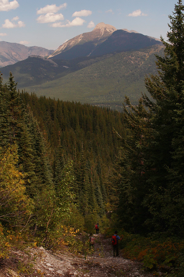
hiking. The logging road essentially makes two sweeping switchbacks
through a huge cut block on the northeast side of Mount Gerry Andrews
before ending at a spacious clearing. At the far end of the
clearing, we followed a rudimentary path through a bit of logging debris
before climbing upward to intersect what appeared to be an overgrown
exploration road along an old cut line. Except for two short
detours, this exploration road runs westward in a fairly straight line
for a kilometre climbing up Gumbo Creek drainage. While some
sections of the road are easy to hike, there are also several long
stretches that have been reclaimed by alders or are choked with deadfall.
After the first kilometre, the road makes a distinct S-curve and heads in
a more southwesterly direction while climbing quite steeply for another
half a kilometre. Where the exploration road begins to curve to the
northwest, there appears to be a less-traveled road branching to the left
(south). This branching road dead-ends fairly quickly, but from
there, we could see some open slabs through the trees above. We
scrambled up these slabs to gain the north ridge which we proceeded to
ascend. About three hundred metres south of the slabs, there is an
obvious cliff band guarding the ridge, but it can be easily circumvented
to climber's right. Other than the cliff band, the rest of the
north ridge poses few problems, and we eventually reached the summit a
little more than 3.5 hours after starting out.
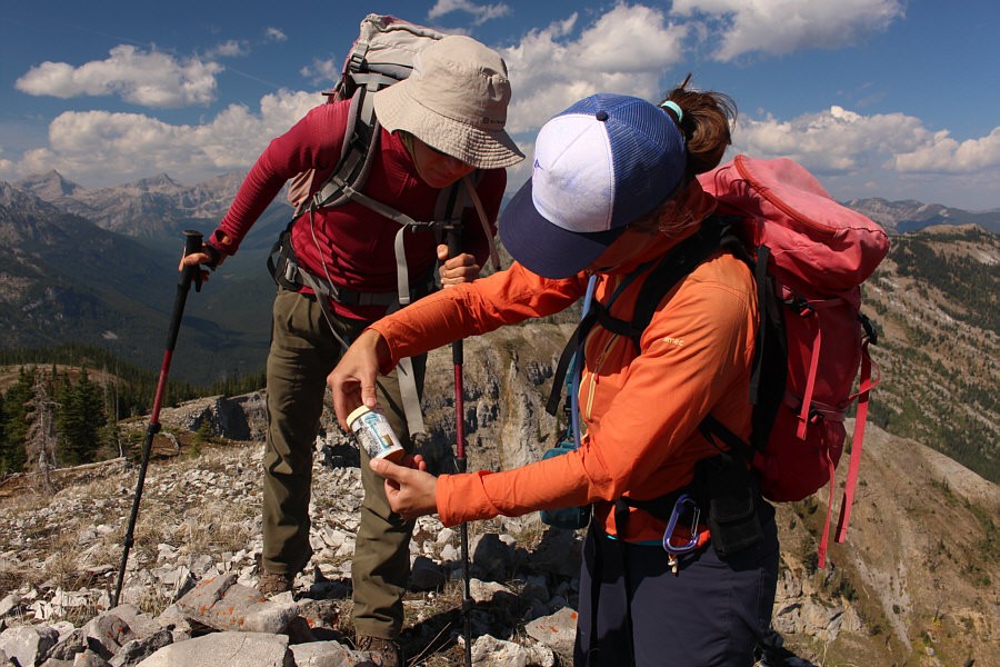
Andrea, Shaun, Zosia and I spent over an
hour on the summit of Mount Gerry Andrews before commencing our descent,
and we basically backed out the way we came. While descending the
north ridge, we had no issues retracing our route to get through the
obvious cliff band, but we slightly overshot the slabs lower down.
A quick course correction got us back on track, and we subsequently
regained the exploration road. We endured a second round of
alder/deadfall-bashing on our hike out the road, but overall, it really
was not bad at all. Once we made it back to the deactivated logging
road, we enjoyed an easy and trouble-free walk back to my car. The
entire descent took less than 2.5 hours.
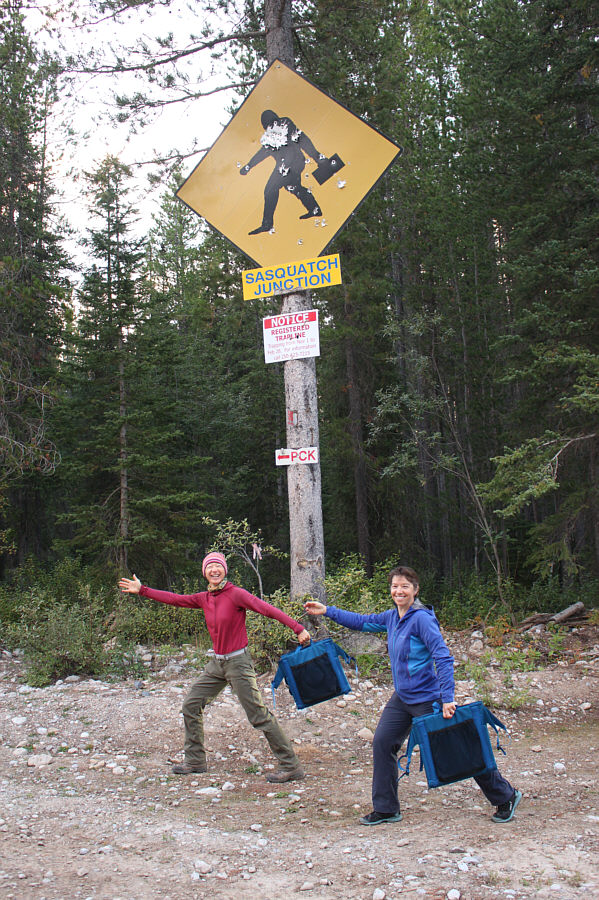 |
Zosia and Andrea mimic the sign at the junction of Lodgepole Forest
Service Road (FSR) and
Flathead FSR. |
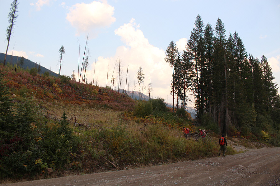 |
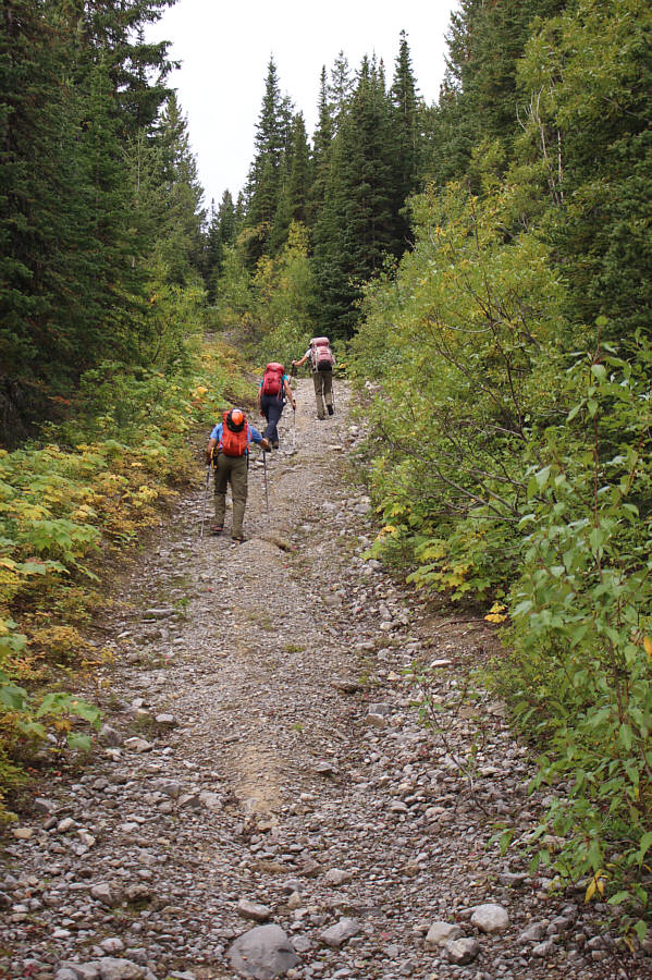
Andrea, Zosia and Shaun leave Flathead FSR to begin hiking up a deactivated logging road. |
The morning sun pokes out from behind the clouds.
 |
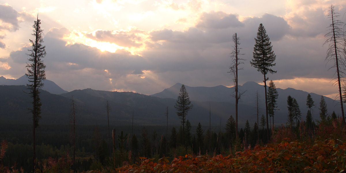
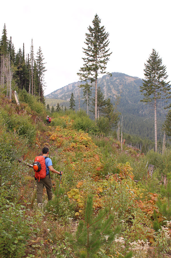
There are already far-reaching views
from the logging road. |
 |
Zosia and Shaun follow a rudimentary
path
at the end of the logging road. |
 |
This overgrown exploration road is key
to the approach for Mount Gerry Andrews. |
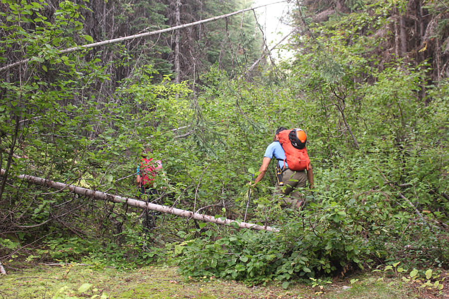 |
Several lengthy sections of the
exploration road have been reclaimed and present some navigational
challenges. |
 |
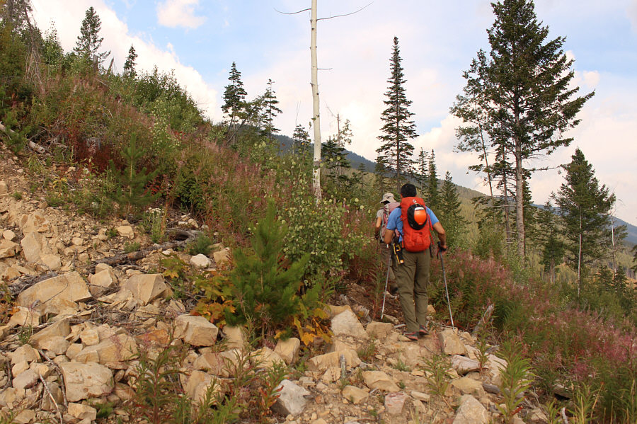
Shaun, Andrea and Zosia climb up a
steep section of road shortly before leaving it. |
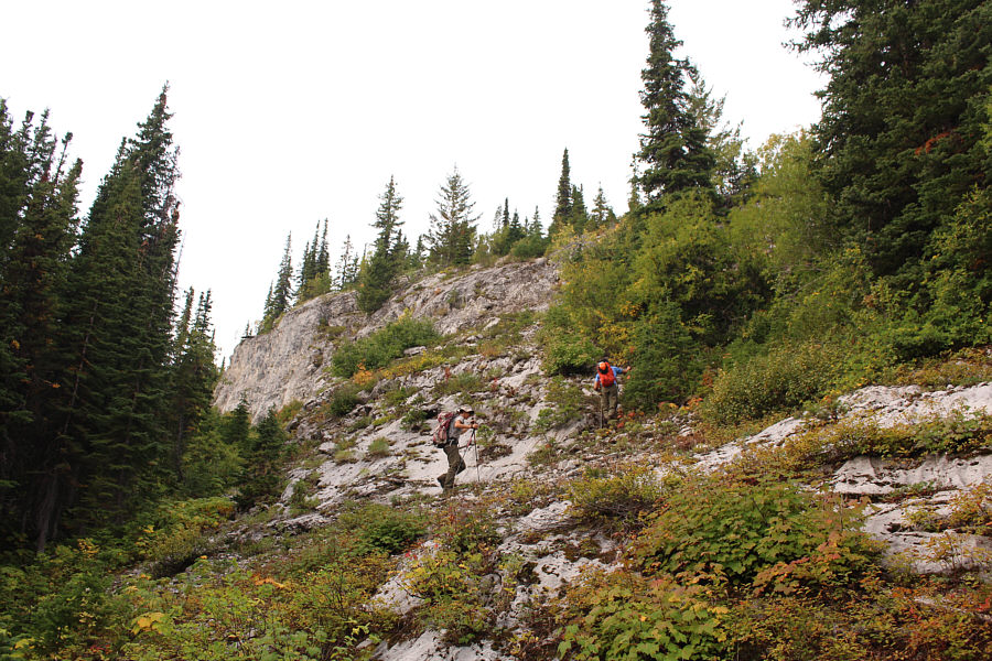 |
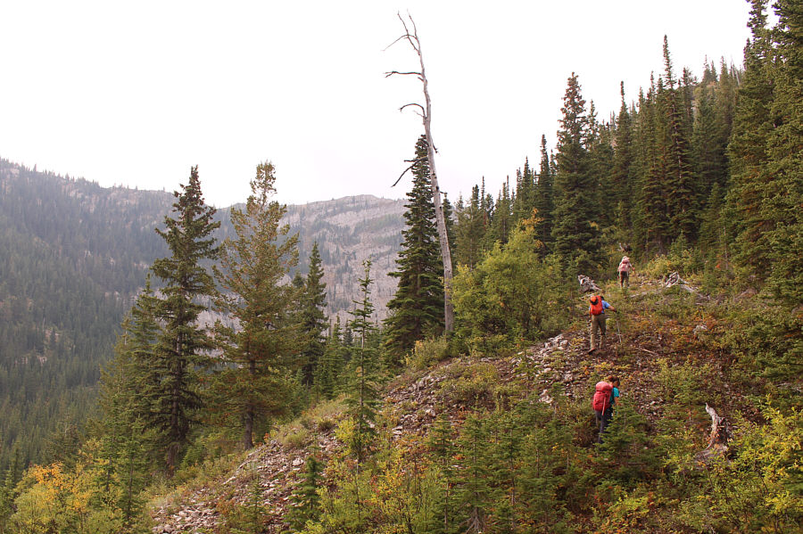
After leaving the exploration road,
Zosia and Shaun scramble up some low-angled slabs to gain the north
ridge of Mount Gerry Andrews. |
 |
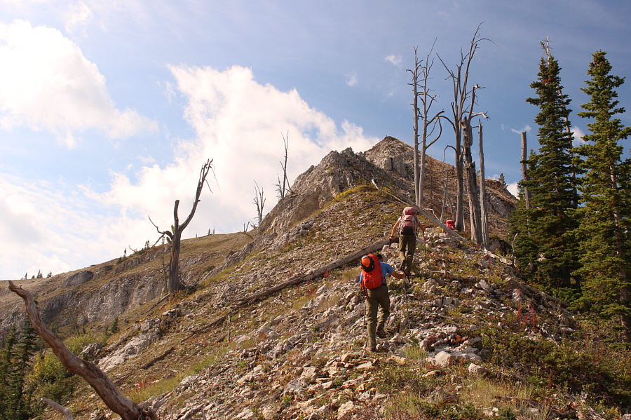
The summit of Mount Gerry Andrews is
visible in the distance as the group gains the north ridge. |
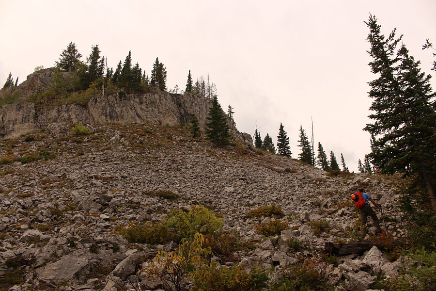 |
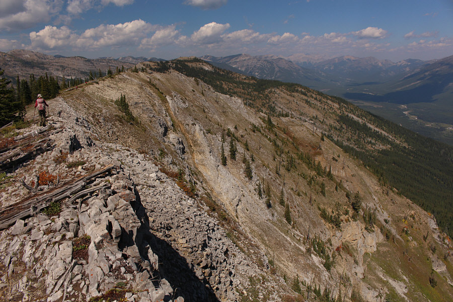
A cliff band along the ridge can be
circumvented to climber's right. |
 |
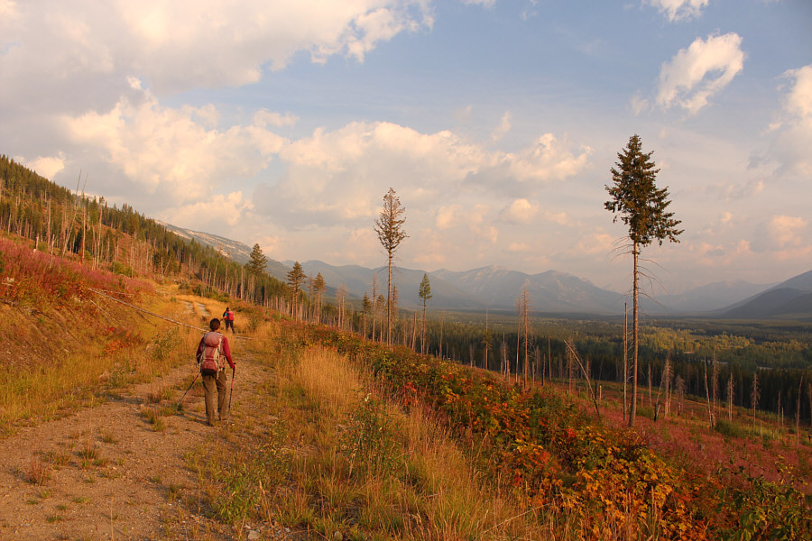
The ridge begins to open up for some
pleasant hiking. |
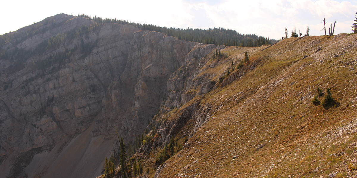
The remainder of the route is fairly straightforward.