 |
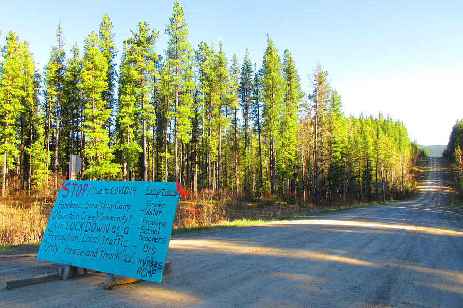
At the east end of Cardinal River Road is this makeshift sign
dissuading people from entering the area around
Smallboy Camp
due to pandemic concerns.
Photo courtesy of Zosia Zgolak |
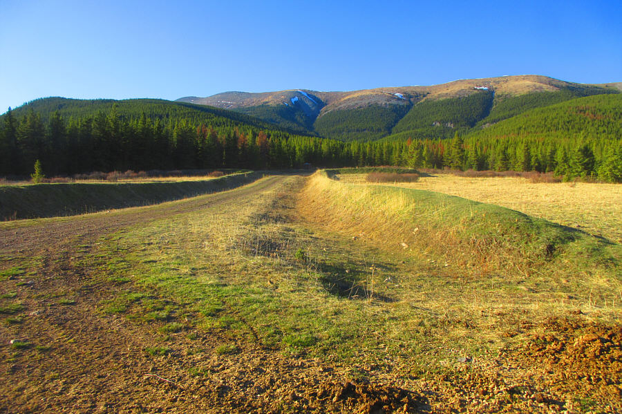 |
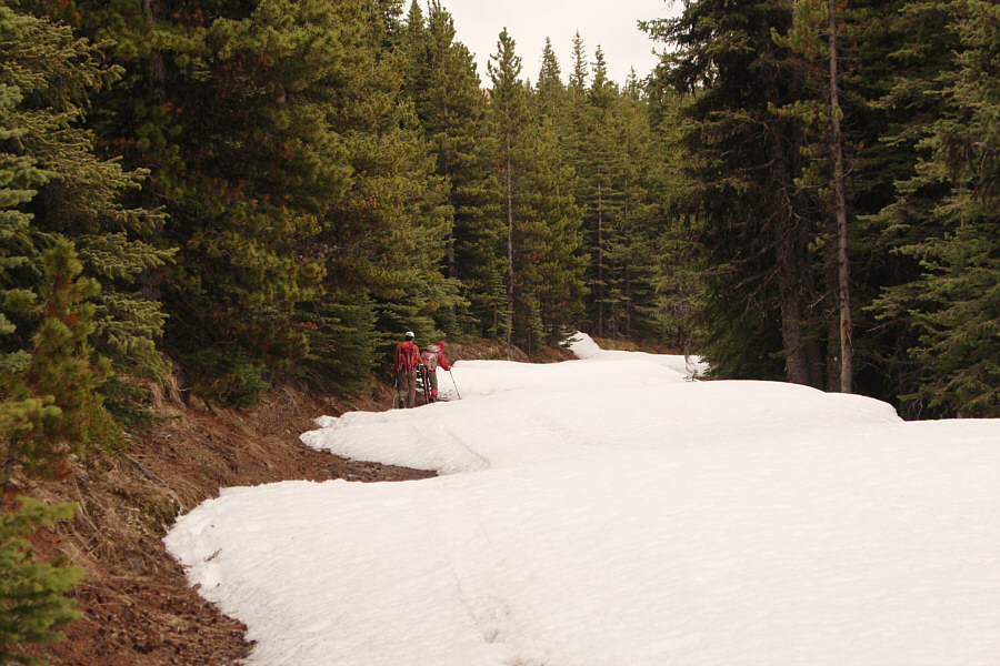
Part of the connecting ridge between Redcap Mountain and Grave Flats
Lookout is visible behind Mile 12 Interim Staging Area. This was
Matthew Clay's starting point for ascending Redcap Mountain.
Photo courtesy of Zosia Zgolak |
The next morning, Ali, Zosia and I drove partway up the Grave
Flats Lookout access road with intentions of setting up a car shuttle
before returning to the staging area to start our hike, but at the last
second, we decided to simply do the trip as an out-and-back hike.
Lingering snow on the road prevented us from driving all the way to the
locked gate near the lookout site, and we simply parked our cars on the
side of the road at the point where we could not drive any further and
started hiking from there. Knowing that the access road makes a
long switchback near the top, we chose to leave it early and ascend more
directly to the lookout site. This seemed like a good idea
initially until we ran into some snow patches which required some
unwelcome post-holing. Fortunately, we did not have far to go
before breaking out of the forest and strolling up easy slopes to the
lookout building which was unmanned on this day.
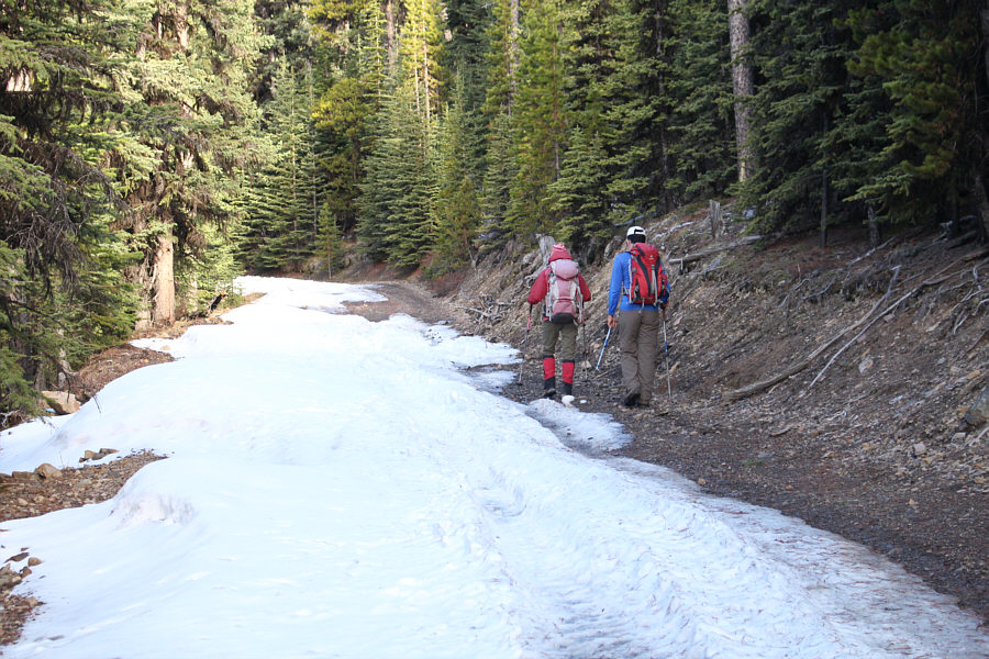 |
Zosia and Ali hike up the snow-choked
road leading to Grave Flats Lookout. |
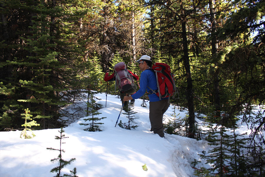 |
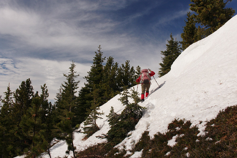
Leaving the road to take a more direct
route to the lookout site, Zosia and Ali encounter some lingering
patches of deep snow. |
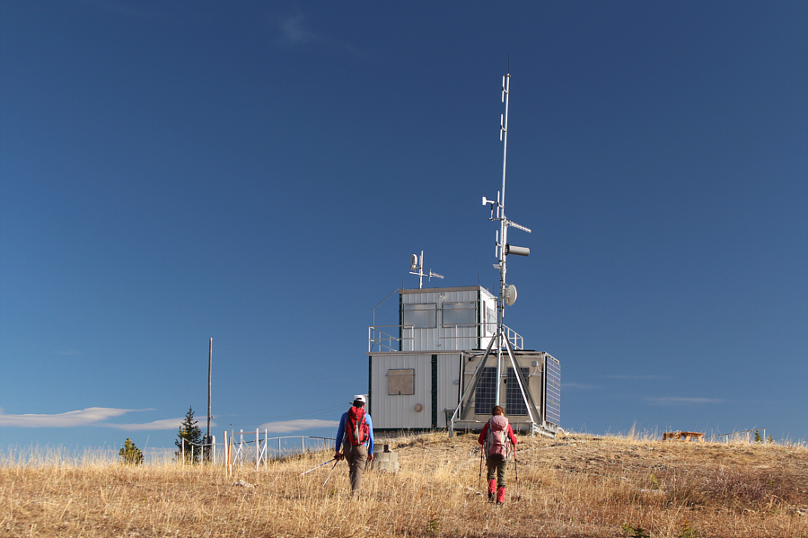 |
Ali and Zosia arrive at Grave Flats
Lookout (2074 metres) which is unmanned on this day. |
 |
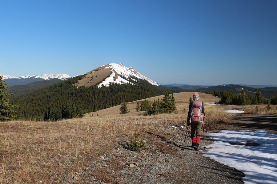
Sonny, Zosia and Ali appear pumped for
the long ridge walk to Redcap Mountain (far left). |
From Grave Flats Lookout, Ali, Zosia and I headed northwest to
drop into a forested dip before the connecting ridge to Redcap Mountain.
There was still a lot of snow in the dip, and although more post-holing
was unavoidable, there were enough dry patches of ground in the trees to
keep us from getting too bogged down. Once we cleared the dip and
gained the open crest of the connecting ridge, we settled into a long but
technically easy walk all the way to the summit of Redcap Mountain.
Most of the ridge crest was dry, and while the numerous elevation losses
and gains along the ridge were psychologically wearisome, they never felt
overly strenuous. Also, the weather on this day was perfect for
walking along the open ridge. We had relatively light winds, and
although clouds rolled in after we left the lookout site, we still had
enough sunny periods to warm and cheer us up.
At the summit of Redcap Mountain, Ali, Zosia and I took a break for about
an hour before faithfully retracing our steps over every bump along the
ridge. On the way back, we surprisingly ran into two separate
parties that were still heading for the summit. One couple had come
up via Clay's route from the staging area while another couple with two
dogs had traversed the ridge from the same starting point as us.
When we eventually returned to the forested dip, we re-crossed it without
too much grief and soon regained the lookout access road. We were
not home free just yet though. The upper parts of the road that we
had skipped at the start of the trip were mostly snowbound, and we still
had to tiptoe around some deep snow before reaching drier ground and
ultimately our parked cars. We subsequently drove back down to
Cardinal River Road and through Smallboy Camp to the Forestry Trunk Road
without any problems. Zosia and I parted ways with Ali here as he
headed back to Calgary while we stopped elsewhere to camp for the night.
 |
Zosia heads toward a forested dip
separating Grave Flats Lookout from the connecting ridge to Redcap
Mountain. |
 |
After some light bushwhacking and
post-holing across the forested dip, Zosia climbs over a final snow
patch before gaining the crest of the connecting ridge to Redcap
Mountain. |
 |
Ali and Zosia hike along the ridge
crest. The summit of Redcap Mountain is not visible here. |
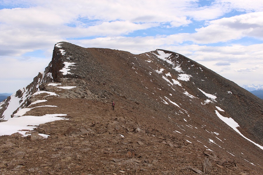
The ridge undulates a fair bit resulting in significant
elevation gains and losses.
 |
Despite a lot of snow still clinging to the ridge, travel along the crest
is generally easy on this day. |
 |
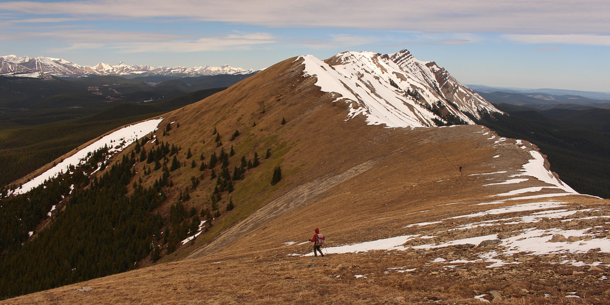
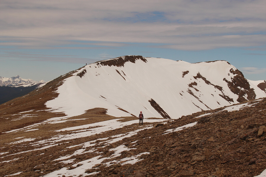
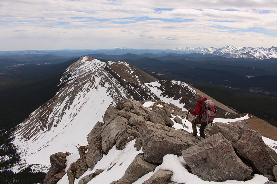
The summit of Redcap Mountain is clearly visible from this point along
the ridge. |
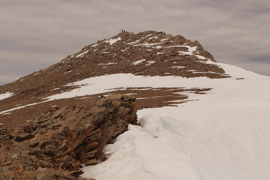
Here is a closer look at the final rise to the summit
of Redcap Mountain.
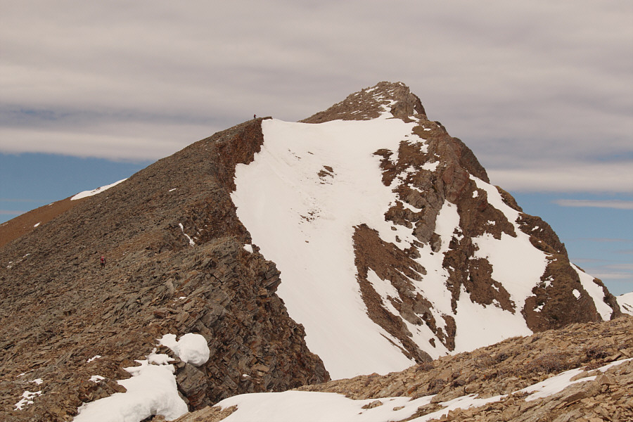 |
Zosia and Ali ascend the remainder of the ridge before the summit. |
 |
The rocks at the summit do not present any technical difficulties. |
 |
Ali, Zosia and Sonny reach the summit of Redcap Mountain (2391 metres). |
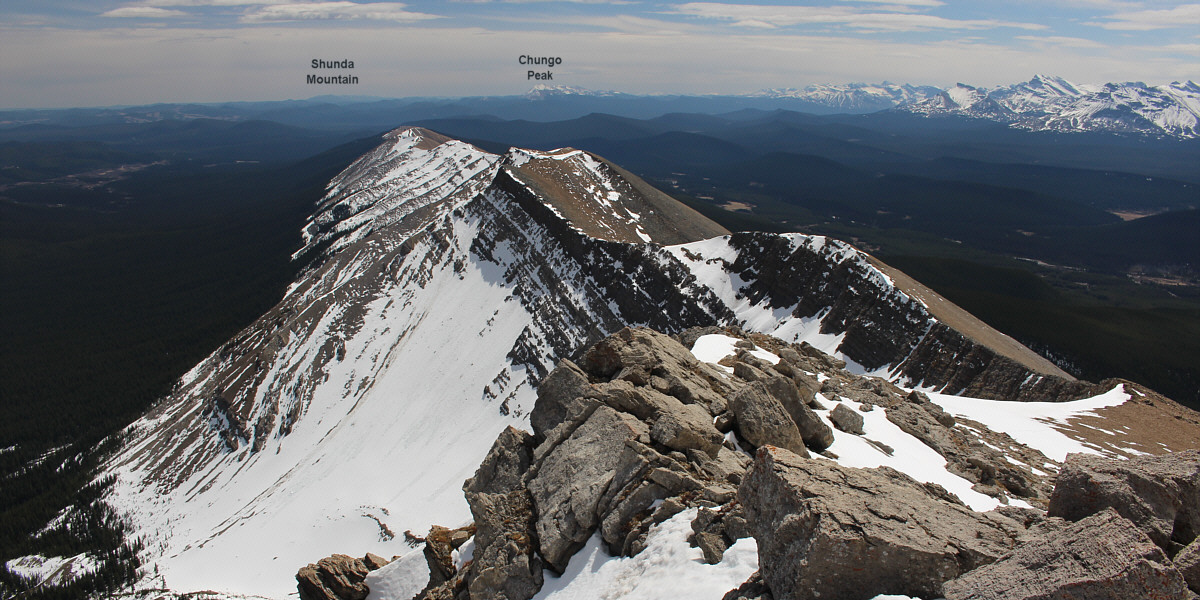
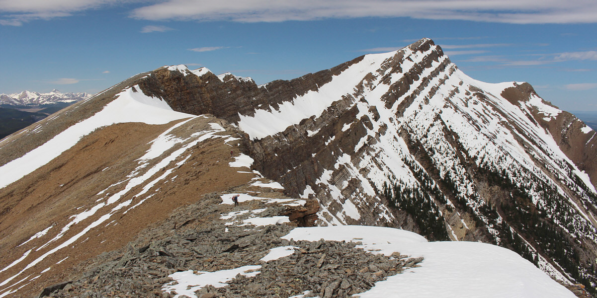
This is looking southeast from the summit at the ridge
used for the approach.
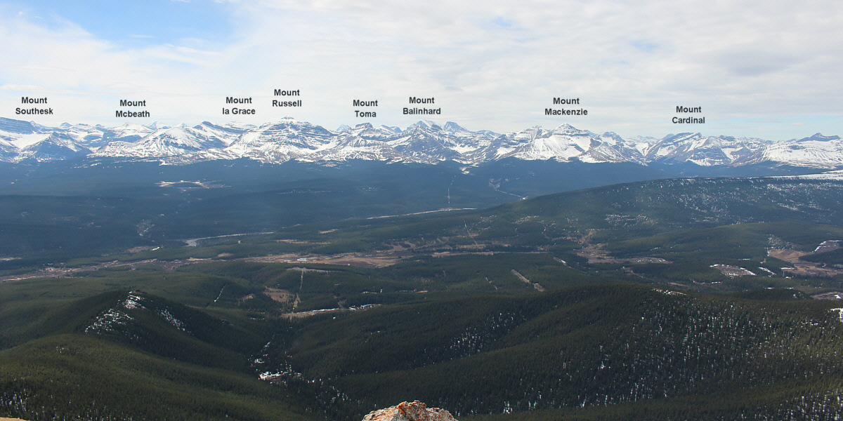
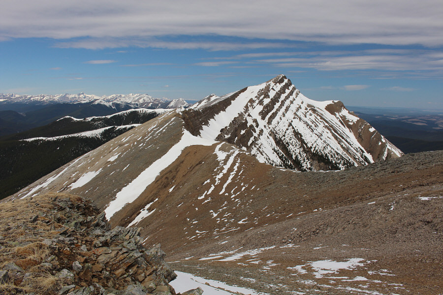
Here is the view to the southwest from the summit.
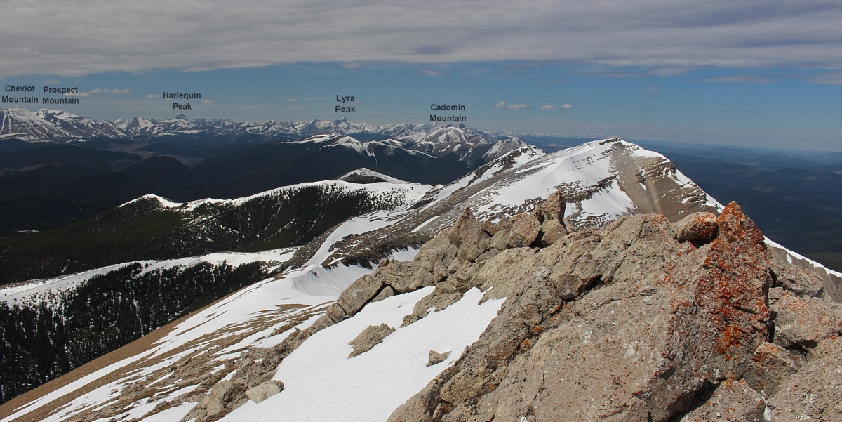
The unnamed ridge (right) to the northwest is possibly
just as high if not higher than Redcap Mountain.
 |
Zosia commences the long hike back along the ridge. |
 |
This is one of the bigger uphill sections to climb on the way back. |
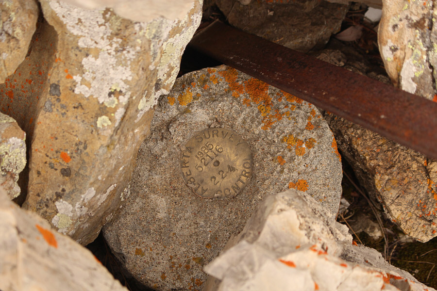 |
This survey marker (2210 metres) is located on the ridge about halfway
between Redcap Mountain and Grave Flats Lookout. |
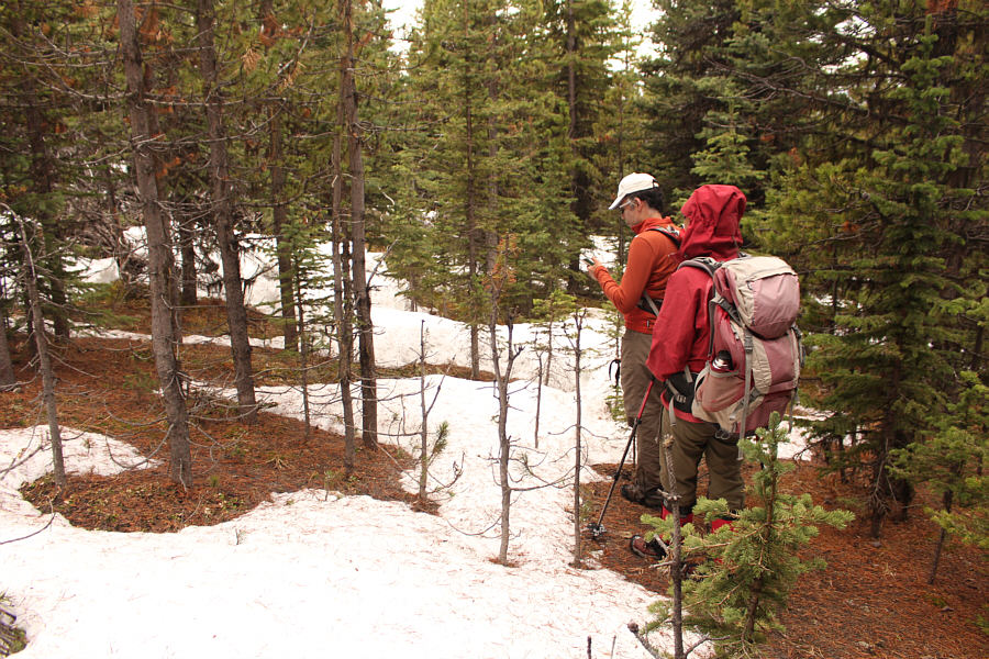 |
Zosia waits as Ali checks his phone for their position while backtracking
across the forested dip. |
 |
Ali and Zosia have to deal with more snow while descending the lookout
access road. |
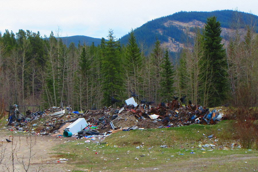 |
This garbage dump near the Smallboy
Camp attracts a lot of crows and even the odd bear (far left).
Photo courtesy of Zosia Zgolak |
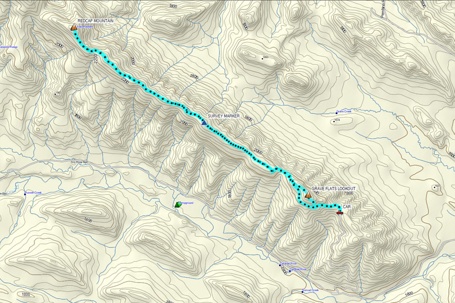 |
Total
Distance: 20.4 kilometres
Round-Trip Time: 10 hours 4 minutes
Cumulative
Elevation Gain: 1005 metres
GPX Data |
