BOU AVENUE
Gunsight Peak
Wrapping up our brief tour of the region near Terrace, British Columbia, Zosia Zgolak and I ascended Gunsight Peak located east of Lakelse Lake on 17 August 2021.  We got the idea for this scramble from the Northern BC edition of the Backroad Mapbooks, but ironically, we did not have to drive any gravel roads to reach the trailhead which is located on the east side of Highway 37 opposite from the entrance to Furlong Bay Campground (19 kilometres south of the intersection with Highway 16).  Of course, having such a convenient starting point also means that there is a whopping amount of elevation gain to bag a peak, and with this in mind, we geared ourselves up for a long day.

From the trailhead information kiosk, Zosia and I followed signs for Gunsight Lake, and after briefly walking south along a power line right-of-way, we turned east to follow a good trail on the north bank of Hatchery Creek.  Though easy enough to hike, the trail annoyingly undulates more than it should for the first three kilometres before reaching a bridge over the creek.  On the south bank, we began a long and steady climb gaining 760 metres over a straight-line distance of less than two kilometres.  Other than some short muddy sections near tree line, the trail was generally in good shape and a pleasure to ascend compared to the boggy, bushy and bug-infested route that we took going up Mount Clague the previous day.  Leveling out a bit after the steep stretch, the trail briefly drops into a shallow dip and climbs up the other side to enter a large basin containing Gunsight Lake.

While the trail to Gunsight Lake is well-documented, the remainder of the route to Gunsight Peak is a bit ambiguous.  Upon reaching the lake, Zosia and I left the trail and circled around the north shore which was not easy to do.  We first had to get over the lake's outlet stream; Zosia took her boots off here while I rock-hopped.  We had to then pick our way across a boggy meadow before thrashing through some dense vegetation to reach the bottom of a bushy ridge at the far end of the lake.  The ridge appears to be the most logical route to gain the upper mountain, but ascending it is far from being straightforward.  The thick stands of trees and bushes here are formidable barriers, and we did a fair bit of bushwhacking and weaving back and forth to progress up the ridge.  When we got high enough, we veered to climber's left where it was more open and ultimately abandoned the ridge altogether in favour of ascending the fringes of an obvious rubble slope.  Above the rubble slope is a vast open area of rolling meadows and rocky benches rising gently to the top of Gunsight Peak.  Much like Mount Clague's southeast ridge, the terrain here is not technically difficult, but good route-finding is necessary to avoid unnecessary elevation losses or precipitous cliff bands.  The summit is also further away than it looks, and it seemed like an inordinately long time before we finally set foot there.  It had taken us nearly a whopping seven hours to reach the summit, but the panoramic views on this day were well worth the effort.

After taking an hour-long break at the top, Zosia and I descended a slightly different but possibly more efficient route back to the rubble slope.  From there, we took advantage of some lingering snow patches to lose elevation quickly before traversing back to the bushy ridge we had come up.  Our route-finding was better while descending this ridge, and we managed to get down to Gunsight Lake with minimal bushwhacking.  Winding around the north side of the lake was also cleaner this time around, and we even found a convenient log jam to easily get across the outlet stream.  Once we regained the main trail, we were pretty much home free except for a few stops to pick ripe huckleberries.  The remaining descent to the bridge and the hike out along Hatchery Creek were uneventful.
She's got the power!

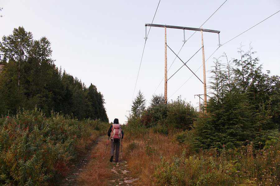
Zosia starts hiking along a power line right-of-way.

The undulations suck at the end of the day though! 
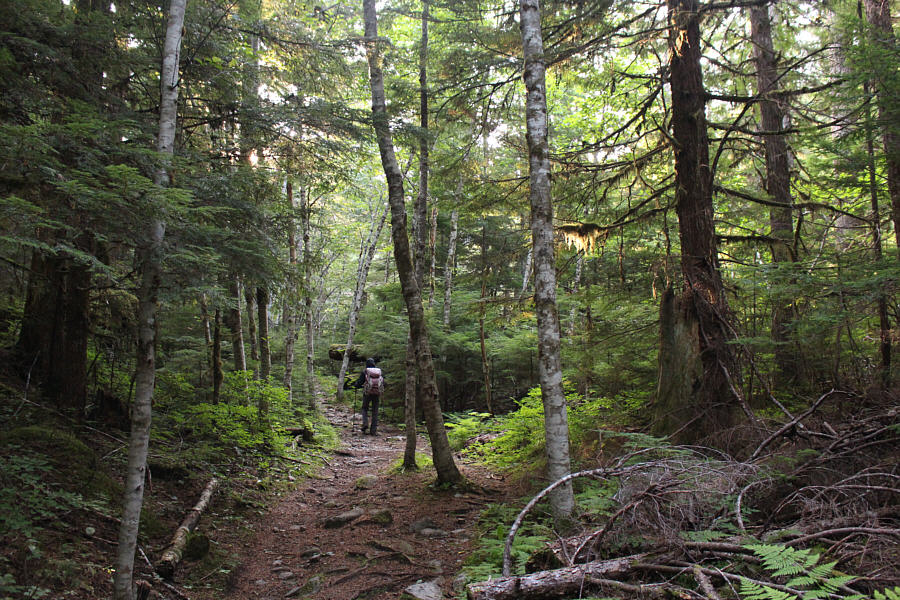
The trail undulates a fair bit and climbs gently for the first three kilometres.
If you like steep grinds, this mountain is for you! 
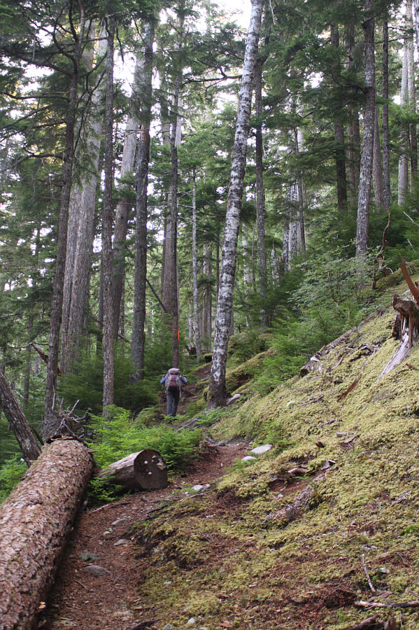
Beyond a bridge over Hatchery Creek, the trail gains 760 metres over a straight-line distance of less than two kilometres.
After all the climbing to get this far, we still have a lot of work ahead of us! 
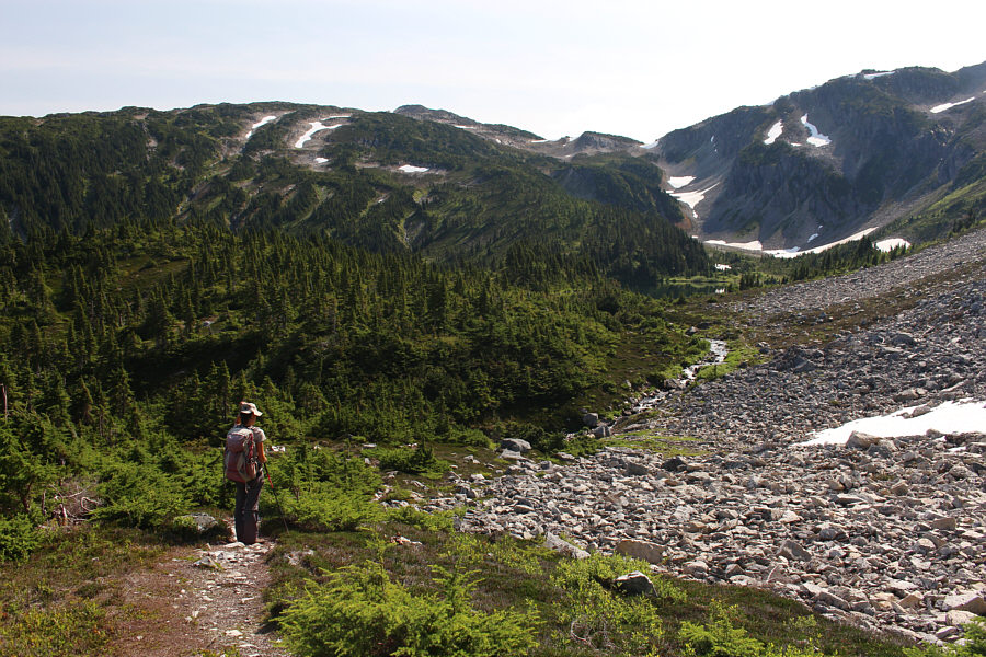
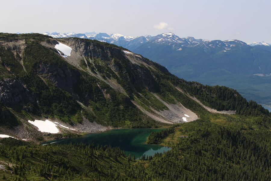
Zosia enters a basin containing Gunsight Lake (right).  The top of Gunsight Peak is also visible left of centre.

So tempting to just call it a day and hang out here!

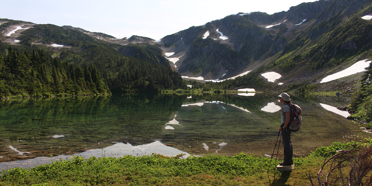
Zosia arrives at Gunsight Lake.


It's not bad, but it's still tiresome. 
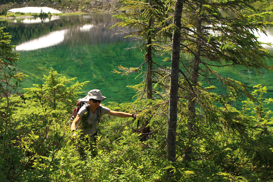
Getting around the north side of the lake entails some bushwhacking.
Route-finding here can be difficult and frustrating. Zosia makes her way up a bushy ridge beyond the lake.
There is not much in the way of beaten paths on this mountain! 
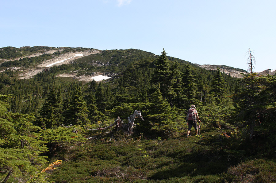
Zosia finally breaks out of the bushes and heads for the rubble slope at far left.
Now we're finally getting somewhere! 
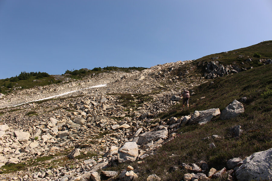
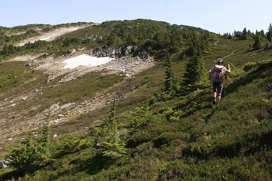
Zosia makes good progress climbing along the edge of the rubble slope.
Beautiful lake. 
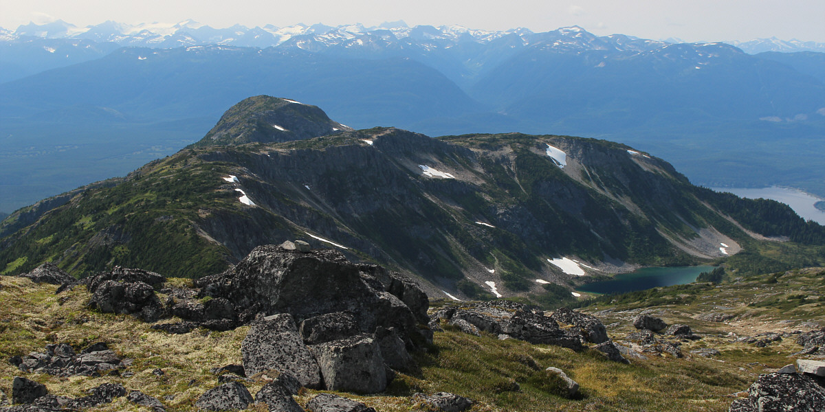
Here is a look back at Gunsight Lake from the slopes leading to Gunsight Peak.
And the summit is farther away than it looks too! 
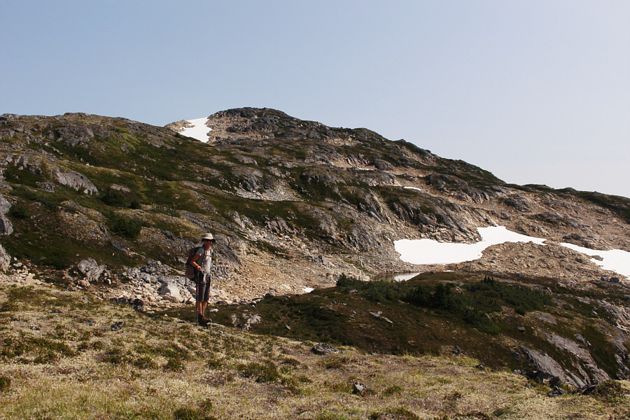
The remainder of the ascent is technically easy, but the route-finding is far from trivial.

The biggest ascent of our entire road trip!

Sonny and Zosia stand on the summit of Gunsight Peak (1613 metres).


Still a long way from the real ocean... 
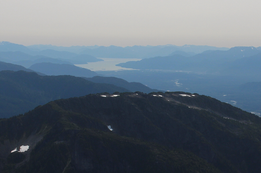
Some tanker ships can be seen in Kitimat Arm (ocean) far to the south.

Maybe someday I'll come back and climb this one...

Gunsight Lake is cradled under the north slopes of Mount de Boer.


Mount Attree looks similar in character to Mount Thornhill and may be worth climbing. 
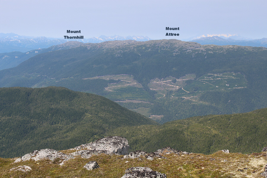
To the north, extensive logging is apparent on the south slopes of Mount Attree.

It would nevertheless be interesting to climb them!

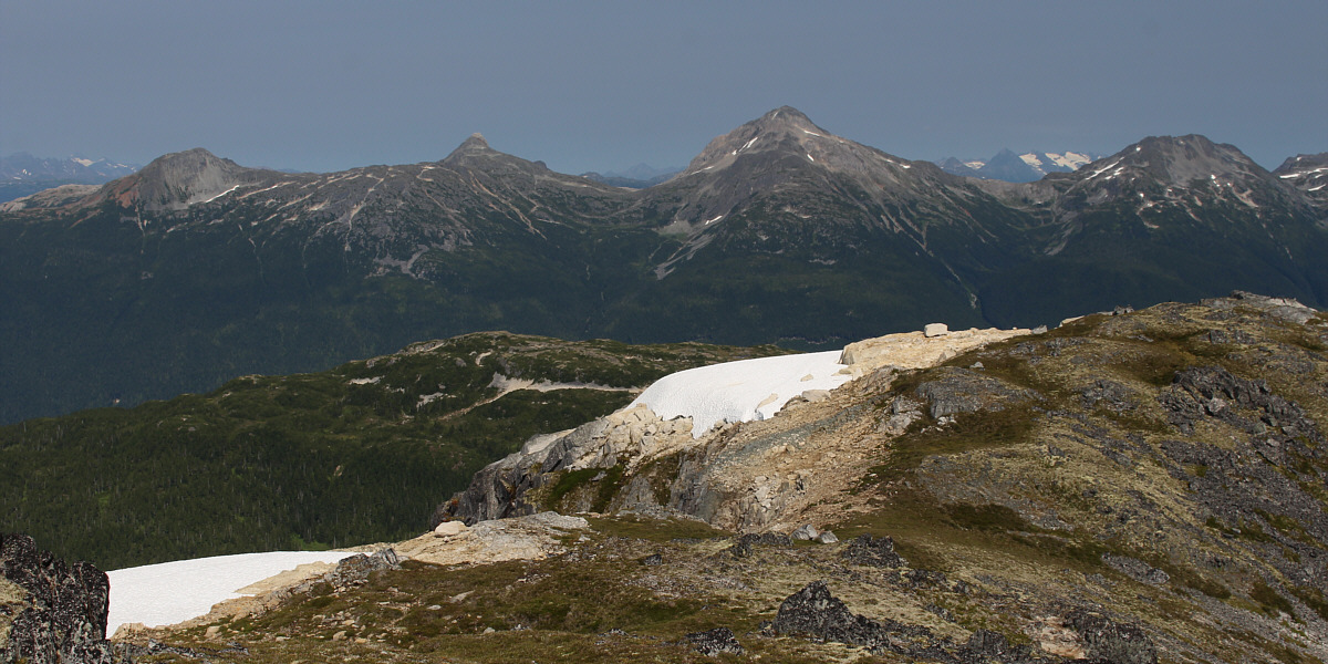
Surprisingly, these four striking peaks to the northeast are all officially unnamed.


The peaks on the horizon are all very intriguing!

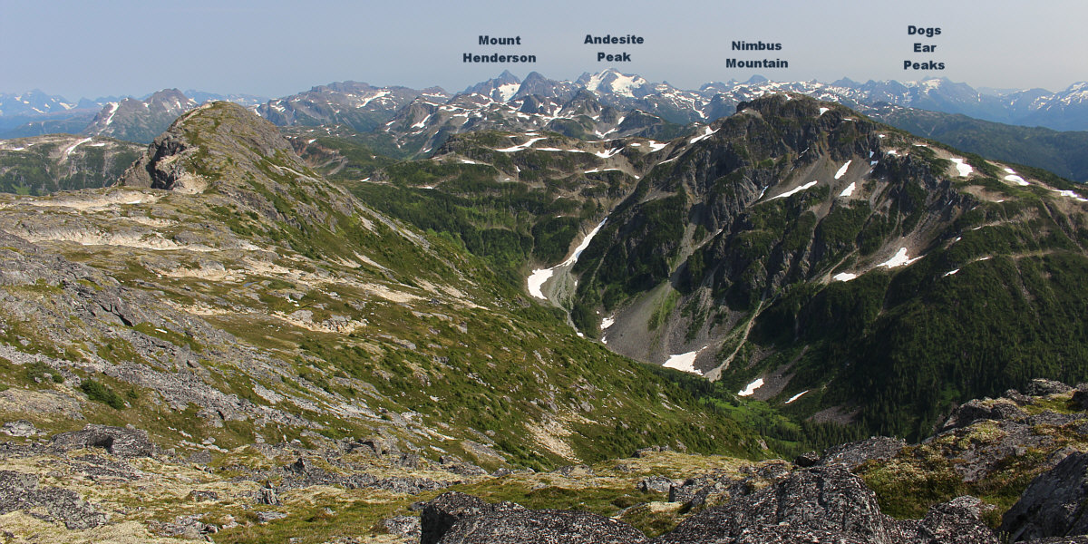
While the connected bump at left is unnamed, the peak immediately to the east in the foreground (right) has an unofficial name--Neon Peak.


We didn't have time for Elizabeth on this trip, but we'll be back...I hope! 
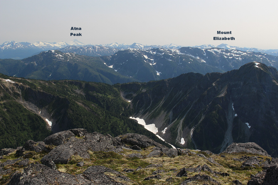
A couple of notable mountains stand out to the southeast.
Summer skiing? 
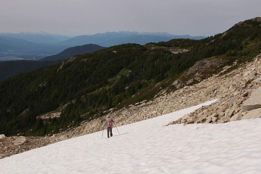
Zosia takes advantage of a snow patch to descend the rubble slope.  Note the half-hidden tarn at right.
Last obstacle of the day! Zosia carefully crosses the outlet stream for Gunsight Lake on a log jam.
Extra fuel for the long hike out! 
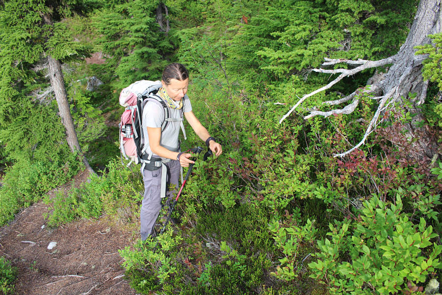
Zosia stops to pick ripe huckleberries.
And they were...trust me! 
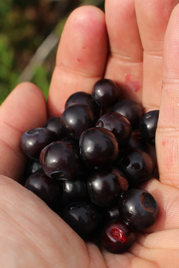
The huckleberries look delicious.
One more hour to the trailhead from here! 
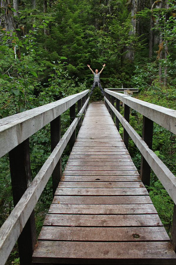
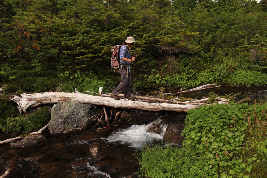
Zosia rejoices on the bridge over Hatchery Creek.
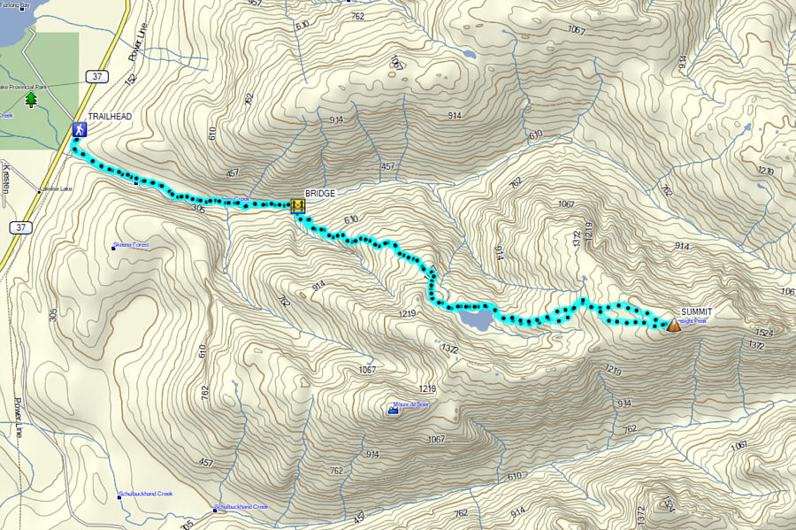
A long and challenging trip that is also very satisfying to complete. Total Distance:  21.4 kilometres
Round-Trip Time:  11 hours 50 minutes
Net Elevation Gain:  1503 metres

GPX Data