BOU AVENUE
Mount Hays And Terrace Mountain
After spending ten wonderful days exploring
British Columbia's Haida Gwaii, Zosia Zgolak and I returned to the
mainland via a nighttime ferry and arrived in Prince Rupert early on the
morning of 14 August 2021. We immediately stopped to get gas and
breakfast before setting our sights on ascending Mount Hays which
overlooks the city. While most hikers who climb Mount Hays probably
use the Kiwanis Trail which starts near the Oldfield Creek Fish Hatchery,
it is also possible to drive all the way to the top via a service road
which starts at the same place. Naturally, I wanted to drive up the
road especially since the weather was kind of miserable (overcast and
drizzly). Of course, this was easier said than done as the road is
both long and quite rough. Ultimately, a very large mud hole
prompted me to turn off onto a spur road and park at a makeshift
campsite. While I probably could have kept going through the mud
hole, we were both weary of the bumpy drive and itching to get out and
walk.
From the campsite, Zosia and I started
hiking along an ATV track but soon ran into a lot of boggy terrain which
forced us back onto the service road. As a result, the walk up to
the top was easy but uninspiring. There are numerous
telecommunications installations at the top, and we were a bit surprised
to see quite a few service technicians already working there on a
Saturday morning. The actual summit of Mount Hays is near a
building at the very end of the service road and is marked by a concrete
monolith. With really no reason to hang around, we simply tagged
the summit and walked back down the service road. We originally
also had plans to traverse to Mount Oldfield further east, but after
walking briefly down the overgrown connector trail, we decided that it
was not worth getting completely soaked by the underbrush for the sake of
tagging a lowly peak with presumably zero views. Instead, we
retreated to our car and drove back down to Prince Rupert where we went
grocery shopping before hitting the highway.
 |
Sonny tries to get some sleep on the ferry during the nighttime crossing
from Haida Gwaii to Prince Rupert.
Photo courtesy of Zosia Zgolak |
 |
After a long and bumpy drive, Sonny
gets ready to hike the remainder of the access road to the top of
Mount Hays. Photo courtesy of Zosia Zgolak |
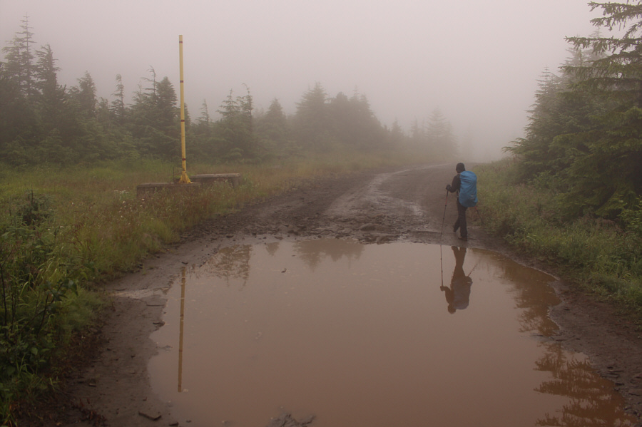 |
Zosia avoids one of several big mud holes along the road. |
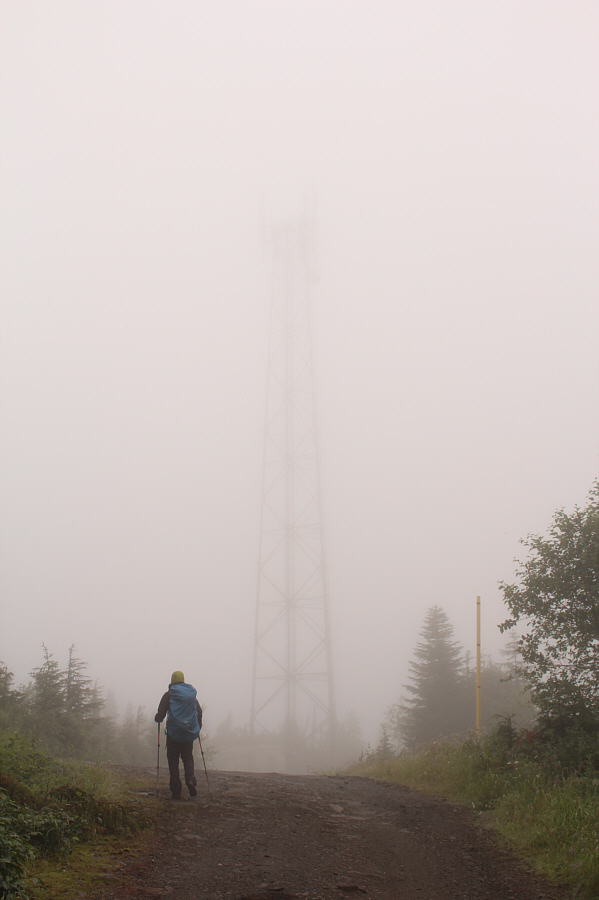 |
An antenna appears in the mist. |
 |
If nothing else, there are plenty of ripe huckleberries to be found at
the top of Mount Hays. |
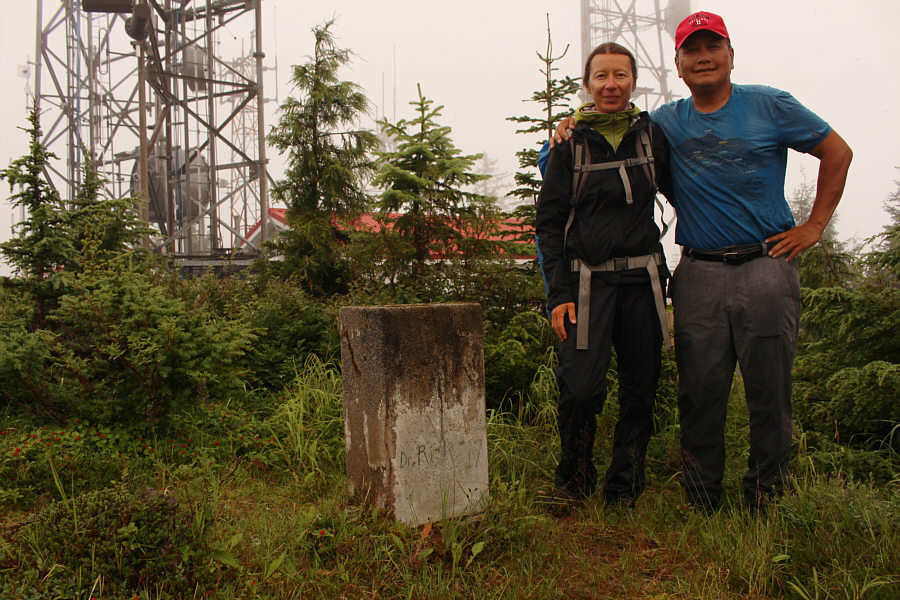 |
Zosia and Sonny stand beside a monolith marking the summit of Mount Hays
(704 metres). |
 |
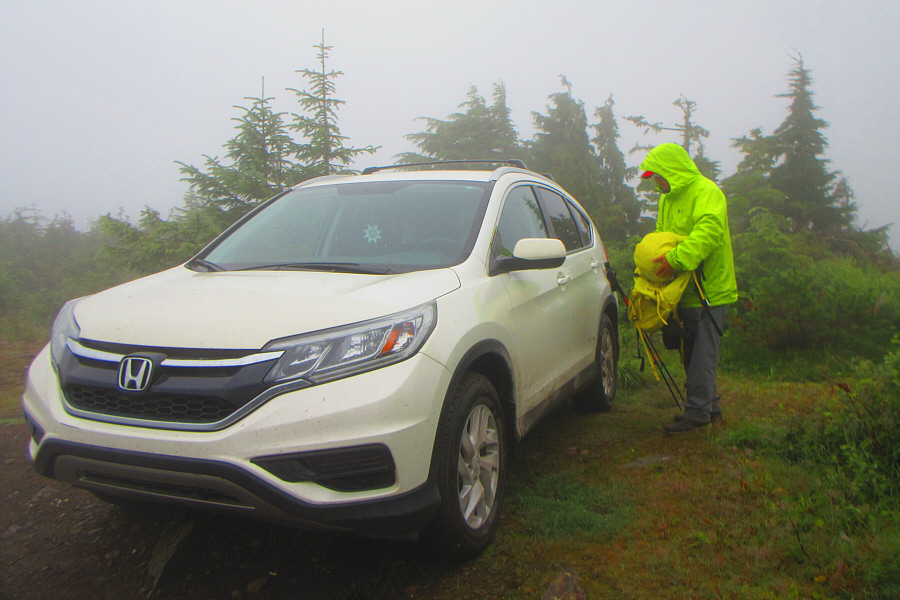
Sonny checks the depth of the mud hole that stopped him from driving
further along the access road. Photo courtesy of Zosia Zgolak |
The weather improved when Zosia and I arrived in Terrace later
in the afternoon. Consequently, we went for an easy walk up the town's
namesake mountain. Starting from a signed trailhead at the juncture of Johnstone Street and Walsh Avenue, we followed a popular two-kilometre
long hiking trail which climbs up to a viewpoint overlooking the town. The trail is well-maintained and quite easy to hike, but it also
annoyingly undulates far more than it should. The true summit of Terrace
Mountain is actually located about 700 metres northeast of the viewpoint
and likely seldom visited. We followed a mountain biking route
called "Griff's
Line" most of the way there before going off-trail for a short distance
to tag the completely forested summit. The only indicator there is a
strip of blue flagging tied around a tree. For our return, we simply
backed out the way we came (round-trip time of 2 hours 35 minutes with 296 metres
net elevation gain).
 |
There is a wealth of information at the trailhead kiosk for Terrace
Mountain.
Photo courtesy of Zosia Zgolak |
 |
With so many signs everywhere, it is hard to get lost on Terrace
Mountain. |
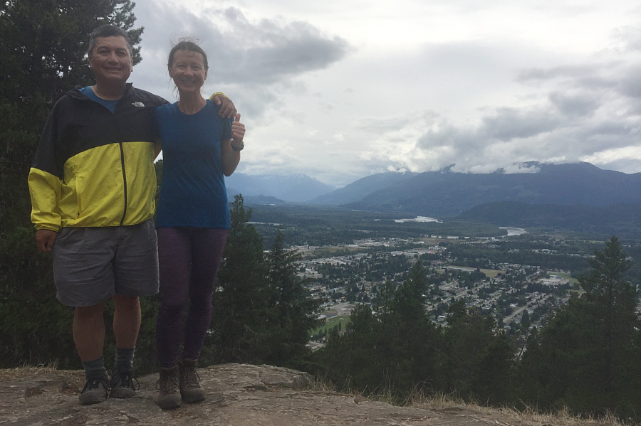 |
Sonny and Zosia arrive at a popular viewpoint overlooking the town of
Terrace. |
 |
Blue flagging tape on a tree is the only indicator at the true summit of
Terrace Mountain (430 metres). |
 |
Off-trail hiking on Terrace Mountain is not too bushy. |