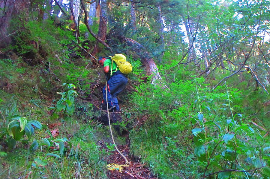
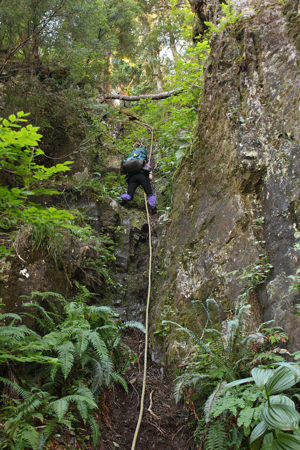
From where we parked--there was another car here when we arrived--Zosia and I easily walked the remainder of the access road to the trailhead which is marked by a sign with the Haida name for Mount Moresby. Entering forest, we followed a distinct trail climbing gradually alongside a creek northeast of the mountain. Some sections of trail were a bit overgrown, and the trail can be a bit difficult to follow whenever it enters or crosses the creek bed. Fortunately, there was a lot of flagging to help keep us on track. About 1.4 kilometres from the trailhead, we began climbing steeply away from the creek and soon settled into a long and somewhat dispiriting uphill grind. At an elevation of around 530 metres, there are two fixed ropes to aid in the ascent of some very steep sections. The first (lower) rope is probably the most challenging as the route feels nearly vertical here. Without harnesses or belay equipment, we were literally hanging onto the rope for dear life as we climbed upwards. Fortunately, we cleared the roped sections without incident.
Near tree line, Zosia and I passed an
unoccupied tent probably belonging to the same person(s) whose car we had
parked behind on the access road. Emerging from the forest, the
trail becomes less distinct, but we still found plenty of flagging and
cairns to help point the way. The route essentially climbs straight
up to a high notch on the east ridge of the mountain, and although one
rocky step lower down requires some easy hands-on scrambling, the rest is
mostly just off-trail hiking. From the high notch, we traversed to
climber's right across an alarmingly steep but short-lived grassy slope
to enter an open rocky bowl. There are some delightfully refreshing
waterfalls in this bowl where we could replenish our water bottles.
Some easy scrambling led us up to the crest of the north ridge where we
turned left and continued up more uncomplicated terrain to the summit.
Just before reaching the summit, Zosia and I ran into a woman who was the
owner of the tent and the other car. Lena Armstrong, a
recently-transplanted local, was also exploring Haida Gwaii much like
Zosia and me. We chatted at length with her and found out that she
had put up a lot of the flagging that we had found so useful along the
route. She also expressed some concerns about descending the roped
sections with her heavy backpack, and Zosia and I offered to accompany
her on the descent once we were finished at the summit. Lena then
departed to go pack up her camp while we went to tag the top of Mount
Moresby.
The summit views were exceptional on this day, and with the pleasant
weather, Zosia and I hung out on top for well over an hour before
reluctantly commencing our descent. We retraced our steps back to
the rocky bowl and then to the high notch without any issues. By
the time we dropped down to Lena's tent site, she had already packed up
and started descending, but we eventually caught up to her at the top of
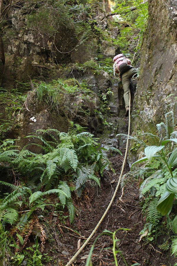
the lower fixed rope. As expected, descending this section was both
tricky and unnerving, probably doubly so for Lena with her extra heavy
pack. Still, we all made it down safely without a slip, and from
there, we descended the rest of the route together without any problems.
When we returned to our cars, Lena thanked Zosia and me for our company
by generously giving us a homemade dehydrated meal and dessert which she
normally sells through her online business,
Gone Gourmet. We
subsequently drove out the access road together and ultimately went our
separate ways once we returned to Moresby Road. Lena would head to
Moresby Camp while Zosia and I drove to Mosquito Lake Recreation Site for
our last night of camping in Haida Gwaii.
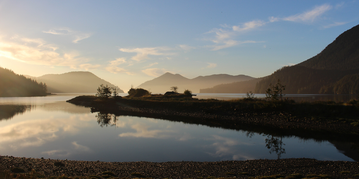
Morning sunlight hits the waters of Cumshewa Inlet at Moresby Camp.
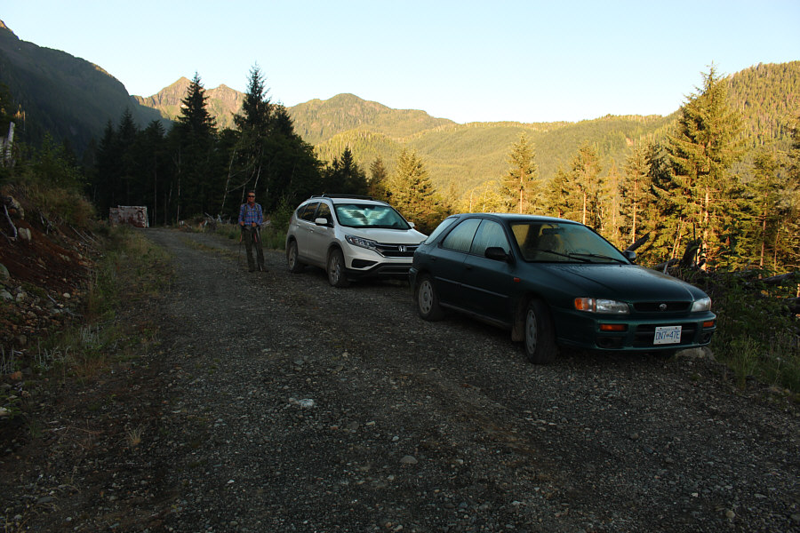 |
Active logging on the access road forces Zosia to start hiking more than a kilometre from the trailhead. |
 |
The remaining walk to the trailhead is easy. |
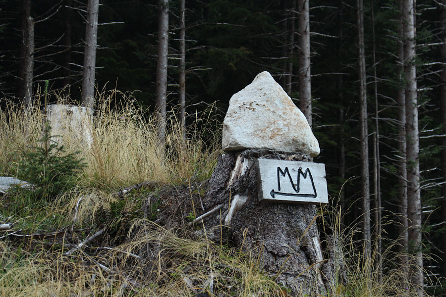 |
This is one of several similar cryptic signs which help point the way to the Mount Moresby trailhead. |
 |
At the trailhead, Sonny tries to prop
up this sign which had fallen down. The sign gives the Haida
name for Mount Moresby. Photo courtesy of Zosia Zgolak |
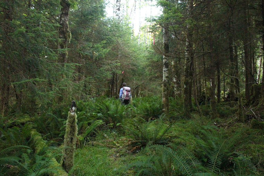 |
The trail is overgrown in places but well-marked with flagging tape. |
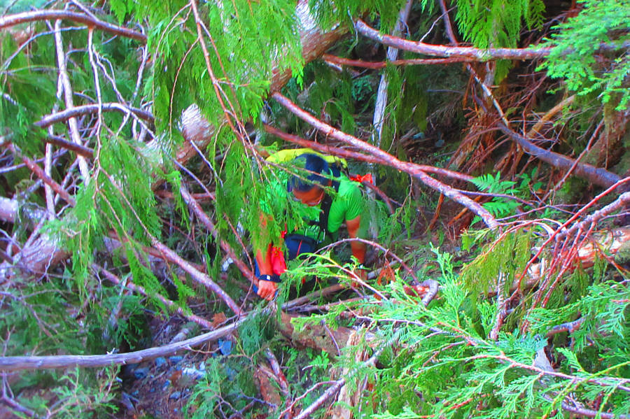 |
Occasionally, the route is
choked with unpleasant deadfall. Photo courtesy of Zosia Zgolak |
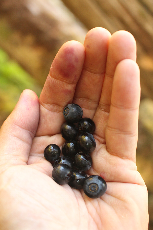 |
Ripe huckleberries provide a welcome diversion from the steep uphill grind. |
 |
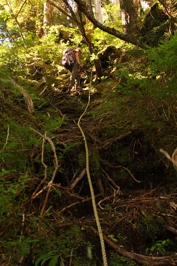
Zosia climbs up the first of two fixed ropes along a very steep section of the route. |
 |
The second fixed rope seems superfluous. |
 |
The forest begins to thin out as Zosia climbs higher. |
 |
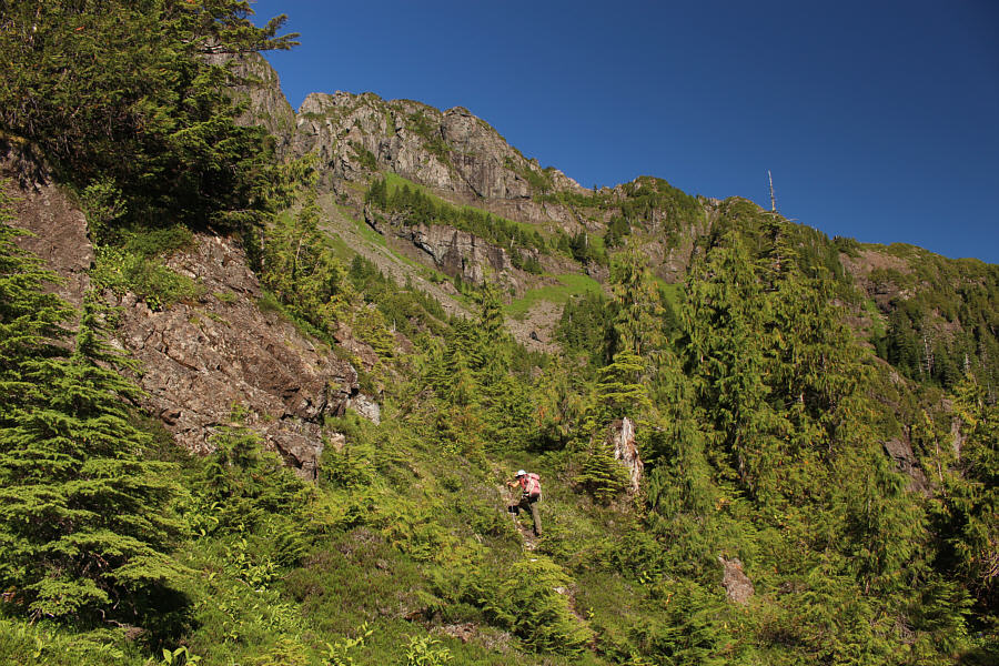
Far-reaching views begin to open up with Cumshewa Inlet visible at right. |
 |
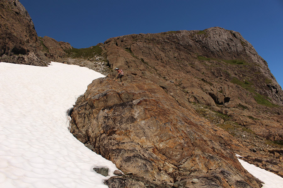
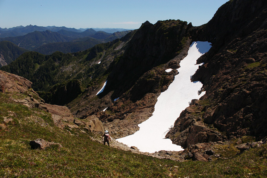
Zosia heads up a gully aiming for the notch at left. |
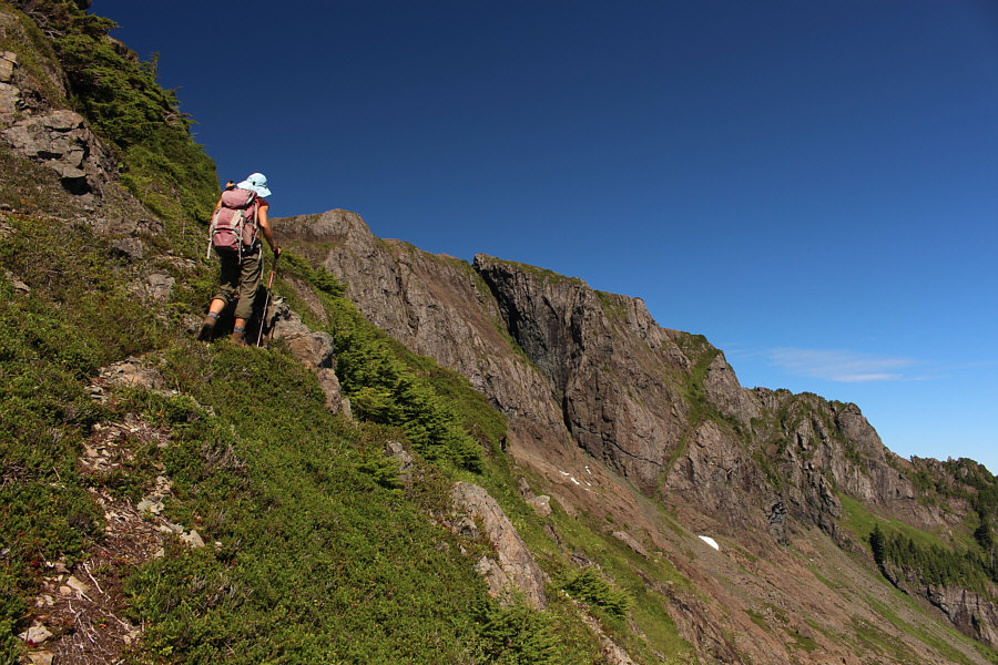 |
From the notch, the route makes an airy traverse across a steep grassy slope. |
 |
Zosia scrambles up easy terrain in a rocky bowl. |
 |
Zosia hikes up the final easy section before the top. |
 |
Zosia and Sonny relax on the summit of Mount Moresby (1159 metres), the highest point in Haida Gwaii. |
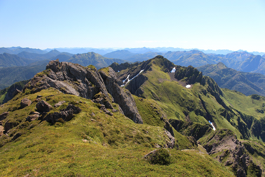 |
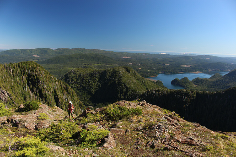
Numerous unnamed mountains stretch away to the south. |
 |
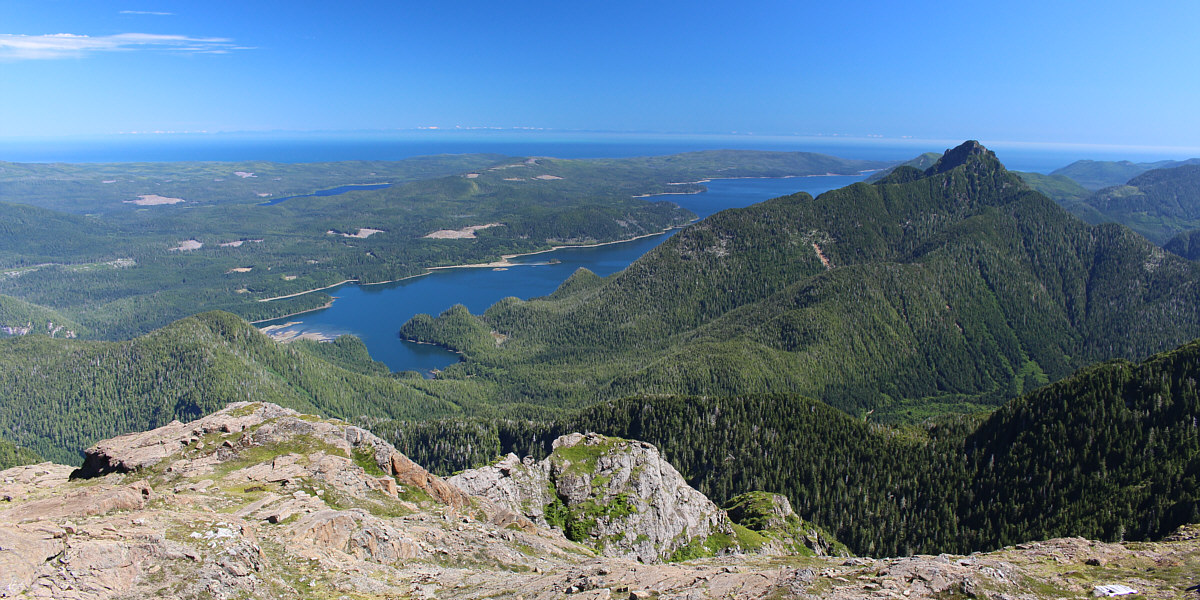
A couple of high alpine lakes and Peel Inlet highlight the million-dollar view to the southwest. The Pacific Ocean is also visible on the horizon. |
 |
A green rocket sits at the end of the summit ridge to the northwest. |
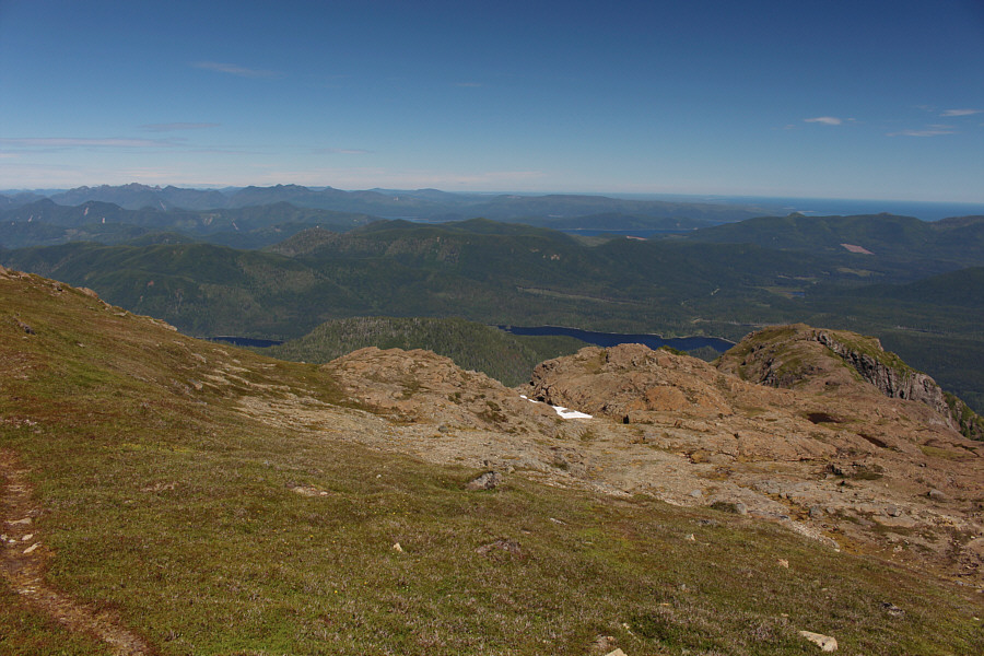 |
Mosquito Lake stands out in this view to the north. |
Skidegate Lake, Cumshewa Inlet and Newcombe Peak round out the view to the northeast. Snow-capped peaks on the British Columbia mainland are also visible on the horizon.
 |
Sonny takes a well-deserved break just
below the summit. Photo courtesy of Zosia Zgolak |
 |
Zosia carefully makes her way down into the rocky bowl. |
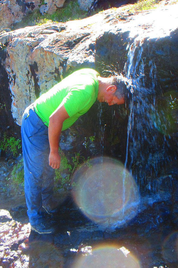 |
Sonny cools off under a refreshingly
cold waterfall. Photo courtesy of Zosia Zgolak |
 |
Sonny makes full use of the upper
fixed rope. Photo courtesy of Zosia Zgolak |
 |
Lena descends the more challenging section on the lower fixed rope. |
 |
Zosia stretches her leg out on the most awkward spot to descend. |
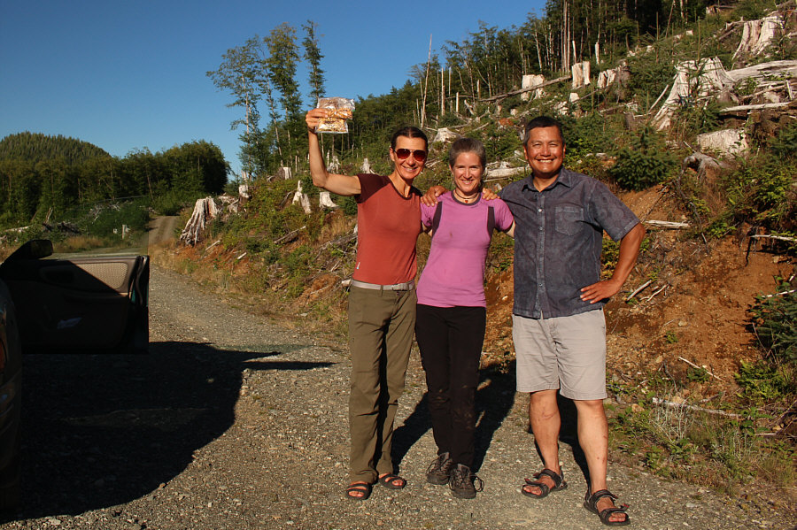 |
Zosia, Lena and Sonny pose for a celebratory photo back at their cars. Zosia is holding up some dehydrated food generously given to her by Lena. |
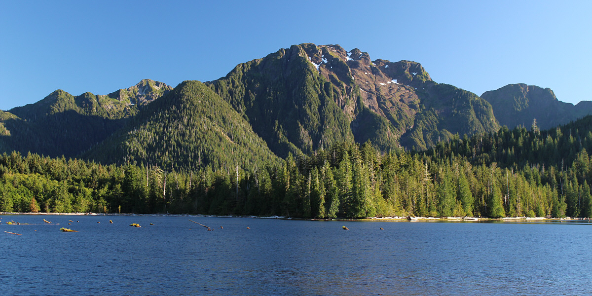
Here is a final view of Mount Moresby from Mosquito Lake.
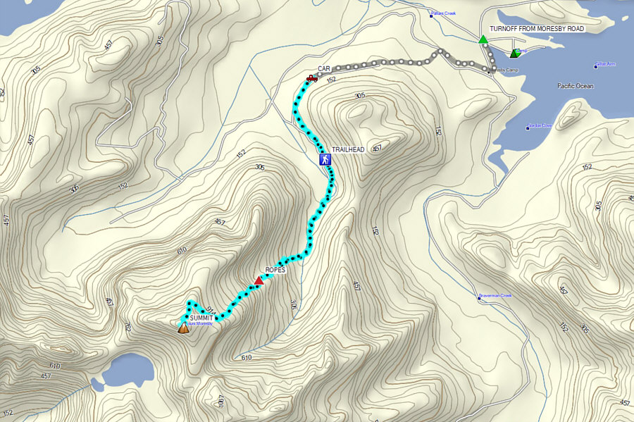 |
Total
Distance: 13.6 kilometres Round-Trip Time: 10 hours 58 minutes Net Elevation Gain: 1053 metres |