BOU AVENUE
Mount Pope
Zosia Zgolak and I hiked up Mount Pope near Fort St. James, British Columbia on 20 August 2021.  This is perhaps the most popular hike in the area since the summit is easily accessed by a well-maintained trail as described on the Mount Pope Provincial Park website.  Not advertised in the website's park map is a second trail which is mainly used to access some rock climbing routes, but this climbers' trail also runs up the mountain and ultimately intersects the main trail about 2.5 kilometres before the summit.  A loop hike is possible by combining the two trails.  According to the British Columbia Geographical Names website, the mountain is named after Franklin L. Pope, an American electrical engineer who was benighted while attempting to reach the summit.  Pope also dabbled in electrical inventions such as the telegraph and railway signaling systems, and at one time, he even formed a company with Thomas Edison.  Ironically, Pope died when he accidentally electrocuted himself in his home basement.

From Fort St. James, follow Highway 27 out the north end of town and turn left at Stones Bay Road.  Drive 4.1 kilometres and turn right to enter a large parking lot at the main signed trailhead.  The unsigned climber's trailhead is another 1.4 kilometres further along Stones Bay Road, but there is no viable space for parking there.

Starting from an information kiosk at the main trailhead, Zosia and I followed a good trail winding up the slope.  Other than the general monotony of hiking through viewless forest, there are no difficulties to speak of with this trail.  It climbs partially over a subsidiary ridge before losing some elevation to traverse across a broad drainage.  Beyond a signed junction with the climbers' trail, the main trail resumes climbing and passes a scenic viewpoint before finishing at a gazebo on the summit.  It took us less than three hours to climb to the top from the main trailhead.

After taking an extended break at the summit, Zosia and I wandered a little further north to get an unobstructed view to the northeast before backtracking to the gazebo.  A hiker from Vancouver arrived at the summit just as we were about to leave, and we chatted briefly with him--Dave was his name--before commencing our descent and returning to the junction with the climbers' trail.  Although the information kiosk warns that the climbers' trail is dangerously steep in places, we decided to take a chance and go see for ourselves.  Soon after we started down the climbers' trail, Dave caught up to us, and we ended up finishing the hike together.  As it turned out, our descent was easier than expected.  The climbers' trail is in just as good shape as the main trail, and the only "dangerously steep" section is where the trail is a bit eroded for the last few metres before the trailhead.  Upon reaching the paved road, we turned left and easily walked back to the main trailhead to complete our loop.
Don't follow the "Memory Trail"!

Zosia studies the information posted at the main trailhead.

Nothing to see here! 
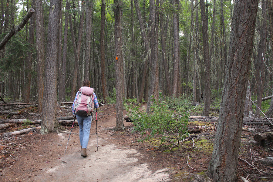
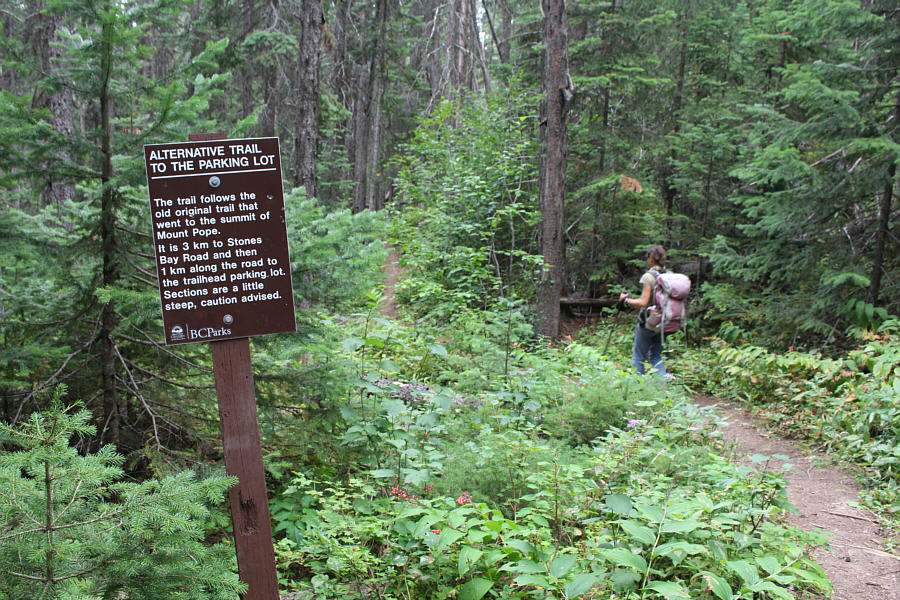
Most of the hike up Mount Pope is on a well-maintained forested trail.
Meh...there are better views to come! 
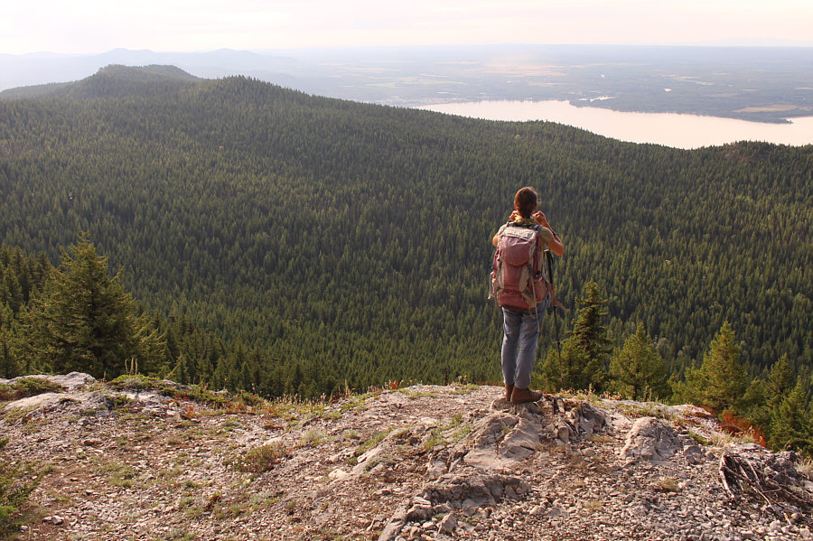
Zosia stops at a viewpoint about two-thirds of the way up the mountain.  The town of Fort St. James is visible just beyond the forested ridge at centre.
I wonder if they have weddings up here...or band concerts! 
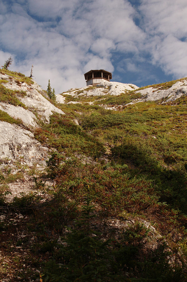
A gazebo sits atop Mount Pope.
Probably gets struck by lightning regularly too, I would bet! 
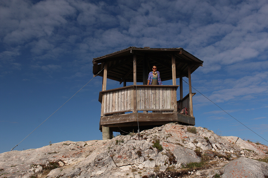
The gazebo is securely anchored to the top of the mountain by several steel cables.
I'd never even heard of this lake before, but it's beautiful! Zosia and Sonny stand near the summit of Mount Pope (1466 metres) with Stuart Lake behind them.
The summit register is housed in a nice, waterproof Pelican case while a nearby geocache is stuffed in a crappy, deteriorating Nalgene bottle! 
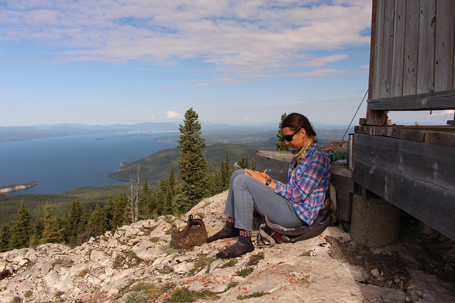
Zosia signs the summit register.
The resort boasts that it has the longest T-bar in North America...and that's supposed to be good thing? 
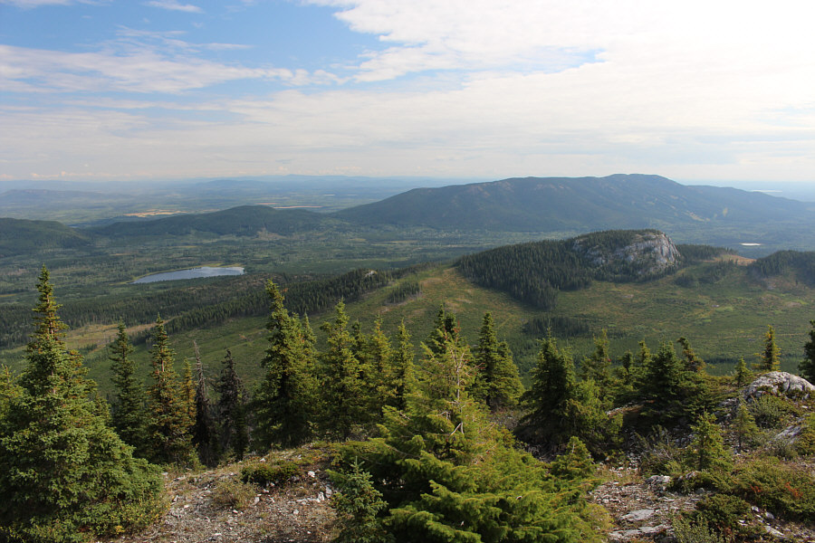
Sitting to the east is Murray Ridge (right) which is the site of a local ski resort.

Those islands aren't even at the halfway point of the lake!

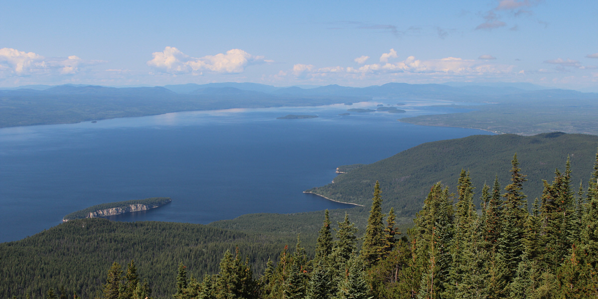
Here is a more extensive view of Stuart Lake which actually extends well beyond what is visible here.


There are some intriguing mountains scattered across the far horizon... 
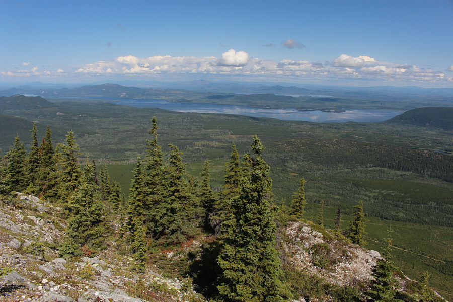
A clearing slightly north of the summit grants an unobstructed view of Pinchi Lake.  A sliver of Tezzeron Lake is also visible further north.
Highly recommended for the descent! Zosia takes an alternative (climbers') trail on descent.
Nobody climbing here today! 
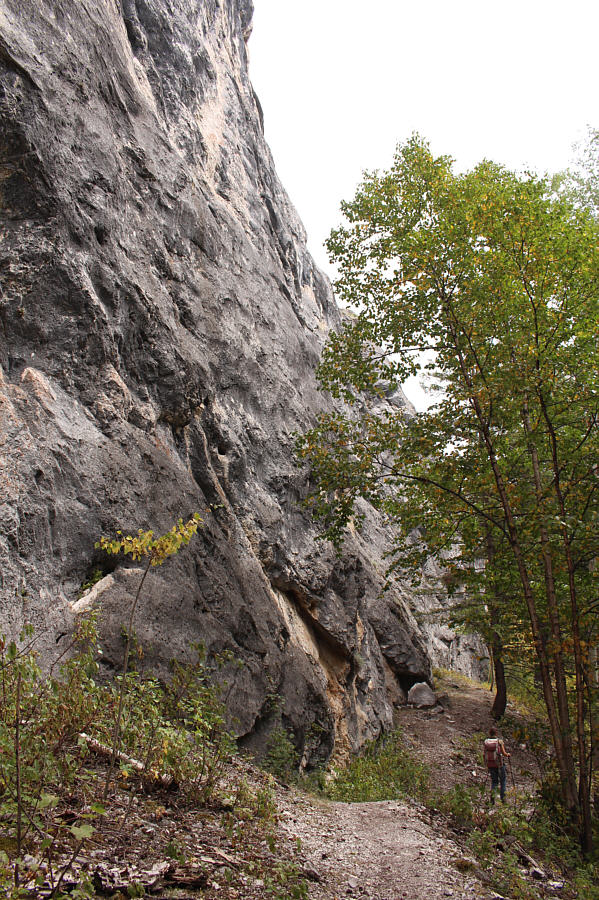
The climbers' trail passes some rock climbing areas.
Off-trail hiking is forbidden here! 
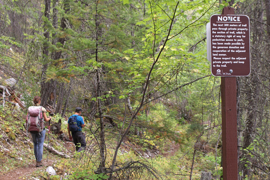
The lower part of the climbers' trail passes through private property.
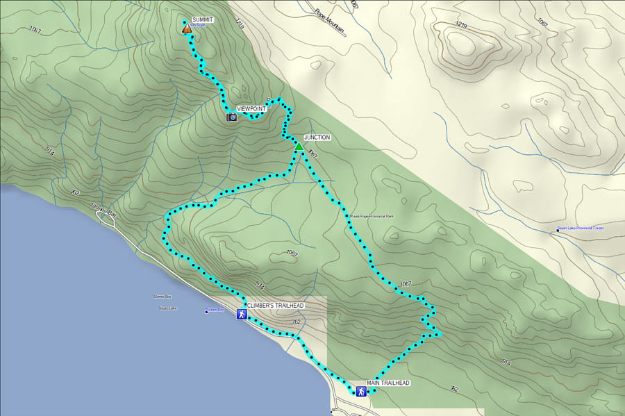
An easy summit with amazing views. Total Distance:  14.5 kilometres
Round-Trip Time:  6 hours 36 minutes
Cumulative Elevation Gain:  825 metres

GPX Data