BOU AVENUE
Mount Raymond And Slatechuck Mountain (Sleeping Beauty)
On 8 August 2021, Zosia Zgolak and I hiked up Mount Raymond and Slatechuck Mountain located just west of the village of Queen Charlotte in British Columbia's Haida Gwaii.  This hike is more commonly known as Sleeping Beauty due to the mountains' resemblance to a reposed woman's face when viewed from the village.  There are actually a number of different trails in the area, but the most direct route up Mount Raymond is via Tarundl Trail as described at gohaidagwaii.ca.

From the intersection with 9th Street (near Queen Charlotte Village Office), drive west along Oceanview Drive for 1.3 kilometres and turn right onto Honna Forest Service Road.  Continue driving west for 3.8 kilometres and turn right about 400 metres past Kagan Bay Recreation Site.  Drive north for 1.3 kilometres and turn left onto another road heading westward (2WD okay, but high-clearance recommended).  Drive 3.6 kilometres to a signed junction.  Keep right (left leads to an alternate route to access Slatechuck Mountain), and drive another 1.5 kilometres to a small pullout.  Park here.  The signed trailhead is a little further at the end of the drivable road and before a footbridge over Tarundl Creek.

Crossing the footbridge, Zosia and I followed a reclaimed section of road for about a hundred metres before turning left and entering forest.  From there, the trail climbs relentlessly gaining about five hundred and fifty metres over the next two and a quarter kilometres.  It is a steep grunt to be sure, but thankfully, the trail is well-maintained and easy to follow.  After a long climb up through the forest, we entered a verdant bowl with an attractive tarn sitting below the summit block of Mount Raymond.  Going past the tarn, we grinded up a very steep beaten path to reach the crest of Mount Raymond's south ridge before turning north and continuing to the summit.  There is at least one spot which may require some easy hands-on scrambling, but otherwise, the remainder of the ascent is uncomplicated.
The creek water is nice and clear here!

The Sleeping Beauty hike begins across this footbridge over Tarundl Creek.

I'm just glad we're not bushwhacking! 
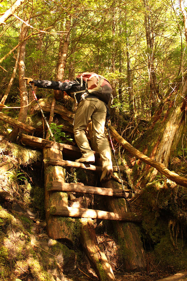
Some parts of the trail are steep enough to warrant the use of ladders.
No need to climb here! 
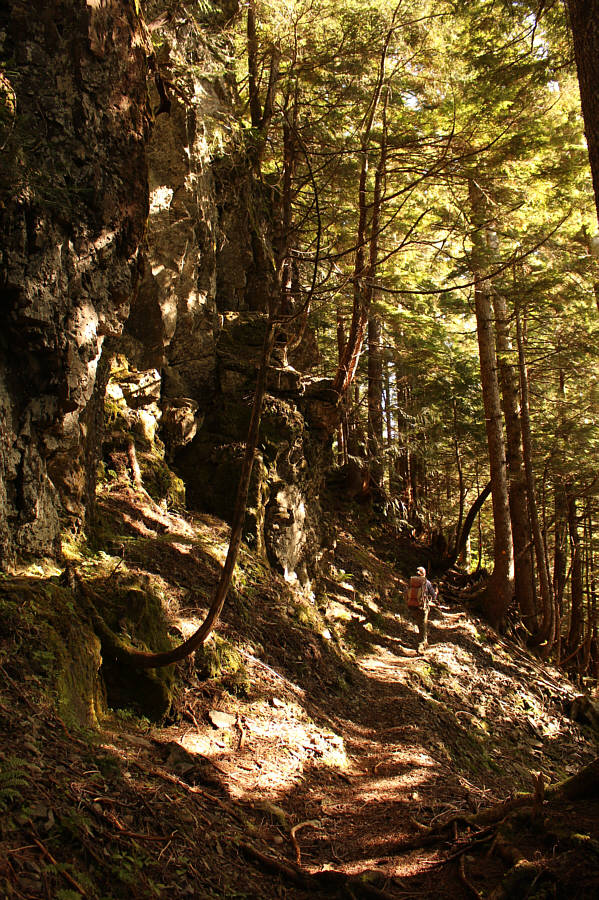
The trail passes under some rugged cliff bands.
Yup, just go up! 
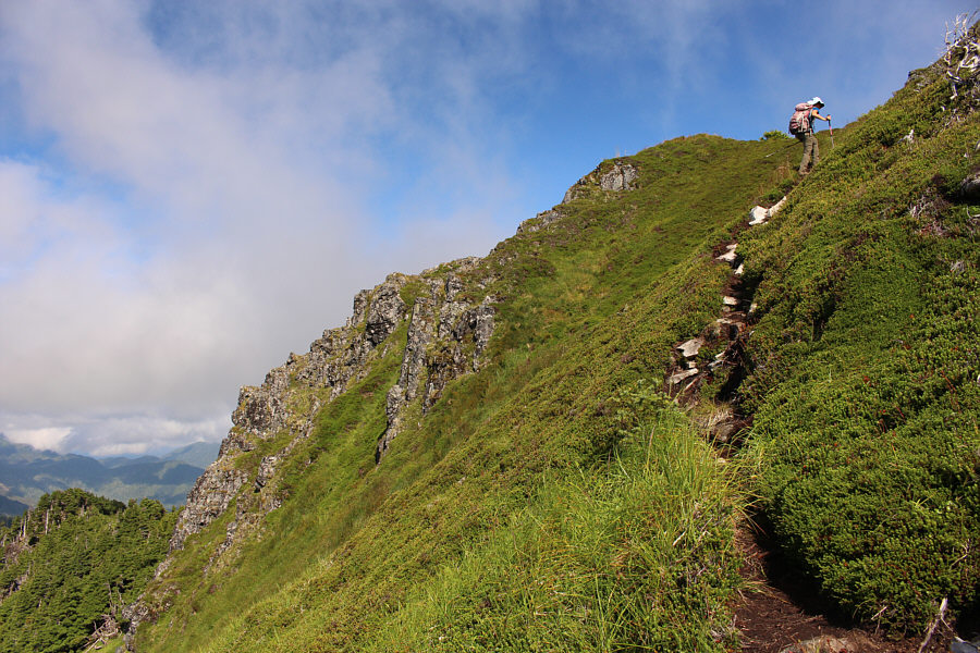
Tarundl Trail is relentlessly steep, but there are no route-finding difficulties.
Couldn't they have built just a few more switchbacks? 
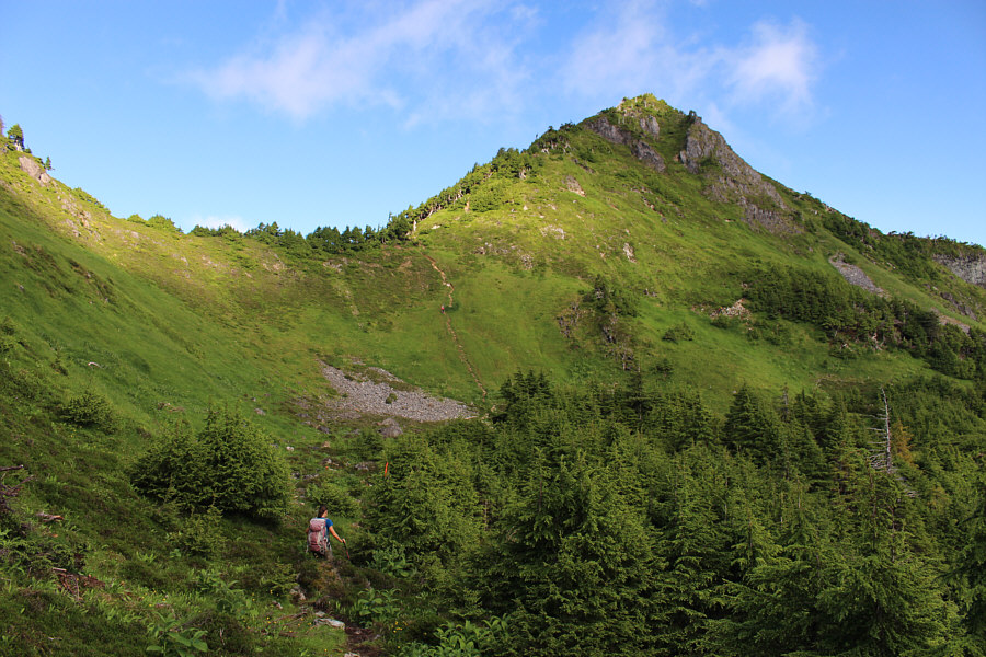
Zosia enters a verdant bowl below the summit block of Mount Raymond.  Note the hikers descending the steep path at centre.
At least it's quick! 
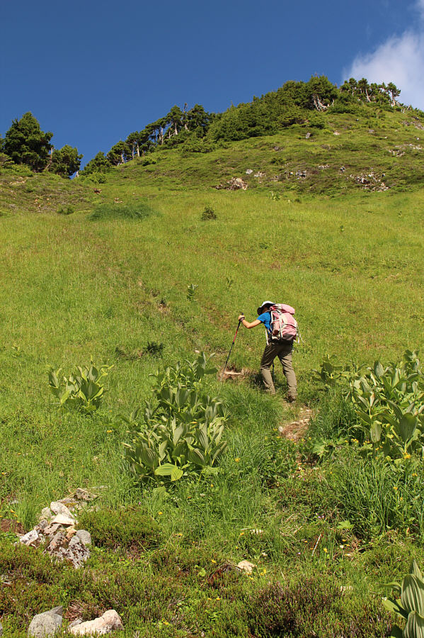
Zosia grinds up the steep path leading to the south ridge of Mount Raymond.
Perhaps even unclimbed... 
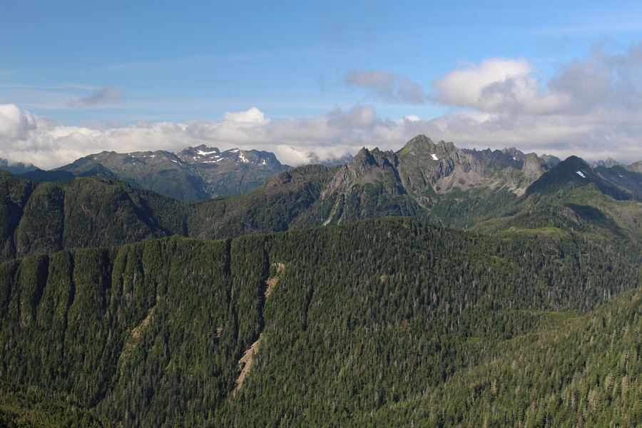
The view to the west from the crest of Mount Raymond's south ridge includes Mount Stapleton at right.  The snowy mountain on the left horizon is unnamed.
Quite an airy trail! Zosia climbs the last few metres before the summit of Mount Raymond.
Yeah, baby! 
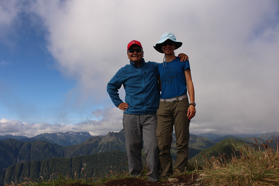
Sonny and Zosia stand on the summit of Mount Raymond (1013 metres).

Best view of the day.

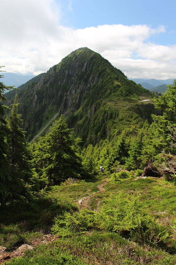
Slatechuck Mountain dominates the view to the south.


Were it not for the clouds, I think we could have seen Rennell Sound and the Pacific Ocean from here. 
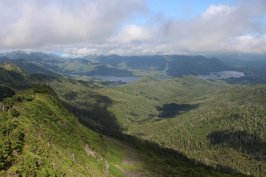
The most recognizable feature to the northwest is Yakoun Lake.
On a clear day, you should be able to see the BC mainland from here. Stanley Lake sits to the northeast.
Zosia and I tagged the summit of Mount Raymond and took a short break before descending back to where we first gained the crest of the south ridge.  Instead of dropping back into the bowl with the tarn, we traversed southward toward Slatechuck Mountain and climbed over a minor bump along the connecting ridge.  On the south side of the bump, we descended to a broad meadow dotted with several smaller tarns where we chatted briefly with a fellow who was camping here.  Beyond the tarns, we ascended the rather bushy north ridge of Slatechuck Mountain.  The beaten path here is more overgrown than the one on Mount Raymond, and it detours off the ridge crest in places to circumvent some unpleasant vegetation.  Nevertheless, the summit of Slatechuck Mountain was still easily attained, and we took a longer break here in the company of a resident deer.

For our descent, Zosia and I retraced our steps down the north ridge of Slatechuck Mountain and back up the minor bump.  At the top of the bump, we turned east and made our way, with some difficulty, back down to where we initially entered the verdant bowl.  Upon regaining Tarundl Trail, we descended to the trailhead without any complications.
No worries--it's easier than it looks! 
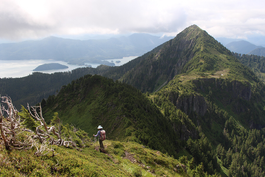
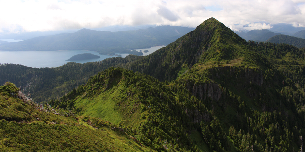
Zosia descends from the top of Mount Raymond and will climb over the minor bump in the foreground en route to Slatechuck Mountain.
We can almost dive in from here! 
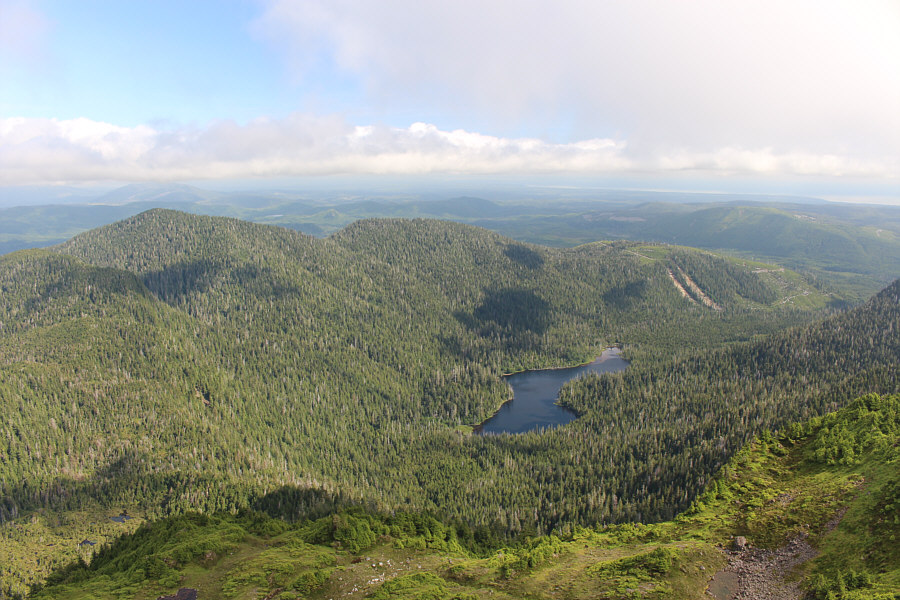
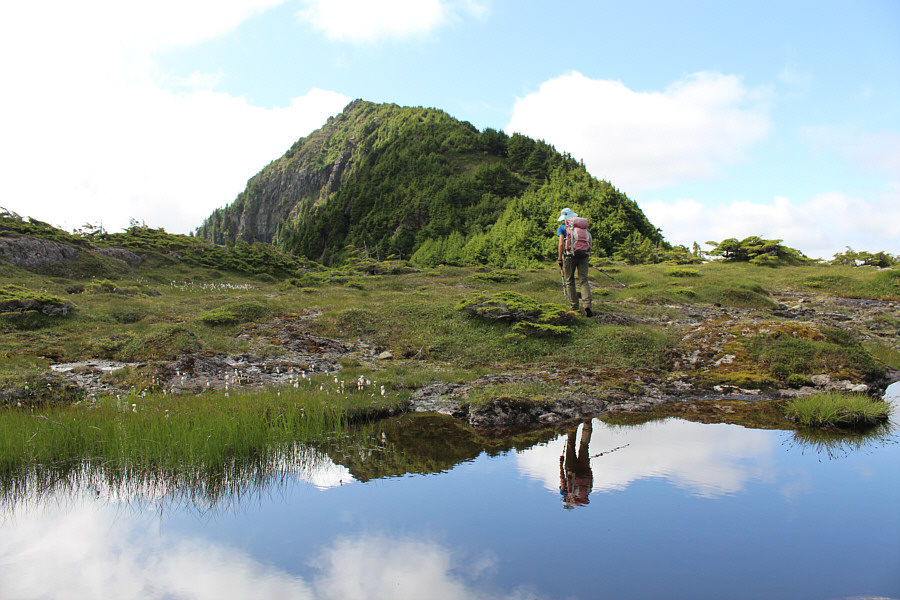
This tarn in the verdant bowl below Mount Raymond's summit block is a popular place for hikers to congregate.
The traverse between the two peaks is truly delightful. Zosia descends the south side of the minor bump on a well-defined trail.
Camping here would be heavenly...unless it was raining!

Zosia passes one of several small tarns in the area and approaches the north ridge of Slatechuck Mountain.

Still pretty easy!

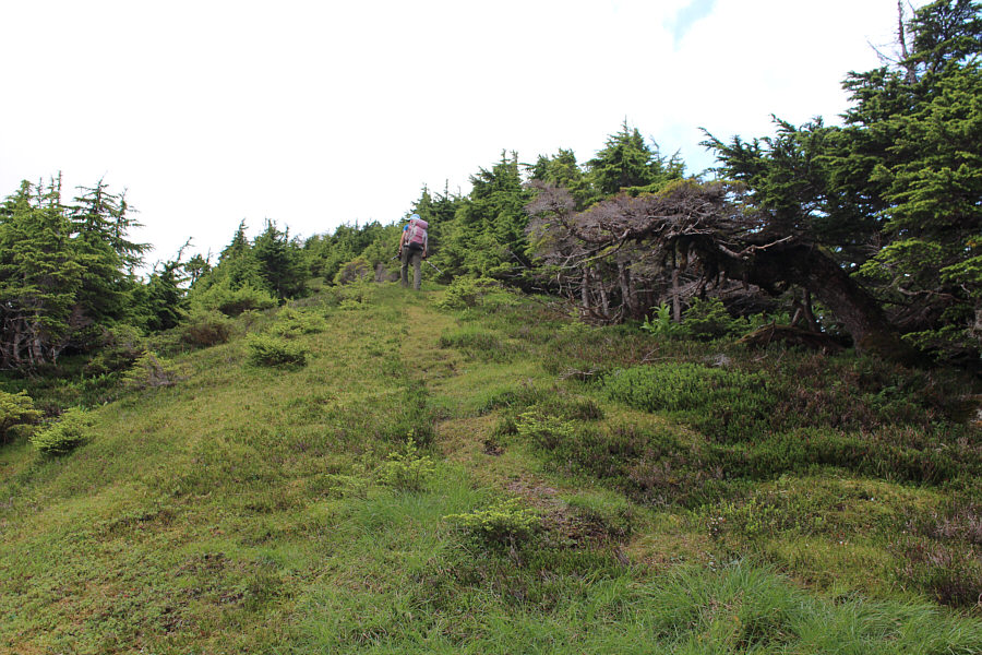
The path going up Slatechuck Mountain appears to be less traveled than the one on Mount Raymond.

Reminds me of a similar version I saw near Bow Peak in Banff National Park.

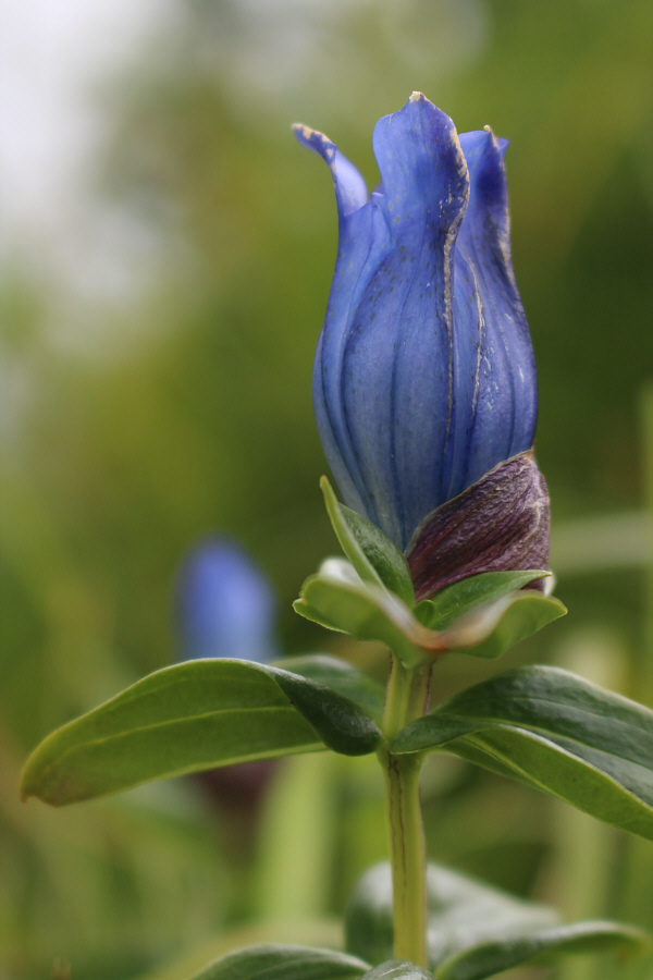
Gentians such as this one are prolific on Slatechuck Mountain.

This deer stuck around while we had a snack on the summit.

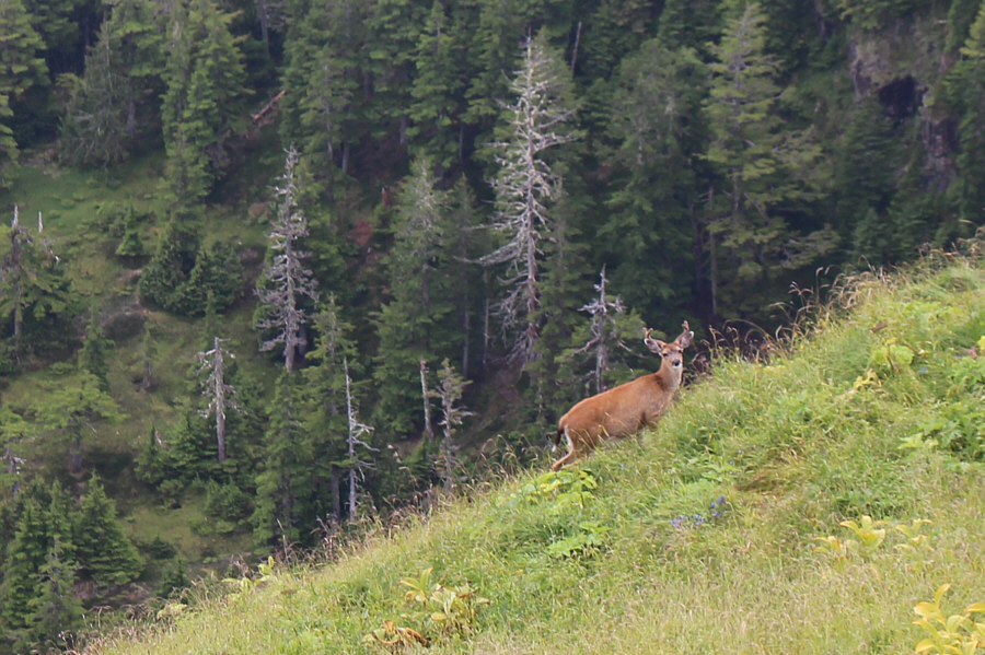
A deer hangs out at a safe distance just below the top of Slatechuck Mountain.

Of course, the clouds rolled in just in time...doh!

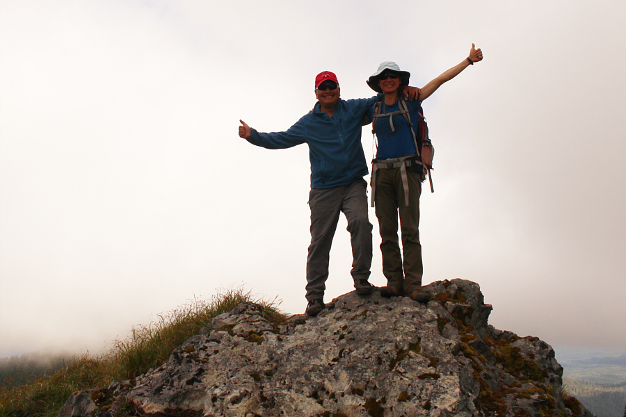
Sonny and Zosia tag the summit of Slatechuck Mountain (1014 metres).

I wonder what the Haida word is for "nipple"...

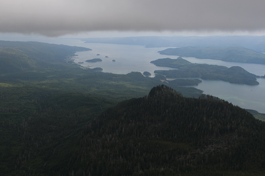
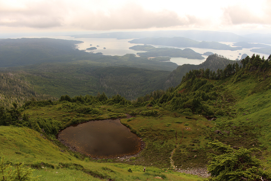
Despite some cloud cover, the village of Queen Charlotte is still visible to the east beyond appropriately-named Nipple Mountain.

It's too bad the minor bump didn't also have an official name!

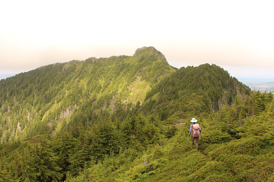
Zosia gets another glimpse of Mount Raymond as she descends from the top of Slatechuck Mountain.

Probably the most easily accessible big peaks to climb in Haida Gwaii. Total Distance:  7.3 kilometres
Round-Trip Time:  6 hours 34 minutes
Cumulative Elevation Gain:  841 metres

GPX Data