BOU AVENUE
Lusk Ridge Main Summit
On 10 April 2022, I hiked up Lusk Ridge in Alberta's Kananaskis Country Public Land Use Zone with Andrew Chinnick, Wendy Kadar, Shaun Luong, Bob Spirko and Wendy's dog, Ruthie.  Noticeably absent was Zosia Zgolak who organized this trip but opted to stay home to recover from illness.  There are a number of online trip reports for Lusk Ridge, but we would most closely follow a route described by Matthew Clay.

Starting from the south side of Highway 68 (4.5 kilometres east of junction with Highway 40 or 16 kilometres west of junction with Homestead Road), Andrew, Wendy, Shaun, Bob, Ruthie and I hiked along a well-defined trail climbing up a wide corridor through the forest.  Some steeper parts of this initial section of trail were treacherously icy, and we had to go off-trail a bit to find better traction.  The trail led us through a series of cut blocks before disappearing at the foot of a broad ridge running up the north side of Lusk Ridge.  We then grinded up a short but very steep slope to gain the crest of the broad ridge.  Lingering snow patches complicated what would normally be a fairly straightforward grunt up the broad ridge, and we had a brief anxious moment when Shaun inadvertently dislodged some sizeable rocks on a steep slope above the rest of us.  Fortunately, the rocks did not roll very far, and we carried on up the remainder of the broad ridge without further drama.  A large cairn marks the top of the broad ridge, but on this day, a snow squall obscured much of the far-reaching views from there.  We subsequently wandered into the forest beyond the cairn to tag the rather indistinct tree-covered highest point of Lusk Ridge.

Given an abundance of snow still covering the ground, we quickly abandoned our original plan of extending the hike to some subsidiary high points further west.  Instead, we simply turned around and backtracked partway down the broad ridge before stopping for a short break.  When we resumed our descent, we made a route-finding gaffe which resulted in some unnecessary muddling through crusty snow patches and unpleasant deadfall, but thankfully, the misery was short-lived.  We eventually cleared the last of the deep snow and made our way down to the cut blocks, and from there, we settled into a somewhat long but uneventful hike back to the highway.

Be sure to check out Bob's trip report.
With a bit more snow, this would be a nice ski run!

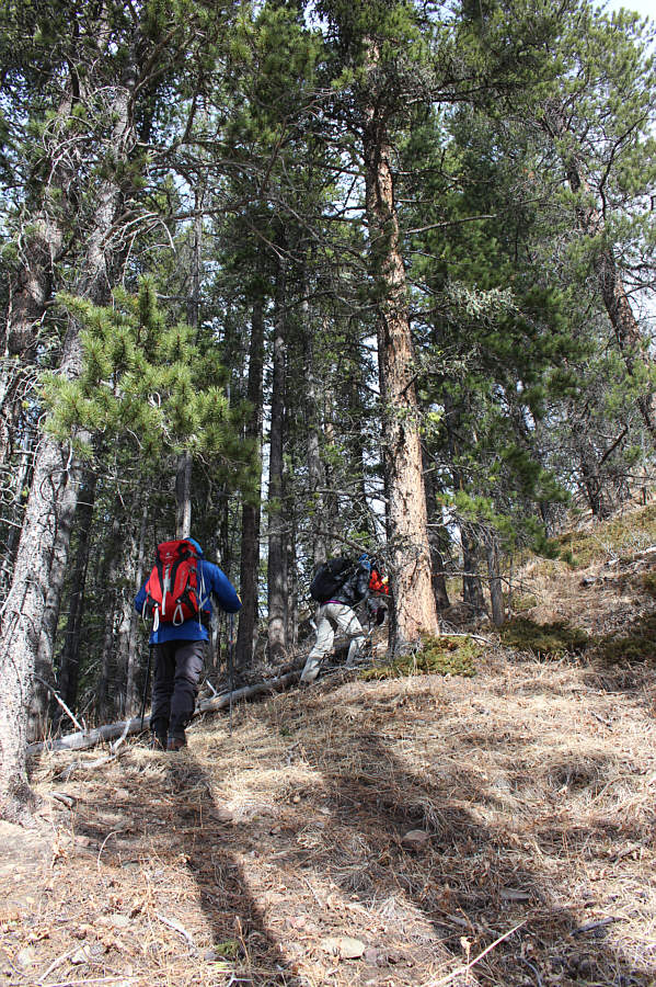
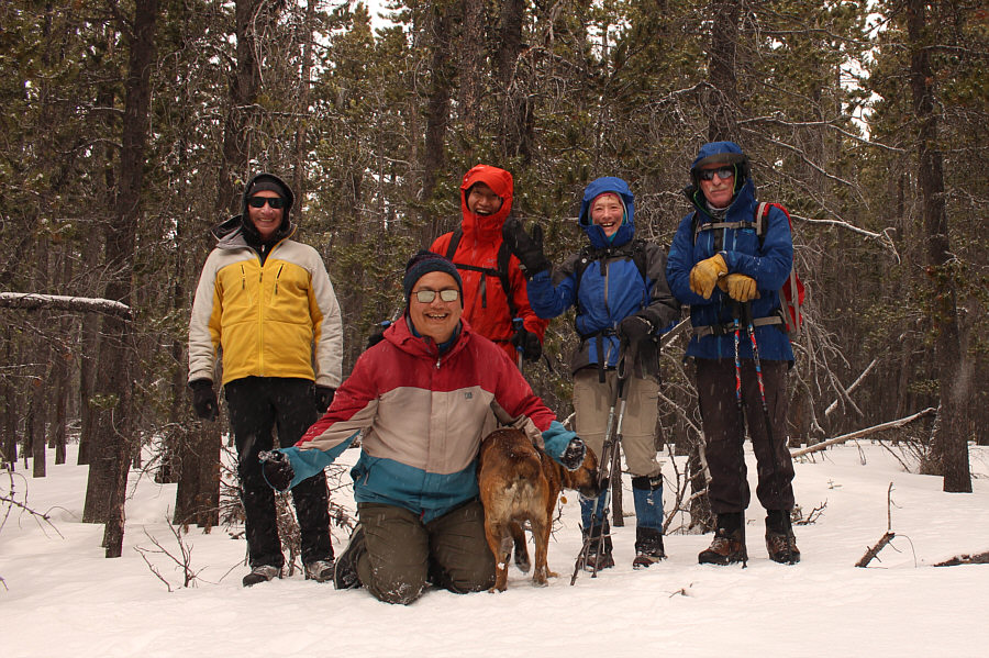
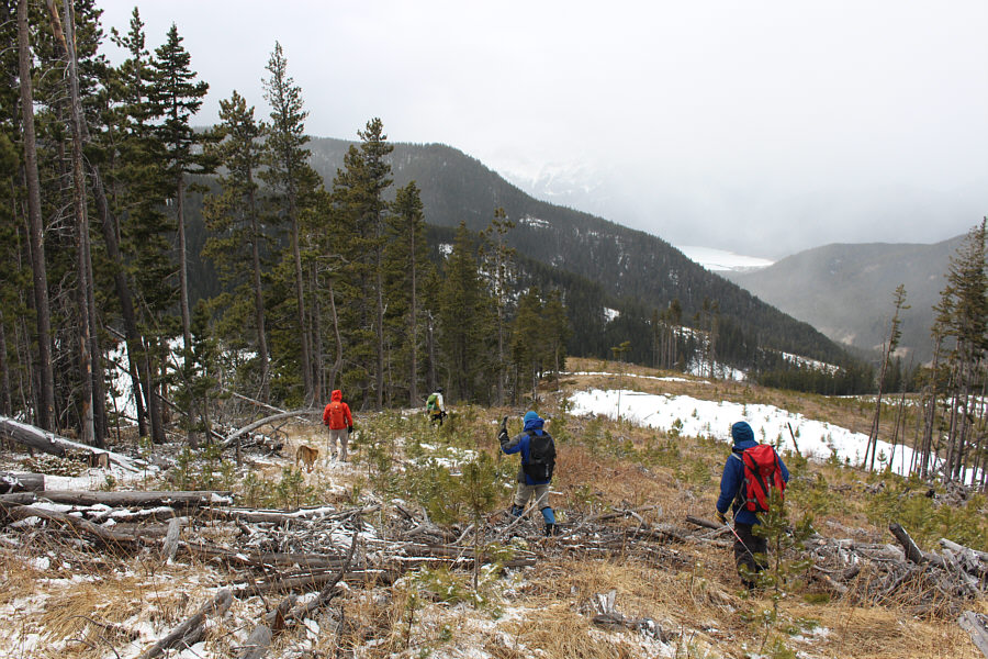
Bob, Wendy, Andrew and Shaun begin hiking up a corridor through the forest.

That's where we're headed!

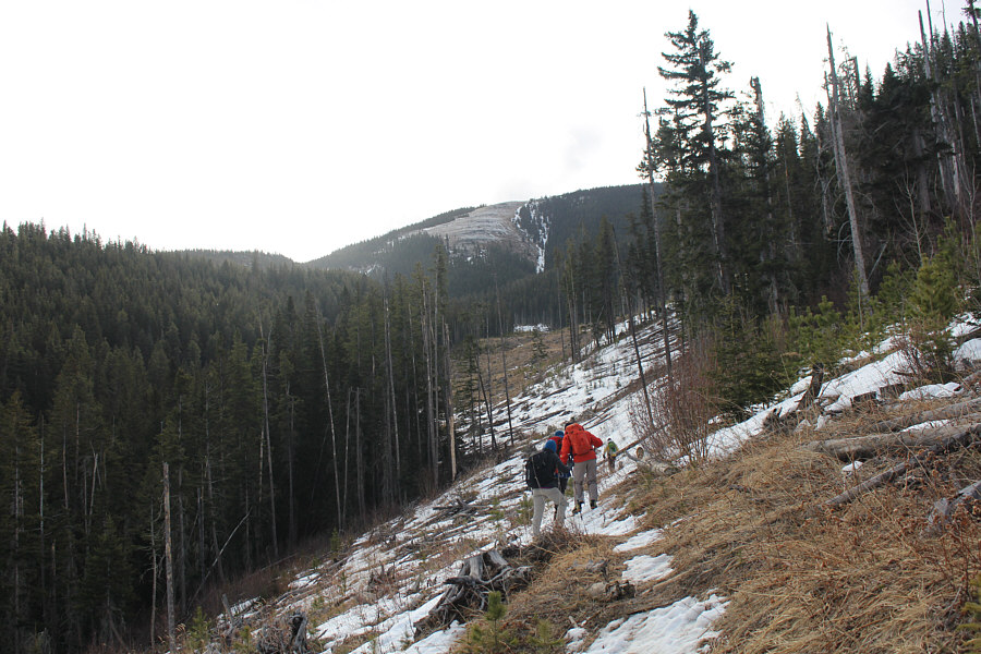
A broad ridge comes into view in the distance as the group continues through the corridor.  The group would later climb up this ridge.

Looks like some happy hikers! 
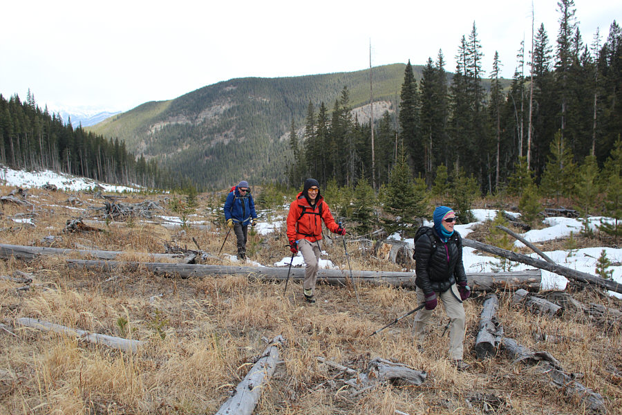
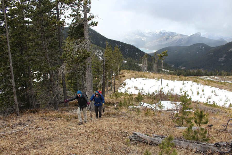
The corridor eventually widens into a series of cut blocks.
Get ready for a steep grunt!

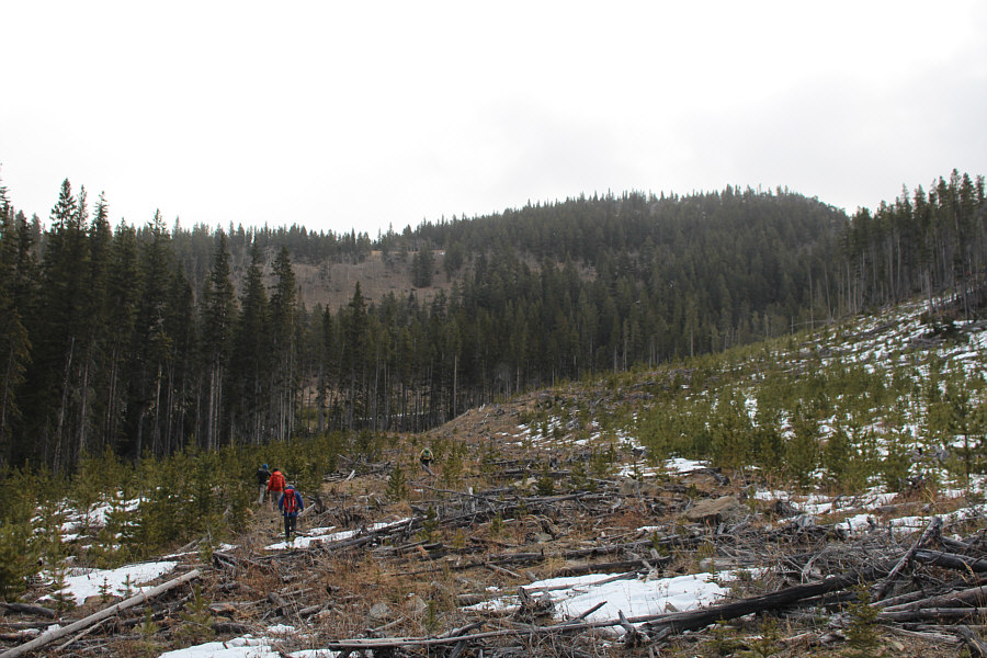
The cut blocks end at the foot of the broad ridge ahead.

Ugh. 
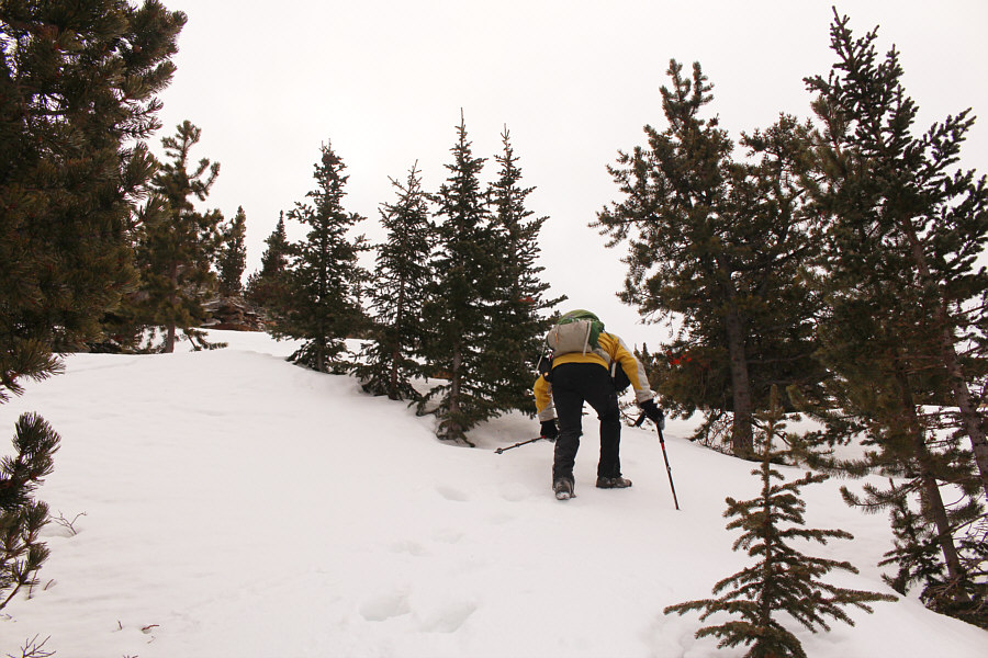
The group climbs up a very steep slope to gain the broad ridge.

Better than a kick in the pants, I suppose!

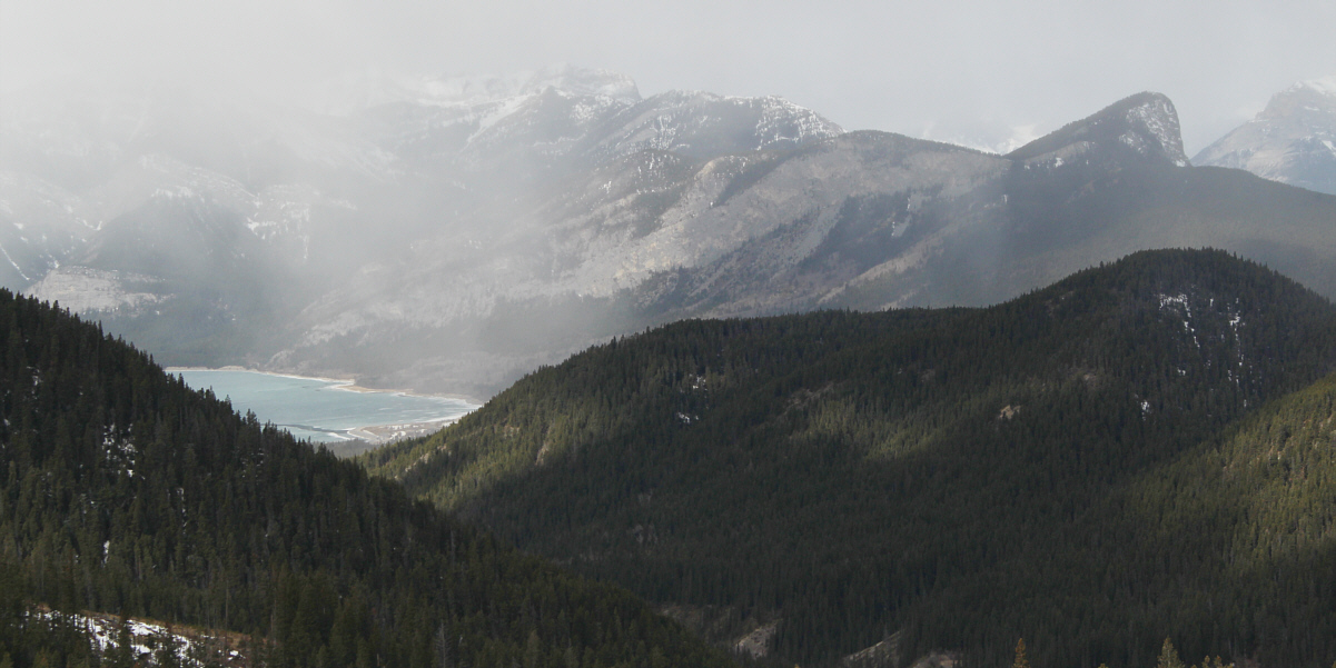
The best view of the day includes Barrier Lake and Barrier Lake Lookout (Yates Mountain).


A happy couple from Bragg Creek! Wendy and Andrew gain the crest of the broad ridge and continue upwards.
It's best to avoid the snow on this day...go right! 
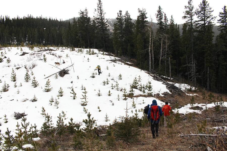
Everyone waits to see how Ruthie and Bob fare going up a large snow patch on the broad ridge.
Optional scrambling!

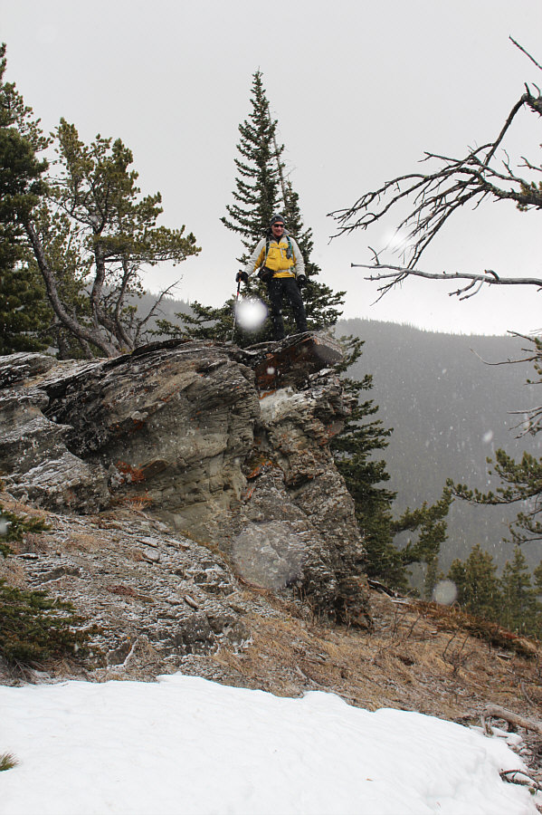
Bob stands on a short bluff partway up the broad ridge.

Doesn't look so bad from here...

Lingering snow patches in the trees would complicate route-finding on the broad ridge.

This is where Shaun almost rolled some rocks onto the rest of us!

Bob carefully ascends a snow patch which is crusty and only partially supportive.

Feels like winter again...

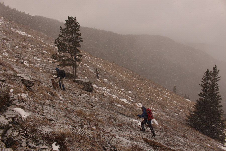
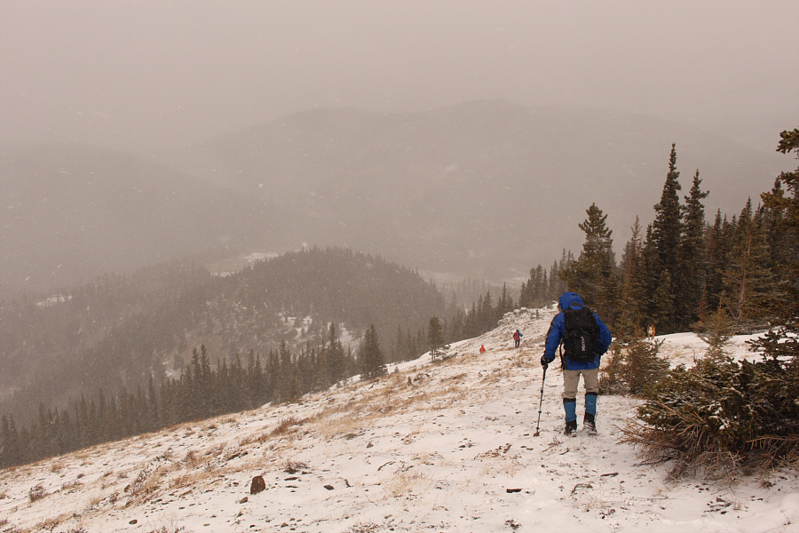
The rest of the ascent up the broad ridge is easy, but an incoming snow squall dampens the mood.

I wonder what Ruthie thinks of this "nice" weather...

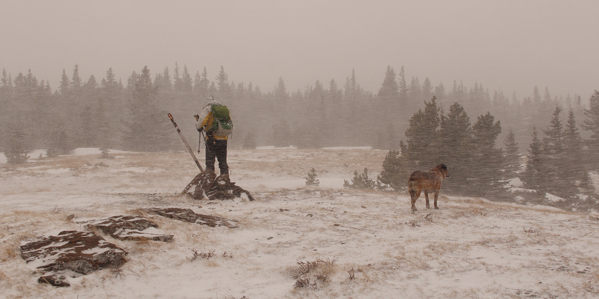
Bob and Ruthie reach a large cairn at the top of the broad ridge.  The actual highest point of Lusk Ridge is somewhere in the forest ahead.


We actually caused a "whumpfing" of the snow here! Bob, Sonny, Shaun, Ruthie, Wendy and Andrew stand approximately on the highest point of Lusk Ridge (2074 metres).
It's a shame that we couldn't ski this!

Eager to get out of the biting wind, the group hastily retreats down the broad ridge.

I guess the lake was still frozen! Near the bottom of the broad ridge, the group gets one last look at Barrier Lake in the distance which is now snow-covered.
Ice cleats would definitely help...or rock skis! Andrew and Wendy avoid a dangerously icy section of trail not far from the highway.
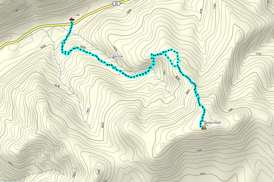
Might be worth a return visit in nicer weather... Total Distance:  7.5 kilometres
Round-Trip Time:  4 hours 45 minutes
Net Elevation Gain:  544 metres

GPX Data