BOU AVENUE
Seven Sisters North Outlier

Wrapping up a modest six-day road trip, Zosia Zgolak and I hiked up an unnamed knob located north of Seven Sisters Mountain in Alberta's Livingstone Public Land Use Zone on 5 July 2022.  This knob is actually the terminus of Seven Sisters Mountain's north ridge, and unable to find any other references, I have taken the liberty to name it Seven Sisters North Outlier.  Google Maps shows a convenient ATV road which grants easy access to the crest of Seven Sisters Mountain's north ridge, and before this hike, I was unaware that this same road is part of the course for the annual Sinister 7 Ultra race.  Heavy rains the previous night made me apprehensive about the muddiness of the ATV road, but being able to drive to our starting point was a good sign.

Turn north onto Allison Creek Road from Highway 3, 28.9 kilometres east of the junction with Highway 43 in Sparwood, BC or 6.1 kilometres west of the intersection with 86 Street in Coleman.  Drive 2.7 kilometres (pavement ends) to the turnoff for Chinook Lake and keep right.  Drive another 2.2 kilometres to reach Atlas Staging Area (vault toilets available).  From the staging area, continue driving north for 9.4 kilometres to a junction with an ATV road branching right.  Park here.  In dry conditions, a 2WD vehicle should be able to make it to the ATV junction, but high clearance is recommended due to the many potholes and a few rutted spots along the way.

Following the ATV road, Zosia and I immediately hopped over a small creek and climbed up a short hill before settling into a gradual descent to a four-way junction about 1.2 kilometres from the start.  Although there were certainly a lot of wet and muddy sections throughout, the ATV road was still in good enough shape for walking, and the few problematic mud holes we encountered were easily circumvented.  At the four-way junction, we followed Sinister 7 course markers along the branch heading southeast and began climbing steadily for the next three kilometres to a creek crossing.  Some lingering snow patches along this stretch did not impede our progress, but we did notice fresh bear tracks going the same way.  After crossing the creek on a supportive snow patch, we climbed steeply for a little more than half a kilometre to reach the crest of Seven Sisters Mountain's north ridge.  At this point, we abandoned the ATV road and hiked northward along the crest of the ridge.  There is a slight dip and some light forest to navigate along the ridge, but otherwise, we had no serious difficulties hiking the rest of the way to the high point of Seven Sisters North Outlier.  A brisk wind made it too uncomfortable to linger on the high point, and we retreated a short distance before taking shelter on the lee side of the ridge for a short break.

When we resumed hiking, Zosia and I more or less retraced our steps back to the ATV road.  Once we regained the road, we simply backed out the way we came without any issues.
We're off to a good start!

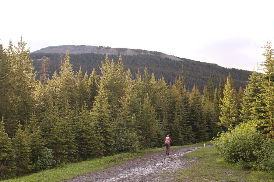
Zosia leaves the parked car and begins hiking on an ATV road.

Seems like I climbed these in a different life!

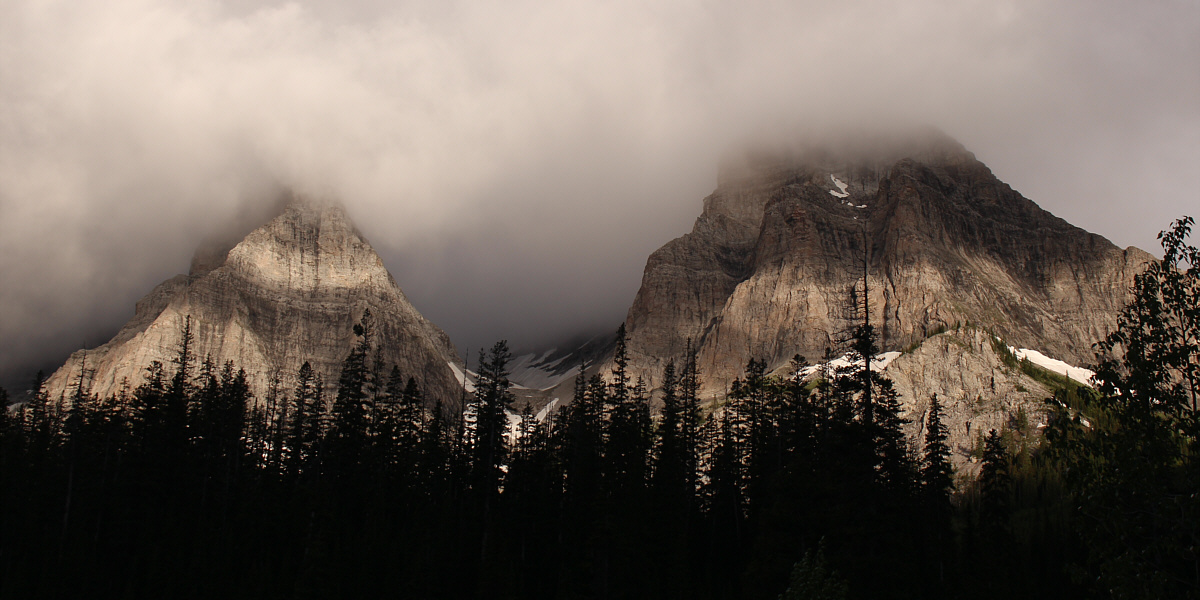
The morning sun illuminates cloud-covered Window Mountain (left) and Mount Ward (right).


Apparently, we were here just a week before the annual race.

At an important junction, Zosia follows markers for the Sinister 7 Ultra race.  Seven Sisters North Outlier is visible in the background.

I guess the Ultra runners just run through this? 
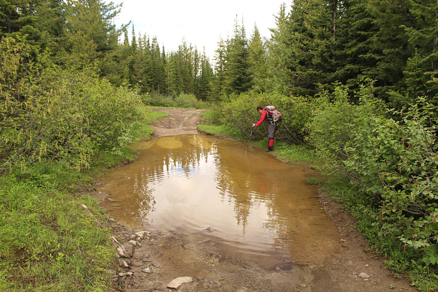
This is one of the few problematic mud holes along the ATV road.
Hey Boo Boo! There is some fresh evidence of a bear following the same ATV road.
Push hard! This is one of the steeper sections to climb along the ATV road.
Looks like it would be fun to scramble at least partway up the north ridge of Seven Sisters Mountain.

Zosia snacks on some peanuts after gaining the ridge crest north of Seven Sisters Mountain.

Very windy here!

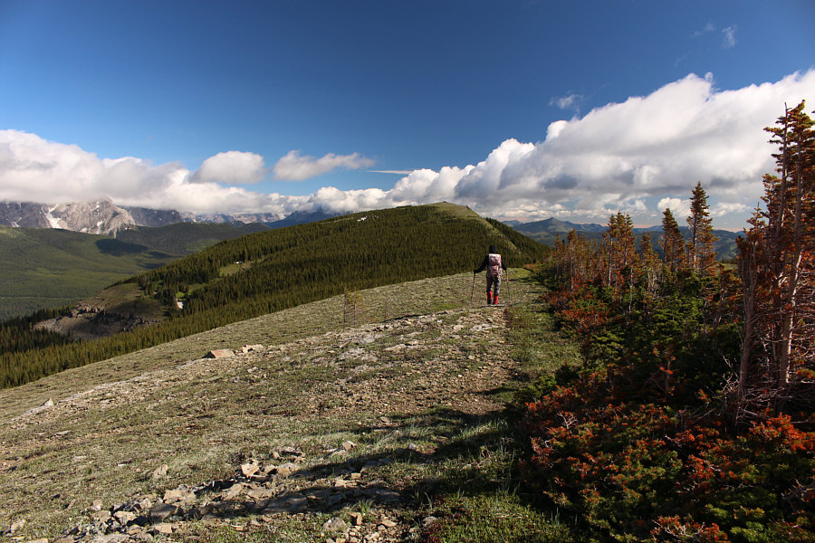
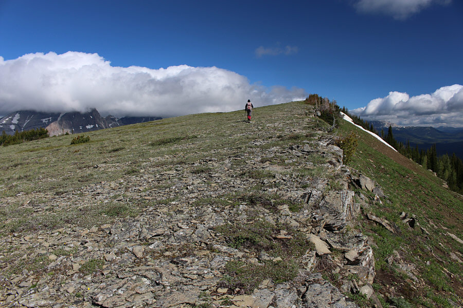
Zosia abandons the ATV road and heads north along the ridge crest.  Seven Sisters North Outlier is visible straight ahead.

Don't worry; the dip is not as big as it looks.

The ridge makes a slight dip here before rising to the high point.


Do you know what "wearing the horns" means?

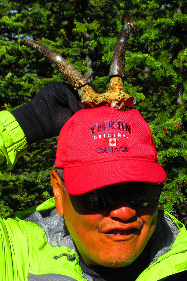
Sonny tries on what appears to be goat horns found by Zosia.

Photo courtesy of Zosia Zgolak

Hands-in-the-pocket easy!

The final approach to the top is wide open and easy.

Yes, four big thumbs up to this hike! Sonny and Zosia give thumbs up on the high point of Seven Sisters North Outlier (2307 metres).
That was a much more strenuous hike than this one! To the southeast are McGillivray Ridge and Ma Butte.

Best view of the day!

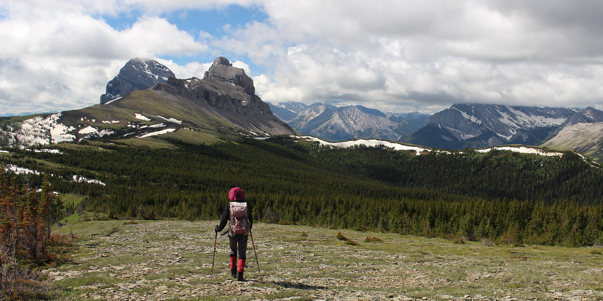
As she leaves the high point, Zosia gets a glorious view of Crowsnest Mountain and Seven Sisters Mountain to the south.


If you look closely, you can even see the scramblers' trail on Crowsnest Mountain! 
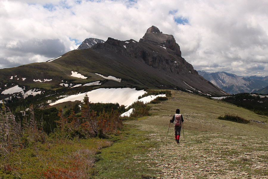
Here is a closer look at Crowsnest Mountain and the north side of Seven Sisters Mountain.

It's like walking by old familiar friends!

The clouds finally lift to reveal the tops of several familiar peaks to the west.


Still some yo-yo skiing to be found here! Here is one last look at Crowsnest Mountain and Seven Sisters Mountain as Zosia approaches the spot where she left the ATV road.
That snowy ridge in the foreground also looks like it would be good to hike... Zosia takes a short cut across the slope to regain the ATV road.
Wouldn't it be fun to just jump in?

Zosia skirts around the edge of another mud hole along the ATV road.

And we didn't see a single ATV on this road!

The long walk out along the ATV road is not without views.  In the background is Racehorse Peak.

A superb hike which surprisingly hasn't been documented elsewhere (as far as I know). Total Distance:  13.9 kilometres
Round-Trip Time:  6 hours 2 minutes
Cumulative Elevation Gain:  807 metres

GPX Data