BOU AVENUE
Square Top Mountain And Jackson Peak
When Zosia Zgolak and I hiked to The Vortex near St. George, Utah in 2020, I was struck by the distinctive shapes of two mountains I saw on the horizon to the northwest--Square Top Mountain and Jackson Peak.  Naturally, I wanted to climb them, but Zosia and I would have to wait out over two years of pandemic travel restrictions/hassles before returning on 16 April 2022 to make an attempt.  Both mountains are not technically difficult, but there are still some route-finding issues to consider as documented in a trip report by Stav Basis.

From St. George, drive northwest through the suburb of Santa Clara and out of town via Santa Clara Drive which becomes Old Highway 91.  After passing the junction with Kwavasa Drive, continue along Old Highway 91 for 7.4 kilometres and veer right onto Gunlock Road.  Drive 11.8 kilometres and turn left onto Manganese Wash Road (gravel) which immediately crosses a bridge over Santa Clara River.  Manganese Wash Road has occasional rough sections but should be generally good for 2WD vehicles in dry conditions.  Drive for 9.9 kilometres before turning right onto a dirt road just before a cattle guard.  This dirt road is a bit rougher but should still be okay for 2WD vehicles although high clearance always helps.  Although this dirt road continues for quite a distance up toward the saddle between Square Top Mountain and Jackson Peak, we parked in a small pullout near an abandoned water tank about 1.4 kilometres from the previous junction (the road is heavily rutted just beyond this point).

From the pullout, Zosia and I continued along the dirt road for about 680 metres before abandoning it to make a beeline for the south side of Square Top Mountain.  As we would soon learn, the mountain is further away than it appears, and the intervening terrain is more complex than expected.  Although the off-trail hiking here is easy, some effort is needed to find the most efficient route across several annoying minor ridges.  We eventually gained one of the ribs on the south side of the mountain and simply followed it up to the summit ridge.  There are a few rocky sections here and there, but all are easily avoidable or pose no significant challenges.  Upon gaining the crest of the ridge, we turned westward and easily hiked to the true summit of Square Top Mountain where we stopped for a short lunch break.
Further away than they look...

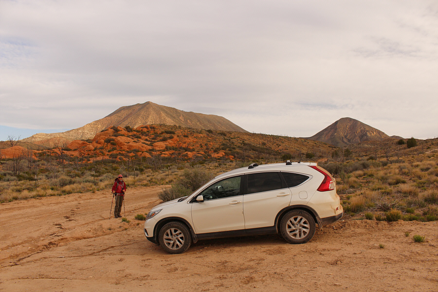
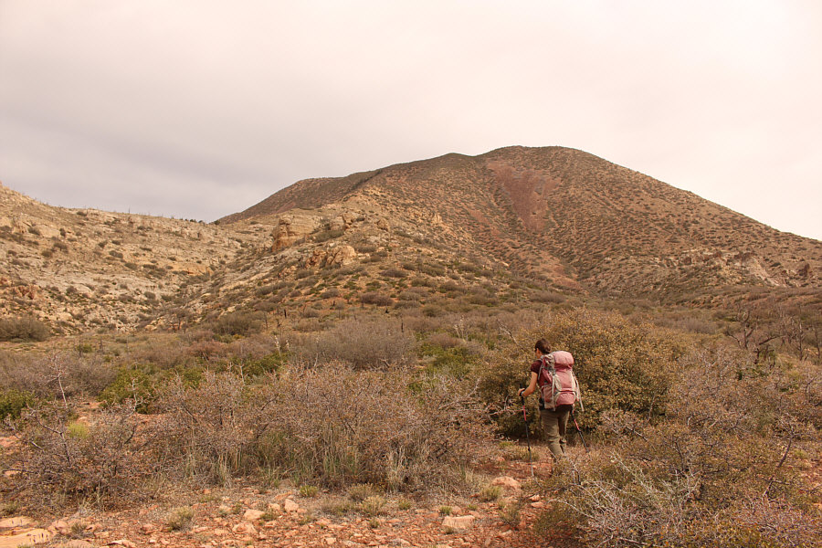
Square Top Mountain and Jackson Peak are visible in the distance as Zosia begins hiking from the pullout.

The road does NOT go all the way to the gap between the two mountains!

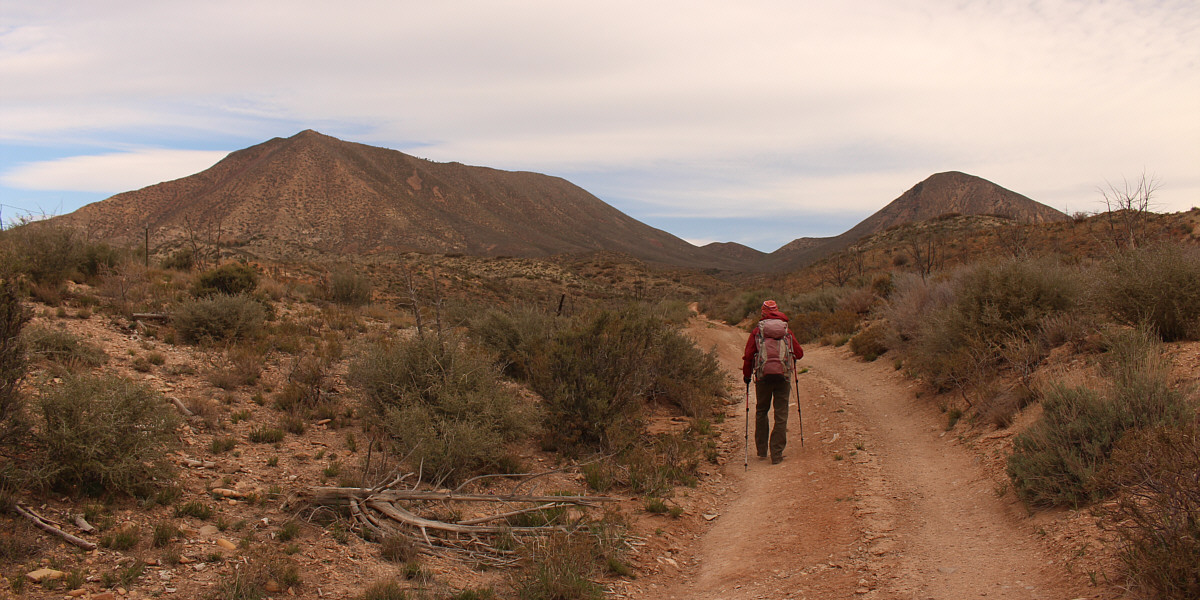
Zosia briefly follows the continuation of the access road toward the two mountains.


Easy walking here, but the mountain doesn't seem to be getting any closer...

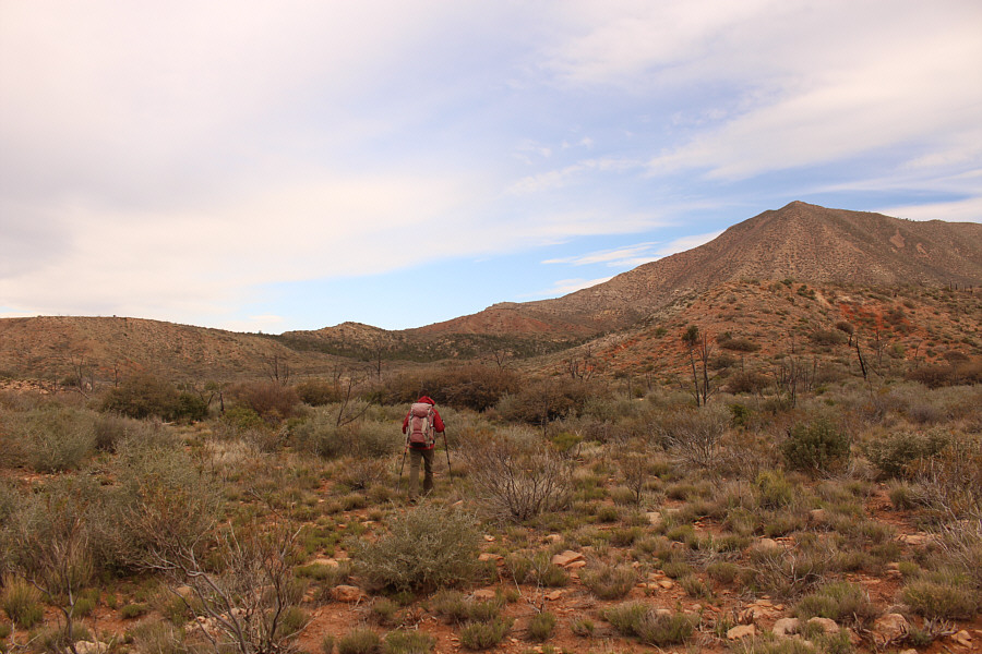
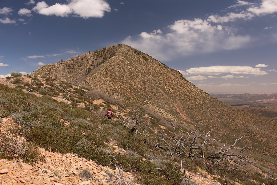
After abandoning the road, Zosia heads cross-country toward the south side of Square Top Mountain.

Lotsa ups and downs! 
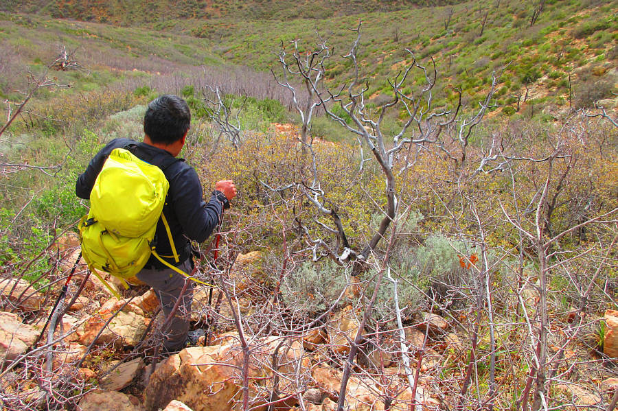
The intervening terrain between the road and the foot of the mountain is more complex than expected.
Finally feels like spring!

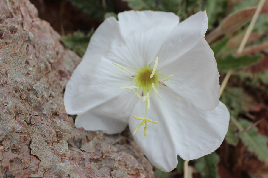
This dune evening primrose is one of many blooming throughout the area.

Get ready for a long uphill grind... 
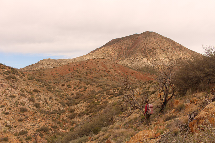
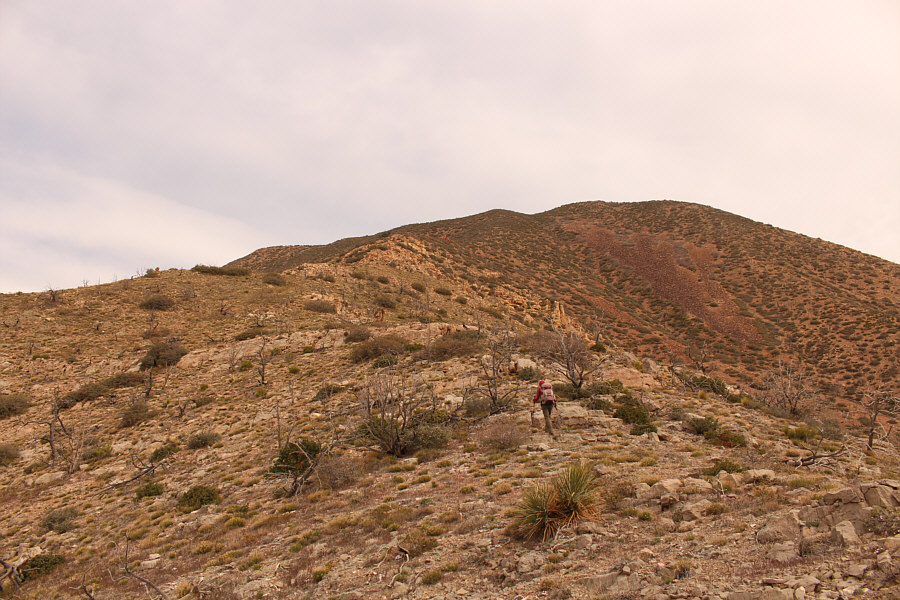
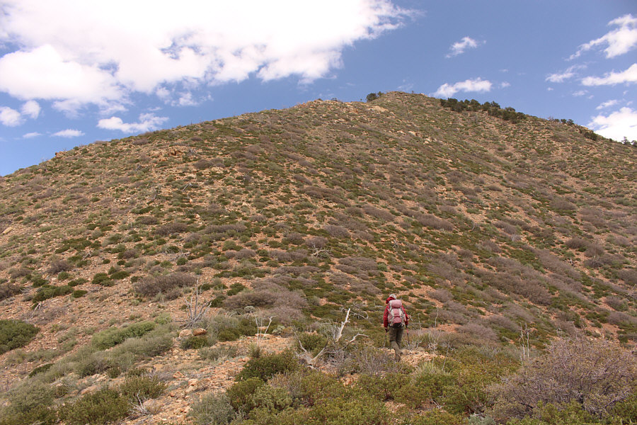
Zosia begins to climb in earnest up the south side of Square Top Mountain.
The red rocks in the background are intriguing... 
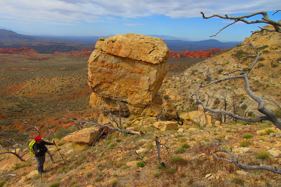
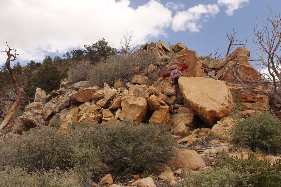
Some striking rock formations help break up the monotony of an otherwise dull ascent.

Photo courtesy of Zosia Zgolak

It's basically a steep grunt! 
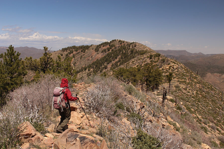
Much of the ascent of Square Top Mountain is nothing more than easy off-trail hiking.
Still not bad compared to what would come later...

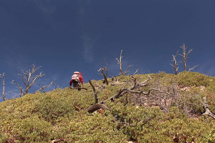
Low bushes near the summit ridge make route-finding a bit more challenging.

Easy finish...thank goodness!

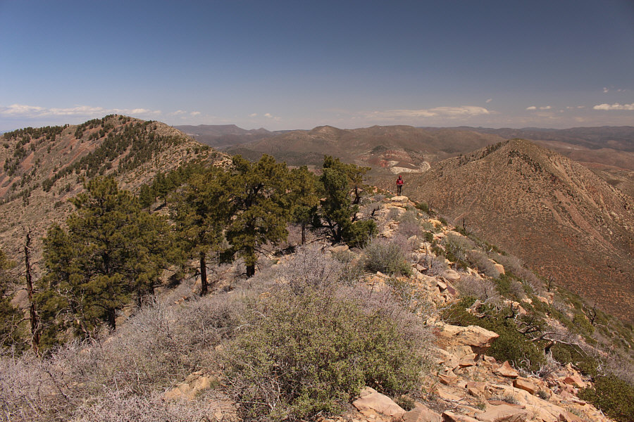
Zosia gains the crest of the ridge and heads westward toward the summit of Square Top Mountain.

R.I.P.

Near the summit, Zosia holds up remnants of a US military aircraft--specifically, a B-52 Stratofortress--which crashed into Square Top Mountain on 11 April 1983 killing all seven crew members.

The actual summit is somewhat bushy and less scenic than this spot.

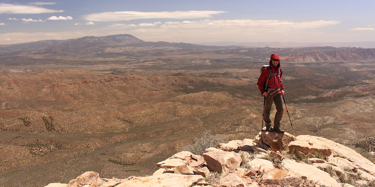
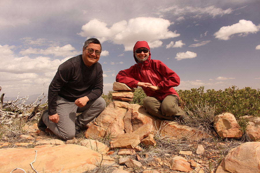
Zosia and Sonny stand near the summit of Square Top Mountain (2141 metres).

When we resumed hiking, Zosia and I backtracked a bit along the summit ridge and climbed over a subsidiary high point before easily traversing to the lower north summit of Square Top Mountain.  From there, we dropped down steep northeast-facing slopes to a double saddle separating Square Top Mountain from Jackson Peak.  The slopes here are rather bushy, but we managed to weave our way down to the saddle without too much grief.  We then grinded our way up Jackson Peak's west ridge which also has a few rocky bits but is otherwise straightforward to ascend.  By the time we reached the summit of Jackson Peak, ominous clouds were rolling into the area, and we stopped only briefly before retreating back down the west ridge.
Because we need to tag ALL the high points on Square Top Mountain!

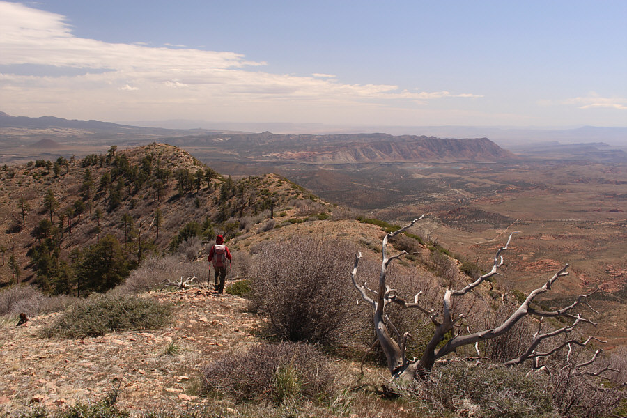
Zosia begins to traverse along the summit ridge of Square Top Mountain.

With a keen eye, you can also spot Veyo Volcano!

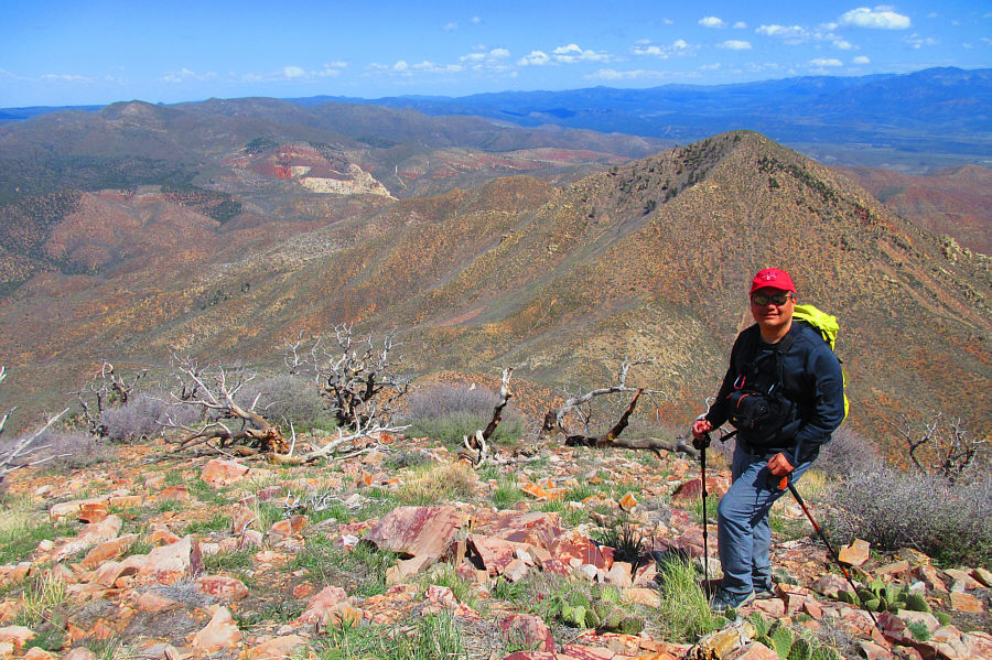
The view to the southeast from this subsidiary high point of Square Top Mountain includes the Pine Valley Mountains on the left horizon.


There is much left to explore here!

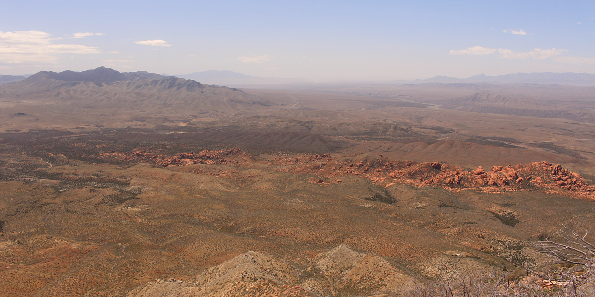
Striking red rocks grab most of the attention to the southwest.  Also visible are West Mountain Peak (far left), Virgin Peak (left of centre on horizon), and Moapa Peak (shark fin on right horizon).


Jackson Peak looks rather innocuous from here... Partway along the traverse of Square Top Mountain's summit ridge, Jackson Peak (right) comes into view.
Someone left a wooden roped ladder here for some strange reason!

Zosia approaches the north summit of Square Top Mountain.

Watch your step around here...lotsa cacti!

Sonny stands just below the north summit (2138 metres) of Square Top Mountain with Jackson Peak looming behind him.

Photo courtesy of Zosia Zgolak

We've come a long way, baby!

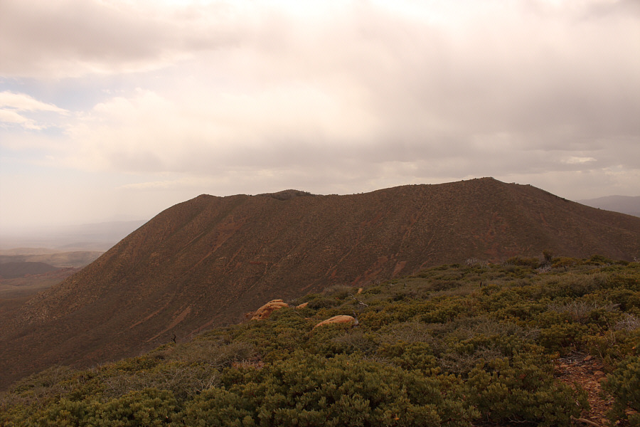
This is looking back at the true summit (right) of Square Top Mountain from the north summit.

The descent is bloody steep!

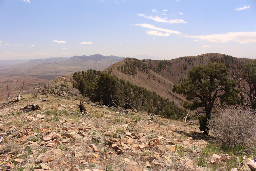
Zosia descends the north side of Square Top Mountain with Flat Top Mountain visible on the horizon at centre.

Nothing comes easy on these peaks it would seem!

Like the approach to Square Top Mountain, getting across the saddle to Jackson Peak is far from trivial.

Steep grunt Part Deux!

The ascent of Jackson Peak's west ridge entails mostly off-trail hiking.

Scrambling!

Partway up Jackson Peak, Zosia has to maneuver through a rocky section.

Second summit of the day!

Sonny and Zosia gather around a small cairn on the summit of Jackson Peak (2072 metres).

Who ordered this crappy weather?

In this view from the top of Jackson Peak, ominous clouds roll over Square Top Mountain.

Partway down the west ridge of Jackson Peak, Zosia and I veered southward aiming for a road--presumably the same one we used to access the area--that we could see on the lower eastern slopes of Square Top Mountain.  Getting to the road would prove to be very problematic though because of the thick bush in the area.  After much heinous bushwhacking, we gravitated toward an obvious drainage which provided some relief from the bush but was still frustratingly tedious to follow due to frequent drop-offs and occasional deadfall.  We eventually left the drainage and simply bulled our way through the thick bush until we intersected the road.  The remaining walk back to our car still felt painfully long, but at least our skin and clothes were no longer getting raked by prickly desert vegetation.

Given the lateness of the day at the conclusion of our hike, Zosia and I opted to stay put and just camp at the pullout for the night.
Arghhhh!

Descending Jackson Peak, Sonny runs into increasingly heinous bushwhacking.

Photo courtesy of Zosia Zgolak

We're not out of the woods just yet...

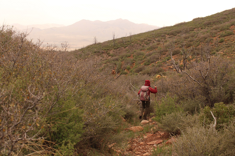
Zosia makes better progress in a drainage, but travel is still tedious here.

Time to turn on the cruise control!

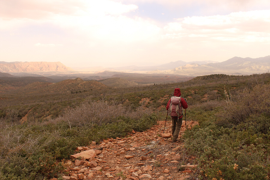
After a lot of miserable bushwhacking, Zosia finally gains the road which would ultimately lead her back to the starting point.

I think I'm ready for bed!

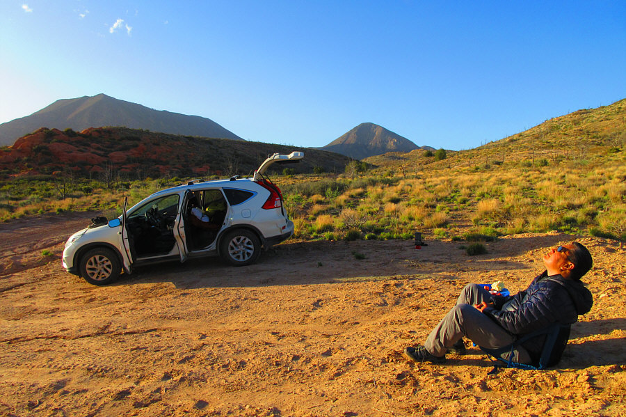
Sonny enjoys dinner and some late-day sunshine after the long hike.

Photo courtesy of Zosia Zgolak
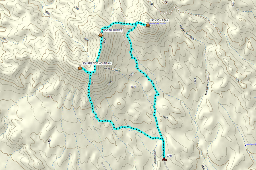
A much more challenging trip than expected... Total Distance:  15.4 kilometres
Round-Trip Time:  9 hours 52 minutes
Cumulative Elevation Gain:  1503 metres

GPX Data