BOU AVENUE
Emory Peak

Kicking off the New Year on 1 January 2023, Zosia Zgolak and I climbed Emory Peak, the highest point in Texas's Big Bend National Park.  As described in the park's website, an excellent trail runs nearly all the way to the top, and consequently, the peak is enormously popular.  Although some hikers opt to spread the ascent over two or more days by utilizing the many backcountry campsites along the way, the peak can be easily climbed in a single day by reasonably fit parties.  The trailhead is located near the Chisos Basin Visitor Center, and all trail junctions are signed.

From Chisos Basin Visitor Center, Zosia and I followed signs for Emory Peak via Pinnacles Trail.  The trail which leaves the west end of the main parking lot takes a rather convoluted route across a small dip and is perhaps not the most efficient way to access Pinnacles Trail.  Regardless, we easily hiked through the dip before passing a signed junction as well as a cut-off trail used mainly by guests staying in nearby cottages.  Once we gained Pinnacles Trail at the next junction, we settled into a fairly long but uncomplicated ascent to a high saddle west of Toll Mountain.  There is an important trail junction at the saddle as well as some bear-proof lockers and a composting toilet.  The lockers provide a convenient place for backpackers to leave extra gear behind while going to tag the top of Emory Peak.  Sadly, the composting toilet is in need of an upgrade or cleaning as it was virtually unusable.

From the saddle, Zosia and I followed Emory Peak Trail which winds its way up the northeast ridge of the mountain and ends at the base of a 7.5-metre high summit block.  At this point, we hugged the base of the summit block and headed to climber's right until we reached an obvious weakness where we could climb up.  There is some mild exposure going up to the top, but overall, the route is nothing more than an easy Class 3 scramble.  The summit is a bit cluttered with antenna equipment, and it can become crowded if a lot of people top out at the same time.  Fortunately, we had enough space to snap some photos and even take a short break.

When Zosia and I were ready to descend, we carefully retreated back down the same way we came up.  We had no problems getting off the summit block safely, and once we regained the trail, we enjoyed a trouble-free walk back to the saddle and subsequently down Pinnacles Trail.  Near the trailhead, we opted to take the cut-off trail and walk down the road past all the cottages.  This is a more direct and efficient route back to the main parking lot than the trail through the dip that we took in the morning.
Nice to be hiking after a long drive in the morning to get here. Zosia passes an important junction near the start of the hike.  Emory Peak is visible straight ahead.
Both are apparently easy scrambles.

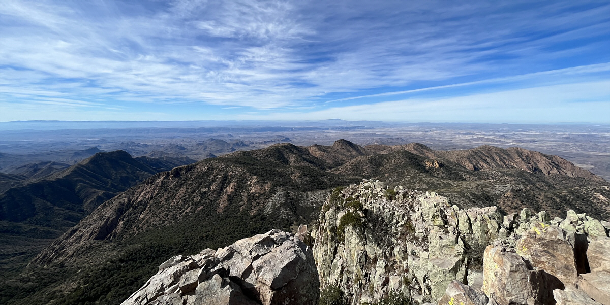
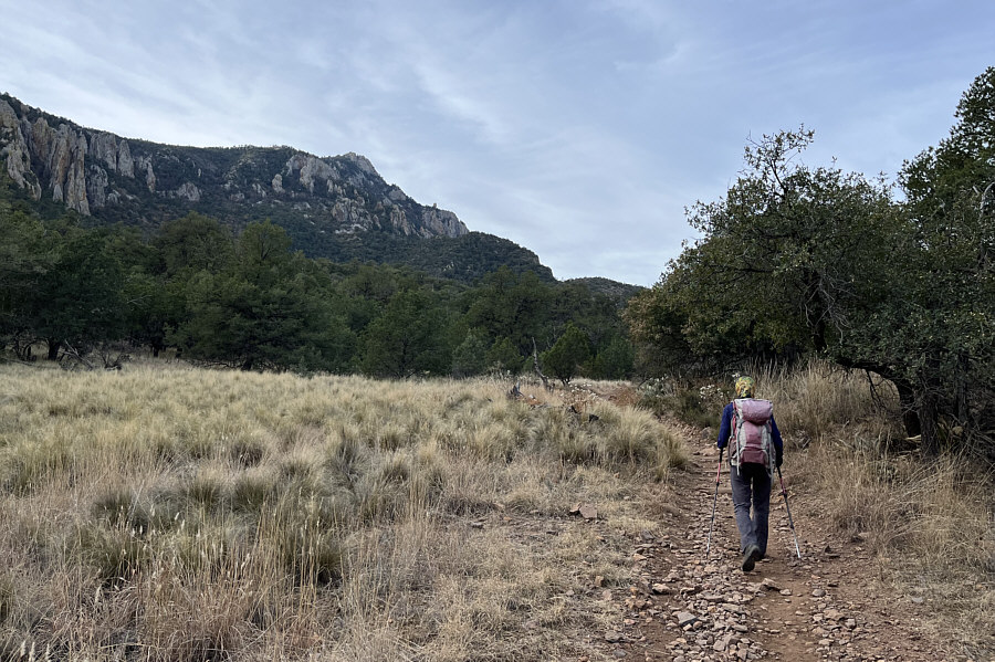
The east side of the basin is guarded by Casa Grande Peak (far left) and Toll Mountain (far right).

Some folks camp in these meadows, but water usually has to be carried in. Here is another view of Emory Peak from a grassy meadow.  The trail eventually climbs up to a saddle on the ridge at far left.
Similarto whiskeyjacks in the Canadian Rockies.

Mexican jays are ubiquitous in the area.

Photo courtesy of Zosia Zgolak

Definitely not what comes to mind when people think of Texas! Zosia passes some striking pinnacles along the trail.
The disgusting composting toilet needs to be buried permanently!

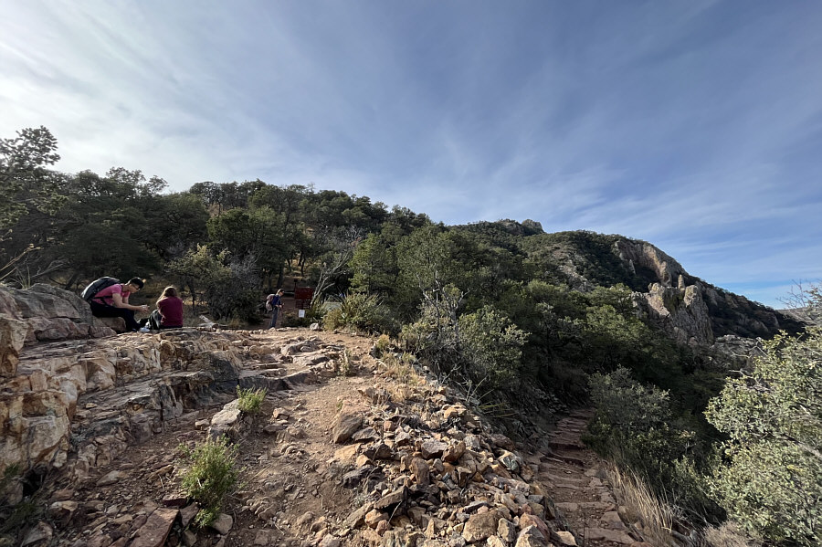
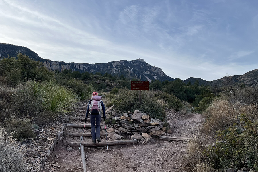
Zosia arrives at the saddle on the ridge crest.  There are bear lockers and a composting toilet nearby.

Still a lot of winding trail ahead of us... The summit block of Emory Peak is farther away than it appears.
Casa Grande Peak looks like a big molar!

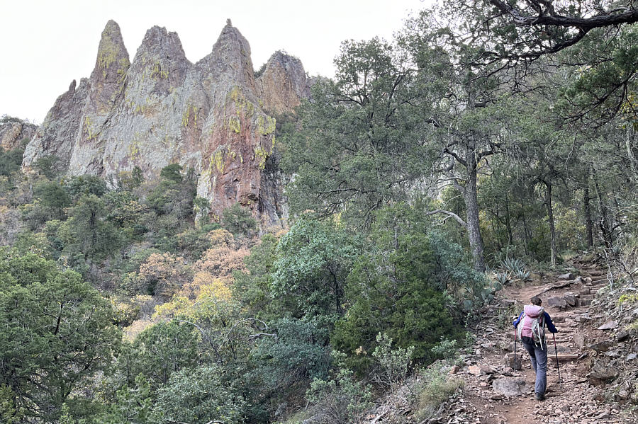
Along a switchback, Zosia gets another view of Casa Grande Peak in the distance.

Very close...and getting steeper too! Zosia is on the final approach to the summit block.
This is where the fun begins!

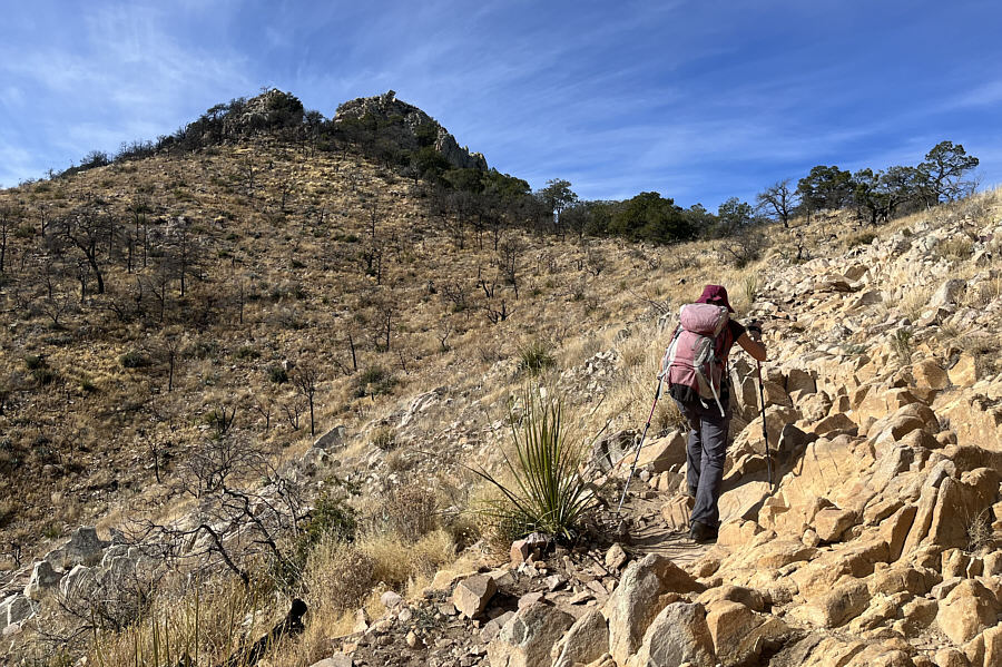
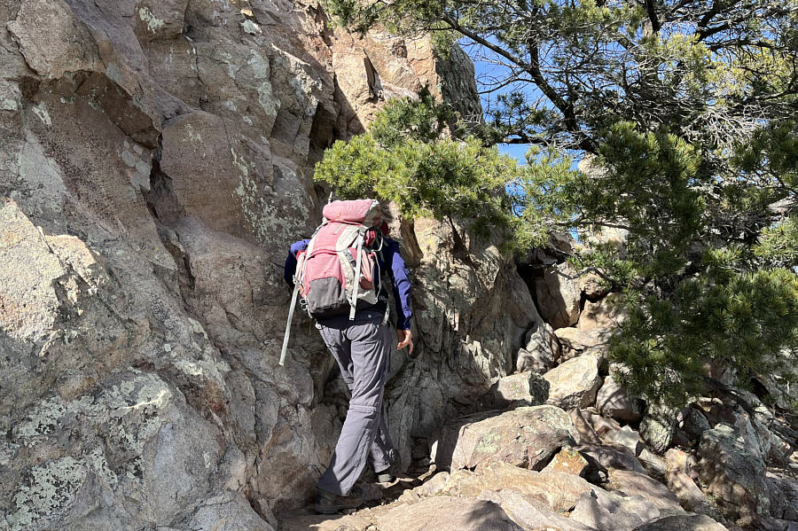
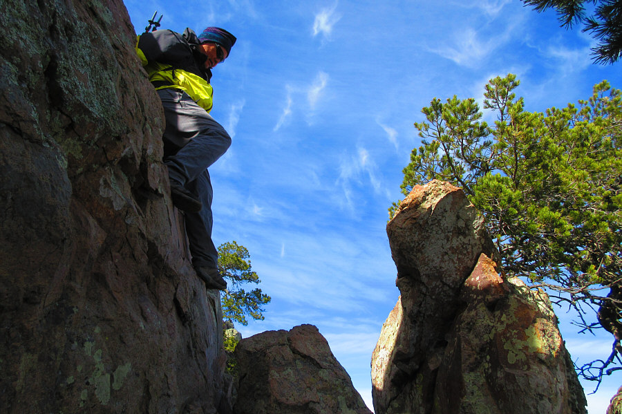
At the base of the summit block, Zosia heads to climber's right under a tree.

Some mild exposure but pretty easy. Zosia scrambles up the northeast side of the summit block.
Crown Mountain must be quite technical--no recorded ascents on peakbagger.com!

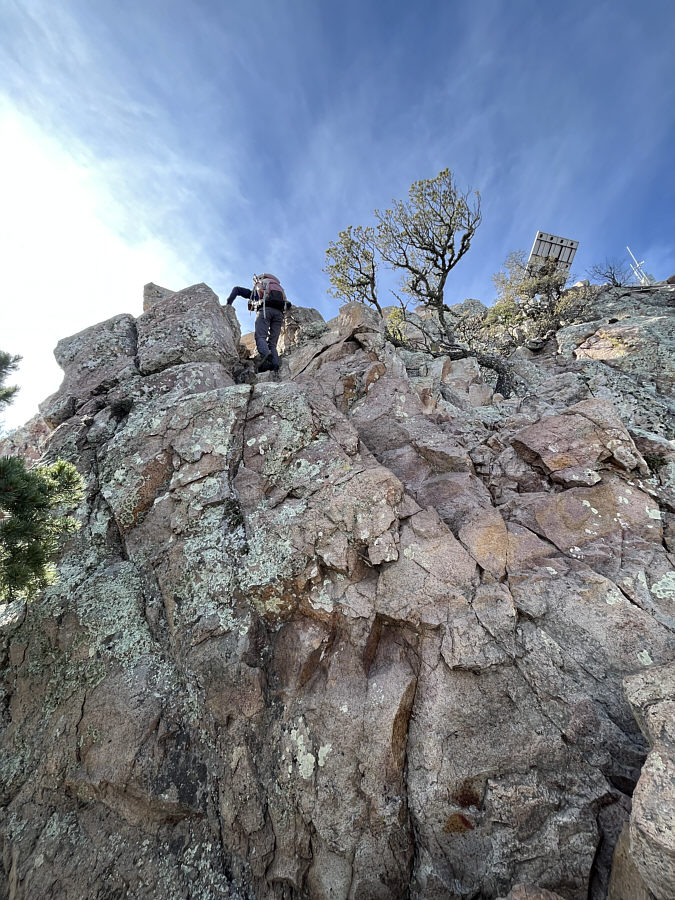
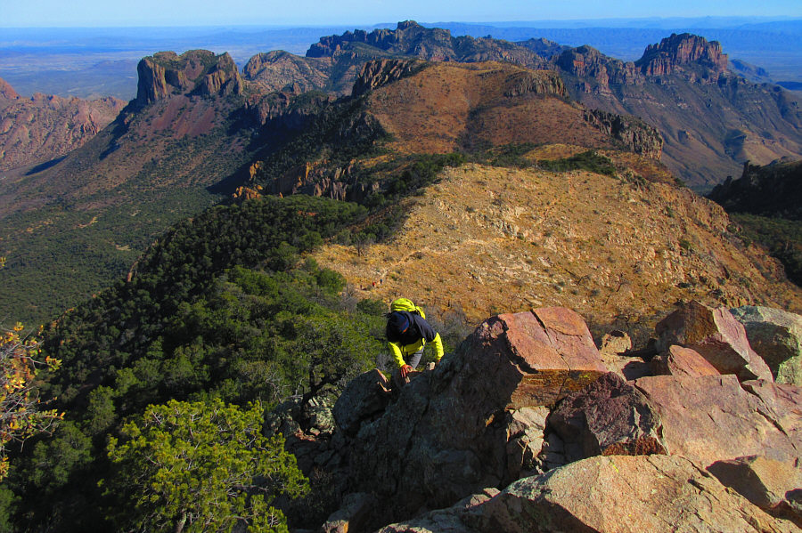
Sonny scrambles up the summit block.  At far right is Crown Mountain.

Photo courtesy of Zosia Zgolak

Happy New Year!

Zosia and Sonny reach the summit of Emory Peak (2384 metres).


Can't find any beta for Sierra Rica...

In this view to the west, Santa Elena Canyon is barely visible at centre as a cleft in the distant escarpment.  The bump on the horizon right of centre is Mexico's Sierra Rica.


Looks a bit awkward! Zosia carefully descends the summit block.
Making it look more dramatic than it really is! Sonny stretches for the next foothold near the bottom of the crux.

Photo courtesy of Zosia Zgolak

The last few switchbacks felt a bit long-winded at the end of the day! Here is one last look at Emory Peak as Zosia hikes back along the trail in the warm afternoon sun.
A deservedly popular hike with some fun scrambling to get to the summit. Total Distance:  16.3 kilometres
Round-Trip Time:  7 hours 16 minutes
Net Elevation Gain:  736 metres

GPX Data