BOU AVENUE
Florida Peak

On 4 January 2023, Zosia Zgolak and I climbed Florida Peak located in the Florida Mountains southeast of Deming, New Mexico.  This isolated but rugged range is largely unknown and undeveloped, but Florida Peak does attract a fair share of attention from die-hard peak baggers.  As reported in several online trip reports, a separate unnamed pinnacle north of Florida Peak's gazetted summit has now been determined to be the true high point of the range.  For clarity, I refer to Florida Peak's gazetted summit as the South Summit and the unnamed pinnacle as the North Summit.  The usual ascent route follows a 4WD road through Windmill Canyon and up a scrubby drainage east of both summits.

From Highway 549, turn south onto Highway 143, 6.6 kilometres east of the interchange with East Pine Street in Deming or 22.0 kilometres west of the interchange with I-10 at Exit 102.  Stay on the main paved road and drive 9.0 kilometres to a junction with Highway 198.  Turn right (straight leads to Rockhound State Park) and drive 1.1 kilometres to a 5-way junction.  Leave the pavement and go straight onto the rightmost of three gravel roads (okay for 2WD vehicles).  Ignore all side roads and drive 2.7 kilometres to what appears to be a private ranch gate (should be open).  Go through the gate and drive for another 1.4 kilometres to a junction with a rough 4WD road heading west toward the Florida Mountains.  Turn onto the 4WD road and park in a large pullout near the junction or continue driving as far as possible (high clearance strongly recommended).

From the pullout, Zosia and I walked the 4WD road which enters Windmill Canyon and ends at some old water tanks.  An intermittent trail continues along the north side of the bushy drainage, but it is not always easy to follow.  About 600 metres beyond the water tanks, the drainage splits, and we veered toward the left-hand valley following the path of least resistance through moderate bush.  Occasional cairns reassured us that we were on the right track.  Where the terrain begins to steepen toward the back of the valley, we began ascending snow-covered talus slopes aiming for the South Summit.  Although we had a brief reprieve from bushwhacking, the vegetation closed in again as we neared the top.  We circumvented some cliff bands guarding the summit block by traversing a bit to climber's left, but even then, climbing the last few metres was quite challenging due to thick bush and slippery footing.
I probably could have driven further up this road in our rental Toyota 4-Runner. Zosia starts hiking along a 4WD road toward the Florida Mountains.
Doesn't look that bad from here...

Both the South and North Summits can be seen through Windmill Canyon.

The yellow fruits are apparently edible. While ascending a drainage, Sonny passes a fruit-bearing cholla.

Photo courtesy of Zosia Zgolak

Zosia looks happy enough regardless!

Although not technically difficult, the off-trail thrash up the drainage is still wearisome.

It only gets tougher from here! The slope becomes steeper as Zosia approaches a prominent rock outcrop.  This rock outcrop would be an important landmark on the descent.
Nothing comes easy on this mountain!

The bushiness of the upper mountain adds plenty of route-finding challenges.

Seemed like it took a lot of blood, sweat and tears to get up here, and this is the EASIER summit! Sonny and Zosia stand atop Florida Peak's South (gazetted) Summit (2266 metres).

Might be worth coming back here someday to tag some of the peaks at the south end of the range.

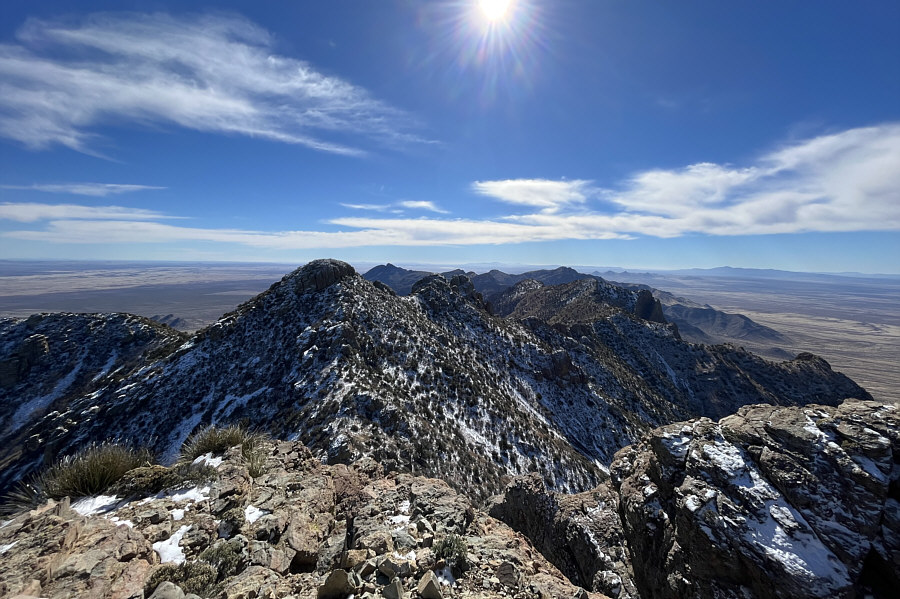
The rest of the Florida Mountains stretch away to the south with Gym Peak visible at left.


Kinda looks lower from here...

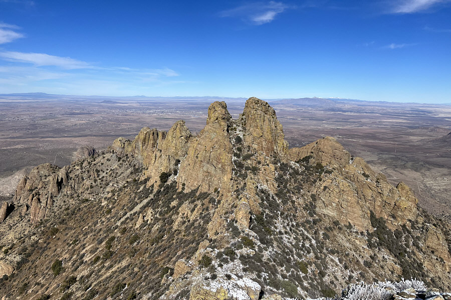
This is looking at the North Summit (right of centre) which is separated from a subsidiary pinnacle to the west by a high col.

Looks like a whole lot of empty space!

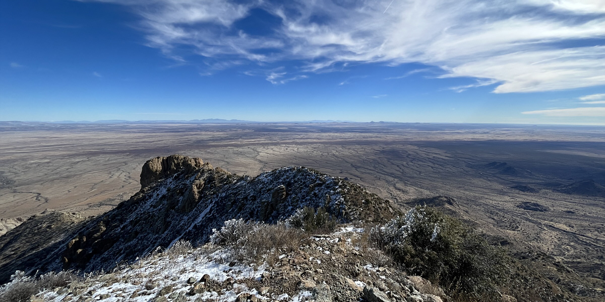
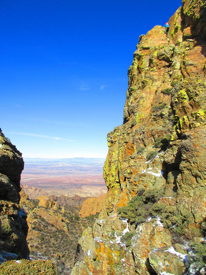
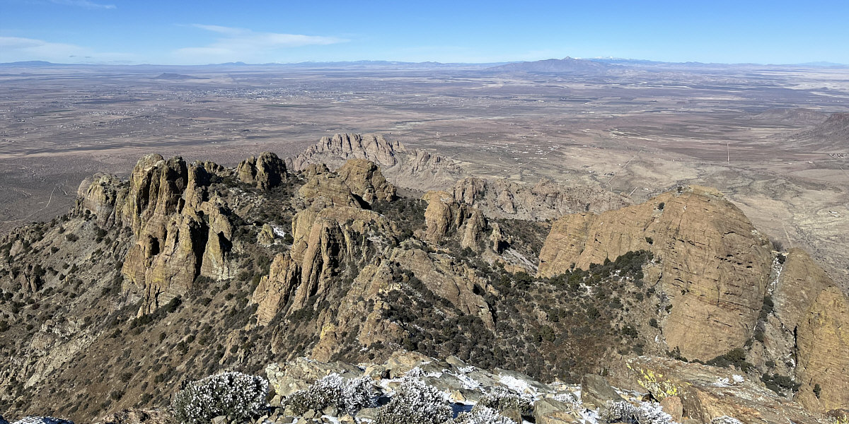
Although the vast plain to the east is mostly featureless, the Organ Mountains (left) and Franklin Mountains (right of centre) can still be discerned on the horizon.


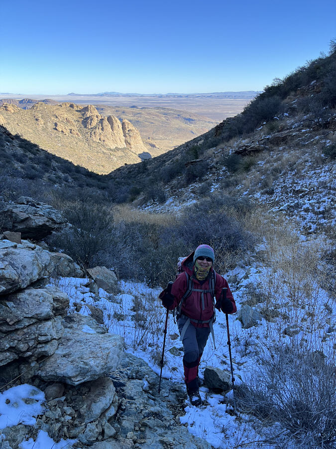
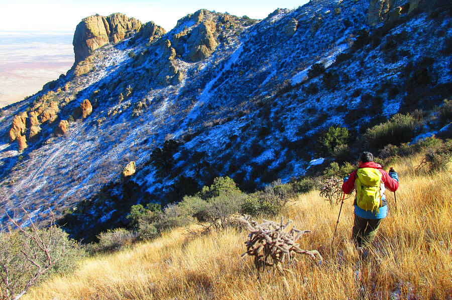
Upon reaching Florida Peak's South Summit, Zosia and I took a short break before setting off for the North Summit.  We backtracked a bit to bypass the cliff bands guarding the South Summit and then endured some unpleasant side-hill thrashing to reach the connecting ridge.  Traversing this ridge was far from trivial for us and entailed more route-finding and bushwhacking before we finally reached a high col separating the North Summit and a subsidiary pinnacle to the west.  Zosia opted to wait for me at the high col while I scrambled 
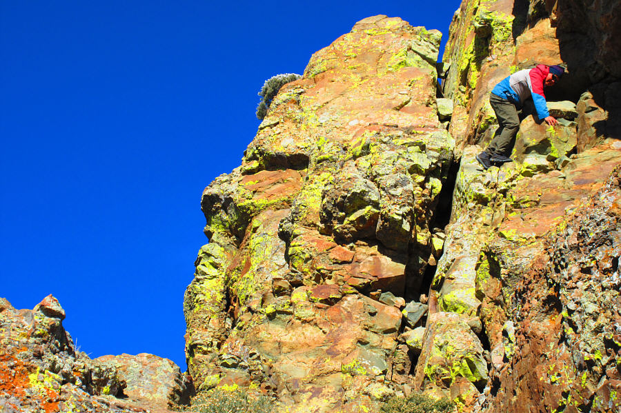
up a series of exposed ledges and cracks on the west side of the North Summit.  This is the crux which I would rate as mostly Class 3 with one tricky spot that could be rated as Class 3+ or 4.  Despite all the snow we encountered on the upper mountain, the crux was thankfully dry on this day, and I enjoyed a fairly straightforward climb to the top of the North Summit.

After signing the summit register and snapping a few photos, I carefully retreated down the crux.  I did not have any problems with the Class 3 sections, but the aforementioned tricky spot gave me pause because I did not fully trust the handholds there.  Fortunately, I managed to down-climb the tricky spot without incident and soon rejoined Zosia for a well-deserved snack break.

For our descent, Zosia and I dropped back down from the high col to the connecting ridge, but instead of returning to where we originally ascended the South Summit, we descended steep grassy slopes below the North Summit in hopes of bypassing some of the unpleasant terrain we encountered on the way up.  This worked well initially, but unexpected cliff bands lower down forced us into a short-lived but anxious bushwhacking traverse back to our original line of ascent.  We felt a measure of relief when we finally stumbled onto our up-track, and apart from a few minor route-finding errors, we made our way down the drainage to the water tanks without too much grief.  The walk out along the 4WD road back to our car was uneventful.
Bushes and pinnacles here are a real pain in the ass! 
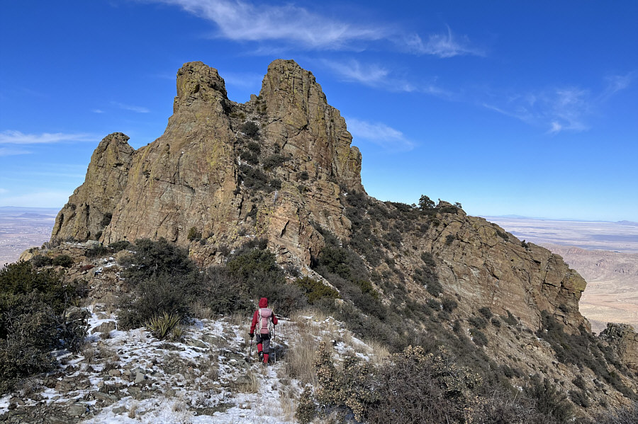
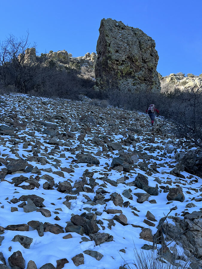
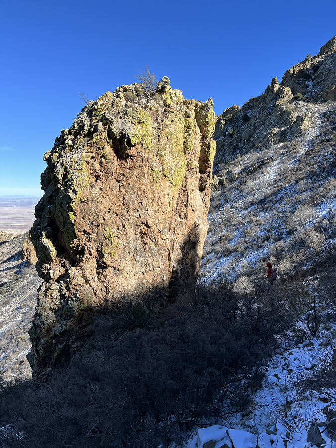
The approach to the North Summit is more problematic than it appears.
Be careful of all the loose rocks here!

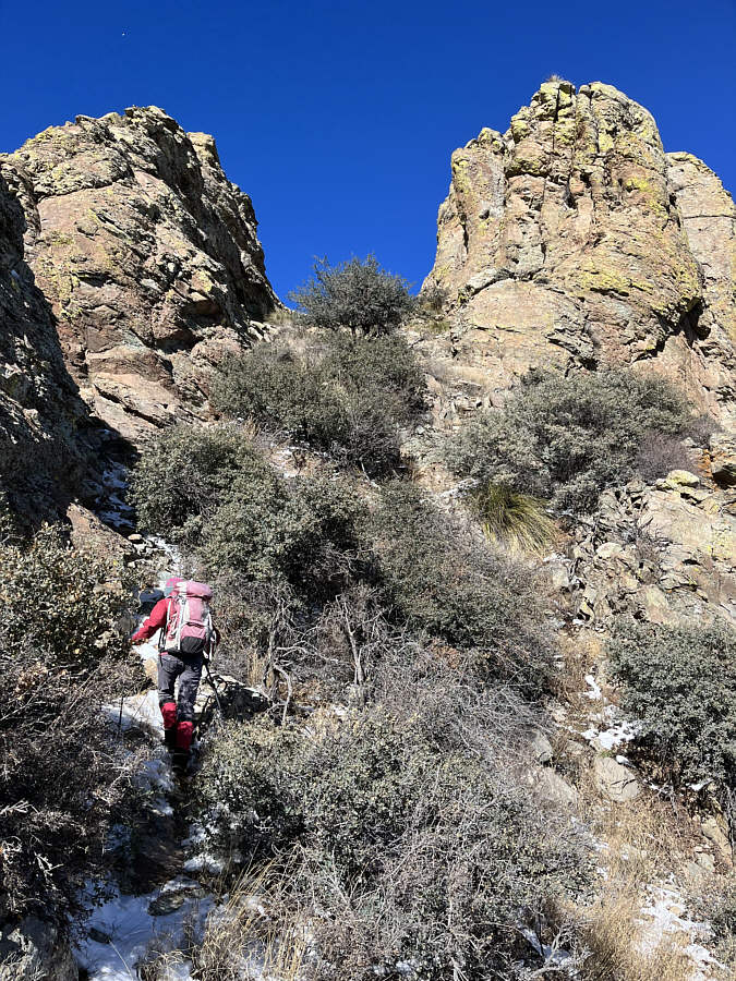
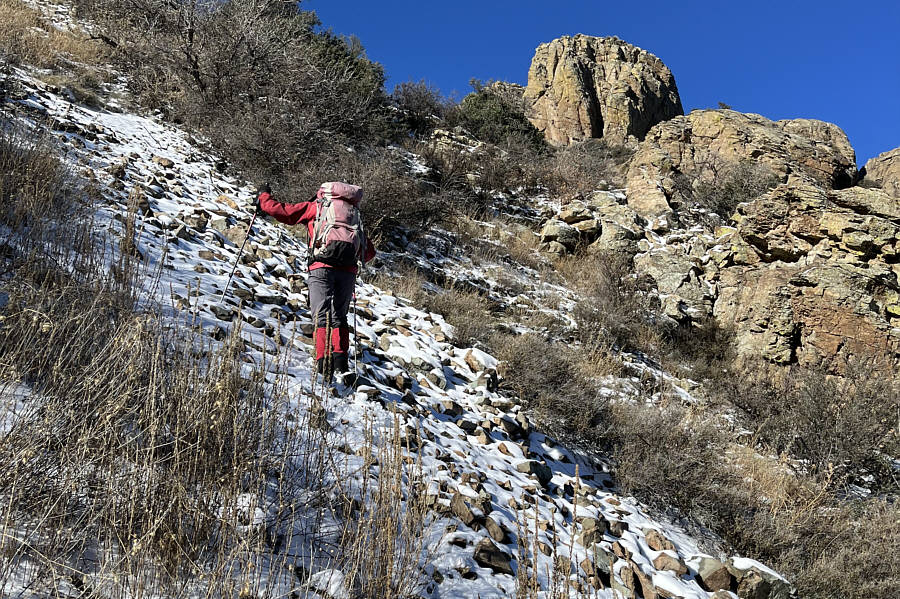
Zosia ascends a steep and loose ramp leading to the high col below the North Summit.

I'm right at the trickiest spot here--probably Class 4. 
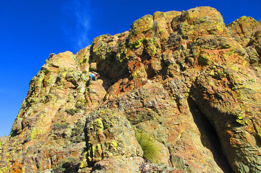
Sonny climbs up the crux on the North Summit.

Photo courtesy of Zosia Zgolak

Yikes! That's quite the drop!

Here is a more comprehensive view of the crux.

Photo courtesy of Zosia Zgolak

I was so thrilled that I totally forgot to take a photo of myself on top! 
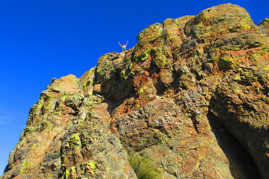
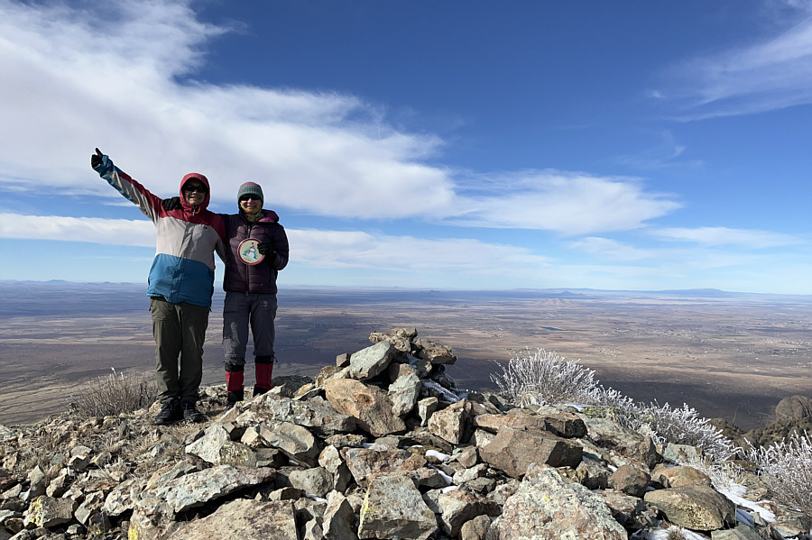
Sonny reaches the top of Florida Peak's North (true) Summit (2272 metres).

Photo courtesy of Zosia Zgolak

Still better than PVC pipes or Nalgene bottles! 
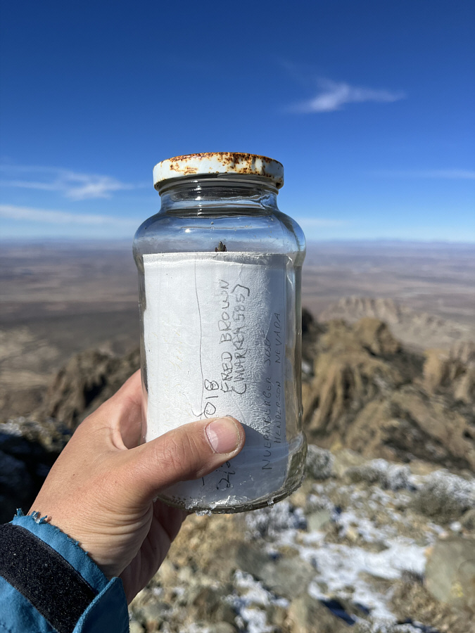
The North Summit's register is contained in a glass jar.
Kinda looks higher from here...

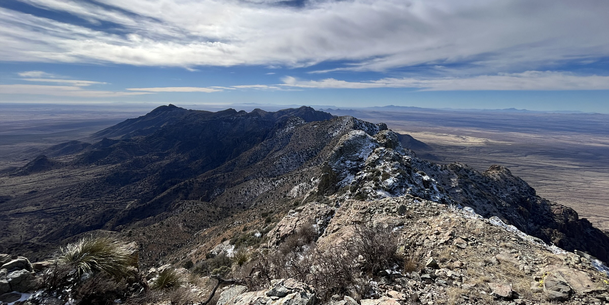
This is looking back at the South Summit (left of centre) from the North Summit.

Cookes Peak just went on my future to-do list!

Notable landmarks to the northwest include Capitol Dome (farthest left of the pinnacles in the foreground), Dragon Ridge (left of centre beyond the pinnacles), and Cookes Peak (right horizon).


Once again, this was the trickiest spot since I didn't fully trust the handholds here. Sonny carefully descends the crux.

Photo courtesy of Zosia Zgolak

I had no scrambling mojo left for the window! 
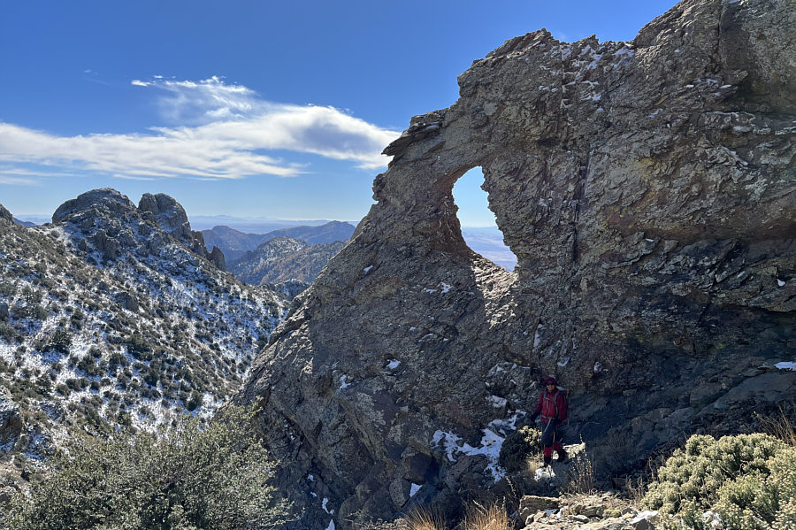
Zosia stands below a natural window near the high col.
Not as easy as it looks to go from here to there! Sonny descends a steep grassy slope aiming for the sunlit rock outcrop at bottom left.

Photo courtesy of Zosia Zgolak

Mostly simple backtracking from here!

Zosia regains her up-track at the sunlit rock outcrop.

We can mentally put ourselves on cruise control now!

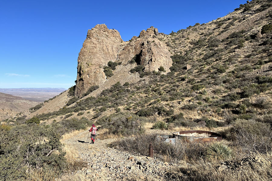
Zosia regains the 4WD road at some dilapidated water tanks.
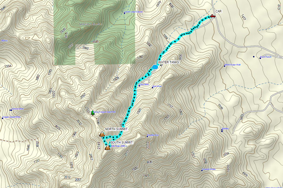
A challenging but also rewarding scramble. Total Distance:  8.7 kilometres
Round-Trip Time:  7 hours 52 minutes
Cumulative Elevation Gain:  ~930 metres

GPX Data