Taking advantage of a favourable weather
forecast on 12 April 2023, Zosia Zgolak and I ascended Pyramid Mountain
near Lake Crescent in Washington's Olympic National Park. Pyramid
Mountain is easy to access and has a good trail most of the way to the
top. As such, it makes for a great early-season hiking objective
when most higher peaks in the vicinity are still covered with snow.
While the mountain can be ascended year-round, a short section of trail
wiped out by a landslide would be tricky to traverse in wet or snowy
conditions.
From Highway 101, turn north onto Camp David Junior Road about 47
kilometres east of Forks or 40.0 kilometres west of the intersection with
South Bean Road in Port Angeles. Drive eastward for 5.2 kilometres
to the trailhead parking area with vault toilet.
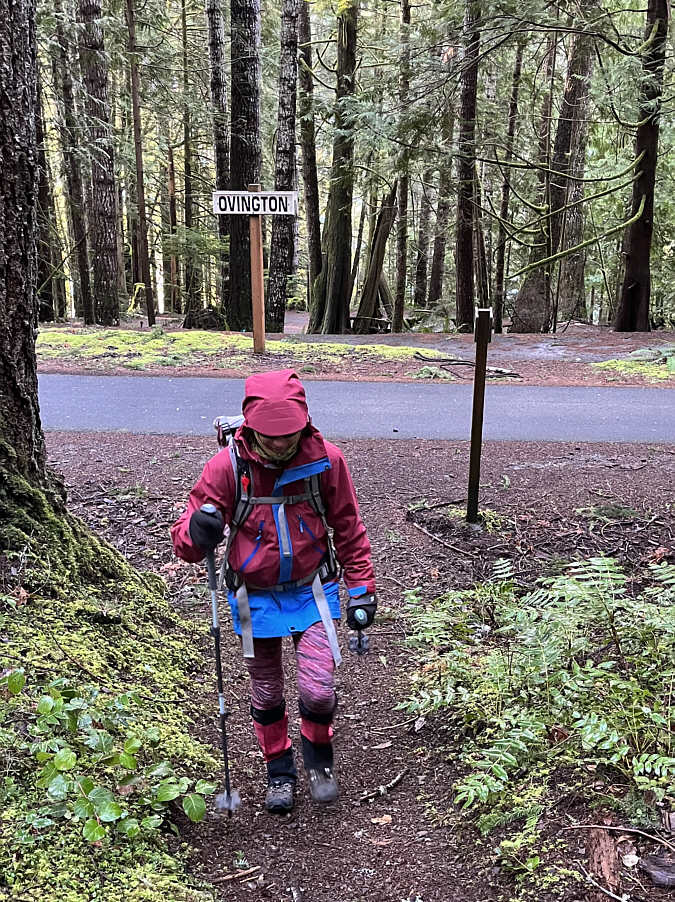
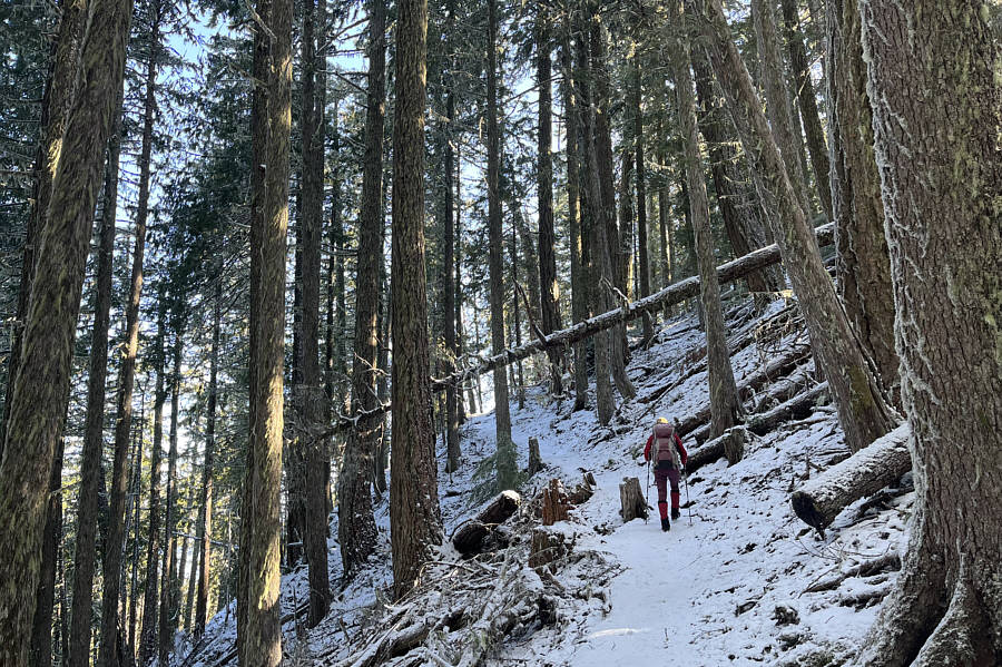
From the parking area, Zosia and I followed the well-maintained trail
which crosses both the access road and a paved section of the Spruce
Railroad Trail. We soon settled into a long and steady climb
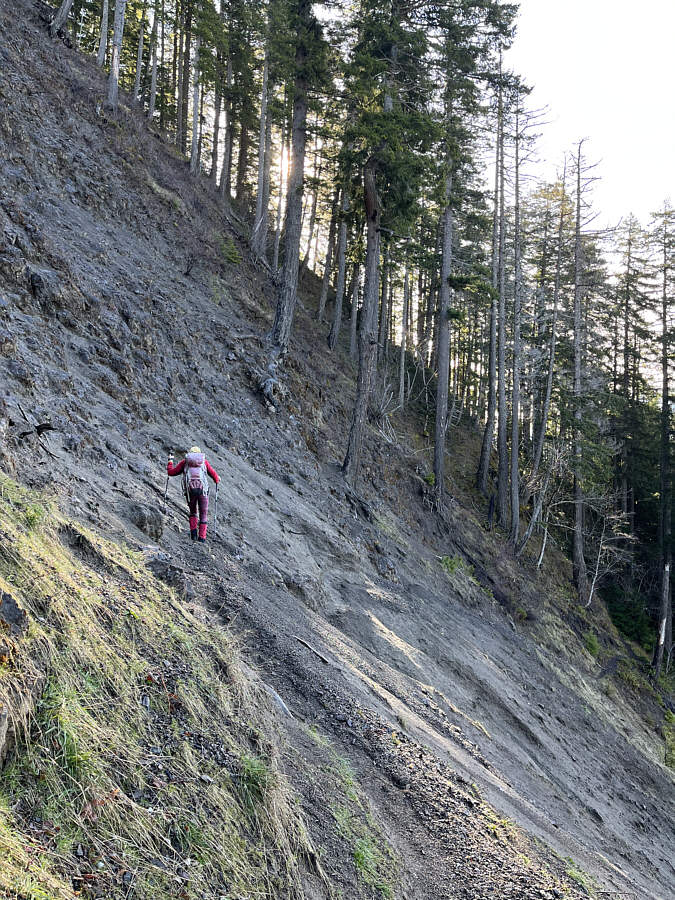
through mostly viewless forest. About 2.9 kilometres from the
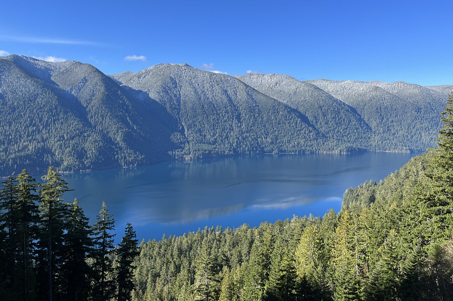
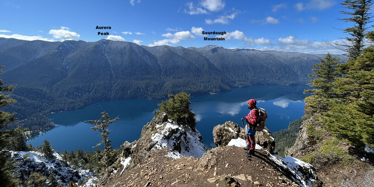
trailhead, we reached the aforementioned landslide which ironically
granted some nice views of Lake Crescent. We had no problems
traversing the beaten path that has developed across the landslide, but
the looseness and steepness of the terrain was still a little unnerving
even with the dry conditions we had. Past the landslide, we began
encountering snow as we gained the crest of Pyramid Mountain's west
ridge. Fortunately, the snow was not too deep or icy, and we only
had to contend with a few muddy sections as we climbed the remainder of
the trail to the summit which is topped by an empty hut.
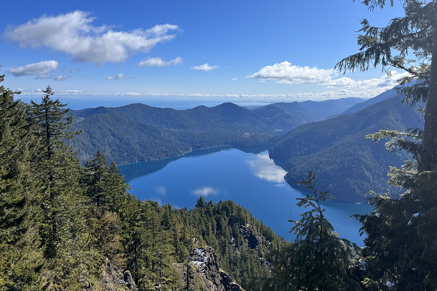
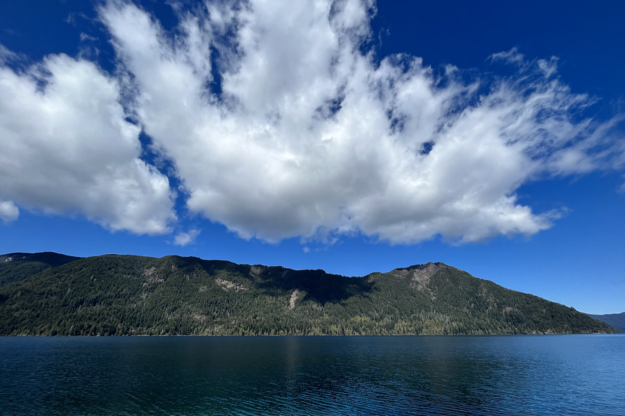
Far-reaching views from the summit are disappointingly limited due to
tall trees blocking much of the panorama especially to the west and
north.
After stopping for a short break atop of Pyramid Mountain, Zosia and I
backtracked along the trail for about 100 metres and took a quick detour
for a marginally better view of Lake Crescent. We then returned to
the main trail and retraced our steps down the mountain. Although
we traversed the landslide section again without incident, we did notice
some loose dirt tumbling at random from above. It is a bit
surprising that the National Park Service has not yet re-routed this
increasingly dangerous section of trail. The remainder of our
descent was uneventful.
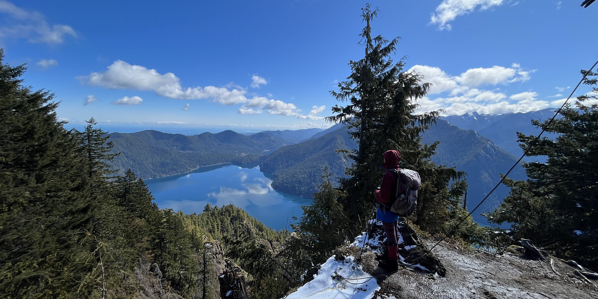
Here is a more comprehensive view eastward from the summit.
This scenic clearing about a hundred metres west of the
summit can be reached via a faint spur trail.
With a lot of daylight left, Zosia and I next drove to Salt
Creek Recreation Area on the north coast of the Olympic Peninsula to hike
up Striped Peak. Other than navigating the numerous trails and
logging roads that crisscross this diminutive mountain, there are no
technical difficulties with the ascent. Unbeknownst to us before
the hike, this area was once a World War 2 military camp, and some of the
infrastructure remain on the mountain.From Highway 101, turn north onto Highway 112 about 82
kilometres east of Forks or 5.0 kilometres west of the intersection with
South Bean Road in Port Angeles. Drive westward for 12.0 kilometres
and turn north onto Camp Hayden Road. Drive 5.6 kilometres to a
Y-junction and keep right. Drive 220 metres to a gate for the Salt
Creek Campground. The day use parking lot and trailhead for Striped
Peak is on the right just past the gate. If needed, toilets can be
found in the campground further down the road.
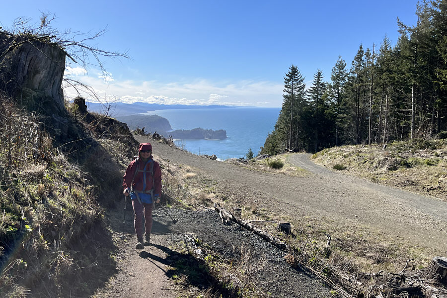
Starting from the trailhead at the day use parking lot, Zosia and I
hiked eastward on Striped Peak Trail for about 700 metres before turning
right at a signed junction with Bunker Ridge Trail. This trail
makes numerous switchbacks up the northwest ridge of Striped Peak, and
along the way, there is a limited viewpoint with a bench as well as a
creepy World War 2 bunker. The trail intersects a gravel road at
the bunker but then diverges again on the north side of the mountain
(look for hiker signs). We eventually crossed the same road higher
up and followed a spur trail which essentially makes a loop around the
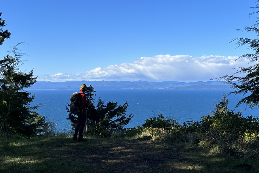
summit block. Although the actual high point is located within a
rather nasty tangle of trees and bushes, some clear-cuts along the loop
grant fairly satisfying views of nearby Crescent Bay and the Strait of
Juan de Fuca.
When we had our fill of ocean breeze, Zosia and I returned to the road
and followed it back to the bunker where we again picked up the Bunker
Ridge Trail. Retracing our steps, we descended back to the
trailhead without any problems.
 |
Zosia starts hiking from the Striped
Peak trailhead. |
 |
Partway up Bunker Ridge Trail is this bench and picnic area with limited
views of the Strait of Juan de Fuca. |
 |
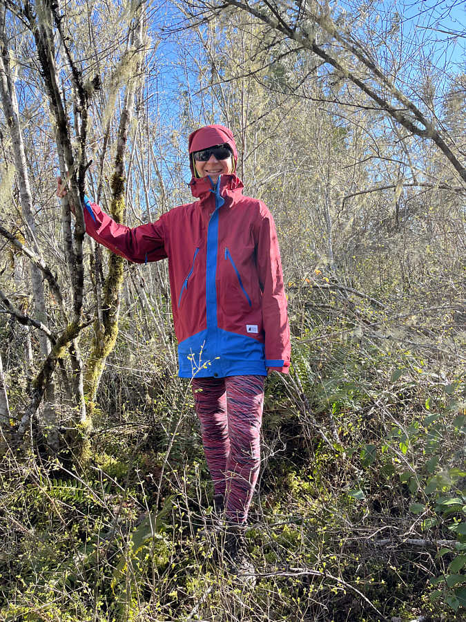
Zosia feels some trepidation about exploring this World War 2 bunker
located along the Bunker Ridge Trail. |
 |
This is the only chamber in the surprisingly large bunker that has an
opening which lets in ambient light. |
 |
This clearing above the bunker grants a nice view of Vancouver Island
across the Strait of Juan de Fuca. |
 |
Zosia picks up a spur trail which provides access to the summit.
The gravel road at right leads back to the bunker. |
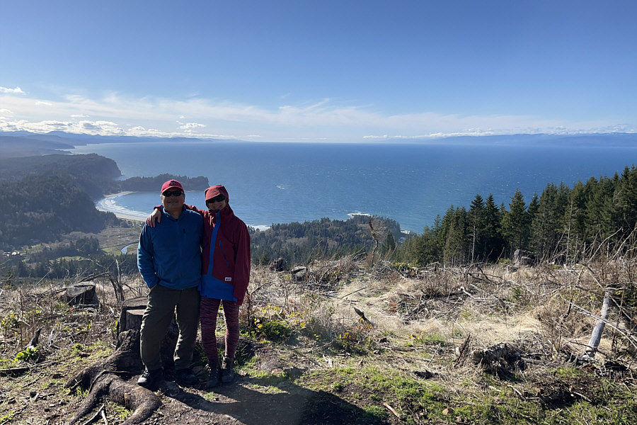 |
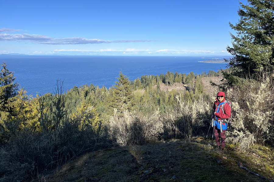
Sonny and Zosia stand on the edge of a clear cut near the top of Striped
Peak. Behind them is Crescent Bay and the Strait of Juan de Fuca. |
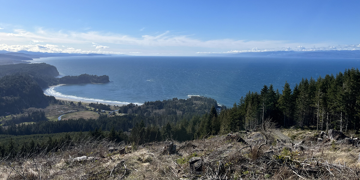
Here is an unobstructed view of Crescent Bay from the
same clear cut.
 |
Zosia stands more of less on the true summit of Striped Peak (345 metres)
in a nasty tangle of trees and bushes. |
 |
More of the Strait of Juan de Fuca can
be seen from this clearing on the northeast side of the summit. |
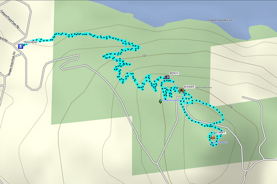 |
Total
Distance: 7.8 kilometres
Round-Trip Time: 2 hours 38 minutes
Net Elevation Gain: 313 metres
GPX Data |