BOU AVENUE
Mount Rose
Wrapping up our spring tour of Washington's
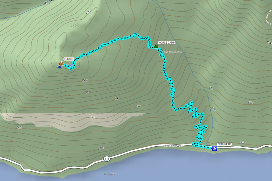
Olympic Peninsula on 14 April 2023, Zosia Zgolak and I hiked up Mount Rose located near
Lake Cushman in Mount Skokomish Wilderness. Easy access and its
relatively modest height make Mount Rose one of the more popular
year-round hiking objectives in the Olympic Mountains. For many
locals, the ascent is the equivalent of Vancouver's Grouse Grind. A
well-maintained trail runs all the way to the summit, but snowy
conditions are likely to be encountered during winter and spring.
As such, Zosia and I brought along our ice cleats for this trip.
Turn onto SR 119 off Highway 101 at the village of Hoodsport.
Drive 15.0 kilometres to a T-intersection and turn left. Drive
another 4.5 kilometres to the turnoff for the Mount Rose trailhead.
The parking lot with a portable toilet is about 120 metres further.
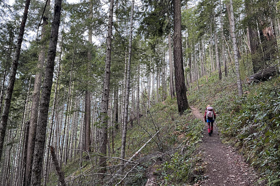
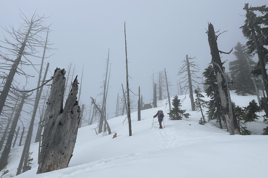
Starting from the signed trailhead, Zosia
and I headed westward crossing a bridge over a boisterous side creek
before commencing a steady ascent up the well-maintained forested trail.
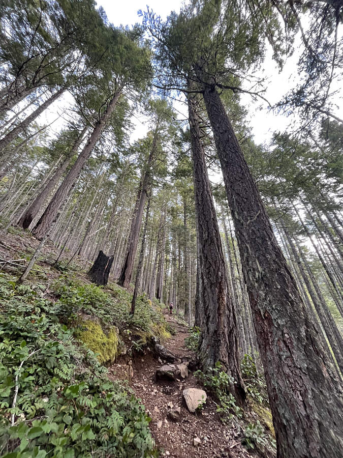
There was nothing complicated about this initial part of the ascent, but
the viewless trail is also not particularly inspiring. As we
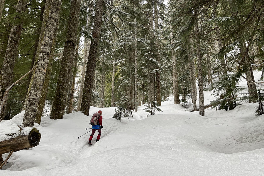
climbed higher, we began encountering more and more snow, and by the time
we reached a horse camp at an elevation of about 900 metres, most of the
terrain was pretty much snow-covered. The horse camp is also a junction
where the trail splits, and while it is possible to combine the two
separate trails into a loop, it appeared that most previous hikers had
simply opted to go out-and-back on the more direct left branch. We
donned our ice cleats here and followed suit feeling very thankful for
the broken trail which led us unwaveringly up to the summit. The
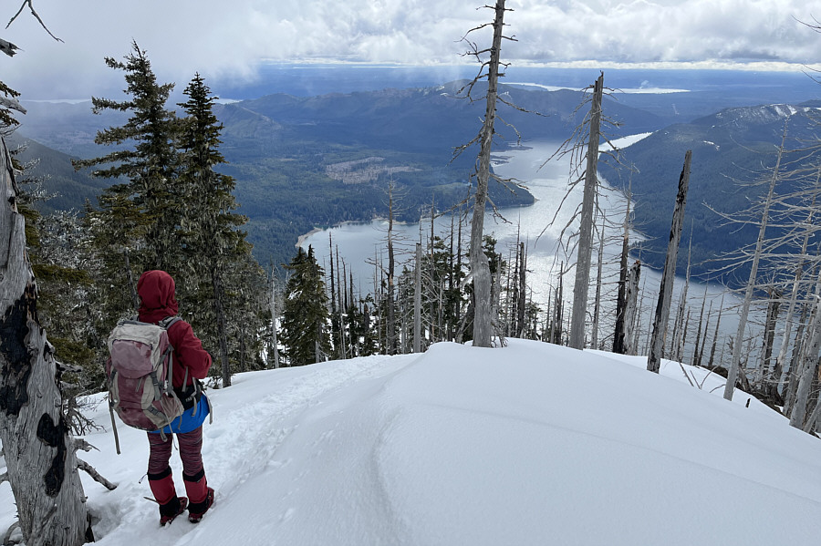
summit is partially treed, but there is a small rock outcrop nearby that
grants some far-reaching views when the weather is clear.
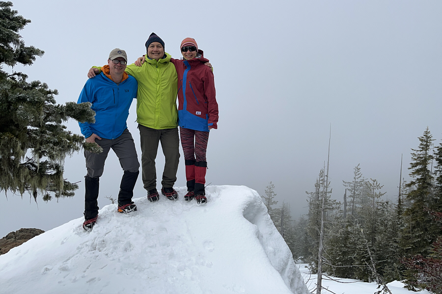
A few minutes after Zosia and I arrived
at the summit, we were a little surprised to see another hiker come up
behind us. This hiker's name was Andrzej, and we quickly learned
that he was originally from Poland but was now living in nearby Tumwater.
We had a long and engaging conversation with Andrzej who has climbed
Mount Rose several times. Before departing the summit, Andrzej
invited us to contact him if we ever return to the area to do more
hiking. Zosia and I saw several more hikers on this day, but
Andrzej would be the only one that we would connect with.
For our descent, Zosia and I simply
retraced our steps down the mountain with very few difficulties.
While the ascent had taken us a little more than 3 hours, we managed to
get back down to the trailhead in about half that time.
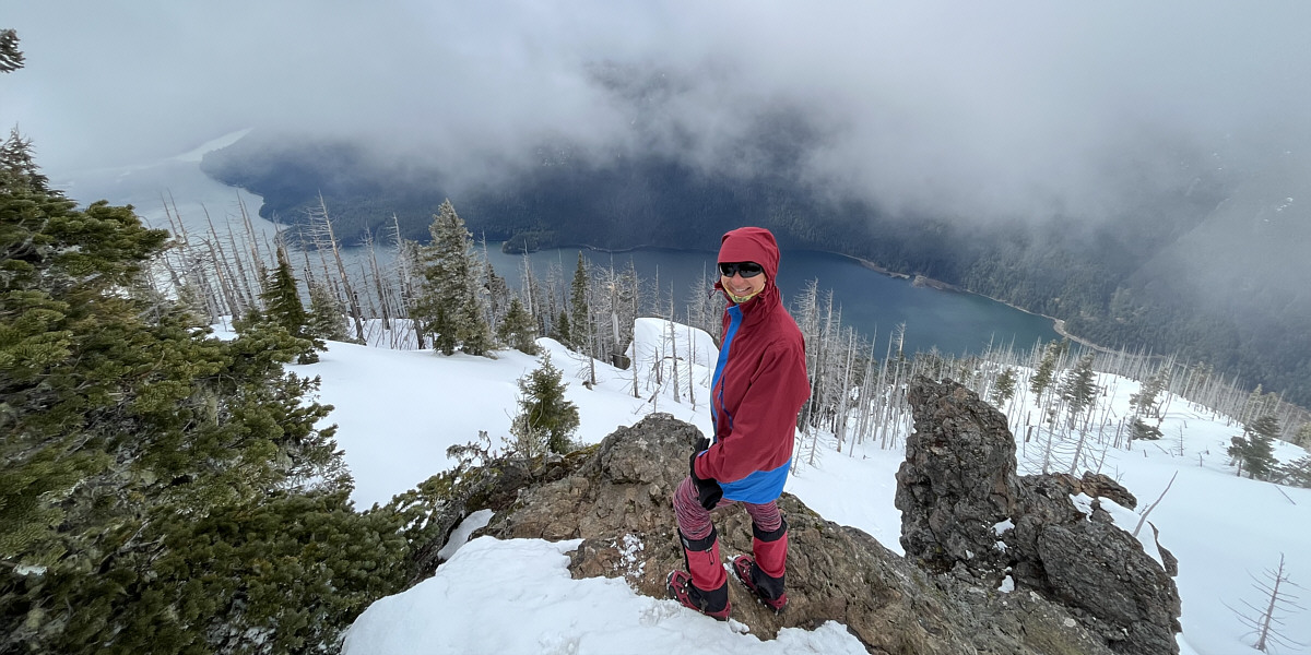
The clouds begin to clear a bit revealing Lake Cushman.