BOU AVENUE
Bluejoint Mountain
On 16 July 2025, Zosia Zgolak and I ascended Bluejoint Mountain at the southern edge of British Columbia's Granby Provincial Park.  An inactive fire lookout sits atop the summit and can be reached via a rough access road and trail running up the south ridge.  Despite the lack of technical difficulty, the mountain is in a remote location and entails a very long approach drive which is an adventure in itself.  Several forestry recreation sites along the way can be used as convenient base camps for launching a day trip to Bluejoint Mountain or other nearby points of interest.

From Highway 3 in Grand Forks, turn north onto Northfork-Franklin Road just west of the McDonald's restaurant.  Drive north for 16.0 kilometres and cross a bridge to the east side of Granby River.  Continue driving north for 28.0 kilometres and turn left onto Granby Forest Service Road (2WD gravel).  Immediately cross a bridge over Burrell Creek (Granby-Burrell Creek Recreation Site to the left) and drive 14.0 kilometres to a junction with a road heading left over Granby River (leads to Howe Creek Recreation Site in 1.4 kilometres).  Keep straight at this junction and drive another 4.7 kilometres before turning left onto Bluejoint Lookout Road (high clearance vehicle with AWD or 4WD capability strongly recommended).  From the turnoff, it is another 11.0 kilometres with more than 1100 metres elevation gain to the trailhead, but the road is rough with numerous water bars.  I managed to push my Honda CR-V about 7.0 kilometres (with 650 metres elevation gain) up the road before deciding that it had taken enough of a beating.

After the nerve-racking drive, the hike itself almost seemed anticlimactic.  From where we parked, Zosia and I easily walked up the remainder of the access road to the trailhead in less than two hours.  The hike from the trailhead to the summit was also fairly straightforward although a few sections such as a boulder slope do require a little bit of route-finding.  The broad summit is occupied by the fire lookout, a helipad, and a couple of green rockets.  The door to the fire lookout was not locked, but some caution is required to open the wonky trap door leading to the upper floor.  After poking around inside the fire lookout, we eventually went back outside to have a lunch break.  Somewhat surprisingly, another hiker joined us at the summit a short time later.  He had managed to drive his jeep all the way to the trailhead and consequently had a much shorter ascent on foot than us.

Following our lunch break, Zosia and I left the other hiker at the summit and retraced our steps back down to the trailhead where we looked with envy at the hiker's jeep.  The rest of the walk down the access road to our parked car was uneventful, but the subsequent drive out was another tense ordeal as we cringed every time my car went over another water bar along the decrepit access road.  Adding to our anxiety, my car's "check-engine" light suddenly came on well after we had returned to the good gravel roads.  Although the car still appeared to be operating normally, we scrapped our plans to explore the area further.  Instead, we would camp for the night at Granby-Burrell Creek Recreation Site before driving out the next day to a garage in Castlegar to have my car checked out.
My car took quite a beating just to get here! 
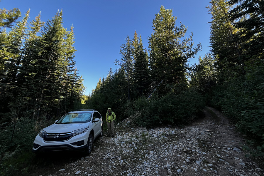
Sonny parks his car about four kilometres short of the trailhead for Bluejoint Mountain.

Photo courtesy of Zosia Zgolak

This was also where the road was supposed to get rougher...if it wasn't already rough enough! The flagging here marks the start of the route as published in AllTrails.com.  This is a little less than two kilometres from where Zosia actually started hiking up the road.
Doe, a deer, a female deer... 
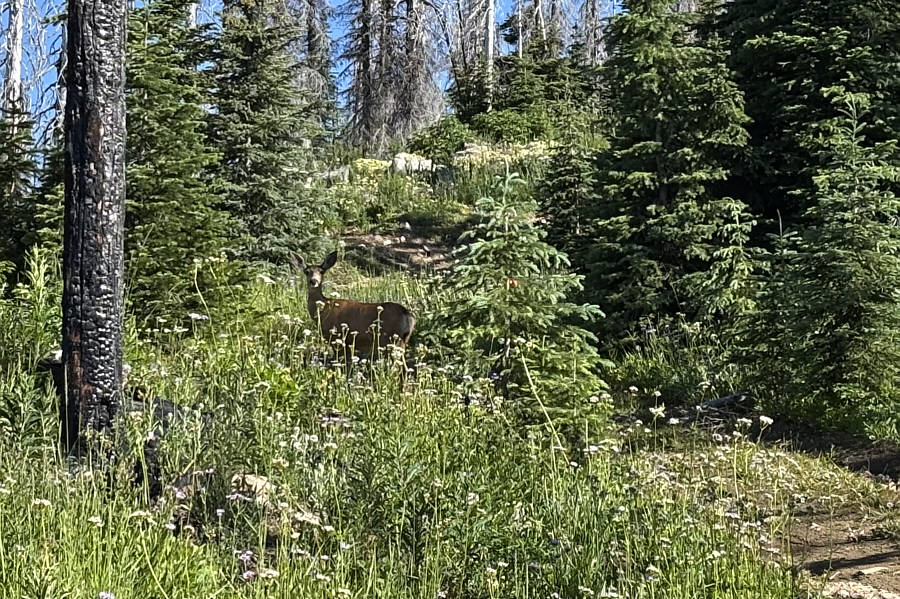
This doe is trying to distract intruders from discovering a fawn hiding in the nearby bushes.
Kinda boring, but it beats bushwhacking! 
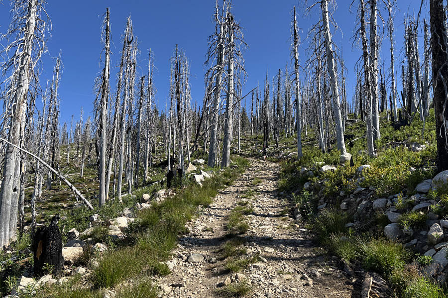
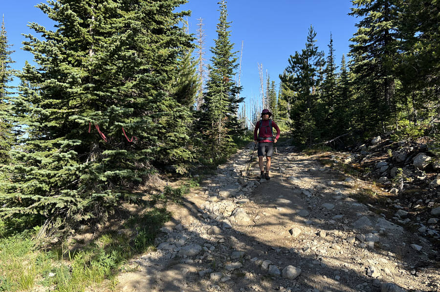
Zosia continues climbing up the road through an old burn.
I wish the people that built this elaborate bench put more effort into improving the road! 
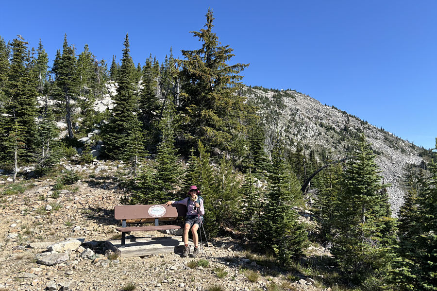
Zosia sits on a bench beside the trailhead at road's end.  Behind the bench is an interpretive sign, and the fire lookout is also visible in the distance.
A little route-finding needed, but it's not that difficult! 
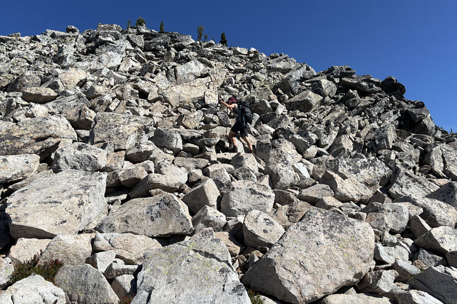
Zosia follows cairns up a boulder slope on the south ridge.
The summit is about 150 metres away. 
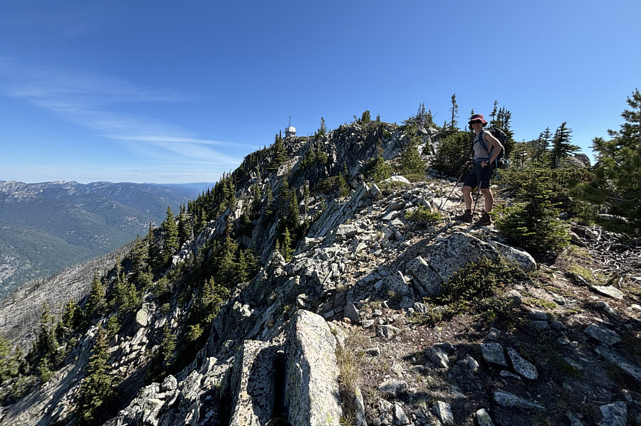
Zosia pauses briefly before the final short walk to the summit.
Don't use the toilet that's sitting in the open beside the collapsed outhouse! 
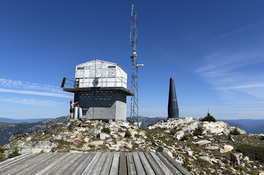
Zosia checks to see if she can climb up a ladder on the outside of the fire lookout, but it is easier to access the balcony from a staircase inside the concrete tower (via an unlocked door on the far side of the building).
Another beautiful day on a BC summit! 
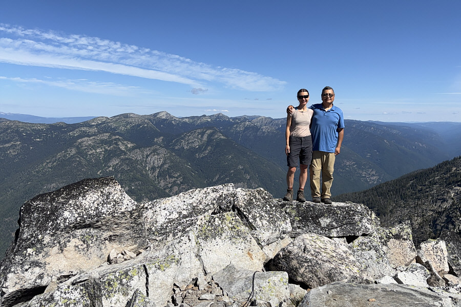
Zosia and Sonny stand on a rock near the summit of Bluejoint Mountain (2320 metres).
If you squint, you might be able to see Mount Bonaparte on the right distant horizon. This is looking back down the south ridge of Bluejoint Mountain.
Maybe we will hike it one day... 
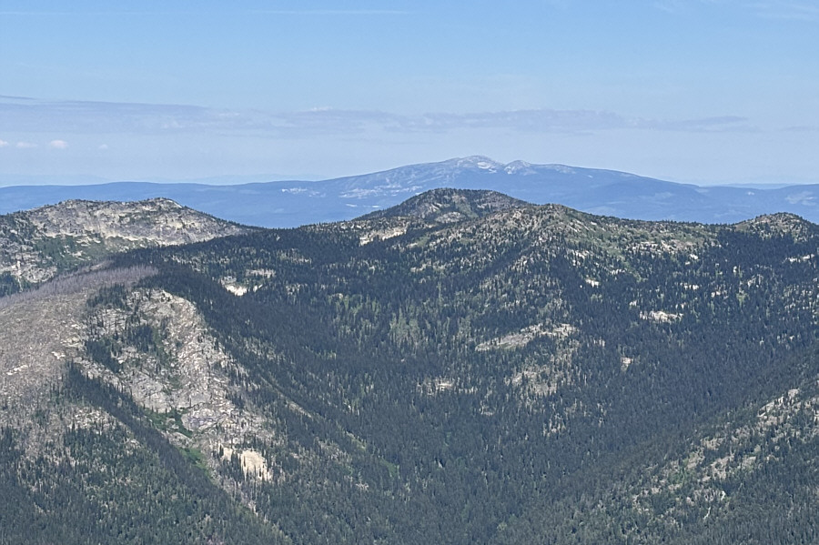
Here is a zoomed-in view of Big White Mountain to the west.

Maybe once I get a new car...

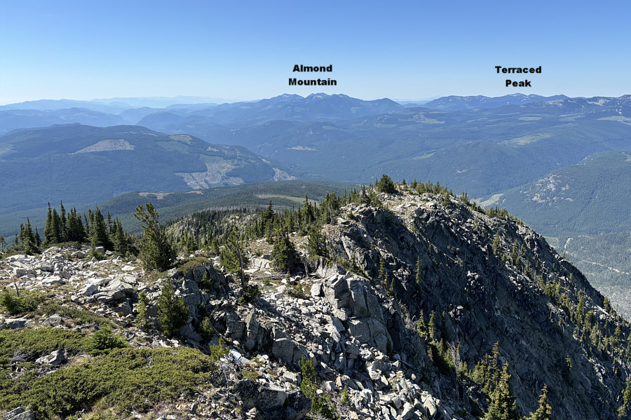
Some intriguing mountains to the northwest invite further exploration.


That would be an adventurous traverse...for someone else! 
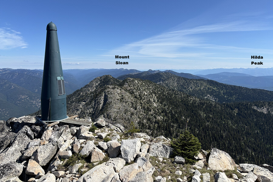
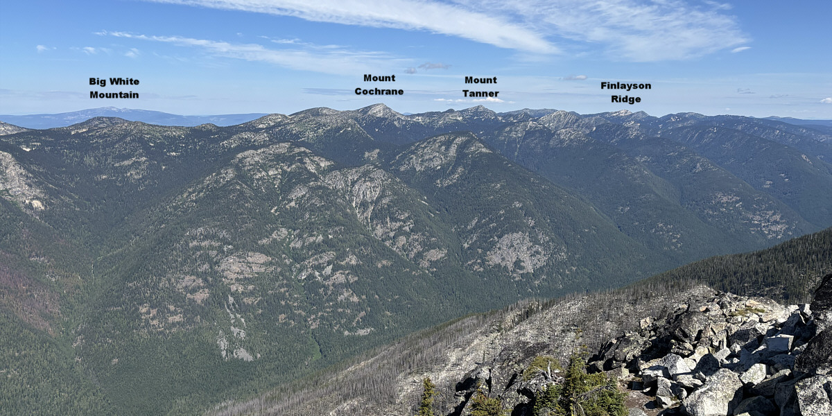
The ridge to the north of Bluejoint Mountain runs all the way to Mount Sloan about 21.6 kilometres away and forms the bulk of the southeastern boundary of Granby Provincial Park.
Sangrida Peak is not in the park but looks like an interesting objective for the future...maybe! 
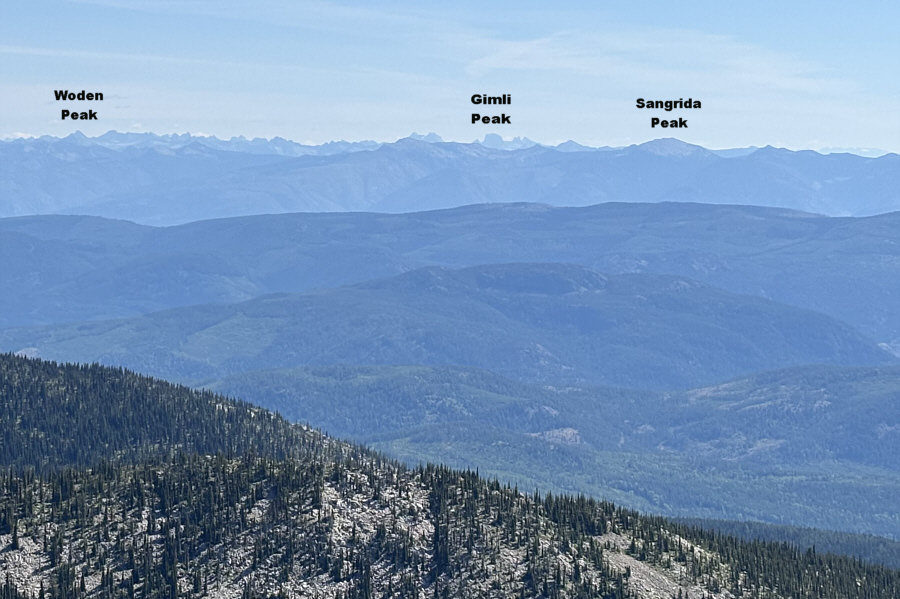
The spectacular peaks of Valhalla Provincial Park can be spotted on the northeastern horizon.
Can you spot Old Glory Mountain?

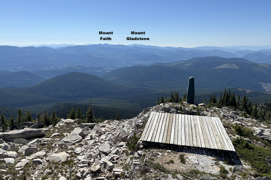
The view to the southeast includes many of the peaks of the Rossland Range on the left horizon.

That trap door was freakin' heavy to push up from below! 
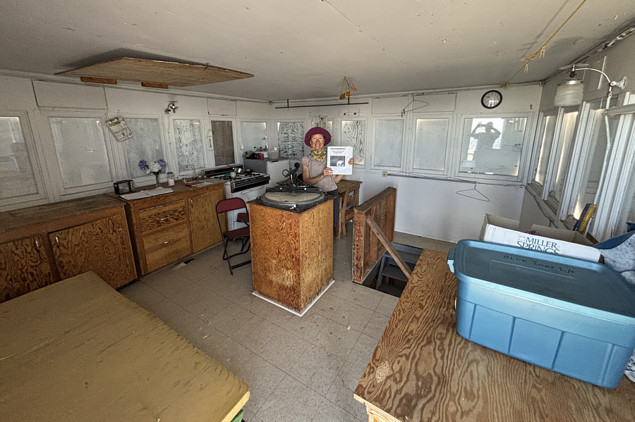
Inside the fire lookout, Zosia finds an operations and training manual dated from January 2008.
This is what you need to explore BC backroads!

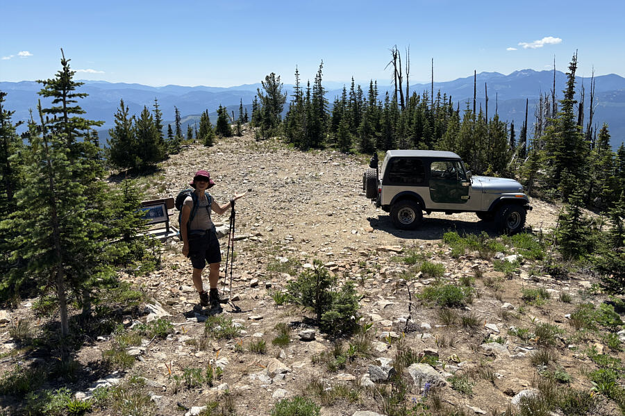
Zosia is impressed that this jeep was able to make it all the way up the rough access road to the trailhead.  The jeep belongs to another hiker who arrived at the summit after Zosia and Sonny.

The right vehicle makes all the difference! 
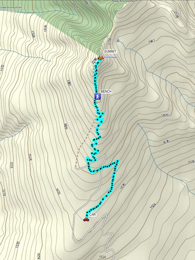
Total Distance:  10.4 kilometres
Round-Trip Time:  6 hours 4 minutes
Cumulative Elevation Gain:  617 metres

GPX Data