BOU AVENUE
Thimble Mountain Outliers
On 14 July 2025, Zosia Zgolak and I hiked to what we thought was the summit of Thimble Mountain near Grand Forks, British Columbia, but as it turned out, we only managed to climb a couple of outliers.  Even worse, we could have easily tagged the actual summit with only minimal extra effort had I done my research more thoroughly, but alas, this was a trip that I had planned on the fly with little more than a cursory description from Backroad Mapbook (Kamloops/Okanagan, 3rd Edition) and a dotted line on my GPS map (OpenTopoMap).  In any event, I did not have great expectations for this hike since most of the trail travels through unremarkable forest with little or no views to speak of.  As it turned out, the hike is not without some merit, but we had to go a long way to find it.

From Highway 3, turn east onto BC Mines Road (2WD gravel) 1.9 kilometres south of Wilgress Lake Rest Area (toilets available) or 18.0 kilometres west and north of the junction with Highway 41.  Drive 250 metres and turn right onto a slightly rougher road heading south.  Drive about 600 metres and park in a small pullout (49.12494, -118.54041) on the right.  The signed trailhead is about 75 metres further down the road on the left (49.124664, -118.53949).

After a slight delay at the trailhead due to bountiful huckleberries, Zosia and I hiked the surprisingly well-maintained trail eastward along the rolling west ridge of Thimble Mountain.  As expected, there was not a lot to see along the forested trail, but it was pleasant enough to walk.  Around maybe the seven-kilometre mark, we came across an unexpected junction with a fallen sign.  Although we did not know it at the time, this turned out to be the turnoff to the true summit, but because we could not decrypt the meaning of the weathered sign, we simply ignored it and continued on the main trail.  Almost a kilometre beyond the junction, we left the trail to scramble up the first of Thimble Mountain's two northern outliers.  The first outlier is mostly open and grants the best panoramic views on the mountain.  From there, we dropped down and regained the trail which continues northward and does an inexplicable loop around the second outlier without going to the top.  Finding no beaten paths, we went off-trail again and easily reached the high point of the second outlier where we stopped for an extended break.

For our return, Zosia and I dropped down to regain the trail and followed it all the way back to the trailhead without incident.  Again, we failed to take the detour to the true summit which, to be fair, is not marked on my GPS map.  Not until long after the hike did I realize my error, but I am not sure if the true summit--apparently tree-covered and viewless--even merits a return visit unless we bring either mountain bikes or skis.
Do we really need to hike further? 
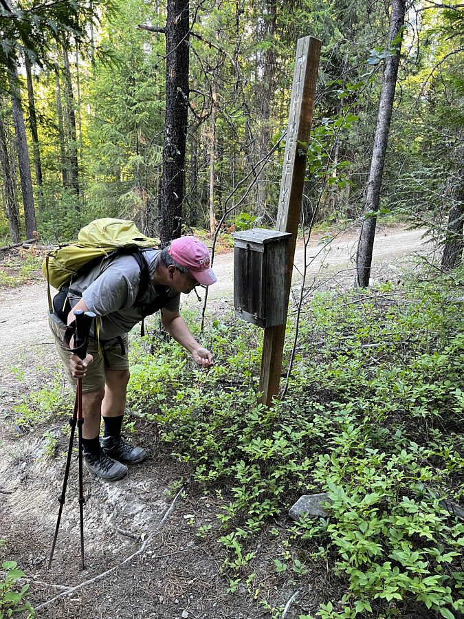
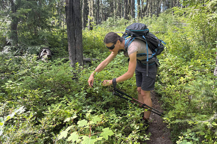
Sonny stops to pick huckleberries beside the Thimble Mountain trailhead register box.

Photo courtesy of Zosia Zgolak

Guess where these went right after the photo was taken...nom, nom, nom! 
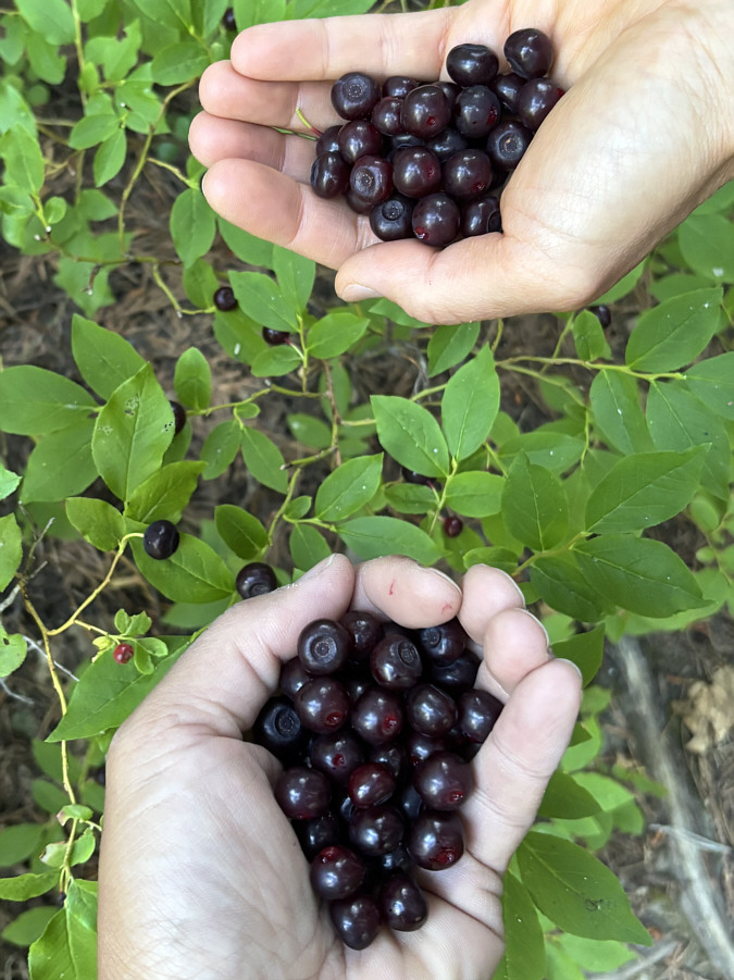
These are only the first of many handfuls of huckleberries that will be collected on this day.
Ideal for mountain biking or skiing! 
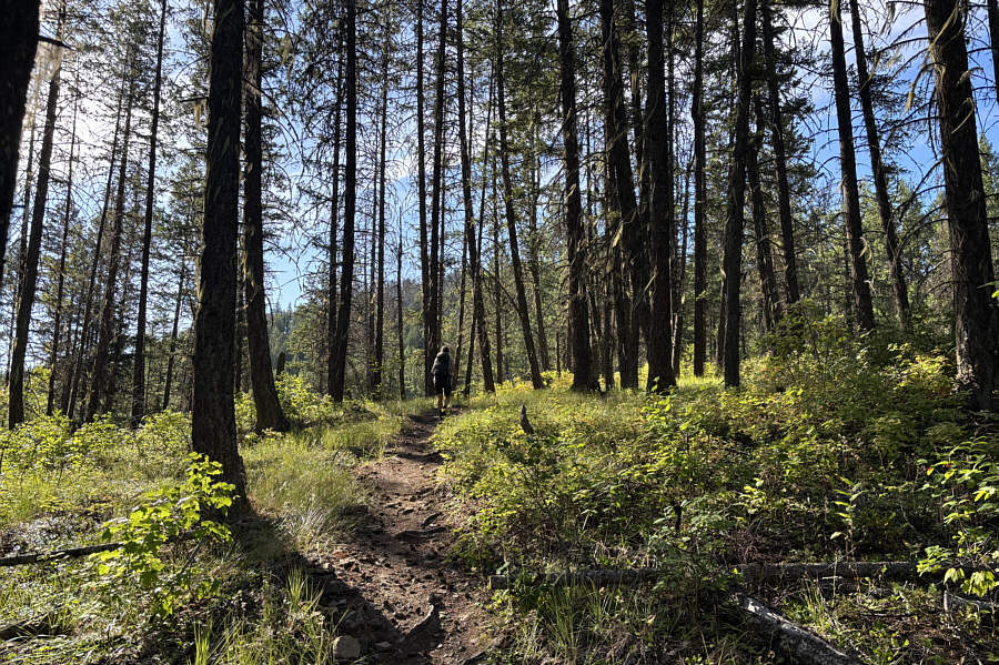
Most of the hike is forested but on a good trail.
We were there only 82 days ago. 
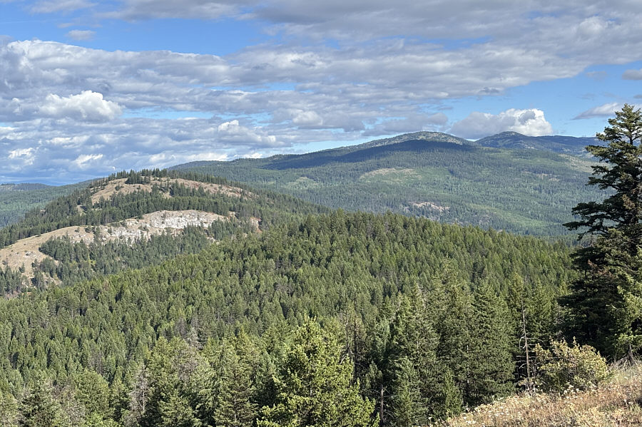
A rare clearing along the trail grants this view to the northwest of Mount Roderick Dhu (first bump right of centre on horizon).
We could be here all day... Zosia finds more huckleberries along the trail.
How can you not stop to eat these? 
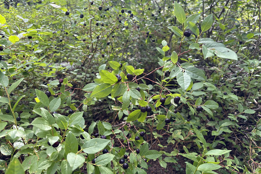
Ripe huckleberries are seemingly everywhere on Thimble Mountain.
They're puny but very tasty! 
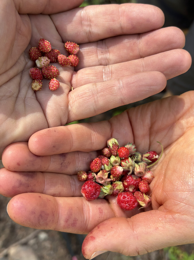
Though not as abundant as huckleberries, wild strawberries can also be found along the trail.
Why didn't they just write "To True Summit of Thimble Mountain"? 
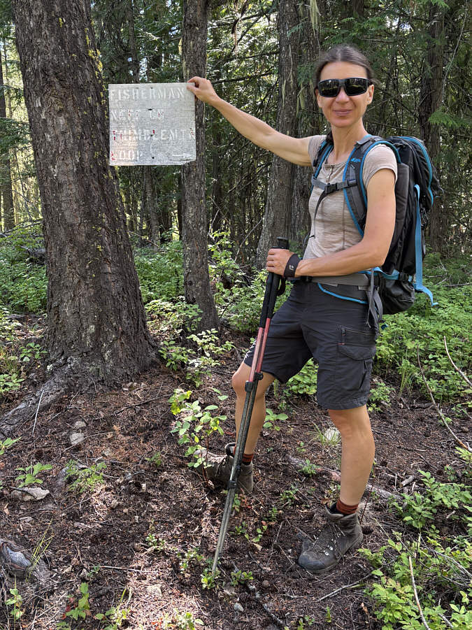
Zosia picks up a cryptic sign at an unexpected trail junction.  It turns out that this is the turnoff to the actual summit of Thimble Mountain.
Watch your step here...some of the wood is not so solid anymore! 
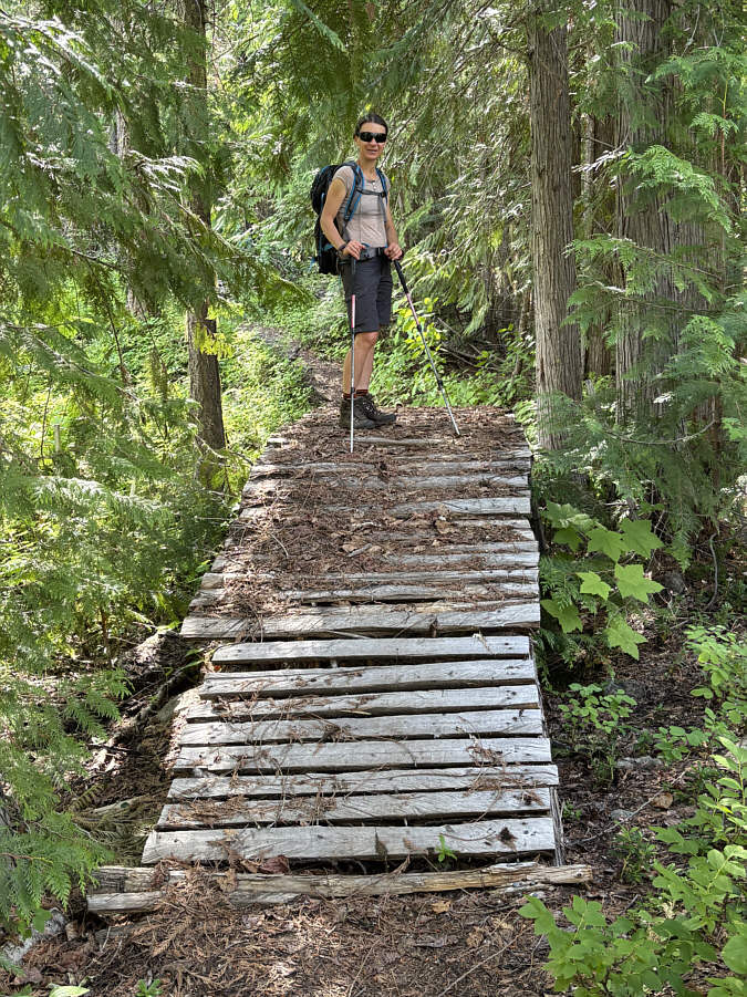
This rickety bridge was built to go over a barbed wire fence.
If only this outlier was 25 to 30 metres higher... 
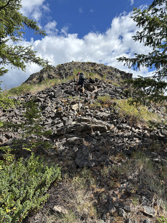
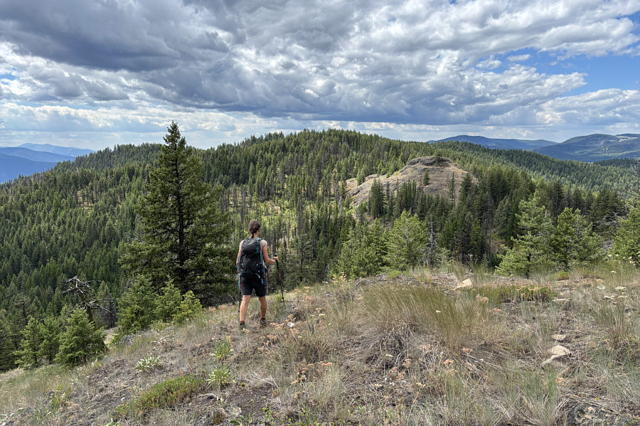
Zosia finally breaks out of the forest and climbs up the first of Thimble Mountain's two northern outliers.
 

Makes the long walk here worthwhile...maybe!

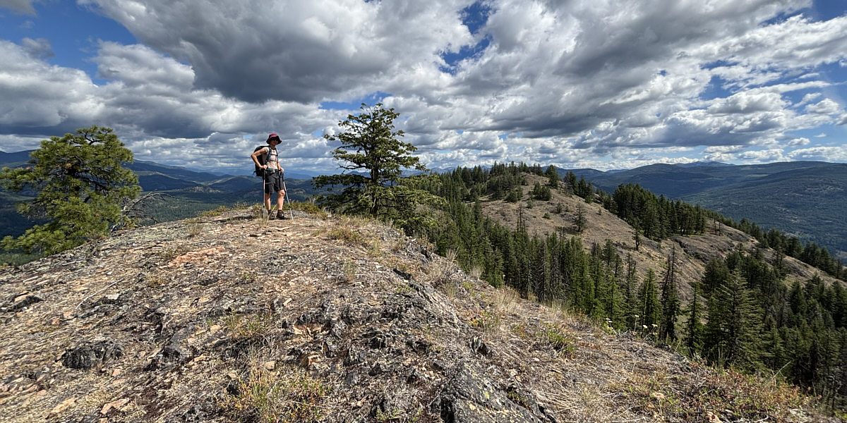
Zosia stands atop the first and most scenic outlier (1289 metres).  The second outlier is just a short distance further.


Not the true summit...DOH! 
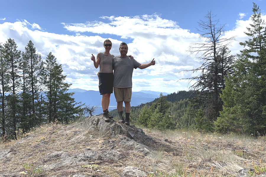
Zosia and Sonny stand atop the second outlier (1298 metres).
When the outliers are more scenic than the summit, you know that you picked the wrong mountain to climb! Zosia begins the long walk back to the trailhead.  The first outlier can be seen at right while the true summit of Thimble Mountain is the forested hump at centre.
Is it worth coming back to tag the true summit? Maybe on skis! 
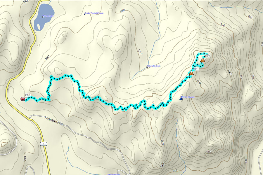
Total Distance:  17.5 kilometres
Round-Trip Time:  6 hours 52 minutes
Cumulative Elevation Gain:  419 metres

GPX Data