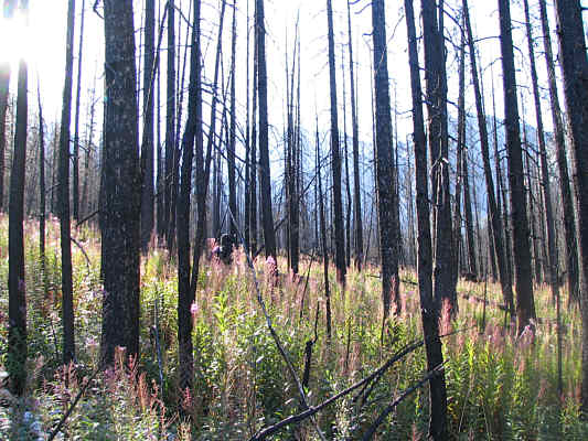
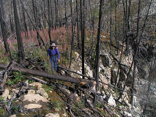


I picked up Bob from his place in the wee hours of the morning of 26 August 2006 and drove out to Marble Canyon Campground in Kootenay National Park. Because the campground was closed due to a bear in the area, I parked my car near a house (some kind of shelter for fire crews) just west of the campground. There is a gravel road here which heads off into the woods near a barn, and I was hoping we could follow it without much fuss to the canyon at the mouth of the valley. We were on our way by 6:54 AM but immediately discovered that the road ends abruptly at Haffner Creek. Rather than bushwhack alongside the creek, we elected to backtrack to the highway and proceed through the rather convoluted loops of Marble Canyon Campground (and ignoring the bear warning sign) until we found the start as described by Kane. We spent the next several hours side-hill bashing, crawling over and under tangled messes of deadfall, hopping slippery boulders in the creek, and tripping over nasty surprises hidden by fireweed. Doing this with a full backpack was physically tiring, but more significantly, it was mentally draining. We had to constantly stay focused on route-finding, and with little to look at but charred tree trunks and knowing full well that we would have to suffer a return trip the following day, I found it difficult to keep my enthusiasm up. Sharing the misery with Bob helped immensely though as one look at his soot-covered face was enough to make me chuckle and lift my spirits.
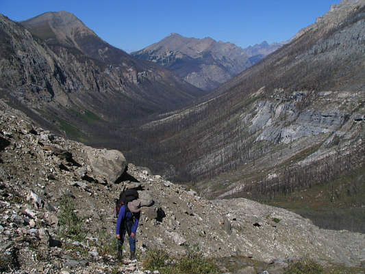
By 11:13 AM, we had cleared the last of the deadfall and were finally climbing the headwall into the upper basin. Dave had described a great camp spot at the last trees, but after all the bushwhacking, I had forgotten most of the details of his report. Bob and I came upon a sparsely treed area near the end of a long moraine, and although there were plenty of nice spots to pitch our tents, we could not find any reliable sources of water. Despite some searching about, all we could find was a very small trickle of water emanating from a karst pavement and collecting in a pathetic little bowl about the size of a cantaloupe. Rather than waste time trying to find more water, we simply hung our camping gear on a small larch tree near my little bowl in hopes of dealing with the issue later. It was already 1:25 PM by the time we resumed our ascent of Mount Ball.
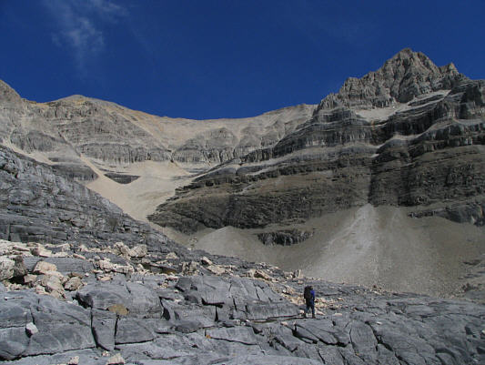
After crossing some dark-coloured karst pavement, we entered the scree
bowl below Beatrice Peak and began the long slog up toward an obvious
break in the cliff band guarding the ridge above. Water was quite
abundant in the bowl, and we felt some relief in being able to replenish
our water bottles here. While Bob continued climbing at a pretty
good pace, I was starting to run out of gas and had a tough time keeping
up with him. Upon reaching the crest of the connecting ridge
between Beatrice Peak and Mount Ball at 4:06 PM, I was disheartened to
see that Mount Ball's summit was still far away and that we had to
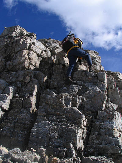
scramble over an intervening bump along the ridge. This bump
actually perked me up a bit as it required some hands-on scrambling to
surmount. While Bob stayed on the scree on the final slope, I opted
to don my crampons and trudge up the snowfield which was actually more
like a sheet of ice. Although messing with the crampons was
time-consuming, hiking up the snow field gave me a bit of a mental break
since I did not have to worry so much about my footing.
Bob reached the summit well before me and was kind enough to endure a
bitterly cold wind while waiting for me to join him. I topped out
at 6:06 PM. After signing the summit register, I convinced Bob to
start heading down while I stayed a little longer to snap a few more
photographs. I then whipped out my ice axe and glissaded down the
snowfield not realizing that Bob had actually stopped higher up on the scree to wait for me. When he finally spotted me well below him,
Bob quickly descended the scree, and together, we headed back along the
ridge to Beatrice Peak.
|
|
Blackened tree trunks and fireweed typify much of the terrain along Haffner Creek. |
|
|
Bob thrashes through some nasty deadfall. |
|
|
This is looking back down Haffner Creek from the headwall. Vermilion Peak is at upper left. |
|
|
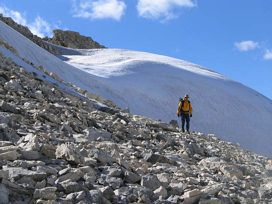
Mount Ball (centre) finally comes into view at tree line. The scree cone in the middle gives access to the dark-coloured karst pavement. |
|
|
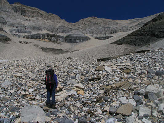
Bob hikes along the dark-coloured karst pavement. Beatrice Peak is on the left. |
|
|
Bob tries to fetch some water oozing out of the karst pavement. |
|
|
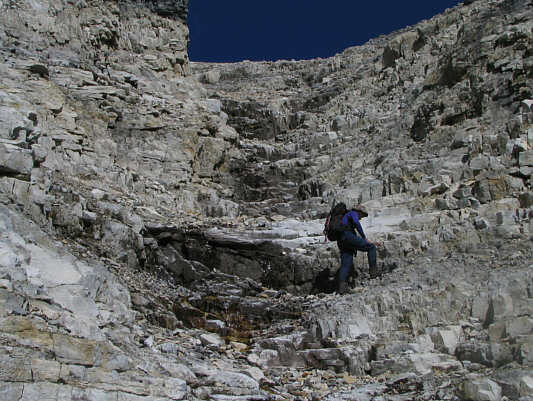
The slog begins! The obvious break in the cliff band is visible at upper right. |
|
|
Bob scrambles up above the cliff band. |
|
|
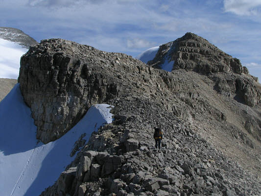
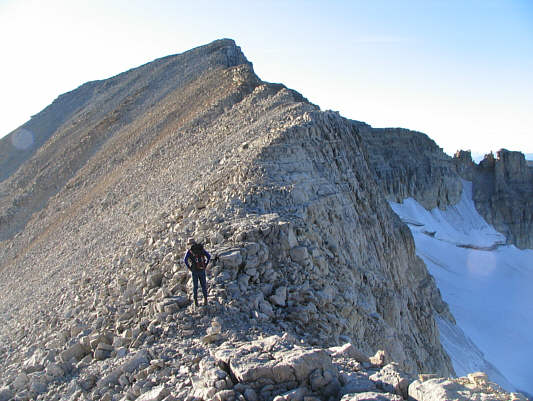
Bob hikes along the connecting ridge between Beatrice Peak and Mount Ball. |
|
|
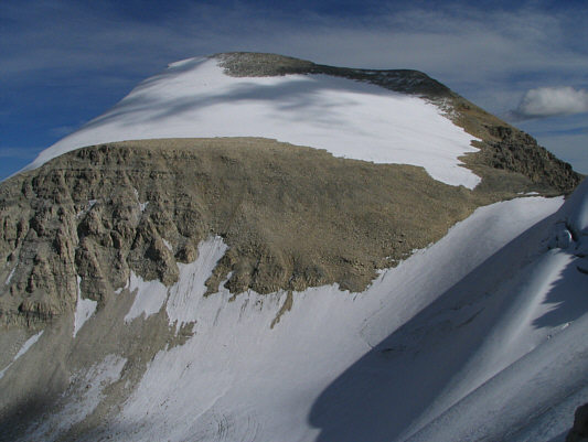
This is Mount Ball as seen from the connecting ridge. |
|
|
Bob scrambles up the intervening bump along the ridge. |
|
|
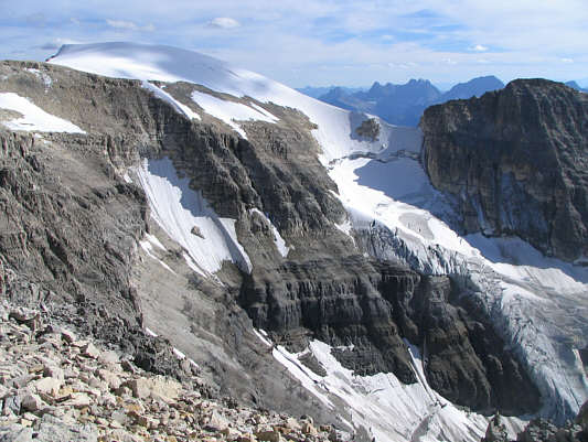
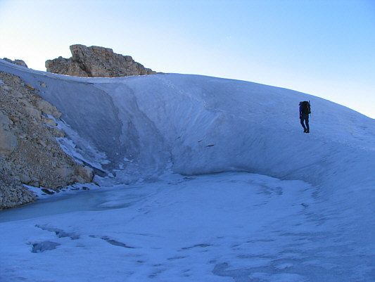
This snowy dome is the southern outlier of Mount Ball. |
|
|
Bob drops down from the intervening bump along the ridge. |
|
|
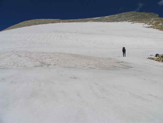
Bob strays onto the snowfield very briefly. |
|
|
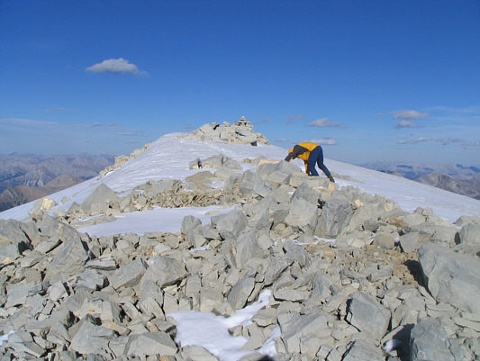
Bob's pose sort of sums up how tiring it is to reach Mount Ball's summit. |
|
|
Bob and Sonny sit on the 3306-metre summit of Mount Ball. |
|
|
Here is an obligatory shot of Mount Assiniboine to the south. |
|
|
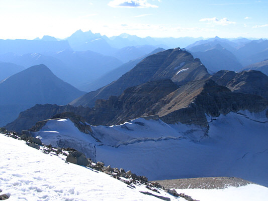
This is looking northwest toward Stanley Peak. On the horizon at left are the Goodsirs. |
|
|
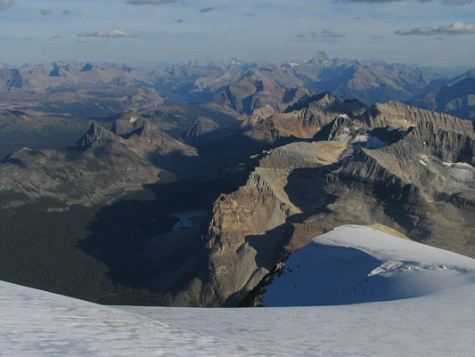
The view to the north includes Storm Mountain and Castle Mountain. |
|
|
Here is a more comprehensive view to the south. |
|
|
Bob climbs back up to the bump along the ridge. |
 |
Bob heads back along the connecting ridge toward Beatrice Peak. |
 |
Bob sticks close to the ridge crest on his way up Beatrice Peak. |
 |
Bob and Sonny reach the 3125-metre summit of Beatrice Peak. |
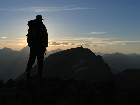 |
As the sun disappears over the horizon behind Bob, he contemplates the next day's adventures on Stanley Peak. |
 |
The last rays of sunshine illuminate this ridge southwest of Mount Ball. |
 |
Bob down-climbs the aforementioned obvious break in the cliff band. |