Total Distance: 10.7 kilometres
Round-Trip Time: 10 hours 15 minutes
Net Elevation Gain: 1447 metres
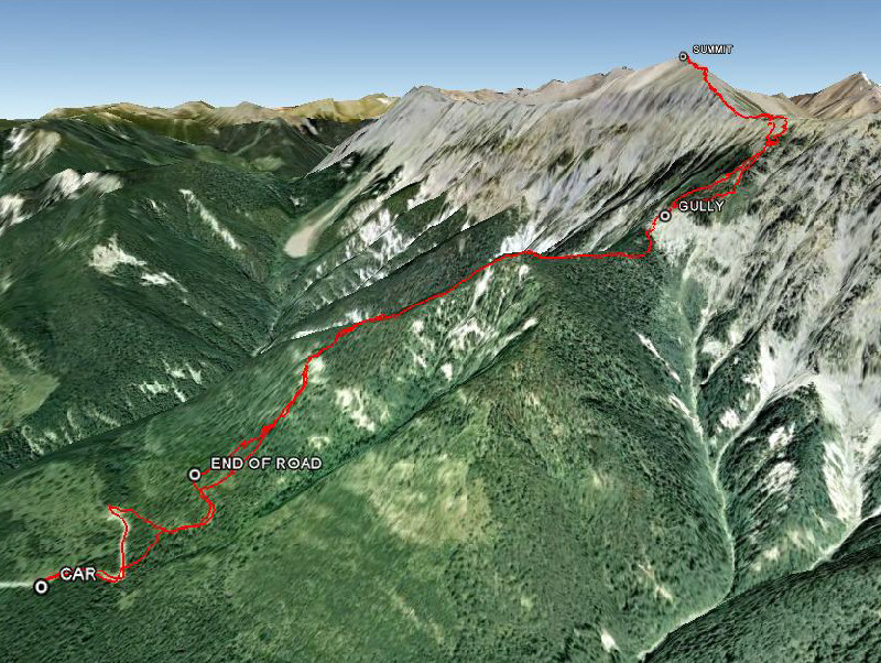
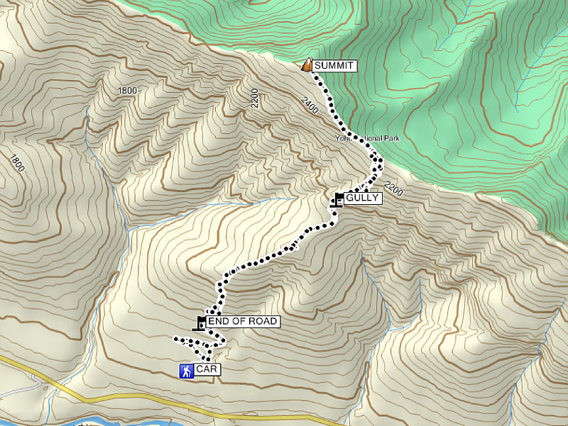
On 28 August 2011, I returned for another direct attempt from the highway, and with road construction already completed, I was able to start much closer at a point about 3.5 kilometres south of the summit. Although not shown on my Topo Canada v4 map, there is a good logging road that turns off the westbound lanes of the highway about 7 kilometres west of the pullout with the big "Welcome Bienvenue" sign (I discovered this road using GoogleEarth). This logging road is not accessible from the eastbound lanes because of barriers along the median. The drivable road (high clearance helps but 2WD should be okay) ends at a clearing 1.8 kilometres from the highway, but for some inexplicable reason, I decided to park in a pullout about 500 metres short. Perhaps subconsciously, I may have wanted to savour a bit of road walking before plunging into the bushes for the rest of the day! From the clearing, I continued along an overgrown and reclaimed section of the road for another 600 metres until signs of human passage petered out completely.
Having delayed the inevitable long enough, I started bushwhacking up
the slope aiming for a white dirt patch I could occasionally see through
the trees. After ascending a steep game trail to climber's left of the
white dirt patch (actually a hoodoo-like eroded section), I settled into
a 'comfortable' thrash up the forested slope. The bushwhacking was not as
bad as I was expecting, and game trails became more plentiful the higher
I climbed. After cresting a forested bump, I dropped down into a shallow
depression choked with deadfall before climbing up to the base of a
significant cliff band guarding the upper ridge. Luckily, I was able to
scramble up a steep and loose gully which breaches this formidable wall. I also built a small cairn and took a GPS waypoint here before resuming
my ascent. I eventually cleared the last of the trees, and shortly after,
I took a well-deserved break on the crest of Mount Hunter's southeast
ridge. Despite appearances to the contrary, the remainder of the ridge to
the summit is mostly a hike with a few spots of moderate scrambling and
exposure. After all that I had been through to get up Mount Hunter, it
was extremely satisfying for me to finally reach the top. The weather was
perfect on this day, and were it not for the prospect of a long
bushwhacking descent, I would have extended my 50-minute stay at the
summit. Retracing my steps, I encountered few difficulties on my way back
down. My GPS waypoint came in handy for re-finding the gully through the
cliff band, and though the bushwhacking was no less tedious the second
time around, I actually welcomed the shade of the forest in the hot
afternoon sun.
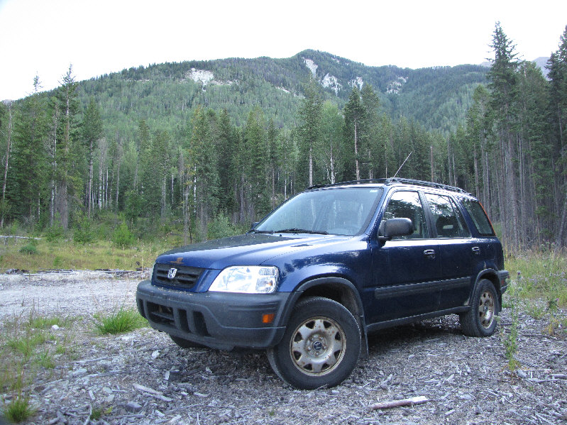
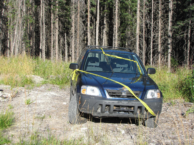
When I returned to my Honda CR-V, I was surprised to see it wrapped in
police tape. I thought it was maybe a joke at first, but a sticker left
on my window by the Royal Canadian Mounted Police (RCMP) indicated that
if my car was not removed within 72 hours, it would be towed at my
expense. I was certain that I was parked on crown land with no
restrictions, and I did not see any "No Trespassing" signs in the area. Dumbfounded, I removed the tape, and without giving the wrap job much
further thought, I drove home. When I arrived at my house, I had barely
closed the door behind me to greet my wife when there came a loud knock. I reopened the door and was greeted by a Calgary Police Services (CPS)
officer who asked if I was the owner of a Honda CR-V. I immediately
confessed that I had parked on the logging road earlier in the day, but
the officer admitted to knowing very little about the situation. Instead,
he handed me the name and phone number of an RCMP constable that I was
supposed to contact immediately, and then the officer promptly left. A
phone call to the RCMP constable revealed that someone had reported my
car abandoned, and as per their normal routine, the RCMP sent someone to
examine and tape my car. The RCMP also attempted to phone me but were
unsuccessful because I had neglected to inform my insurance company when
I recently dropped my landline. As a result, the RCMP enlisted the CPS to
basically hand-deliver a phone number to me! After I reassured the RCMP
constable that both my car and I were safe and sound and explained what I
was doing in the area, she had a good laugh and apologized for the
misunderstanding. I still wonder who bothered to go up that logging road
to nowhere and why they reported my car abandoned.
|
|
The road continues a little further beyond this point. Sonny's route goes up the left side of the white dirt patch at left before following the skyline over the forested bump at centre. |
|
|
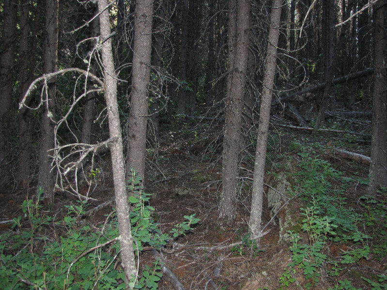
The forest is typically like this on the lower slopes. |
|
|
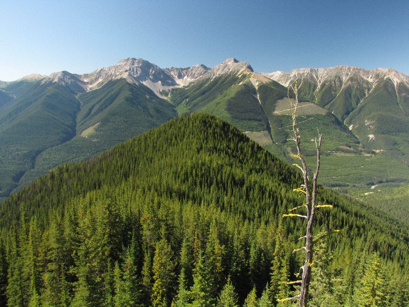
This is looking back at the forested bump from further up the route. |
|
|
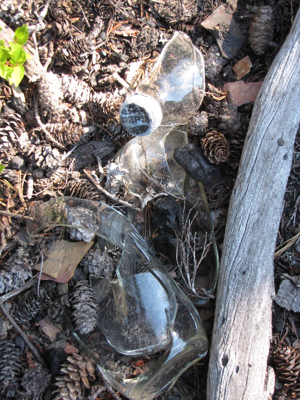
Signs of human passage can be found in the seemingly most remote parts of the wilderness. |
|
|
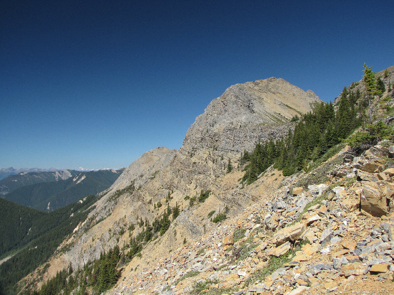
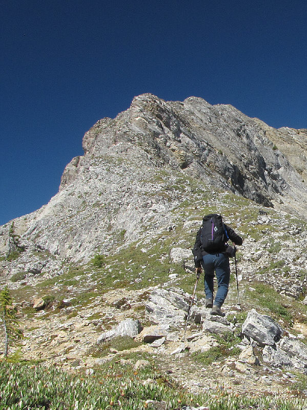
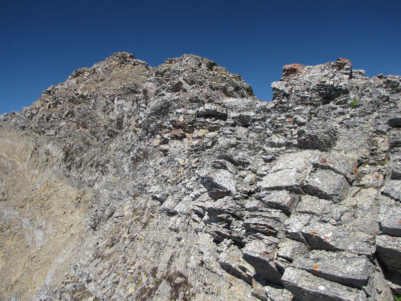
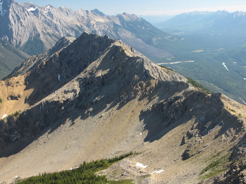
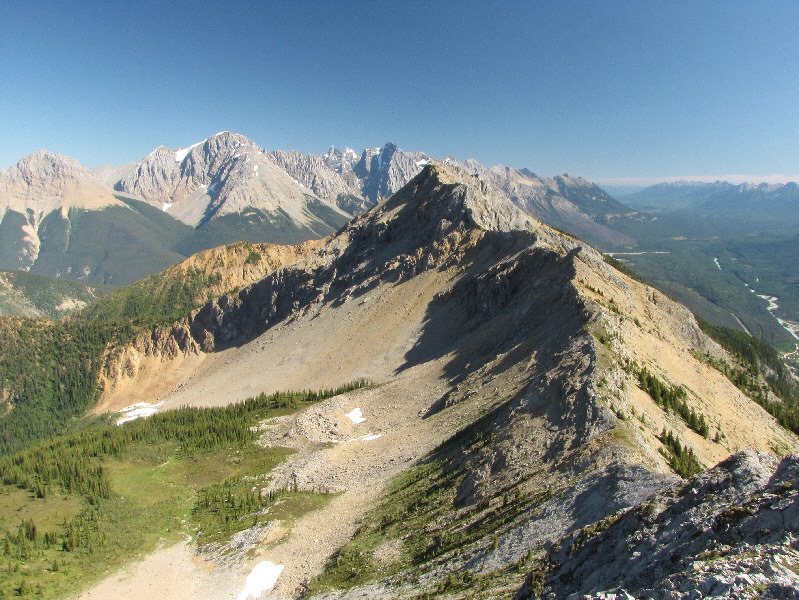
The summit block is finally in view from below the ridge crest. |
|
|
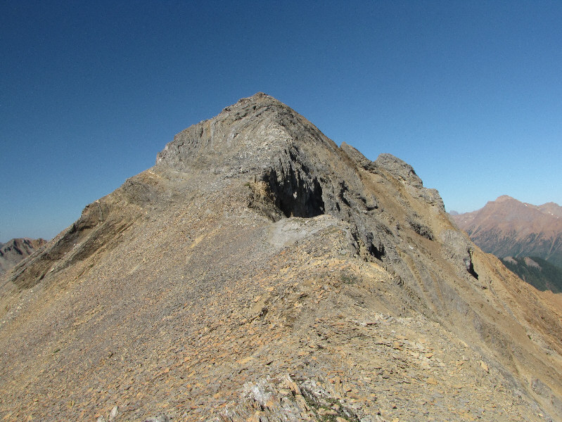
This is the remainder of the route from the ridge crest. |
|
|
Mount Seven sits to the west. |
|
|
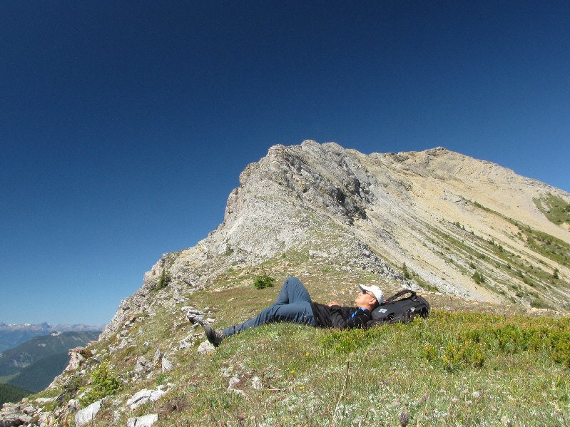
Sonny takes a well-deserved break before tackling the final ridge to the summit. |
|
|
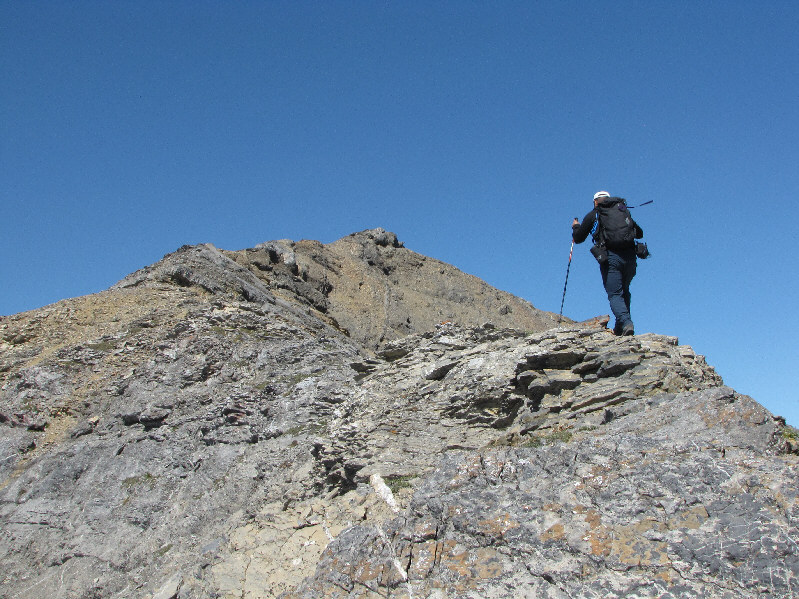
Sonny starts to climb the ridge. |
|
|
Some parts of the ridge are narrow and exposed. |
|
|
Sonny continues hiking up the ridge. The summit is not visible here. |
|
|
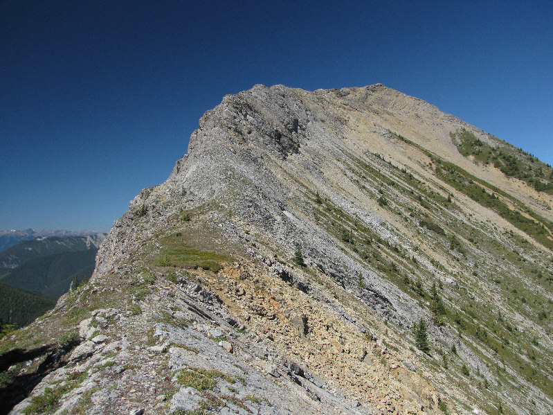
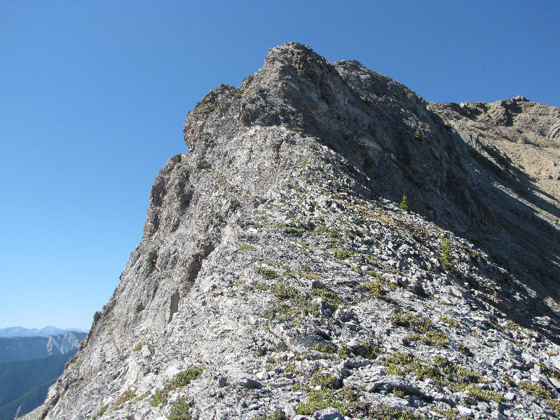
The true summit is visible here. |
|
|
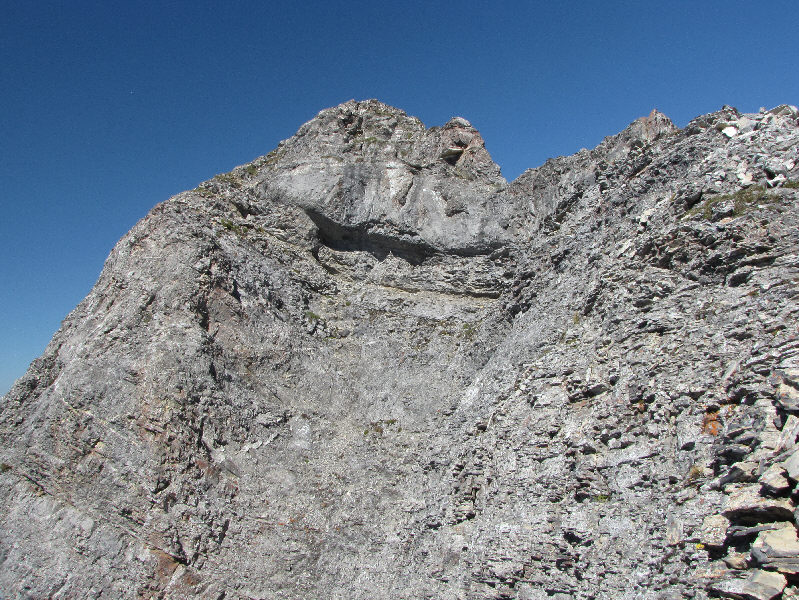
The ridge just below the summit appears to be complicated. |
|
|
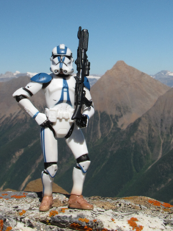
Sonny tags the 2644-metre summit of Mount Hunter. |
|
|
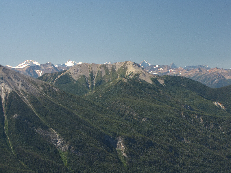
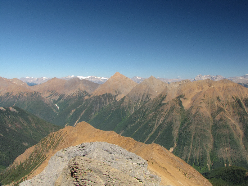
To the southwest is Kapristo Mountain (centre). |
|
|
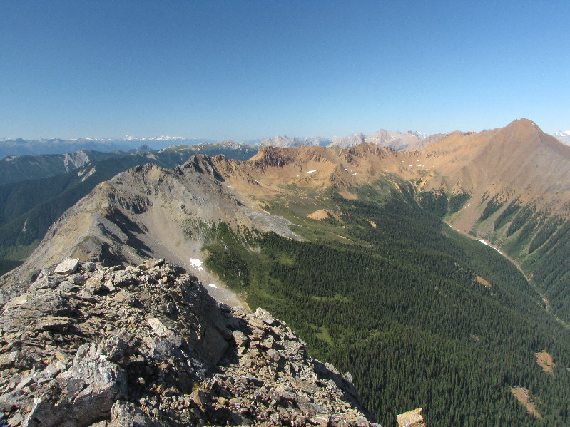
This is looking along the northwest ridge of Mount Hunter. Porcupine Peak is at far right. |
|
|
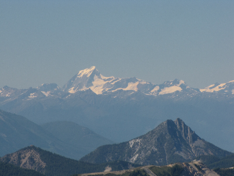
Mount Sir Sandford is visible over 90 kilometres to the northwest. In the foreground is Moberly Peak which is less than 20 kilometres away. |
|
|
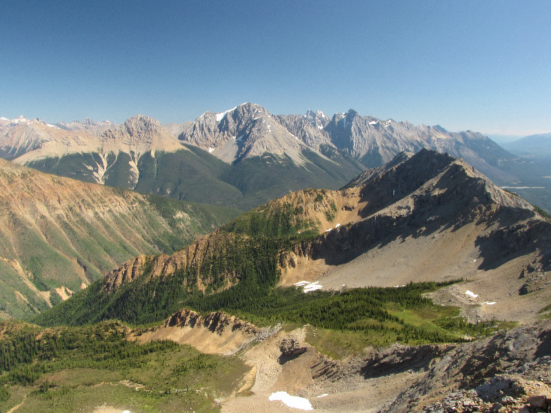
The view to the northeast includes Mount King at centre. |
|
|
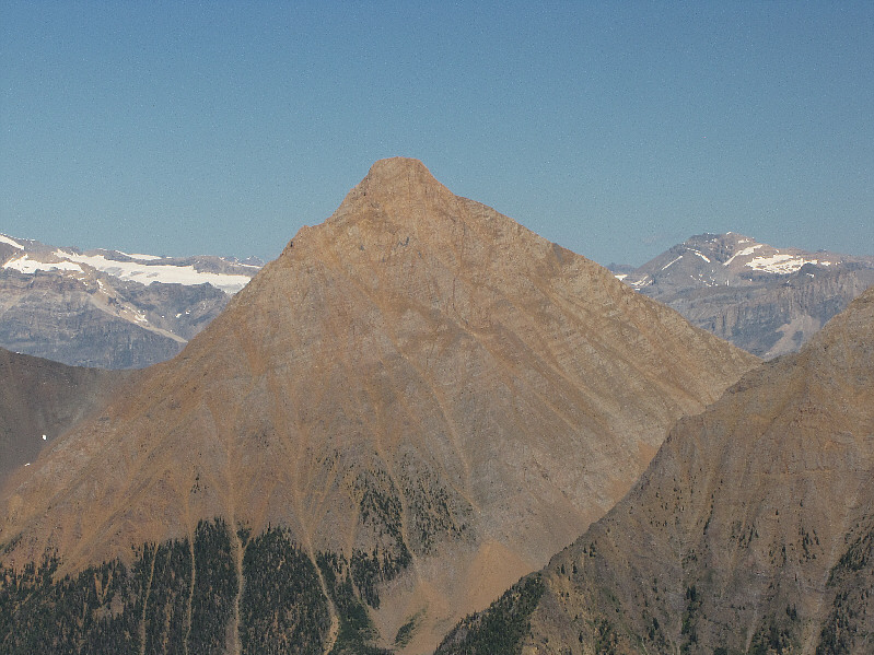
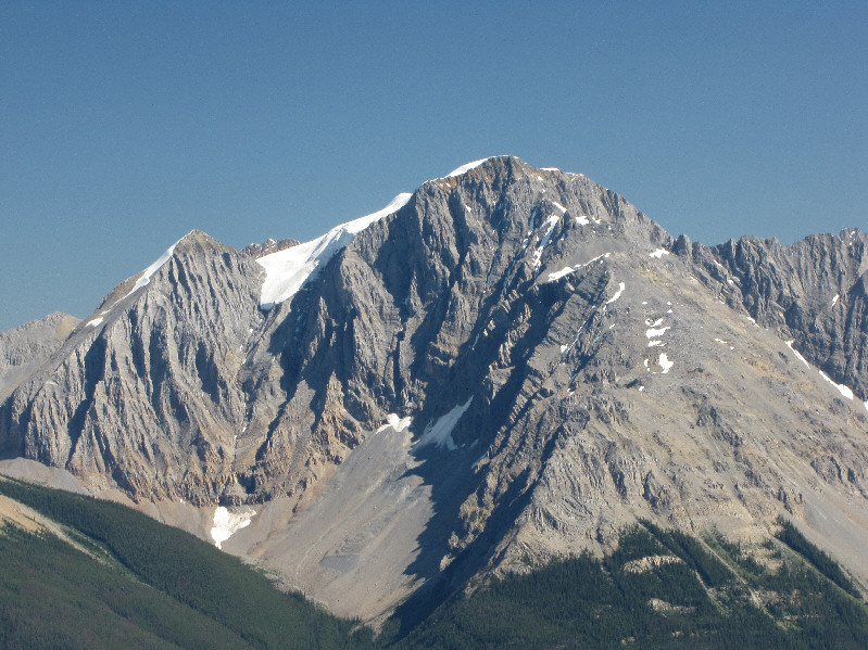
Here is a closer look at Mount King. |
|
|
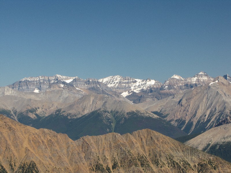
Some of the peaks visible on the eastern horizon include Mount Victoria (left), Mount Lefroy (centre), Mount Temple (right) and Hungabee Mountain (far right). |
|
|
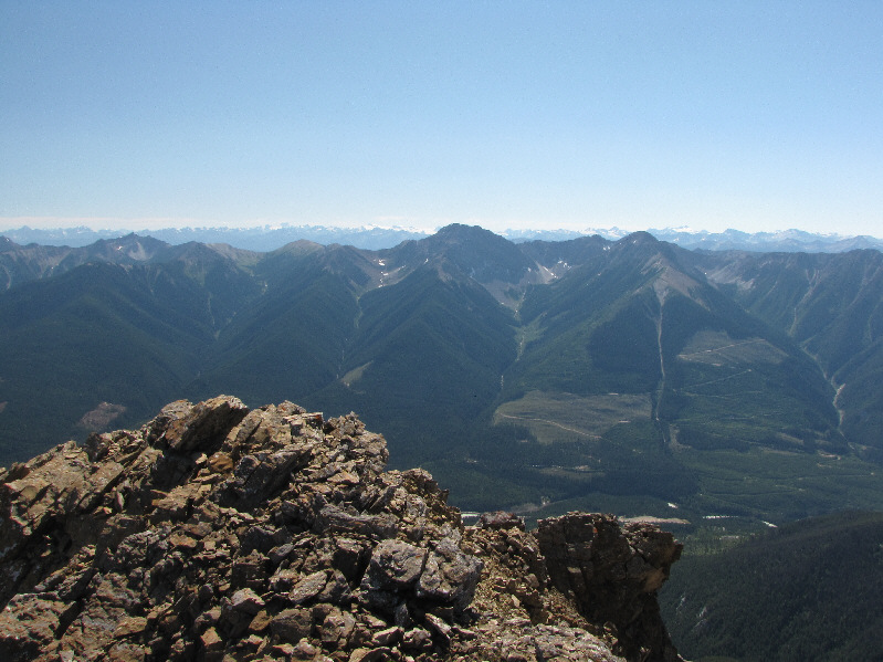
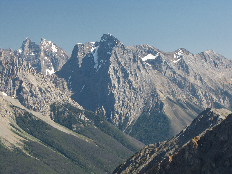
This is the view to the southeast which includes GR232803 in the foreground at right. In the background are Mount Hurd (left), Mount Vaux (centre), the Goodsir Towers (right of centre), and Chancellor Peak (right). |
|
|
Mount Vaux is one of the most attractive peaks in the area. |
|
|
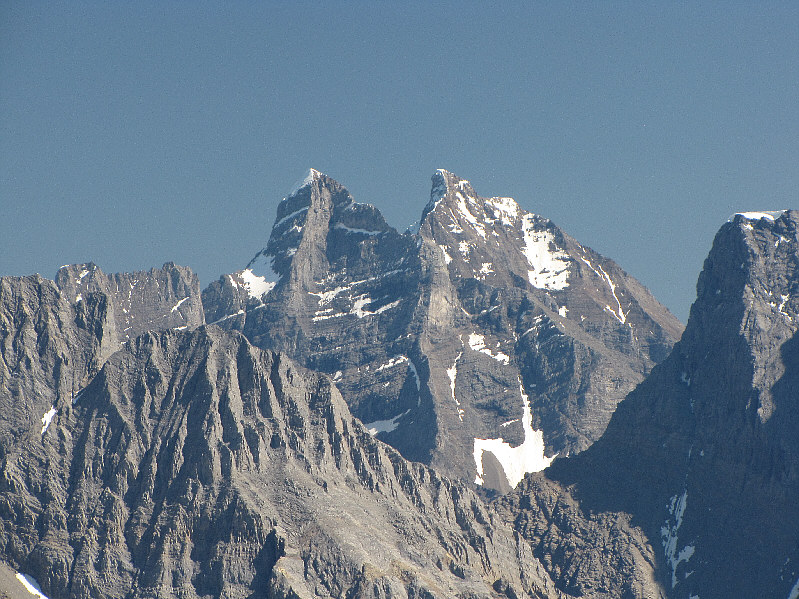
The Goodsir Towers never fail to impress or, at the same time, to instill fear. |
|
|
Not far from the Goodsir Towers is Chancellor Peak (centre), a challenging climb in its own right. |
|
|
Here is a closer look at GR232803. |
|
|
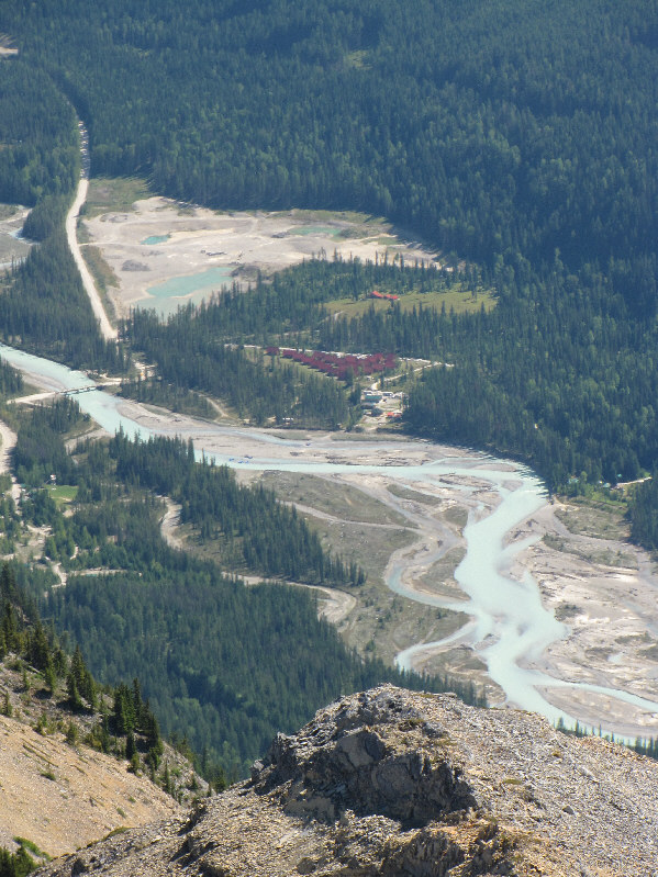
The Chancellor Peak Chalets are quite conspicuous along the Kicking Horse River. |
|
|
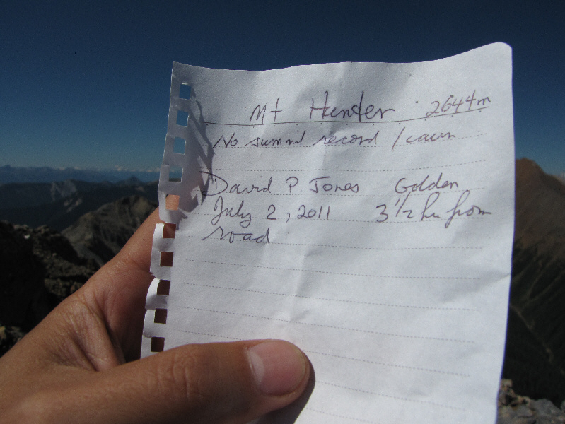
This was the only document in the summit register canister. |
|
|
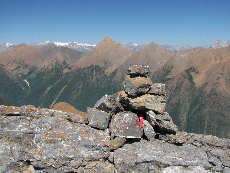
The register canister is tucked inside the summit cairn. |
|
|
Here is another look at GR232803 from partway down Mount Hunter's southeast ridge. |
|
|
The southeast ridge looks more daunting than it really is. |
|
|
Sonny's car is surprisingly wrapped with police tape at the end of the day. |
|
|
This is the route as viewed in Google Earth. |
|
|
Total Distance: 10.7 kilometres |