Total Distance: 9.0 kilometres
Round-Trip Time: 12 hours 30 minutes
Net Elevation Gain: 2190 metres
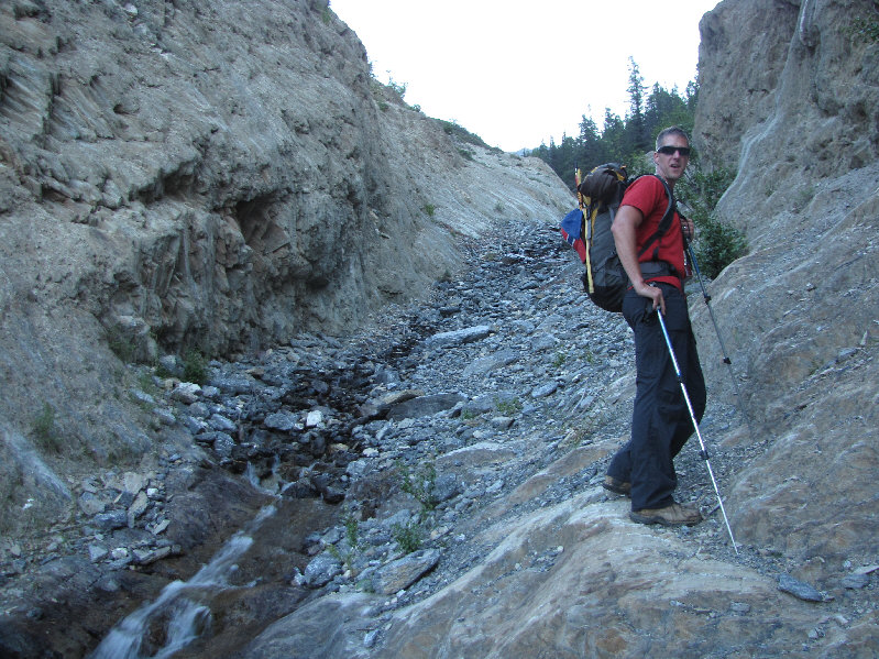
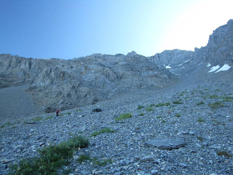
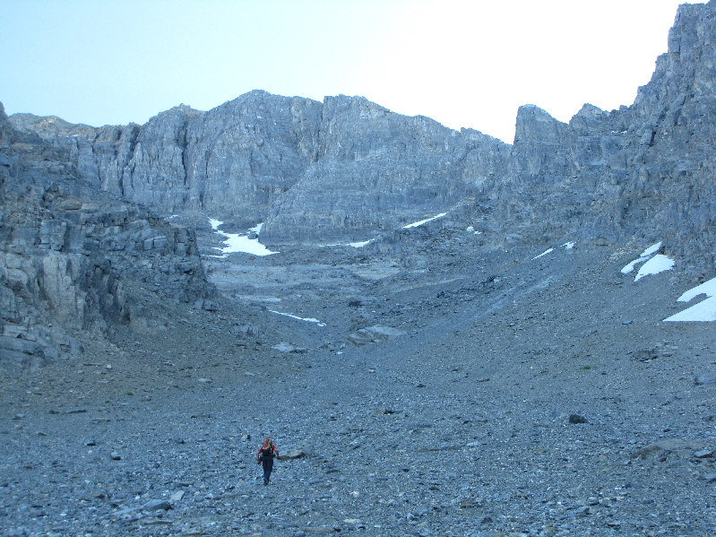
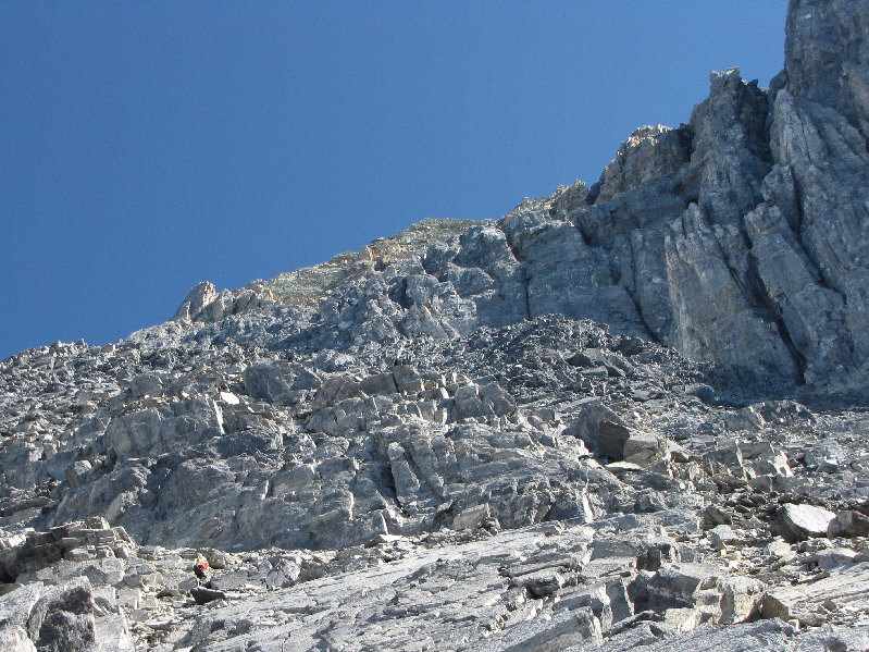
Starting from right near the Trans Canada Highway, we made our way across a logged area to the base of a very obvious gully running all the way down the southwest face of Mount Vaux. After ascending a rocky slope full of raspberry bushes, we entered a shallow canyon that had water flowing intermittently for much of its length. We eventually emerged from this canyon and began a very long slog up a wide avalanche slope. The foreshortening here is severe, and every time I paused to look up, the scenery seemingly did not change except for Vern getting further and further ahead of me! Frankly, I had no illusions of keeping up with Vern on this day, but it was disheartening to look at my GPS every once in awhile and realize that I still had an enormous amount of elevation to climb ahead of me. I eventually lost sight of Vern in the increasingly complex terrain of the upper gully, but he would occasionally give out a shout just to check that I was alright. He even built the odd cairn to point me in the right direction. This upper section is steep and entails more hands-on scrambling, but I preferred this to all the treadmill scree lower down. Prior to the start of our trip, Vern gained some insight on the route by studying the photo of Kane's partner, Sim Galloway, on the crux. Vern figured that Barton and Kazmierczak had probably wandered a little too far to climber's left of the crux which is perhaps why they had missed it. Vern stayed as much to climber's right as possible and eventually found the crux across a snow ridge. The snow ridge itself was quite daunting as it dropped away steeply on both sides, but I managed to get across safely by stepping in Vern's footprints (Vern wisely donned his crampons here, but I was too lazy to dig mine out). The crux consists of a series of small ledges going up a steep wall. The exposure here is significant, but more alarming to me was the looseness of the rock. As Vern remarked to me later, he felt like everything he touched seemed to move. Above the crux, I had to contend with more loose scree before finally gaining the summit ridge. Vern, who had reached the summit about 45 minutes before me, came partway down to cheer me on as I staggered up the remaining few vertical metres. I was finally on top of Mount Vaux.
Vern was kind enough to hang around with me for another 37 minutes on the summit while I snapped photographs and devoured a sandwich. On descent, we stuck fairly close to each other on the upper mountain in order to minimize the danger from rockfall. Fatigue was catching up to me though, and I caused a few near-misses on the way down. I even slipped at one point while downclimbing the crux but managed to catch myself before momentum could send me hurtling down the mountain. My GPS was not so lucky as it slipped off my pack and bounced down to the snow ridge below. I managed to retrieve my GPS (it still worked) but not without some difficulty. After scrambling down some steep sections below the crux, we utilized lingering snow patches to help speed our descent. While I glissaded a few sections (sometimes involuntarily), I never felt comfortable enough to completely let myself go probably because of the steepness of the slope. Plunge-stepping seemed to work well enough for us though, and that is how we descended much of the upper gully. Once we reached the wide avalanche slope, we were clear of all difficulties although we still had a lot of elevation to lose. This part of the day seemed to drag on forever as we descended endless rubble with a hot afternoon sun beating down on us. The intermittent streams lower down were most welcome as our water supplies began to dwindle. As we emerged from the shallow canyon near the bottom, we noticed a black bear feeding among the raspberry bushes along our route. Ironically, I had convinced Vern to leave his bear spray in his car when we began our trip, but that did not matter as the bear simply moved off once it noticed us coming down the slope. A last annoying thrash through the logged area had us back at Vern's car.
This was a big trip on a big mountain, and I want to thank Vern for doing the legwork in studying and researching the route, for driving, for route-finding, and for being great company as usual.
Be sure to check out Vern's trip report and photographs here.|
|
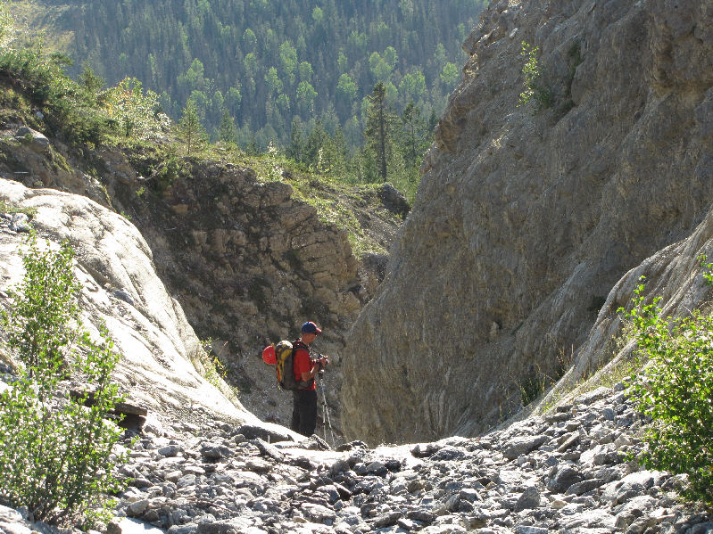
Vern heads up a shallow canyon near the base of the gully. |
|
|
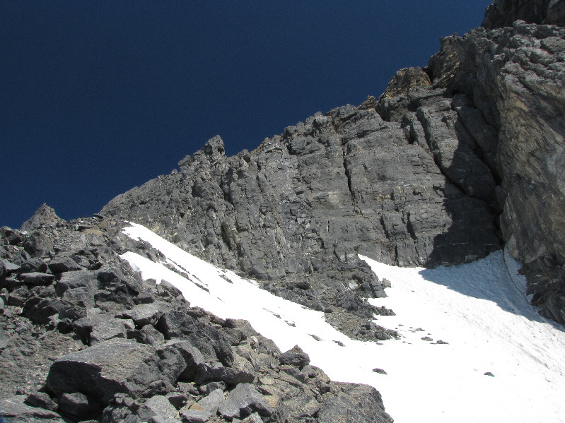
The gully opens up wide above treeline. |
|
|
Vern grinds his way up the gully. |
|
|
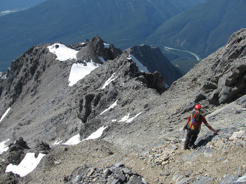
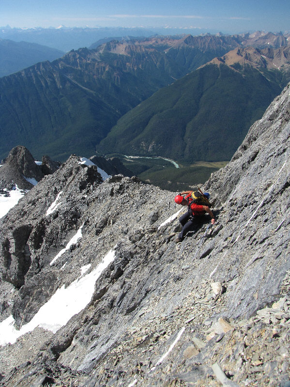
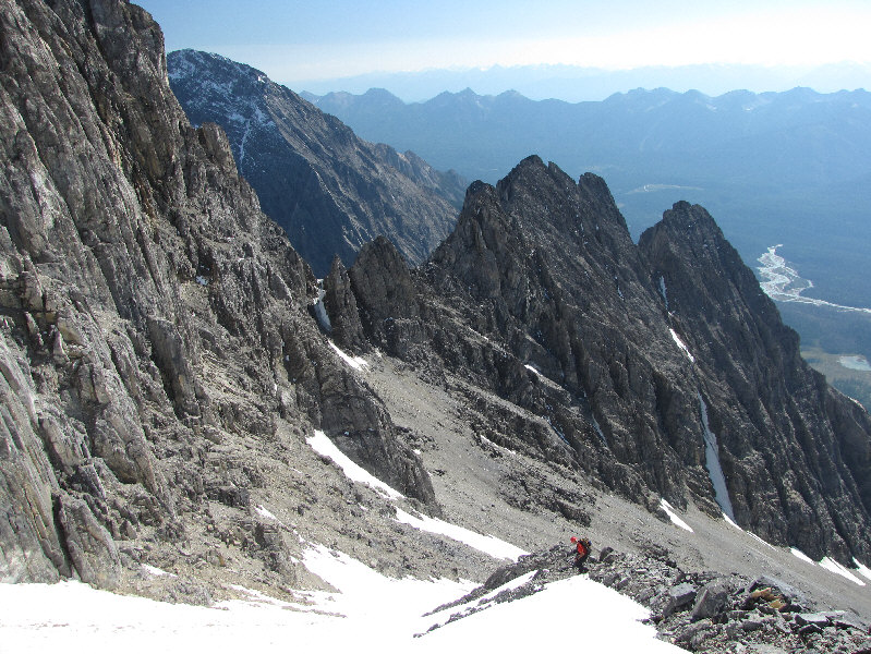
Vern makes his way up increasingly complex terrain in the upper gully. |
|
|
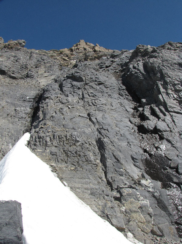
A black band of rock guards the summit block. |
|
|
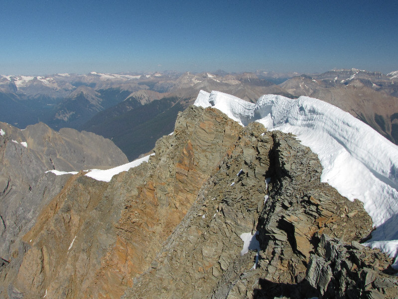
Here is the crux. The route crosses the snow ridge and goes up the right or left side of the shadowy crack at left. |
|
|
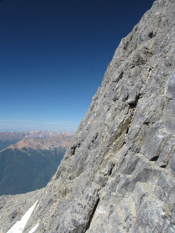
The terrain near the crux is very steep and exposed. |
|
|
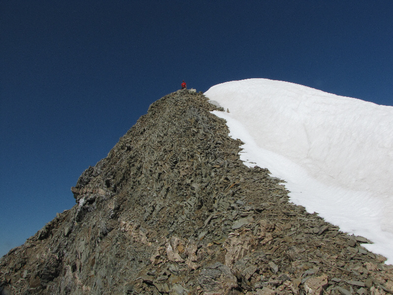
Vern waits for Sonny to ascend the summit ridge. |
|
|
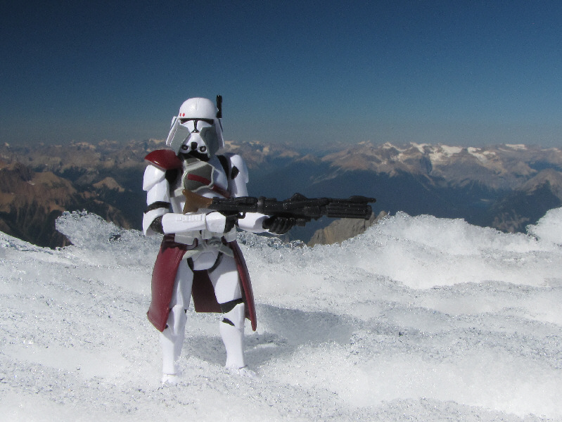
Sonny and Vern stand on the 3310-metre summit of Mount Vaux. |
|
|
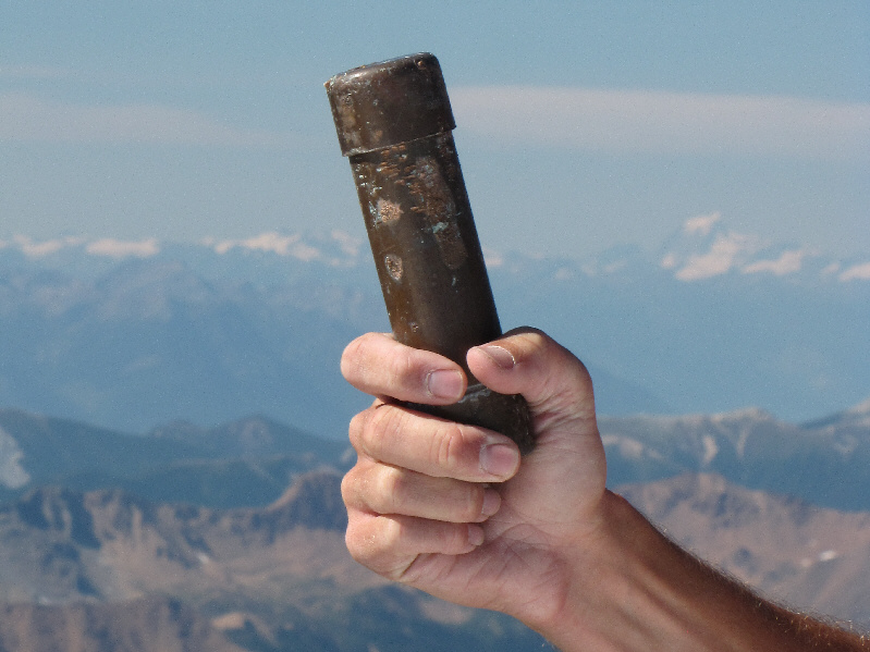
The summit register, which dates back to 1961, is housed in this copper pipe. |
|
|
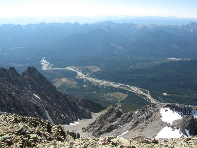
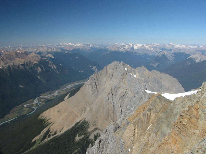
Most of the route can be traced all the way down the gully to the highway. Also visible is the Kicking Horse River. |
|
|
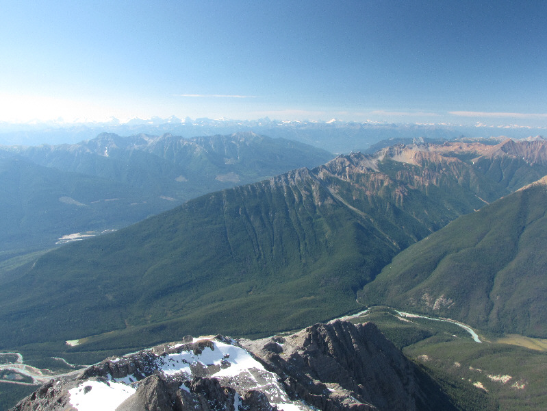
The Columbia Mountains stretch across the western horizon. At the centre is the long southeast ridge of Mount Hunter. |
|
|
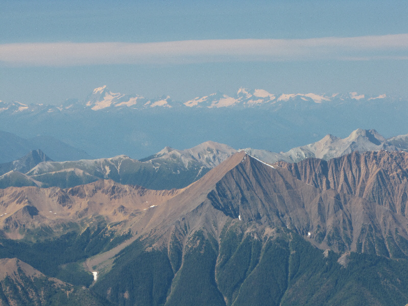
Porcupine Peak is in the centre foreground while Mount Sir Sanford (left) and Adamant Mountain (right) are the most prominent peaks on the distant horizon. |
|
|
Mount Hurd is the next summit to the north. |
|
|
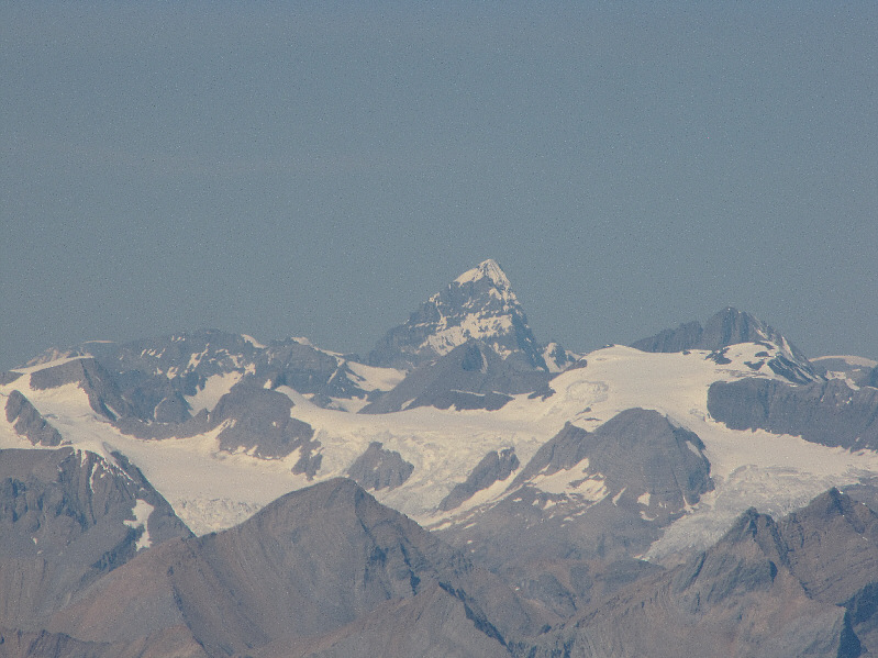
Over 70 kilometres away to the northwest is the striking form of Mount Forbes. |
|
|
The top of Hanbury Glacier follows the contours of Mount Vaux's north ridge. |
|
|
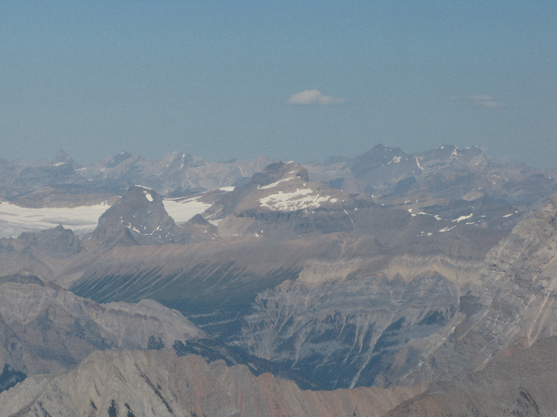
Some of the peaks visible to the northeast include Mount Niles (left), Mount Daly (centre), and Mount Willingdon (right). |
|
|
Also visible to the northeast are Mount Stephen (left) and Mount Hector (far right). |
|
|
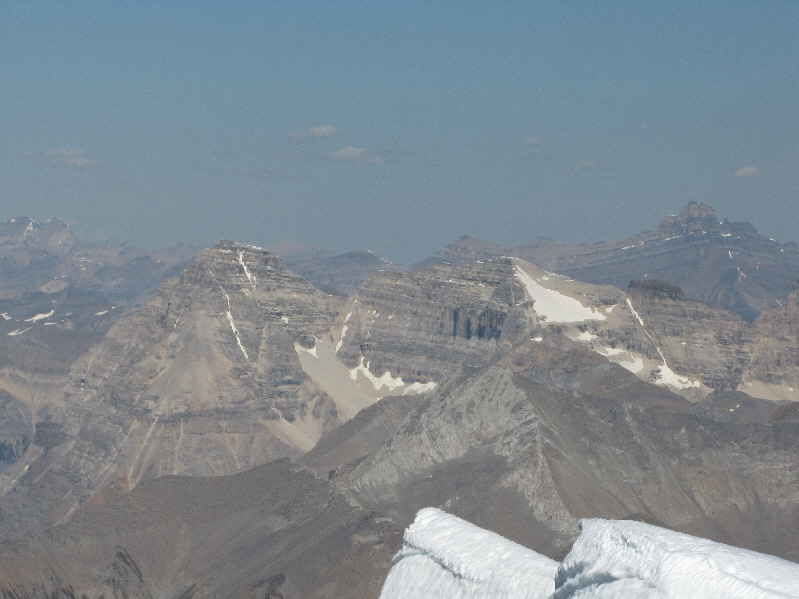
The peaks that are clearly visible on the eastern horizon include (L to R) Mount Lefroy, Glacier Peak, Ringrose Peak, Hungabee Mountain, and Mount Temple. |
|
|
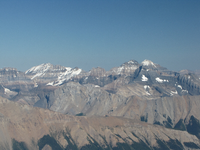
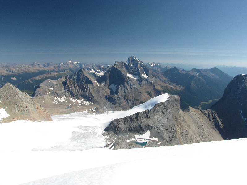
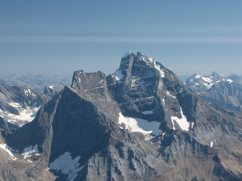
The Goodsir Towers and Hanbury Glacier dominate the view to the southeast. The pointy peak at far left is Mount Ennis. |
|
|
Here is a closer look at the Goodsir Towers. |
|
|
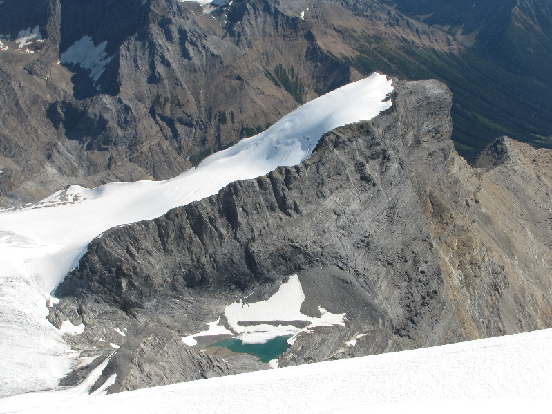
Both the outlier and pond to the southeast are unnamed. |
|
|
Vern descends the summit ridge. Chancellor Peak looms to the south. |
|
|
The terrain below the summit is very loose and steep. |
|
|
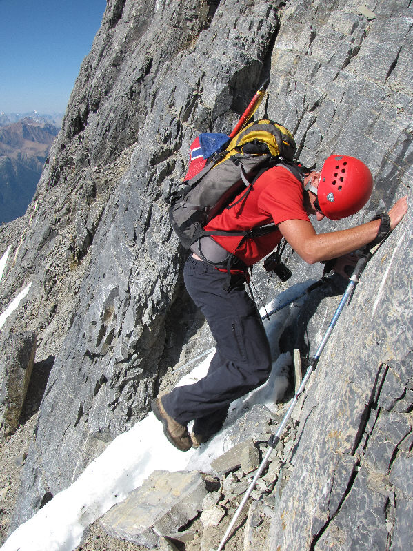
Despite the great views in the distance, Vern focuses his attention on downclimbing the crux. |
|
|
Vern carefully steps on the ridge of snow just below the crux. |
|
|
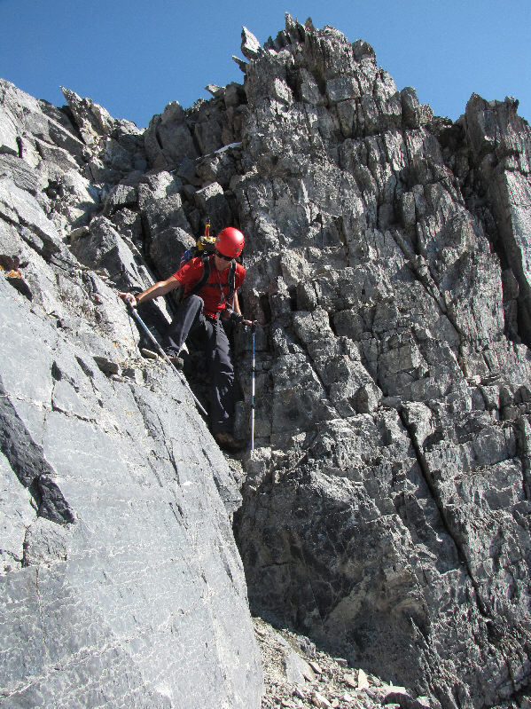
This section is not nearly as nerve-racking to descend as the crux. |
|
|
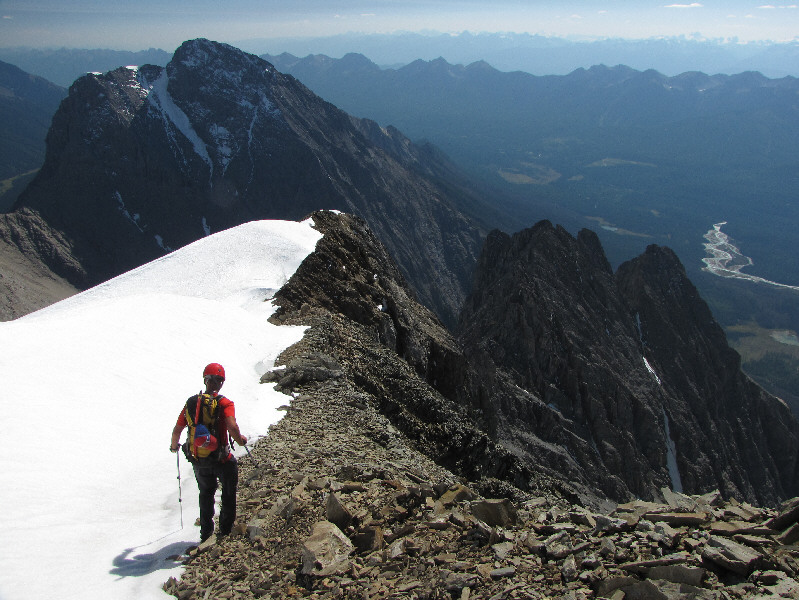
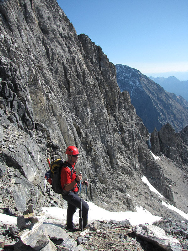
Vern pauses to admire the views after clearing the most difficult sections on the mountain. |
|
|
Vern continues his descent down the gully. |
|
|
Vern re-enters the shallow canyon near the lower end of the gully. |
|
|
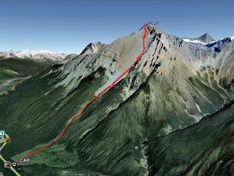
This is the route as viewed in Google Earth. |
|
|
Total Distance: 9.0 kilometres |