BOU AVENUE
Mount Timpanogos
Despite being the second highest peak in Utah's Wasatch Range (the highest is Mount Nebo), Mount Timpanogos is arguably the most popular mountain near Salt Lake City.  Affectionately referred to as "Timp" by locals, the mountain is easily ascended via good trails from two separate trailheads.  Hoping to avoid the weekend crowds, I waited until Monday, 5 August 2013, before paying Timp a visit.  I started my hike from the Aspen Grove trailhead ($6 USD or US National Park Pass required) and quickly made my way up a concrete path toward a picturesque waterfall.  From the waterfall, the trail begins a relentless climb up a big headwall, and I spent the next 2.5 hours hiking up countless switchbacks before finally leveling out in the cirque above.  Another 30 minutes of hiking brought me to Emerald Lake and a tidy-looking shelter.  Heading west from the shelter, I continued to follow the obvious trail which traverses a lengthy scree slope before climbing steeply to the crest of Timp's northwest ridge.  This is where the trail from the Aspen Grove trailhead converges with the trail from the Timpooneke trailhead (the Timpooneke trail is longer but starts at a higher elevation).  The remainder of the climb up the northwest ridge is straightforward, and I topped out 5.75 hours after leaving my car.  I spent over 50 minutes at the summit before retracing my steps back down the mountain.  My descent was uneventful but long and maybe even a little boring.  Perhaps that says it all about Timp.
I startled a moose near here, but it disappeared before I could take a photo. A paved concrete trail attests to the popularity of this hike.
Ugh. 
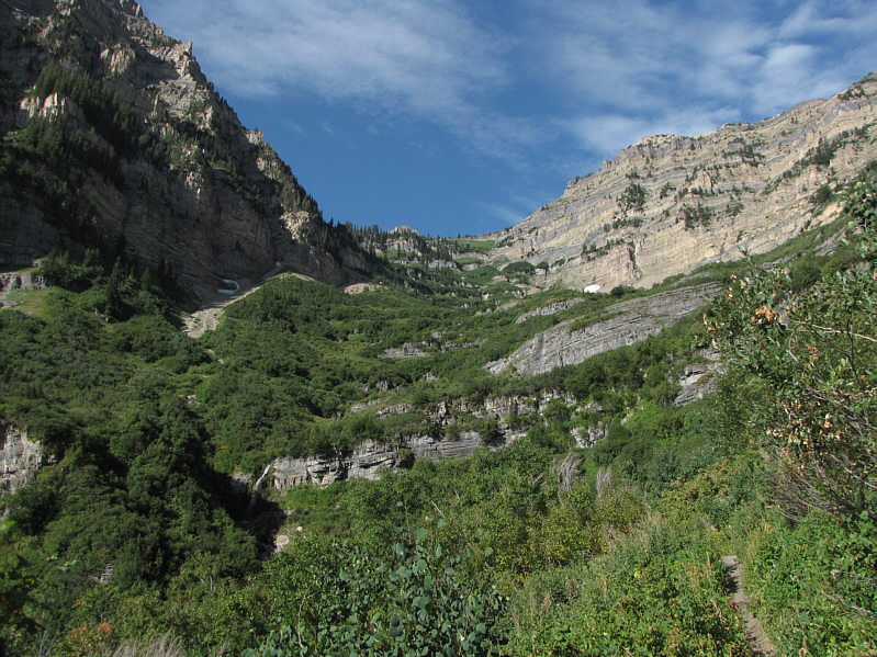
The bulk of the climb is up this headwall.
I feel refreshed already! 
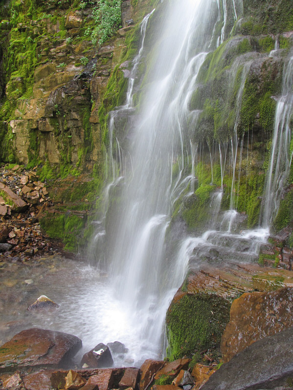
This is one of several cascades spilling down the headwall.
Oddly enough, it has been exactly 1 year to the day since I last hiked in shorts! 
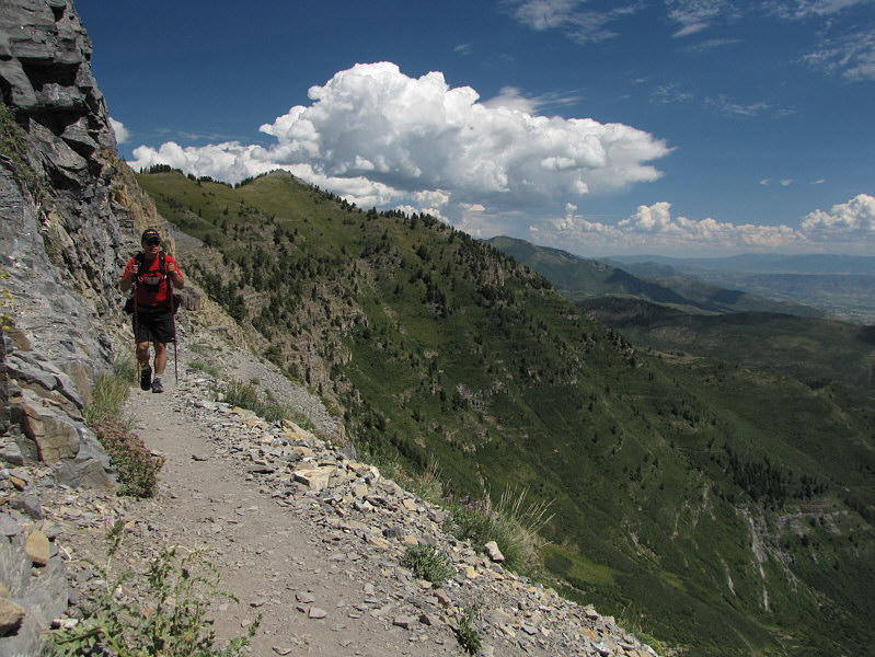
Sonny hikes up the well-graded trail.
Looks easy enough to bag...if you have the extra energy! 
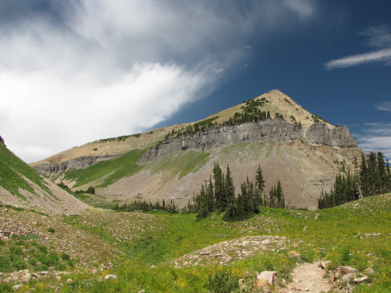
The trail continues up the draw at left in front of Roberts Horn.
Too bad they didn't build the switchbacks straight up the rock face. This is the first view of the summit from the trail.
I have my doubts that the glacier even exists anymore. 
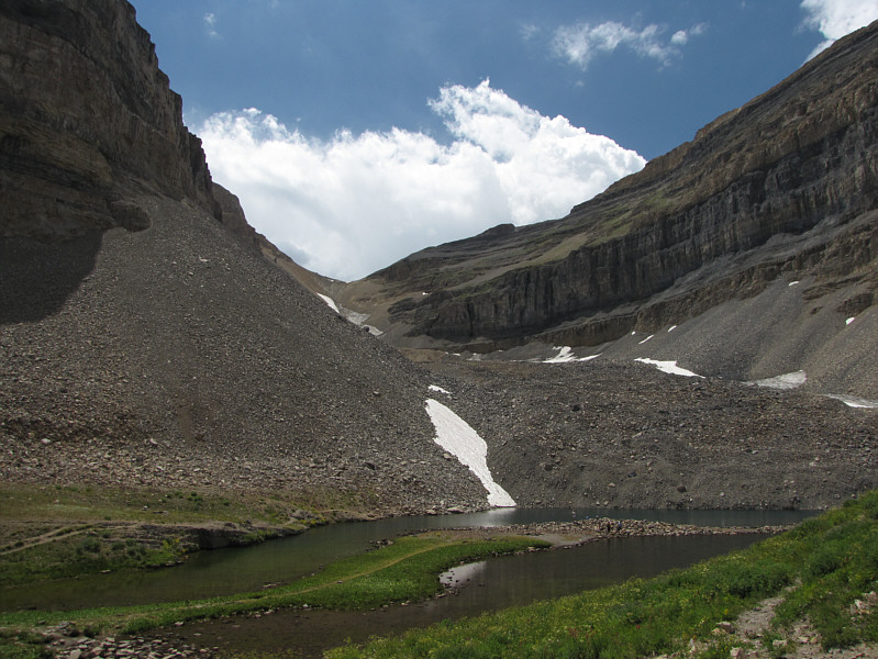
Emerald Lake sits at the toe of the last glacier in Utah.  The photo only shows lingering snow patches.  The remaining glacial ice is supposedly buried under the talus.
The last bit of trail before the junction is steep and very loose. 
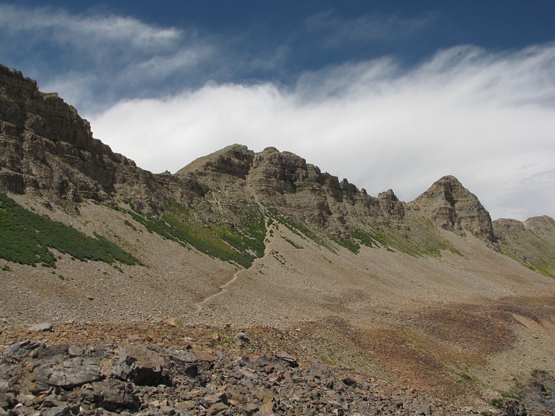
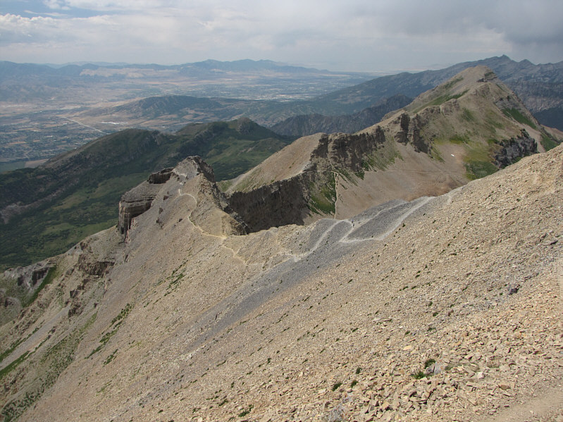
The trails from the two separate trailheads converge near the base of the cliffs at centre.
Don't worry; it's a lot easier than it looks. The northwest ridge of Mount Timpanogos looks a bit daunting from this angle.
Lotsa interesting info about this lake on Wikipedia...go check it out! 
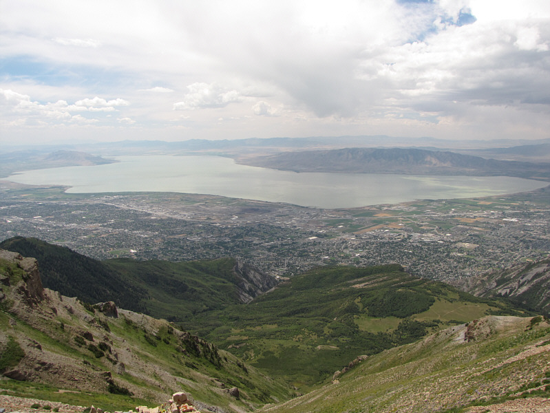
The ridge crest grants a comprehensive view of Utah Lake.
Without the trail, this would likely be a Class 3-4 scramble. The trail climbs up this gully via some cleverly-built switchbacks which are not so obvious in the photo.  Note the man near the top of the gully.
Another 20 minutes to the summit from here. 
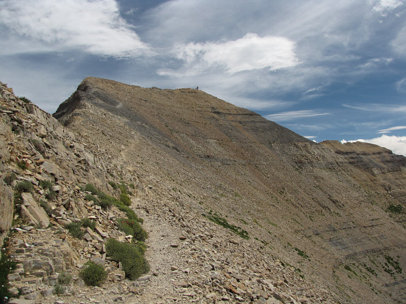
The trail continues all the way to the summit.
The wind actually made it a tad chilly up here. Sonny stands on the summit of Mount Timpanogos (3582 metres).
Looks like it has seen its share of abuse! 
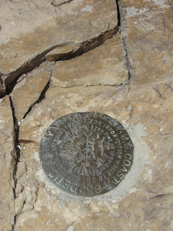
Here is the bench mark found at the summit.

Thankfully, the hut doesn't smell like urine!

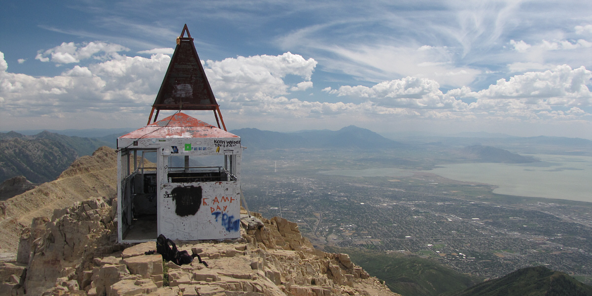
A metal hut adorns the summit of Mount Timpanogos.  Mount Nebo is visible in the hazy distance at right.

There are still some people coming up. 
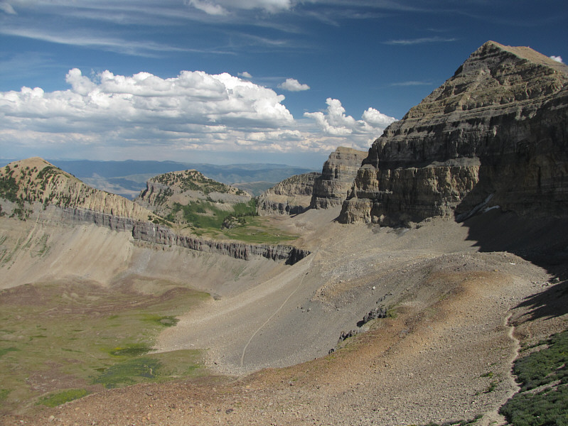
Access trails are visible all along the northwest ridge.
It's like looking down on a map! 
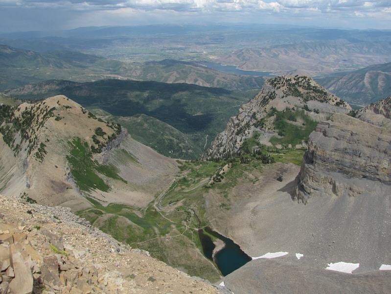
Emerald Lake is about 400 metres below to the east.  Roberts Horn is at left.  The bigger body of water in the distance is the Deer Creek Reservoir.
I saw a few people over there. 
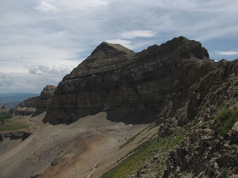
This is the impressive southeast outlier of Mount Timpanogos.
What you lookin' at?? 
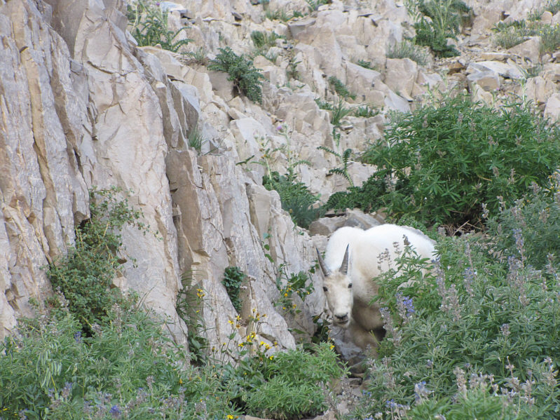
A goat hides among the bushes not far from the crest of the northwest ridge.
A lot of walking left ahead of me! Here is another look at the north face of Mount Timpanogos (right) with Roberts Horn at far left.
Not much else to see on the way down the headwall! 
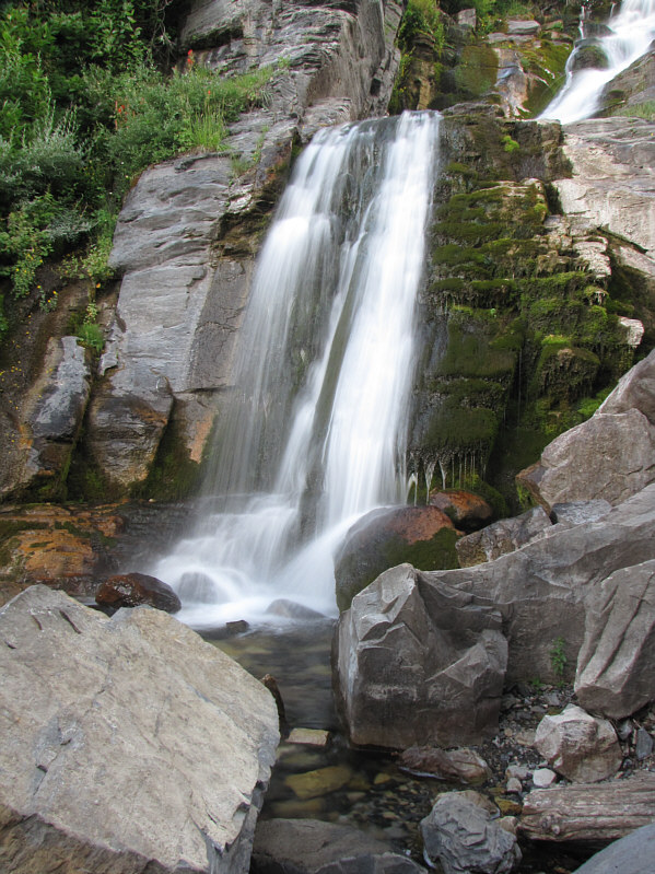
This is the picturesque waterfall near the base of the headwall.
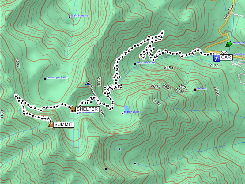
An easy but long hike. Total Distance:  ~20.7 kilometres
Round-Trip Time:  10 hours 46 minutes
Net Elevation Gain:  1522 metres