 |
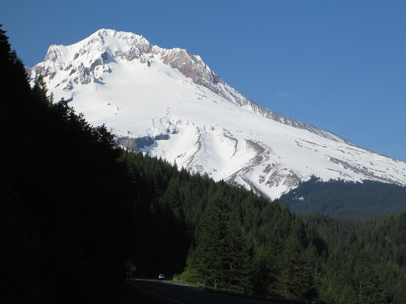
Mount Hood appears suddenly around a bend in the highway. |
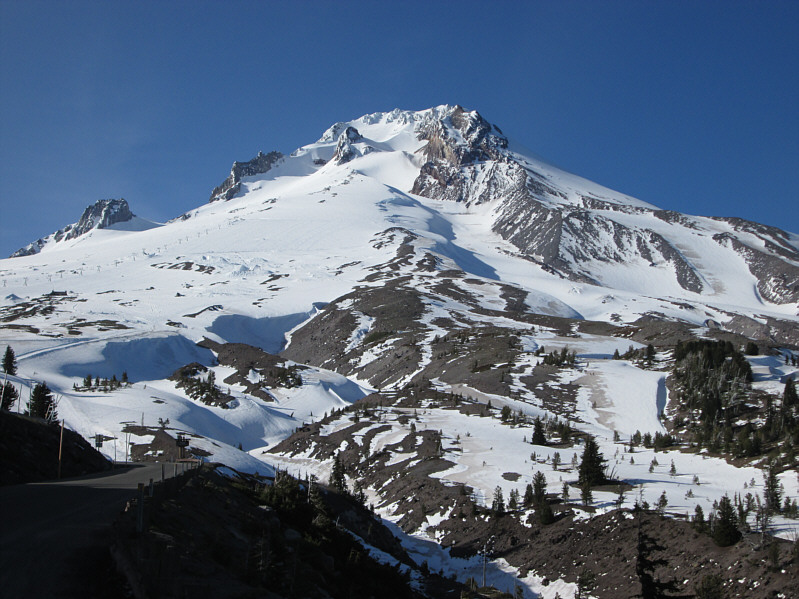 |
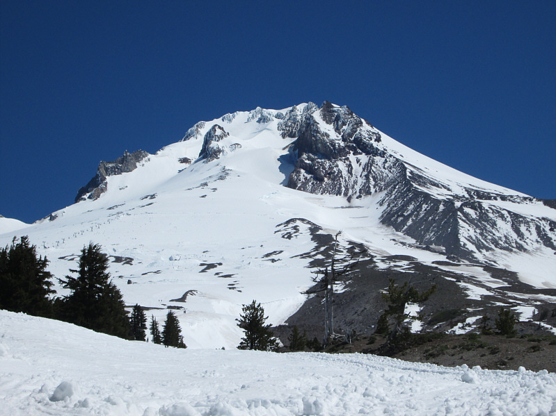
The crater of Mount Hood is more evident from this angle on the access road to Timberline Lodge. |
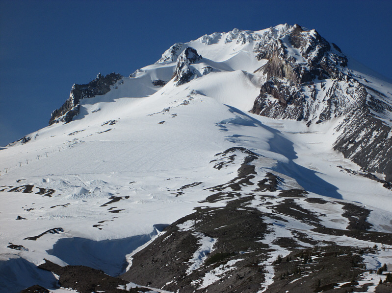 |
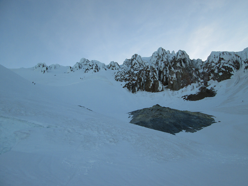
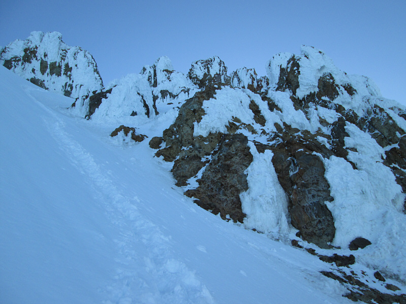
The protrusion at centre on the upper mountain is known as Crater Rock. Tracing an ascending line to the right of Crater Rock is the snow ridge known as the Hogsback. The bergschrund that cuts across the Hogsback is also visible. Further right of the Hogsback are the Steel Cliffs. |
A snowcat track on the eastern boundary of the ski area has been set aside for climbers ascending Mount Hood. The snow was nicely firm as I hiked up this track in the dark. Even in the middle of the night, the entire area was bustling with activity. Numerous snowcats rolled up and down the slope grooming the ski runs, and I could see the headlamps of lots of other climbers both ahead of and behind me. With plenty of light between the snowcats, other climbers, and the moon, I hardly used my headlamp during the night. Above the top of the Palmer Chairlift (the highest in the ski area) , the slope began to get steeper, and although the traction on my snow boots was still quite good, I eventually stopped to put on my crampons (this was the only time I turned on my headlamp). When I resumed climbing, I followed a ridge of rocks protruding from the snow and immediately noticed a few tents pitched here. Like on Mount Adams, some people choose to break the climb up into two days, but frankly, I do not think it is necessary or even worth the effort of hauling camping gear up there.
At this point, the sky was beginning to brighten, and I could start to see more features on the upper mountain. I soon entered what is known as Devils Kitchen which is essentially the inside of Mount Hood's volcanic crater. There are numerous active fumaroles (steam and gas vents) here, and the smell of rotten eggs is quite noticeable. After climbing onto the crest of a prominent snow ridge known as the Hogsback, I took a short break and donned my climbing helmet. The usual South Side route continues straight up the crest of the Hogsback to what are known as the Pearly Gates, a couple of chutes which break through the cliffs guarding the summit. An alternate route traverses to climber's left and ascends steep open slopes to the summit ridge via what is known as the Old Chute. While I was taking my break on the Hogsback, a large group of climbers caught up to me, and they began having discussions about which route to take. One of them, presumably a guide, said that, from earlier reports she had read, the Pearly Gates were "nasty" this year and that they should take the Old Chute route. Most of the other climbers concurred, but because I had earlier watched a lone climber descend from the Pearly Gates, I opted to take that route instead which would have the advantage of being less congested.
As I climbed up the Hogsback, the mountain seemed to get steeper and steeper with every step I took, and I was very thankful that someone else had already broken trail through the snow. Further up, there is a bergschrund that cuts across the Hogsback, and it is necessary to circumvent it usually to climber's right. The section between the bergschrund and the Pearly Gates is quite possibly the steepest part of the entire route. Even with crampons on, I felt a little unnerved climbing up this section. At the base of the Pearly Gates, there was a bit of a flat area which allowed me to catch my breath and mentally relax a little. I also noticed here that another climber was coming up fast behind me. Judging from the footsteps in the snow, most of the traffic here was going through a chute to climber's left. The first thing I noticed about this chute was that it was pure ice for about a 3- or 4-metre stretch. It was definitely nasty! A couple of shallow footholds in the ice showed some promise initially, but after climbing halfway up, I found myself without anything to really grab onto. My ice axe was still attached to my pack, and I decided to back down for a chance to take it out. In the meantime, the other climber who was behind me gave the chute a try, and he too was stymied. After backing down, he decided to traverse further to climber's left to find another way up. With my ice axe in hand, I tackled the icy chute again, and this time, I made it up albeit with a fair amount of difficulty. As I climbed out of the chute, I noticed the other climber on the steep and exposed ridge just above me. He was still working his way to safer ground, and he did not look like he was enjoying his predicament at the moment. I left him to his struggles as I leisurely trudged up the remaining steps to the summit.
Most of the climbers that I bumped into on the Hogsback were on the summit when I arrived. The other climber that followed me up to the Pearly Gates also arrived safely a few minutes later. There was a lot of jubilation on that summit, but the guide was soon urging everyone in her group to start their descent back the way they came (Old Chute route). She also offered to set up a belay which several in her group were eager to accept. My "partner" at the Pearly Gates eventually followed the big group to the Old Chute and left me to enjoy the summit in solitude. After taking my requisite photographs, I began descending back to the Pearly Gates. I took a quick glance westward and noticed that the large group and my "partner" were still standing on the far side of the summit ridge. Obviously, the belay was taking some time to set up as they had been standing there already for a good 10 minutes or so. The icy chute was just as tricky to descend but I made it down none the worse for wear. From the Pearly Gates, I carefully retraced the trail down to the Hogsback where I could finally breathe a sigh of relief knowing that the worst was behind me. I took another break on the Hogsback and was entertained by the plethora of climbers on the Old Chute route. The group that had left the summit before me was still quite high up and descending rather slowly.
After exiting Devils Kitchen, I removed my crampons
and mostly plunge-stepped down the slope with a couple of slightly
out-of-control glissades thrown in. During one stretch of
glissading, I actually felt some heat on my butt, and I would later learn
that I had burnt a hole right through my wind pants! I certainly
lamented the missed opportunity to ski down this mountain, but my descent
was still pretty quick. The base area and parking lot were a bit of
a zoo when I got back down at 10:29 AM, but that was understandable given the
gorgeous weather. After "checking-out" at the self-registration
kiosk, I changed my clothes and re-hydrated before
hitting the road for an 11-hour, 940-kilometre drive to Fairmont Hot
Springs. Oddly enough, I did not feel drowsy at anytime during the
long drive probably because I was still wound up about my amazing and
memorable climb up Mount Hood.
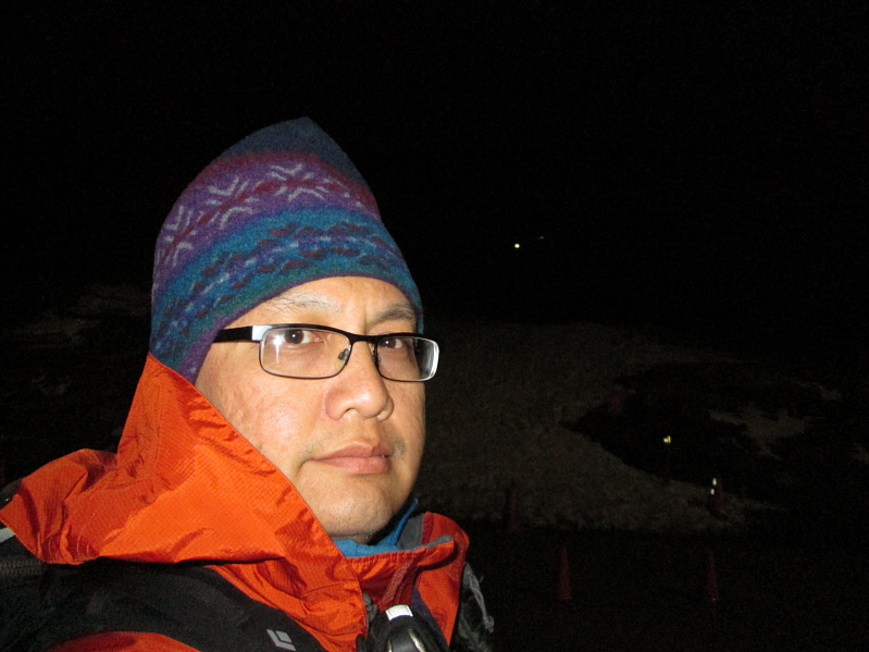 |
Sonny is ready to start climbing at 12:41 AM. |
 |
Other climbers can be seen on the south slopes as dawn breaks on Mount Hood. Mount Jefferson can also be seen on the horizon. |
 |
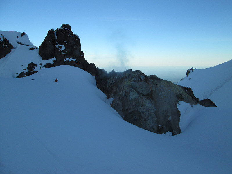
A large active fumarole marks the entrance to Devils Kitchen. Note the two climbers at left who have gained the crest of the Hogsback. |
 |
A climber on his way down sits in the snow beside another fumarole near Crater Rock. |
 |
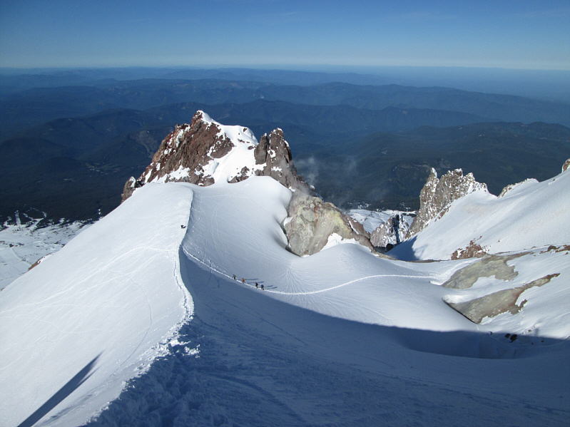
The Hogsback rises steeply to the Pearly Gates (top centre). At upper far left is the Old Chute. The Hogsback is known to shift left or right over time. Compare this photo with another one taken in March 2002 (courtesy of summitpost.org). |
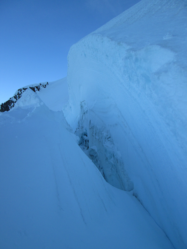 |
The bergschrund is a good reminder that there is actually a glacier here--specifically, the Coalman Glacier. |
 |
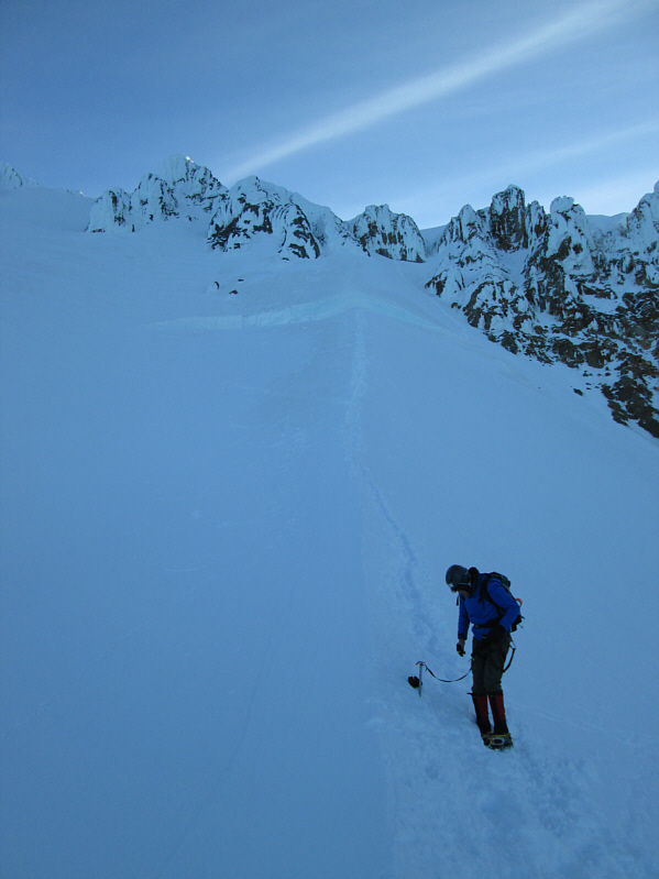
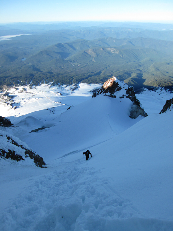
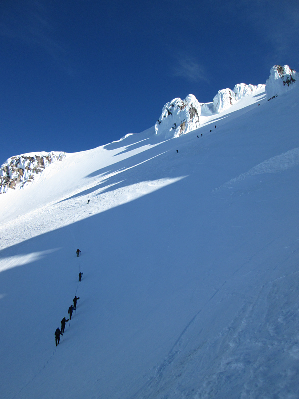
Above the bergschrund, the trail in the snow leads to the Pearly Gates at upper left. |
 |
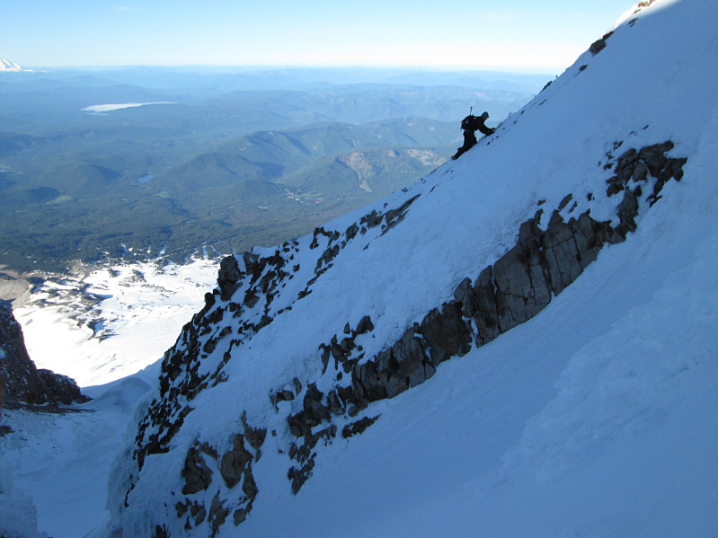
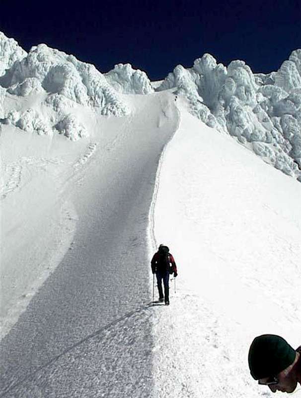
Another climber comes up the steep trail to the Pearly Gates. Sunlight is hitting the top of Crater Rock. |
 |
The other climber finds himself on increasingly exposed terrain after he opted to forego going up an icy chute. |
 |
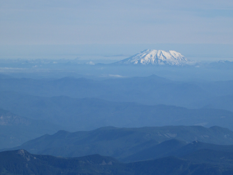
Sonny takes a knee on the 3426-metre summit of Mount Hood, the highest point in Oregon. Visible in the distance is Mount Saint Helens. |
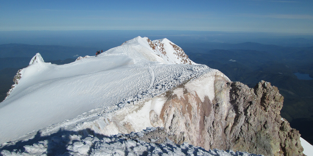
A group of climbers prepare to descend the Old Chute route in this view looking west from the summit.
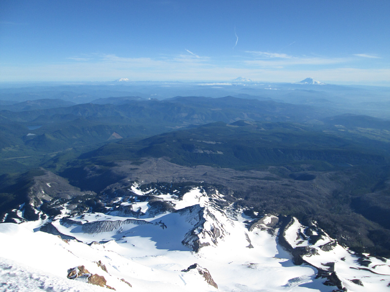 |
The view to the north includes Ladd Glacier (bottom left), Pulpit Rock (far bottom centre), and Coe Glacier (bottom right). Spread across the horizon are (L to R) Mount Saint Helens, Mount Rainier, and Mount Adams. |
 |
On the northeast side of Mount Hood are Eliot Glacier (centre) and Cooper Spur (right of centre). |
 |
Here is a closer look at Mount Rainier (left) and Mount Adams. |
 |
Mount Saint Helens looks resplendent in the morning sun. |
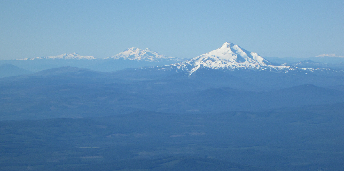
Visible on the southern horizon are (L to R) Broken Top, Three Sisters, Mount Jefferson, and Diamond Peak.
 |
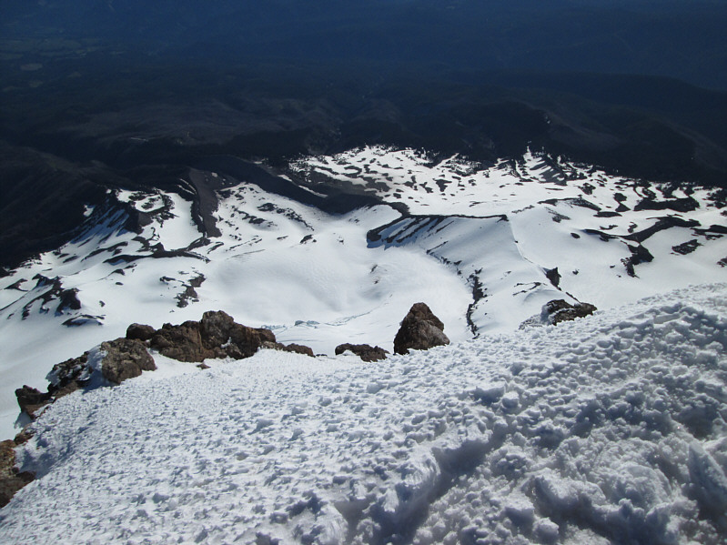
This is looking back down the Hogsback from below the bergschrund. Crater Rock is now fully bathed in sunlight. |
 |
The Old Chute route is very busy on this day. |
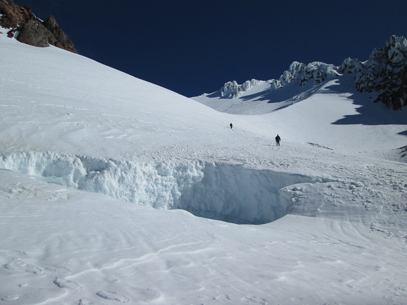 |
A couple of climbers descend from the Hogsback. The hole in the foreground is the result of yet another fumarole. |
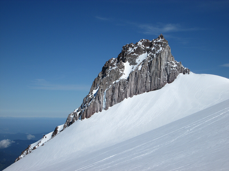 |
Illumination Rock is usually the first notable feature on the south side of the mountain to be lit up by the morning sun. |
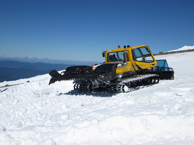 |
Here is one of the many snowcats that seemingly work non-stop and around the clock on the ski hill above Timberline Lodge. |
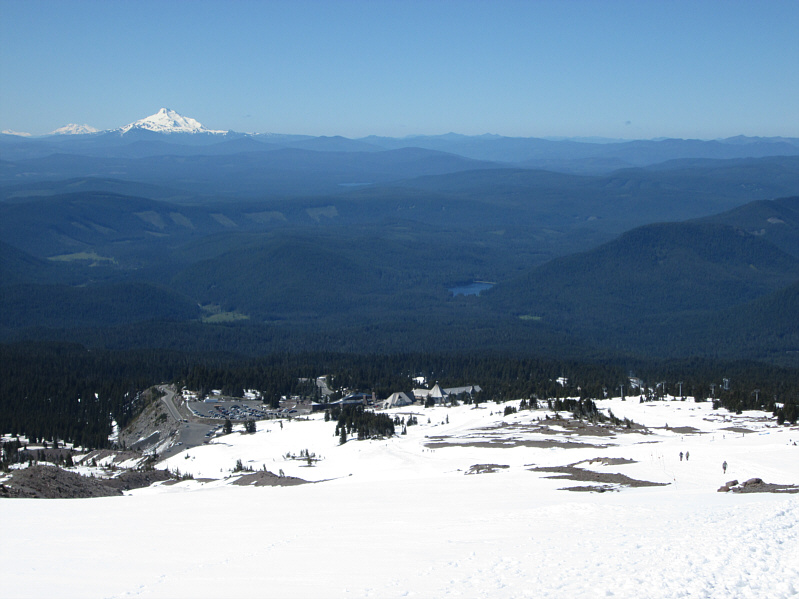 |
Timberline Lodge and the parking area are a sight for sore eyes after a long day of climbing on Mount Hood. |
 |
Here is a last look at Mount Hood from the parking area near Timberline Lodge. |
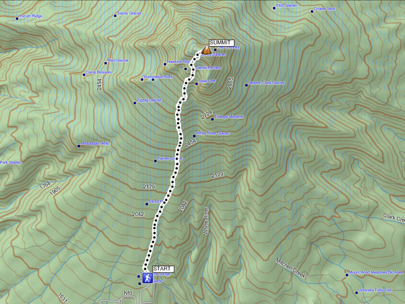 |
Total
Distance: ~10.2 kilometres Round-Trip Time: 9 hours 48 minutes Net Elevation Gain: 1660 metres |