BOU AVENUE
Mount Washburn
When I climbed Teepee Mountain in 2010, a very striking peak to the east caught my eye.  I would later learn that this peak is Mount Washburn located about 16 kilometres west of Sparwood, British Columbia.  Despite its great prominence, Mount Washburn is somewhat remote and seldom seen except from the tops of other peaks in the region.  In 1999, Rick Collier published a trip report for Mount Washburn on Bivouac.com, but since I am not a subscriber, I could only glean a few route details from what I could see of his report and the lone accompanying photo.

On 11 August 2015, I made a half-hearted attempt at climbing Mount Washburn after leaving Calgary rather late.  The turn-off to Cummings Creek forestry road from Highway 43 is not signed and is easy to miss.  A high clearance vehicle is required to proceed beyond a large parking area about 500 metres from the highway, but disappointingly, the road is only drivable for another 1.3 kilometres to a rickety bridge over Cummings Creek (there is a spacious camping spot here).  In anticipation of this, I brought along my mountain bike and was able to cycle along the continuation of the road beyond this first bridge.  Shortly after, I crossed back to the north side of the creek on another rickety bridge, and from there, I enjoyed a fairly easy ride to the junction with Telford Creek forestry road.  I managed to ride or push my bike for about another three kilometres before deciding that it was more efficient to continue on foot.  With daylight running out, I pulled the plug just past a large avalanche gully descending from the eastern outlier of Mount Washburn.  Although I did not come anywhere close to even starting the actual climb, this trip gave me a good feel for the level of commitment required on the long approach, or so I thought.
It's already too late to climb Mount Washburn on this day...sigh. 
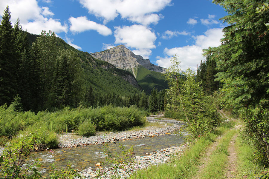
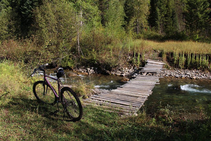
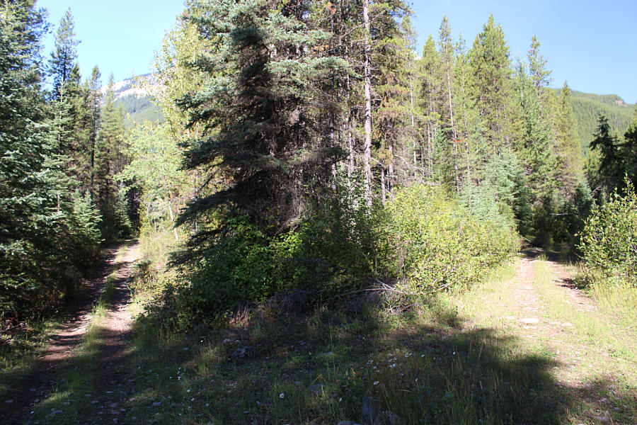
The Cummings Creek road is mostly an easy double-track to the Telford Creek junction.
What a cutie! You could easily swallow this one in one gulp! 
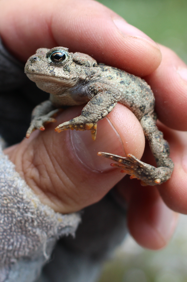
Sonny picks up a rather small boreal toad somewhere along Telford Creek.
*Yawn*...I'm pretty much ready for bed at this point! 
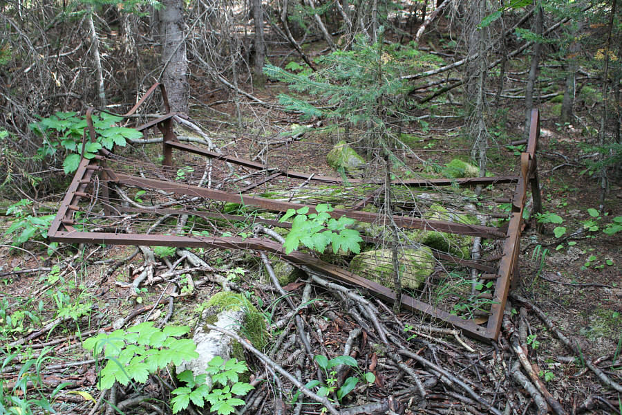
A rusted bed spring in the middle of the woods invites much speculation about how it may have gotten here.
Maybe I should get up a little earlier next time... 
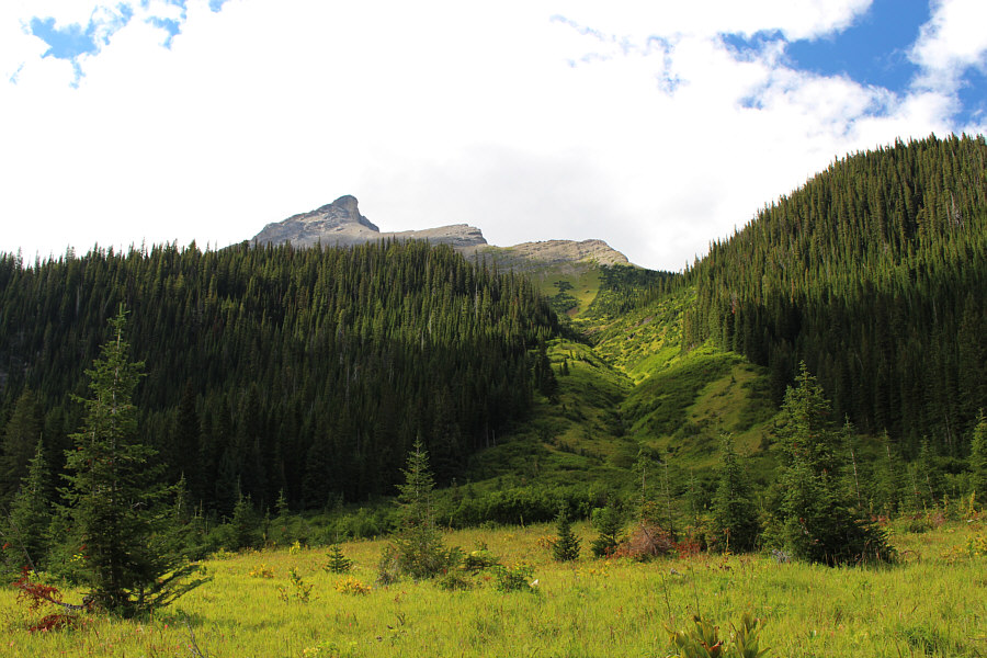
Sonny would turn around shortly after reaching this avalanche slope.
With a fantastic weather forecast for the weekend, I returned for a more serious attempt to climb Mount Washburn on 20 August 2016.  Unfortunately, I slept in and left Calgary about three hours later than I should have, but I was still highly confident that I had ample daylight left to complete the trip.  As before, the cycling up Cummings Creek and Telford Creek was easy, but this time, I ditched my bicycle just before the first bridge over Telford Creek.  I remembered having to push my bicycle a lot after this spot on my previous attempt and felt that the return ride, where I was braking a lot down steep hills, hardly justified the extra effort.  The Telford Creek road eventually ends near the lower of two tarns at the head of the valley, and I had to bushwhack for a bit to reach the upper tarn which, contrary to what is shown on maps, has actually split in two.  Circling around the north shore of the larger of the upper tarns, I found a game trail to get through a short stretch of forest before breaking out of the trees for good and ascending steep grassy slopes leading to a large amphitheatre.

My heart sank upon first glance of the amphitheatre as it appeared to be guarded completely by impassable cliffs.  However, as my old scrambling buddy, Vern Dewit, would say, sometimes you need to get your nose right into it before deciding if a route will go or not.  I trudged up wearisome rubble in the amphitheatre and kept stopping every few metres to catch my breath and look up to see if I could discern a weakness in the cliffs.  As I got closer, I veered to climber's left to follow a goat path hugging the base of the cliffs, and I began to see a reasonable route above where the goat path ends.  Although there is some exposure, I found the weakness in the cliffs to be fairly straightforward to climb.

My elation at finding a route through the cliffs of the amphitheatre was very short-lived as what I saw ahead proved to be even more disheartening.  I was confronted with a cirque containing a permanent snowfield and ringed by massive cliffs.  As with the amphitheatre, my initial reaction was that there was absolutely no way to breach the cliffs, but upon closer inspection, I spotted a possible route near the top left corner of the snowfield.  This, however, would turn out to be a far more challenging crux to surmount.  I climbed as high as possible on scree before donning my crampons to traverse the top of the steep snowfield.  There is a huge gap between the top of the snowfield and the cliffs it abuts, and partway across, I was alarmed by how deep the chasm was between the two.  This felt very much like a bergschrund on a glacier, and at times, I was perched precariously on a knife-edge at the top of the snowfield praying for the snow under me not to collapse.  The transition from the corner of the snowfield to the rocks above was probably the most dangerous section of all.  Water cascaded from the cliffs above here making all the rocks slick and carving hidden melt-water channels under the snow.  I nearly broke through one of the thinned-out patches of snow before I hastily scrambled to the "safety" of the wet rocks above.

Leaving my crampons on for better traction, I continued up a mix of loose scree and steep snow patches before finally gaining the broad crest of Mount Washburn's south ridge.  I removed my crampons and left them here along with my ice axe before hiking up the ridge toward an impressive buttress guarding the south side of the summit block.  A hidden gully on the west side grants access to the summit, but getting to the base of this gully is almost as challenging as climbing the gully itself.  A belay station partway up the gully attests to its apparent difficulty, but compared to the wet mess at the top of the snowfield, I found this gully to be considerably easier to climb.  After some more scrambling up loose rubble above the gully, I was standing on the summit.  From my car, the entire ascent had taken me nearly 9 hours, far longer than I had anticipated.  I started to regret not getting up three hours earlier that morning, and I now faced the prospect of hiking and biking out in the dark.

My first priority was to at least get down all the difficult stuff before sunset.  Retracing my steps, I had no serious difficulties down-climbing the summit gully.  After returning to where I had left my crampons, I put them back on and stumbled my way back to the top of the snowfield.  Carefully avoiding where I thought the melt-water channels were, I stepped back onto the snowfield and began hiking down the steep slope.  I briefly thought about digging out my ice axe to glissade the slope, but there were a lot of rocks strewn about which did not look appealing to slide over.  As it turned out, I took an involuntary slide anyway after taking a few steps down.  Thankfully, the run-out was relatively safe, and I even managed to kick a few of the bigger rocks aside on my way down.  When I finally stopped, I was remarkably unscathed except for having a slightly wet bum and numbingly cold hands.  I trotted down to the end of the snowfield before removing my crampons for good.

I had no issues down-climbing the cliffs above the amphitheatre and descending to the upper tarn, but by now, light was quickly fading.  To complicate matters, I was wearing my prescription sunglasses and had neglected to bring my regular glasses.  This made route-finding through the bushes between the tarns a little tricky.  Things looked either too dark or too blurry although I could alleviate a bit of the darkness by using my headlamp.  This may have been the first time I have ever worn sunglasses while using my headlamp; I guess it never hurts to look cool even in the dark!

Once I regained the road, I settled into a long but uneventful march back to my bicycle.  Despite still wearing my sunglasses, I had enough illumination from my headlamp and my bicycle's LED light to ride back to my car without a spill.  On the ensuing drive back to Calgary, I began to fade a bit on the outskirts of the city, but I managed to make it home safely.  Unfortunately, after putting away my bicycle, feeding my hungry cats, and cleaning my hiking gear, I would only get about an hour's worth of sleep before I was up again to meet a friend for another adventure in the mountains the next day.  Such is my love affair with mountains--here today, gone tomorrow!
I guess I should be thankful that all of the bridges in the area are still intact... 
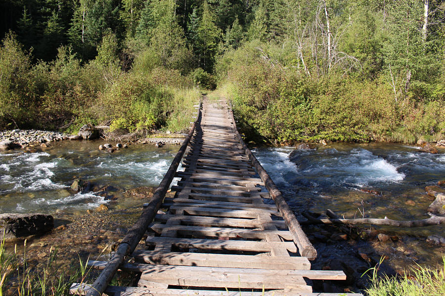
The first bridge over Cummings Creek is the end of the line for most cars.
That gap seems a lot bigger when you're tired and it's after midnight! The second bridge over Cummings Creek is in need of repairs (gap at far end).
Two roads diverged in a yellow wood... The Telford Creek road branches off to the left at this junction.
Actually, most of the route on the upper mountain is visible from here. 
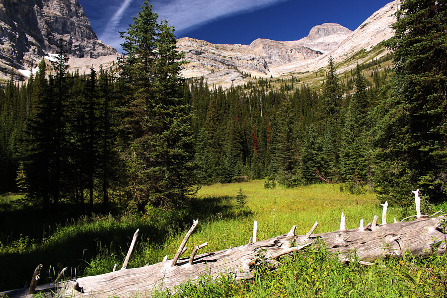
A glade near the end of the Telford Creek road grants a view of the summit of Mount Washburn.
Good place to camp too if you wanna make it a 2-day trip. 
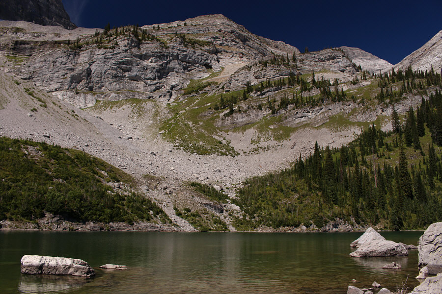
The upper tarn at the head of Telford Creek valley is a good place to take a break before tackling the remaining 1000+ metres of elevation gain to reach the summit (visible through the gap at upper right).
The tarn looks deep enough on this side for diving... This perspective shows how the upper tarn has split in two.
This is where people say, "I could've gone elsewhere and climbed a Kane peak!" 
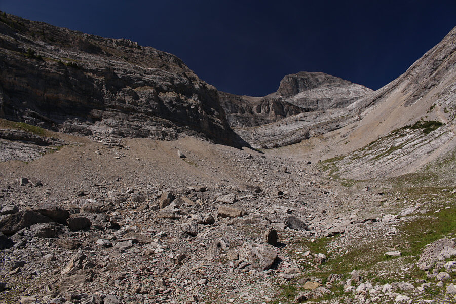
From a distance, the amphitheatre appears to be impregnable.
It's no cakewalk, but it's doable! 
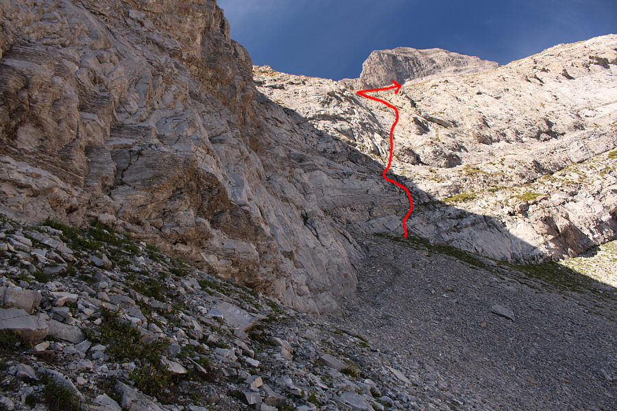
A goat track leads to the weakness in the cliffs of the amphitheatre.
This is where people say, "I could've gone elsewhere and climbed a Nugara peak!" 
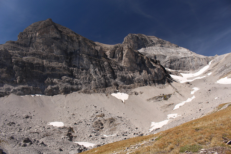
Above the cliffs of the amphitheatre is the cirque (far right) with the permanent snowfield.
Not as easy as it looks! 
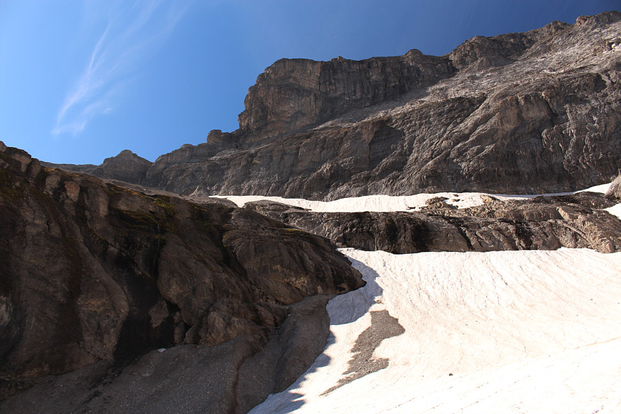
The upper left corner of the snowfield is key to climbing out of this cirque.
Scariest part of the whole mountain! 
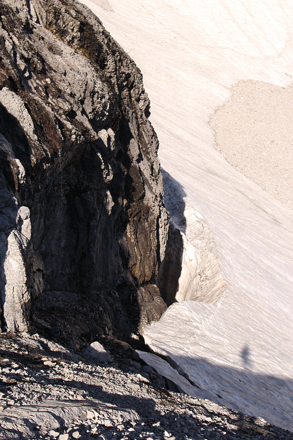
This is looking back down at the crux above the snowfield.  Note Sonny's tracks and the chasm between the snowfield and the cliffs.
I actually angled higher and traversed above the cliff band at upper right. 
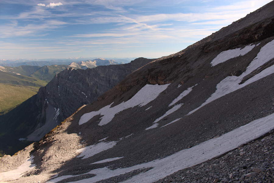
Above the cirque, a traverse across steep scree and snow patches leads to the south ridge.
Don't worry; these aren't the gullies you're looking for... 
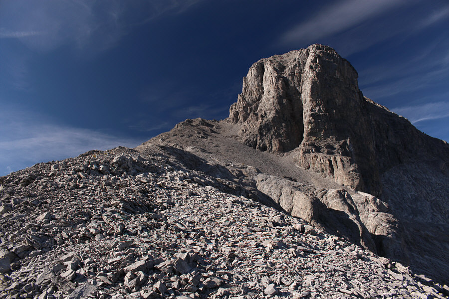
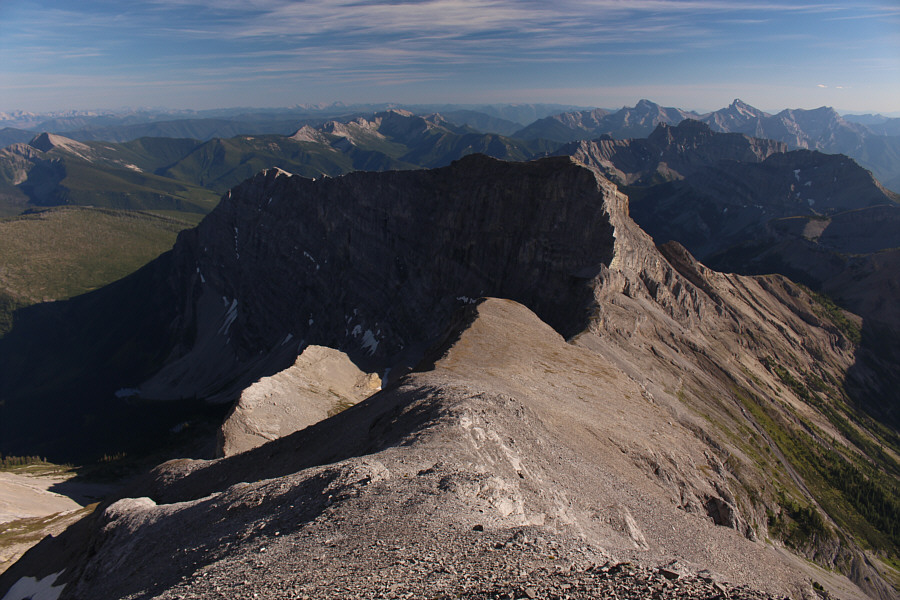
An impressive buttress guards the south side of Mount Washburn's summit block.
The approach from the Bull River Road would be shorter although the drive to get to the start would be much longer. Some parties that climb Mount Washburn approach from the Bull River Road to the west and likely come up the slopes at bottom right.
Start looking up to the right here. The west side of the summit block has some complicated terrain.  The block at right is an outlier, and the shadowy cleft is not the route to the summit.
Way more enjoyable than the snowfield! 
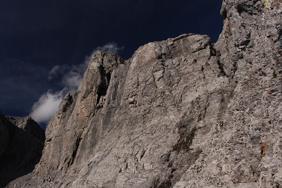
The access gully is the crack on the right.
Hallelujah! 
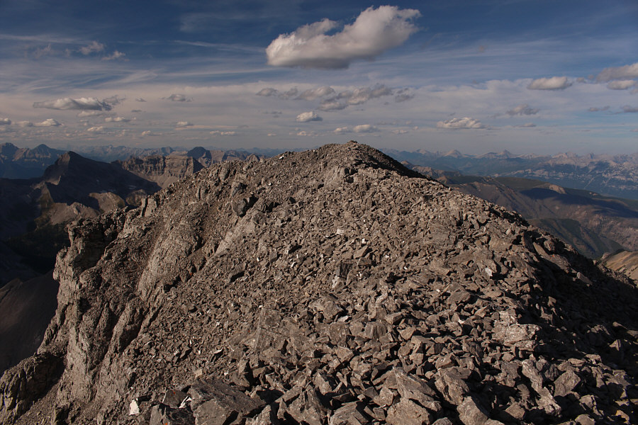
The summit cairn is finally in sight.
Mine was the 12th recorded ascent since 1979 but the second one in as many days! Sonny holds up the summit register on top of Mount Washburn (3024 metres).  The current register was placed by Rick Collier and Bill Hurst exactly 17 years ago to the day.
Oddly, my TopoCanada v4 map shows the lower knob just right of centre as the summit of Mount Gydosic! To the north, Mount Frayn is the dark peak at left while Mount Gydosic is the peak in the foreground.  On the horizon at far left is Mount Harrison.
Can you pick out Crowsnest Mountain and Mount Ptolemy on the horizon? 
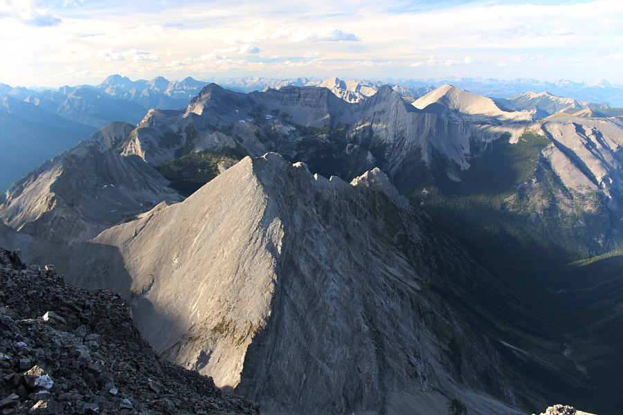
The eastern outlier of Mount Washburn obscures most of the Telford Creek (approach) valley.
Mount Bisaro is next on my hit list... 
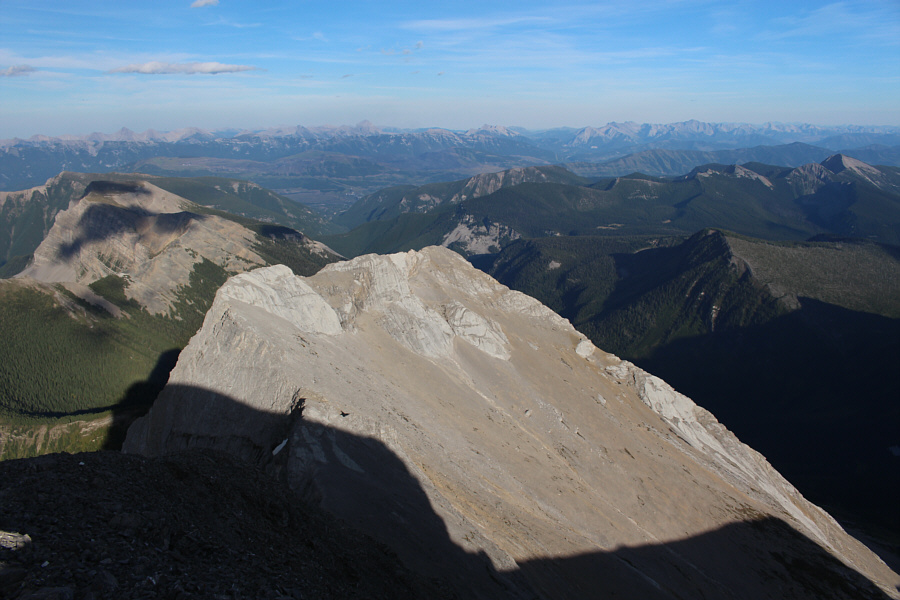
Some of the peaks in the Fernie area are visible to the south including Mount Hosmer (centre), Three Sisters (right), and Mount Bisaro (far right).
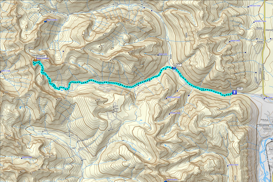
A very long but gratifying trip. Total Distance:  37.2 kilometres
Total Time:  14 hours 49 minutes
Net Elevation Gain:  1807 metres

GPX Data