BOU AVENUE
Mount Evans

Mount Evans is a prominent peak in the Moyie Range west of Kimberley, British Columbia (BC).  I first noticed Mount Evans while gazing westward from the top of Mount Baker in 2011, but at the time, I only took a photograph and did not give the peak much further thought.  While researching hiking objectives ahead of spending the 2017 Canada Day long weekend in Cranbrook, BC with Zosia Zgolak, I became interested in Mount Evans again when I came across a trip report on trailpeak.com which describes a scramble route via the west ridge.  Unbeknownst to me before our trip, there was already a published description of this same route in a previous edition of Janice Strong's Mountain Footsteps: Hikes in the East Kootenay of Southeastern British Columbia.  Strong deleted the Mount Evans hike from the latest (3rd) edition of her guidebook because of problems with trailhead access, but people apparently still climb the peak perhaps because of improvements to the area's back roads in recent years.  The trailhead description from trailpeak.com has some minor errors; therefore, I have drafted a more accurate one here:

From the junction of Highway 95A and St Marys Lake Road just north of Marysville, drive west on St Marys Lake Road for 16.1 km.  Turn left (south) onto S St Marys Creek road to cross the bridge over St Mary River, and in 0.6 km, take a hairpin right turn onto Hellroaring Forest Service Road.  Drive south for 1.1 km and turn right onto Meachen Creek Forest Service Road.  This road has a few rough spots but should be passable for 2WD vehicles.  Drive west for 13.8 km to reach the junction where Fiddler Creek Road branches off to the left just past marker "14".  Either park here or drive another 1.2 km up Fiddler Creek Road to the actual signed trailhead for Mount Evans.

Armed with the route description from trailpeak.com, Zosia Zgolak and I met up with Eva B. and John Bence in Marysville on the morning of 1 July 2017.  Together, we piled into my car, and I drove us all to the junction of Meachen Creek Forest Service Road and Fiddler Creek Road.  We started our hike here because I was unsure about the condition of Fiddler Creek Road, but in retrospect, I could have easily driven the final short distance to the trailhead.  Regardless, it did not take us long to walk up the road to the trailhead, and we were soon climbing steadily through the forest on a good trail which appeared to be well-maintained despite the occasional deadfall blocking the trail.  We eventually passed a tarn near the entrance to the basin northwest of Mount Evans, and here, we left the main trail to visit an old, dilapidated cabin.  A faint trail continues past the cabin, but it peters out fairly quickly.  Aiming for the west ridge, we bushwhacked a bit before reaching a vast rubble slope.  Partway up this slope, we stumbled across a good trail which, in all probability, would have led us onto the west ridge.  We briefly followed this trail only to see it disappear under a swath of avalanche debris.  Giving up on the trail, we resumed scrambling up the rubble slope and ultimately gained the crest of Mount Evan's west ridge.

The lower part of the west ridge is a little bushy, but we had no issues hiking up to tree line before continuing over more rubble to a false summit.  The false summit is a good place to take a breather and survey the final 100 metres of elevation gain up a steep and airy ridge.  Though a bit daunting at first glance, the ridge is actually quite easy to scramble up and is only mildly exposed.  We all subsequently made it to the summit without any serious problems.

On descent, we retraced our steps back to the false summit and down the west ridge.  After dropping down the vast rubble slope below the west ridge, we again came upon the good trail which we abandoned earlier.  This time, we followed it the other way and found that it eventually disappears in a bushy and boggy area not far from some old mine cuts.  We bushwhacked again for a bit before regaining the main trail near the tarn.  A lengthy but uneventful hike back to my car ensued.
I should have kept driving up this road to the actual trailhead. 
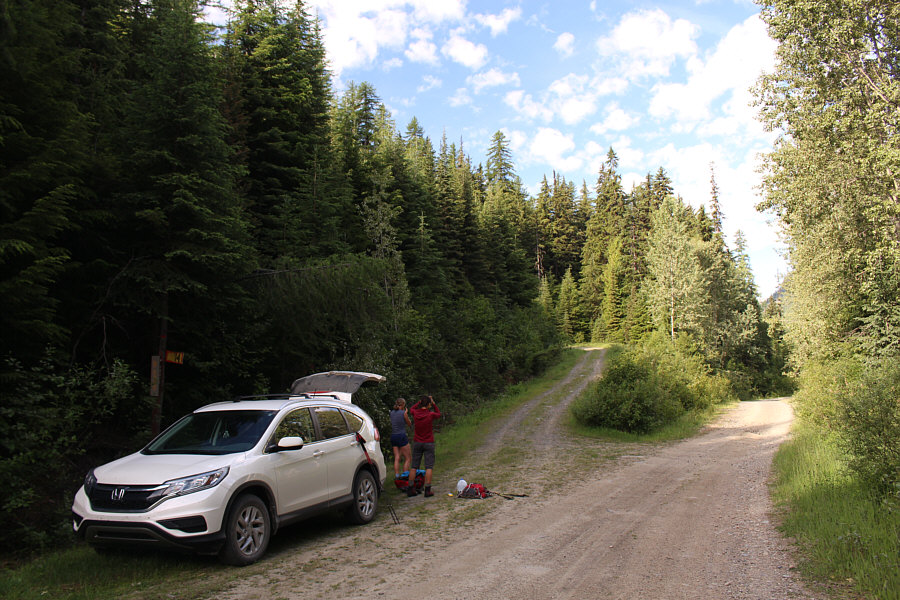
Fiddler Creek Road branches off from Meachen Creek Forest Service Road at marker "14".
Sorry, no outhouse here! 
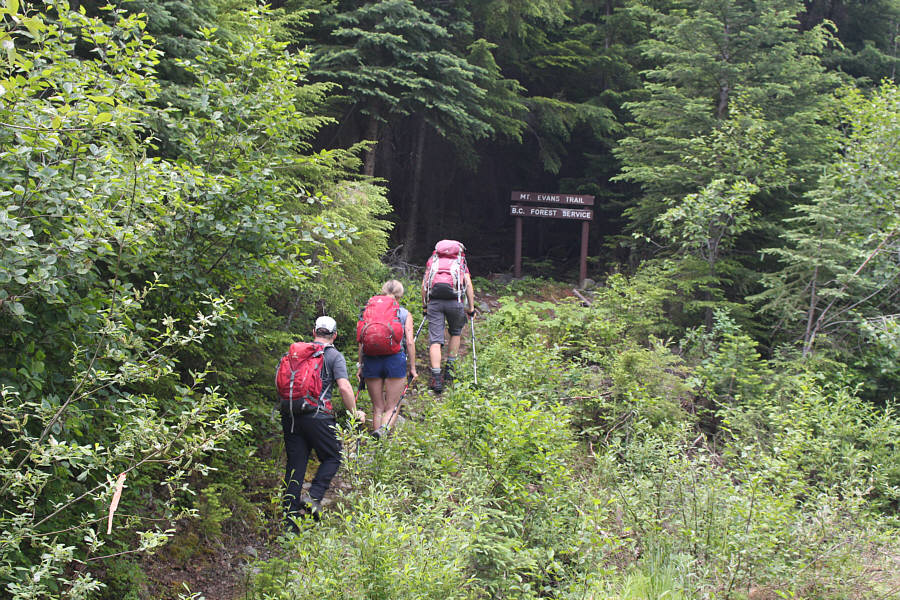
The group arrives at the trailhead for Mount Evans.
In other words, don't follow the trail into the basin! 
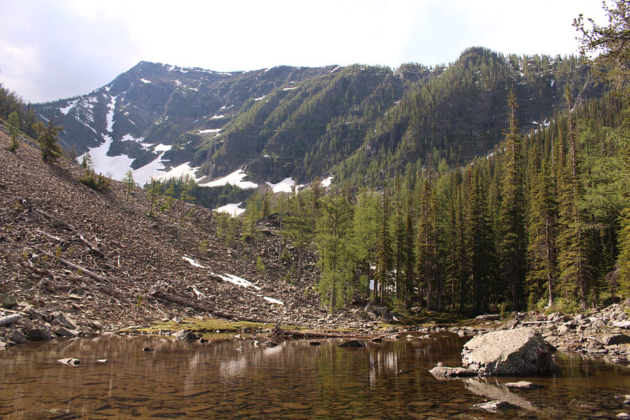
The west ridge of Mount Evans is visible from this tarn.  While the main trail into the basin heads up the scree slope on the left, the route to the summit requires a moderate bushwhack through the trees on the right.
I think I've stayed in worst places than this... 
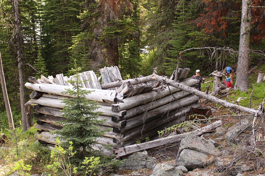
A dilapidated cabin sits in a glade not far from the tarn in the previous photo.
We lost the trail in the deadfall and snow in the trees ahead, but if I had to guess, I think it eventually leads to the crest of the west ridge. 
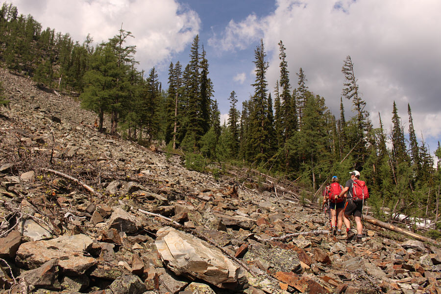
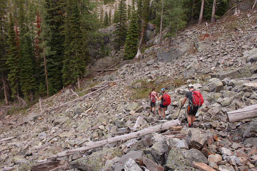
The group follows a trail briefly across this rubble slope.  They would soon abandon the trail and head straight uphill.
Some route-finding still required below tree line. The group hikes up the west ridge of Mount Evans.
And of course, mind the cornices! 
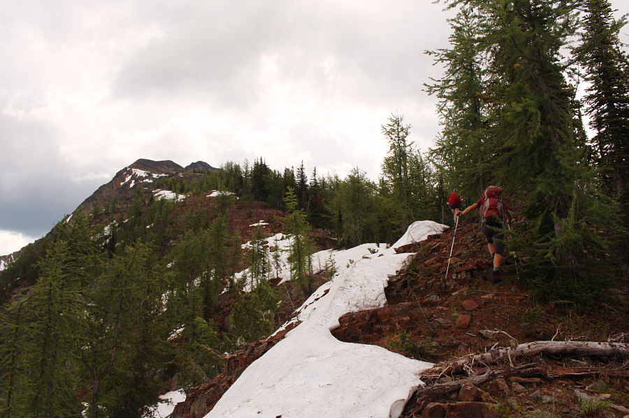
The trees begin to thin out higher up the ridge.
The false summit is a great spot to take a deep breath... 
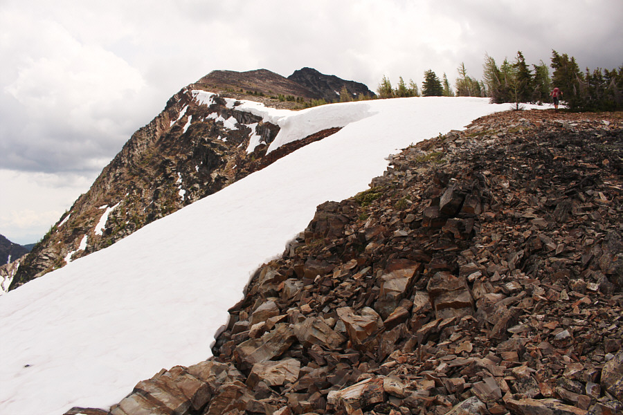
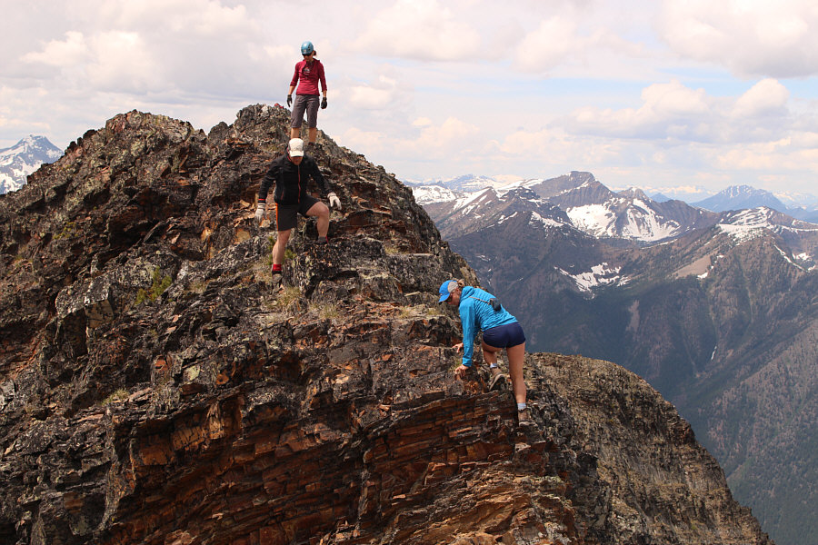
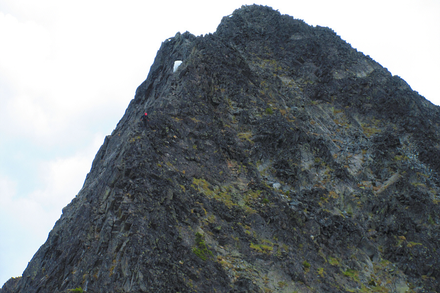
Zosia approaches the top of a false summit (right of centre), but the true summit is already visible here.
This is where the real fun begins... 
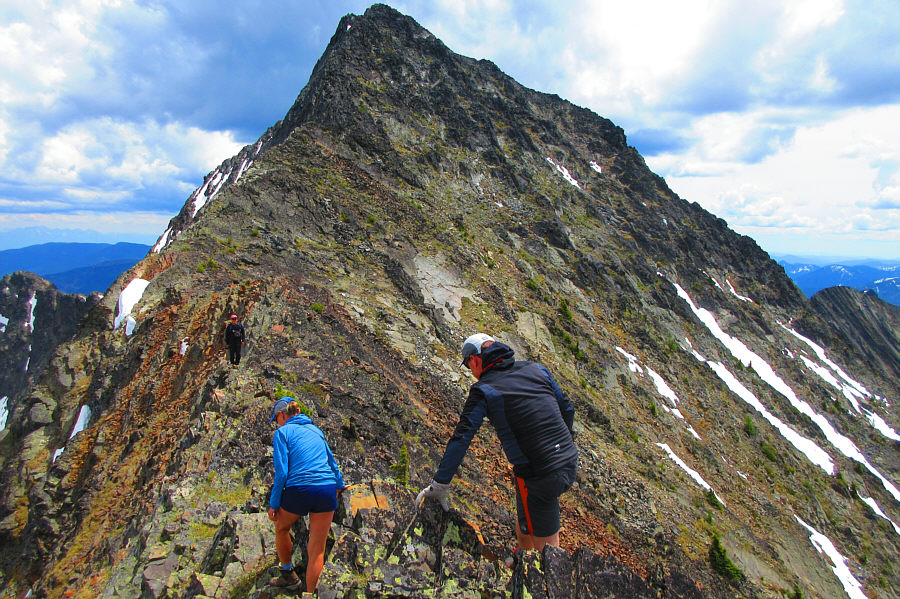
Sonny waits further along the ridge as Eva and John begin the traverse from the false summit.

Photo courtesy of Zosia Zgolak

Gratuitous butt shot! Eva negotiates a somewhat tricky down-climb shortly after leaving the false summit.  John and Zosia prepare to follow her down.
Looks like everyone is still happy... 
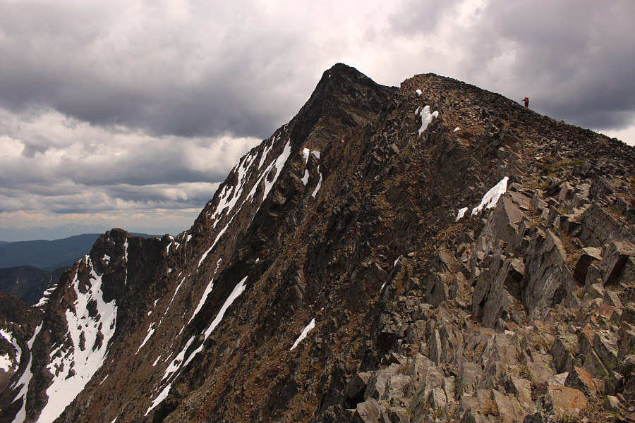
The group continues up the west ridge of Mount Evans.
Moderately difficult with some mild exposure. Zosia and John enjoy some steep, hands-on scrambling just before the summit.

O Canada!

Sonny, Zosia, John and Eva celebrate Canada's 150th birthday on top of Mount Evans (2726 metres).


Now there's a real flag Pole! 
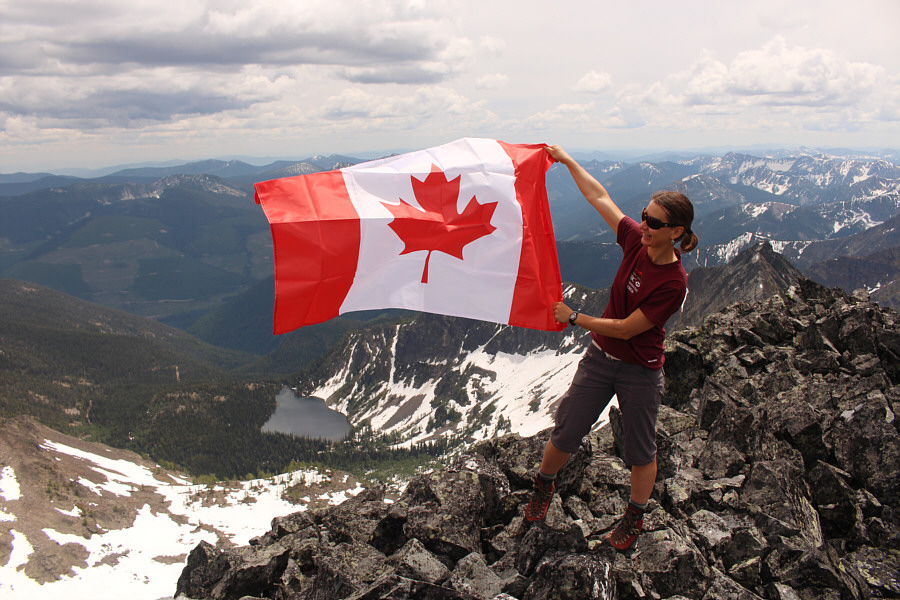
Zosia flies the Canadian flag over an unnamed lake to the southeast.
Looks worse than it really is! 
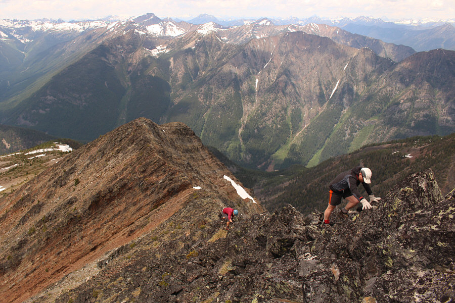
Sonny carefully descends the west ridge of Mount Evans.

Photo courtesy of Zosia Zgolak

Looks like a good scramble, but the approach would be long. 
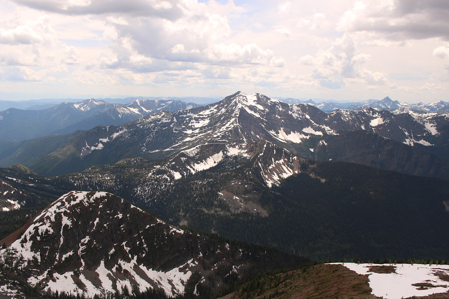
The prominent peak to the southwest is Mount McKay.
Depressing, isn't it? 
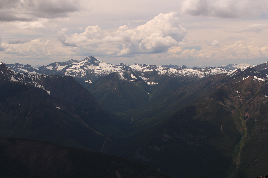
To the west, Snowcrest Mountain (left) is even higher and more remote than Mount Evans.
Beautiful peak! 
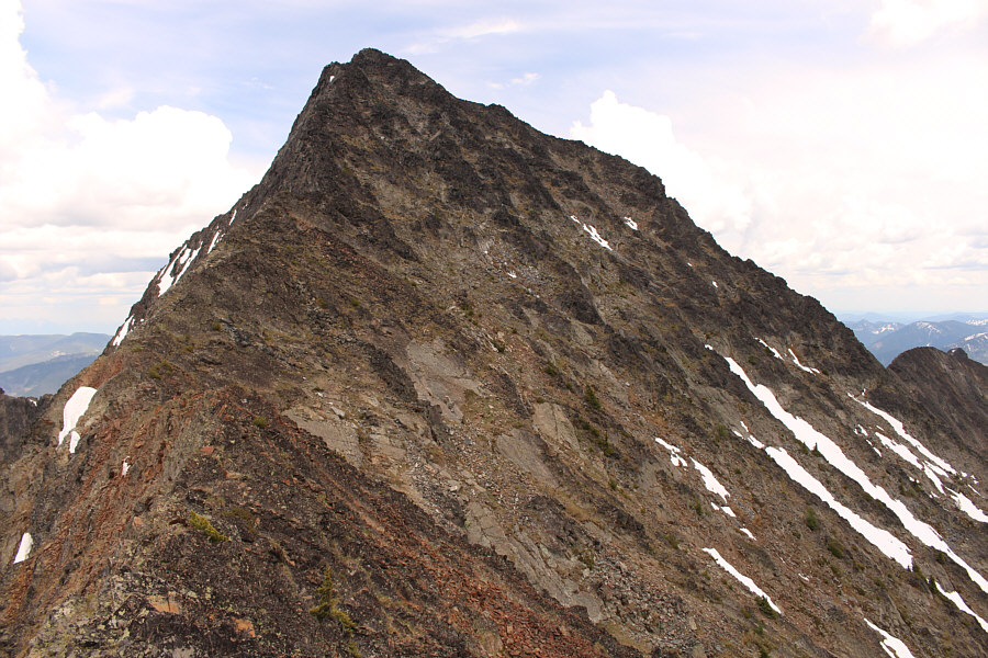
Here is a last look at the top of Mount Evans from the false summit.
It probably would have been better to retrace our ascent tracks. The group descends the trail that they previously came across on the rubble slope below the west ridge.  Unfortunately, the trail eventually peters out in a boggy and bushy area near an old mine cut.
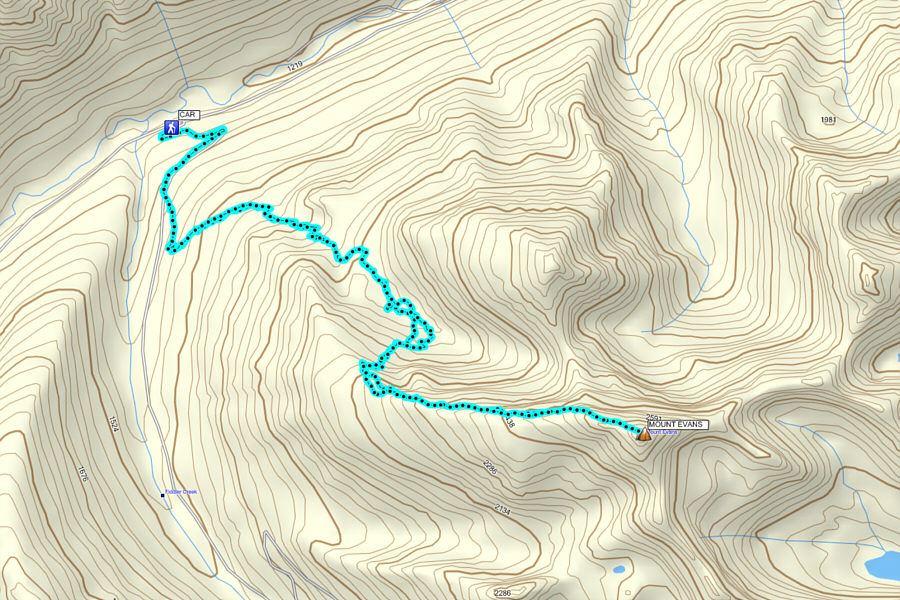
A worthy peak that deserves more attention. Total Distance:  15.4 kilometres
Round-Trip Time:  9 hours 34 minutes
Net Elevation Gain:  1472 metres

GPX Data