BOU AVENUE
Dogtooth Ridge
After spending a long weekend with friends near Kicking Horse Mountain Resort (KHMR) just outside Golden, British Columbia, Zosia Zgolak and I hiked part of the Dogtooth Ridge traverse on 24 June 2018.  We started the trip by riding the Golden Eagle Express Gondola ($43.00 per adult including GST) to Eagle's Eye Restaurant at the top of the resort.  On our way up, we spotted KHMR's resident grizzly bear, Boo, stretching out in one corner of his mid-mountain enclosure.

When we disembarked from the gondola, we made a quick stop at the restaurant washroom before setting off along the hikers' path which initially descends parallel to the mountain bikers' track.  Carefully checking for passing mountain bikers, we briefly merged onto the bikers' track before leaving it to follow a marked trail climbing up the ridge crest.  We had no problems hiking up and over the first two high points--Blue Heaven (as named on the KHMR trail map) and Ozone (as named by GoldenHikes.ca).
Well worth the 43 bucks to start this high for a hike! 
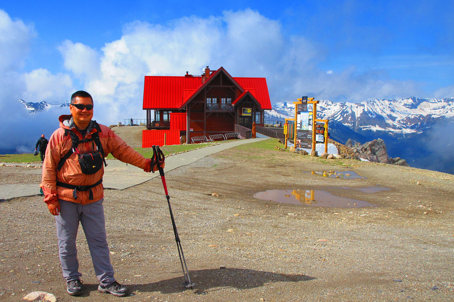
Sonny arrives at Eagle's Eye Restaurant after riding the resort gondola.

Photo courtesy of Zosia Zgolak

Hmmm...I'm kinda wishing I brought a mountain bike now... Zosia takes the designated hikers' path which eventually merges with the bikers' track at the short fence in the distance.
Wow, a black diamond hike! 
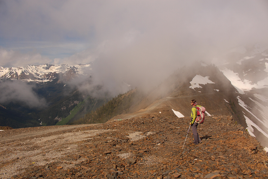
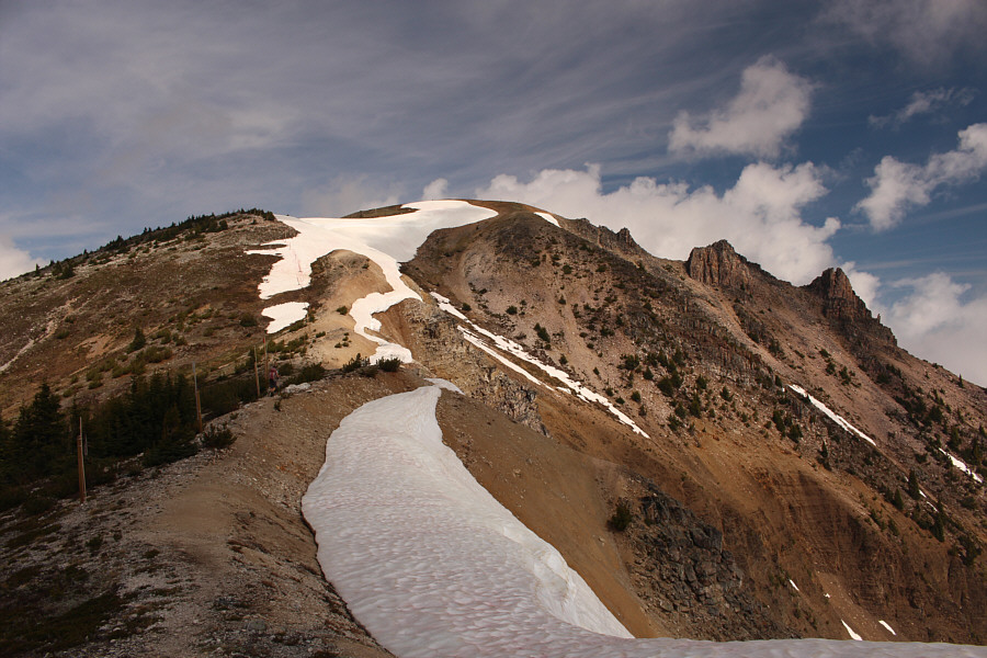
The hikers' trail splits from the bikers' track here.  Blue Heaven, the first high point along Dogtooth Ridge, is visible in the distance.

Photo courtesy of Zosia Zgolak

Hmmm...I need to come back in the winter and ski this resort!

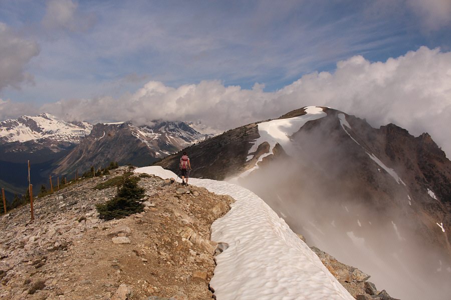
Zosia crosses a lingering snow patch en route to the top of Blue Heaven.

I'll be baack!

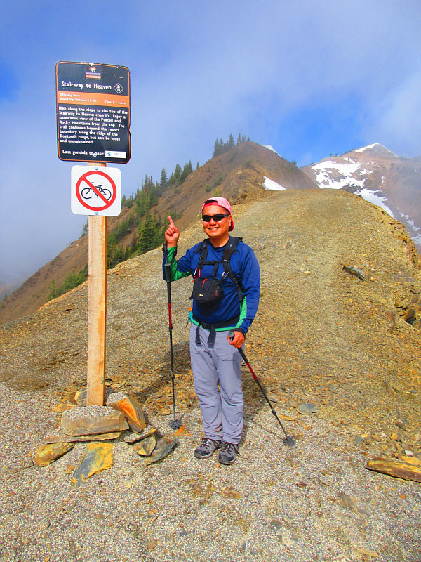
Zosia pauses beside a ski run sign on her way up Blue Heaven.  The upper gondola station and restaurant are visible in the distance as well as the multiple high points of Terminator Ridge.


And she's buying a stairway to heaven... Stairs provide an easy ascent of the final few metres before the top of Blue Heaven.
That would be MY Blue Heaven! Zosia hikes over the top of Blue Heaven (2449 metres).
Ozone stinks...literally! Zosia hikes along the fence posts toward Ozone (2505 metres), the second high point along Dogtooth Ridge.
Beyond Ozone, the route is rougher and less defined.  We more or less traversed below the ridge crest of the next high point (unnamed) utilizing bits of trail and following the odd cairn.  The most challenging terrain we encountered on this day was the big drop from this third high point to the col before the next (fourth) high point (also unnamed).  The rocky terrain here is steep and loose which demands greater care with footing and route-finding.  The fourth high point is guarded by a serious-looking gendarme, but upon closer inspection, we easily surmounted this obstacle by scrambling up big blocks to climber's right.  While it would have been nice to continue further, we decided to turn around at this fourth high point.
Some good route-finding helps here!

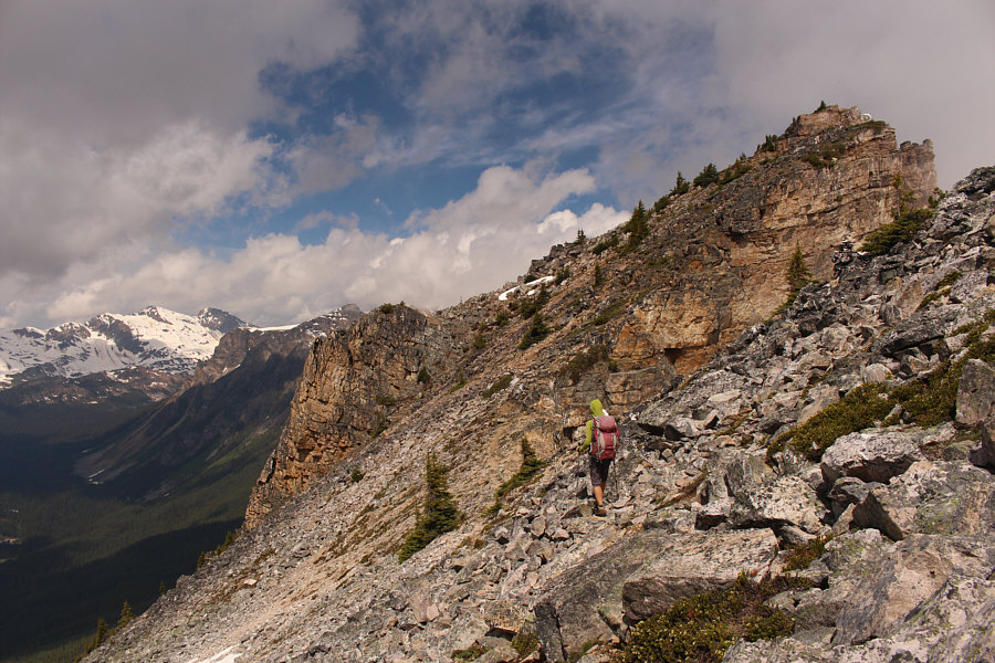
Zosia traverses some rugged terrain below the third high point along Dogtooth Ridge.

We've got a steep drop coming up... 
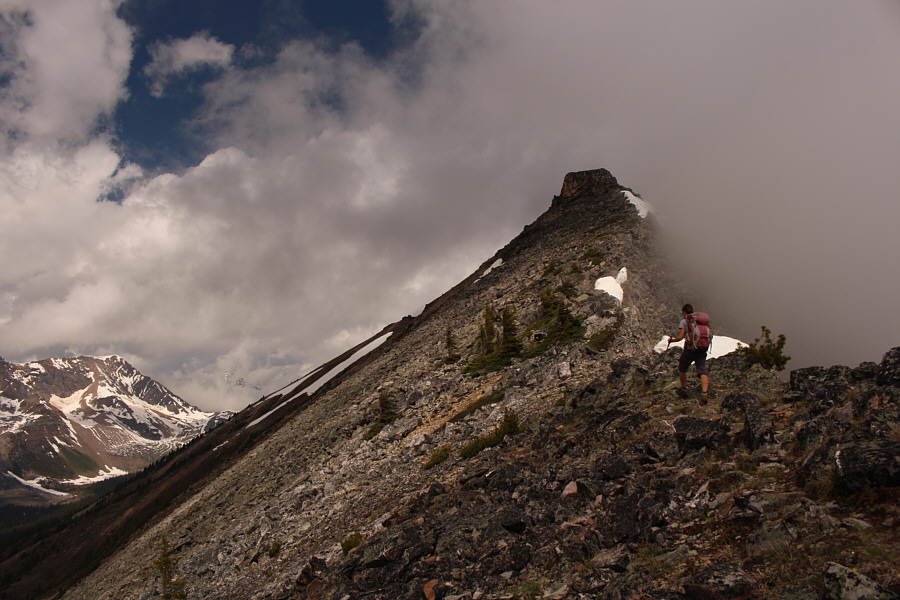
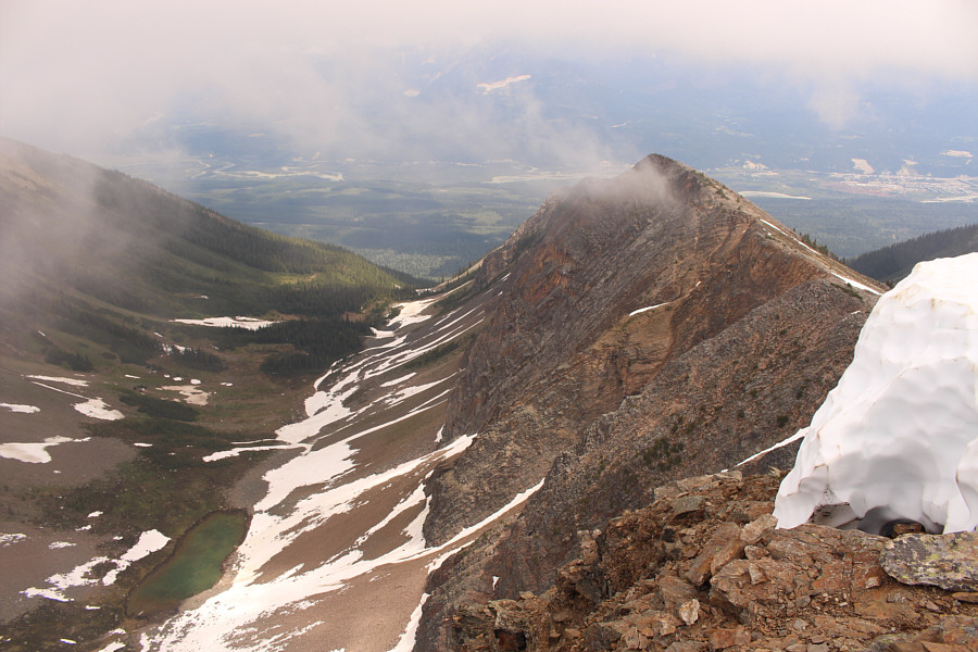
From this vantage point near the third high point along Dogtooth Ridge, the top of the fourth high point is obscured by clouds.
The high point is not visible from here.

Zosia approaches a seemingly difficult gendarme guarding the fourth high point.

No problemo!

Zosia easily scrambles up the right side of the gendarme.


Wow, there are some impressive cliffs below the third high point! 
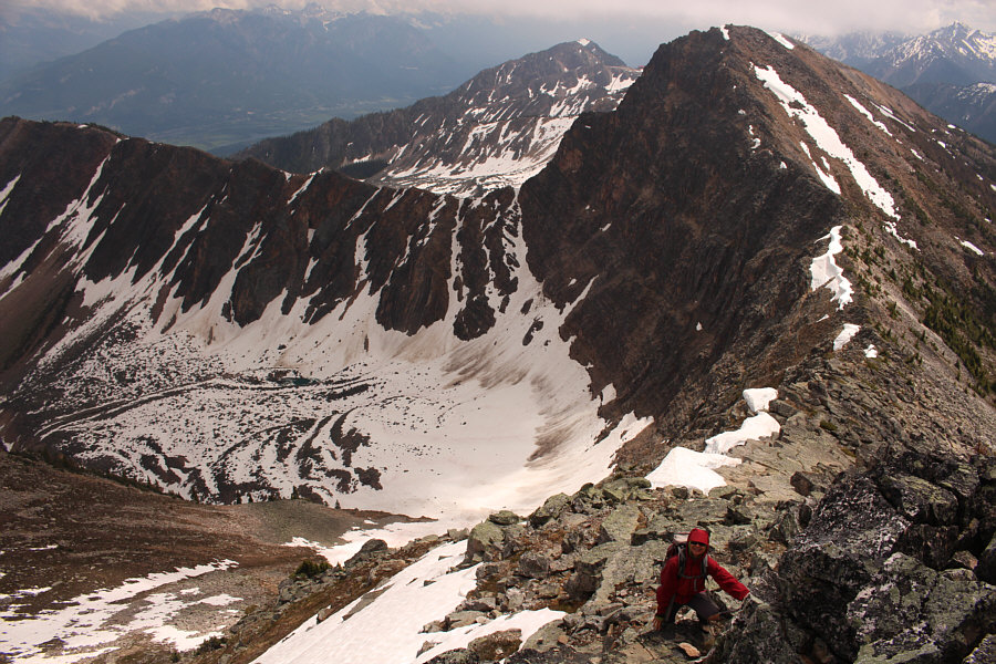
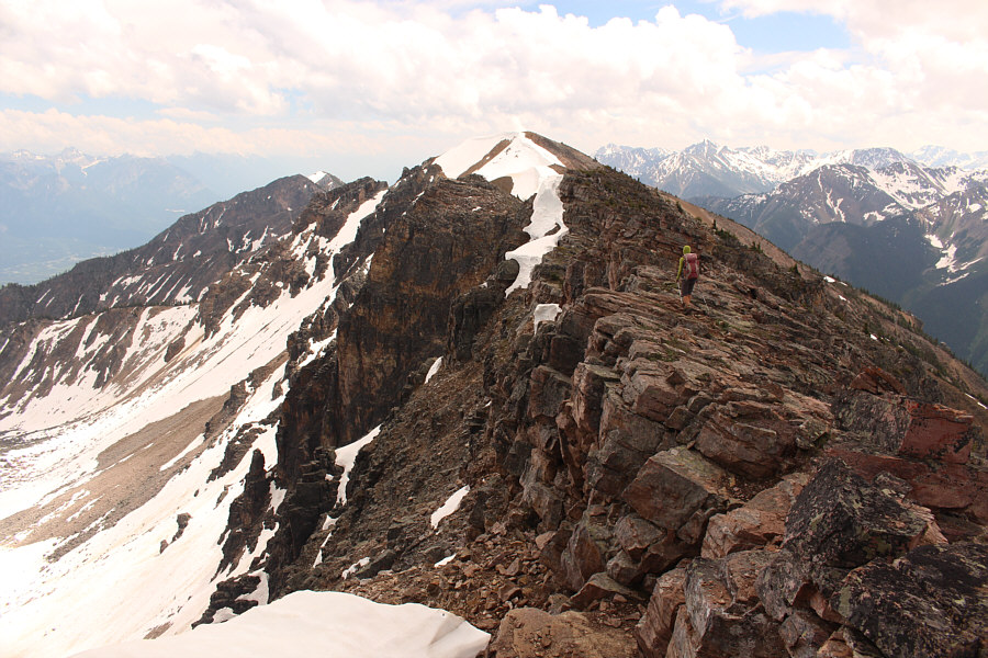
Here is a look back at the third high point as Sonny surmounts the gendarme guarding the fourth high point.

Photo courtesy of Zosia Zgolak

Does that count as four separate summits?

Zosia and Sonny stand on the fourth high point (2558 metres) along Dogtooth Ridge.


Maybe a few of these are unclimbed? 
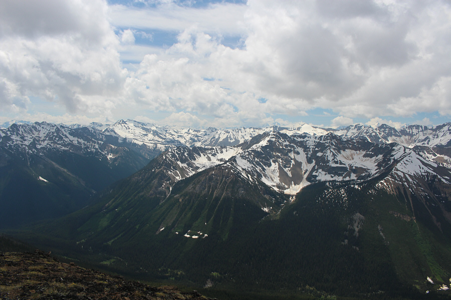
A sea of mostly unnamed peaks stretch away to the southwest.
I think my Black Diamond ice axe is still lying somewhere at the foot of Moonraker Peak! Moonraker Peak is visible just left of the dark unnamed peak at centre.
Probably very few people ever venture into this basin. A small tarn sits in the basin to the north of the fourth high point.
With the numerous ups and downs along the ridge, our return journey was just as strenuous as the hike out, but with no surprises in retracing our steps, we made it back to the gondola station without any incidents.  During our ride back down to the resort's base area, we again spotted Boo as he sauntered through some bushes underneath the gondola lift line.  Seeing this magnificent grizzly bear really put an exclamation point at the end of a wonderful hike as well as the end of a most enjoyable weekend.
If you have a keen eye, you can spot Mount Seven across the valley at distant left! Zosia descends the gendarme as she heads back towards the third high point.

Now I wanna come back and do the full traverse of this ridge!

Here is a clearer view of the fourth high point (centre) from the third high point.  Visible at distant left up the valley is Dawn Mountain.


The King of Rogers Pass! 
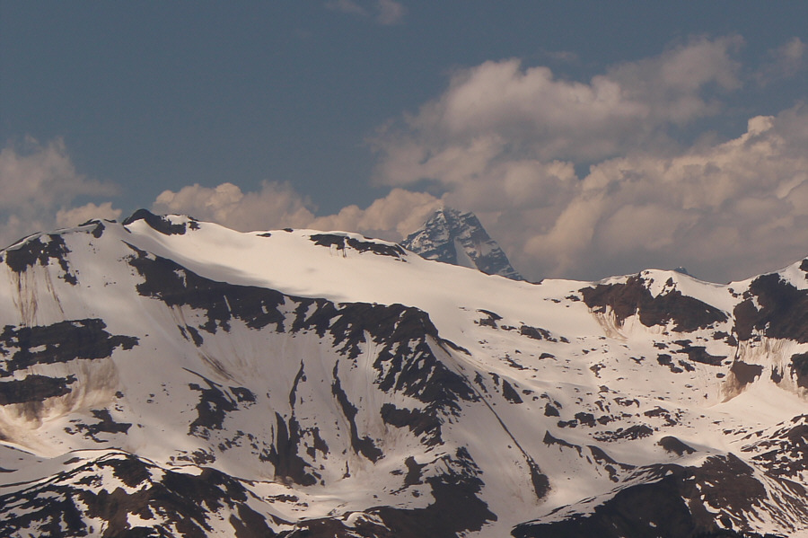
Peeking over the intervening ridge to the west is Mount Sir Donald.
Very enjoyable ridge walking. Zosia sticks closer to the ridge crest on her way back to Ozone (centre).
Surprisingly, no one else besides us ventured beyond Blue Heaven on this beautiful day. The red roof of Eagle's Eye Restaurant is within sight again just left of Blue Heaven.
Too much heaven... The top of Stairway to Heaven chairlift is just below the summit of Blue Heaven.
Last uphill of the day coming up! Sonny descends the final section of the hiking trail before it merges again with the bikers' track.

Photo courtesy of Zosia Zgolak

Hitchhike? A couple of mountain bikers zoom past Zosia as she walks back up to the start of the hikers' path.
Inside joke: Name a movie that begins with the letter C...Centipede! 
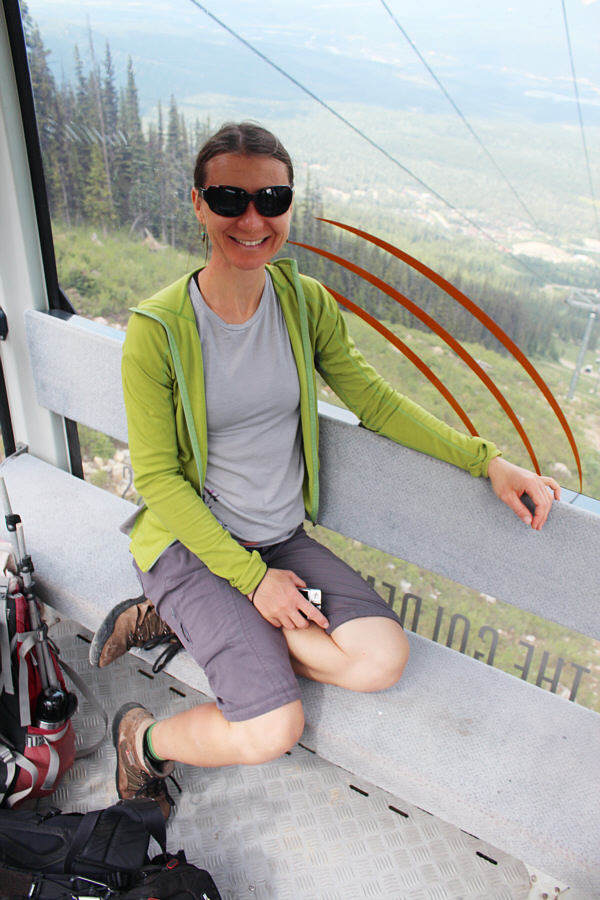
Zosia rides the gondola back to the base area.
Hey Boo Boo! 
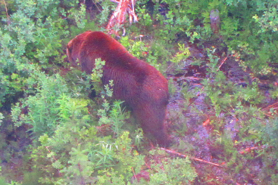
Boo, the resort's resident grizzly bear, ambles through the bushes within his mid-mountain enclosure.

Photo courtesy of Zosia Zgolak
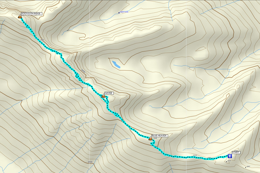
Even without the full traverse, this is a fabulous hike! Total Distance:  8.2 kilometres
Round-Trip Time:  5 hours 40 minutes
Total Elevation Gain:  738 metres

GPX Data