On descent, we returned to the saddle and followed the trail back down to the bottom of the access gully. Instead of retracing our steps cross-country from there, we stayed on the good trail and found that it eventually intersects with Panther Peak Wash only about 800 metres further west of where we initially left it. Turning left, we followed the wash back to the trailhead under an increasingly hot sun.
 |
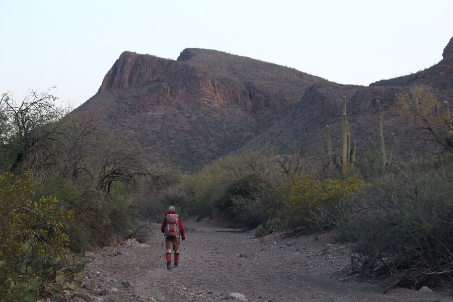
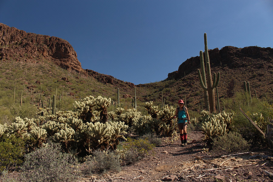
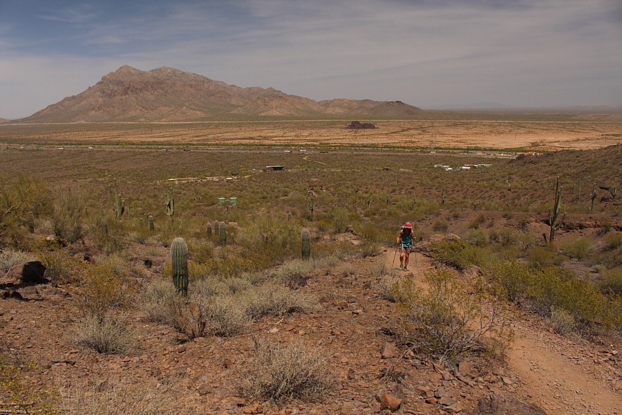
Panther Peak is visible at distant
right as Sonny starts hiking along the trail. Photo courtesy of Zosia Zgolak |
 |
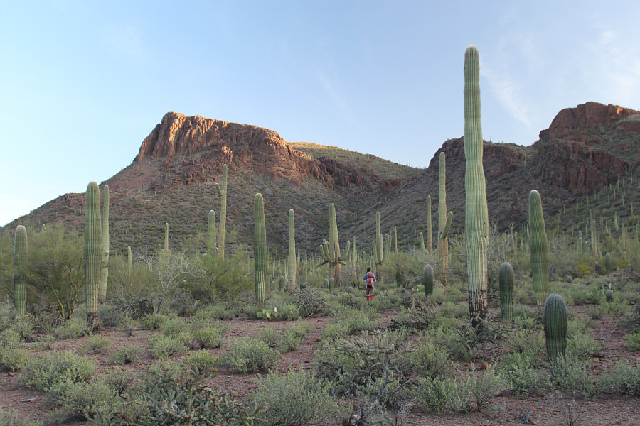
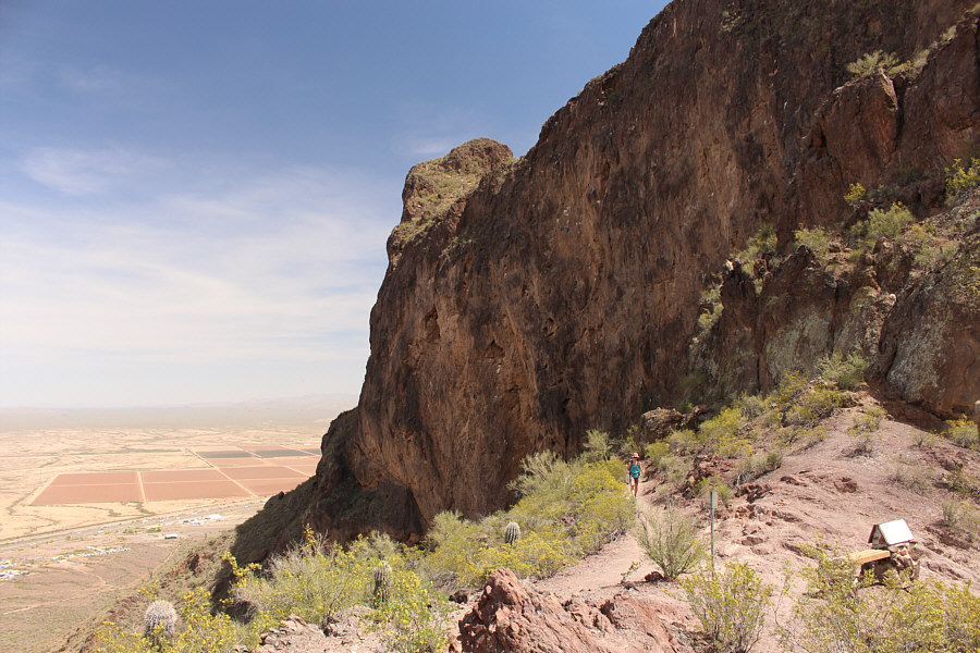
The route to Panther Peak climbs up the obvious gully and the right-hand upper slope. |
 |
Some crows are curiously perched on
the tops of several saguaro cacti. Photo courtesy of Zosia Zgolak |
 |
The morning sun illuminates
Wasson Peak
(left) to the south. Photo courtesy of Zosia Zgolak |
 |
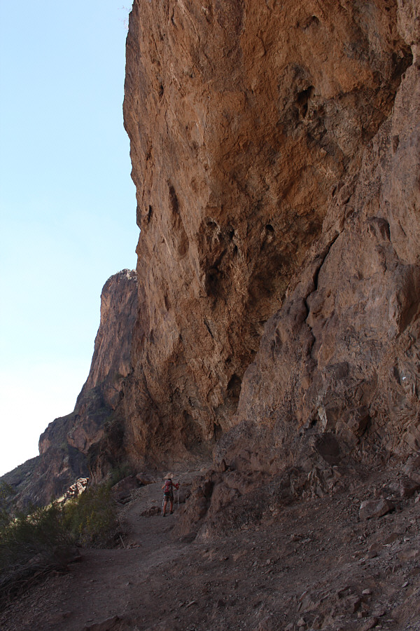
Zosia leaves the trail and makes a beeline toward the access gully. |
 |
Zosia finds a good trail going up the access gully. |
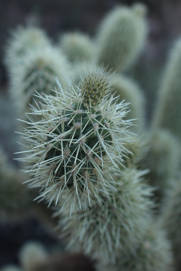 |
Here is a close-up look at a jumping cholla whose segmented stems easily separate when an animal or person inadvertently brushes up against its barbed spines. |

Zosia climbs up the final slope before the top of Panther Peak.
 |
Zosia and Sonny reach the summit of Panther Peak (1034 metres). |
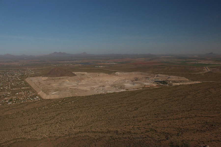 |
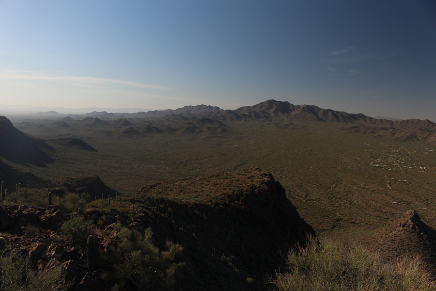
A rock quarry lies to the west of Panther Peak. The bump on the left side of the quarry is the sole survivor of what used to be known as Twin Peaks. |
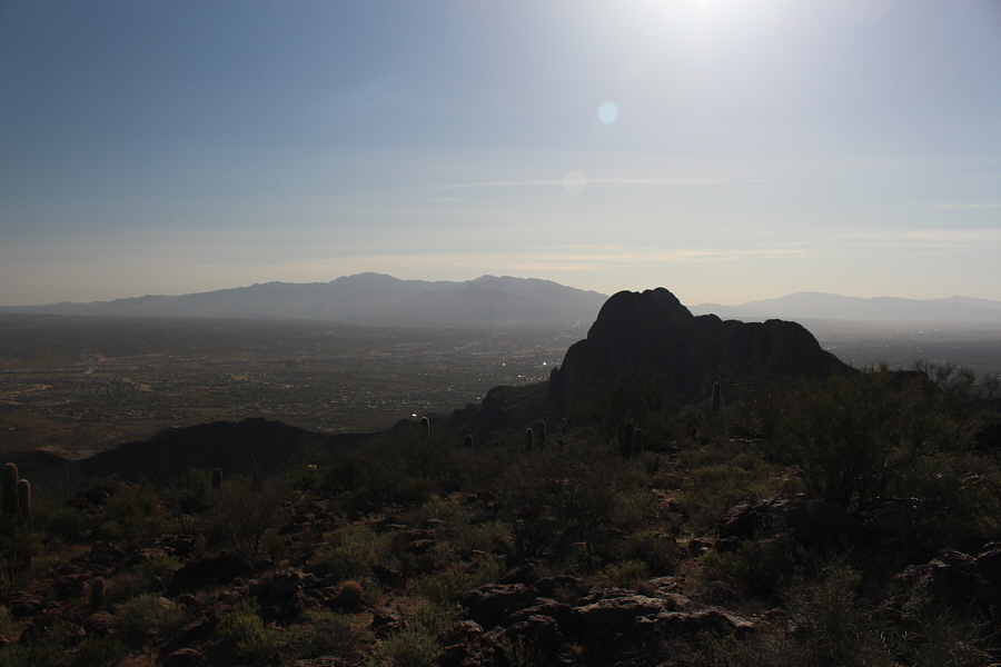 |
The silhouette of Safford Peak partially hides the city of Tucson to the east. |
 |
Wasson Peak (right) stands out among the Tucson Mountains to the south. |
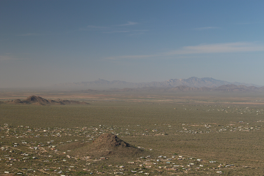 |
Visible on the southwest horizon are Baboquivari Peak (left of centre) and the white observatories on Kitt Peak (right). |
 |
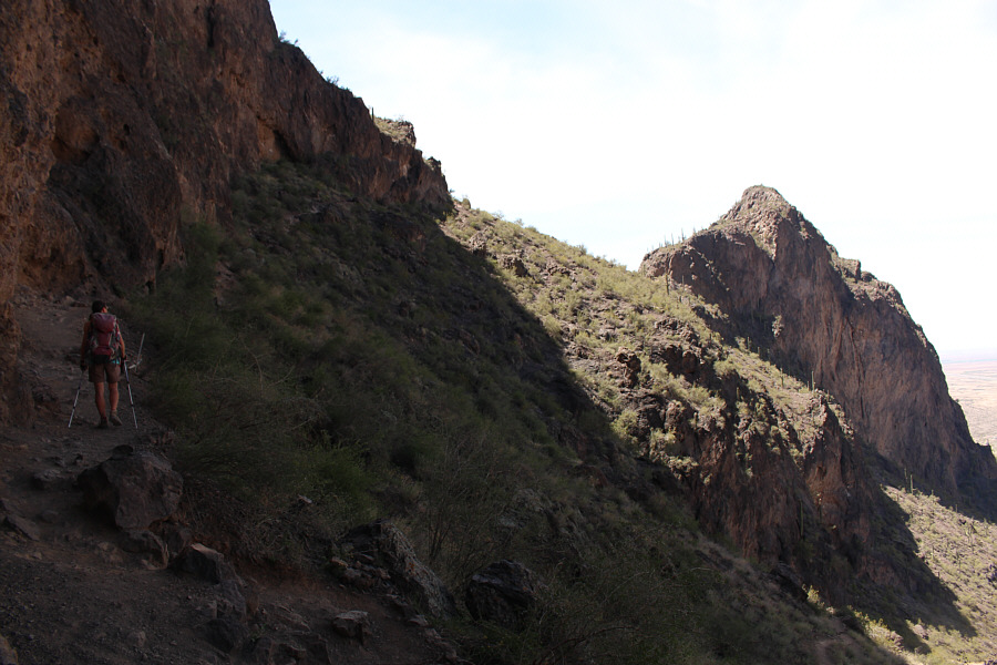
Zosia follows the trail down from the access gully. |
 |
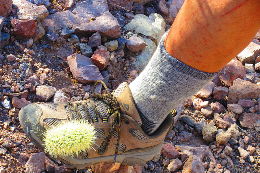
Sonny stops to pick a cactus spine out
of his foot. Photo courtesy of Zosia Zgolak |
 |
Pieces of jumping cholla have a
tendency to get stuck on inattentive hikers. The cholla's
spines are incredibly hard to pull out once they become embedded. Photo courtesy of Zosia Zgolak |
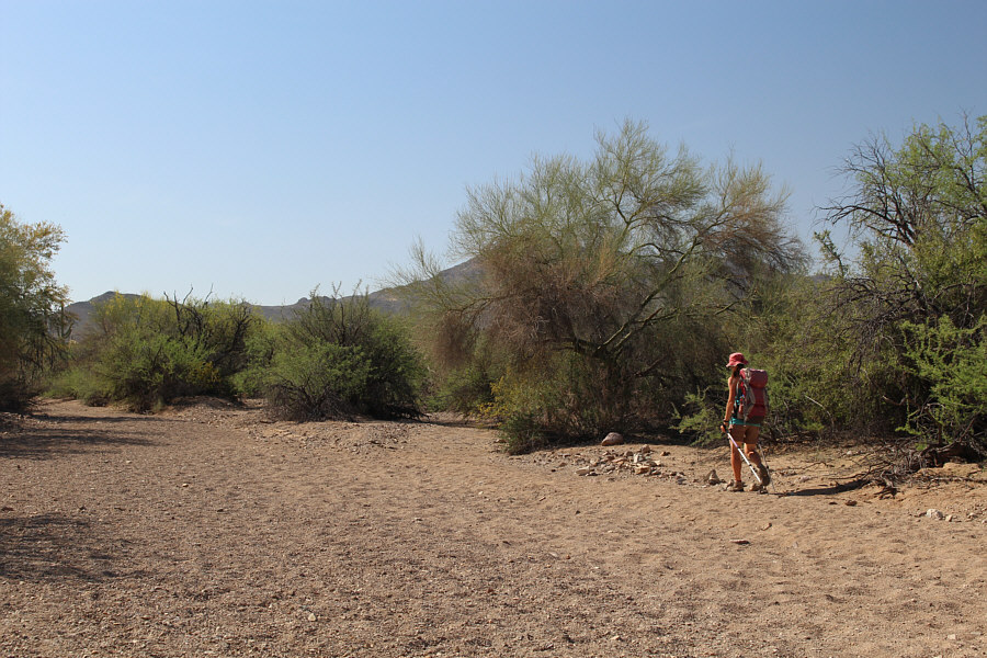 |
Under a hot sun, Zosia trudges back to the trailhead along Panther Peak Wash. |
 |
Total Distance:
8.6 kilometres Round-Trip Time: 4 hours 17 minutes Net Elevation Gain: 285 metres |
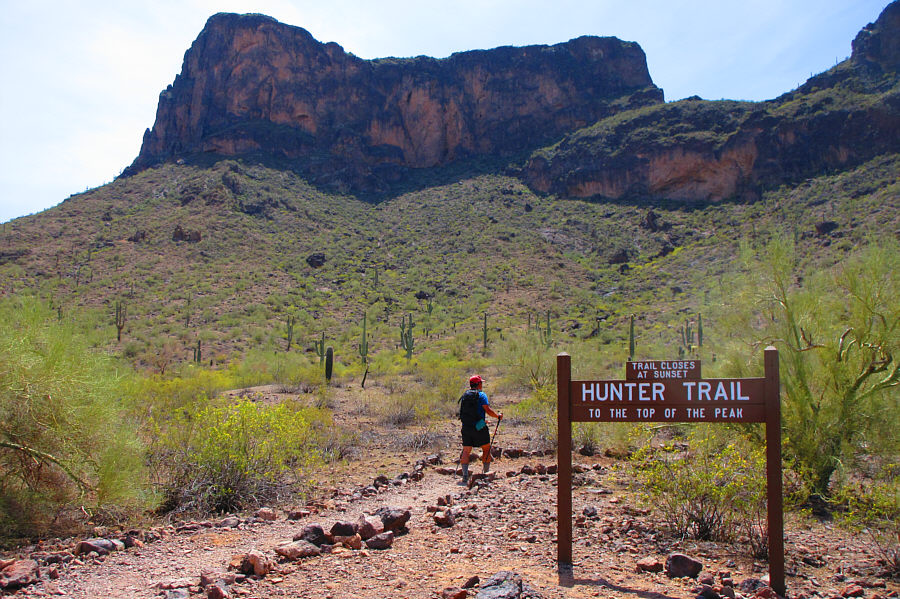
Temperatures were soaring by the time we started hiking up Hunter trail, and I was already feeling weary just from the heat. We got a bit of a reprieve from the hot sun as we climbed up along the shady base of Picacho Peak's north-facing cliffs. Unfortunately, we were back in the sun again for good once we reached a high saddle a little west of the summit. Strangely, the trail descends very steeply down the south side of the saddle before traversing to a junction with Sunset Vista trail which is a longer and probably less popular approach.
Beyond the junction, the trail resumes its climb to the summit, and there are at least three steep sections where cables and fencing (ie. via ferratas) have been installed to assist hikers who may be spooked by the surprising exposure at these locations. Overall, the via ferratas had the same feel as some amusement park rides, and I could not help thinking that the park might have saved itself (and hikers) a lot of work by simply building a single via ferrata going up the cliffs back near the high saddle.
In any case, Zosia and I reached the top of Picacho Peak without any
mishaps, but with the hot sun bearing down on us, we stayed only long
enough to snap a few photographs before retreating to a shady cliff just
below the summit to take a short break. Other than enduring sweltering
heat, our subsequent return trip via the same route was largely
uneventful.
Upon returning to our car, we drove to one of the park's campgrounds and
enjoyed a much-needed and refreshing shower before hitting the highway.
 |
Sonny starts up the trail to Picacho
Peak early in the afternoon. Photo courtesy of Zosia Zgolak |
 |
Newman Peak can be seen across the interstate highway (I-10) in this view looking back toward the park headquarters (left of centre). |
 |
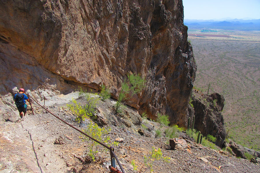
Zosia finds some relief from the hot sun while hiking below the north-facing cliffs of Picacho Peak. |
 |
Zosia hugs another set of cliffs as she climbs up to a high saddle (centre). |
 |
A bench and interpretive sign are situated on the high saddle. The summit of Picacho Peak is visible above the cliffs. |
 |
Sonny drops steeply down the far side
of the high saddle. Photo courtesy of Zosia Zgolak |
 |
The steel cables help immensely with the descent of this steep section. |
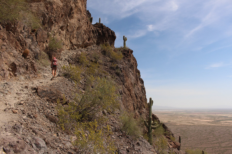 |
The trail resumes climbing upward on the south side of the peak. |
 |
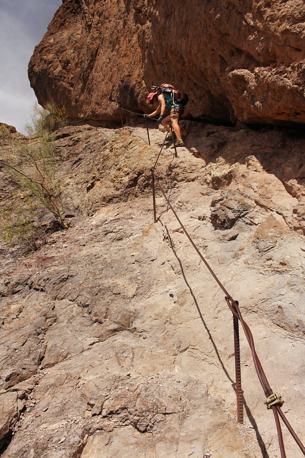
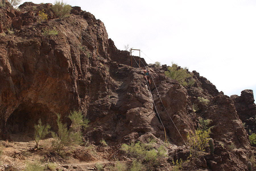
Steel cables and wire fencing provide a measure of safety as Zosia climbs up this steep section of the route. |
 |
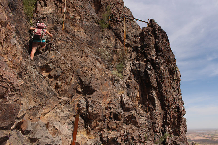
It is hard to see in this photograph, but near the top just right of centre is a catwalk leading to easier terrain below the summit. |
 |
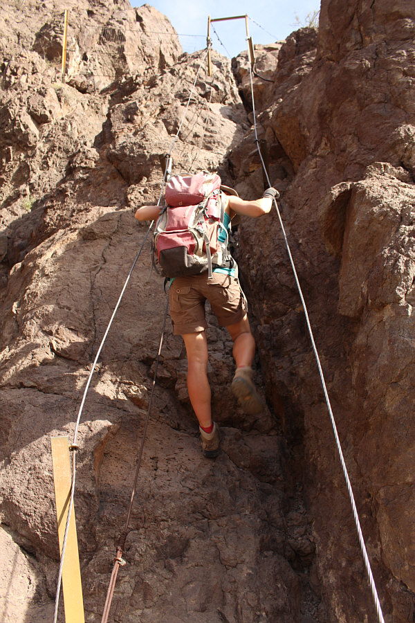
Aided by fixed cables, Zosia ascends a steep cliff band. |
 |
Zosia and Sonny stand on the summit of Picacho Peak (1023 metres). |

The summit provides an aerial view of the park's facilities at bottom. Newman Peak sits to the north across the I-10.
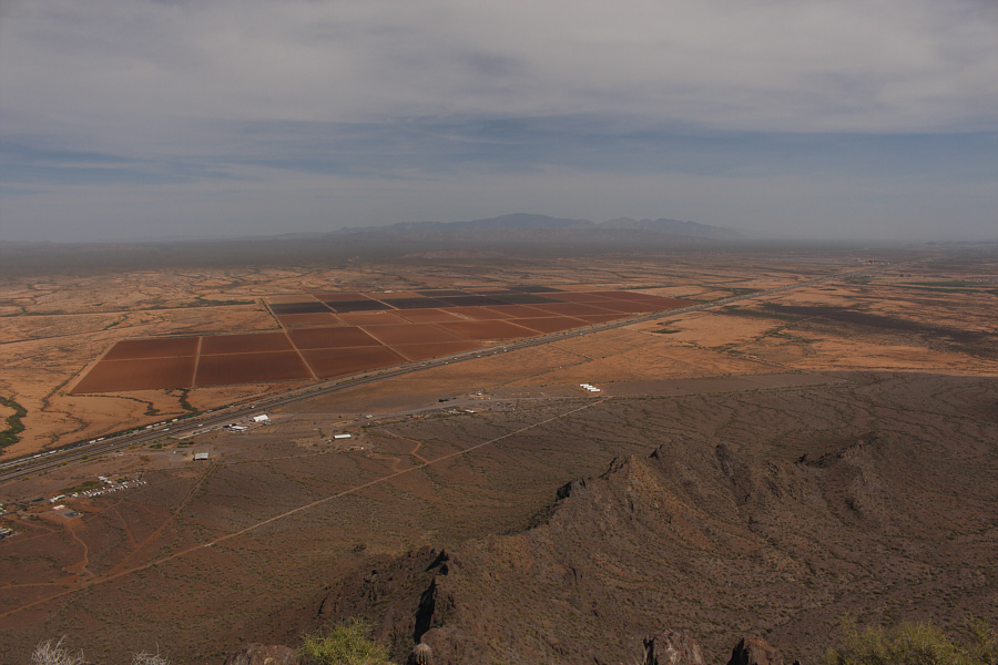 |
Farm land and the Santa Catalina Mountains are the most remarkable features to the southeast. |
 |
An antelope squirrel appears to be curious about a couple of intruders
just below the summit. Photo courtesy of Zosia Zgolak |
 |
Zosia carefully descends the steep cliff band with the fixed cables. |

Here is a final look at Picacho Peak from near one of the campgrounds. The summit is on the far left.