BOU AVENUE
Scotchman Peak
Located near the town of Clark Fork, Idaho,
Scotchman Peak is the high point of Bonner County. Easy access and
a good trail all the way to the top make it one of the most popular hikes
in the area. In
2015, I was
denied an attempt to climb Scotchman Peak due to wildfire closures, but
there were no such restrictions when I returned with Zosia Zgolak on 4
August 2018.
After camping the previous night at a nearby boat launch, Zosia and I
enjoyed a relaxing breakfast before driving to the trailhead. The
following excellent trailhead directions (with distances converted to
metric) are courtesy of the Friends of Scotchman Peaks Wilderness
website:
Take Highway 200 to Clark Fork, Idaho, and then turn north at the
Chevron Station onto Main Street. Follow this road past Clark Fork
High School and then around a bend to the right. At the
intersection with Lightning Creek Road, set your trip odometer to 0.
Dont turn here; keep going straight on Mosquito Creek Road.
At 0.9 kilometres, keep left at the fork. At 3.3 kilometres, turn
right onto FR 2295. There wont be a sign marking it as FR 2295.
Its marked as such on the map. Youll know youre heading into the
right neighborhood when you pass the sign telling you youre entering
grizzly bear habitat.
At 4.9 kilometres, turn left onto FR 2294. Again, there wont be a
sign marking it as FR 2294. Youll see a small sign pointing toward
Trail 65. At 5.7 kilometres, turn left onto FR 2294A. Yet
again, there wont be a sign marking it as FR 2294A, and again, youll
see a small sign pointing toward Trail 65. Follow FR 2294A for
another 3.5 kilometres to the end of the road where youll find the
trailhead just beyond two portable toilets.
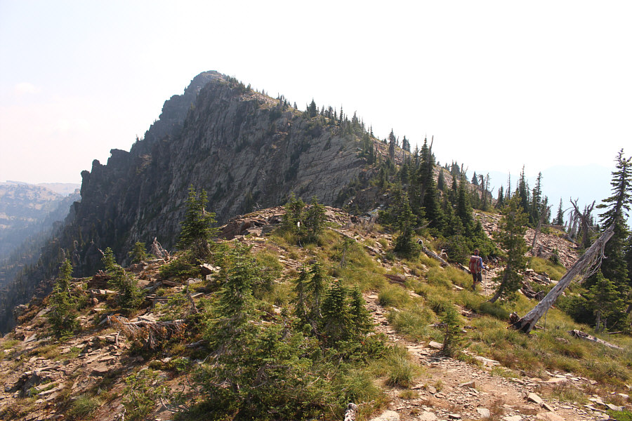
Right from the start, we settled into a long and steady climb up the
well-maintained trail which essentially winds up the forested southwest
ridge of Scotchman Peak. Although the trail is long, the grade is
consistently moderate which makes for very pleasant hiking. An
abundance of saskatoon berries and huckleberries slowed our ascent
somewhat but not as much as what we would encounter higher up the
mountain. About two-thirds of the way up, the trail makes a couple
of sweeping switchbacks across open slopes, and although Lake Pend
Oreille is normally visible from here, we were initially unaware of the
lake due to the thick haze from distant wildfires. 
Across Clark Fork (river), the morning sun
rises over the shoulder of Scotchman Peak (left).
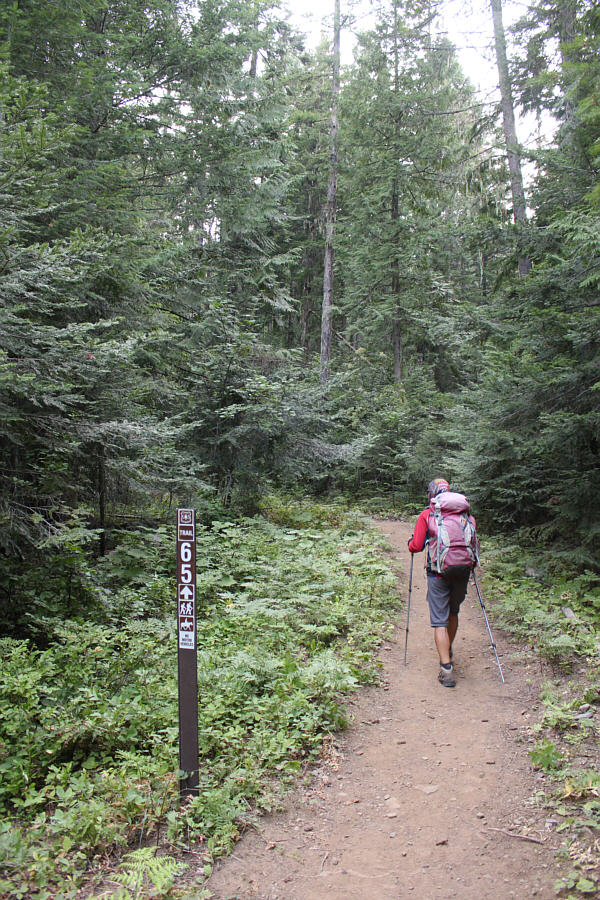 |
Zosia starts up the trail to Scotchman
Peak. |
 |
Ripe saskatoon berries are abundant
along the lower sections of the trail. |
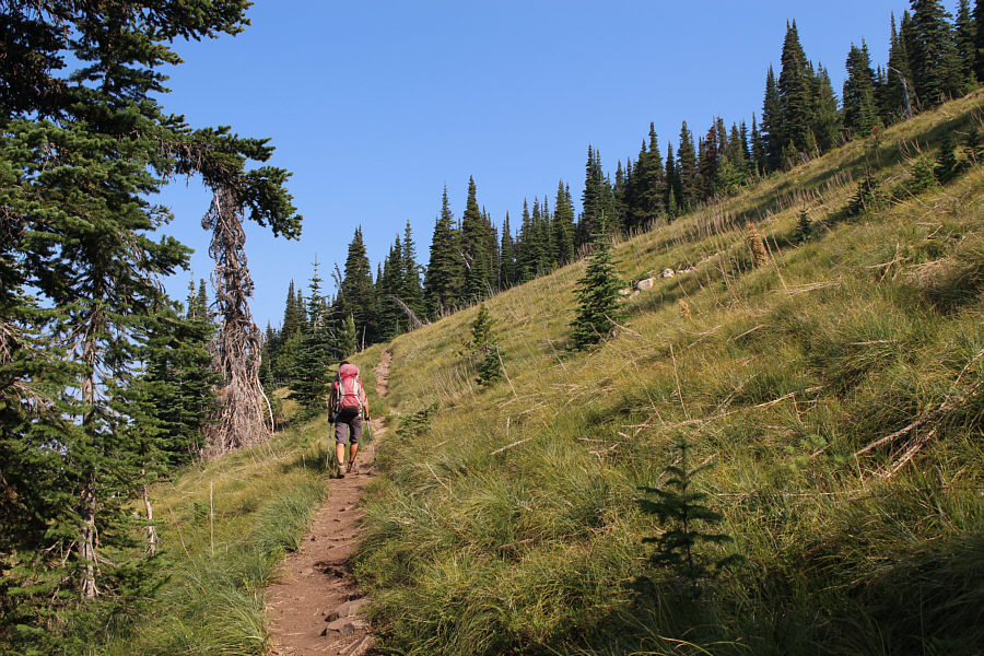 |
Trees begin to thin out higher up the
mountain. |
Near tree line, we passed a curious sign warning hikers not to
harass or feed mountain goats in the area. As if on cue, three
mountain goats--a father, a mother and their baby--suddenly appeared
above us. We gave them a wide berth, and initially, the father and
mother both descended past us as if to enter the forest below. The
baby was hesitant to follow its parents and seemed more curious about
Zosia and me. We eventually gave up waiting for the baby to pass us
and started hiking up the trail where we quickly encountered two more
goats grazing just off to the side. These two seemed unconcerned
about our presence, and we stopped for a lengthy break here to observe
them while ogling the impressive northwest face of Scotchman Peak.
Meanwhile, the baby goat had by now circled around us even though we had
left it a clear passage to rejoin its parents. The parents
themselves soon came back up to rendezvous with their baby, and Zosia and
I were now surrounded by goats. Perhaps the sign we saw earlier has
it backwards and should instead be warning about goats that may harass
hikers! After being entertained at length by all the mountain
goats, Zosia and I finally left them to resume our ascent to the top.
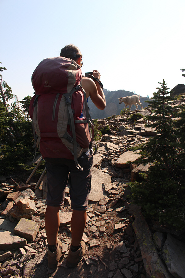 |
Zosia snaps a photograph of a baby
goat. |
 |
Two goats are busy munching away
beside the trail. |
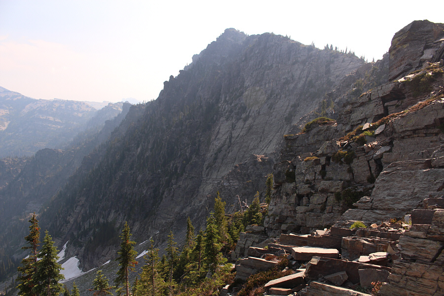 |
The northwest face of Scotchman Peak
is surprisingly impressive. |
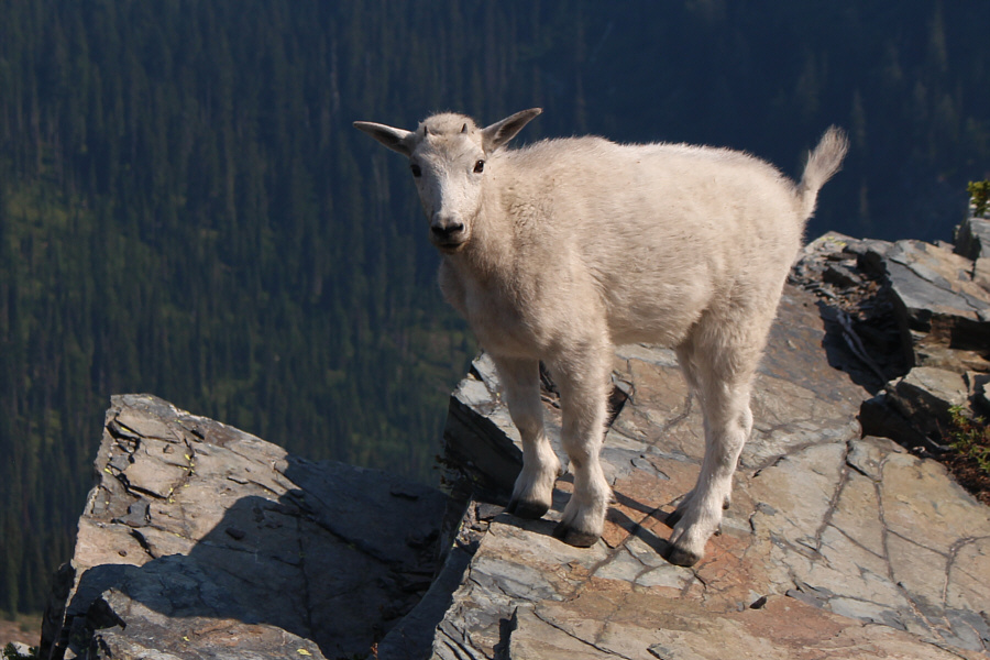 |
The baby goat is not shy to strangers. |
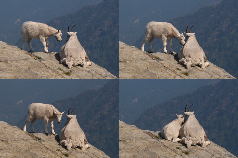 |
The baby goat approaches and snuggles
next to its mother. |
 |
Zosia resumes hiking to the top of
Scotchman Peak. |
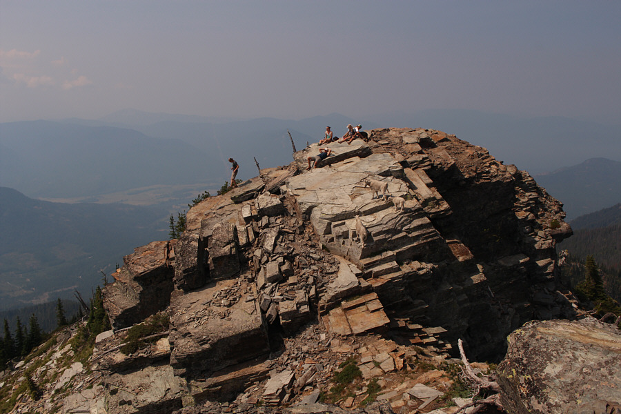
Upon reaching the first summit bump which has a surveyor's
benchmark, we continued further by dropping down a short gap and
scrambling up a second slightly higher bump marked with a cairn.
Unfortunately, a deep chasm prevented us from traversing to a third more
distant bump which may or may not be slightly higher. In any case,
the first bump with the benchmark is generally regarded as the gazetted
summit of Scotchman Peak, and we were quite content to retreat back to
the second bump to take a break.During our break, the three goats we
initially encountered surprisingly appeared on the first bump which was
now occupied by some other hikers who had come up behind us.
Curiously, the goats passed the other hikers and eventually joined Zosia
and me on the second bump. I actually hoped that they would
continue traversing to the third bump and possibly reveal a secret easy
route to get past the chasm. Instead, they walked slowly in a big
circle around Zosia and me before returning to tease the other hikers on
the first bump.
 |
Zosia stands on the second bump along
the summit ridge in this view from the first bump. A third bump
is visible just beyond the second bump. |
 |
A surveyor's benchmark is located on
the first bump (2127 metres) which is the gazetted summit of
Scotchman Peak. |
 |
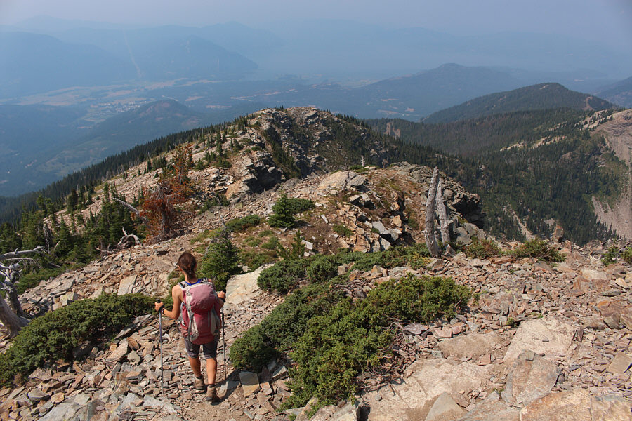
Zosia scrambles back up to the top of
the second bump after an aborted attempt to traverse to the third
bump. |

Sonny and Zosia stand together at the top of the second
bump
(2129 metres).
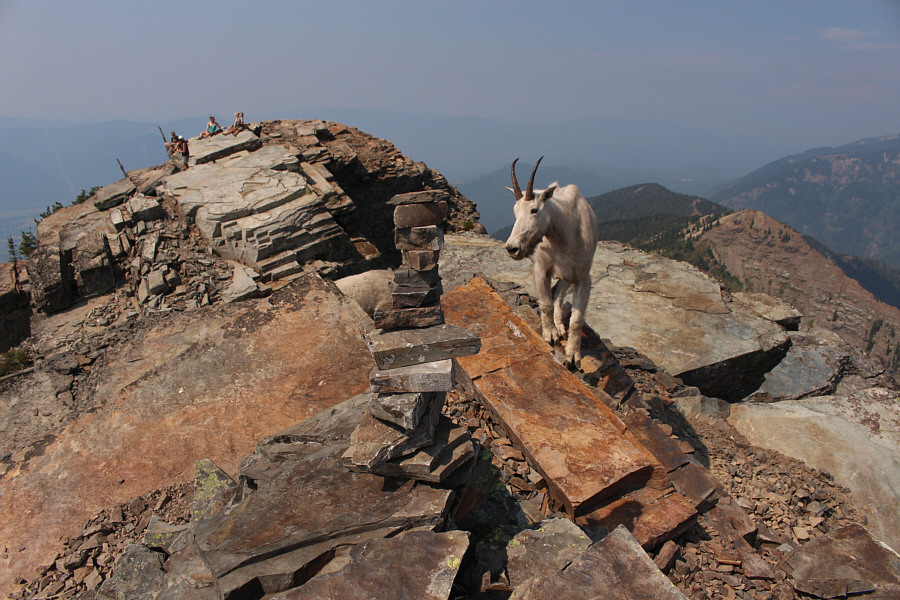 |
One of the goats that Zosia and Sonny
encountered earlier arrives at the second bump. |
 |
Baby goat, papa goat and mama goat make a slow circuit around the top of
the second bump. |
 |
The three goats return to harass the hikers at the first bump. |
 |
Visible to the northwest are Goat Mountain (left foreground) and Bee Top
Mountain (distant centre). |
 |
The connecting ridge to the third bump is more problematic than it
appears here. Further north at distant left is the peak known as
Scotchman No 2. |
After this second round of entertainment from the goats, Zosia and I
reluctantly left the summit and retraced our steps back down the
mountain. While we enjoyed almost complete solitude during our ascent
earlier in the morning, we now encountered numerous parties during our descent. The
majority were still ascending, and Zosia and I were thankful that we had
the summit (and the goats) mostly to ourselves. Upon returning to the trailhead, we promptly drove back to the main
highway and eventually found a nice beach along Lake Pend Oreille to cool
off and soak our tired feet.