BOU AVENUE
Mount Bachelor
Overshadowed by some of its loftier neighbours, Mount Bachelor in central Oregon is nevertheless one of the most popular Cascade volcanoes by virtue of the ski resort which occupies much of the mountain.  The resort has a defined uphill travel policy with a designated route allowing access to the volcano's summit, but the route is subject to occasional closures depending on weather or avalanche conditions.

After being denied an opportunity to climb the upper half of Mount Bachelor the previous day due to poor visibility, Zosia Zgolak and I returned on 21 April 2019 for another attempt, this time under a clear blue sky.  From the resort's West Village parking lot (drive west of Bend along Highway 372 for about 34 kilometres to the end of the plowed road), we followed yellow marker signs up Leeway and Ed's Garden ski runs to Pine Marten Lodge at mid-mountain.  Some sections of the uphill route below Pine Marten Lodge were slippery enough on this day to warrant using ski crampons, but we both managed to muddle through using just our skins.

This is the kind of day you want to climb a Cascade volcano!

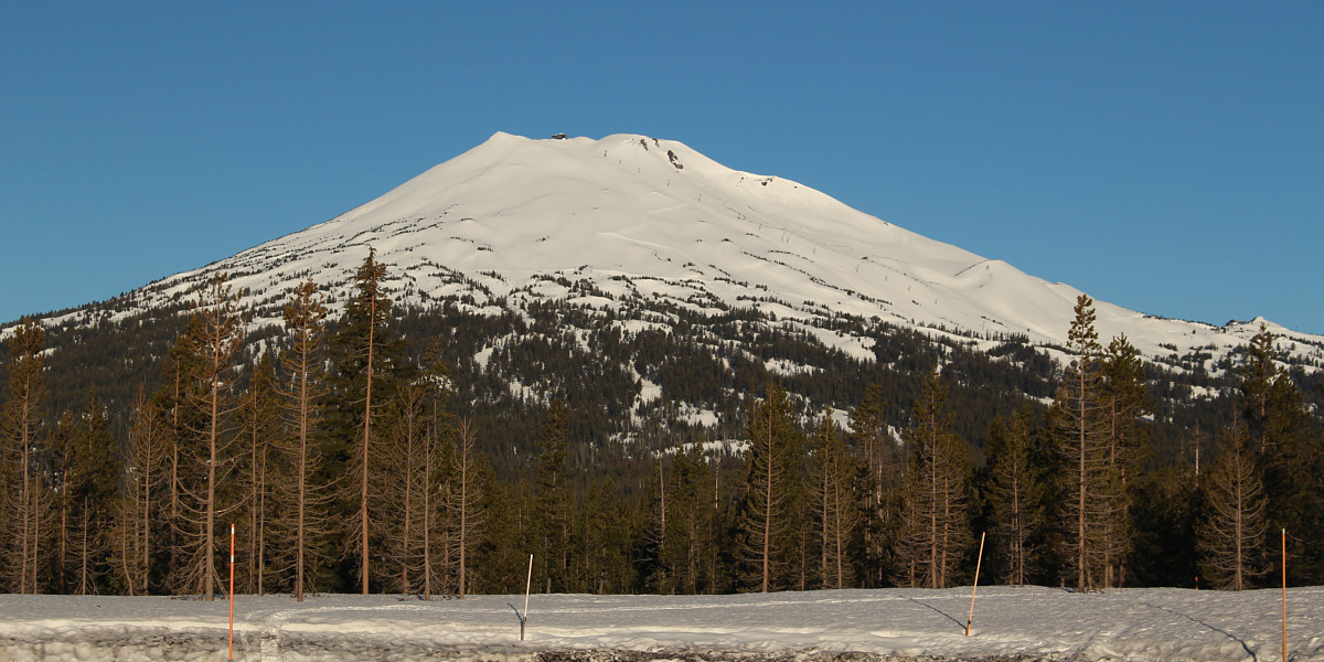
Mount Bachelor looks resplendent in the morning sun in this view from Kapka Butte Sno-Park.

I don't think the restrictions on the upper mountain are as stringently enforced on bluebird days like this. 
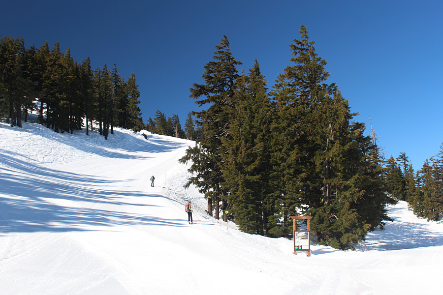
Zosia starts climbing the designated uphill route along Leeway ski run.  This section from the base area to the Cinder Cone (visible behind the trees) is normally open to uphill traffic 24/7.  Note the uphill travel information sign at right; the upper sections of the designated uphill route are still marked "closed" only because the ski resort has yet to open for the day.
As expected with the awesome weather, we are cleared to go all the way to the top! Zosia passes another sign at the start of the middle section of the designated uphill route.  This middle section via Ed's Garden ski run is normally only open to uphill traffic during normal operating hours of the ski resort.  Note that the entire uphill route is now marked as "open" on the sign.
Still a lot of climbing left! 
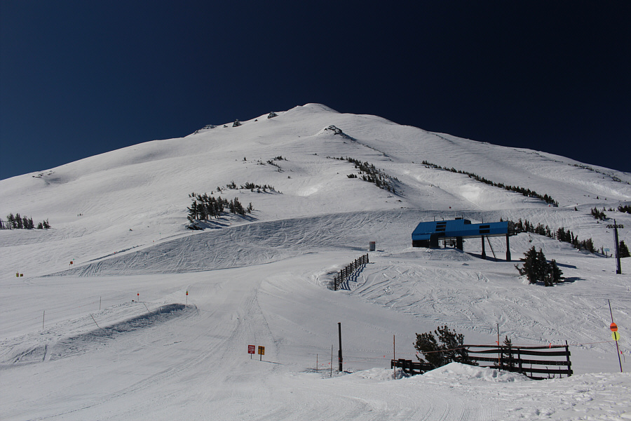
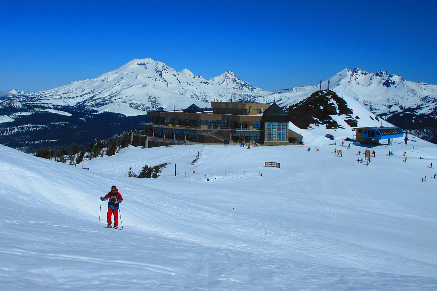
In this view from Pine Marten Lodge, the upper section of the designated uphill route is unmarked but more or less follows the crater ridge line at far left.  The route is normally open to uphill traffic only when the Summit chairlift (not visible here) is operating (subject to weather conditions and avalanche hazards).
Bill: Yep, that's where you should go up, Zosia! 
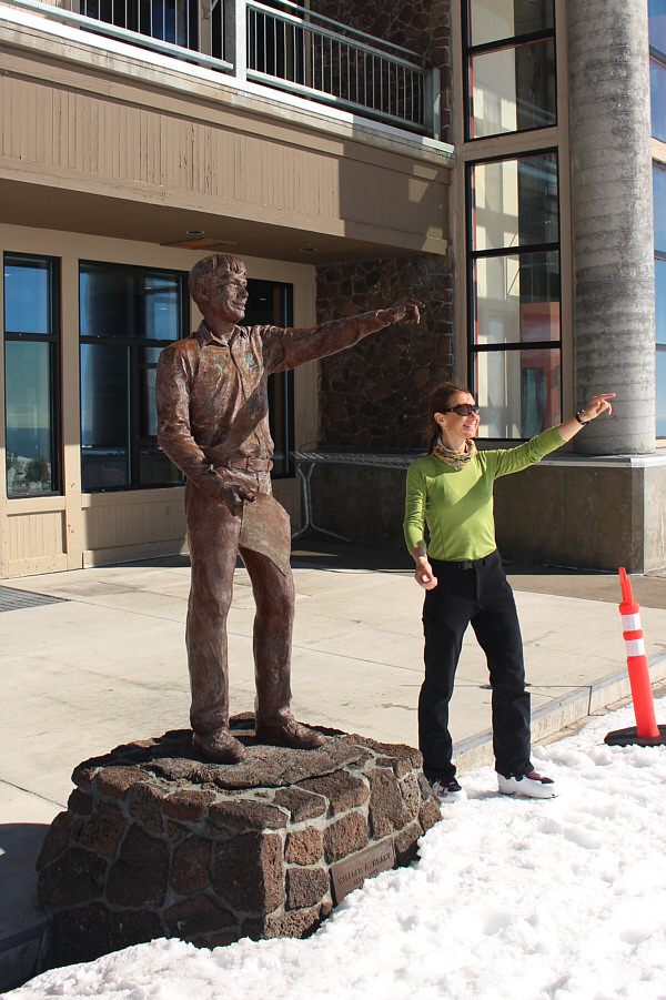
In front of Pine Marten Lodge, Zosia mimics the statue of Bill Healy, the founder of Mount Bachelor ski resort.  Interestingly enough, the statue appears to point toward the designated uphill route!
Zosia and I took a short break at Pine Marten Lodge before starting up the open slopes of the upper mountain.  The designated uphill route is not marked above the lodge, but it generally follows the western edge of the crater rim all the way up to the summit.  Initially, the climb above the lodge was fairly moderate, but as we gained elevation, the angle of the slope increased significantly.  The snow also became icier, and we both eventually stopped to affix our ski crampons in order to continue upwards.  The final slope before the summit is the steepest part of the ascent, and we had to resort to a bit of zigzagging before finally topping out (one person that came up behind us simply boot-packed up this last slope).
No more markers here...you're on our own! 
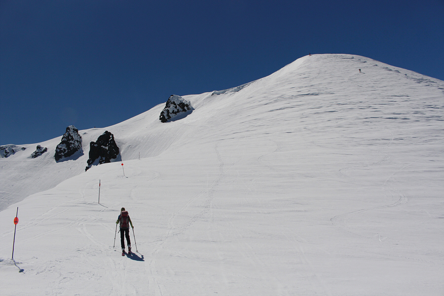
Starting to climb the upper section of the uphill route, Zosia aims for the exposed rocks on the ridge at centre.
The lodge is a great place for a break on the way up Mount Bachelor. Sonny leaves Pine Marten Lodge behind him as he climbs up the upper slopes of Mount Bachelor.  The Three Sisters and Broken Top (far right) are visible in the distance.

Photo courtesy of Zosia Zgolak

Contrary to the appearance in the photo, the ascent slope is getting steeper! Zosia gains the crater ridge (right of centre).  Note the snowshoer ahead of her at upper right and the skiers descending into the crater at distant centre.

I wanna ski South Sister someday!

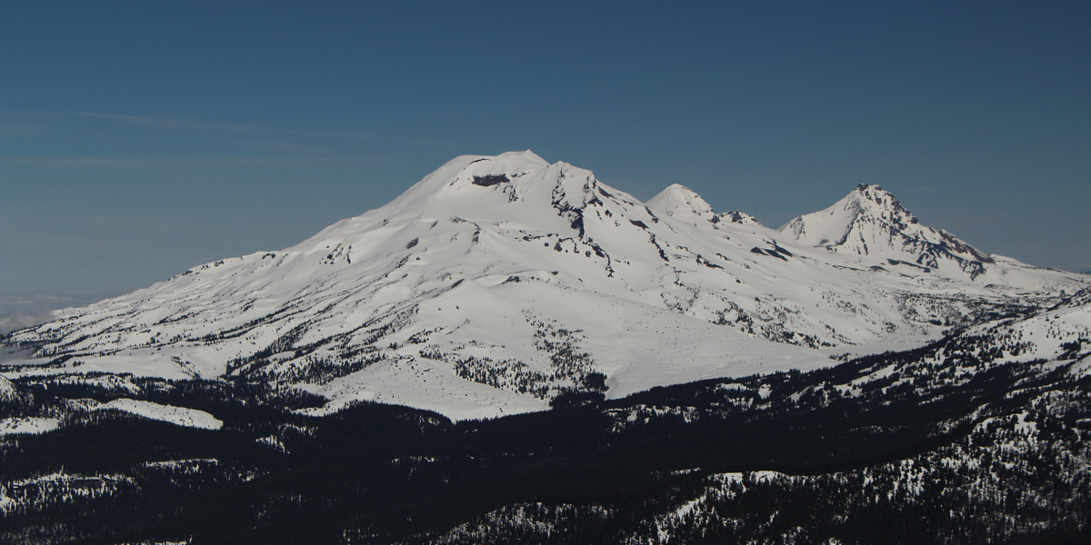
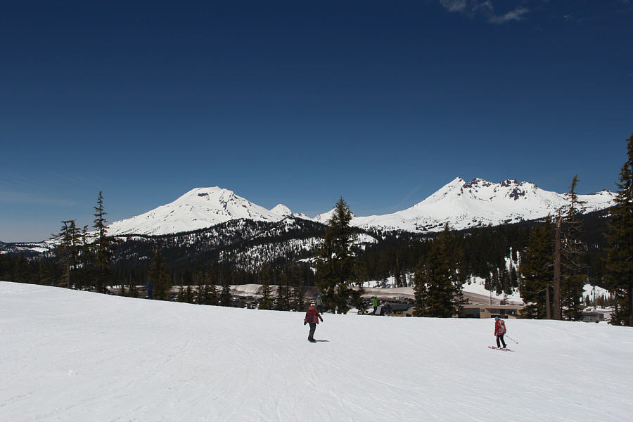
Here is an unobstructed view of South Sister, Middle Sister and North Sister to the northwest from the upper slopes of Mount Bachelor.


Almost there, right? 
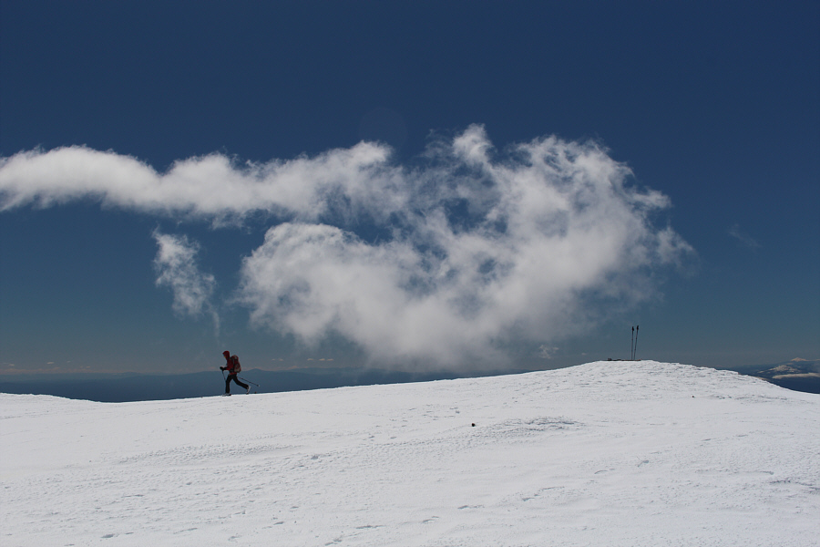
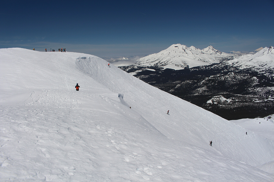
Zosia passes some warning wands along the crater edge as she approaches the final slope before the summit.
When snow conditions are not ideal, ski crampons are a must here! 
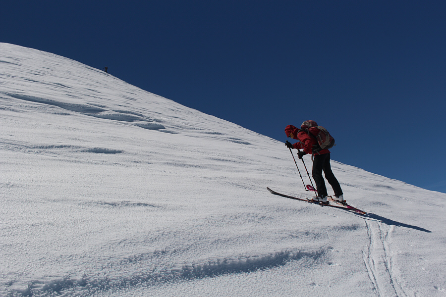
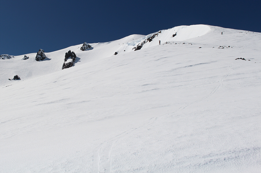
The final slope before the summit is unquestionably the steepest part of the designated uphill route.
The crux of the ascent is right here. This angle gives a better perspective of the steepness of the final slope.
Well worth the long drive and extra wait!

Zosia and Sonny give thumbs after reaching the top of Mount Bachelor.

A light but chilly breeze made it too uncomfortable to linger on the summit, and Zosia and I took our requisite photos before skiing across the top edge of Mount Bachelor's crater.  We then stripped off our climbing skins and skied down Beverley Hills ski run under the Summit Express chairlift.  Like our experience on Tumalo Mountain the previous day, the skiing here on spring corn snow was adequate, but it was nowhere near as enjoyable as some of the delightful descents we experienced elsewhere earlier in the season.

At the bottom of the Summit Express chairlift, we took the West Village Getback ski run and easily cruised back to the West Village parking lot without much fanfare.
Depending on the snow drifts, the highest point may vary a bit throughout the year. Zosia skis off the highest point of Mount Bachelor at right (2758 metres).
I love this place! 
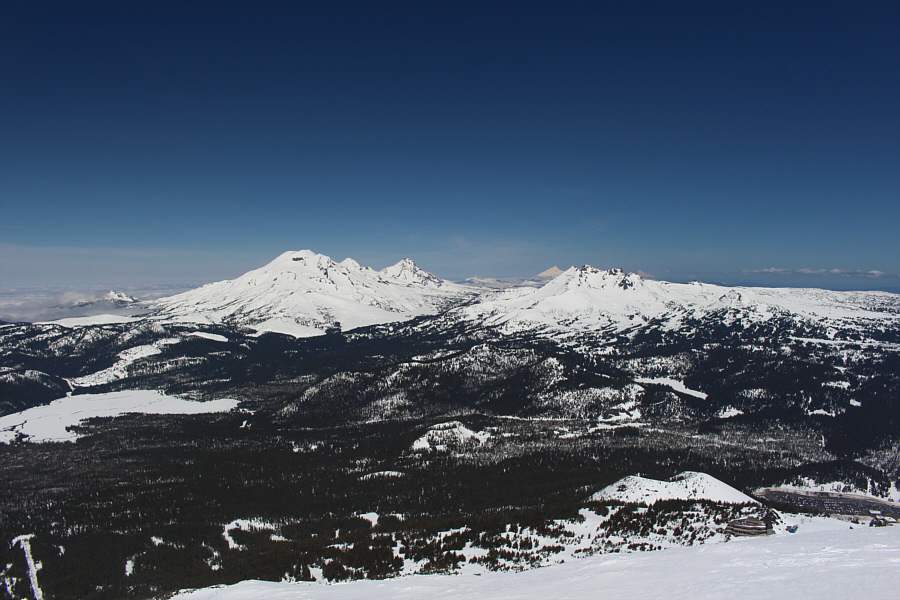
Here is a more comprehensive view of The Three Sisters and Broken Top from the top of Mount Bachelor.  Also visible behind Broken Top are Mount Jefferson and Mount Hood.
It would have been nice to be up there too on this day. 
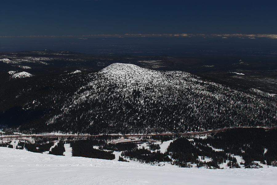
Tumalo Mountain sits across the highway to the northeast.
I will have to come back in the future to try skiing into the crater! Numerous resort skiers hike the short distance to the top of Mount Bachelor before descending into the crater.
Time to enjoy some downhill fun! 
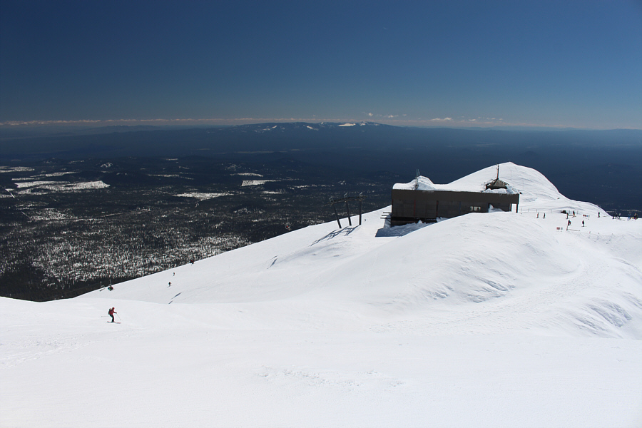
Zosia skis toward the top of the Summit chairlift.

Mount Thielsen is high on my scrambling to-do list.

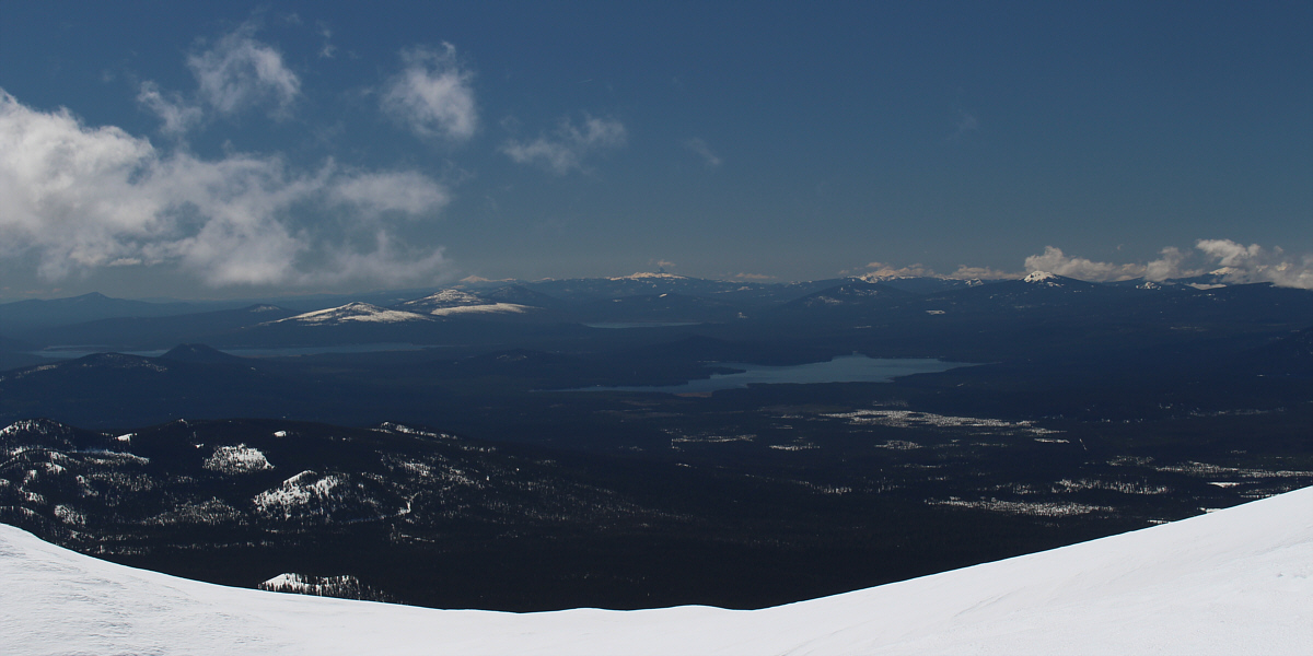
This view to the south includes Wickiup Reservoir (left), Davis Lake (centre), and Crane Prairie Reservoir (right of centre).  Also visible on the horizon are Mount Scott (left) and Mount Thielsen (centre).


Not bad corn snow skiing. 
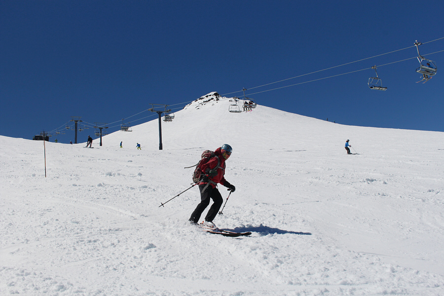
Zosia skis under the Summit chairlift.
Too bad we couldn't stay longer! Zosia (right) glides back to the base area to complete the trip.
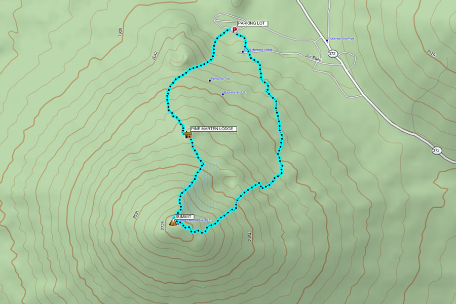
Probably the safest and most convenient Cascade volcano to ski! Total Distance:  8.3 kilometres
Round-Trip Time:  4 hours 43 minutes
Net Elevation Gain:  822 metres

GPX Data