BOU AVENUE
Mount Brewster
Marta Wojnarowska and I climbed Mount Brewster in Alberta's Banff National Park on 22 July 2020.  A couple of different ascent routes are described in the 3rd Edition of Alan Kane's Scrambles in the Canadian Rockies, and it is worth noting that, for some reason, Kane's route description and accompanying photographs for Mount Brewster are significantly different between the original publication in 2016 and the re-print in 2017.  Regardless, we chose to follow a somewhat different route taken by So Nakagawa in 2010.

Starting from the Mount Norquay Ski Resort's parking lot, we walked north past the day lodge and Spirit Quad chairlift before veering left onto ski run #58 (Deerfoot Trail).  This led us to the signed trailhead for Forty Mile Creek, and we followed the trail for another 2.5 kilometres before crossing the bridge to the north side of the creek.  About 100 metres west of the bridge is an obvious rocky drainage, and we left the trail here to follow a faint path to climber's left of the drainage.  Bushwhacking was light as we climbed up the slope which eventually becomes a more defined ridge.  Above tree line, some route-finding is required to get over or around several minor bumps along the ridge.  Just as Nakagawa had done, we left the ridge at around the 2380-metre level and traversed to climber's left across a huge bowl.  Despite the presence of a game trail, this traverse is by no means trivial.  There are some steep slabs which can be tricky to cross, and a few rocky ribs add some route-finding difficulties.  At the far side of the bowl, we hopped over a melt-water stream and ascended a broad gully feature which allowed us to gain the crest of Mount Brewster's southwest ridge.  At this point, we still had over 400 metres of elevation gain left, and a lot of it entails hands-on scrambling.  There are many jagged bumps along the southwest ridge, but most drop-offs could be easily down-climbed or circumvented.  Nakagawa recommends dropping down and side-hill bashing around a 40-metre long crack which cuts across the southwest ridge, but we found it easier to just stay right on the crest where it was feasible to down-climb into the crack albeit with some exposure.  The remainder of the scramble to the top was fairly straightforward, and Marta was really in her element here tackling the terrain with fervor.  As usual, I had trouble keeping up with her, and Marta had already read and signed the register by the time I staggered onto the summit.

For our descent, we retraced our route back along the southwest ridge, and this was fairly tedious because of the ridge's complexity.  We made better progress once we cleared the last of the jagged bumps and got down to where we first gained the southwest ridge, but instead of traversing back across the huge bowl, we plunged down the steep gully that the bowl feeds into.  While descending this gully, I often looked downward and felt like we were going to get cliffed out, but such an obstacle never materialized.  The gully is, in fact, quite straightforward to descend, but it is very long and maybe even a bit monotonous.  Near the bottom where the terrain begins to flatten out, we found it easier to leave the gully and tramp through the forest with its soft, mossy ground.  Ultimately, we intersected the Forty Mile Creek trail and settled into a long but easy walk back to the bridge and out.  Given the warm temperatures, mosquitoes were out in force along the trail and relentlessly hounded us all the way back to the parking lot.  I am still itching as I write this.
Eerily quiet here... 
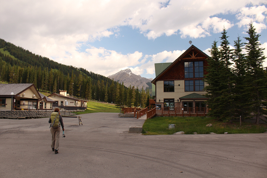
Marta walks through the deserted base area of Mount Norquay Ski Resort.  Mount Brewster is visible in the distance.
Here we go again... 
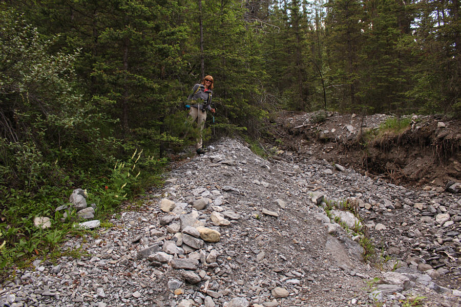
Marta is about to disappear into the forest alongside a rocky drainage near the bridge over Forty Mile Creek.
Bloody steep though! 
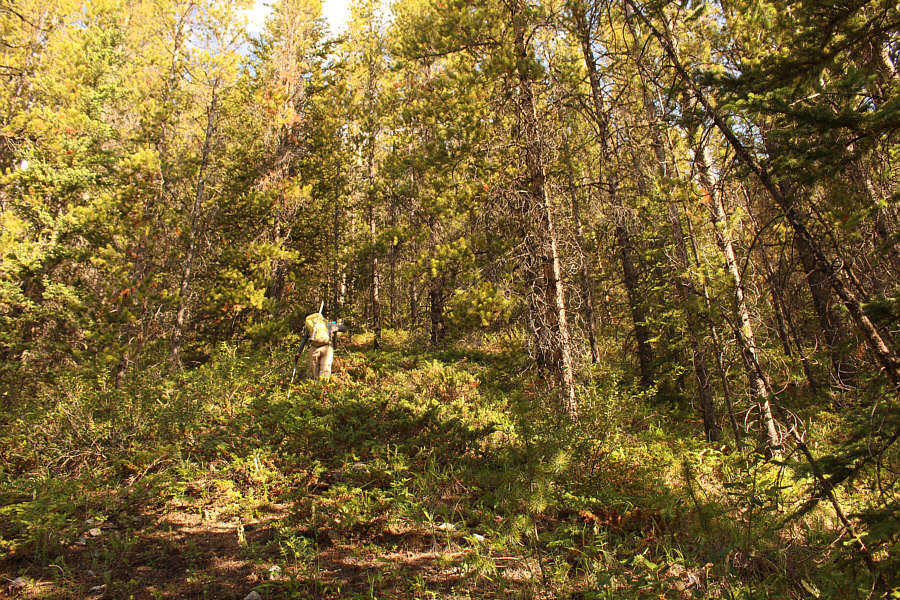
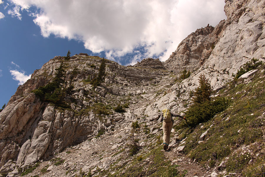
The bushwhacking is fairly light on the slope adjacent to the drainage.
Can you spot Marta? 
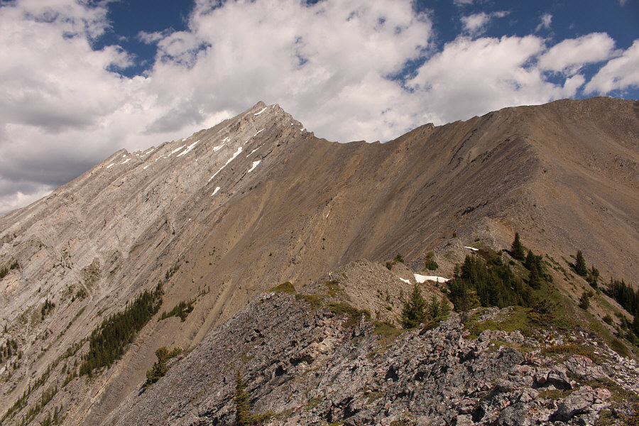
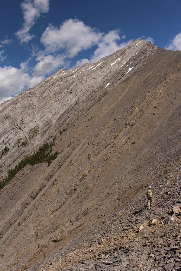
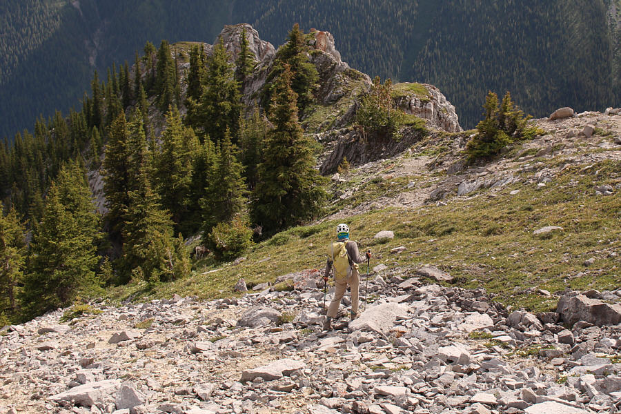
By the time Marta reaches tree line, the ascent slope has become a well-defined ridge.
Always the scrambler that Marta! Marta tackles one of several minor bumps along the ridge.
Sorry, Alan; we're going with So on this one! The upper mountain comes into view as Marta makes her way up the ridge.  One of Alan Kane's described routes carries on to the ridge along the right skyline.  So Nakagawa's route traverses across the bowl and ascends the southwest ridge at far left.
Piece of cake with a game trail, right? Marta begins the traverse across the bowl on a game trail.
I wouldn't want to be here if conditions were wet or snowy! 
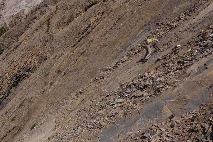
The game trail sort of disappears in a few places such as these steep slabs.
Better than traversing the slabs! Marta scrambles over a rocky rib along the traverse.
Hey feller! Are you lost? 
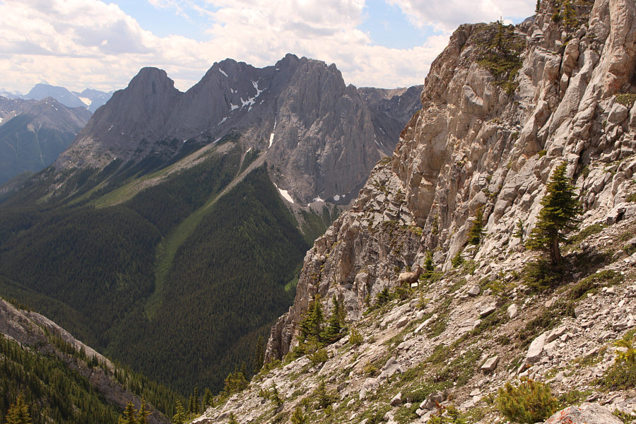
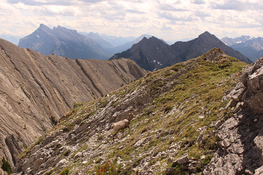
A lone sheep wanders on steep terrain near the end of the bowl traverse.  The three peaks of Mount Edith are visible in the background.
The sheep followed us up here! Marta heads up a broad gully feature which grants access to the southwest ridge.
Okay, let's follow the sheep! The lone sheep shows an easier way to get onto the southwest ridge.
If you like scrambling, this is your playground! 
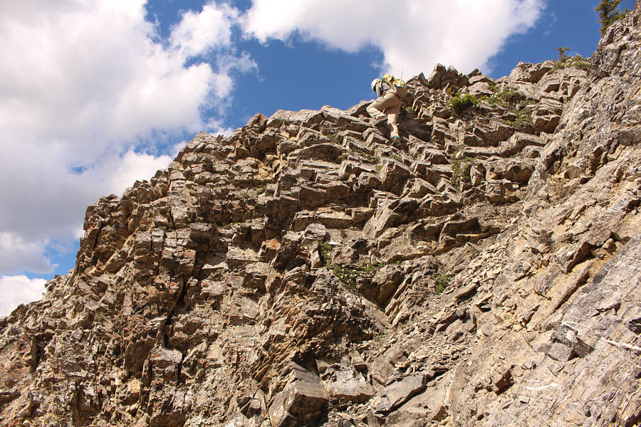
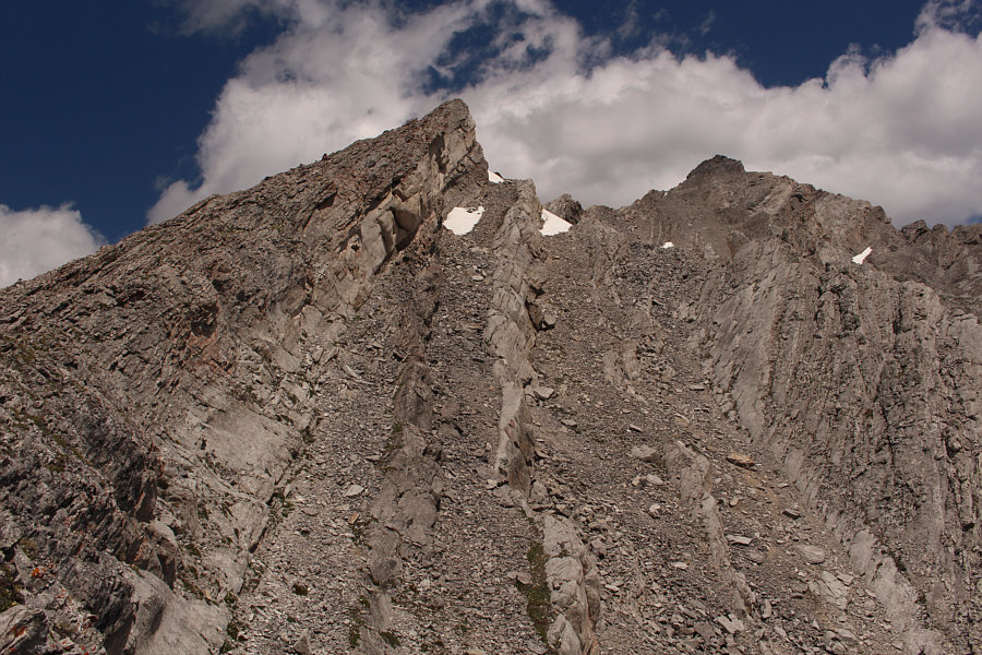
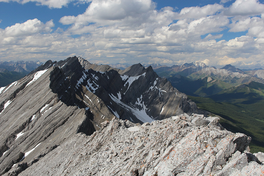
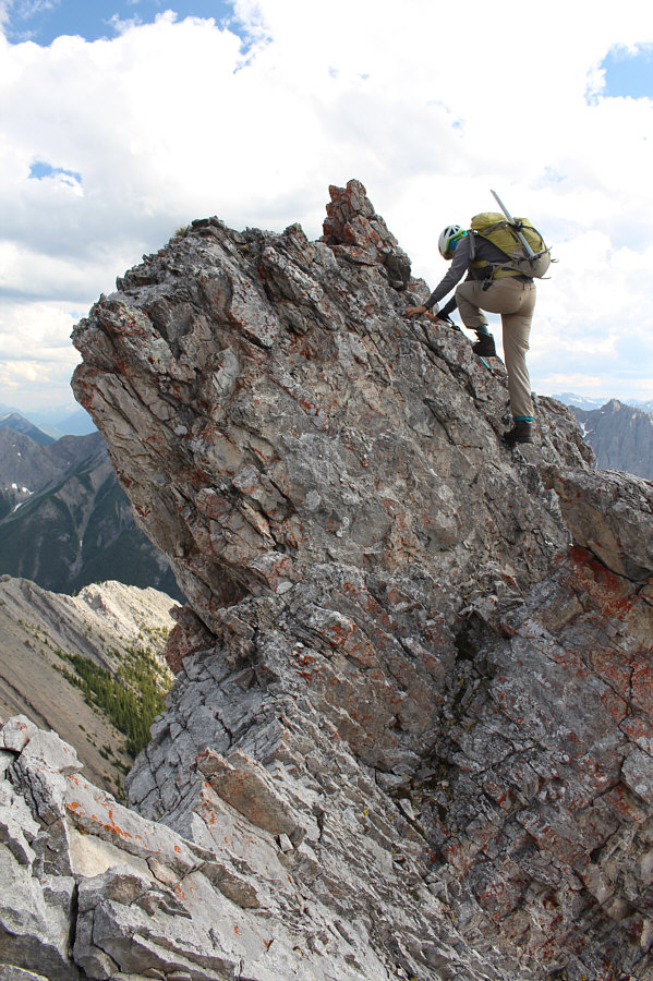
The southwest ridge is a series of jagged bumps leading to the false summit at right.
She's hard to see here, but Marta is almost at the top! 
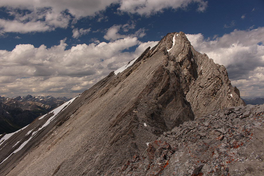
From the false summit, this is the view of the connecting ridge to the true summit.
Boy, I could go for a brewski right about now! Marta and Sonny sit on the summit of Mount Brewster (2863 metres).
Maybe some of these unnamed peaks are even unclimbed... Mount Brewster is only the southernmost bump of a long and rugged ridge stretching away to the north.
Mount Assiniboine...sigh... 
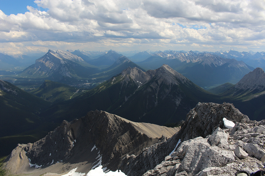
Familiar peaks to the south include Mount Rundle (left), Mount Norquay (centre), and Mount Assiniboine (far right horizon).

Descending this ridge is almost as exciting as climbing it!

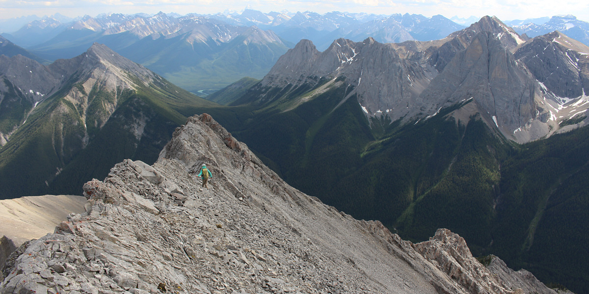
Marta retraces her steps down the southwest ridge.  Mount Louis is at far right and directly in front of Mount Cory.


I prefer facing outward when I descend, but to each their own! 
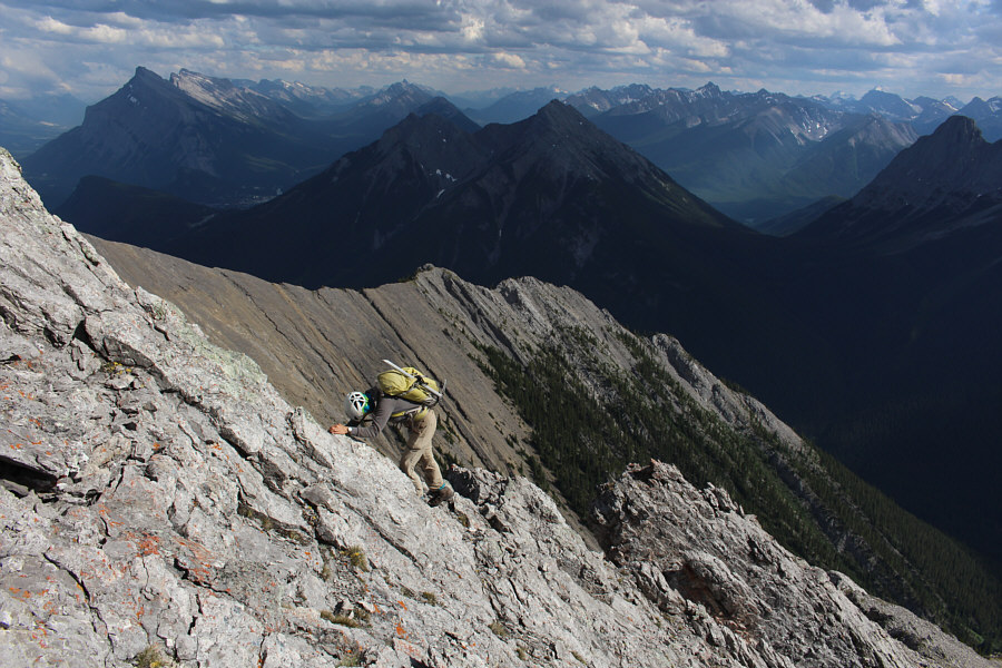
Marta faces inward to down-climb a steep section of the southwest ridge.
But first, we have to get across this crack! Marta down-climbs into the 40-metre long crack mentioned by So Nakagawa.  Note the huge boulder near the bottom of the gully to the right.  This gully is an alternate ascent route described by Kane; however, Marta and Sonny would eventually descend a different gully below the ridge to the left.
Pretty easy scrambling, but there is some serious exposure to the left. Marta climbs up the other side of the 40-metre crack near the crest of the southwest ridge.
Hmmm...none of these sheep were wearing COVID-19 masks! Some sheep can be seen hiding in the trees.  Marta would eventually continue descending below the trees to the left.
We saw about five lambs among the huge herd of sheep here. 
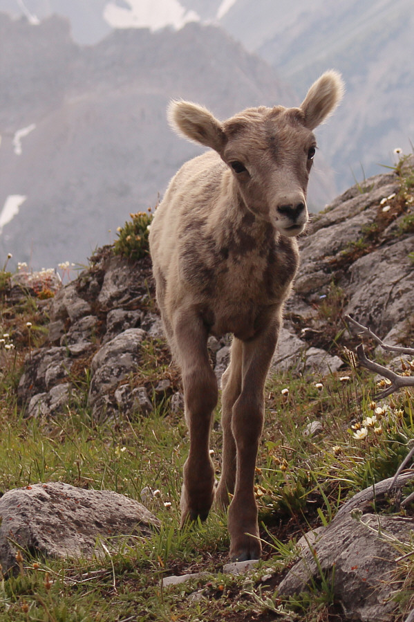
This lamb seems genuinely curious about its photographer.
Very quiet over there because the trail to Rawson Lake was closed due to bear activity. 
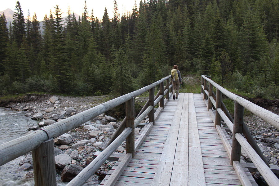
Marta crosses the bridge over Forty Mile Creek on the long walk back to Mount Norquay Ski Resort.
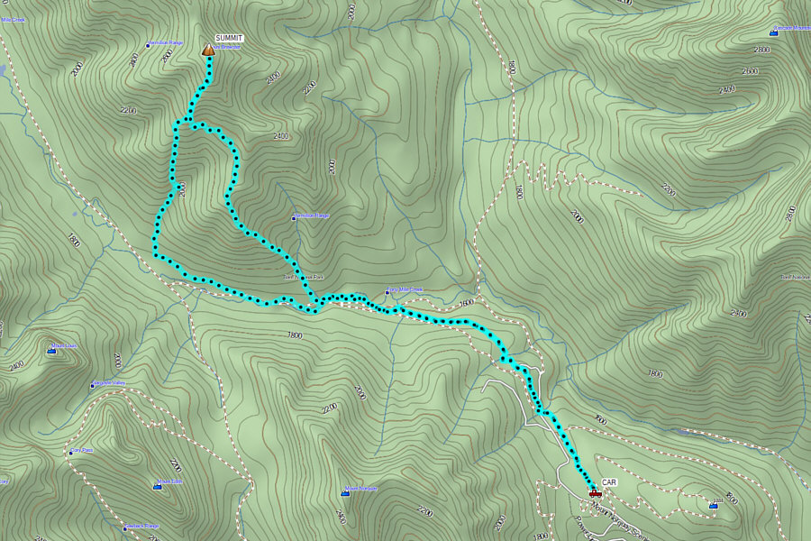
Is it me, or is every mountain outing of mine getting longer and longer? Total Distance:  19.9 kilometres
Round-Trip Time:  13 hours 46 minutes
Cumulative Elevation Gain:  1544 metres

GPX Data